Download Agreement, Release, and Acknowledgement of Risk:
You (the person requesting this file download) fully understand mountain climbing ("Activity") involves risks and dangers of serious bodily injury, including permanent disability, paralysis, and death ("Risks") and you fully accept and assume all such risks and all responsibility for losses, costs, and damages you incur as a result of your participation in this Activity.
You acknowledge that information in the file you have chosen to download may not be accurate and may contain errors. You agree to assume all risks when using this information and agree to release and discharge 14ers.com, 14ers Inc. and the author(s) of such information (collectively, the "Released Parties").
You hereby discharge the Released Parties from all damages, actions, claims and liabilities of any nature, specifically including, but not limited to, damages, actions, claims and liabilities arising from or related to the negligence of the Released Parties. You further agree to indemnify, hold harmless and defend 14ers.com, 14ers Inc. and each of the other Released Parties from and against any loss, damage, liability and expense, including costs and attorney fees, incurred by 14ers.com, 14ers Inc. or any of the other Released Parties as a result of you using information provided on the 14ers.com or 14ers Inc. websites.
You have read this agreement, fully understand its terms and intend it to be a complete and unconditional release of all liability to the greatest extent allowed by law and agree that if any portion of this agreement is held to be invalid the balance, notwithstanding, shall continue in full force and effect.
By clicking "OK" you agree to these terms. If you DO NOT agree, click "Cancel"...
With four ppl who never hiked a 14er, we debated whether Handies or Redcloud would be the best choice. Handies has the least amount elevation gain and miles but Redcloud would have the least amount of snow to deal with. We ultimately decided on Handies and rented hiking poles for everyone who didn't have any in hopes that they would be enough protection when we had to cross snow. Looking to get an early start, we left our Lake City rental at 415am towards American Basin and got to the creek crossing around 545am. Around 6 we crossed the snow bridge and headed into the basin. Hiking up the road to the actual trailhead was pretty easy and any snow was easily avoided. Once we started the actual trail, however, snow became unavoidable pretty quickly.
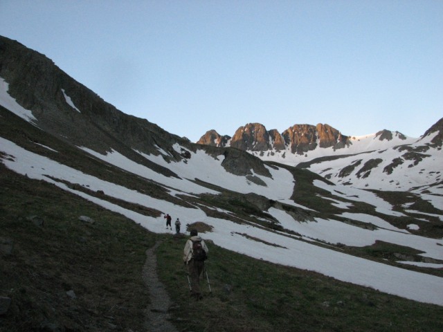
A look up the basin from the trailhead.
Even with the snow, it was relatively easy to stay on the trail. The prior night's temps also meant the snow fields had a pretty slippery crust on it which had me a little worried about what was coming a little higher up. Once the trail turns east into the basin we got a glimpse of what would be the hardest part of the hike. The east facing slope of the basin was holding a ton of snow and it looked like traversing across the slope would be difficult to do with only hiking poles.
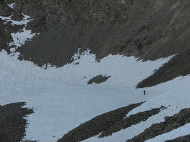
The fastest of our party, Robert, crossing the snow field. Pic taken from near Sloan Lake.
Another look across the big snow field taken on the way out.
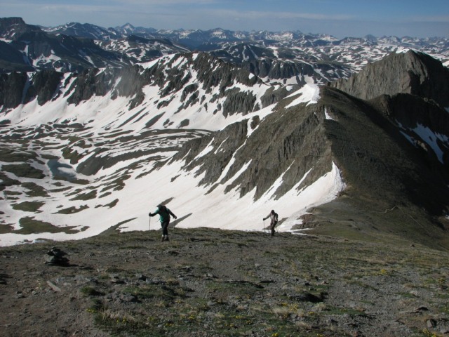
Once we got past Sloan Lake and got a good look at the traverse across the snow field we could see that it wasn't as steep as it looked head-on. Crossing only took about 15 minutes and was fairly easy with just poles. The field is heavily snow-cupped which kinda acted like natural places to put your feet. From Sloan Lake you could also tell that once past this part we would have snow free hiking all the way to the summit.
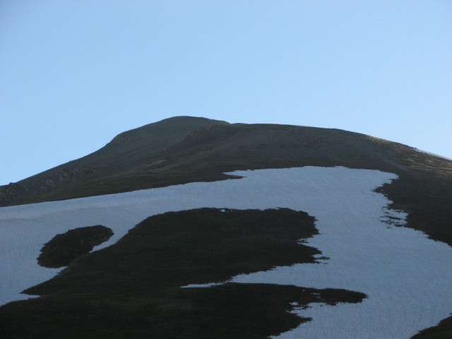
Looking up to the summit from the lake. The route avoids almost all the snow in the picture.
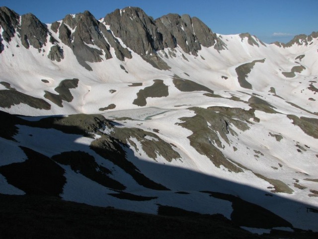
Looking into the basin and Sloan Lake as the trail switchbacks up to the saddle.
With perfect weather we all set our own pace and headed up the summit. The switchback up to the saddle went quick but the final push up to the summit gave the four folks from sea level a nice challenge.
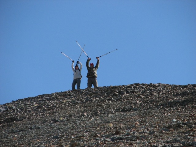
Robert and Sarah let us know that we aren't looking at a false summit.
John and Gina lowering their head for the final push up to the summit.
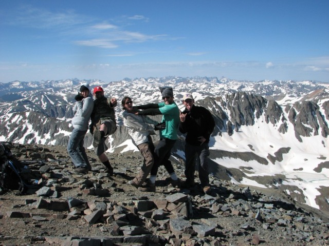
After a quick 3 hours, four flatlanders and I took the summit and soaked in the views. We spent about 30 minutes on summit and only briefly shared it with a single hiker who came up from Grizzly Gulch.
Looking across Grizzly Gulch into Silver Creek.
Once we headed down the warm temps made the traverse across the big snow field easier but all the rest of the snow crossings much more annoying. There were a couple of opportunities for a glissade on the way down but for the most part it's just a matter of trudging through it. We spent about 6 hours on the route with almost perfect weather and had a great time. It was also wonderful to be a part of my friends and family first 14er experience.
Sarah, Robert, Gina, John and Dave taking a "Jackson" summit shot.
Thumbnails for uploaded photos (click to open slideshow):
Thanks for the mountaineering saavy- you are a sherpa
Caution: The information contained in this report may not be accurate and should not be the only resource used in preparation for your climb. Failure to have the necessary experience, physical conditioning, supplies or equipment can result in injury or death. 14ers.com and the author(s) of this report provide no warranties, either express or implied, that the information provided is accurate or reliable. By using the information provided, you agree to indemnify and hold harmless 14ers.com and the report author(s) with respect to any claims and demands against them, including any attorney fees and expenses. Please read the 14ers.com Safety and Disclaimer pages for more information.
Please respect private property: 14ers.com supports the rights of private landowners to determine how and by whom their land will be used. In Colorado, it is your responsibility to determine if land is private and to obtain the appropriate permission before entering the property.