| Report Type | Full |
| Peak(s) |
Mt. Belford - 14,202 feet Mt. Oxford - 14,158 feet |
| Date Posted | 06/19/2008 |
| Date Climbed | 06/14/2008 |
| Author | RoanMtnMan |
| Mt. Belford/Oxford Ski |
|---|
|
My weekend included rodeo plans on Saturday at 5pm and skiing with my wife at Independence Pass on Sunday. This left me with a relatively small window to get out and ski a 14er this weekend. I decided to head up Missouri Gulch on Saturday and have a look at Belford and Oxford. The approach and climb are both direct and moderate. The unknown was snow. Would there still be any? I arrived at the TH at 6:30am to a 30 degree temperature. There had been a nice freeze the previous few nights so if there was snow, it would be perfect. The trail was clear of snow all the way to the trees below the basin at 11,000 ft. Given the freeze the previous night, I was able to walk across the few snow patches that remain without difficulty. In fact, I was able to wear my trail shoes to Belford's summit. A welcome reprieve for my feet. A look at Belford in the morning sun.  I reached the bottom of Belford's northwest ridge (11,900 ft) at 8am. There were a few people behind me and I could see at least one person above me on the ridge. 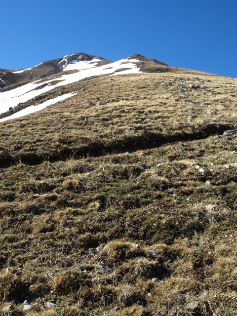 I started up the ridge feeling the weight of my ski boots in my pack with every step. I've heard a pound on your feet uses as much energy as 6 on your back, but I must say I felt the weight of the boots on my back more than I ever have on my feet. I still made good time up the ridge. The switchbacks on this route are easy on the legs, but they must double the length of the trail. Near the summit I snapped a pic of Missouri Mountain's north face that I skied earlier in the spring. The C Couloir still looks to be in good shape.  I also got a partial picture of Huron Peak's east side in the distance. Another memorable spring ski this spring. Still looks to be enough snow. 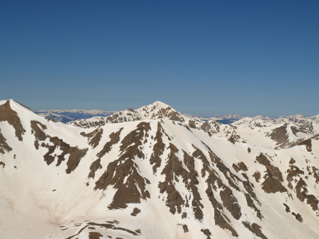 I topped out at 9:30am on Mt. Belford. It was an absolutely beautiful morning. The surrounding peaks are still covered in snow as are many of the northern and eastern aspects of the Sawatch Mountains.  A marmot kept an eye on me during my short stay on the summit. 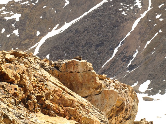 As I looked down Belford's northeast side, I was not disappointed. A nice line starting directly below the summit rock was laid out below me.  As I looked across to Oxford however, the story was much different. It was pretty much dry on the visible west side of the mountain.  The plateau below Belford's summit was also fairly dry. You can see Mt. Harvard in the background. 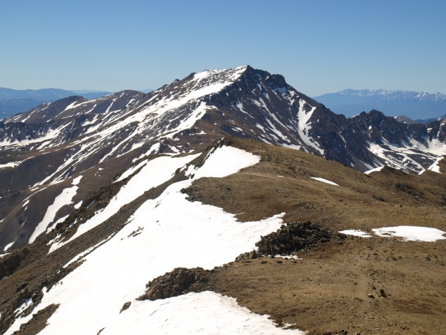 I decided to ski the line off of Belford and then traverse to the saddle between the two peaks. I would then scout the southeast side of Oxford for snow. It was 10am by the time I put on my ski boots, ate a snack, and clicked into my sticks. The June 14th corn harvest began. 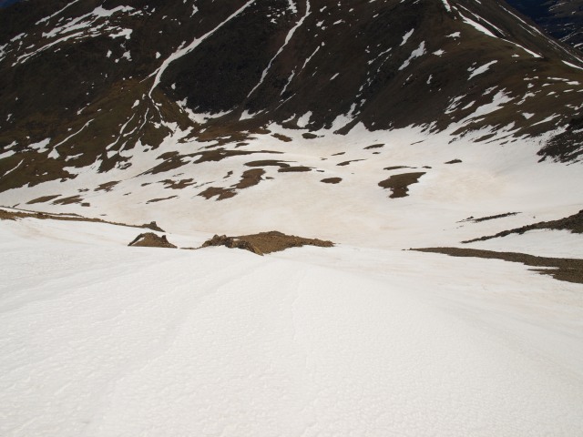 It was perfect spring skiing for 1,000 vertical feet on a consistent 38 degree slope. As I skied toward the saddle between Belford and Oxford, I had the thought of climbing to Belford's summit again for the same line. I was wishing it had been 5,000 vertical instead of 1,000. I put my skis on my back and kept my ski boots on for the few hundred vertical feet of climbing back up to the saddle. The southeast side of Oxford looked better from a snow perspective, but with the topography, I couldn't get a good read on a continuous line from the summit. I decided to boot pack it up to Oxford's summit and hope for the best when I got there. On my way up the west ridge, I stopped a couple of times to catch my breath and admire the ski line from Belford's summit. 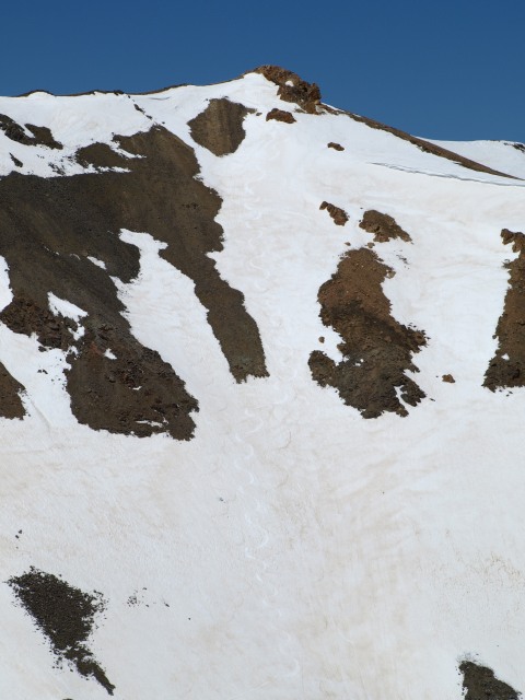 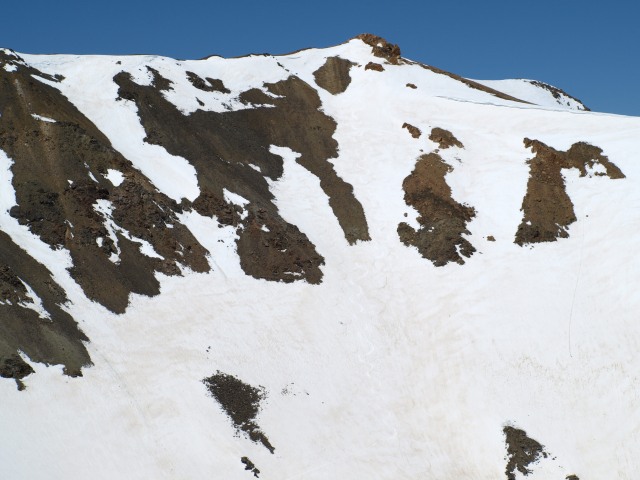 I reached Oxford's summit at around 11:30am. It was bone dry. 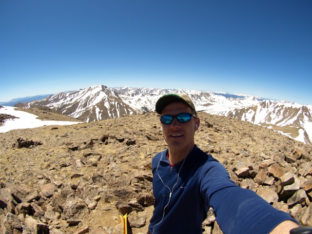 I decided to contemplate my options over a snack in the warm sun.  The north facing side of Oxford still has some great snow filled lines, but I knew I would end up bushwacking down to Clear Creek and then had no idea if I could find a way across. For those that haven't seen Clear Creek lately, it's not really in wading condition. More like kayaking condition. There was a meager patch of snow beginning about 75 feet from the summit that led off the south side of the mountain.  It was the only alternative, so I clicked into my skis and headed off. A few turns later I came to 30 feet of dry rock. A look back up the slope.  Further turns led me down the southeast side of the ridge and then down into the basin below the saddle. I know there are a myriad of differing criteria that people use to define a "ski descent" and I'm not sure any of them fit this melee. I'll have to come back and do this one justice when the snow is more plentiful. Still not too bad for mid June though. The sun was really warming things up by the time I began my ascent back to Belford's summit. The snow on the east ridge leading to the top of Belford was avoidable in most places.  I gained the plateau below the summit and quickly traversed Belford's top and down a few hundred feet on the northwest ridge to a snow filled north facing slope. I down climbed to a rocky spot that allowed me to confirm continuous snow all the way down. Due to the aspect's lack of sun the snow was still holding up well in spite of the late hour. The slope was probably in the mid 30's though I didn't check it with my inclinometer.  The snow was good and I was soon negotiating my way down the tight snow filled drainage below the northwest ridge. I could see evidence of recent rock fall from the outcroppings above, which put haste in my descent.  I exited at the exact spot I had stopped at 8am before starting my ascent up the northwest ridge. The skis went on my back and I hopped across the rocks to the main snowfield that follows Missouri Creek down the gulch. I was able to ski down to treeline, put on my trail shoes, and hiked the 45 minutes back the TH.  Quite a day. The Belford ski was excellent, Oxford was not. In total, I think the trip was about 11 miles, 6,500 vertical feet of ascent, and 4,300 vertical feet of ski descent. All before 3pm. Thumbnails for uploaded photos (click to open slideshow): ")
")
")
")
")
")
")
")
")
")
")
")
")
")
")
")
")
")
")
")
|
| Comments or Questions |
|---|
|
|
Caution: The information contained in this report may not be accurate and should not be the only resource used in preparation for your climb. Failure to have the necessary experience, physical conditioning, supplies or equipment can result in injury or death. 14ers.com and the author(s) of this report provide no warranties, either express or implied, that the information provided is accurate or reliable. By using the information provided, you agree to indemnify and hold harmless 14ers.com and the report author(s) with respect to any claims and demands against them, including any attorney fees and expenses. Please read the 14ers.com Safety and Disclaimer pages for more information.
Please respect private property: 14ers.com supports the rights of private landowners to determine how and by whom their land will be used. In Colorado, it is your responsibility to determine if land is private and to obtain the appropriate permission before entering the property.


