Download Agreement, Release, and Acknowledgement of Risk:
You (the person requesting this file download) fully understand mountain climbing ("Activity") involves risks and dangers of serious bodily injury, including permanent disability, paralysis, and death ("Risks") and you fully accept and assume all such risks and all responsibility for losses, costs, and damages you incur as a result of your participation in this Activity.
You acknowledge that information in the file you have chosen to download may not be accurate and may contain errors. You agree to assume all risks when using this information and agree to release and discharge 14ers.com, 14ers Inc. and the author(s) of such information (collectively, the "Released Parties").
You hereby discharge the Released Parties from all damages, actions, claims and liabilities of any nature, specifically including, but not limited to, damages, actions, claims and liabilities arising from or related to the negligence of the Released Parties. You further agree to indemnify, hold harmless and defend 14ers.com, 14ers Inc. and each of the other Released Parties from and against any loss, damage, liability and expense, including costs and attorney fees, incurred by 14ers.com, 14ers Inc. or any of the other Released Parties as a result of you using information provided on the 14ers.com or 14ers Inc. websites.
You have read this agreement, fully understand its terms and intend it to be a complete and unconditional release of all liability to the greatest extent allowed by law and agree that if any portion of this agreement is held to be invalid the balance, notwithstanding, shall continue in full force and effect.
By clicking "OK" you agree to these terms. If you DO NOT agree, click "Cancel"...
Mt. Rosa - 11,499ft
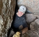
Hiking Parnter - Brad
Distance - 14miles RT
Trail Head - Gold Camp Road Parking
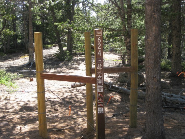
Trail - St. Mary's Falls
This is another local Colorado Springs hike for those new to Colorado to try before attempting a 14er and it is a good test.
In 1806 and on a survey mission of the recently acquired Louisiana Purchase, Lt. Zebulon Pike attempted to climb the peak that bears his name. The purpose was to get a high point view of the area. It was November and he failed when a winter storm moved in. To gain a similar view, his party climbed nearby Mt. Rosa.
Third time is certainly a charm. I have attempted this peak three times in the last 5 month. One adventure ended with me wrecking my car. Adventure two turned into a 12-hour day, missed trails, and heavy snow. Finally, the signs were right.
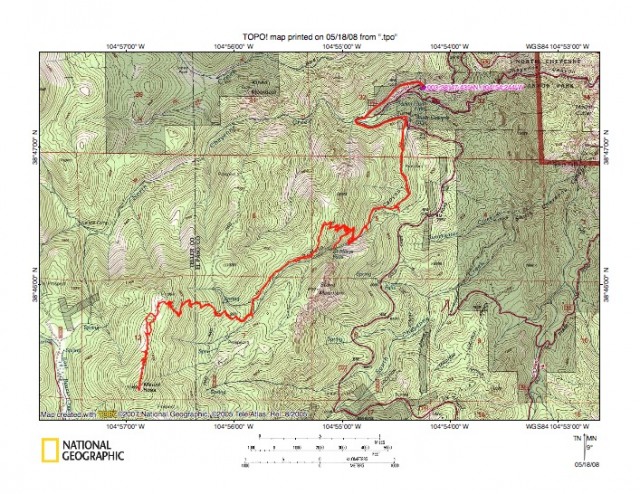
Earlier in the week, I PM'd Brad with the invite. We have met as part of the local CSMC group and talked off and online about local climbs. Felt he would enjoy bagging this one. The trail was the longer and more challenging St. Mary's falls trail with an altitude gain of roughly 4200ft.
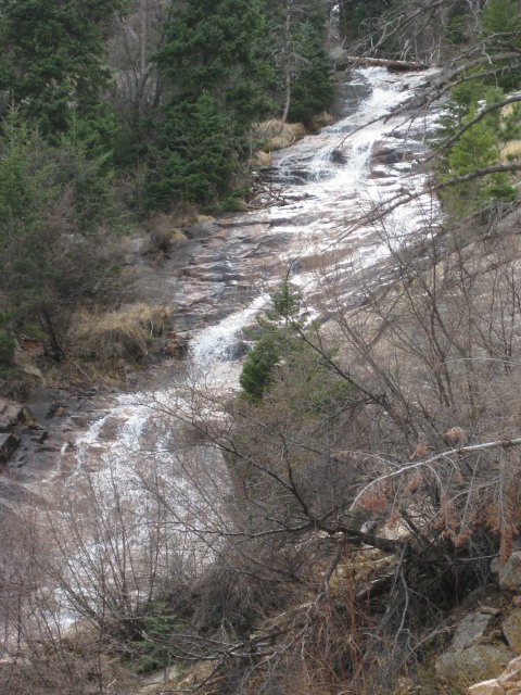
We started at 7:15am after waiting for a possible additional hiker. Afterwards, we headed down the closed portion of Gold Camp Road to Tunnel 3. The trail veered left to head over the collapsed tunnel 3. From here, we followed the creek up the hill towards St. Mary's. It took us about two hours to reach the top of the falls and past one of the more challenging parts of the climb.
After continuing west on a slight incline, we finally reached a gate to a FS road. This was the point that goofed us up on the last trip. This time would be different. Thanks to cftbq and 53_Peaks, we knew which way to go and what to look for. For those interested, when you leave the gate, go right on the road about 100 ft. On the road's west side are two small Cairns marking the trail. The FS marker is well up the trail and can easily be missed.
Our Tracks
St. Mary's Falls Sign
St. Mary's Falls
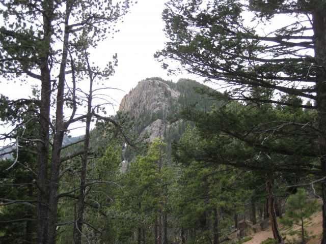
First shot of Rosa
The Gate
The correct Path (notice the small Cairns)
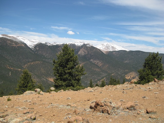
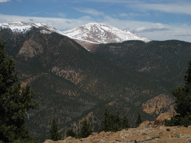
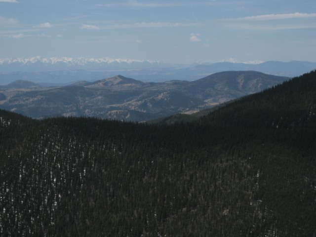
We headed up this second steep section towards the north ridge where the final summit push would begin. At the top, we got our first beautiful views of Baldy, Almagre, and Pikes. It happened to be where our real work was about to begin. Between us and our goal, was some deep snow.
First view to the west (L-R Baldy, Almagre, Pikes)
Rosa from the Ridge
Pikes
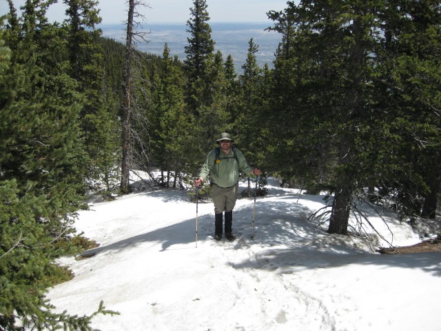
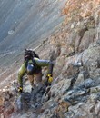
We were less that ½ mile from the summit, but it took us some time. We post-holed regularly in 2-3 foot snow. Brad and I decided to put on our leggings and gaiters (boy am I glad we thought of them). Anyway, it took us over an hour and some patience to get to the summit, but was it worth it.
Brad on the snow (one of the few times we didn't post-hole)
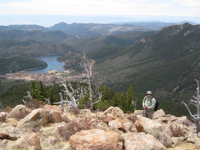
Brad feet away from the summit with Rosemont Reservoir
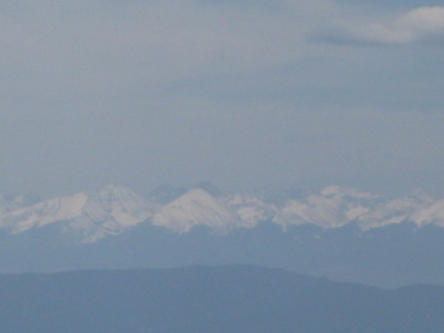
I have been here a few times, but never had the clear views. We could see Bierstadt and Evans to the north, Pikes (dah), All the Sangre's, Shavano, Antero, and Princeton. After 30 minutes on top, we headed back down.
Sangre De Christo Range
Shavano (I think)
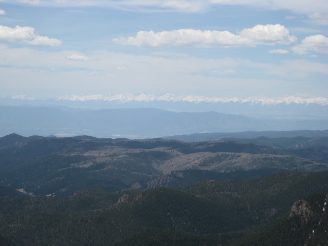
Close-up of Humbolt with the Crestones in the background
On decent, we took a slightly different route to avoid the snow, and I think we managed to reduce our encounters. We made good time descending and reached the cars at 4:30. It was a good/fun 9 hour day and I'm happy Brad joined.
View of Stove Top Mountain from the top of St. Mary's Falls
Thumbnails for uploaded photos (click to open slideshow):
peak! I love that one... so much that I‘ve done it three times. Even slept up there once, in November. It‘s definitely a grunt though, up to St Mary‘s Falls (as you mentioned). Nice job guys!
If you head down to the east shoulder just below the rock cliffs, there‘s a cave where Zebulon Pike‘s team slept on the very first summit of Mount Rosa, back in November, 1806. Two folks in my team slept in that cave, while I ”camped” slightly higher and to the south, maybe 100 feet from the cave. There‘s a nice big level area, but it‘s exposed to the winds, which got up to 40 MPH that night. I had no tent (long story)... The one saving grace was that one of the guys set up a ”bar” on a big rock and served us shots of Southern Comfort in the dark, by headlamp. That put me out, tent or no tent. We summitted Pikes two days later. I don‘t think I would camp on the summmit - the winds can get pretty nasty, and you‘re right about the rocks: they‘re not very soft! My recommendation is to use the cave: the two who grabbed that spot slept like babies.
Thanks for the info. I have heard about ”Pikes Cave”, but didn‘t realize how close it was. Yesterday was probably the least amount of wind I experienced on the summit of Rosa or the nearby 12K peaks. Couldn‘t have asked for a more beautiful day. Thanks for sharing.
We were the group you encountered on your trip up. Thanks for the directions from the Gold Camp Road parking area (we will try that route next time). Hiking back through Frosty Park to the 2WD trailhead at Rosemont Res. was the scariest part of the day... Dodging lots of people shooting guns and driving their 4X4‘s in corded off areas is not a nice way to end a day. Frosty Park is littered with spent shells, trash, broken bottles and smells like oil has leaked all over the road. :cry:
I certainly remember you and your family. The only people we saw on the trail above St. Mary‘s Falls. And got a kick watching you walk past us on the snow as we kept post-holing.
Understand what you mean about Frosty Park, the area is beautiful, but too many people camp (and partake in other destructive activities). I tend to avoid the area anymore and go for the longer hikes into the surrounding areas.
Always wonder if I am seeing other 14er.com folks on the trail, glad to confirm this one and thanks for the comment.
Thanks for the TR Dave! I wish that I could have gone...I did that hike a couple times in my teens with my Boy Scout troop, but haven‘t been up there in 10 or 12 years, I‘d love to do it again sometime soon!
Brad it was a pleasure to spend the day with you. It was a tought trek, but a lot of fun. Thanks for joining and look forward to future adventures.
Susanjoypaul...I must ask this question. Brad and I talked about camping on the summit and with all the rocks, couldn't figure out where the best place would be. There were a couple small spots, but did you sleep on the summit or just off to the north?
I do agree with you that this is a beautiful peak. This was my third summit and the views are surprising considering it doesn't break 12K. This trip had the best views.
I just got back from Michigan (well almost... stuck at DIA at the moment). Anyway, congrats on making it up Mt Rosa. Those pics bring back memories. Sorry I couldn‘t join you. By the way, that gate you describe is new. I don‘t remember it when I was up there about 3 years ago. Let me know if you do any more local hikes! :-)
Just did this hike today and if it werent for your tips about where to go for the right trail I most definitely would have been lost! Thanks for posting those! Beautiful place by the way
Caution: The information contained in this report may not be accurate and should not be the only resource used in preparation for your climb. Failure to have the necessary experience, physical conditioning, supplies or equipment can result in injury or death. 14ers.com and the author(s) of this report provide no warranties, either express or implied, that the information provided is accurate or reliable. By using the information provided, you agree to indemnify and hold harmless 14ers.com and the report author(s) with respect to any claims and demands against them, including any attorney fees and expenses. Please read the 14ers.com Safety and Disclaimer pages for more information.
Please respect private property: 14ers.com supports the rights of private landowners to determine how and by whom their land will be used. In Colorado, it is your responsibility to determine if land is private and to obtain the appropriate permission before entering the property.