Download Agreement, Release, and Acknowledgement of Risk:
You (the person requesting this file download) fully understand mountain climbing ("Activity") involves risks and dangers of serious bodily injury, including permanent disability, paralysis, and death ("Risks") and you fully accept and assume all such risks and all responsibility for losses, costs, and damages you incur as a result of your participation in this Activity.
You acknowledge that information in the file you have chosen to download may not be accurate and may contain errors. You agree to assume all risks when using this information and agree to release and discharge 14ers.com, 14ers Inc. and the author(s) of such information (collectively, the "Released Parties").
You hereby discharge the Released Parties from all damages, actions, claims and liabilities of any nature, specifically including, but not limited to, damages, actions, claims and liabilities arising from or related to the negligence of the Released Parties. You further agree to indemnify, hold harmless and defend 14ers.com, 14ers Inc. and each of the other Released Parties from and against any loss, damage, liability and expense, including costs and attorney fees, incurred by 14ers.com, 14ers Inc. or any of the other Released Parties as a result of you using information provided on the 14ers.com or 14ers Inc. websites.
You have read this agreement, fully understand its terms and intend it to be a complete and unconditional release of all liability to the greatest extent allowed by law and agree that if any portion of this agreement is held to be invalid the balance, notwithstanding, shall continue in full force and effect.
By clicking "OK" you agree to these terms. If you DO NOT agree, click "Cancel"...
Date: Saturday, May 3, 2008 Group: BillMiddlebrook and myself Route: North Slopes (standard) ascent (2mi.), Northeast Face ski descent (1.75mi.) from Grays Peak TH Total mileage: 3.75 miles Total elevation gain: ~2,100ft.; slightly under 2,100ft. vertical skied Total time out (including stop time): 5hrs. 15min.
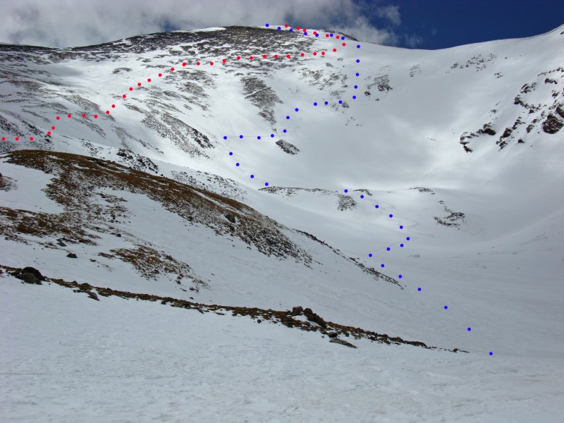
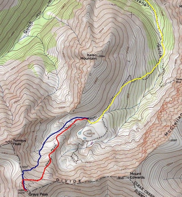
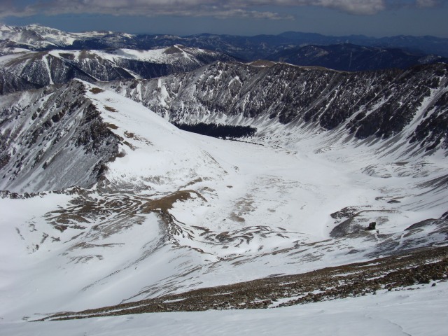
Our routes (red=climb; blue=ski):
Topo of the route (yellow=snowmobile; red=climb; blue=ski):
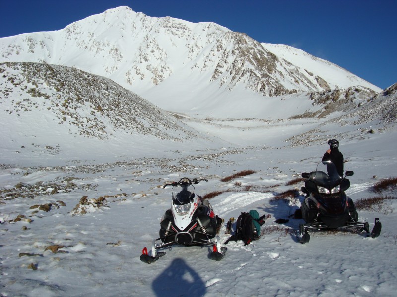
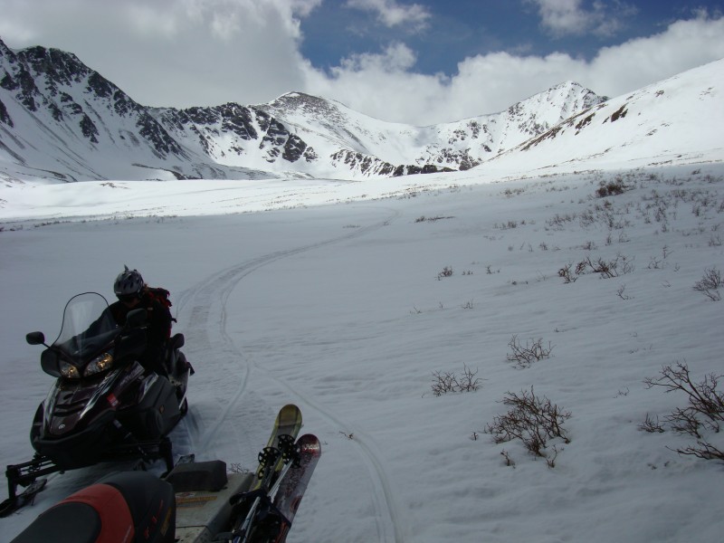
I met Bill at the Bakerville exit at 6:15am, so excited for my first-ever snowmobile ride! With the recent snowstorm, Bill wasn't certain what the avalanche conditions would be, but surveyed when we got there. We started up the road just after 6:30am. Cars can make it 1/2 of a mile up the road, if that. Above this, there are stretches of patchy snow which could get cars stuck when the snow softens. A few vehicles have made it higher up on the road, but remain stuck. We entered the basin and parked the sleds at 12,200ft. I ended up having two of the same boot liners with me - both right-foot molded liners which was biomechanically awkward, so I was ok with the least amount of climbing.
Getting ready to climb, with snow-loaded Torreys behind (taken from 12,200ft.):
At 7:30am, we began skinning over the willows to a flat rocky section; a few spots required us to take off skis and climb. Minimal winds and sunny skies made a climb and ski of Grays even more pleasant. We were able to scope out a ski line and better see the current snow conditions in the bowl; sastrugi in the upper parts of the face and a few inches of powder in the lower halves. After rounding the small ridge, we skinned up the east side of the slope, heading west to meet up with the standard trail again (closer to the saddle).
The snow was pretty hard-packed near 12,600ft. below the small ridge along the standard route, and we side-hilled most of it on skis:
Skinning up the east side of Grays with Kelso Mountain behind:
We stopped for a snack around 13,700ft. and decided to head straight for the North Ridge rather than zig-zagging up the remaining standard trail. We reached the ridge near 14,000ft., Bill switched to bootpack, and I skinned up a little farther. However, I took my skis off when my skins had trouble sticking to some powdery snow.
We shouldered our skis for the last 100 feet to the summit (the prevalent Southwest side of Torreys in the distance):
At a leisurely 3hrs. 40min. later, we were on the summit at 11:10am, still with minimal winds and great views.
On the summit:
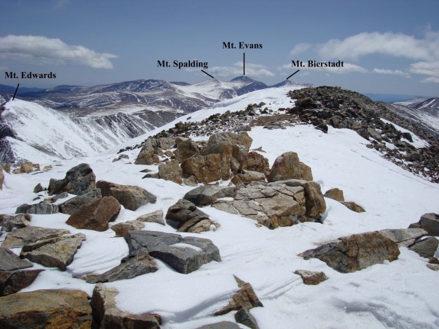
Some Centennials...
...east of Grays Peak (left photo, Evans and Bierstadt looking really dry), and Torreys (right photo, Longs and Meeker hidden by clouds):
Stevens Gulch from the summit:
After a 40min. summit break, we stripped the skins, clicked in, and started off the summit to the North Ridge at 11:50am skiing sastrugi.
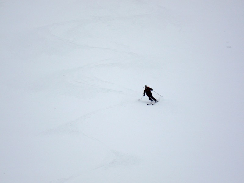
Me skiing off the summit along the North Ridge:
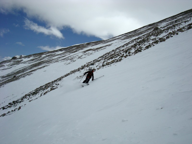
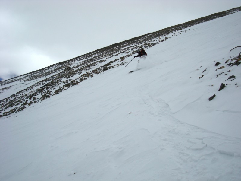
We hit the face, and made a few turns down that. I hit a hidden rock with my tip, double-ejection, and banged up my knee pretty bad.
Hiking back up to pick up my yard sale (JUST FOR YOU BILL!):
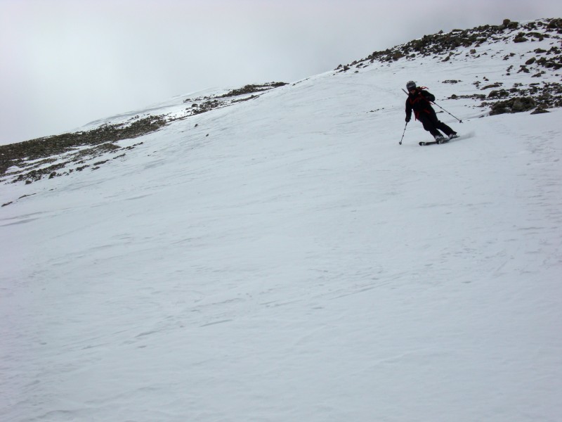
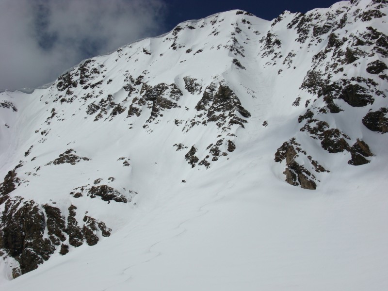
We skied about half way down between two rock ribs, south of the saddle low-point (not the bowl directly below the saddle)...
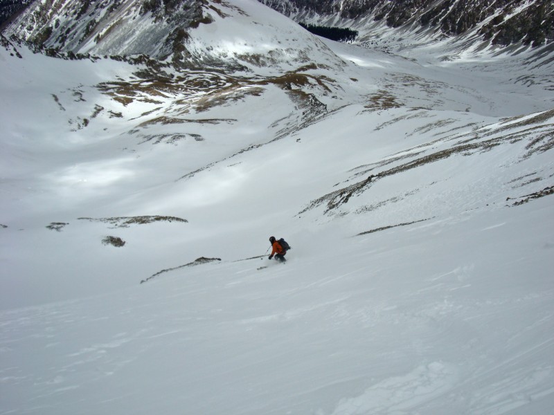
From here, Bill skied over and traversed through a rick rib (I followed), and skied down in between another set of ribs east of the first, aiming for a small rock patch at the bottom of another patch of rocks (seen in the bottom photos of this series).
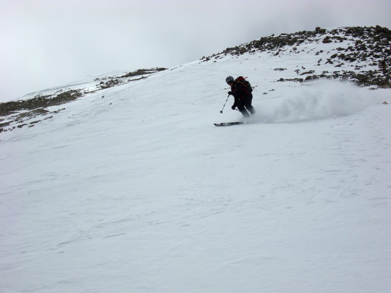
Bill getting ready to hit it...
...and making it work:
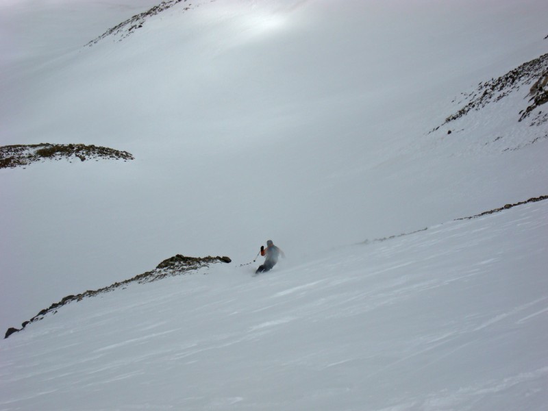
At this rock patch, we traversed over to the most eastern part of the face we would ski; Bill went first to test the snowpack. Nothing was going to slide, so I went after.
Some shots of the last part of the face we skied (creamy snow down here) before reaching a small plateau in the upper basin:
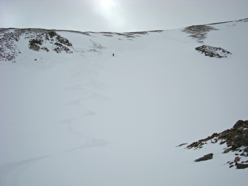
Our turns on the lower half of the Northeast Face:
We didn't want to ski back along the small ridge we climbed below in the way up, so we hung lower in the basin closer to the base of Torreys. We had to take our skis off for 10-15ft. in a few places. As we skied the lower part of the face, we saw a skier finishing a solo descent of Dead Dog on Torreys.
Torreys beta: Dead Dog Couloir with fresh tracks, and South Paw Couloir (far left, looking a little unstable; nice cornice above though!):
It took us 55min. to ski down back to the sleds, where we arrived at 12:45pm.
Heading back down, with the classic view of Grays and Torreys:
And it was time again for another fun sled ride back to the cars - what a fantastic day! Great to get out with you as always, Bill.
Thumbnails for uploaded photos (click to open slideshow):
Bill: How do you think I feel with the shot of me hiking back up to get my skis?! That's why I had to keep the photo small!
frozenfore075:I thought I saw the light when I switched from snowshoes to skis, but now I really do with the snowmobiles! :D Have a great trip if you go this week; hopefully this report can provide you with some current info.
Dustin: Yes, it's 3 summit descents now. I love it and hope to get many more this spring. I'll keep you posted on plans!
looks like a pretty sweet day - i hope to head up there later this week...i think i need to take your advice and find someone w/ some snowmobiles though!
Caution: The information contained in this report may not be accurate and should not be the only resource used in preparation for your climb. Failure to have the necessary experience, physical conditioning, supplies or equipment can result in injury or death. 14ers.com and the author(s) of this report provide no warranties, either express or implied, that the information provided is accurate or reliable. By using the information provided, you agree to indemnify and hold harmless 14ers.com and the report author(s) with respect to any claims and demands against them, including any attorney fees and expenses. Please read the 14ers.com Safety and Disclaimer pages for more information.
Please respect private property: 14ers.com supports the rights of private landowners to determine how and by whom their land will be used. In Colorado, it is your responsibility to determine if land is private and to obtain the appropriate permission before entering the property.