Download Agreement, Release, and Acknowledgement of Risk:
You (the person requesting this file download) fully understand mountain climbing ("Activity") involves risks and dangers of serious bodily injury, including permanent disability, paralysis, and death ("Risks") and you fully accept and assume all such risks and all responsibility for losses, costs, and damages you incur as a result of your participation in this Activity.
You acknowledge that information in the file you have chosen to download may not be accurate and may contain errors. You agree to assume all risks when using this information and agree to release and discharge 14ers.com, 14ers Inc. and the author(s) of such information (collectively, the "Released Parties").
You hereby discharge the Released Parties from all damages, actions, claims and liabilities of any nature, specifically including, but not limited to, damages, actions, claims and liabilities arising from or related to the negligence of the Released Parties. You further agree to indemnify, hold harmless and defend 14ers.com, 14ers Inc. and each of the other Released Parties from and against any loss, damage, liability and expense, including costs and attorney fees, incurred by 14ers.com, 14ers Inc. or any of the other Released Parties as a result of you using information provided on the 14ers.com or 14ers Inc. websites.
You have read this agreement, fully understand its terms and intend it to be a complete and unconditional release of all liability to the greatest extent allowed by law and agree that if any portion of this agreement is held to be invalid the balance, notwithstanding, shall continue in full force and effect.
By clicking "OK" you agree to these terms. If you DO NOT agree, click "Cancel"...
Mt. Kineo - 9,478ft
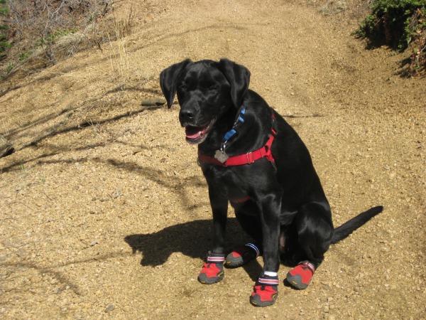
Hiking Parter - Molly Mae (K9)
Distance - 8miles RT
Trail Head - Top of High Drive
Unfortunately, the month of April was a very busy one for me. Work, business trips, soccer games (my son) and other activities, getting out to do anything has been hard. Moreover, I am always amazed how hard it is to build stamina and how easy it is to loose it. Today, I got my first chance to get out in over a month.
This isn't a 14er, or a 13er. Hell, it doesn't even break 9500 ft., but it got me out. I am posting this, as there have been a couple forum posts on easy local hikes in the Colorado Springs area. Cheyenne Canyon provides the start of some really enjoyable hikes. This hike started at the top of High Drive (open from May 1 - Oct 1) in North Cheyenne Canyon. This point serves where Captain Jacks trail ends and Mt. Buckhorn Trail begins. Additionally, it is one of the multiple locations to begin heading towards Jones Park.
We started at 10:00am (a late start, but only decided I had to go at 8:30) heading up Mt. Buckhorn Trail. The first 0.6 miles is a pretty good cardio jolt as you gain altitude fairly quickly. After 0.6 miles, the hike becomes much more enjoyable as the trail runs along a ridge for about 2 miles. Around 2.5 miles, the trail begins to descend towards Bear Creek and the Jones Park Trail (where there is a small creek crossing).
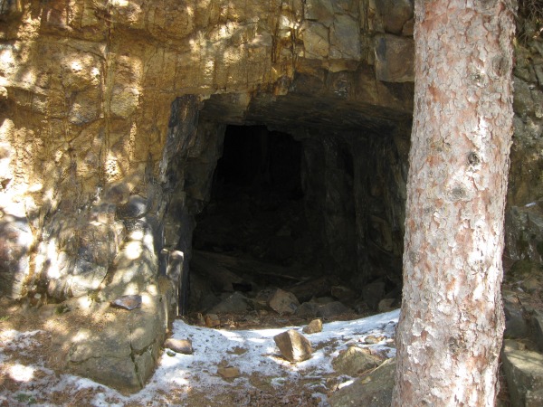
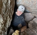
At this point, my partner and I started to gently ascend towards the Jones Park area. Along the trial, we came to an old mine.
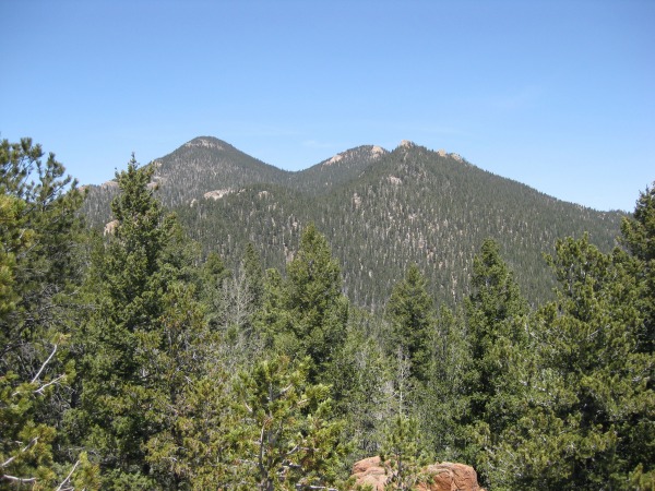
First shot of our goal.
One of my faithful hiking partners.
Mine shaft along the trail.
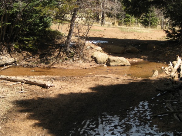
We finally came to the junction of multiple trails with another stream crossing in the Jones park area. For those interested, I have summitted Mt. Garfield, Mt. Arthur, The Tenny Crags, and Hideaway Peak from this location. There are additional peaks that can be reached from here, but there are better approaches. The approach to Garfield and Arthur take you through Jones Park where there are remnants of three old cabins from the late 1800s to early 1900s.
The water crossing at the multiple trail junction.
At this point, it is roughly 1/2 mile to the summit of Mt. Kineo.
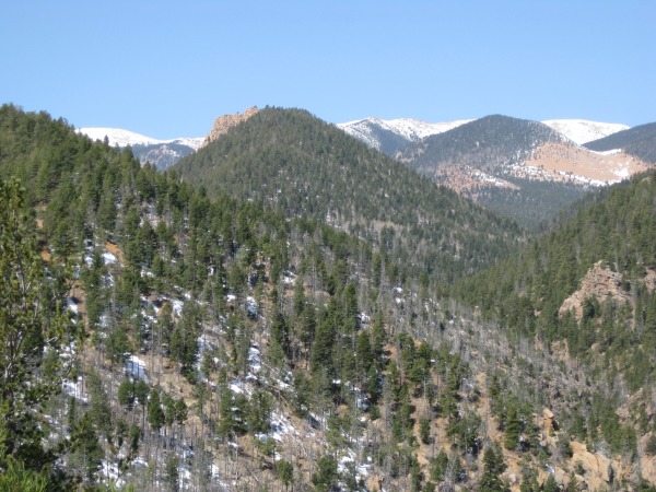
Mt. Garfield and Mt. Arthur from Mt. Kineo.
Tenny Crags from Mt. Kineo.
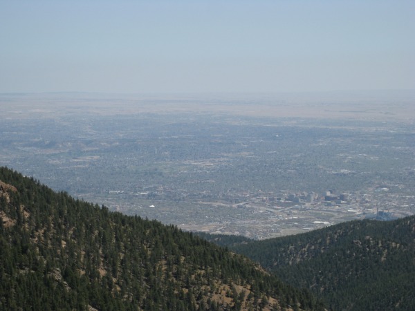
Colorado Springs
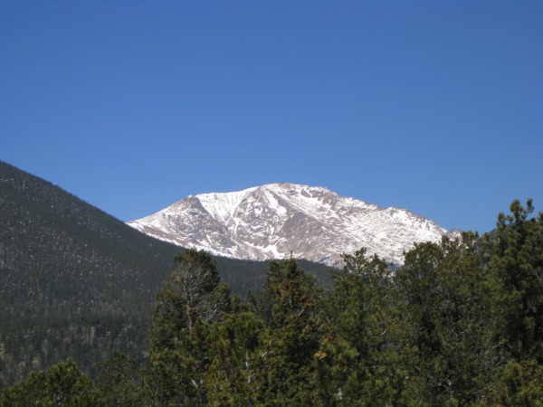
Snow covered Mt. Baldy (left) and Almagre (right).
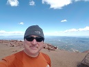
And since this is a 14ers site...Pikes Peak from Mt. Kineo.
A closer look.
Overall, it was a nice day out in the foothills. Looking forward to the summer challenges.
Thumbnails for uploaded photos (click to open slideshow):
So another area peak bites the dust, or have you already done this one? Nice day to be out under those blue skies. Isn‘t Colorado Springs cool with all the local peaks that seem rarely traveled?
There are few peaks in the CS area I haven‘t hit. Been on this one a few times. I love the Jones Park area (especially in the fall when the Aspen are changing). If I would have known I was doing this, probably would have contacted you (as I know you are working on these peaks).
Congrats on thepeak. I did Mt. Rosa last weekend with a friend from work, pretty nice day and no one else was on the trail all day. We should really and try to hook up this summer for a peak or two, you also Brad.
It looks like I am going to do the Cristo Couloir on Quandry this thursday or friday, should be fun!
Caution: The information contained in this report may not be accurate and should not be the only resource used in preparation for your climb. Failure to have the necessary experience, physical conditioning, supplies or equipment can result in injury or death. 14ers.com and the author(s) of this report provide no warranties, either express or implied, that the information provided is accurate or reliable. By using the information provided, you agree to indemnify and hold harmless 14ers.com and the report author(s) with respect to any claims and demands against them, including any attorney fees and expenses. Please read the 14ers.com Safety and Disclaimer pages for more information.
Please respect private property: 14ers.com supports the rights of private landowners to determine how and by whom their land will be used. In Colorado, it is your responsibility to determine if land is private and to obtain the appropriate permission before entering the property.