Download Agreement, Release, and Acknowledgement of Risk:
You (the person requesting this file download) fully understand mountain climbing ("Activity") involves risks and dangers of serious bodily injury, including permanent disability, paralysis, and death ("Risks") and you fully accept and assume all such risks and all responsibility for losses, costs, and damages you incur as a result of your participation in this Activity.
You acknowledge that information in the file you have chosen to download may not be accurate and may contain errors. You agree to assume all risks when using this information and agree to release and discharge 14ers.com, 14ers Inc. and the author(s) of such information (collectively, the "Released Parties").
You hereby discharge the Released Parties from all damages, actions, claims and liabilities of any nature, specifically including, but not limited to, damages, actions, claims and liabilities arising from or related to the negligence of the Released Parties. You further agree to indemnify, hold harmless and defend 14ers.com, 14ers Inc. and each of the other Released Parties from and against any loss, damage, liability and expense, including costs and attorney fees, incurred by 14ers.com, 14ers Inc. or any of the other Released Parties as a result of you using information provided on the 14ers.com or 14ers Inc. websites.
You have read this agreement, fully understand its terms and intend it to be a complete and unconditional release of all liability to the greatest extent allowed by law and agree that if any portion of this agreement is held to be invalid the balance, notwithstanding, shall continue in full force and effect.
By clicking "OK" you agree to these terms. If you DO NOT agree, click "Cancel"...
For those of us in the Pikes Peak region, there is a great summit directly behind "the Peak". No, it's not a 14er, or even a 13er, but a rather challenging 12er named "Sentinel Point". One of my climbing partners ( Yosemite98 ) and I took a stab at it last weekend. This was his 1st attempt and my 3rd (I was turned back once due to heavy snow/no snowshoes; and once due to illness/cold). This is my first Trip Report on 14ers.com and (after a quick search) appears to be the first trip report for Sentinel Point! My hope is to give others in the Colorado Springs area some good data on a peak that is seldom climbed but a great spring warm up hike for 14ers!
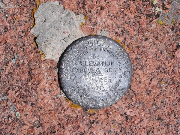
Sentinel Point lies about 3.25 miles due west of Pikes Peak. My best guess at the altitude is 12,527 feet. However, this is debatable since I've seen other altitudes recorded on maps for this peak and the summit marker didn't have the elevation).
We left Colorado Springs a little after 6:30 am, arriving at Horsethief Park (the trailhead) about an hour later. After gearing up, we began our ascent at about 7:50 am.
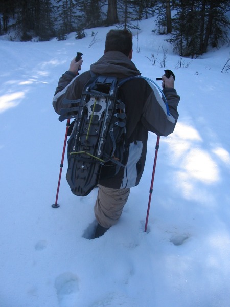
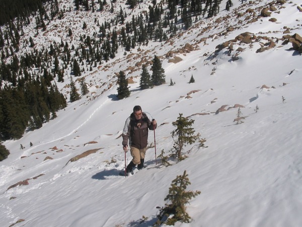
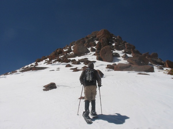
Above is a picture of Yosemite98 at the start of the hike. Because of the way the trail starts out heading east and then banks to the south, the sun was in our eyes most of the way up. My advice for others is to start early on this peak so the sun is always behind the mountains as you hike. It seems like it was always "just over the horizon" for us.
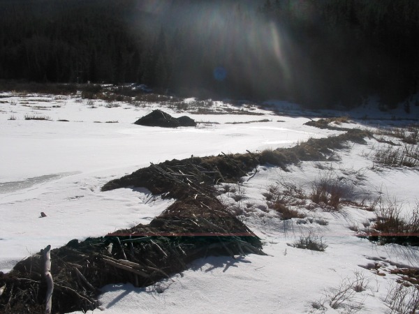
Since much of this hike is along the north face of the mountains and/or wooded, snowshoes were required for almost all of the hike. We did, however, experience a stretch just after crossing a small creek where the trailed opened up to a small valley next to a creek with beaver dams.
Here's a shot of the beaver dams. These are particularly impressive in the summer.
Yosemite98 was the first to posthole as we headed back into the trees. We donned our snowshoes not long after this shot was taken.
The picture above gives a good idea of how the trail looked through the trees. As you can see, there's quite a bit of snow... well shaded and guarded on the north face.
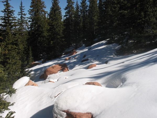
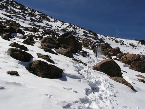
As we approached treeline, a large gully opened up. I understand from others, this is a rather formidable boulder field during the summer. In winter the boulders weren't the problem, but the deep snow between them! Even in snowshoes we did a fair amount of postholing. This section shows one of the less intimidating portions of the trail.
Here's a picture of me running uphill in snowshoes. Ok... ok... actually, this is an optical illusion... but this shows one of the more difficult sections we were navigating.
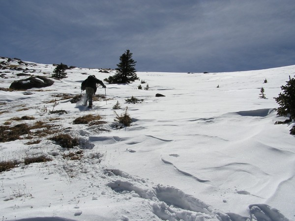
As we made our way up the gully, the climb got quite steep. This is a representative picture looking north along the route we were traveling. Fortunately, this area was more wind-swept and we actually had a bit of alpine tundra under our feet.
A look at Yosemite98 climbing the steep gully. Our snowshoe trail can be seen behind him.
And this is a look UP the gully at me.
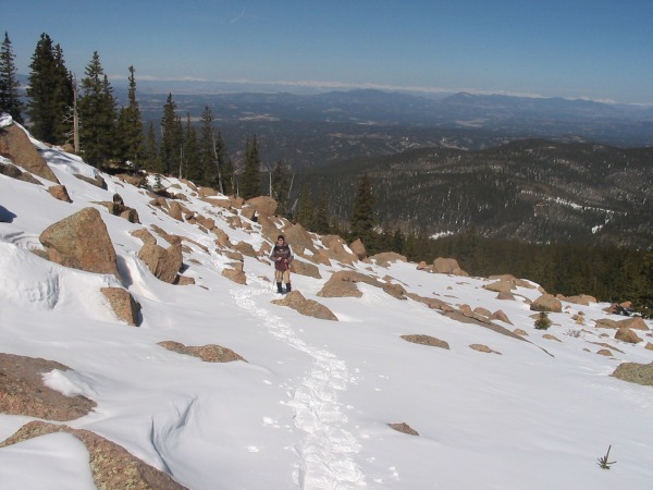
The final push to the summit! Once you come out of the gully, you reach this short ridge line that leads to an equally short boulder climb to the summit. On other web sites, I've heard this is rather treacherous Class 3 climbing. We found it rather simple and had no difficulty boulder hopping to the top. I have to guess that maybe the snow made it easier?
As a side note, up until this point we'd had perfect conditions. Warm (probably in the 40's) and no wind at all. Once we reached this ridge line, winds started hitting us at about 20 to 25 mph with gusts a bit more. Still, not bad at all for April in the high country!
The "final" final push to the summit!
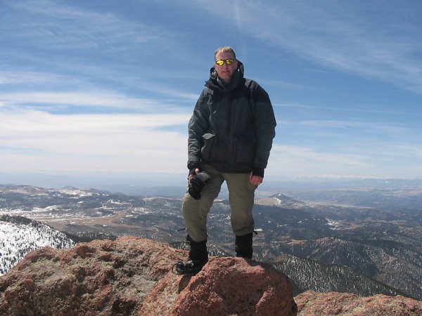
Victory! The reason why I look old and tired is because I am old and tired.
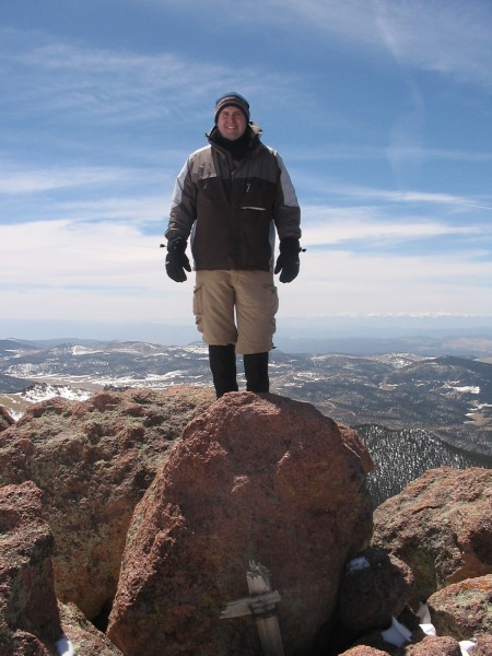
Yosemite98 made it to the summit too.
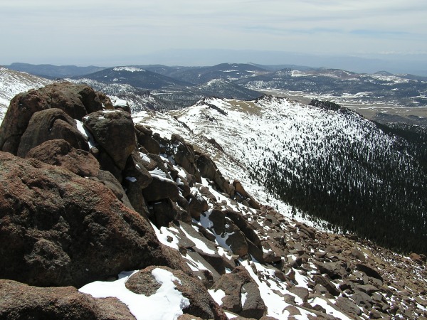
The summit of Sentinel Point provides a unique view of Pikes Peak. As you can see, there's still a fair amount of snow on the west side of the peak.
If desired, you can do Sentinel Point as a loop trail... heading down this ridge and then down the slope to the "right" in the picture to Horsethief Park. Unfortunately, it was at this point I realized I lost my GPS and we decided to head back the same way to look for it (yes, we did find it).
Here's the marker! As you can see, no elevation. Sigh...
This is a view from the summit of the Horsethief Park area where we hiked. The trailhead is actually about dead center in the picture. I've highlighted the path we hiked through the park in green. Had we done the "loop" trail, we would have come back along the yellow line.
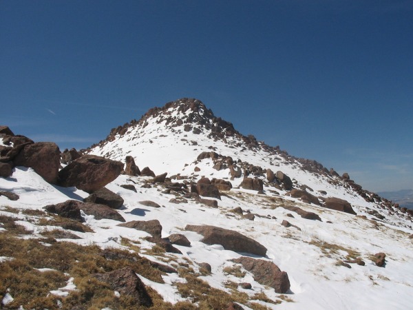
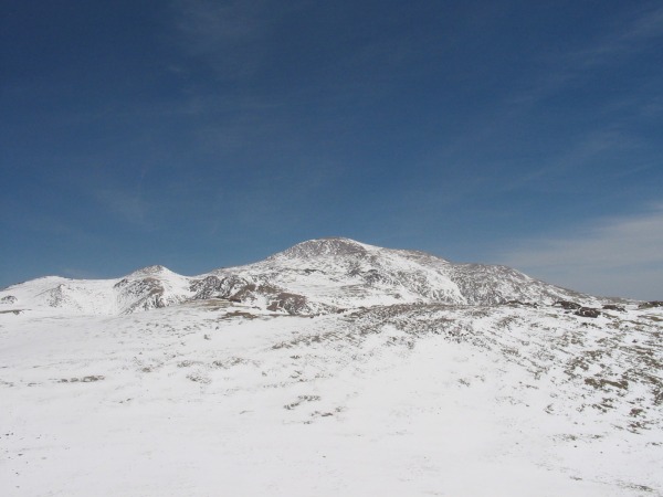
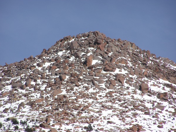
Here's a look back from Horsethief Park to Sentinel Point.
One last (heavily zoomed) shot of the summit.
In all, the trip was about 7.8 miles round trip with 2,900 feet of elevation gain. I understand that the loop trail (had we taken it) is about 6.5 miles. This was our first summit of any peak in winter and it took us about 8 hours and 20 minutes. I'm sure those with more experience and conditioning could do this much faster but our goal wasn't speed. One last item of note... We saw no one. I mean NO ONE on this hike... either on the way up or the way down. This was a little surprising as Horsethief Park is pretty popular with local snowshoers and this was a beautiful Saturday with ideal weather conditions. There's nothing better than having a peak to yourself!
Thumbnails for uploaded photos (click to open slideshow):
Good pictures and beta, I will be out there in 4 weeks. If you‘re in the area you should also hike the ridgeline to pt 12499 along with sentinal. You might just see me because this is one of my favorite training spots.
Your not old...Your only 1 year older than me and I am feeling pretty young compared to 5 years ago. What a paradox!!!
Anyway, just found this report and loved it. Gives me something to look forward to next winter. I am looking at some local hikes including the East face of Almagre. Will let you know when I plan to attempt which maybe soon considering the snowmelt.
I'm a little late in reading your TR, but glad I found it. Sentinel is definitely on my list of peaks to hike. I want to do it summer of '11. Can't wait!
Mennoguy... Is that the point in the direction of Devil‘s Playground (to the North of Sentinel Point)? If so, we almost went that direction by mistake... That is, we were heading up the gully to the left instead of the right.
Tjohn67238, this is a great hike... especially in summer. Let me know if you need any additional information. I have our GPS Tracks and lots of other information.
Caution: The information contained in this report may not be accurate and should not be the only resource used in preparation for your climb. Failure to have the necessary experience, physical conditioning, supplies or equipment can result in injury or death. 14ers.com and the author(s) of this report provide no warranties, either express or implied, that the information provided is accurate or reliable. By using the information provided, you agree to indemnify and hold harmless 14ers.com and the report author(s) with respect to any claims and demands against them, including any attorney fees and expenses. Please read the 14ers.com Safety and Disclaimer pages for more information.
Please respect private property: 14ers.com supports the rights of private landowners to determine how and by whom their land will be used. In Colorado, it is your responsibility to determine if land is private and to obtain the appropriate permission before entering the property.