Download Agreement, Release, and Acknowledgement of Risk:
You (the person requesting this file download) fully understand mountain climbing ("Activity") involves risks and dangers of serious bodily injury, including permanent disability, paralysis, and death ("Risks") and you fully accept and assume all such risks and all responsibility for losses, costs, and damages you incur as a result of your participation in this Activity.
You acknowledge that information in the file you have chosen to download may not be accurate and may contain errors. You agree to assume all risks when using this information and agree to release and discharge 14ers.com, 14ers Inc. and the author(s) of such information (collectively, the "Released Parties").
You hereby discharge the Released Parties from all damages, actions, claims and liabilities of any nature, specifically including, but not limited to, damages, actions, claims and liabilities arising from or related to the negligence of the Released Parties. You further agree to indemnify, hold harmless and defend 14ers.com, 14ers Inc. and each of the other Released Parties from and against any loss, damage, liability and expense, including costs and attorney fees, incurred by 14ers.com, 14ers Inc. or any of the other Released Parties as a result of you using information provided on the 14ers.com or 14ers Inc. websites.
You have read this agreement, fully understand its terms and intend it to be a complete and unconditional release of all liability to the greatest extent allowed by law and agree that if any portion of this agreement is held to be invalid the balance, notwithstanding, shall continue in full force and effect.
By clicking "OK" you agree to these terms. If you DO NOT agree, click "Cancel"...
Peak : Wilson Peak (14,017 feet)
Trail Head: Bilk Basin (Lizard Head)
Total Mileage: 13.5
Elevation Gain: 4,267 feet (trail head estimated at 9,750 feet)
The plan for the weekend was to climb Wilson Peak on Saturday and Mount Wilson traversing to El Diente on Sunday. The big unknown was how much snow Colorado's high country had received the past few weeks.
(In this trip report I had initially made nice lines showing routes and such, but they would not transfer over to this site for whatever reason. I spent a few hours trying everything I could think of to make it work, but no luck. Someone please enlighten me!)
Jake and I left Vernal at 5:00 Friday afternoon and arrived at the trailhead at about midnight. Finding the trailhead was a process of elimination due to the lack of signage. From the Illium townsite take a right onto 63J (mentioned as 631 in Dawson's guide). From here the road heads up a gradual grade up canyon. After a couple of miles the road will start switch-backing up the mountain with several spur roads along the way. The first trailhead you come to is not the one. At the first trailhead intersection take a right, the road from here on is very muddy when wet. Take a left at the intersection that has some historic structures on the along the left fork. Continue 1/8 mile to trailhead (NOT labeled as Bilk Basin Trailhead.) I believe it was labeled as Lizard Head. This was confusing since there is another Lizard Head Creek Trailhead. Trailhead is now 2 miles prior to the Morningstar Mine ruins adding another 4 miles round trip.
Since there was an almost full moon (waning gibbous) we decided to start our hike in. Our thought was to make it to the connecting ridge between Gladstone and Wilson Peak within 3-4 hours. There was a couple of inches of snow on the ground and I was glad that was it. However the trail was extremely slick due to partially melted snow (basically ice.) The first trail intersection mentioned Wilson Mesa trail going right, Lizard Head trail going left. From here you can go either way. We opted the right (Wilson Mesa way, the other way is probably quicker). Both take you to the Morningstar Mine. At the next intersection take a left (there are no trail signs.) The next intersection was a mystery. There is an arrow pointing right and the left route is a closed road. We started out taking the right, but after a half mile we turn around because it was taking us the wrong direction and we lost a few hundred feet in elevation. Now on the closed road we found ourselves following a water pipeline up canyon. Eventually it led to a head gate at the bottom of a waterfall. After crossing the stream we found the Lizard Head 505 trail about 200 feet from the creek. At this point the snow depth was increasing significantly (1-2 feet). We followed the (unmarked) Lizard Head 505 trail up canyon and soon came up on the Morningstar Mine ruins. This was a relief, something finally matched up to the guide books. The wilderness boundary is just past the ruins.
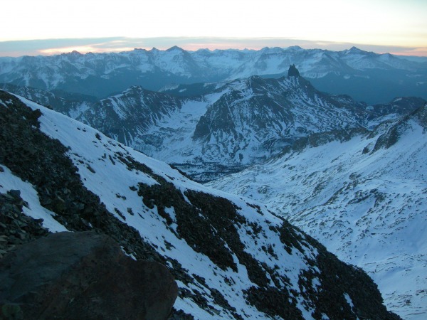
From here the hike became very arduous due to a couple feet of snow and finding the trail was sometimes tedious. By the time we made it to tree-line it was 5:00 in the morning and we were both spent. We found a small flat grassy patch in a boulder field and crashed for a couple of hours. At 8:00 I awoke to the site of Lizard Head Peak. Awesome looking peak!
At 9:00 we were back to plowing and post-holing our way up the trail. At about 10:30 we crested to the point of looking into Bilk Basin. The journey to this point had been exhausting, postholing in snow most of the way. After seeing how much snow was in Bilk Basin (2-3+ feet) and on the surrounding mountains our plans changed. Some areas were void of snow but these areas were nasty loose rock. We decided to make camp at the bottom of Bilk Basin (a little over 12,200 ft.) in a small area melted free of snow. We cancelled thoughts of Mount Wilson and El Diente and focused on Wilson Peak. For the rest of the day we kicked back and relaxed, enjoying the beauty of the surroundings.
(Lizard Head Peak from camp)
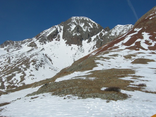
(Wilson Peak, I wanted to take the prominent couloir, but did not know what the top led to, so we later went up Bilk Basin most of the way then took a direct route straight up.
Sunday morning at 5:00am we set out for the summit of Wilson Peak. The moon lit Bilk Basin up nicely. We were hoping the snow would have set up strong enough so that we would not be postholing. No such luck. We post-holed all the way up Bilk Basin. Once reaching a little over 2/3 of the way up Bilk Basin, we started straight up the mountain side. Once we were out of the Basin a couple hundred feet the snow was solid and crampons became necessary due to the 45% slope. We snow climbed straight up about 2/3 of the way until coming to a large area of rock void of snow. The rock was very loose and for every four steps you took one was gained. At the first opportunity we put our crampon back on and took back to the snow. The angle at this point was very steep exceeding 45% slope.
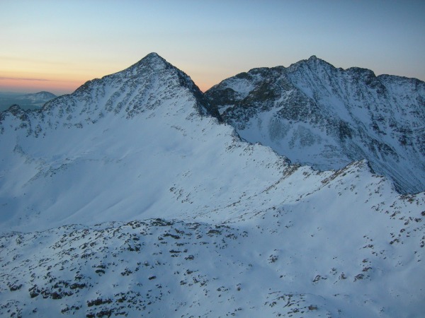
(over 2/3 of the way up looking back towards Lizard Head Peak)
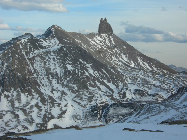
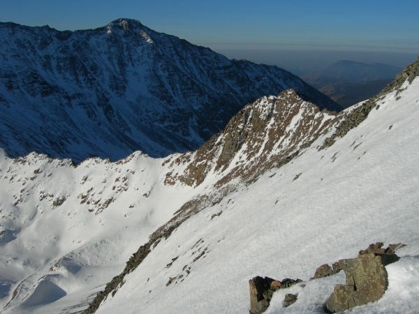
(Gladstone/ Wilson Peak Ridge, Gladstone & Mount Wilson in background)
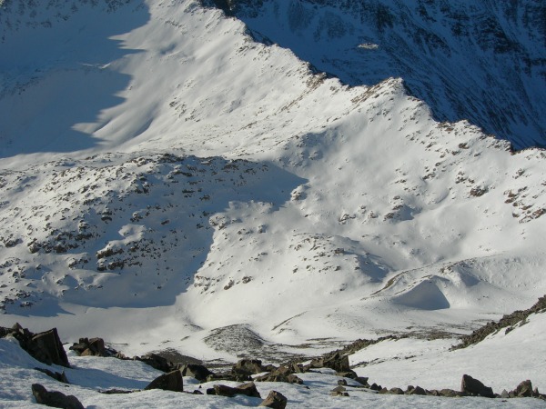
(old miners cabin, in lower right of photo, we started our ascent before reaching the hill in which cabin is located)
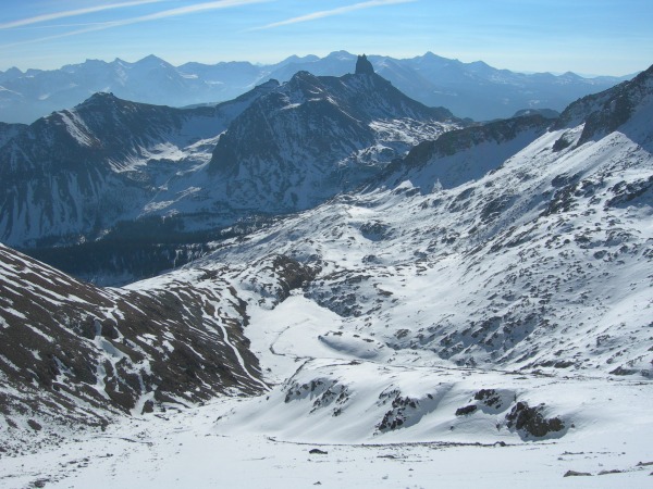
(upper portion of Bilk Basin, our ascent was straight up from lower right corner of photo.)
We crested just below the summit above a prominent couloir at sunrise.
(Just below the summit, couloir we descended directly behind me)
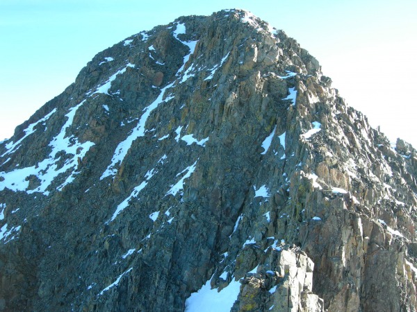
Shortly thereafter we were on the false summit looking across at the crux of the climb. From here we left our packs and took only rope, harness, and a few misc. pieces of hardware for a rappel back down. The snow and ice made this class 4 part of the climb very interesting to say the least. I took a few pieces of pro just in case, but the rock is pretty unstable and loose in most places. The summit was capped with a few feet of snow. The view was great, but not much time was spent there due to needing to get back down before the snow began to thaw. Anyone know the story behind the wreckage on the summit?
(Our route up was slightly to the right once past the connecting fin of false summit, right side of photo)
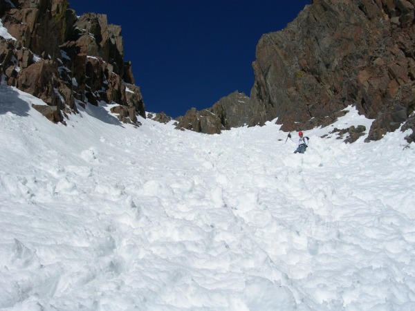
Once off the summit we descended the couloir below the false summit and true summit. This made for a nice smooth decent. An avalanche from the previous day had scoured out the middle of the couloir, but there was still plenty of snow left.
(halfway down couloir looking up at Jake)
(Bottom of Couloir, arrow pointing to high camp above old mining road)
(descent route was prominent couloir on left side of Peak in photo)
We were back at high camp at 11:00. Once reaching camp ate lunch and packed up camp. Yesterday and today after about 1130-1200 the rock fall off Wilson Peak was frequent. The combination snow and an abundance of loose rock on very steep slopes made for dangerous conditions once heated by the sun. On numerous occasions rockfall from the upper 1/3 of the mountain made it down to Bilk Basin and partially up the other side.
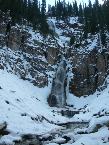
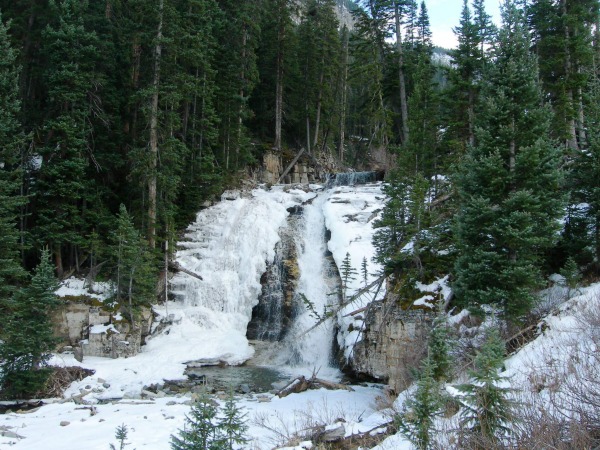
The hike out was much better, a lot of the snow had melted at lower elevations and the trail was much easier to find in daylight. Along the way out we stopped at all the major waterfalls and at the Morningstar Mine ruins. I wish this valley was closer to home, it looks like an ice climbing paradise!
(Uppermost falls)
(middle falls)
(lower falls, beginning of water pipeline)
At 5:00 pm we were back at trailhead. We followed the same way out as we came in. This was definitely the hardest 14er for this year so far. Mount Wilson and El Diente will be another day!
(Has anyone every tried summiting via the couloir angling up to the right in this photo? It looks good except a questionable pitch at the top of the couloir. At the top of the couloir it looks like it would become a class 4+ rock climb going up and to the left. )
Thumbnails for uploaded photos (click to open slideshow):
Big thanks for the beta and excellent TR.
After driving by Wilson Peak on Sunday, I was considering giving it a shot this weekend, but I can wait until I don't need pro or snow gear.
Sweet climb man. The wreckage is from a small plane crash but I'm not aware of the details. It was being discussed on the forum at some point. I usually draw routes on my images in paint and save a copy before uploading them.
"An avalanche from the previous day had scoured out the middle of the couloir" - Wow! Already? I didn't realize these suckers were getting that much snow.
Caution: The information contained in this report may not be accurate and should not be the only resource used in preparation for your climb. Failure to have the necessary experience, physical conditioning, supplies or equipment can result in injury or death. 14ers.com and the author(s) of this report provide no warranties, either express or implied, that the information provided is accurate or reliable. By using the information provided, you agree to indemnify and hold harmless 14ers.com and the report author(s) with respect to any claims and demands against them, including any attorney fees and expenses. Please read the 14ers.com Safety and Disclaimer pages for more information.
Please respect private property: 14ers.com supports the rights of private landowners to determine how and by whom their land will be used. In Colorado, it is your responsibility to determine if land is private and to obtain the appropriate permission before entering the property.


")


