| Report Type | Full |
| Peak(s) |
Mt. Sniktau - 13,239 feet |
| Date Posted | 10/25/2007 |
| Date Climbed | 10/25/2007 |
| Author | coloradokevin |
| Mt Sniktau - Beautiful day for a hike! |
|---|
|
Okay, I have to start this report off by saying that I "promised" myself that I wouldn't do any peak ascents this week... After all, as some of you already know, I spent the last two weeks in Hawaii on vacation! And, despite a few significant hikes there, I have to admit that a lot of my time was spent sitting on a beach eating fatty foods, and imbibing in beverages of the tropical and alcoholic type Needless to say, my body didn't want to "work" this week! So, after I came to terms with the fact that I was kidding myself about not hiking up high, I decided to pick a very easy climb. Thus, a trip report from Mt. Sniktau! (Besides, everyone is itching for snow conditions right now anyway!!) One thing I love about late fall is that I can safely start my ascents at much more "practical" times in the afternoon. As you may know from my previous trip reports, I'm not much of a morning person. So, knowing that this was a very short hike, we started around 2pm this afternoon! The weather was gorgeous, and even at this elevation I didn't need a jacket for most of the hike! We discovered that the route was mostly snow-free (thought it looks like the wind may keep it that way most of the season). Here is Julie at the start of the ascent: 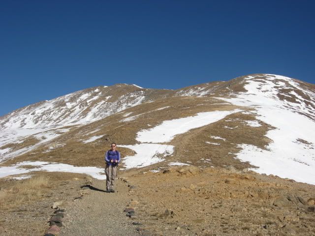 This picture looks towards PT 12,915, which is the first obstacle on this 2-mile long ascent. As you can see, much of this side of the peak is windswept!: 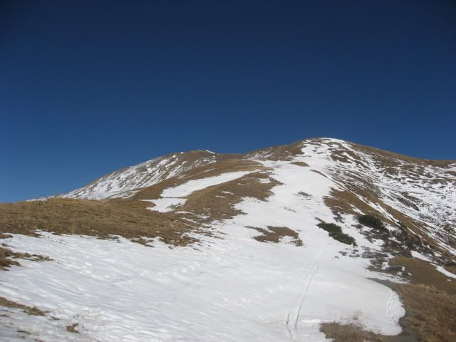 The climb towards Sniktau involves bumping along a couple of hills over the course of a gentle ridge leading to the peak. The first hump on this ridge was fairly straightforward, and the trail was wide and "touristy" throughout this section. After gaining the top of PT 12,915, we were rewarded with great views of the surrounding valleys! I should also note that this is the spot where the route to Grizzly Peak D splits off from the Sniktau trail... Julie nearing the top of PT 12,915: 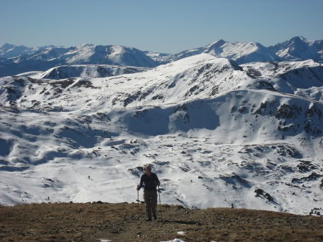 A view towards Torreys from the top of this hill: 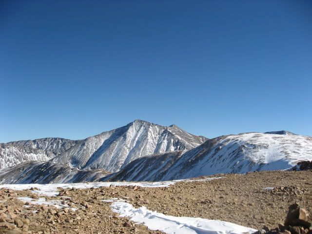 Juno decides to complete her obligatory roll-in-the-snow at this point: 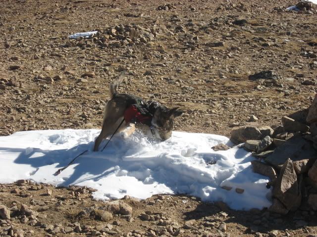 Julie was feeling a bit under the weather today, so we stopped for lunch at the top of this first hump. Unfortunately food didn't improve her situation, so Julie decided to head down with our puppy while I continued the climb by myself. The remainder of the hike that followed involved a few unaesthetic climbs over less-than-pleasing slag heaps. However, the route greatly made up for this shortcoming with the views of the surrounding peaks! Additionally, the final push to the top was a bit more pleasing, and involved a gentle ridge ascent next to a building cornice on the lee side of the peak: 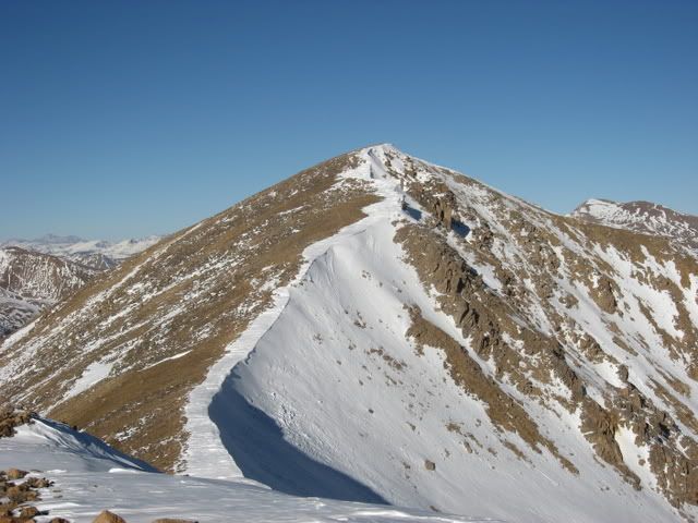 Being that it was late October, and not a "14'er", I had the summit of this peak to myself. Fortunately I brought along my "gorrilapod" tripod, and managed to snap a self-portrait on the summit. Note my goofy-looking fishing style hat 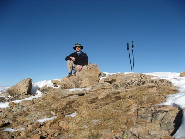 Although I was pretty sure of the summit, I verified it with the GPS because of the up-and-down ridge hoping this short route involved. Fortunately I was in the right place: 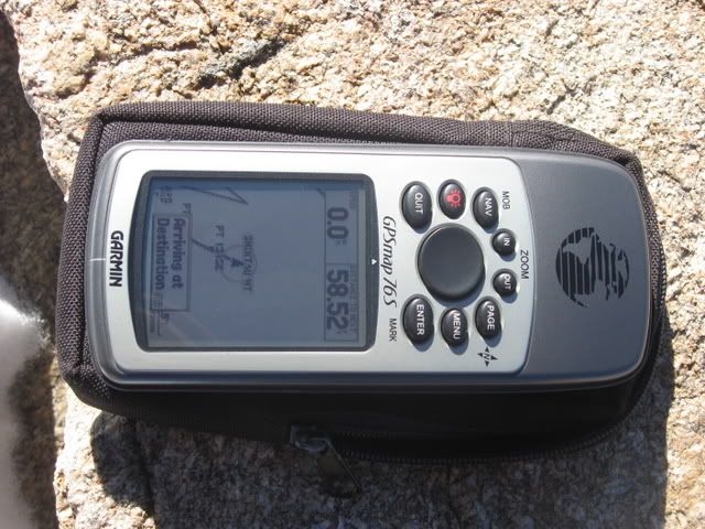 The trip down the mountain was straightforward, and it was nice to have a mountain all to myself! When I arrived at my car I noted that the round-trip had taken 2:45 hrs. I imagine this hike could be done a good bit quicker without the lunch breaks and photo op's! A NOTE ON CONDITIONS (for anyone who cares): As I mentioned previously in this report, most of my route was snow-free. However, I also observed that had my route involved travel on the lee side of these mountains, I would have spent the day traveling through what was very much a winter-like snowpack. Just on the other side of the ridge that I climbed a cornice was beginning to form. A solid snowpack continued from that point most of the way down the lee-valley of this mountain. The other nearby peaks also looked quite snowy on their lee sides, and a number of folks were out backcountry skiing/riding from the top of Loveland Pass today. Again, you will likely deal with very little (or no) snow on the windward sides of most of these peaks, so your results may vary!!! I also observed extremely variable snow conditions during this hike. Some areas were consolidated and felt like spring-time corn snow. In other spots I noticed a foot-thick and densly packed wind crust had developed over much less dense snow (this was, however, observed in a relatively flat area). In one of these areas (I think it was the NE bowl below PT 13,152) I noted that there appeared to be possible signs of a recent avalanche. A possible crown line appears to run horizontally across this slope, near the top of the rock pile that is in the lower-center part of this picture. Although this image doesn't show it, there also appeared to be some associated snow/avalanche debris directly below this long crown line... 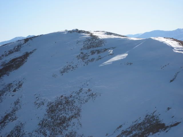 I must admit that I can't verify this situation with absolute certainty, given that I was viewing this slope from a significant distance without the aid of binoculars.... and against the setting sun! Additionally, I didn't dig any pits or attempt to conduct any type of "formal" snow analysis during this hike (my route didn't involve steep snow travel today, so I obviously didn't bother). However, I would probably be as bold as to say that winter travel considerations should now be thought of when traveling in the steep-and-deep snow that some of the peaks are now showing on their lee sides. In short, winter is here!!!! |
| Comments or Questions | |||
|---|---|---|---|
|
Caution: The information contained in this report may not be accurate and should not be the only resource used in preparation for your climb. Failure to have the necessary experience, physical conditioning, supplies or equipment can result in injury or death. 14ers.com and the author(s) of this report provide no warranties, either express or implied, that the information provided is accurate or reliable. By using the information provided, you agree to indemnify and hold harmless 14ers.com and the report author(s) with respect to any claims and demands against them, including any attorney fees and expenses. Please read the 14ers.com Safety and Disclaimer pages for more information.
Please respect private property: 14ers.com supports the rights of private landowners to determine how and by whom their land will be used. In Colorado, it is your responsibility to determine if land is private and to obtain the appropriate permission before entering the property.


