Download Agreement, Release, and Acknowledgement of Risk:
You (the person requesting this file download) fully understand mountain climbing ("Activity") involves risks and dangers of serious bodily injury, including permanent disability, paralysis, and death ("Risks") and you fully accept and assume all such risks and all responsibility for losses, costs, and damages you incur as a result of your participation in this Activity.
You acknowledge that information in the file you have chosen to download may not be accurate and may contain errors. You agree to assume all risks when using this information and agree to release and discharge 14ers.com, 14ers Inc. and the author(s) of such information (collectively, the "Released Parties").
You hereby discharge the Released Parties from all damages, actions, claims and liabilities of any nature, specifically including, but not limited to, damages, actions, claims and liabilities arising from or related to the negligence of the Released Parties. You further agree to indemnify, hold harmless and defend 14ers.com, 14ers Inc. and each of the other Released Parties from and against any loss, damage, liability and expense, including costs and attorney fees, incurred by 14ers.com, 14ers Inc. or any of the other Released Parties as a result of you using information provided on the 14ers.com or 14ers Inc. websites.
You have read this agreement, fully understand its terms and intend it to be a complete and unconditional release of all liability to the greatest extent allowed by law and agree that if any portion of this agreement is held to be invalid the balance, notwithstanding, shall continue in full force and effect.
By clicking "OK" you agree to these terms. If you DO NOT agree, click "Cancel"...
| Report Type |
Full |
| Peak(s) |
San Luis Peak - 14,023 feet
|
| Date Posted |
08/13/2007 |
| Date Climbed |
08/04/2007 |
| Author |
Spam |
| San Luis, wet slog from Stewart Creek |
San Luis Peak
Date Climbed: August 4, 2007
Trailhead: Stewart Creek
Elevation: 14,014 feet
Trailhead Elevation: 10,500
Elevation Gain: 3600 Feet
Roundtrip from campsite: 13.5 miles
We arrived at trailhead about 9:30pm after a nice meal at Garlic Mikes in Gunnison, which I highly recommend. Drove through the beautiful canyon (114) arriving at the dirt road (NN14) heading to the trailhead. Once on 794 you are home free and it is a fun drive in when dark. Arrived at the trailhead and went about ¼ mile up the road to a nice campsite.
Woke at 5:00 and after breakfast and coffee hit the trailhead at 6:01 am.. Unfortunately did not see any wildlife on the way in, however this is a very scenic hike. It does not gain altitude quickly and the hike in by the marsh and through the forest which has a very defined trail...
 >
>
Once in the trees you cross 3 bridges and there are a few obstacles as some trees have fallen over that you must cross. At this large tree my recommendation is that if you go under be very careful of this branch (see circle) as when you stand up you can hit your head and it will make you woozy for a moment. Damn that hurt...
 >
>
The trail opens up into more marsh area. Treeline is well over 12,000 feet in this area we discovered and is not as clearly noticeable as on most peaks. In the morning the vegetation is wet and our pant legs were very wet on the way in, nothing to be workup over at all however, you just need to expect to get wet...
 >
>
 >
>
It is a long hike in and San Luis is really not visible for the first 4 miles or more. Once you make the third bridge crossing, you start to gain elevation. The trail continues to be well defined and follows the creek all the way up. There are several creek crossings as the trail meanders up the creek...
 >
>
This was my first trip to this area and was amazed by the geology of this area. This is around Organ Peak which is named for looking like organ pipes. Can someone in here give the background of the formations in this area, they are cool...
 >
>
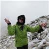
We reached the summit at 9:55 am. The weather held for us, however it was clear that it was not going to hold completely. The clouds did provide for some cool pictures...
 >
>
Here is a shot of Uncompahgre and Wetterhorn...I am sure they are beautiful somewhere there...
 >
>
Redcloud and Sunshine I am sure were very pretty that day also, if we could see them...
 >
>
I paid my tribute once more to Talus Monkey and to make it special Talys Anne on this summit. Welcome to the world Talys Anne, this is for you and Uncle David...

>
We stayed on the summit for 45 minutes then headed down. We got to the trees before the steady downpour began. I had to put away my camera as it poured on us for the majority of the trip down. I am thankful that there was no lightning and I was not turned away from a peak. I got this last shot of the peak as we high tailed it to treeline...
 >
>
We got back to camp at 2:30 and after consuming a PBR laid down in the tent for a nice 2 ½ hour nap as the thunderstorm finally rolled through.
This was an underrated peak I thought as the march in is very scenic and on other days would certainly have great opportunity for wildlife. That was the only disappointment of this trip. We had intended on also climbing Organ Peak, however, the weather gods were not on our side and so it was not to be. There are several high 13ers right by this peak that are begging to be climbed that look like a lot of fun. It was a an enjoyable trip.
|
Caution: The information contained in this report may not be accurate and should not be the only resource used in preparation for your climb. Failure to have the necessary experience, physical conditioning, supplies or equipment can result in injury or death. 14ers.com and the author(s) of this report provide no warranties, either express or implied, that the information provided is accurate or reliable. By using the information provided, you agree to indemnify and hold harmless 14ers.com and the report author(s) with respect to any claims and demands against them, including any attorney fees and expenses. Please read the 14ers.com Safety and Disclaimer pages for more information.
Please respect private property: 14ers.com supports the rights of private landowners to determine how and by whom their land will be used. In Colorado, it is your responsibility to determine if land is private and to obtain the appropriate permission before entering the property.