Download Agreement, Release, and Acknowledgement of Risk:
You (the person requesting this file download) fully understand mountain climbing ("Activity") involves risks and dangers of serious bodily injury, including permanent disability, paralysis, and death ("Risks") and you fully accept and assume all such risks and all responsibility for losses, costs, and damages you incur as a result of your participation in this Activity.
You acknowledge that information in the file you have chosen to download may not be accurate and may contain errors. You agree to assume all risks when using this information and agree to release and discharge 14ers.com, 14ers Inc. and the author(s) of such information (collectively, the "Released Parties").
You hereby discharge the Released Parties from all damages, actions, claims and liabilities of any nature, specifically including, but not limited to, damages, actions, claims and liabilities arising from or related to the negligence of the Released Parties. You further agree to indemnify, hold harmless and defend 14ers.com, 14ers Inc. and each of the other Released Parties from and against any loss, damage, liability and expense, including costs and attorney fees, incurred by 14ers.com, 14ers Inc. or any of the other Released Parties as a result of you using information provided on the 14ers.com or 14ers Inc. websites.
You have read this agreement, fully understand its terms and intend it to be a complete and unconditional release of all liability to the greatest extent allowed by law and agree that if any portion of this agreement is held to be invalid the balance, notwithstanding, shall continue in full force and effect.
By clicking "OK" you agree to these terms. If you DO NOT agree, click "Cancel"...
We took a trip up to Beaver Creek and stayed overnight there to get an early start.
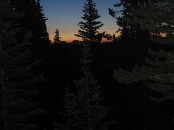
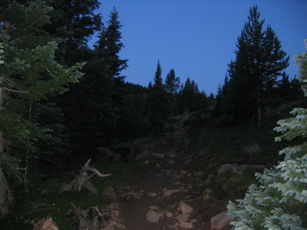
We hit the Tigiwon Road at 4:30 a.m. and other than some washboard sections the road is easily accessible. Got to the TH with a full parking lot about 4:45 a.m. From there we took off by headlamps at 5:00 a.m.
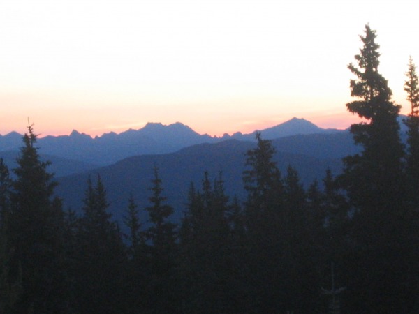
The trail to the top of the pass is solid. The view was mostly consumed with us watching the sun come up because Notch Mountain obscures the view of Holy Cross. Watching the sunrise was an awesome experience!
The trip down the other side of the pass was a welcome break from the uphill. It quickly reinforced the fact that is well known that the end of the trip involves am elevation gain coming back out of the valley at the end of the day.
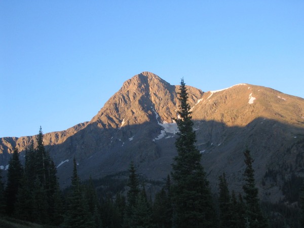
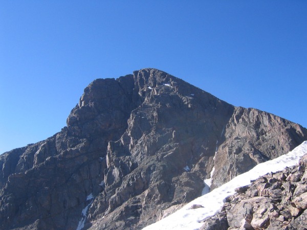
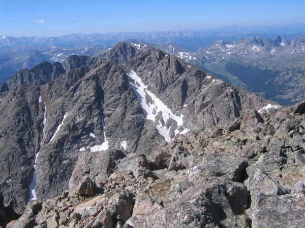
The view of Holy Cross as you round Notch Mountain is impressive. Th entire valley is a sight of the East Cross Creek waterfall/stream coming down into the area from Lake Patricia.
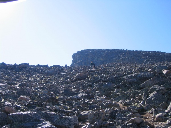
We navigated the stream and continued to push across the valley and began the walk up the shoulder of Holy Cross. I have to admit I was surprised at the amount of talus to navigate. One important lesson is to remember that it is not as important to constantly pay attention to where you are going but to watch where you have come from to get there. I will explain later.
There was a good crowd on the ridge (about 12 people within site the entire time). We managed to round the corner just below the summit section and look down the Angelica Couloir. An unbelievable view.
The final talus section was somewhat random slogging through the rocks. The biggest issue along the North Ridge and the summit section is watching out for tippers (unstable rocks that tip when you put weight on them).
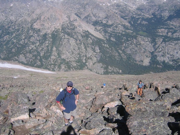
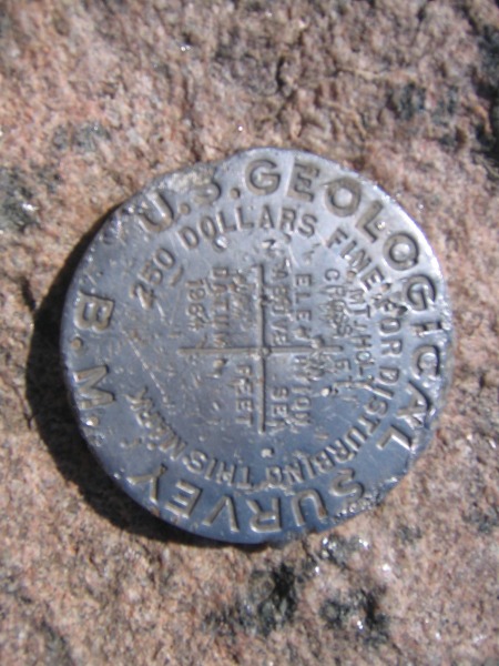
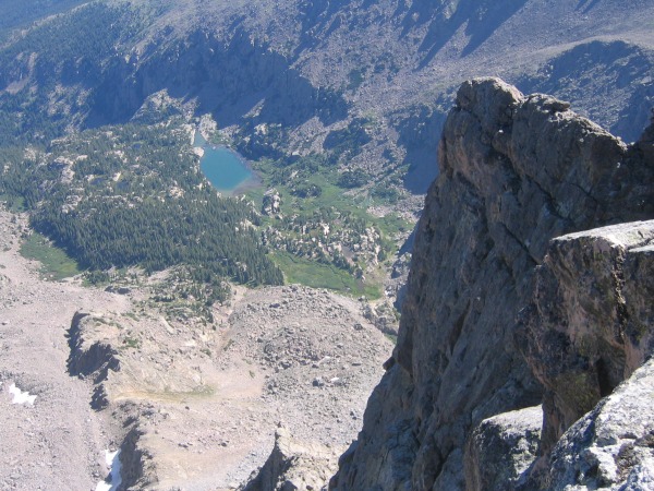
We left the main TH at 5:00 a.m. and reached the summit at 10:00 a.m. There were about 12 other people on top and the view is awe inspiring. The sight down to the Bowl of Tears is spectacular and the Elk Range was in full glory.
We descended the ridge following another group we had been with most of the day. Soon on the North Ridge we began to debate the right line to descend. Another hiker approach who pointed to the other group and said: "There's where everyone's going. That's the right way". Famous last words. The other group was off trail and descending too far to the West. Lesson:
Don't just follow everyone else.
Pay attention to what the descent looks like as you ascend (Turn
around at critical points and take a look so you recognize it).
Holy Cross' North Ridge is easy if you look at and follow the large cairns.
We quickly got back on trail and descended to East Cross Creek. I suffer from two things on every trip's descent: Knees and feet that cry on the way down. My friend chose to take off the boots and dip them in the creek for some relief. I was afraid that I would not get them back in the boots so I took a pass.
As is well documented the climb back out of the valley is not what anyone wants to do after 9 or so miles. We managed to work our way back up the trail and cross over Half Moon Pass just as a rain shower began. The descent was not the most fun I have ever had but a necessary price to pay for the great experience of climbing Mt. of the Holy Cross. We arrived back at the car around 3:00 p.m.
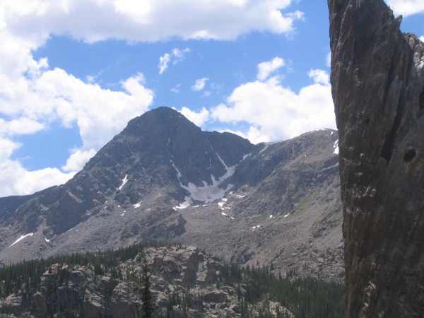
Mt. of the Holy Cross is a spectacular Colorado landmark. It is filled with eye popping natural beauty and was worth every step.
I recommend the experience if you are up to the long day.
Thumbnails for uploaded photos (click to open slideshow):
The descent is always my least favorite time; my feet are usually hammered beyond sore by the time I get to the car. Still, great report, and I'm really looking forward to this climb next summer.
Caution: The information contained in this report may not be accurate and should not be the only resource used in preparation for your climb. Failure to have the necessary experience, physical conditioning, supplies or equipment can result in injury or death. 14ers.com and the author(s) of this report provide no warranties, either express or implied, that the information provided is accurate or reliable. By using the information provided, you agree to indemnify and hold harmless 14ers.com and the report author(s) with respect to any claims and demands against them, including any attorney fees and expenses. Please read the 14ers.com Safety and Disclaimer pages for more information.
Please respect private property: 14ers.com supports the rights of private landowners to determine how and by whom their land will be used. In Colorado, it is your responsibility to determine if land is private and to obtain the appropriate permission before entering the property.