Download Agreement, Release, and Acknowledgement of Risk:
You (the person requesting this file download) fully understand mountain climbing ("Activity") involves risks and dangers of serious bodily injury, including permanent disability, paralysis, and death ("Risks") and you fully accept and assume all such risks and all responsibility for losses, costs, and damages you incur as a result of your participation in this Activity.
You acknowledge that information in the file you have chosen to download may not be accurate and may contain errors. You agree to assume all risks when using this information and agree to release and discharge 14ers.com, 14ers Inc. and the author(s) of such information (collectively, the "Released Parties").
You hereby discharge the Released Parties from all damages, actions, claims and liabilities of any nature, specifically including, but not limited to, damages, actions, claims and liabilities arising from or related to the negligence of the Released Parties. You further agree to indemnify, hold harmless and defend 14ers.com, 14ers Inc. and each of the other Released Parties from and against any loss, damage, liability and expense, including costs and attorney fees, incurred by 14ers.com, 14ers Inc. or any of the other Released Parties as a result of you using information provided on the 14ers.com or 14ers Inc. websites.
You have read this agreement, fully understand its terms and intend it to be a complete and unconditional release of all liability to the greatest extent allowed by law and agree that if any portion of this agreement is held to be invalid the balance, notwithstanding, shall continue in full force and effect.
By clicking "OK" you agree to these terms. If you DO NOT agree, click "Cancel"...
Me, my husband and my neighbors left from Denver Wed. night and drove just a little over 4 hours to Lake city. We turned in Lake City onto 2nd street and found the road for Engineer pass. I can't remember the exact mileage, but we followed Gerry Roach's directions to the start of the 4 wheel drive road. We expected a campground before this road, but no such luck. It was raining and very late, I think past midnight. We decided we had no choice but to head up the 4 wheel drive road for an informal campsite. Right after we turned up the road, there were several, thank goodness! We still drove up a little farther and found a nice level site about a mile or two up the road. We set up tents and finally hunkered down after 1am. We thought we'd be up by 6am, but when that alarm went off and it was still raining, we all fell back asleep. We finally rose from the dead around 8am. We thought we'd just go for a hike and see where it led us. After food and caffeine we drove up to the trailhead and started hiking. The clouds were hovering overhead and it was drizzling from time to time. Occassionally we would get a glimpse of sunlight.
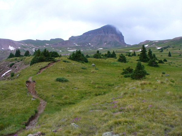
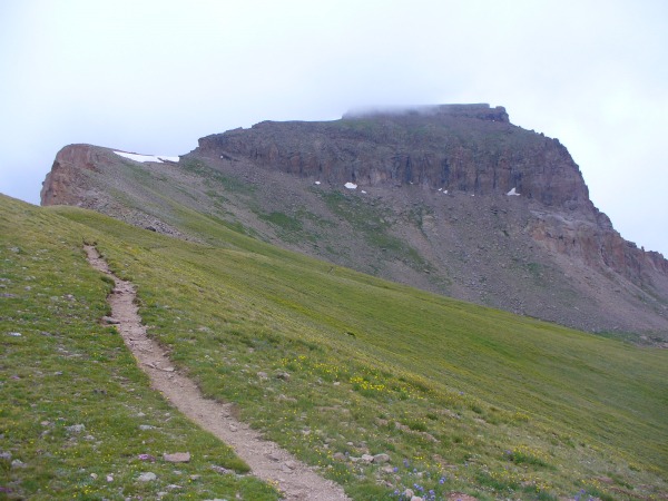
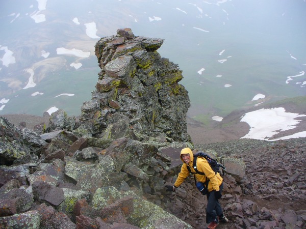
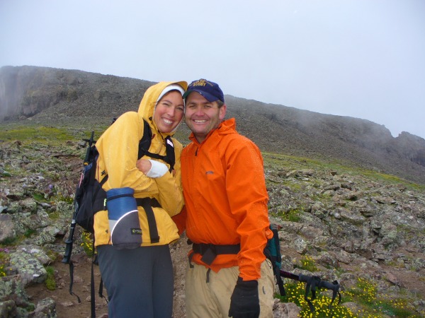
The trail is in perfect condition, it is super easy to follow and as you start walking you can see Uncompahgre ahead of you. After about 2.5 miles you switchback up to a section where you go around the mountain and have to contend with approx 150 ft. of scramble on lose dirt(in our case- wet), and loose talus. It isn't hard and it is over before you know it. Once through that, the trail is easy to follow as it heads up onto the plateau that Uncompahgre is famous for. We stopped there because the weather got so bad we couldn't see and we heard thunder. It was entirely too late to summit. 1:30pm and we should have been down. We don't normally summit this late and we honestly didn't plan on finishing. The GPS said 14,020ft when we turned around so I am happy we made it that far. We want to do this one again anyway. It was so pretty and the trail literally prestine!! I can't wait to go back and actually sign the summit register!
Thumbnails for uploaded photos (click to open slideshow):
using your judgement and turning back. This is so hard to do but I always admire when people have the prudence to turn around so close to the top. The mountain will always be there, you'll get it for sure! Nice pics too!
Caution: The information contained in this report may not be accurate and should not be the only resource used in preparation for your climb. Failure to have the necessary experience, physical conditioning, supplies or equipment can result in injury or death. 14ers.com and the author(s) of this report provide no warranties, either express or implied, that the information provided is accurate or reliable. By using the information provided, you agree to indemnify and hold harmless 14ers.com and the report author(s) with respect to any claims and demands against them, including any attorney fees and expenses. Please read the 14ers.com Safety and Disclaimer pages for more information.
Please respect private property: 14ers.com supports the rights of private landowners to determine how and by whom their land will be used. In Colorado, it is your responsibility to determine if land is private and to obtain the appropriate permission before entering the property.