Download Agreement, Release, and Acknowledgement of Risk:
You (the person requesting this file download) fully understand mountain climbing ("Activity") involves risks and dangers of serious bodily injury, including permanent disability, paralysis, and death ("Risks") and you fully accept and assume all such risks and all responsibility for losses, costs, and damages you incur as a result of your participation in this Activity.
You acknowledge that information in the file you have chosen to download may not be accurate and may contain errors. You agree to assume all risks when using this information and agree to release and discharge 14ers.com, 14ers Inc. and the author(s) of such information (collectively, the "Released Parties").
You hereby discharge the Released Parties from all damages, actions, claims and liabilities of any nature, specifically including, but not limited to, damages, actions, claims and liabilities arising from or related to the negligence of the Released Parties. You further agree to indemnify, hold harmless and defend 14ers.com, 14ers Inc. and each of the other Released Parties from and against any loss, damage, liability and expense, including costs and attorney fees, incurred by 14ers.com, 14ers Inc. or any of the other Released Parties as a result of you using information provided on the 14ers.com or 14ers Inc. websites.
You have read this agreement, fully understand its terms and intend it to be a complete and unconditional release of all liability to the greatest extent allowed by law and agree that if any portion of this agreement is held to be invalid the balance, notwithstanding, shall continue in full force and effect.
By clicking "OK" you agree to these terms. If you DO NOT agree, click "Cancel"...
Uncompahgre
Elevation: 14,309'
Round Trip: ~8 miles
Elev. gain: ~3000'
Total trip time: Just under 6 hours (about 3.5 up, .5 on summit, and 2 down)
Hiking party: Myself (Jim) and girlfriend Jess
The road:
A quick note on the road before I begin the hike. We research the Nellie Creek road a bit before driving all the way out to Lake City from Denver, because we had to decide which car to take. It was either Jess's new Liberty (automatic and cd player ) or her parents' Wrangler (manual, but more importantly, no cd player ). I love driving manuals, but I'd have to do all of the driving (a little over 10 hours for the weekend), although the Wrangler would avoid potentially damaging the new car if the road was too bad. We finally opted to take the Liberty and give it its first good off-roading experience (driving on dirt roads in the plains of Nebraska to Panarama Point doesn't truly qualify, I feel). The Liberty handled the road like a champ. There was really only one spot that I was a little concerned with, the first creek crossing a little over 2 miles up. Getting into the creek was cake, but coming out was a bit sketchy (sorry, didn't get a photo). We stopped in the middle of the creek to analyze, and finally went with the 'just gun it' approach on the right side, mostly following the fresh tracks left by a car not too far ahead of us. Despite being bumpy, we got out without scraping anything and the rest of the road went well (including the other creek crossing). Granted, this is because the Liberty has a short wheel-base, good clearance, and 4WD. I could imagine that if you really didn't like your car, you might be able to get it to the first creek crossing, but I wouldn't take mine up there. Strangely, the last mile of the road to the trailhead was the nicest, having very little rocks and only a few of those little hills designed for water runoff (don't know what they are called). We parked across from the restroom at a little camping site, just barely shy of the actual parking lot. Overall, the road was MUCH better than the Baldwin Gulch road up Antero, which we drove a few weeks ago in the Wrangler.
Bullet (her Liberty) and our camping spot near the trailhead.
The hike:
Now to the good stuff! This hike was absolutely beautiful. Everything was green all around and the wildflowers were going crazy. After counting on the sun to wake us up in the morning, we got to a slightly later-than-hoped-for start about 7:30. With camp broken down and Nalgenes full of fresh-filtered water, we set off along the Nellie Creek trail. After a brief stint in the woods, we hiked for awhile along the Nellie Creek trail, which was quite enjoyable.
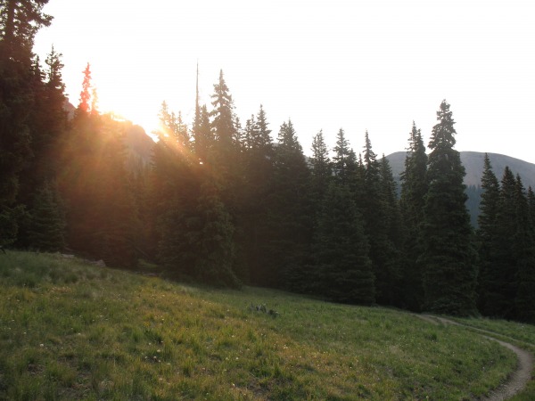
The morning sun rising as we left the trees.
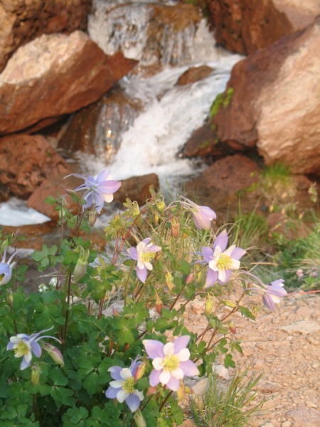
We both got to see plenty of what we believe to be the first Columbines either of us actually saw.
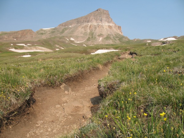
The trail as it parallels Nellie Creek, with Uncompahgre in the background.
Columbines next to the trail.
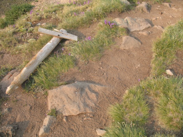
Continuing along the wonderful trail, we got to listen to the relaxing sound of the creek and see flowers and green all around. After a quick switchback, we came to a trail junction. One way led to a different drainage area (Blue... something), and the other was the Nellie Creek trail heading towards Uncompahgre, now looming ahead. While taking pictures at the junction, I found the sign lying on the ground slightly off the trail, so I moved it so it at least lied next to the correct trail.
The sign has seen better days....
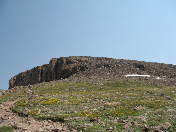
There is a solid, never terribly steep trail all the way to 13,800'. After curving to the left, you get onto the South Ridge (~13,000') and continue along the way. Here you reach another trail junction. Left goes down the Matterhorn Creek trail and right stays on towards Uncompahgre (well marked).
A view of the trail through the basin with Uncompahgre ahead.
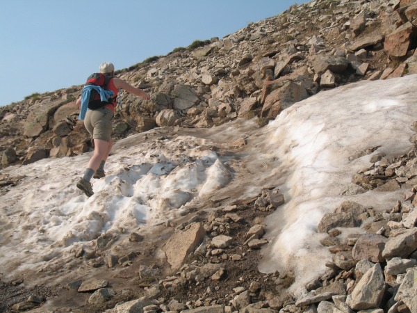
The only snow we had to cross the entire time, all 10 feet of it, just before the Matterhorn Creek junction.
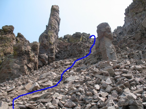
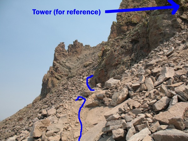
After a few switchbacks just before 13,800' you reach the ridge crest and shortly thereafter reach the tower (pictured below). We stopped here momentarily, enjoyed a great view of Wetterhorn, and decided which path to take. The trail seemed to turn right and then die off as it climbed up a rock-staircase looking chute, but staying straight (left) dropped a few feet, had a few small cairns, and then curved out of sight around the tower. We decided to go ahead and climb the right side and go up the chute. It was a very enjoyable scramble, probably not even reaching class 3, with great solid rock (sometimes with a thin layer of loose dirt on top) and even a few great handholds if you felt so inclined. As we reached the top and veered left, knowing that was the way to the summit, we ran back into a very obvious trail. Heading down, we opted to follow that trail down and found it was the same one we saw curving around the tower. Although being an obvious trail though, it was very steep loose dirt, not solid rock like the other way. We had to go down very slowly since the footing was so poor and I would definitely have to recommend the rock chute as opposed to this short section.
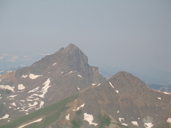
Wetterhorn and Matterhorn. Looks like I'll have to wait for another summer to climb them.
This tower is an excellent landmark for the trail split, which is right below its base.
The rock chute on the right side that we climbed, with approximate path.
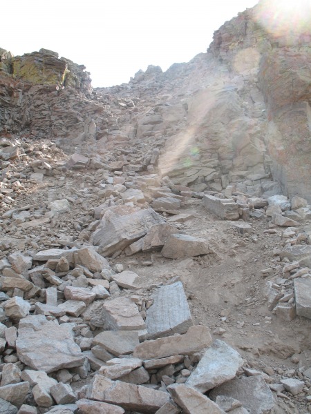
Another look at the chute from directly below.
The 'official' trail heading around the left side of the tower.
Anyway, upon finishing the chute, the rest of the route to the summit was once again very easy and not very steep at all. Even at 14,000' there was plenty of green and wildflowers!
The final summit pitch, still accompanied by wildflowers.
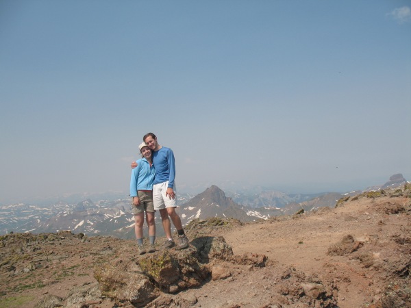
The summit was wonderfully calm, and we rested there almost half an hour before heading back down. Unfortunately, though, it was a bit hazy that day so I did not have a good view of other nearby 14ers.
Obligatory summit photo.
After navigating that one bad section down, we were able to fly down the rest of the great trail. With the wonderful scenery, being to see Uncompahgre and its unique shape the entire way up as motivation, and variations during the hike (forest, along Nellie Creek, the gorgeous basin, ridge hiking, and the short rock chute), I decided to change what I had as my favorite 14er. Crestone Peak was great (my previous favorite), but the beauty of Uncompahgre won me over. This was a wonderful hike!
Thumbnails for uploaded photos (click to open slideshow):
In June of ‘05, my teenage sons, Jordan and Spencer, and myself hiked Uncompahgre, it‘s always been my fav! Even though it took me 27 years to accomplish!!!!!!! I tried it in ‘79, at the age of 14 by myself, and a lightning storm kept me from progressing any further than the place you took the pics of Wetterhorn. We‘re going back to Lake City this June for another 2 week adventure. Being from Arkansas, it‘s the best escape I‘ve ever found outside of here. Don
Great report! Me and my girlfriend (both east coast flatlanders) are going to try Uncompahgre in late August. It's shape and surrounding environs just looks so beautiful to me.
Thanks for a very good report; I'll be there on the 21st!
Caution: The information contained in this report may not be accurate and should not be the only resource used in preparation for your climb. Failure to have the necessary experience, physical conditioning, supplies or equipment can result in injury or death. 14ers.com and the author(s) of this report provide no warranties, either express or implied, that the information provided is accurate or reliable. By using the information provided, you agree to indemnify and hold harmless 14ers.com and the report author(s) with respect to any claims and demands against them, including any attorney fees and expenses. Please read the 14ers.com Safety and Disclaimer pages for more information.
Please respect private property: 14ers.com supports the rights of private landowners to determine how and by whom their land will be used. In Colorado, it is your responsibility to determine if land is private and to obtain the appropriate permission before entering the property.