Download Agreement, Release, and Acknowledgement of Risk:
You (the person requesting this file download) fully understand mountain climbing ("Activity") involves risks and dangers of serious bodily injury, including permanent disability, paralysis, and death ("Risks") and you fully accept and assume all such risks and all responsibility for losses, costs, and damages you incur as a result of your participation in this Activity.
You acknowledge that information in the file you have chosen to download may not be accurate and may contain errors. You agree to assume all risks when using this information and agree to release and discharge 14ers.com, 14ers Inc. and the author(s) of such information (collectively, the "Released Parties").
You hereby discharge the Released Parties from all damages, actions, claims and liabilities of any nature, specifically including, but not limited to, damages, actions, claims and liabilities arising from or related to the negligence of the Released Parties. You further agree to indemnify, hold harmless and defend 14ers.com, 14ers Inc. and each of the other Released Parties from and against any loss, damage, liability and expense, including costs and attorney fees, incurred by 14ers.com, 14ers Inc. or any of the other Released Parties as a result of you using information provided on the 14ers.com or 14ers Inc. websites.
You have read this agreement, fully understand its terms and intend it to be a complete and unconditional release of all liability to the greatest extent allowed by law and agree that if any portion of this agreement is held to be invalid the balance, notwithstanding, shall continue in full force and effect.
By clicking "OK" you agree to these terms. If you DO NOT agree, click "Cancel"...
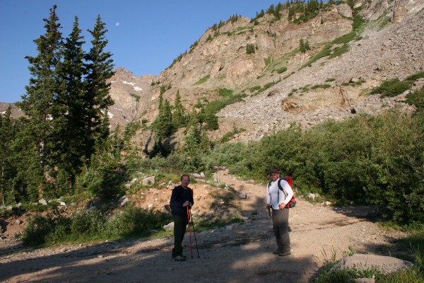
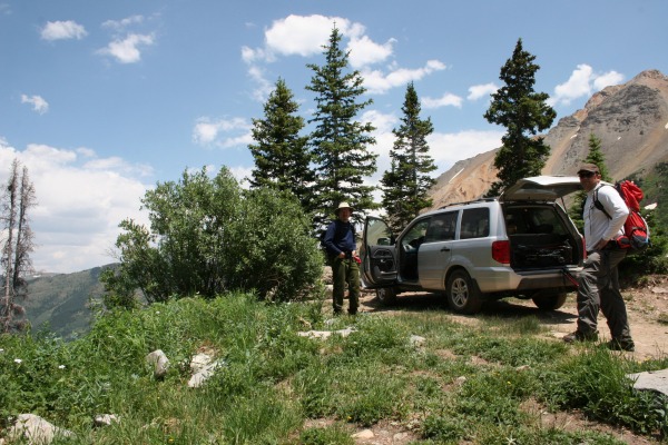
Left Glenwood Springs around 5:00 am. Arrived at the Pearl Pass jeep road turnoff and parked there due to the low clearance of our vehicle (Honda Pilot I think) at about 6:50 am. I think this parking area is around 11,200'
Hiked about 1.6 miles to the upper parking area. Photo below is from near the upper parking area.
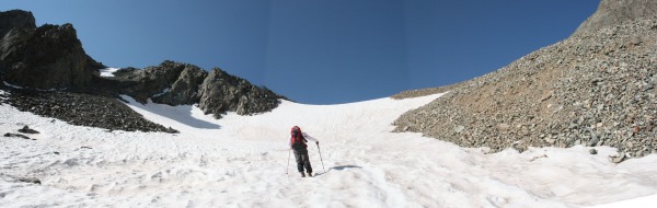
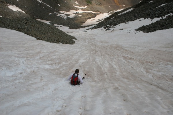
We kick stepped our way up the snow field with no problem. The Northeast ridge was our planned route and we stuck with the plan after looking over our options.
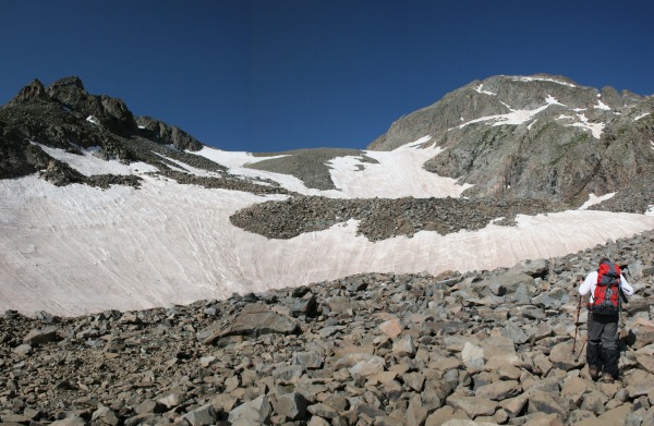
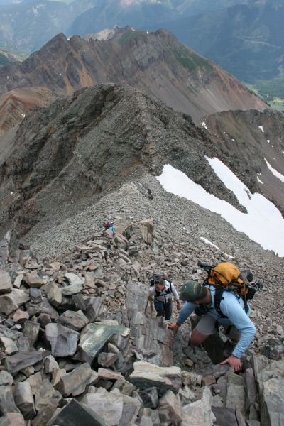
Once out of the snow we hiked up a dirt/scree trail to the ridge. It was a little slick on the loose rock but there was no exposure to speak of. See trail at the bottom of this photo.
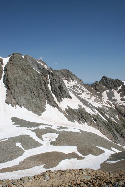
The ridge is rocky with some exposure and a little scrambling. We reached the top of a shorter peak and descended less than 100' to the final pitch to the summit.
Once at the summit you are rewarded with excellent views in all directions. Below is a about a 90 degree view.
The trip down was a lot of fun. See photo below of 14ergirl, her husband and friend down climbing.
Hope you don't mind me using your photo.
Glissading down the snow field was huge fun and almost worth a second climb up to take another run.
Got back to the car around 2:00 pm. The time included lots of breaks for picture taking and a half hour on the summit.
This was my first Class 2 and my favorite peak to date. Oh and don't forget your gators.
Thumbnails for uploaded photos (click to open slideshow):
Comments or Questions
Caution: The information contained in this report may not be accurate and should not be the only resource used in preparation for your climb. Failure to have the necessary experience, physical conditioning, supplies or equipment can result in injury or death. 14ers.com and the author(s) of this report provide no warranties, either express or implied, that the information provided is accurate or reliable. By using the information provided, you agree to indemnify and hold harmless 14ers.com and the report author(s) with respect to any claims and demands against them, including any attorney fees and expenses. Please read the 14ers.com Safety and Disclaimer pages for more information.
Please respect private property: 14ers.com supports the rights of private landowners to determine how and by whom their land will be used. In Colorado, it is your responsibility to determine if land is private and to obtain the appropriate permission before entering the property.