Download Agreement, Release, and Acknowledgement of Risk:
You (the person requesting this file download) fully understand mountain climbing ("Activity") involves risks and dangers of serious bodily injury, including permanent disability, paralysis, and death ("Risks") and you fully accept and assume all such risks and all responsibility for losses, costs, and damages you incur as a result of your participation in this Activity.
You acknowledge that information in the file you have chosen to download may not be accurate and may contain errors. You agree to assume all risks when using this information and agree to release and discharge 14ers.com, 14ers Inc. and the author(s) of such information (collectively, the "Released Parties").
You hereby discharge the Released Parties from all damages, actions, claims and liabilities of any nature, specifically including, but not limited to, damages, actions, claims and liabilities arising from or related to the negligence of the Released Parties. You further agree to indemnify, hold harmless and defend 14ers.com, 14ers Inc. and each of the other Released Parties from and against any loss, damage, liability and expense, including costs and attorney fees, incurred by 14ers.com, 14ers Inc. or any of the other Released Parties as a result of you using information provided on the 14ers.com or 14ers Inc. websites.
You have read this agreement, fully understand its terms and intend it to be a complete and unconditional release of all liability to the greatest extent allowed by law and agree that if any portion of this agreement is held to be invalid the balance, notwithstanding, shall continue in full force and effect.
By clicking "OK" you agree to these terms. If you DO NOT agree, click "Cancel"...
Aaron, Jacob, Miriah, and I arrived in Gunnison around 7:00p.m. on Saturday night after rafting Brown's Canyon with Noah's Ark rafting company that afternoon. We checked into the Quality Inn. We had dinner and a few Budweisers at Mario's Pizza, great place -- great place. Went back to the hotel (great hotel, by the way) and crashed around 10pm. Around 3:30a.m., we woke up and were packed & checked out of the hotel by 4a.m. You take HWY 50 about 10 miles west of Gunnison where you catch HWY 149. Take this winding road for about 50 miles (watch out for deer, we saw about 15 of them) until you get to Lake City. In lake city, take a right on Second St. for 2 blocks until you get to the North Henson Road trail. This is all accessible by any car to this point. Take this road for about 8.8 miles (all gravel with a few rocks sporatically), then take a right at a Y intersection. From here, high clearance and 4wd is all but necessary ... take this road up to 11.4 miles where the trailhead and small parking area exists ...
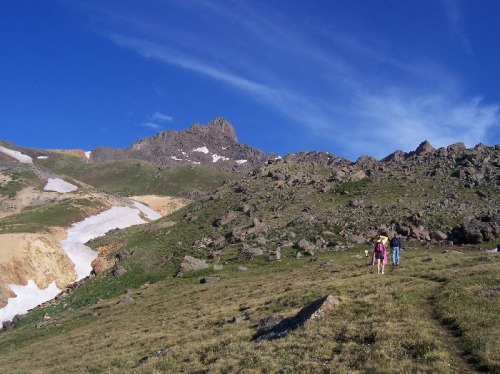
After some leftover Mario's pizza and packing up shop, we were on the trail by 6:15am. The hike starts out pretty standard at 10,800 feet. You hike for a good 3/4 of a mile, then the trail splits ... hang a right (even though it appears you should go left) ... it switches back towards Wetterhorn in about 5 mintues, then you cut through some trees again. Out of the trees, you can finally view Wetterhorn peak to your left (we were unsure which peak it was until this point).
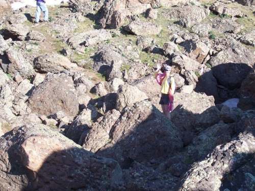
You go through a neat boulder field ...
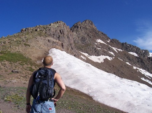
...then hike across a short snow field or two up to the brownish saddle.
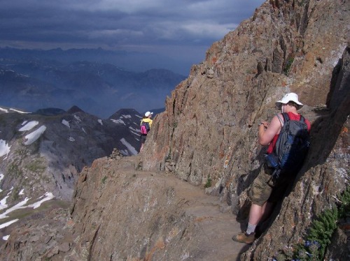
From here the climb gets fun and into some class 2 and 3 maneuvers. We noticed in the distance that clouds may be coming in so we decided to hurry it up.
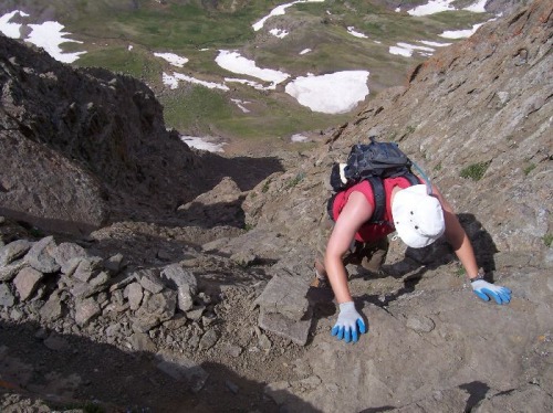
After boulder hopping for awhile, you get to some areas where you need to free climb and make sure your steps are in tact and the rocks are sturdy (which they were for the mostpart). We made the mistake of curving around to the right of the prow instead of taking a "shortcut" that went straight to it (that everyone else we saw that day took), that's where the cairns led us. This brought us to an area I hated ... scree with no good handles while climbing up. I can honestly say I got scared at this point for a good 15 feet or so as I had no confidence in my steps or handles. After that whole debacle, we made it to the Prow and climbed up and over. From this point, you have about 100' of elevation gain left, all Class 3 free climbing.
It's relatively simple, just make sure you've got your grip. It can be very intimidating and scary if you look down ... so I just didn't look down and I was 100% fine and confident.
We reached the summit around 9:50 for a total climb of just over 3 1/2 hours. The clouds were rolling in hardcore at this point so we only stayed on the summit about 5 minutes ... just enough time for Gatorade and pictures. We flew down the mountain ... after some brief bouts with hail and some light rain, we made it down the mountain in about 1 3/4 hours ... back to the car at 11:45, back to Gunnison around 2:00, back to Denver around 6:00.
All in all, this is easily in the top 2 best 14ers I've climbed. The sense of accomplishment of Long's was better than this, but the views and the challenge of the hard parts were every bit as challenging. If it were closer, I'd climb this mountain every year.
Link to all the pictures (90 total):
http://www.fleetmack.com/gallery2/main.php?g2_view=core.ShowItem&g2_itemId=1202
Thumbnails for uploaded photos (click to open slideshow):
in Capitol Hill do you live? I‘m at 6th and York. Are you planning on a busy summer? We should try to hook up at some point, either for a climb, or just for beers and mountain talk.
James
Caution: The information contained in this report may not be accurate and should not be the only resource used in preparation for your climb. Failure to have the necessary experience, physical conditioning, supplies or equipment can result in injury or death. 14ers.com and the author(s) of this report provide no warranties, either express or implied, that the information provided is accurate or reliable. By using the information provided, you agree to indemnify and hold harmless 14ers.com and the report author(s) with respect to any claims and demands against them, including any attorney fees and expenses. Please read the 14ers.com Safety and Disclaimer pages for more information.
Please respect private property: 14ers.com supports the rights of private landowners to determine how and by whom their land will be used. In Colorado, it is your responsibility to determine if land is private and to obtain the appropriate permission before entering the property.
")
")
")
")
")


