Download Agreement, Release, and Acknowledgement of Risk:
You (the person requesting this file download) fully understand mountain climbing ("Activity") involves risks and dangers of serious bodily injury, including permanent disability, paralysis, and death ("Risks") and you fully accept and assume all such risks and all responsibility for losses, costs, and damages you incur as a result of your participation in this Activity.
You acknowledge that information in the file you have chosen to download may not be accurate and may contain errors. You agree to assume all risks when using this information and agree to release and discharge 14ers.com, 14ers Inc. and the author(s) of such information (collectively, the "Released Parties").
You hereby discharge the Released Parties from all damages, actions, claims and liabilities of any nature, specifically including, but not limited to, damages, actions, claims and liabilities arising from or related to the negligence of the Released Parties. You further agree to indemnify, hold harmless and defend 14ers.com, 14ers Inc. and each of the other Released Parties from and against any loss, damage, liability and expense, including costs and attorney fees, incurred by 14ers.com, 14ers Inc. or any of the other Released Parties as a result of you using information provided on the 14ers.com or 14ers Inc. websites.
You have read this agreement, fully understand its terms and intend it to be a complete and unconditional release of all liability to the greatest extent allowed by law and agree that if any portion of this agreement is held to be invalid the balance, notwithstanding, shall continue in full force and effect.
By clicking "OK" you agree to these terms. If you DO NOT agree, click "Cancel"...
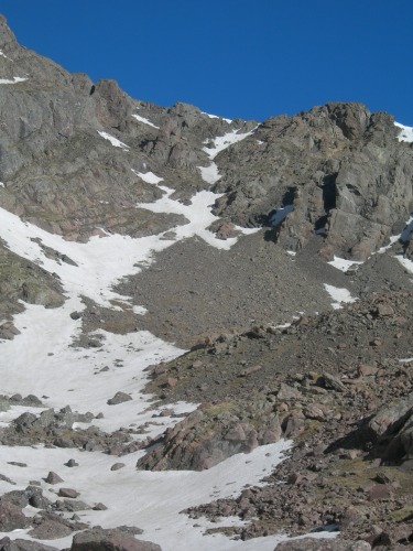
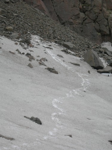
On sunday night we drove up the south colony road and reached the top somewhere after midnight. After getting a few precious hours of sleep, we awoke at 430 and after tearing down camp, and slowly getting ready, we finally hit the trail about 6. We made quick time to lower south colony lake, as most of the snow on the trail is gone. After reaching upper south colony lake we passed it on the left and soon found ourselves on a low angle, bullet proof snow field leading up to the cirque. We chose a couloir on the left side of the cirque.
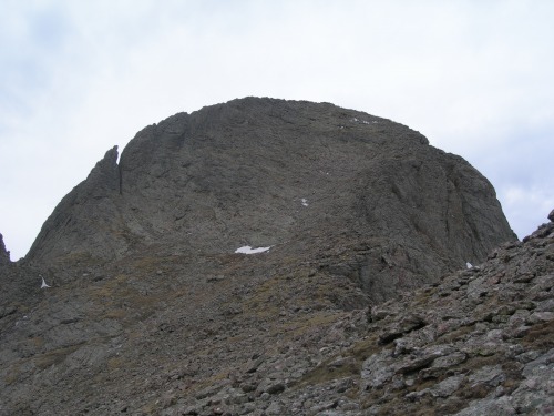
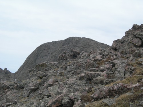
Upon topping out here, we headed across bears playground which is completley devoid of snow. Unlike some guide books, the route traverses around kitty kat carson or point 13799, and hits the saddle below Columbia AKA kat carson. The rest of the route is free of snow from the playground on. Upon reaching the top of columbia my climbing partner decided he wasnt going to head over, so i dropped my ice axe and crampons with him and after a couple of minutes of route finding off the top, began the down climb down to the notch between the two peaks. After hitting the notch, i followed the well marked trail and ledge system to the top of kit carson.
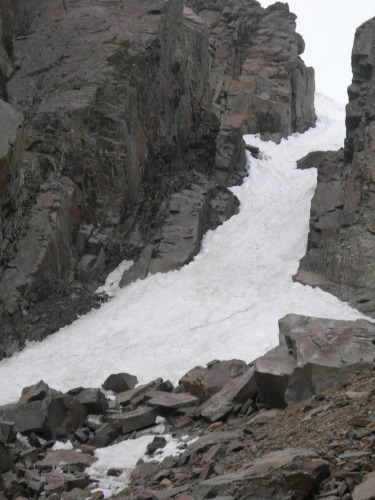
I tagged the summit, signed the register and headed off back to the summit of columbia. It took me about 1:10 to go from the top of columbia to the top of kit carson, and back to columbia at an extremely fast pace. This climb requires some time in general, and an early start is a neccesity. After climbing back to the bears playground, we decided to take a different couloir down the cirque. This time we chose the right most couloir and down climbed hard snow and skidded down loose scree at the bottom.
After hitting this we started on down the trail towards the trailhead, first following snow to the upper lake, and then the actual trail all the way to the car from there.
Thumbnails for uploaded photos (click to open slideshow):
The Route goes something like this:
Leaving upper south colony lake you are headed to the cirque below Bears Playground. You can climb out of this cirque using any of the couloirs. More than likely it will be somewhat of a scree run. Once you get onto Bears Playground, you head out across this high saddle with Crestone Peak on your left. There is an obvious cairned route that leads you around the first false summit and to the base of Columbia point. The climbing up Columbia is easy class 3. Once on top of Columbia (there is a plaque on top for the space shuttle) there is a downclimb that is fairly well cairned, but sometimes hard to find from the top. If you are facing Kit Carson you need to head almost straight left to start. The downclimb takes you to the notch at the top of Coles couloir and from here you just climb some easy Class 3 to the top of Kit carson. As for Challenger, Just take a little hike around the Avenue and over to Challenger, which is fairly easy. You pretty much have to return back over Columbia so its another 500 ft climb on the way out, but its fun because its not just hiking.
Thinking of doing Kit Carson/Challenger this weekend via Colony Lakes. You said you can go around point 13,799, is this to the north? Is it cairned? Also, is it difficult to find the route off of Columbia to Kit Carson? You spoke of a notch but didn't see it in any pics. Is that cairned as well?
Caution: The information contained in this report may not be accurate and should not be the only resource used in preparation for your climb. Failure to have the necessary experience, physical conditioning, supplies or equipment can result in injury or death. 14ers.com and the author(s) of this report provide no warranties, either express or implied, that the information provided is accurate or reliable. By using the information provided, you agree to indemnify and hold harmless 14ers.com and the report author(s) with respect to any claims and demands against them, including any attorney fees and expenses. Please read the 14ers.com Safety and Disclaimer pages for more information.
Please respect private property: 14ers.com supports the rights of private landowners to determine how and by whom their land will be used. In Colorado, it is your responsibility to determine if land is private and to obtain the appropriate permission before entering the property.
")
")
")
")
")


