Download Agreement, Release, and Acknowledgement of Risk:
You (the person requesting this file download) fully understand mountain climbing ("Activity") involves risks and dangers of serious bodily injury, including permanent disability, paralysis, and death ("Risks") and you fully accept and assume all such risks and all responsibility for losses, costs, and damages you incur as a result of your participation in this Activity.
You acknowledge that information in the file you have chosen to download may not be accurate and may contain errors. You agree to assume all risks when using this information and agree to release and discharge 14ers.com, 14ers Inc. and the author(s) of such information (collectively, the "Released Parties").
You hereby discharge the Released Parties from all damages, actions, claims and liabilities of any nature, specifically including, but not limited to, damages, actions, claims and liabilities arising from or related to the negligence of the Released Parties. You further agree to indemnify, hold harmless and defend 14ers.com, 14ers Inc. and each of the other Released Parties from and against any loss, damage, liability and expense, including costs and attorney fees, incurred by 14ers.com, 14ers Inc. or any of the other Released Parties as a result of you using information provided on the 14ers.com or 14ers Inc. websites.
You have read this agreement, fully understand its terms and intend it to be a complete and unconditional release of all liability to the greatest extent allowed by law and agree that if any portion of this agreement is held to be invalid the balance, notwithstanding, shall continue in full force and effect.
By clicking "OK" you agree to these terms. If you DO NOT agree, click "Cancel"...
Looking at the map and trying to link together multiple peaks in a different and efficient way, I saw that from the Zapata Falls trailhead one could go up to California Peak and then traverse the ridgelines all the way to Twin Peaks, in what would end up not being that long of a day for summiting 7 separate peaks. The total was 8200ft elevation and 17.4 miles, and not too continuous of technical scrambling terrain, but enough to keep things fun, engaging, and interesting.
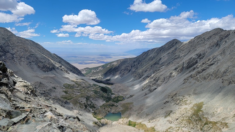
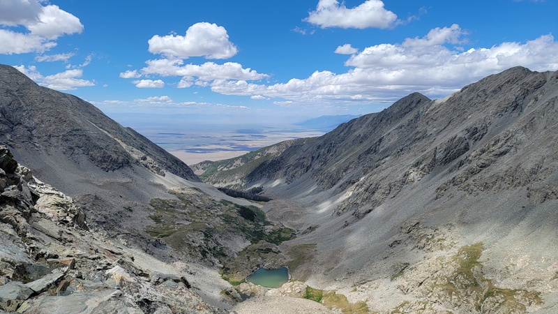
From the Zapata Falls trailhead it is mellow class 1 on the Zapata trail, to some light class 2 off-trail up California Peak’s West Face to North Ridge, from where you can then see the rest of the day to Twin Peaks. You also get incredible views of the Sand Dunes and Blanca Group and northern Crestone/Sangres throughout the day, as well as expansive views across the San Luis valley.
California Peak to UN 13656, the first 4 peaks, is mostly class 2 and easy 3 along the ridgelines with fairly obvious route finding.
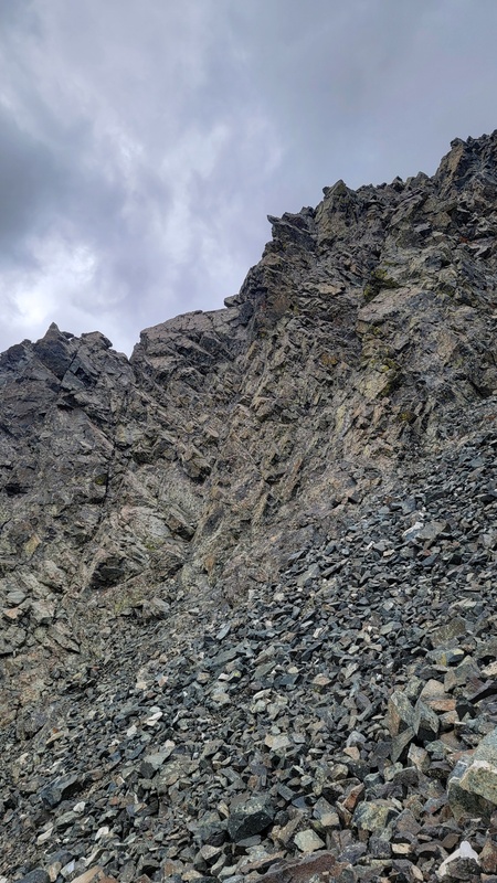
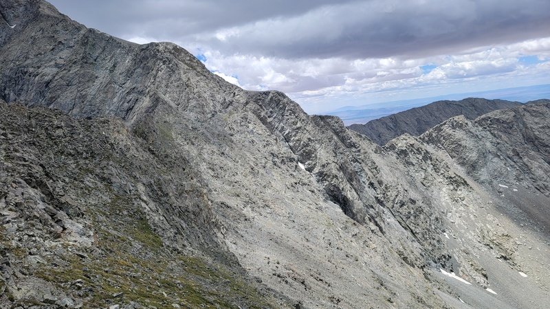
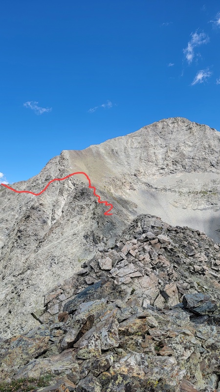
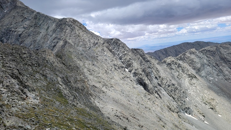
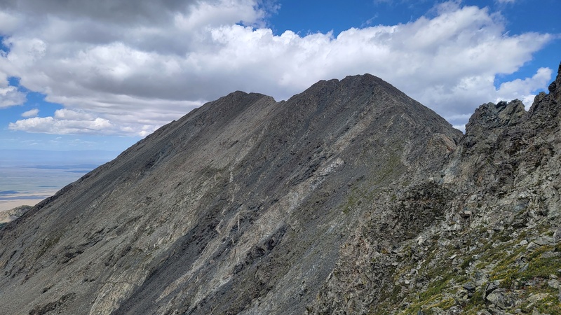
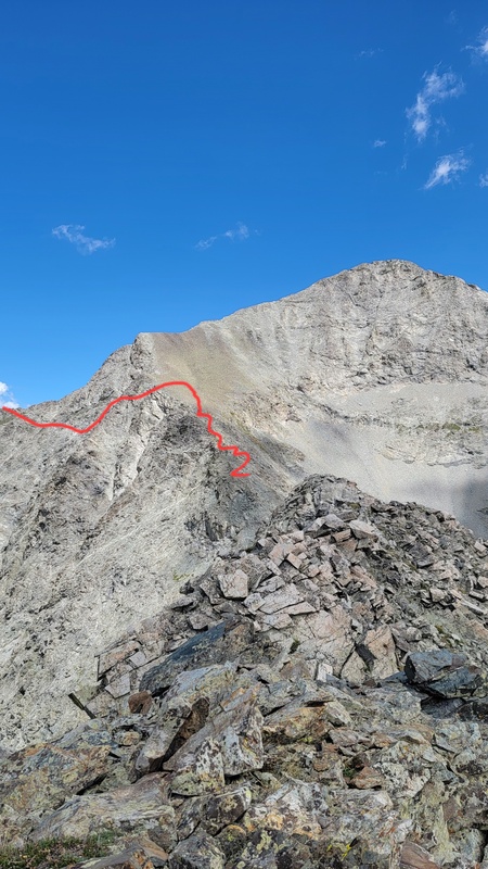
From UN 13656 to Crossfire Ridge, it gets into some class 4 terrain and the route finding for path of least resistance gets more complicated. Instead of staying on the ridge crest the entire way, I opted to traverse a series of grassy ledges on the West side of the ridge at parts, just following what seemed to be most expedient and logical.
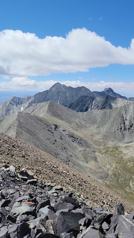
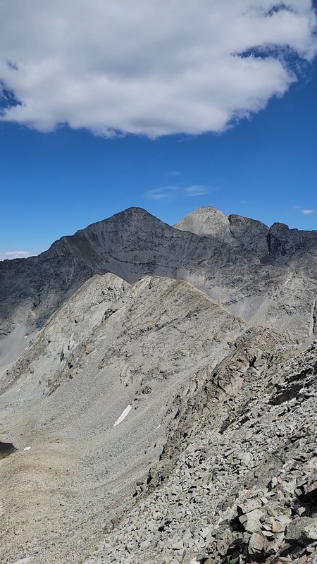
Crossfire Ridge to Twin Peaks A South continued fun class 3 and then it is just a brief stroll to the top of Twin Peak A North. From the top, it is straight down a steep and loose talus field until the South Fork Zapata Creek trail is reached and its back to cruiser class 1 all of the way to the falls and car. This makes for a very enjoyable day in a beautiful basin to knock out a good number of peaks in an aesthetic style that provides a lot of different views and perspectives from the varied ridgelines and high points along the way.
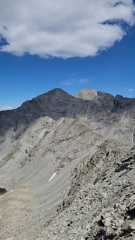
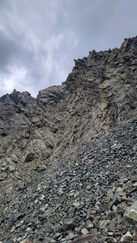
some class 4 downclimbing and tricky route finding going south from UN 13656
Crossfire ridge is off to lookers right, continued tricky terrain
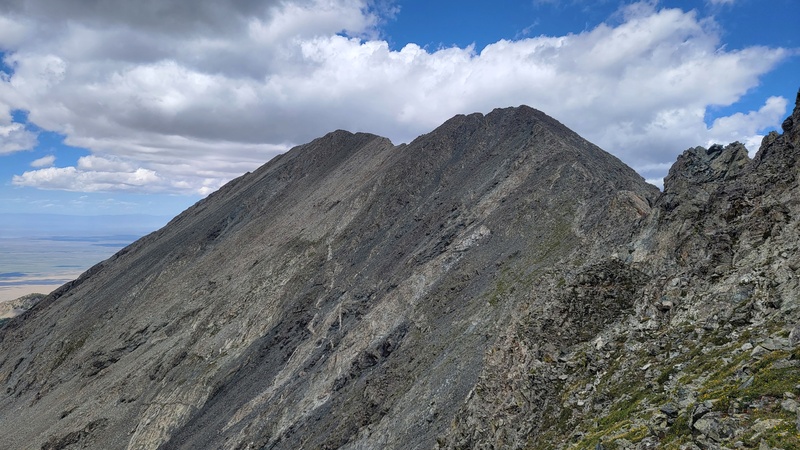
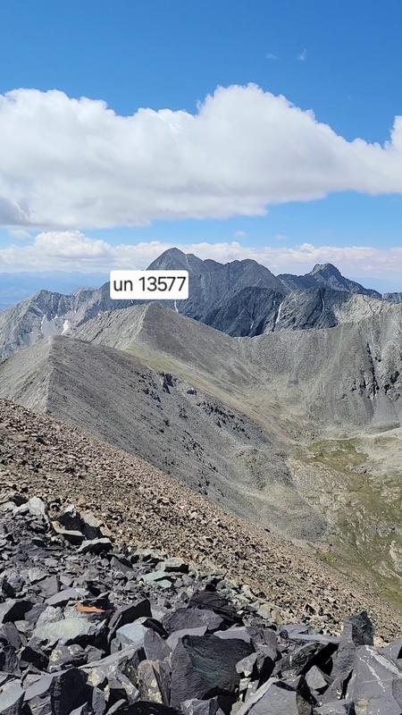
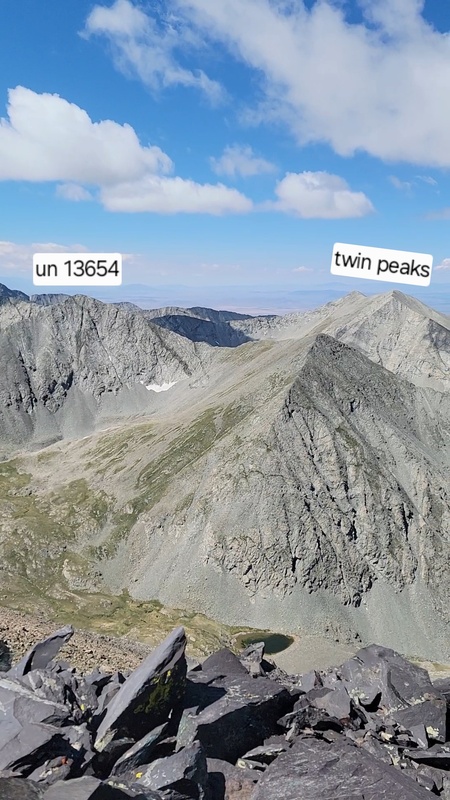
Looking back at UN 13656
approximate path from UN 13656 on Left, looking from start of Crossfire Ridge. EP in back
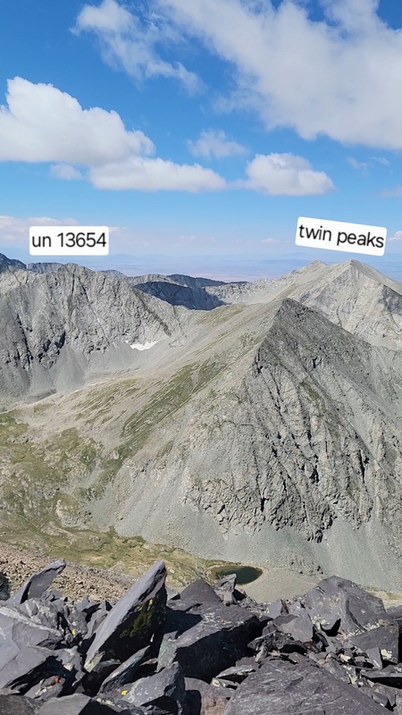
Crossfire Ridge from Twin Peaks
My GPS Tracks on Google Maps (made from a .GPX file upload):
Thumbnails for uploaded photos (click to open slideshow):
Comments or Questions
Caution: The information contained in this report may not be accurate and should not be the only resource used in preparation for your climb. Failure to have the necessary experience, physical conditioning, supplies or equipment can result in injury or death. 14ers.com and the author(s) of this report provide no warranties, either express or implied, that the information provided is accurate or reliable. By using the information provided, you agree to indemnify and hold harmless 14ers.com and the report author(s) with respect to any claims and demands against them, including any attorney fees and expenses. Please read the 14ers.com Safety and Disclaimer pages for more information.
Please respect private property: 14ers.com supports the rights of private landowners to determine how and by whom their land will be used. In Colorado, it is your responsibility to determine if land is private and to obtain the appropriate permission before entering the property.




 Download GPX file used in this map