| Report Type | Full |
| Peak(s) |
Jagged Mountain - 13,833 feet |
| Date Posted | 09/18/2026 |
| Modified | 09/19/2026 |
| Date Climbed | 09/03/2026 |
| Author | andrew85 |
| A Series of Jagged Events |
|---|
|
Well, this is certainly not the report I had planned on writing to document what I had hoped would be my Jagged redemption quest! I apologize for the delay in getting this up, but as I'm sure you can see from the scroll bar there's quite a lot in here lol. As many of you may have already seen from my Lost and Found post, I did end up needing to be rescued after getting stranded on a ledge after rappelling from the summit. While that is arguably the most significant part of this story, I had originally planned on writing a trip report for Jagged that functions as a trip report for anyone seeking beta for future attempts and that's what I hope to still achieve here (lol especially since I haven't written one on here in nearly seven years now) in addition to documenting the events of the rescue.
With that out the way and after reflecting over the whole ordeal for over a week now, I feel this adventure can be appropriately broken down into three phases as shown below:
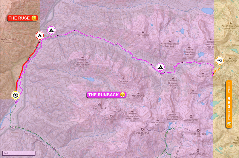 For those immediately seeking a breakdown of the events of the rescue, feel free to skip ahead to that section (lol don't worry, it will be self-contained enough to make sense without reading through everything else). Otherwise, I hope you follow along for the rest of the story because I'd like to think the adventure I was already having was a story worth telling as well :). 1. The Ruse
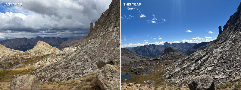
Round 1
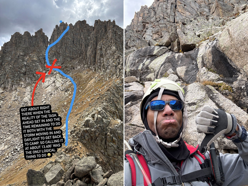
Many of you know from facebook or instagram that I had originally attempted Jagged last year, got to about 13,400' and ultimately decided to call it when I saw the dark clouds moving in from the east. 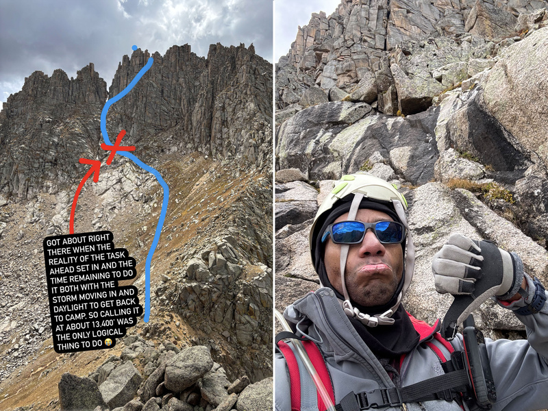 It was absolutely the right decision as I was already being hailed on before I even made it back to the waterfall portion of the creek. I ended up hunkering down there for a day and a half before the storm cleared out enough for me to start making my way back, five days in the wilderness with no summit to show for it: Lol it was what it was, but now I gotta come back and having just done the No Name approach it wasn't something I was exactly looking forward to. Don't get me wrong, once you cross No Name Creek and join the trail, the nuisancery of the lower approach subsides considerably... but that doesn't change the fact that the lower approach is part of the route and it is highly unpleasant to the degree that I wanted nothing to do with it ever again.
In the past year I had given serious consideration to the Vallecito approach and that was likely going to be how I reattempted this year until I heard about the bridges washing out (I know Beartown's an option as well, but I don't have a vehicle capable of getting there and the idea of starting out with a 2000' elevation loss and finishing with a 2000' elevation gain doesn't sound too appealing lol). Not the biggest fan of creek crossings where I actually have to commit to getting wet--I'll do it if I have to, but if that's now a factor on top of the additional distance of the Vallecito approach I might as well just stick to reattempting from No Name.
So what's this Ruse I'm alluding to here? Lol so you know how we've had a record low snow year? Somehow I got it in my head that would translate to the rivers running low and that rather than deal with the nuisancery of the lower approach with Watertank Hill and whatnot, perhaps I could just walk up the tracks until I'm in line with where No Name Creek empties into the Animas and find a place narrow enough to wade across there. Great idea, right?
Probably one of the biggest problems with Jagged and the No Name approach in particular is logistics if you're planning your trip around the train, not so much because of the train schedule which could definitely be a limiting factor but mainly the uncertainty of the weather when your trip window finally comes around. Both last year and this year now, I put in for a week of vacation around the first week of September and reserved my train tickets to correspond with that. Unfortunately, both last year and this year the weather forecast that had been great for weeks nosedived in the days leading up to me heading out there. I'm pretty much like well I gotta be out there anyway, let's see what happens and maybe I get lucky with the weather (lol I should know by now that this never happens).
Day -2
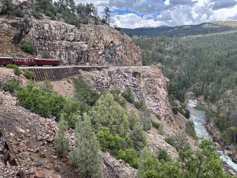
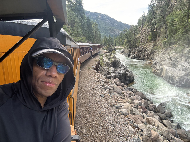
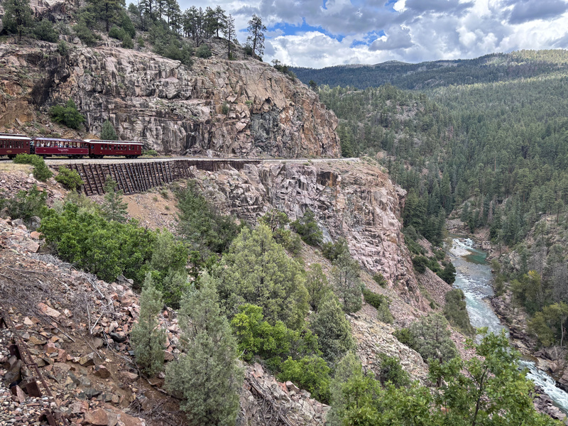
So on Saturday, August 29, I caught the train into Needleton hoping to begin a week of hitting 13ers, starting with redeeming myself on Jagged first. Lol now being the fourth time I've ridden the train, I felt this time it was worth spending the extra $20 to sit in the open air gondola! I have to admit that the gondola gives you access to a lot of new views I don't remember seeing in the cars and I'm glad to have done it this once, but as an anti cold kind of person I'm good sticking with the cars on any future rides because you get hit with a bit of a cold breeze (lol I'm the type who will operate at 110°+ far more comfortably than at anything under 40°).
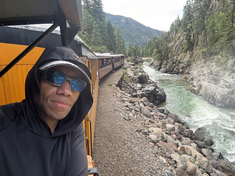
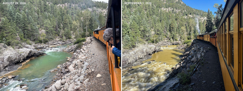
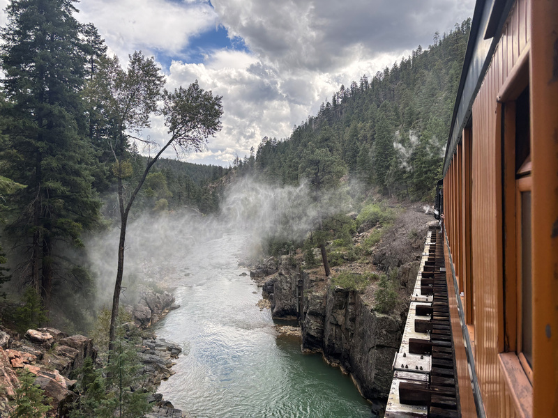
As the train made its way up to Needleton, I was feeling optimistic about my plan to wade across the Animas given how low the water level appeared to be: 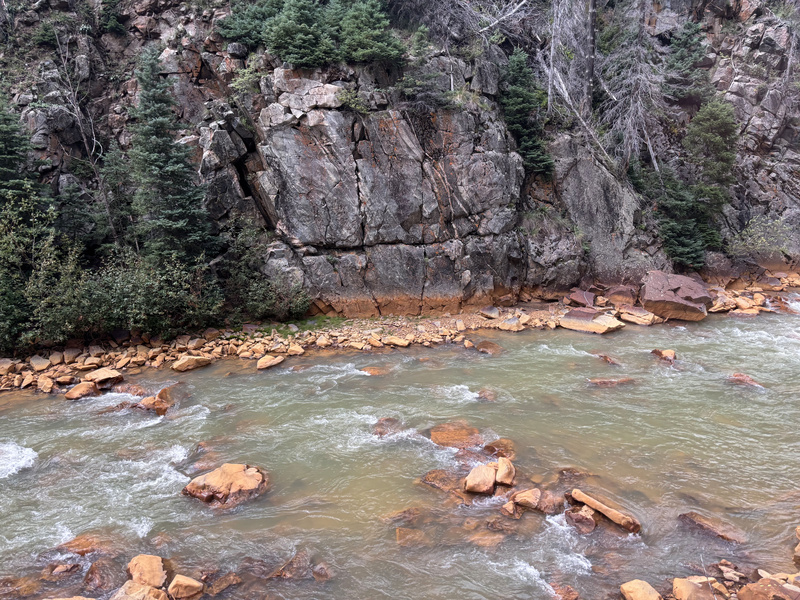
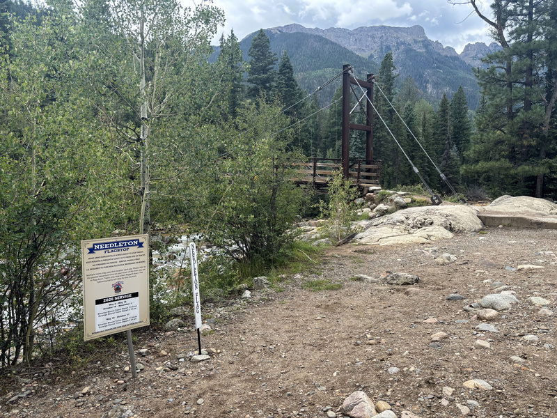
The train finally arrived at Needleton where I noticed they have a nice little sign now: 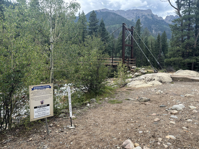
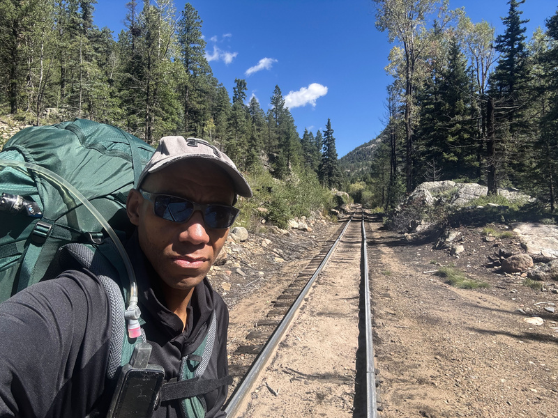
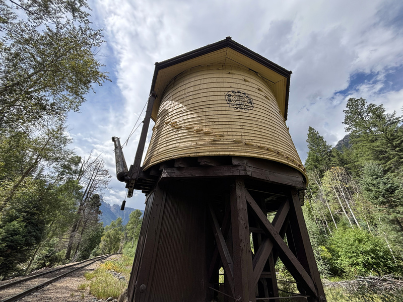
Seemed to be a very busy day for Chicago Basin, lol when I did Chicago Basin originally back in 2019 I think in addition to me like seven people got off! But yeah, I waited for the crowd to dwindle out before starting my journey up the tracks. Lol gotta say for carrying a 66lbs pack, I barely even felt it on those tracks. It's amazing how light that much weight feels when there's like zero elevation gain! I was a bit worried that I might get in trouble for walking on the tracks, but I ran into multiple railway employees who just waived at me an carried on. Got to see the next train come through when I passed by Needleton Siding: As you can see in that video, the weather is clearly starting to not look all that favorable. Optimistically I was hoping to get all the way into No Name Basin, but at minimum I at least wanted to cross the river. I approached the water tank for which Watertank Hill is named and sure enough, it started to rain. 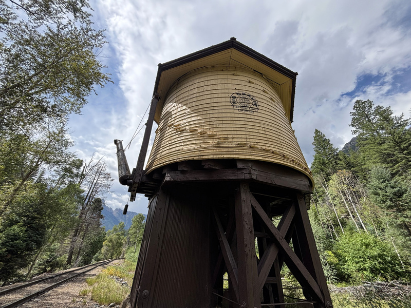
I sheltered under the tank noting that the rain seemed light and may just pass over (lol plus, I didn't want to downgrade my heavy gear yet to get my jacket and put coverings on and whatnot because I was kind of in a rhythm). The rain did pass and I continued up the tracks thinking I still had some kind of window to work with as I only had like 0.5 miles to to my intended crossing point, but as soon as the rain left it returned and this time with a vengeance. At this point I'm in a complete torrential downpour and I'm sorely regretting my decision to leave the hardcover protection of the water tank. With the rain coming down this hard, the river is now roaring and crossing it anywhere is completely out of the question and I had no choice but to set up camp in that spot. By the time I got my tent up, my jacket and sleeping bag were both soaked but I was at least free from getting pummeled further and basically just called it a day, defeated before I could even ask the question I went out there to ask. To add insult to injury, water had seeped into my battery pack as well and it wasn't recharging any of my devices. Day -1 Despite the rain, I was extremely lucky that it wasn't cold that night as somehow spending the night sleeping in a wet sleeping bag wasn't as annoying as I thought it would be. It had stopped raining, but the creek was still running high enough that I wasn't even going to entertain trying that or any other crossing spot. Furthermore, with my battery pack nonresponsive that put an end to my time in the wilderness. Lol I've gone full analog before, Capitol and Pyramid I did before I even knew GPS or electronic aids were options but I went there prepared to navigate without them. Sure I still had my watch, but from last year I knew that at some point I needed to recharge my watch, Inreach, and phone, and no battery pack basically deadlines the mission. So yeah, packed up the tent and began my short ~2.4 mile hike back to Needleton probably having had the shortest hike of all the people getting back on at around 4.8 miles RT :(. Obviously I was disappointed that my drive from the Springs and my trip into Needleton ended this way WITHOUT EVEN CROSSING THE BRIDGE and had already mentally begun preparing for other Western Slope objectives like Vermillion, but as I was getting back on the train a seed was planted that would completely change what I thought my options were. A friend of mine recognized me and let me know he was going back in to get Pigeon and Turret after just having gotten Jupiter a few days prior on a SEPARATE train trip?! How did I not realize that this was an option?!! Lol that got me thinking the whole train ride back. Sure I got defeated and rained out and yada yada yada, but now the question for when I got back to Durango was is there a window for me to go back in? I'll worry about all this when I get back to Durango, for now I'll never get tired of this majestic train ride and the opportunity to ride it certainly helped ease the blow of not meeting my objective. 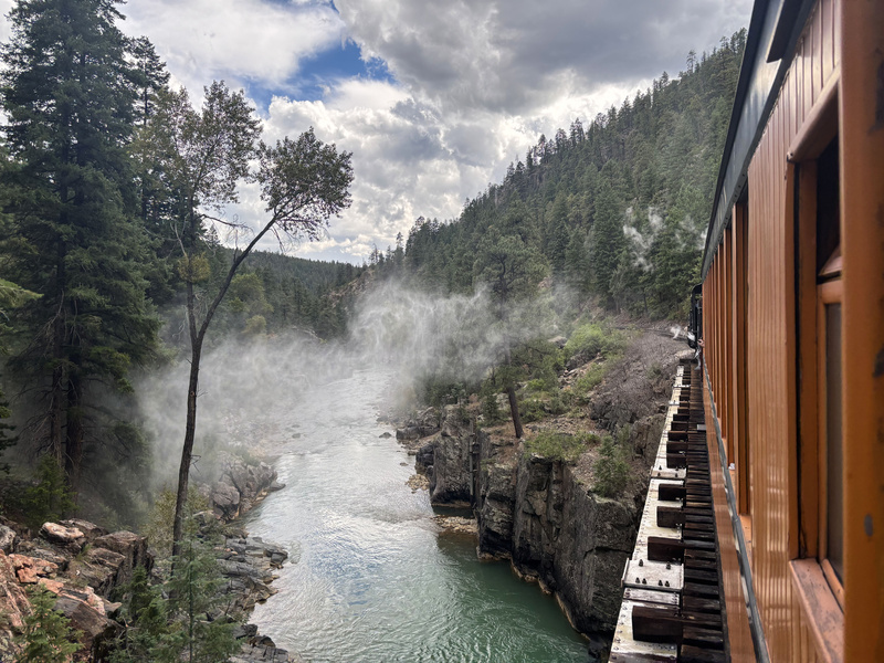
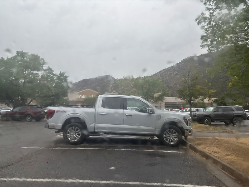
When I got back to Durango that Sunday night, my first order of business was putting my jacket and sleeping bag in the dryer at the laundromat and figuring out how to rescue my battery pack. I feared it was a lost cause, but three hours in a bag of brown rice was enough to get it up and running again! This was my biggest worry because if I couldn't get it working, I wasn't even going to try to get another train ticket. It started raining again that evening, but looking at the forecast it appeared it as going to be completely bluebird from Tuesday (September 1st) onward! I retreated to my base of operations whenever I go to Durango which is the Walmart parking lot, ideal for sleeping in one's backseat unbothered as no version of me is ever going to pay actual money for lodging when I have a free backseat and the whole reason I'm even out there in the first place is to rough it in the wilderness lol. 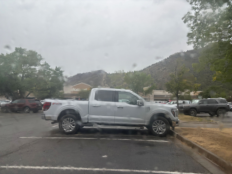
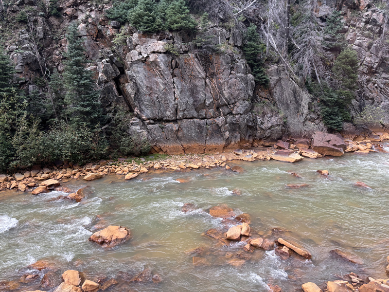
Day 0 The next day I secured my ticket, made sure to eat at Denny's to at minimum have their seasoned fries swimming in ranch dressing (seriously, #bringdennysbacktocoloradosprings and if you're reading this and in an actionable position to make it happen, please be square with the IRS), explore Durango a bit, and spend one more night in the Walmart parking lot before heading back to Needleton on Tuesday. Round 2 Day 1 Lol alright, I got my fix of the open air gondola and decided to go back to being cheap and warm this time: Probably slept more than half of the way there, but sufficient as it is you don't exactly get the best night's sleep in your back seat lol. While the forecast was currently and projected to continue being completely clear, looking at the Animas on the way up it versus a few days earlier I perhaps should have taken a hint that attempting to cross it still wasn't going to be the best use of my time and effort: 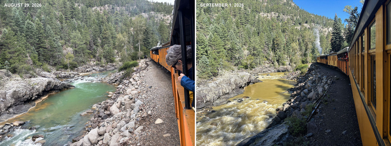
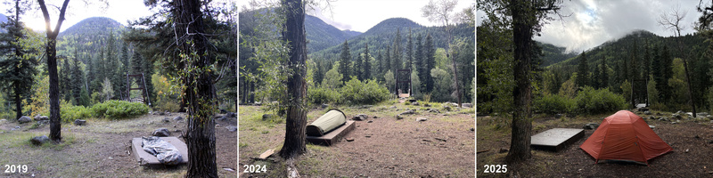
Made it back into Needleton and being on the left side of the train, I caught a glimpse of my beloved slab that has become an all too familiar final resting spot on these trips! 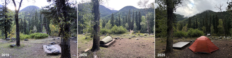
2024: Thought I found gold with this ultra lightweight bivy I took into Jupiter that ended up being a condensation magnet and expeditiously found its way into the trash before I even left the train station parking lot. 2025: My most comfortable slab experience borrowing this tent for what unfortunately ended up being a failed Jagged mission. 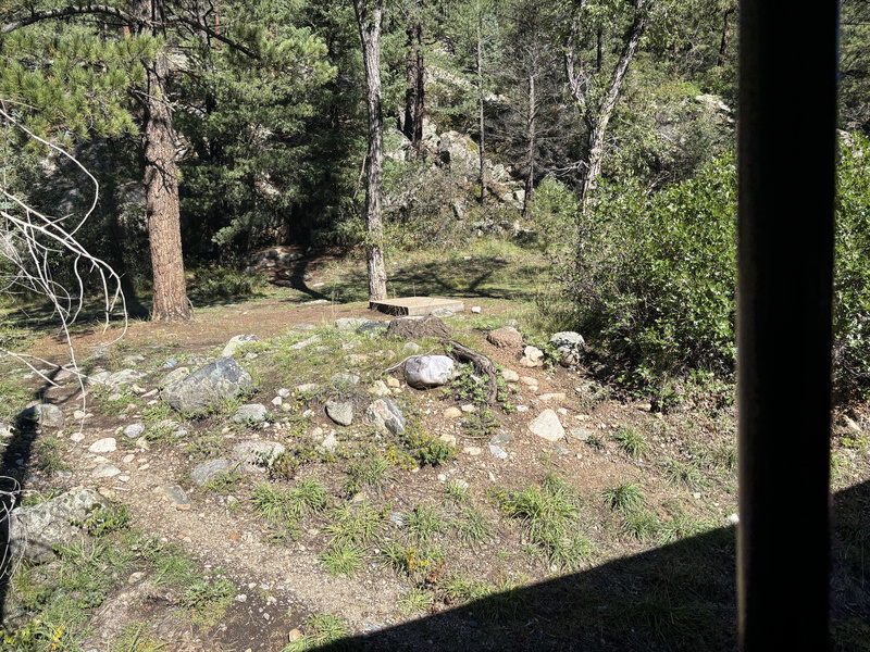
Lol so now that weather's no longer a factor, it was time to embark upon this river crossing exercise in futility that Stevie Wonder could have seen wasn't going to pan out one more time. 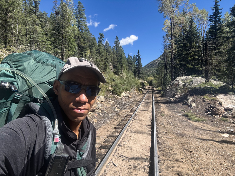
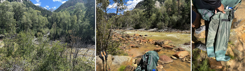
I'm clearly seeing this water's running way faster and higher than it was a few days go, but I'm determined to test this out for my own mental satisfaction: I finally get up to the planned crossing point where I can see No Name Creek and already I'm like that's not happening. I hiked a little bit farther up the tracks and it only seemed to get worse at which point I figured it best to cut my losses, defeats the purpose if I find a crossing point that results in having to do like a mile of deadfall hopping back to No Name on the other side of the river. I remember seeing a potential crossing spot on the way up that looked tame...ish. I got down to it and I wasn't feeling all that optimistic, but I brought these trusty dusty wading boots I just got off Amazon specifically for this objective and damnit I was going to try them out! 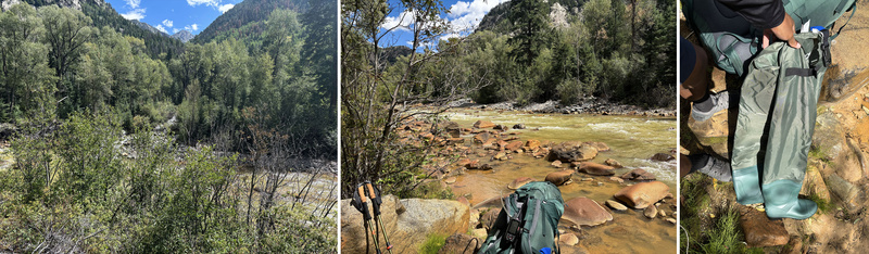
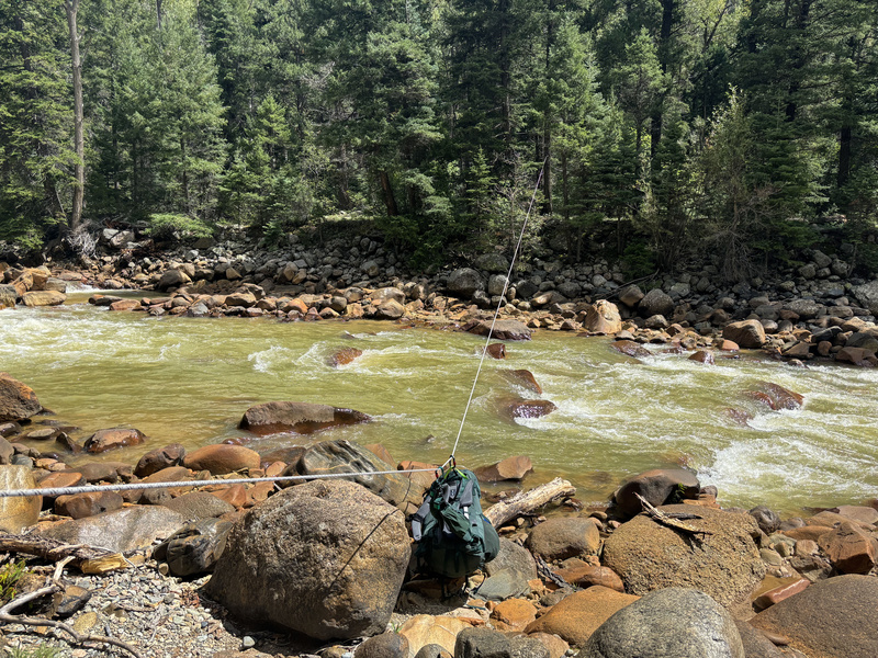
Lol as I said earlier, I don't take kindly to unnecessarily getting wet and will do all kinds of crazy stuff that potentially involves hours of effort to avoid it (Lindsey and Middle Palisade have entered the chat) and if I know it's inevitable, these boots are a small price to pay :). But alas, I probably made it about 30-35% of the way across before surrendering my effort. The current was too strong and I felt taking another step risked me getting swept out, not to mention the water being so brown that you couldn't see the river floor to make out any trip hazards down there. You would think I'd learn my lesson though and just hike back to Needleton, right? Lol well there's this small problem of this rope I saw someone had spanned across the river last year, and I noticed the same rope again this time except from the tracks side. This is what originally gave me the idea to even consider crossing the river as an option as this rope was evidence that someone had done it. 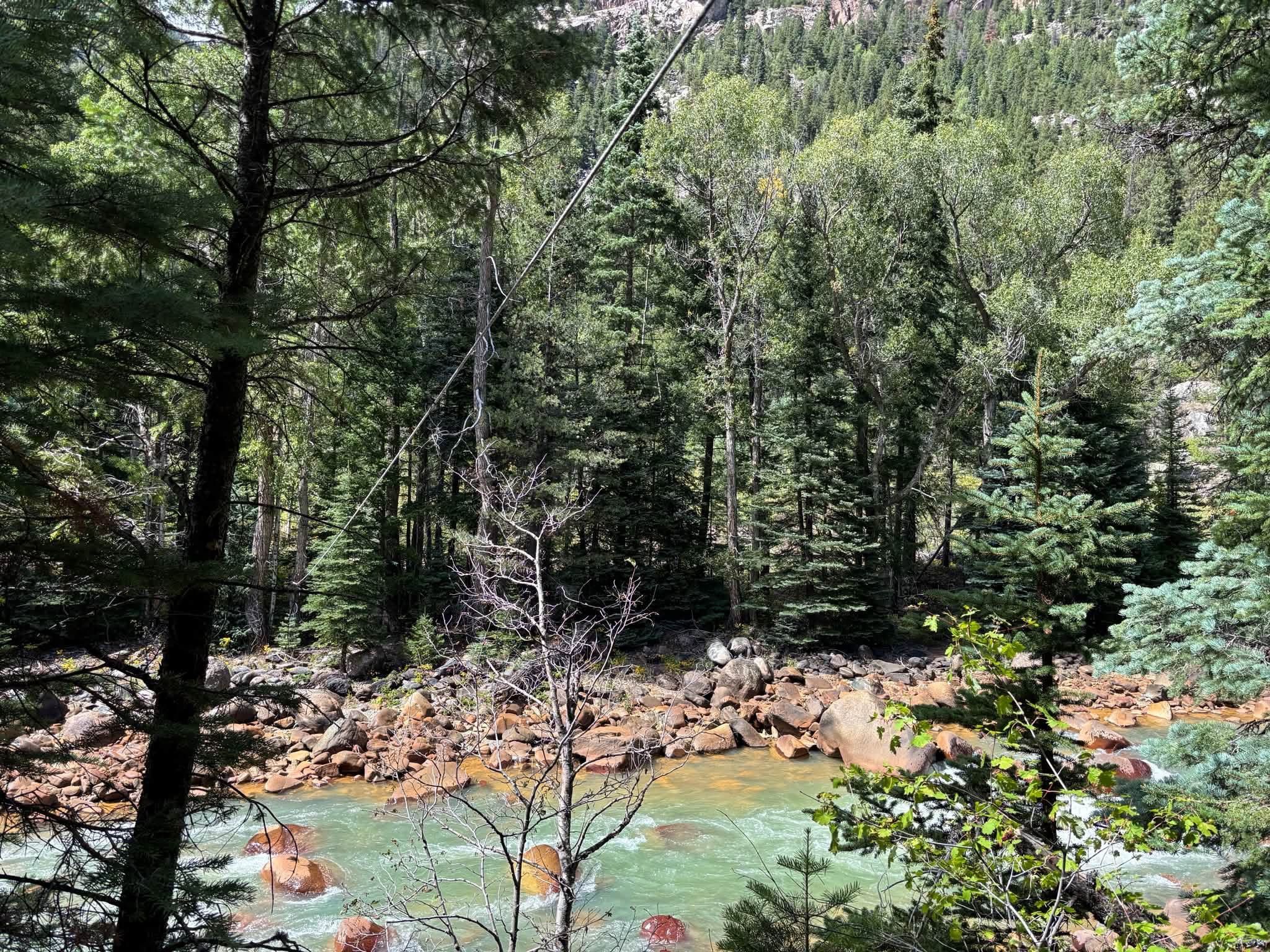
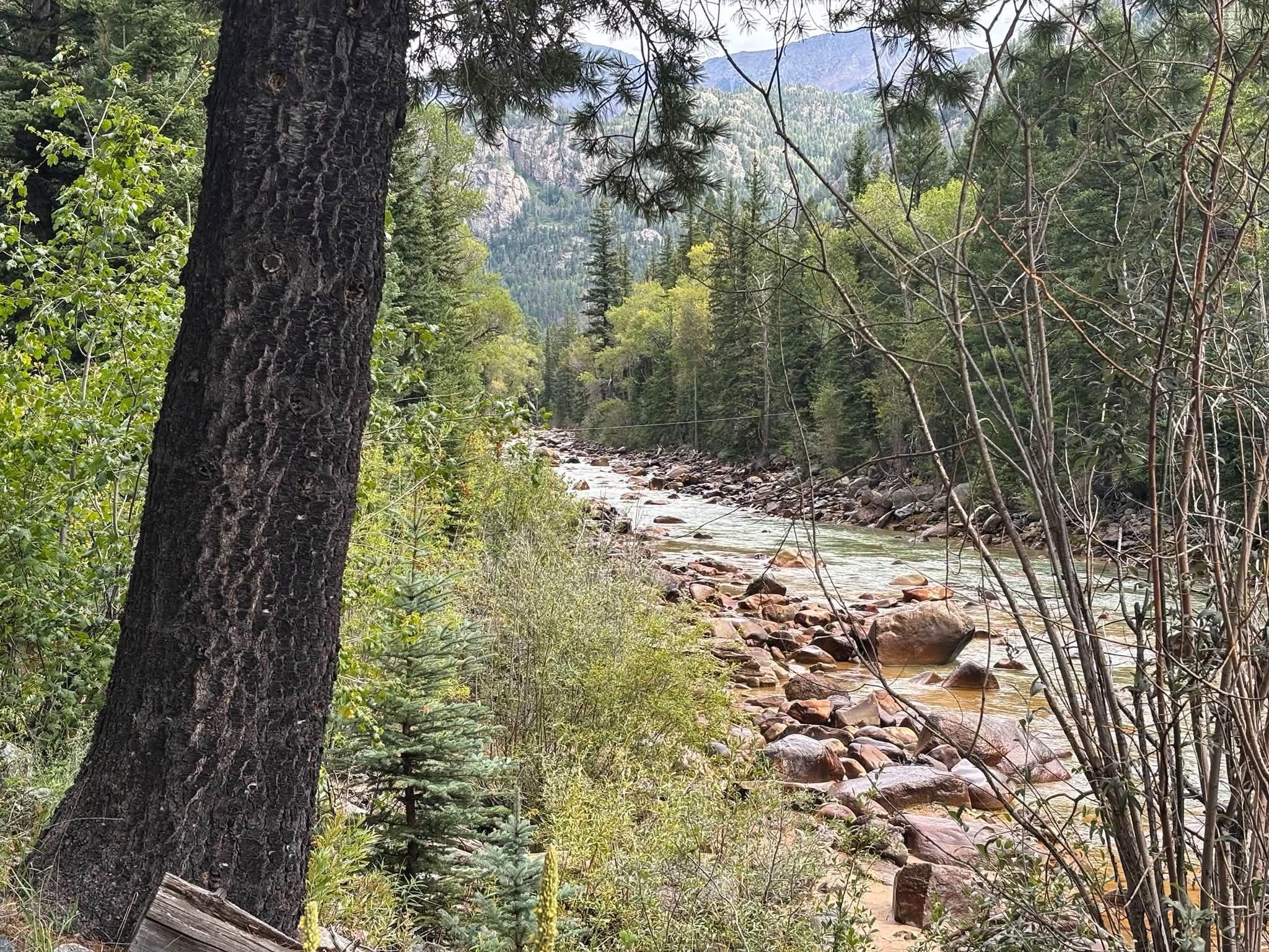
I kept hiking down the tracks and figured I'd try this location as well, maybe even get an assist from the rope lol. Already I noticed the water was running way deeper and faster here, but I figured I could tie my pack and loop myself in as well and maybe make it across that way? 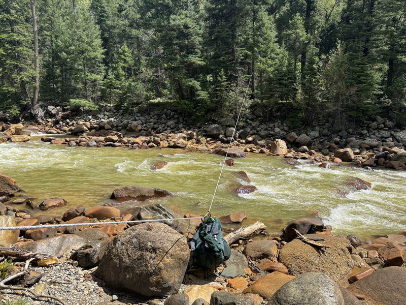
Lol so much for that idea, I made it like two steps in the water and I'm like yeah I'm good--notice that the opposite tree is higher than the one on this side so I'm getting no gravity assist either trying to pull this 66lbs pack across. So yeah, that put an emphatic bow on my Animas crossing attempts and at this point I was like it's time to just head back to Needleton and do the No Name approach the way you're supposed to. 2. The Runback
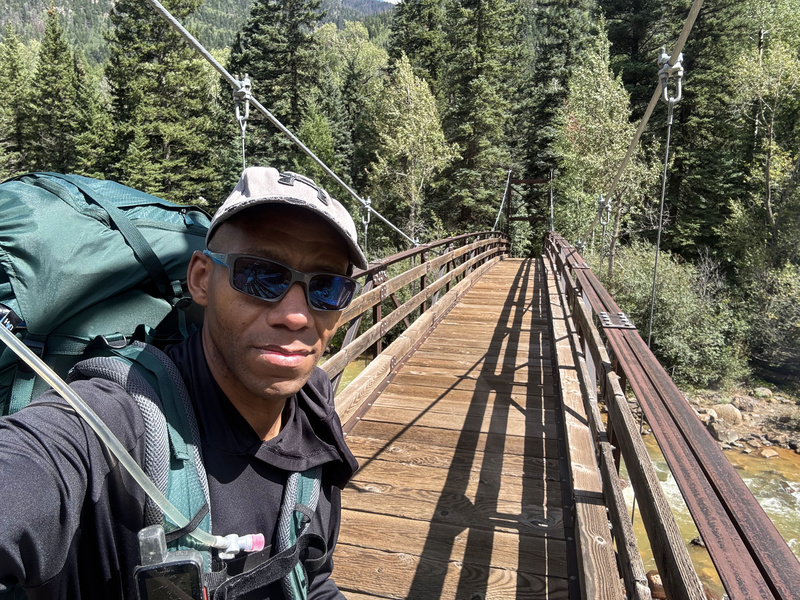
Day 1 Continued (lol it's green now because now I've actually started the mission) Lol alright, now that we've gotten all of that river crossing tomfoolery out of the way and know definitively that it's not a viable option under current conditions (and we're 5 miles and two crossing attempts of energy spent), we can begin the actual "standard" journey into No Name basin! 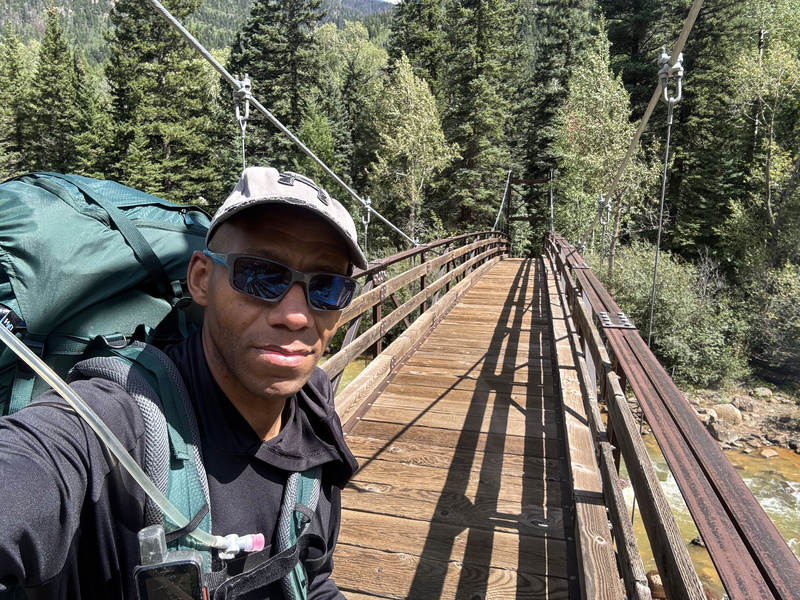
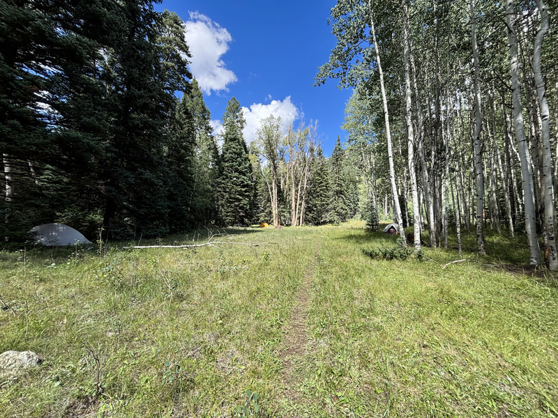
The first part of this was pretty routine, lol just go the opposite direction from where the Chicago Basin people are going. A short ways in at one of those initial clearings, I came across like eight tents though not a soul in sight. I assumed it had to be some kind of organization, but I didn't think any work ever got done on the Ruby or No Name approaches so it seemed inconveniently far if they were doing work on the Chicago Basin trail. I later found out from a friend who also encountered them that they were indeed doing trail work. 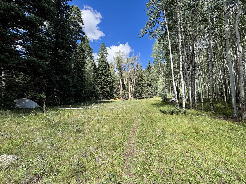
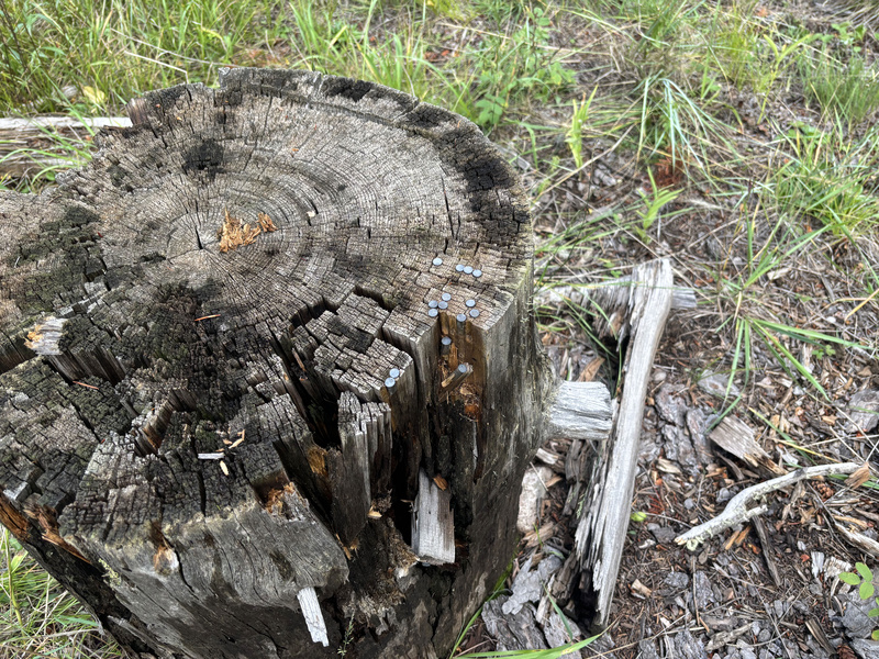
Came across this stump with what I thought to be a bunch of random nails hammered into it, but upon further inspection it's actually a bunch of small caliber shells hammered in. Probably .22LRs or something similar: 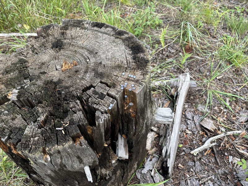
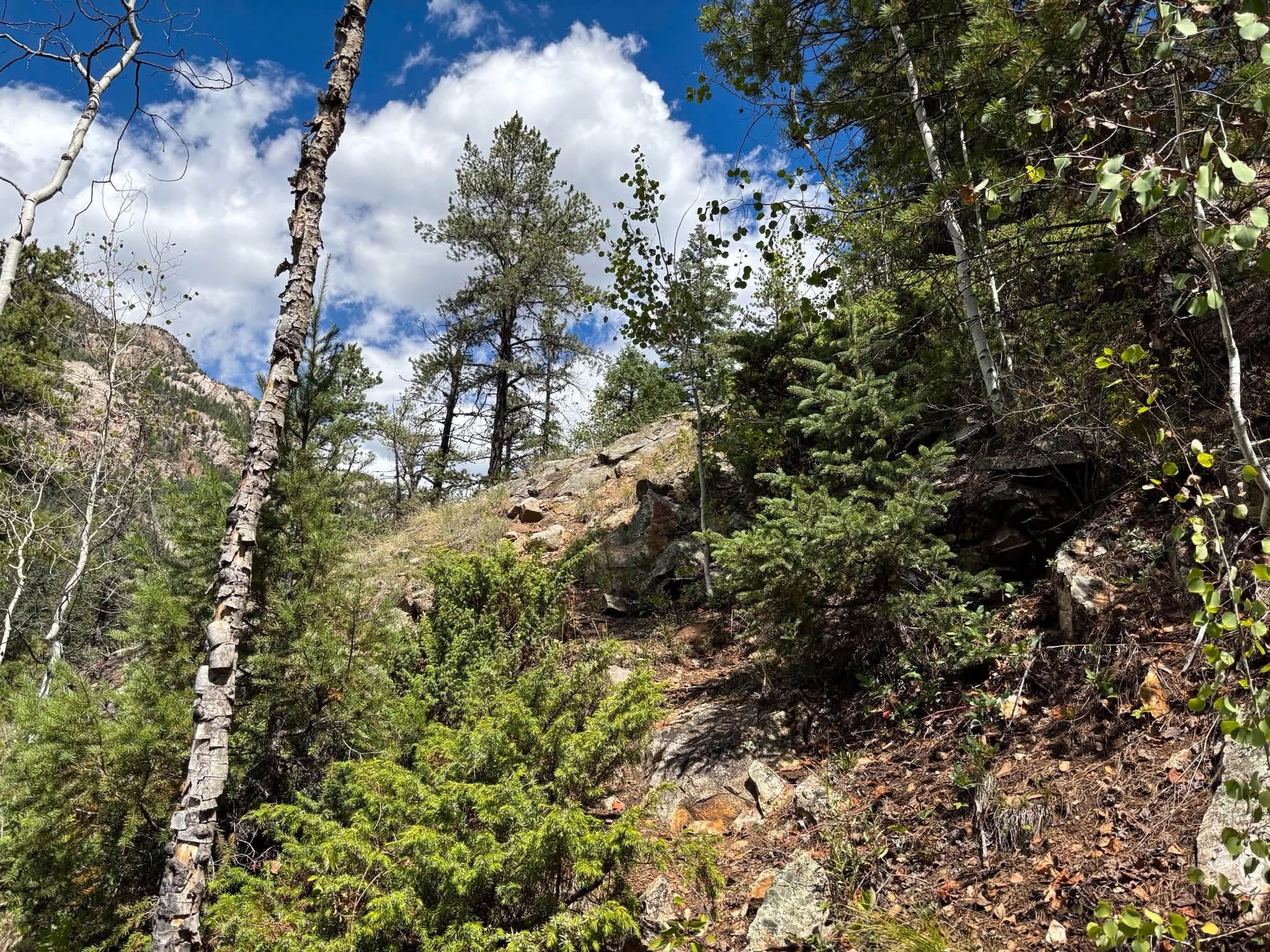
Lol and that pretty much ends the "pleasant" portion of the lower approach, pretty much everything from the Ruby Basin junction to crossing No Name Creek and actually joining the trail ranges from unpleasant annoyance to soul crushing nuisancery. Once you get to the trail on the other side of the creek, the approach into the basin isn't all that bad. Yeah there are definitely some nuisance areas, but nowhere near as bad as what you deal with down here. It starts out just fine and then you come across some deadfall on this "trail" you think you're on. Common sense would lead you to believe once you climb over these five trees the "trail" will just continue on the other side... nope! You clear the trees and there's no trail to be seen in any direction, so then you check your GPS. GPS says the "trail is to your left, so you climb over like 20 trees and find another "trail" and see that it's been going there in both directions?! Then what was I just on?!! Anyway, fine. It is what it is, let's keep it moving. I'm now committed to THAT trail that's seemingly in line with the GPS only to come across another deadfall pile. I climb over these thinking again the "trail" "should" be on the other side, and sure enough there was nothing there. Lol basically you'll be rinsing and repeating this process like 7-8 times over the 2.7 miles or so it takes to get to the creek during which you gain NO elevation, and all of this doesn't even include Watertank Hill. Lol so yes, knowing I had to deal with all this you see why I was so desperately trying to make the river crossing idea work but alas, I found myself back at square one. .jpg?updatedAt=1789376666068)
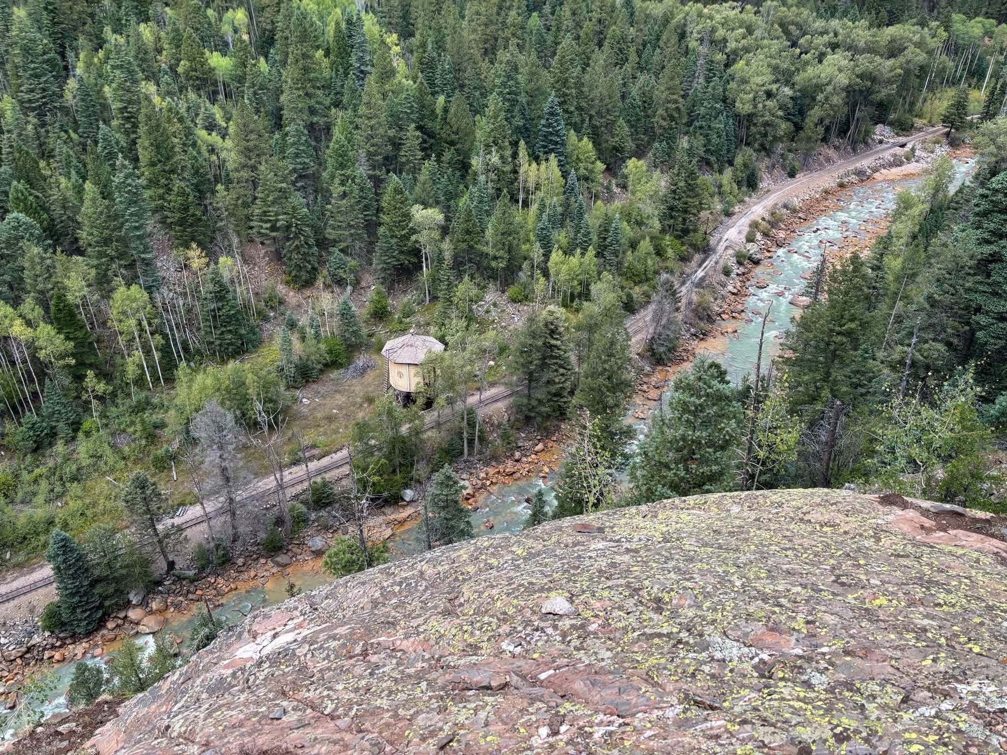
I was kind of locked in just trying to push through and didn't get any pictures going up Watertank Hill, so here's a pic from last year's attempt:
Heard the afternoon train coming back which was cool to see from the hill, lol I'd be amused if anyone saw me up there. This is also a pic from last year from near the top because I was not in picture taking mode this time around lol:
A little more nuisancery descending and on the back side of Watertank Hill (which was soul crushing to ascend last year on the way back when wet, might want to bring microspikes just for that), but No Name Creek was finally within reach. Ideally I had hoped to make it all the way into the basin, but with all the energy I spent on the river crossing escapades I was feeling pretty spent at this point. There was a beautiful wide open camping area right before the creek and part of me considered camping there for the night, but I remembered there being some unpleasantness both crossing the creek and getting up to the trail so at minimum I wanted to make contact with the trail before calling it a day. FILTER YOUR WATER HERE IF YOU HAVE ANY DOUBTS ABOUT YOUR WATER LEVEL!! It will be a decent amount of effort before you have access to the creek again, and you wouldn't want to run out like some people who didn't learn their lesson from the year before... Bit of a slog up the slope on the other side of the creek, but I finally joined the trail. I noticed last year and again this year that trail turns sharply north, like 90° to who knows where and I don't see it reflected on any map. I was fully intending to scope it out on the way back, but I guess that'll have to wait for another time. Probably pushed about a couple hundred more feet, saw a flat area on the side of the trail, and was like I'm good for the night right here. Day 2 Think I had one of the longest night's of rest I've ever had in the wilderness that night lol. With the nuisancery of the lower approach behind me, I wasn't too worried about anything ahead between there and where I would camp in the basin. 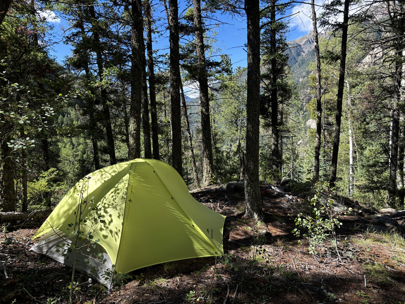
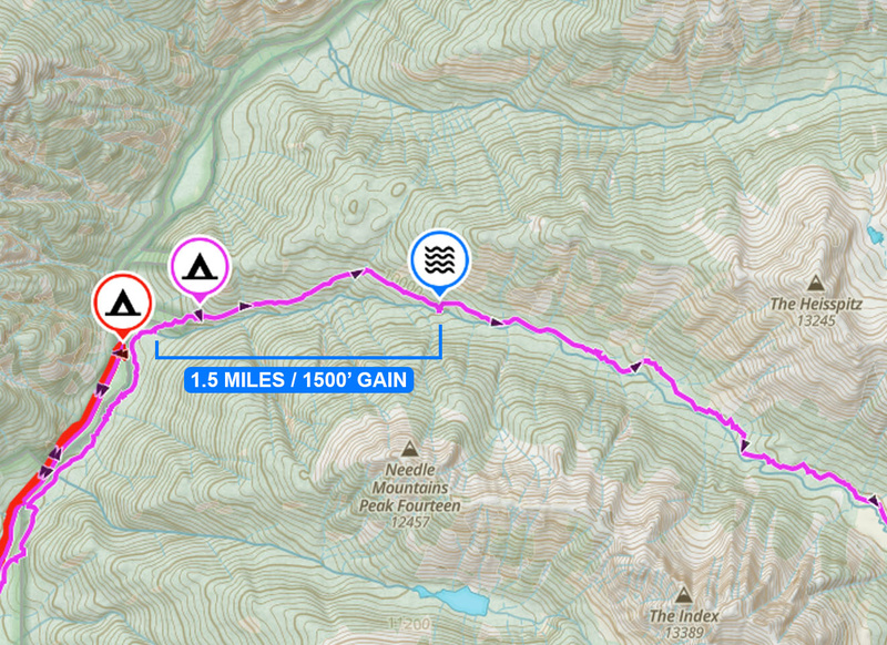
Yeah, that whole not filtering water thing because I was in a rhythm but didn't want to take my heavy pack off and disrupt that rhythm really came to bite me as I started the morning running on fumes. I knew where the water spot was and for some reason I remembered it being closer than it actually was but yeah, it's a bit of a haul: 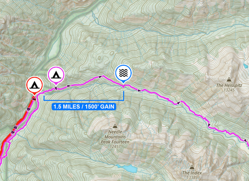
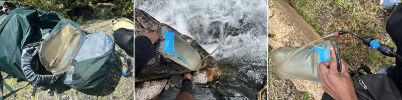
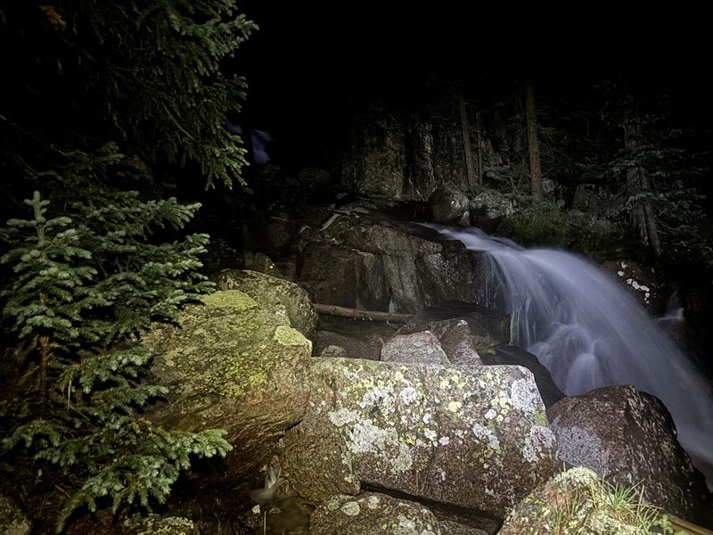
The creek isn't exactly off the trail and you do kind of have to take an easy scramble down to it, but it's the first place where the creek has climbed high enough to even be reachable from the trail. 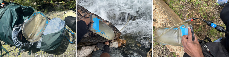
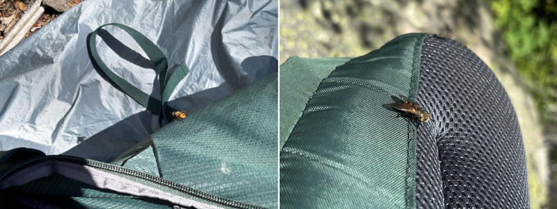
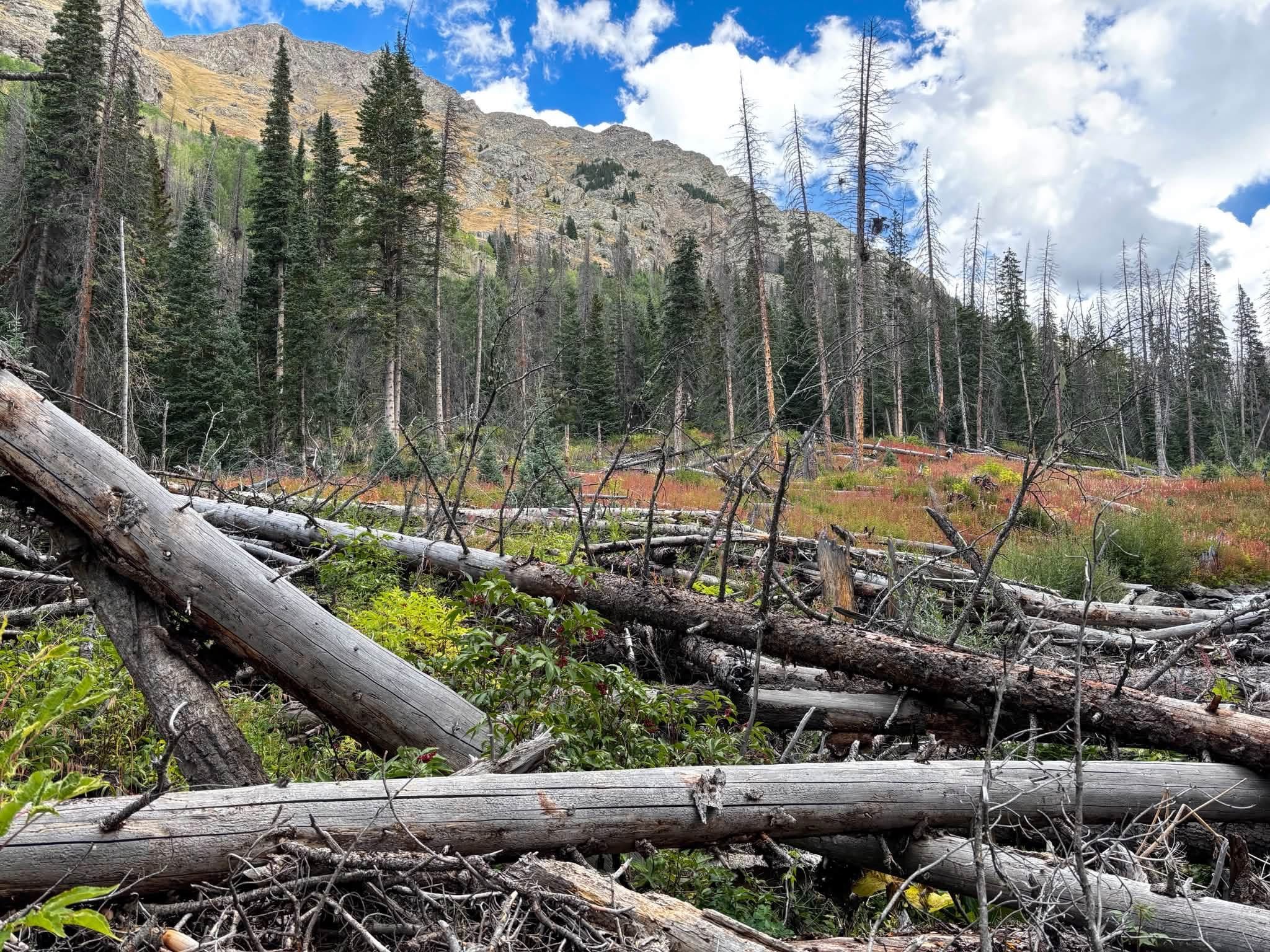
Fully replenished now, I continued marching on until I encountered one of the first nuisance areas of the upper trail. Certainly unpleasant, but not soul crushing like the bottom stuff was so I pretty much just pushed through and tried to avoid as much of it as possible by staying to the left.
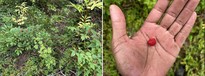
Lol you'll be ready for Swan Lake on logs instead of ice by the time you're done with this journey! After dealing with the first big deadfall section, you do find the trail again but it start's getting steep after being fairly flat for a few miles. When you approach this steep section, there are quite a few wild raspberry bushes that were way more full than last year!
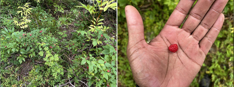
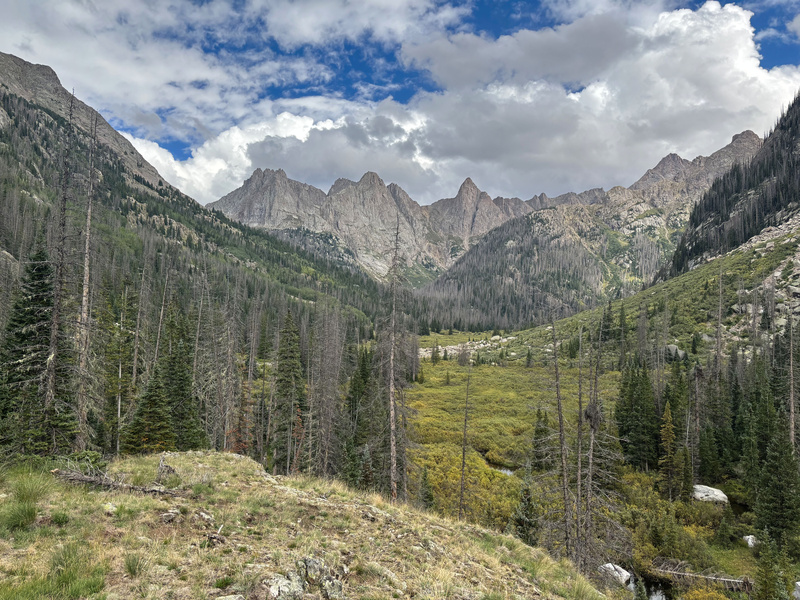
Once you make it to the top of this steep portion of the trail, the forest opens up and you'll be treated to an amazing view of your objective ahead: 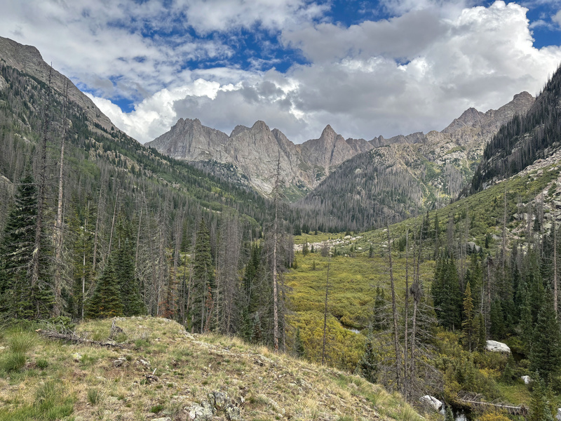
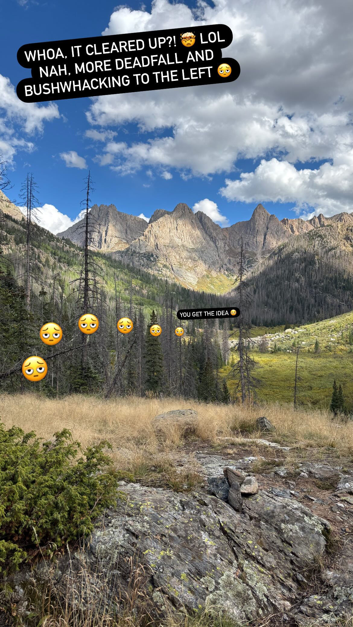
Not much in the realm of unique wildflowers heading up this basin, but I did come across these which were pretty cool: 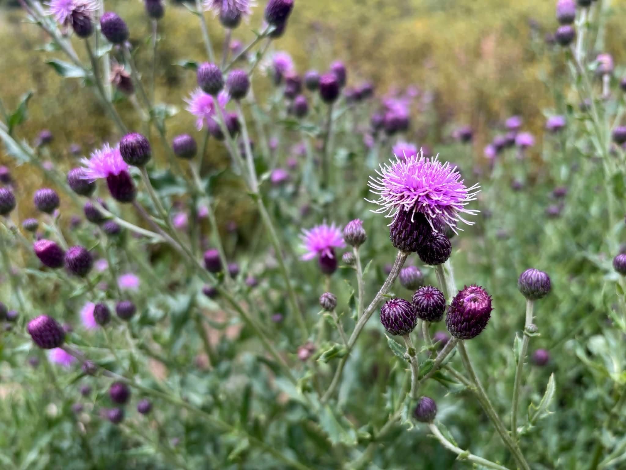
Not sure which path I took around the willows, but somehow I completely avoided passing Jagged Cabin which I passed both ways last year. Lol I'm pretty sure it's right on the trail, did it disappear or was I that in the zone that I completely missed it?! 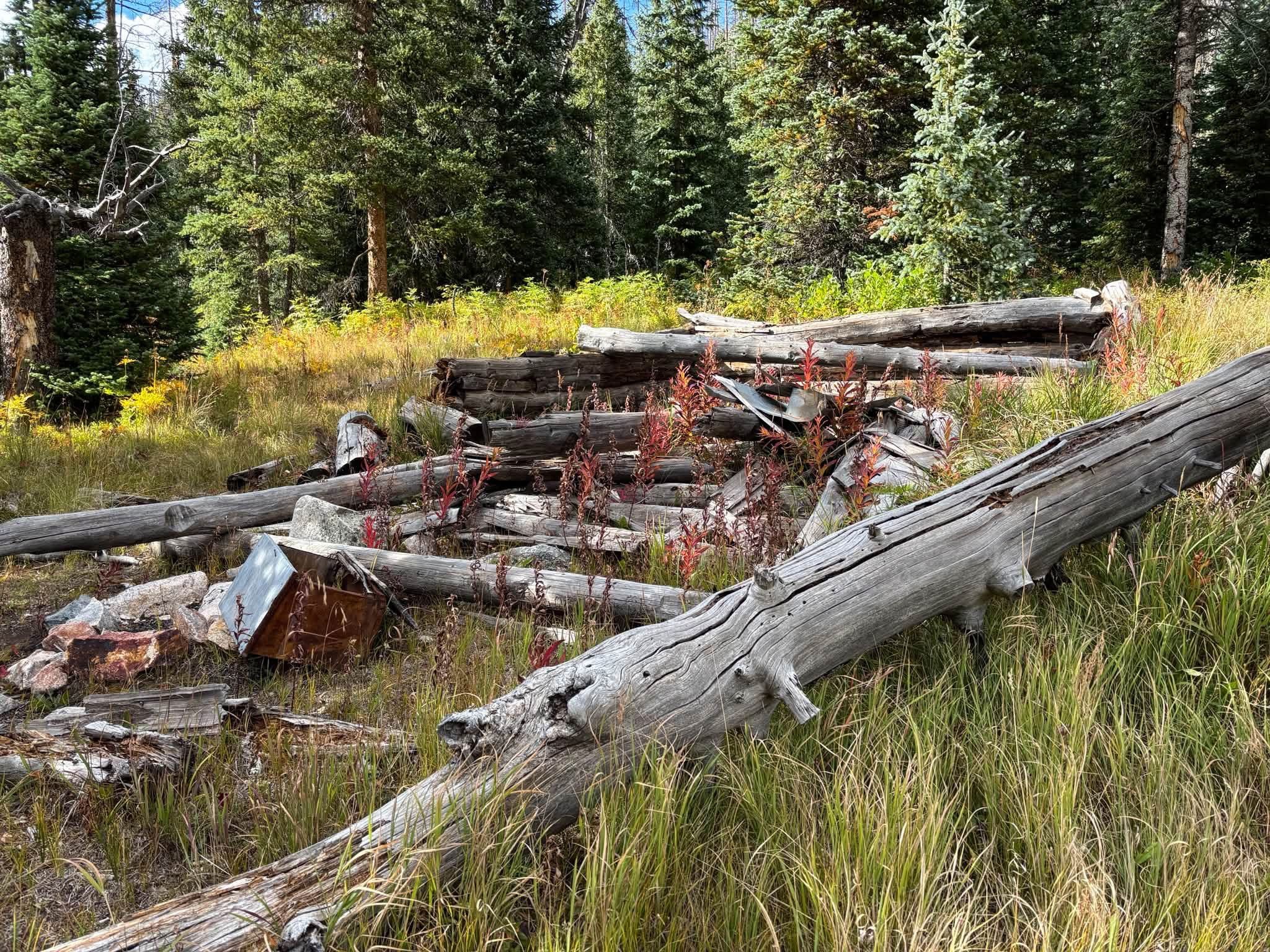
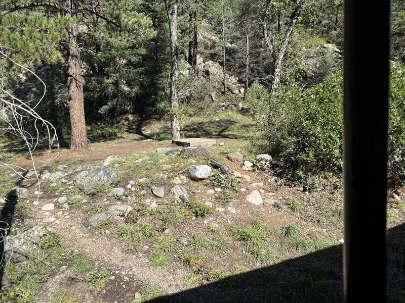
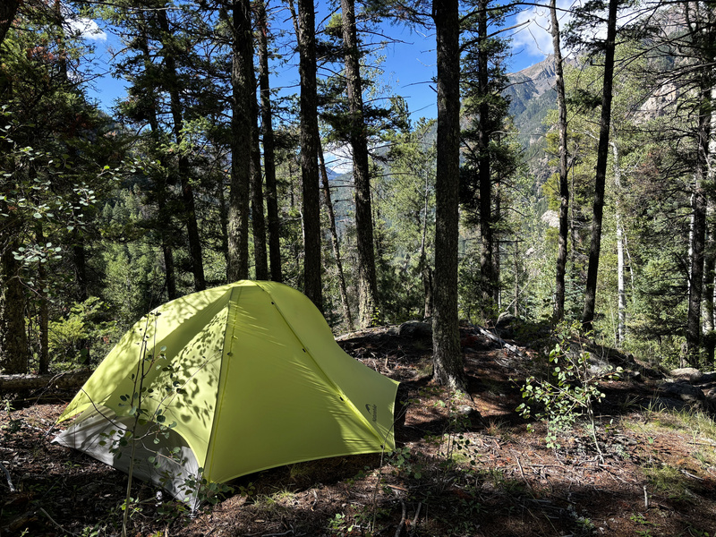
By the time I got to the campsite, it looked like it was going to start raining so I didn't bother getting any pictures of the area and just prioritized getting my tent up. I camped a little but further up the trail and closer to the creek than this picture of where I camped last year, but this whole area has an amazing backdrop with several great camping locations!
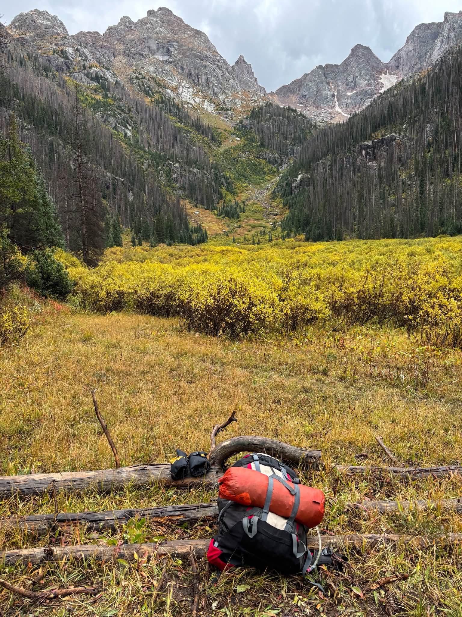
Day 3 Alright, summit day! Lol I set several alarms only to snooze through all of them and only start heading up at 6 which in retrospect is workable but probably on the late side if you're a slow ascender like me and I'd recommend starting earlier from here. 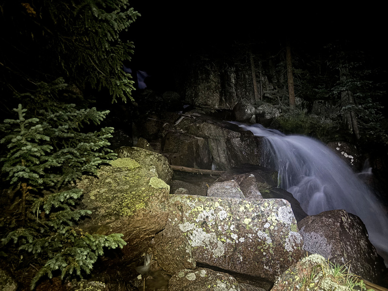
Some moderate deadfall to deal with at the top of the drainage, but nothing crazy. It ultimately leads to a meadow which makes for another great camping spot which as evidenced by the fire pit, some have done before. Lol it'd be a bit of a chore though getting a heavy pack up the drainage, so I would only consider this as a camping spot if your pack is light. 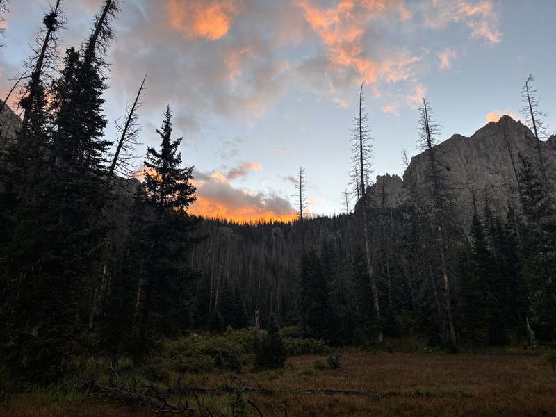
Continuing up the STEEEEEP slope to finally clear tree line:
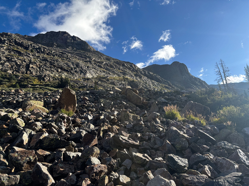
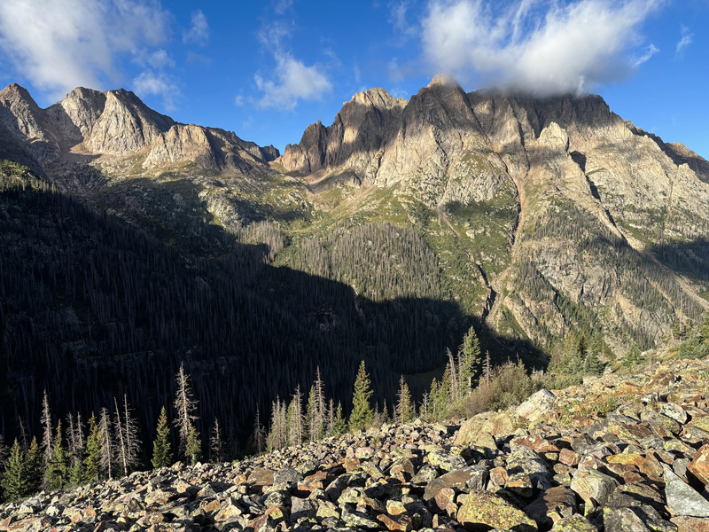
The distance here from the campsite to Jagged Pass is quite far, like 2.3 miles of very slow progression up steep switchbacks and scree. Eventually you get there though and face one final challenge in ascending the scree slope to get up Jagged Pass. 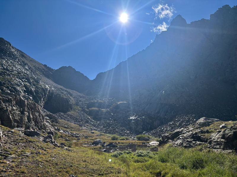
And there you have it, ALREADY looking more promising than last year! 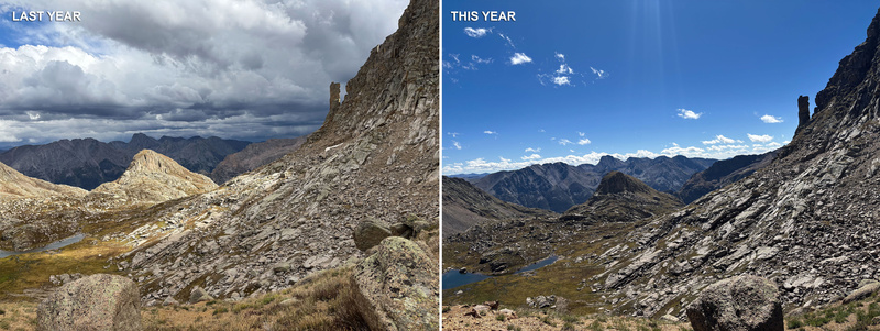
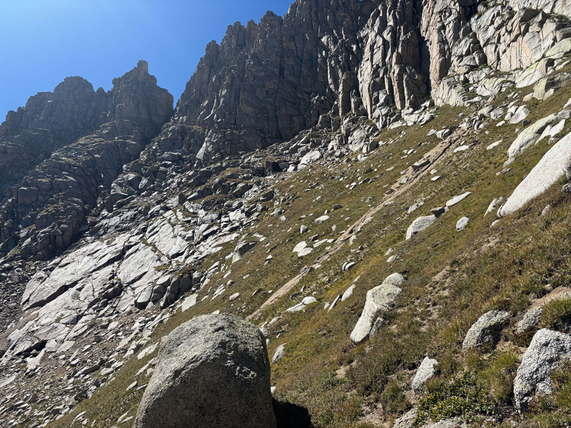
A trail continues upwards towards the slabs, but after gaining about 150' it pretty soon becomes evident that trekking poles will serve no more purpose going forward and it's time to at least put my helmet on. 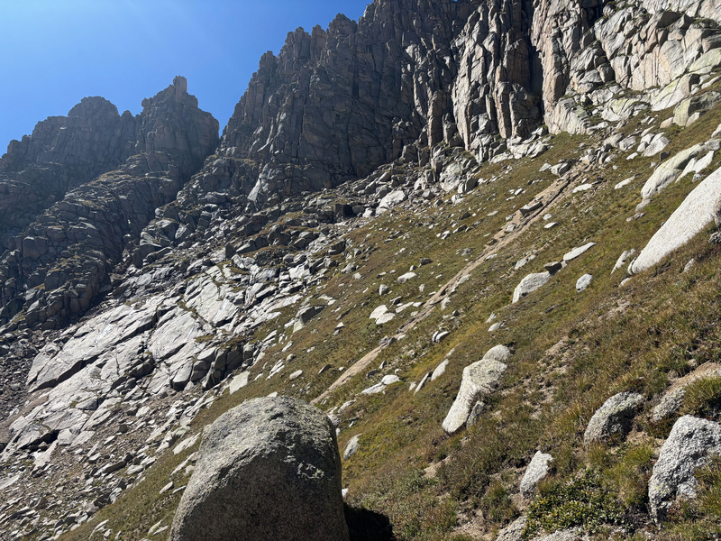
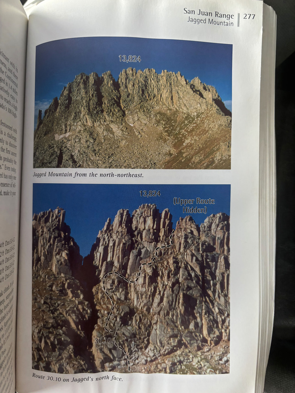
Lol during the "Ruse" section of this adventure, I actually had Roach's whole book in my pack with me only to realize that's unnecessary weight and I can just take pictures of the important pages for when I came back out. Both of these pictures are taken from the east, so it's kind of hard to orient the black dotted line when coming at a sharp angle from the north. 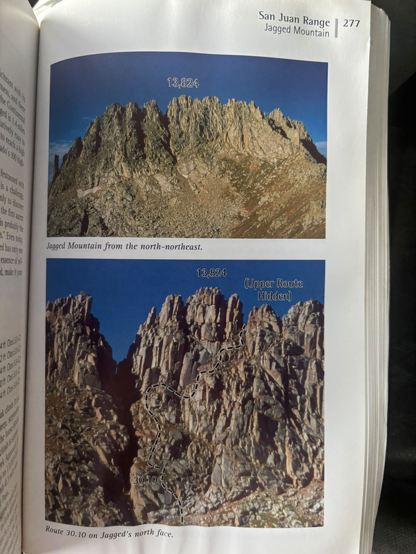
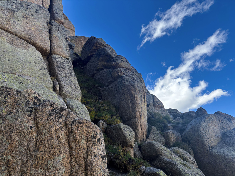
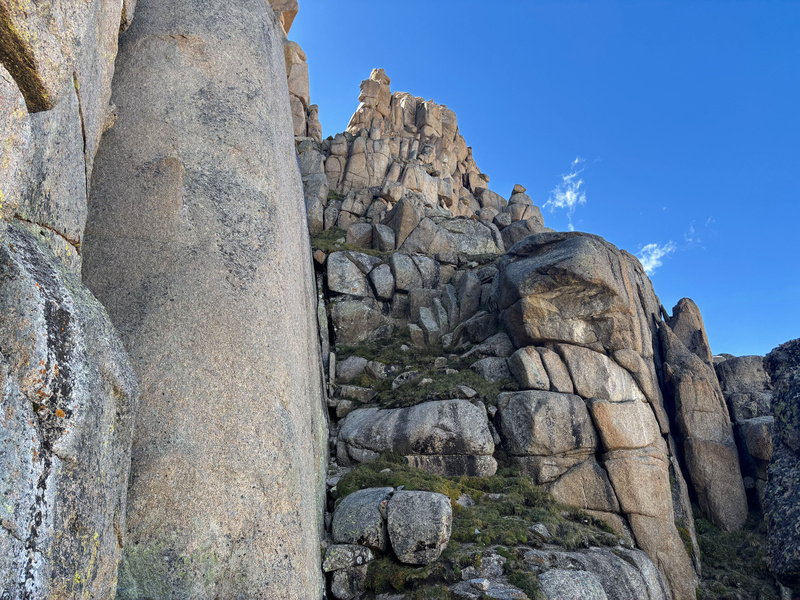
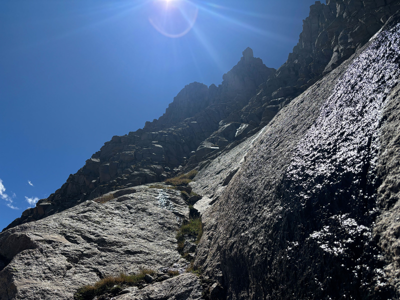
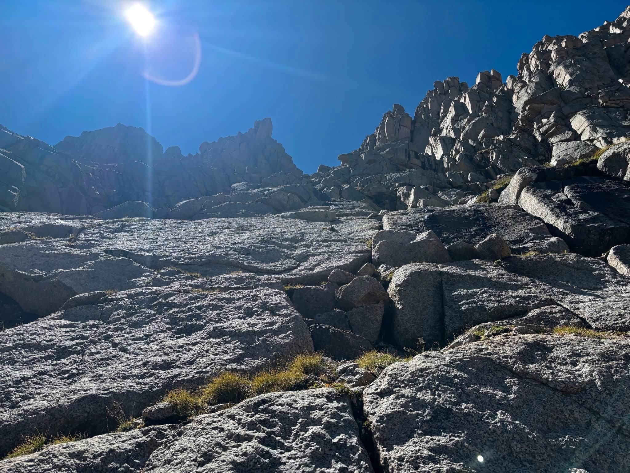
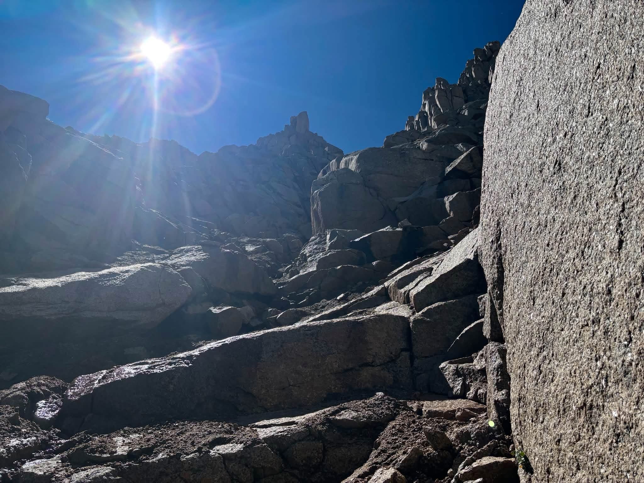
Still, I tried to orient myself as best possible. I tried to cut across the initial slabs, but I'm here to say that despite the chimneys getting most of the attention in route descriptions the slabs are not a trivial obstacle. I initially cut all the way across to the gully thinking that may be my easiest option, but there was the tiniest piece of ice clinging to dear life at the top of the gully making the whole gully wet and ultimately unclimbable, at least for me. This meant cutting back into the slabs which took a whole lot of guessing and checking and being willing to fully downclimb a section to try another line to finally find a way that goes. 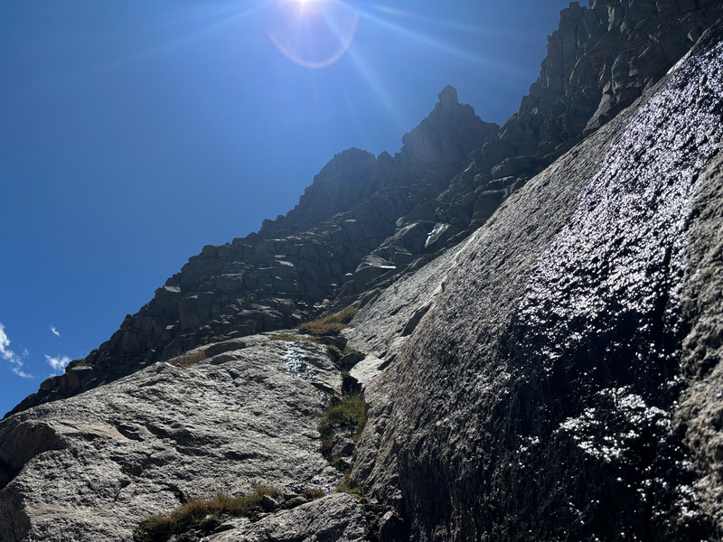
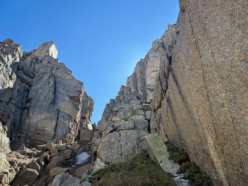
After getting sketched out several times (to the degree that I was likely going to rappel some of those slabs on the descent), I finally made it high enough to intersect with the top of the gully and the entrance to chimney 1. 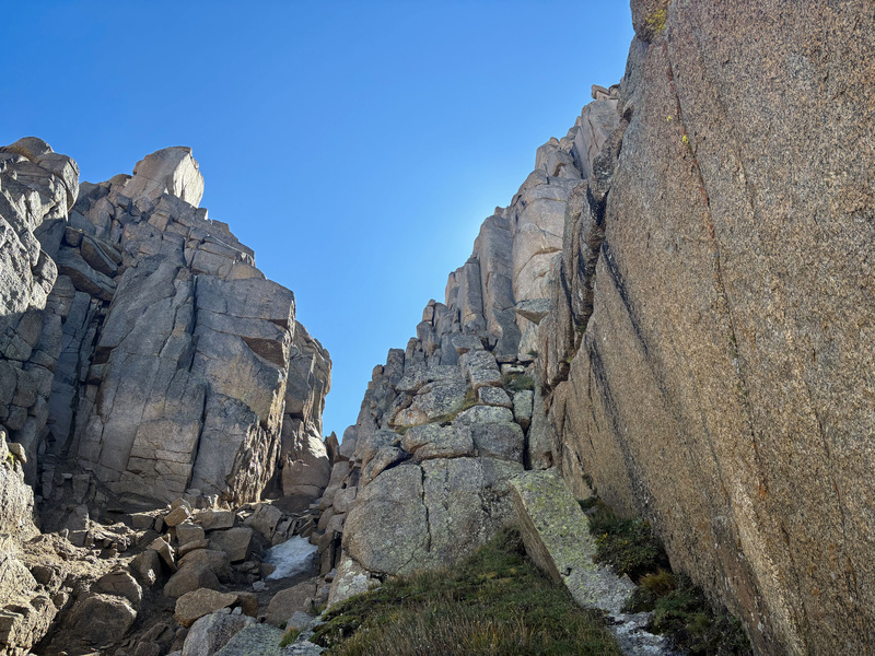
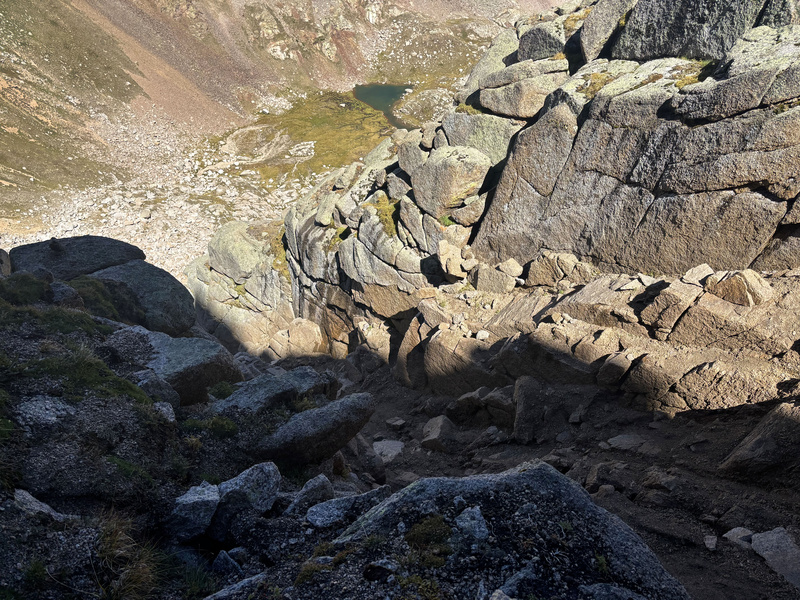
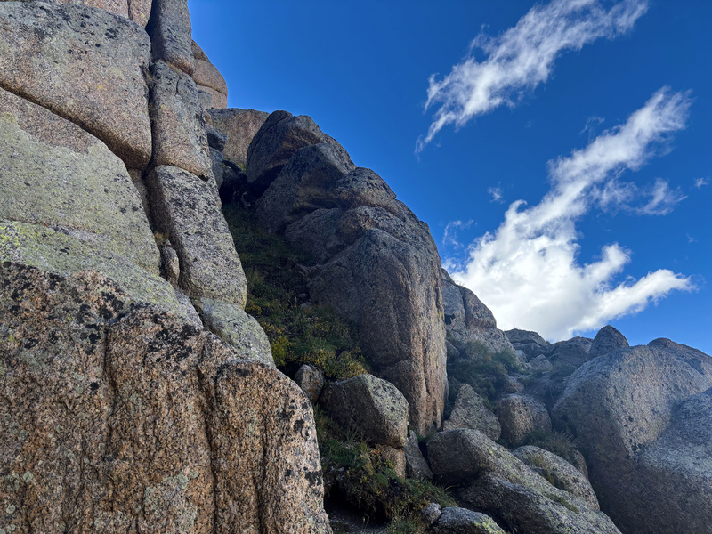
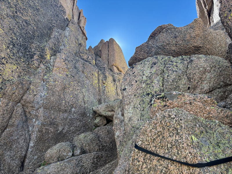
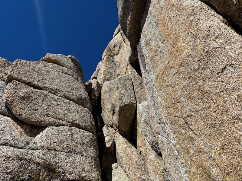
Chimney 2 is where the difficulty picks up considerably. Right out the gate there's a crack with a chockstone that I legit couldn't get up and was seriously questioning if I'd potentially have to turn around right there. It was here that I decided to switch to my climbing shoes as I was definitely not about to give up that easily. I surveyed the area though and I found a line out to the side that was a little exposed, but allowed me to ascend further up the chimney where the rest of the obstacles were more manageable. 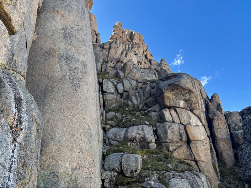
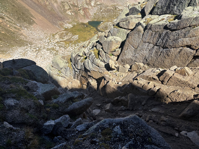
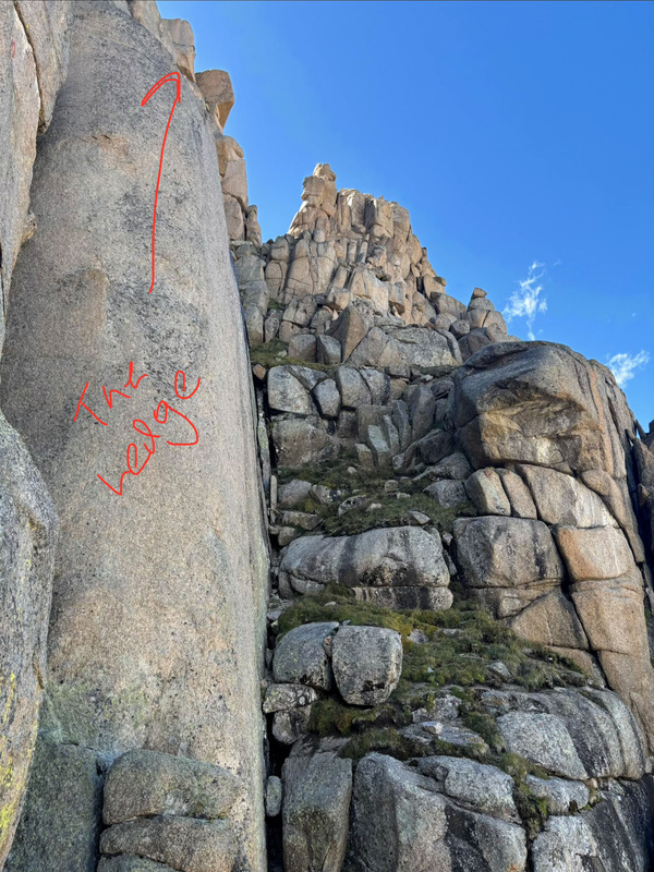
Didn't really get a good pic of the entirety of chimney 3, but I remember it appearing difficult looking at it head on and finding a line up the side to get around it. Specifically, there was a crack I was able to get into and pull myself up to the next platform. Like I did with the Bells Traverse, I found that these chimney type obstacles are more manageable without my pack on so I took it off, short roped it, and would pull it up after navigating the obstacle. Lol this crack was very narrow and I just managed to squeeze in, so if you know you're on the larger side you may need to look for other options but it looked like there were plenty of lines to try there. The pic below is of an anchor at the top of chimney 3 that I honestly wouldn't use as it's in pretty bad shape behind the rock. 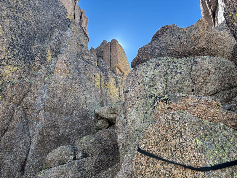
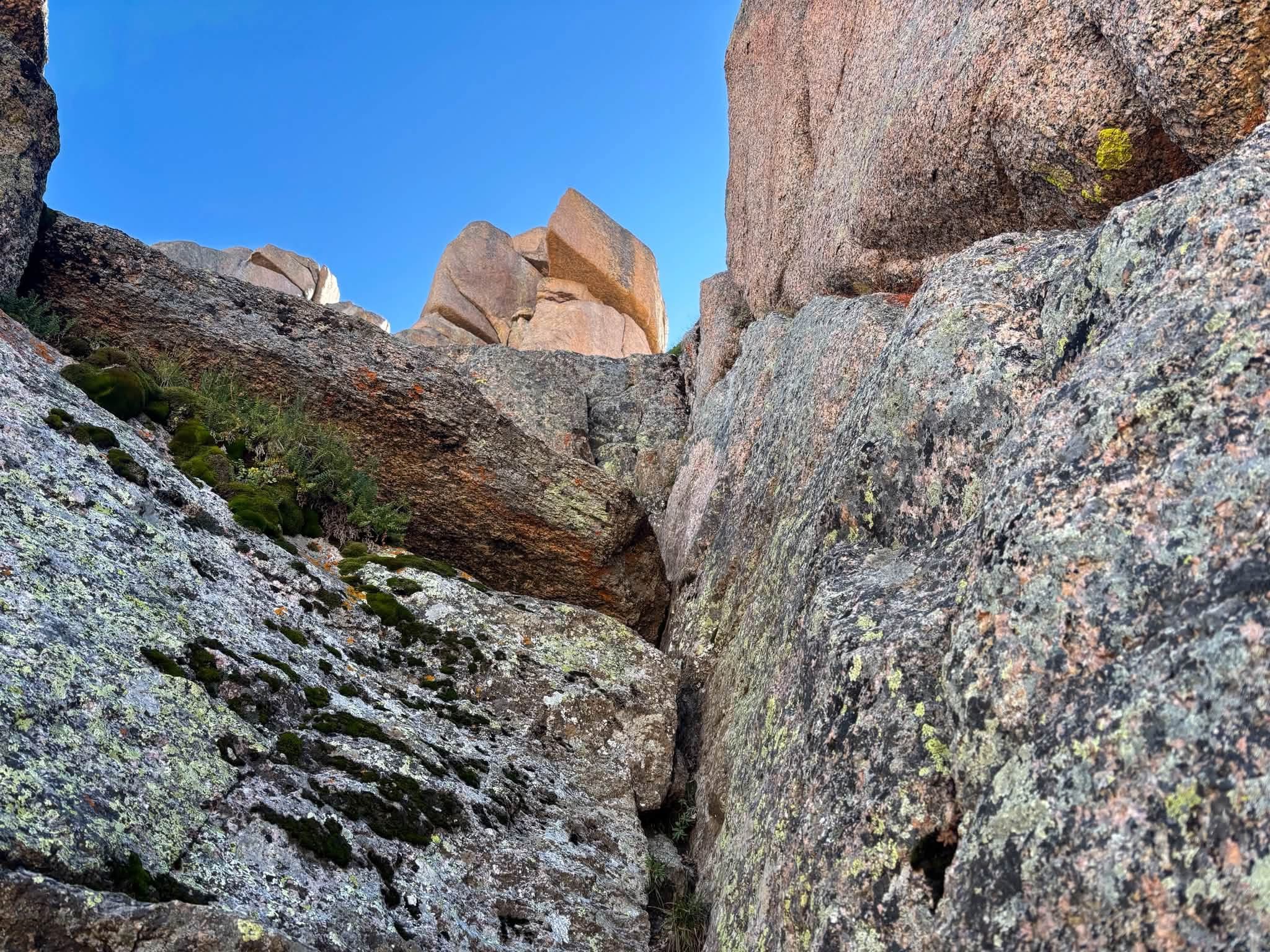
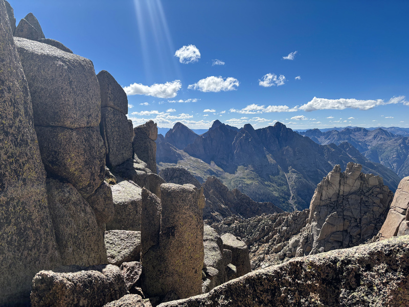
Through the notch! Amazing view of Pigeon and Turret but the exposure hits you here as well lol. 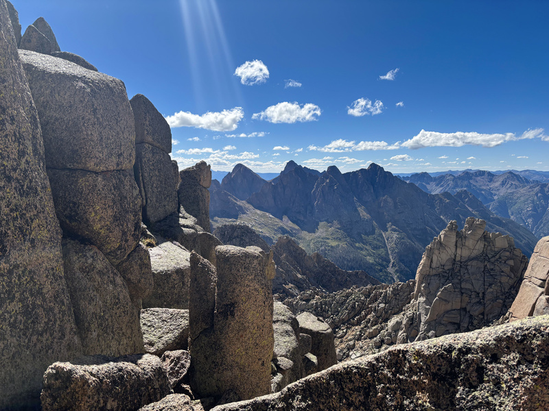
When you get to the traverse it is EXPOSED! Lol you'll be fine if you got this far, just don't be clumsy. 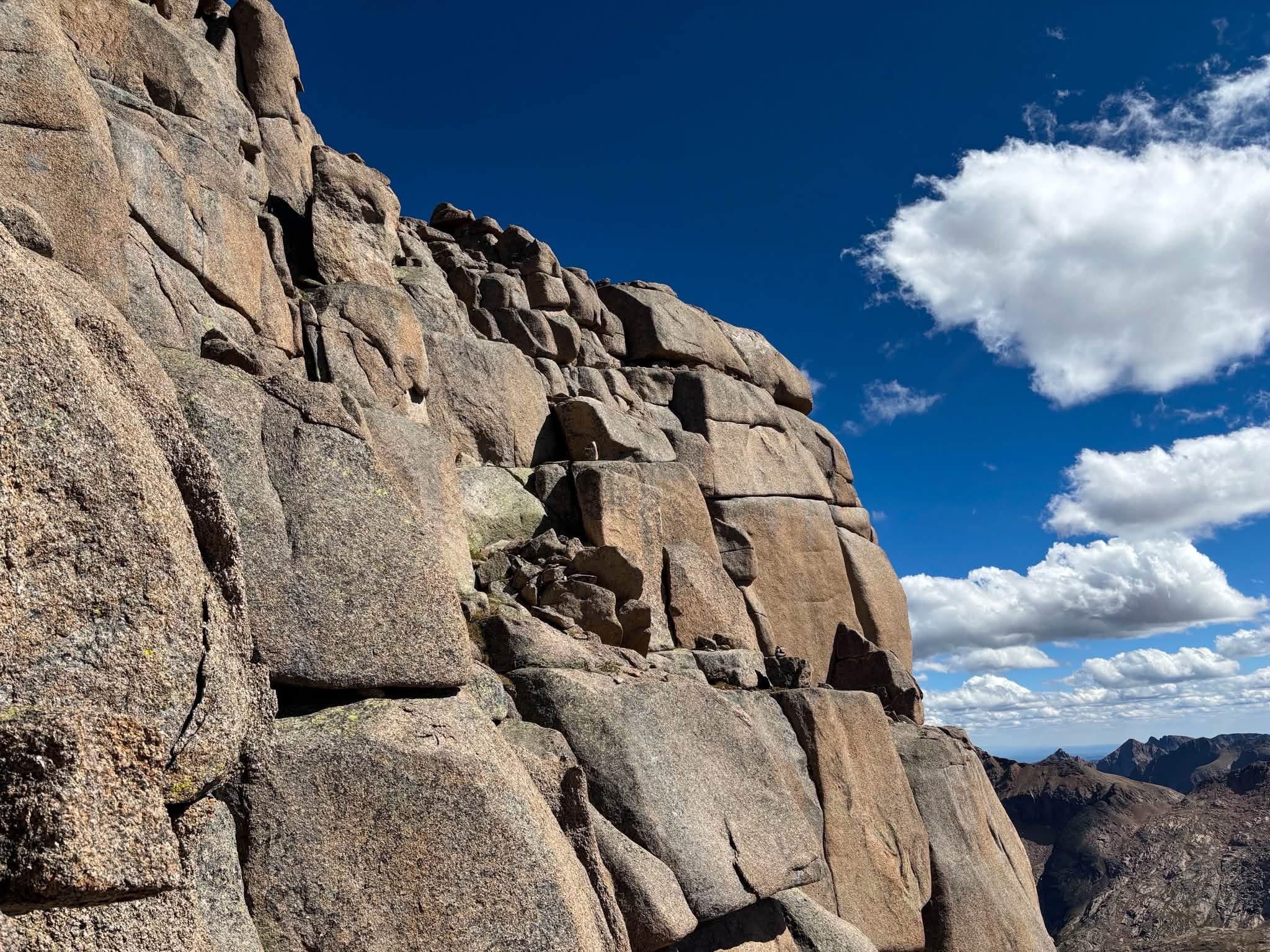 And we come to it at last, our final obstacle! This was indeed the most tricky of the chimneys and just like with chimney 3's obstacle, there was no way I was ascending this with my pack on. First order of business was to remove it, short rope it, and this time I put on my harness and tied it to a gear loop to ensure I didn't drop it on the way up (lol this is not the kind of chimney I had any interest in downclimbing). Basically had to brace my back to one side and my legs at 90° to the other and brace my way up like that until I got to a rock I could pull myself off on. But yeah, it's tricky! 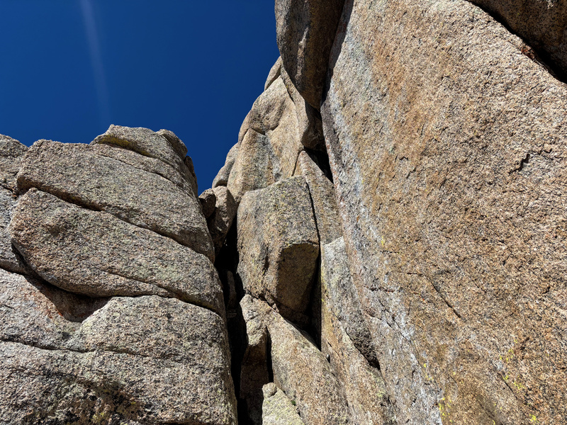
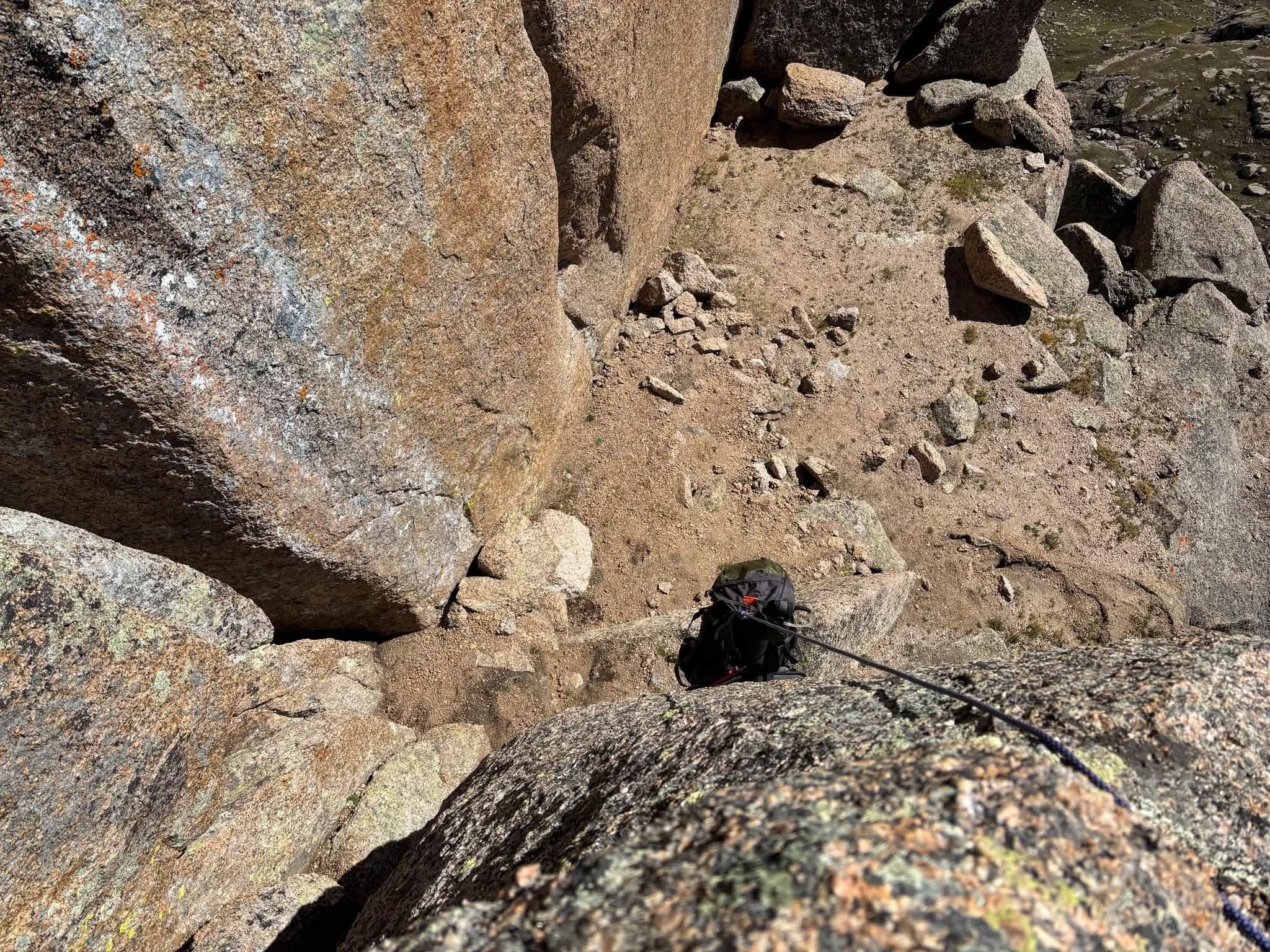
There's an anchor at the top of the chimney and I would say of all the anchors coming up, if I were going back down this way this is one that I for sure would use because again, that's not a chimney I would feel great about downclimbing lol. Most reports basically skip from the top of this chimney to the summit which effectively is true, but there's still a couple moves between the chimney that aren't routine and I'd still say you need to be alert for. 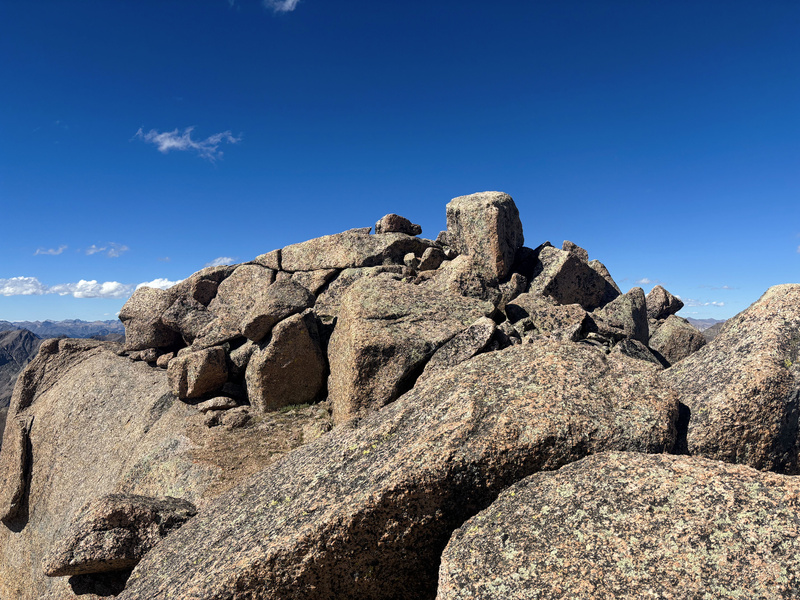
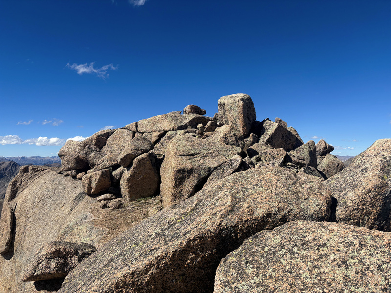
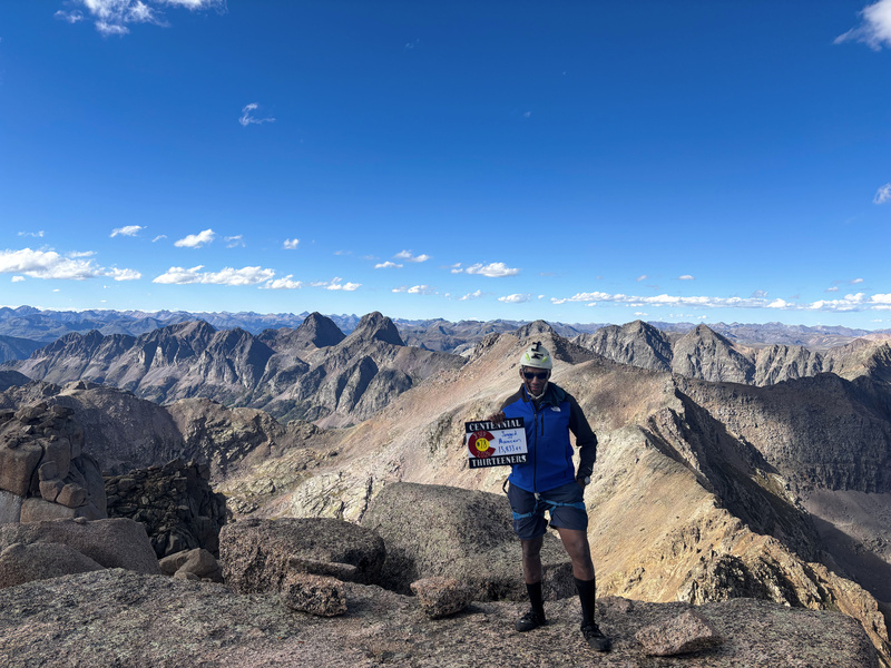
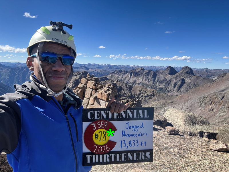
But yeah, after such a devastating failure last year I finally made it to the summit of Jagged! 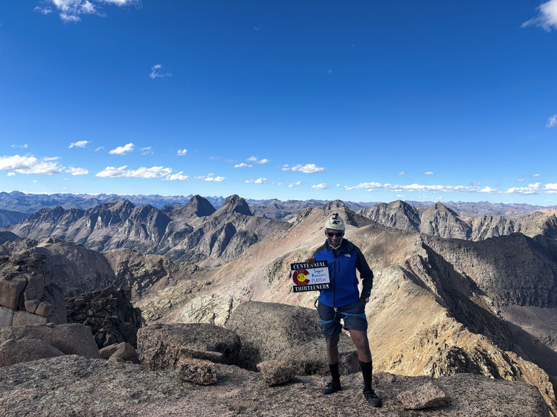
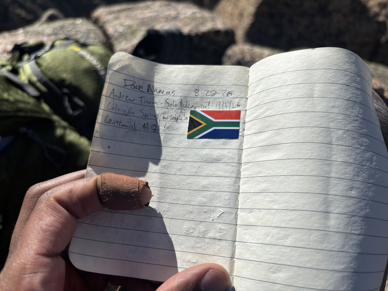
Sure I've been living in Colorado Springs for 17 years now, but I'm still of South African descent and figured I'd put a little sticker in the summit register to represent, though if I'd know the direction this adventure was about to take I probably shouldn't have lol. But know that at the time this picture was taken and not knowing the future, it was a moment of pride. 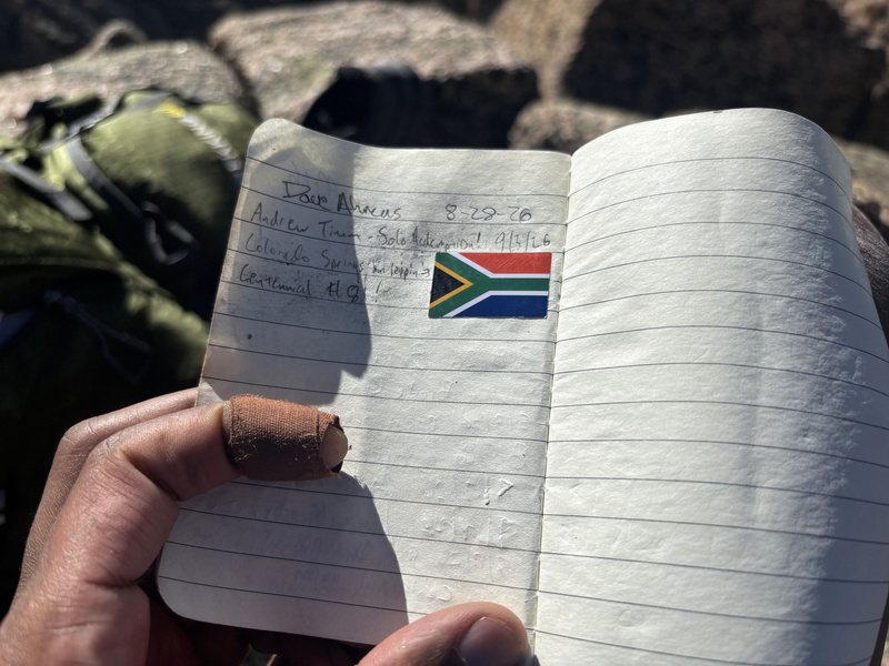
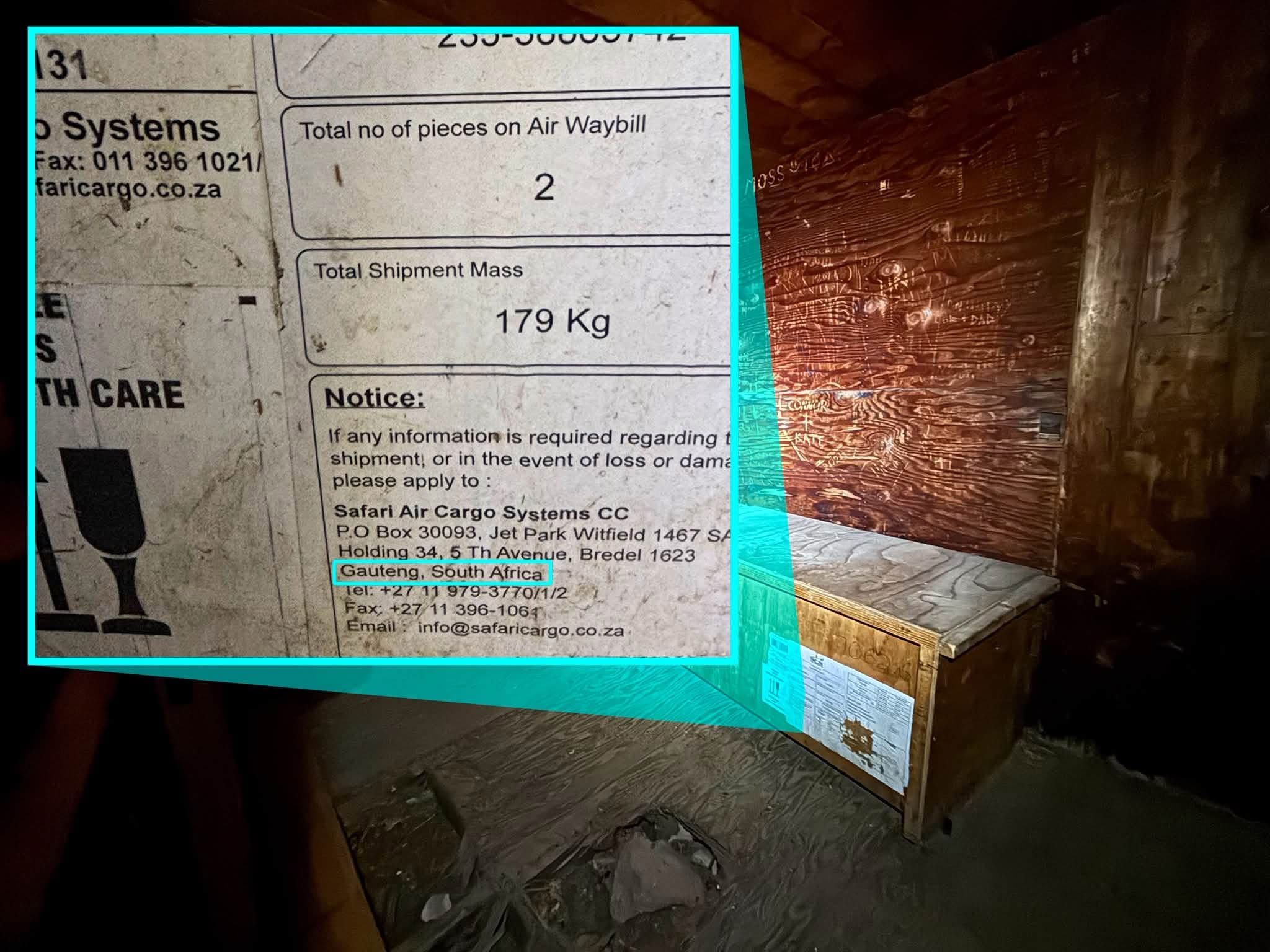
By the way, I'm just going to throw this in here--I am not the only product of South Africa to be passing through the Weminuche! Down in that old cabin by Needleton, there's an abandoned crate that was shipped there from a South African cargo facility, like that place is literally next to Johannesburg's airport! But what on earth was in this crate and how did it make its way to Needleton?! I didn't check for it this year, but it was there last year and the year before.
Anyway, I'm getting sidetracked lol. With that, so concludes the "normal" portion of this trip report documenting my journey to the summit of a mountain and I hope at least this portion of the report proves useful for any Jagged interest or attempts. As for getting down from said mountain, it's safe to state that that part was anything but normal... 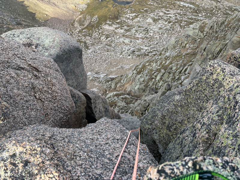
3. The Rescue
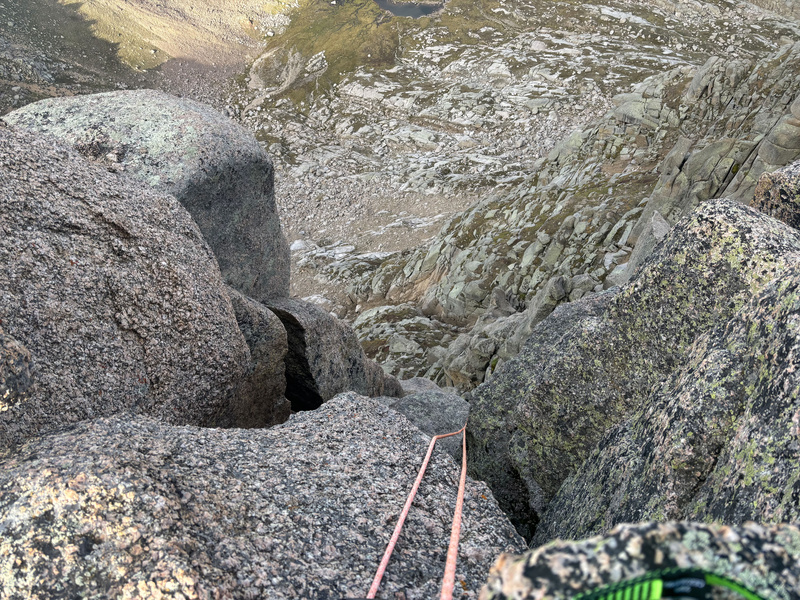
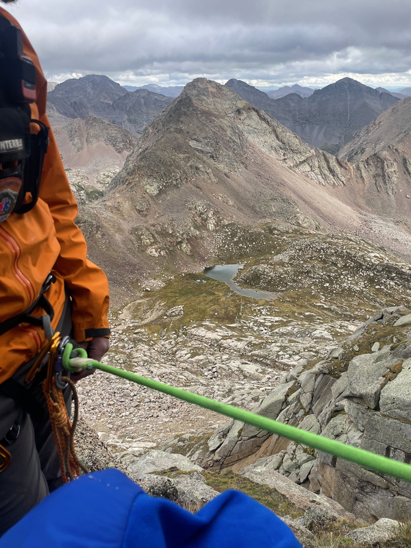
Day 3 Continued (uh oh, another color change...) For last year's attempt I brought a 70M rope having originally read reports that that's what was necessary to make the long rappel from the summit. Knowing that I was planning to single rappel, I tied a few sections of paracord together to use as a pull cord which was quite bulky (basically the size and shape of a honeydew melon). Since last year's attempt, I came across additional reports saying 60M was sufficient and seeing as I was trying to cut weight wherever I could I opted to bring a 60M this time. Additionally, I was looking for better pull cord options as that much paracord on top of being bulky twists easily. I came across some twine that was marked as having the same length at a fraction of the weight and volume of that ball of paracord, but was it strong enough? I practiced my retrieval system on several practice rappels I did at various low class 5 routes I found in the Springs vicinity and each time I was able to retrieve my rope without issue and the twine never broke, so I "thought" I had found a much more efficient pull cord alternative than the paracord. So I see the two bolted anchors on the summit and check each of them, both feeling rock solid. On my practice rappels, whenever I needed to set a natural anchor I always tried to have redundancy on the supports. This time though, at least in the moment I felt the anchor was in there so solidly that I only attached a maillon and setup to rappel off of one of them which at the time I didn't think was unsafe to do. But in reading the comments on my lost and found post, I now realize was probably the most dangerous thing I did as however secure that bolted anchor appeared, it still could have popped out and I would have had no backup for it. Even before locking in, I threw the rope over the edge and tested that pulling the carabiner looped back on the rope could slide freely when pulled with the pull cord/twine and that when pulling down on that side the main rope would go up. So in my mind everything was set. I begin the rappel and it at least seemed to go smoothly as I simultaneously was unrolling the twine, though definitely a few more rock fissures and bends than what I had been practicing on as usually I'm able to keep an eye on the entirety of my rope between myself and my anchor point. I saw what seemed to be a logical resting point below and I continued to rappel down to it (perhaps this was the mistake that snowballed everything that followed as prior to that bending point in the rope, I probably could have upclimbed back to the summit and reassessed this whole operation). I got down and saw a pretty beefy anchor made by a bunch of abandoned cams in a crack. Seeing as I didn't have any cams on me and only webbing, this is not a place where I would have been able to make an anchor or even thought to make an anchor had that not been there, but it made for a good resting spot to secure myself into after verifying that it was secure. Hard to gauge how far it was to that first anchor, but my guess would be about 60' because I could see the halfway mark on the rope still a ways down.
I could see how far I still had to go and that's when doubt first entered my mind about whether or not the 60M was going to be long enough, so I decided this would be a good spot to reset my rope and that's the first time I knew something was wrong. I go to pull the pull cord and neither it nor the rope are moving at which point I realized one or both of them were stuck which had never happened in the times I had practiced with it before, so this was a new problem to me. I pulled REALLY hard on that twine and it didn't break so that's at least a testament to its strength, but I got to thinking maybe being that small it perhaps was more susceptible to getting caught in cracks? Either way, I knew I had a serious problem on my hands. I did have foot ascenders and figured I would try to upclimb from there, but I don't know if it was a lack of upper body strength or technique or experience on that type of obstacle but once I got up to the first bend in the rope where the rock was kind of cantilevered over, I simply couldn't pull myself up any further. If one of the criticisms of me or my decisions is that I SHOULD have been able to pull myself up here, then that's one that I have to own and accept. Either way, my rope was stuck and now I have to weigh my options.
At that point I figured my best option was to keep descending, trusting that the 60M would be sufficient to get me to a safe base and the worst case scenario would just be having to abandon my rope. I rappelled past two more natural anchors, both appearing to be very solid and likely areas I would have seen fit to build my own if they weren't already there. In retrospect, with the relatively even spacing of these anchors/anchor locations I likely could have done without the pull cord altogether and just double rappelled all the way down. Don't know if that would have prevented my rope getting stuck as I still don't know if it was my rope or the pull cord that got stuck, but I have to think fewer moving parts would have minimized that risk. I got down to the lower of the two anchors and at that point I realized I was getting close to chimney 2 but also the end of my rope (I had put in a catastrophe knot about 18' from the end of the rope just so I'm well aware of it coming up as well as tying the tip of the rope into my belay loop). The whole time down I was looking around to see if there were any lateral exit options to something I could potentially downclimb, but nothing caught my attention. From that last anchor, I could see that my rope at least made it down to what appeared to be a flat ledge above chimney 2 and went over that edge, but I couldn't see how far it went. I continued to rappel down to the ledge because it had some standing space and would be far better resting spot than just being tied into that last anchor, but when I got there and looked over I could see chimney 2 below and my rope about 4-5M short of the bottom. I was stuck.
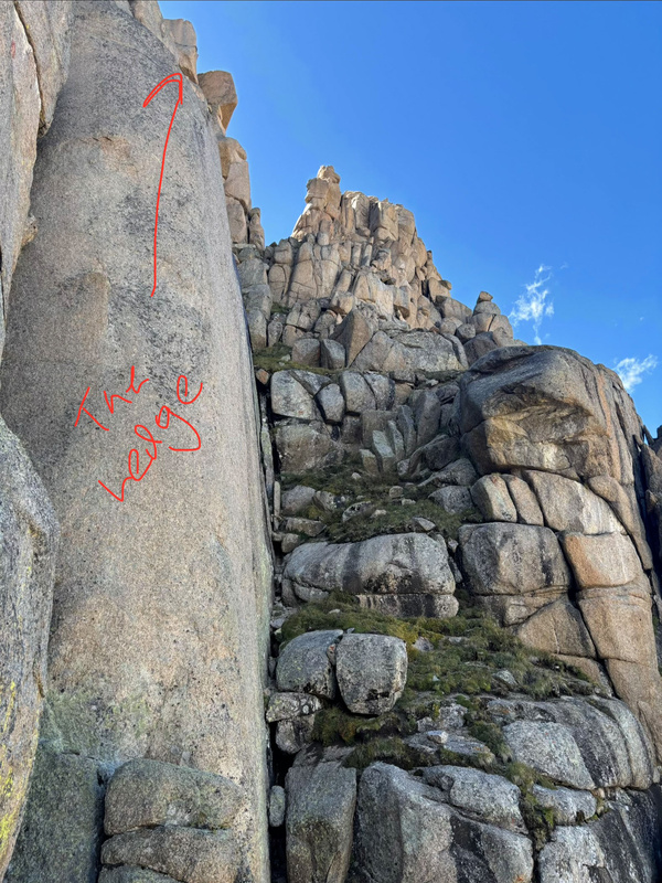
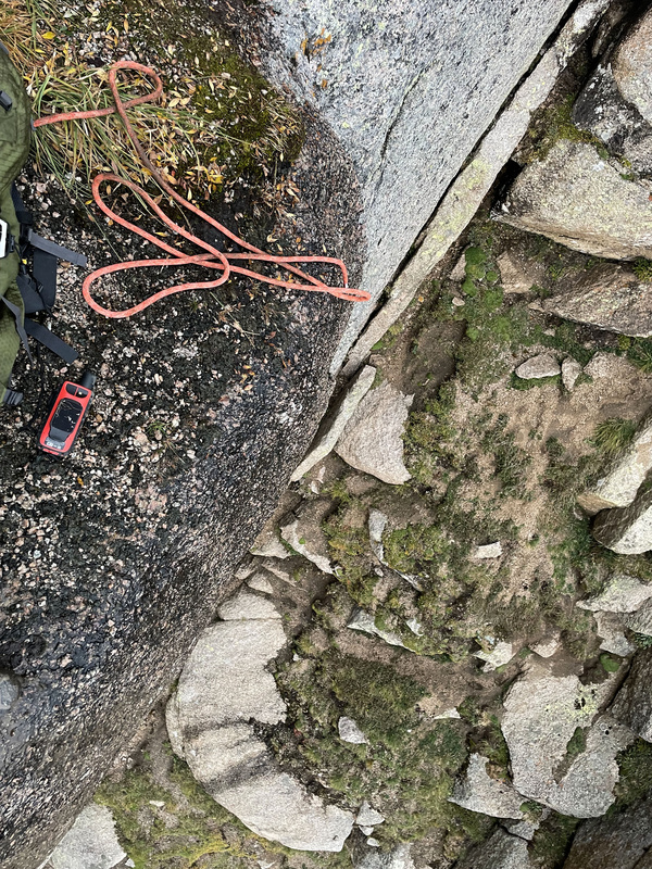
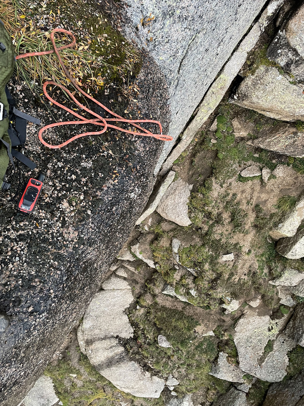
Immediately my heart sunk because I wasn't really seeing a way out of this situation. I freed myself from my rappel device and anchored myself into a new catastrophe knot on the rope, which would serve as my security net the entire time I was up there as it allowed me enough freedom to move about the ledge but would catch me if I leaned over. I started going through other stuff I had to see if there was anything I could use to elongate the rope, but nothing seemed viable. I was even considering lowering my pack down with the 30' of webbing I had and trying to gamble with how much I'd get hurt falling from the end of the rope at that distance, but it was a pretty significant gap and I'd say even though it was close enough to be survivable the likelihood of avoiding significant injury doing that would probably only be like 20-30%. I knew if I activated the SOS there'd be a media release about me and I'd take a massive hit to my reputation and I've maintained a pretty clean track record with all my adventures thus far and wanted desperately not to blemish it, but all those things are secondary to staying alive. After about an hour of trying what I could and the reality finally setting in that I had no other options, I activated the SOS at 7:16pm on 9/3.
.jpg)
One fortunate thing about being still above 13,600' was that I still had solid reception and wasn't only limited to satellite communication through the Inreach. Having never used this before, I had no idea what to expect. Within minutes Garmin called me and my mom who's in California as well because apparently whenever you active an SOS they notify your emergency contact immediately. The Garmin representative was basically just saying they're reaching out to the appropriate local agencies who will be in touch with me once they have a plan in place. They asked me what supplies I had and I had enough snacks to last me a while, but I was worried about my water level as I was down to 0.25L. In terms of layers I didn't bring anything additional outside of thicker gloves that I definitely needed because the forecast wasn't showing any kind of weather or temperature swings overnight, but only being in shorts it would definitely get cold enough to start seriously bothering me.
Silverton Medical Rescue first reached out around 8:17pm, so about an hour after first activating the SOS through Garmin. They let me know initially that I'm likely looking at 4-5 hours before someone can get out to me which given where I was, I wasn't expecting this to be a fast process and was fine with that estimate. They said I would see a helicopter coming through, but it was only doing recon on the area and seeing if it could locate me but wouldn't be extracting me or anything. It was thoroughly dark at this point and I think it was around 9:30pm that I first heard then saw the helicopter circling the area. I flashed both my headlamp and my phone light repeatedly hoping they could see me (though trying not to directly in their direction because SMR said not to) and after circling the area 3-4 times, they flew away.
I called SMR shortly afterwards to confirm that the helicopter had seen me and fortunately it did, but they said unfortunately due to it now being dark and the complexity of the terrain back there I'd now likely be looking at a morning rescue :(. I mean, logistically and from a risk assessment/triage standpoint I understand the decision knowing that I wasn't injured (yet), had food and "some" water, no weather was coming in, and that it wasn't going to drop to freezing temperatures, but as the person who now has to brace to spend the night out here on this ledge this was the worst thing I could hear. Yes it wasn't or wouldn't be "freezing," but hours on end in thin shorts and only my moderately warm gloves in 37° certainly began to FEEL like it was freezing. I did everything I could to stay warm, constantly shanking my legs and hands every few seconds throughout the night which was barely cutting it. Beyond being cold, I now had the additional problem of getting tired because I was constantly burning energy to stay warm and I had to keep standing the whole time because there was enough of a trickle of water on the rock face behind me to make the whole ledge surface wet and I wasn't trying to be both cold AND wet. Fatigue in itself wasn't the problem, but as the hours went by I started catching myself falling asleep standing up either by being woken up by the rock face behind after leaning back or by being woken up after the rope caught me leaning forward toward the ledge which terrified me. Fortunately the majority of the time I caught myself nodding off while standing, I fell backwards but those few forward falls were enough to feel like I was trapped in a horror movie and were really beginning to mess with my mind.
One thing SMR had asked about earlier was the battery on my phone which at the time of that conversation (9-10pm ish) was at 54%. They had wanted to maintain the ability to have voice communication with me when needed, so they asked me to do everything I could to conserve the battery. My battery pack that I rescued earlier (lol those skipping ahead to this section without reading part 1, swing back up there for the full story) proved to be a lifesaver here! I have an iPhone 12 and its battery drains very quickly, but between turning off every other app and keeping it connected to the pack which was on its last bit of charge, I was able to get up to 84% before it died which was able to last through the night.
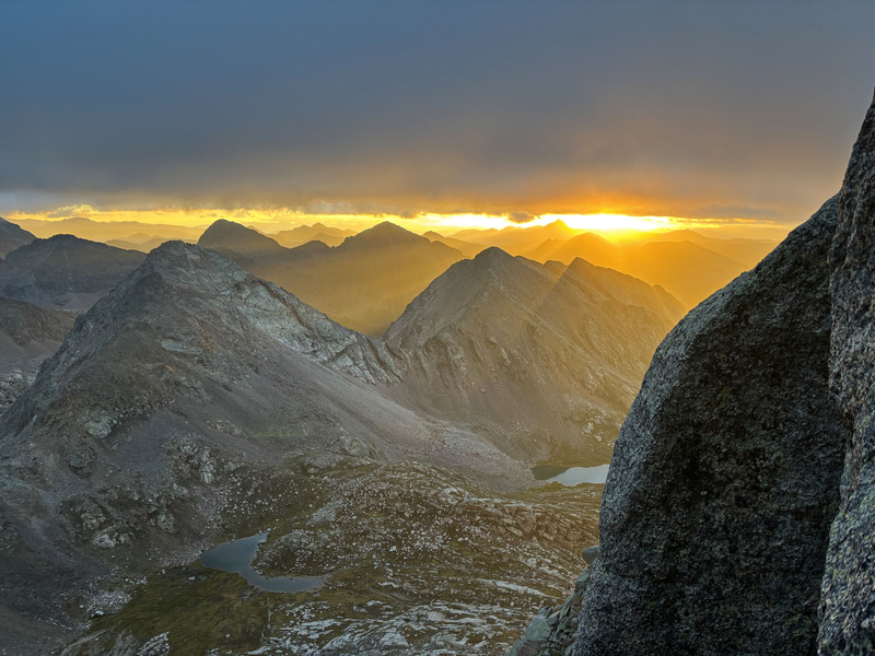
Day 4 Water ended up being a concern as well as I only had 0.25L when I first got to the ledge. I pretty much committed to taking a few sips on the hour, but I could feel myself getting more and more thirsty and dehydrated as the night carried on. Garmin had asked me if I wanted them to check on me every hour and I said yes hoping as I relayed my declining status that something I said would raise an alarm and move up the ETA, but unfortunately nothing moved the needle and I didn't want to lie or exaggerate either. It very much became a mental exercise to just do everything I could not to lose my state of mind. My fingers had started to get stiff as well from the cold and as a result, I didn't touch any of my food the entire time I was up there because I only wanted to have to expose my fingers when I had to use the phone or the Inreach. Garmin continued to check on me, though it kind of started to feel like I was interacting with a bot that wasn't going to sound any alarms unless I used some kind of trigger word. I was starting to get nauseous as well along with some pretty severe stomach cramping which I initially thought was me starting to get altitude sickness, but I think it was likely due to being unable to use the bathroom (the inconvenient version, another reason I didn't want to eat) while I was up there due to there being no place to properly dispose or store it and the cramping and nausea were the result of being... backed up (lol TMI, sorry). My last message from SMR was around 12:30am (hourly communication through the night was with Garmin who would relay any significant updates both ways) saying that they were sending a team out at 5am with the hope that flights could get moving at sunrise (6:30-7am), so in my mind I was counting down to 5am or worse case to sunrise to basically look to the east and see my version of Gandalf on horizon (except it'd be dawn of the fourth day instead of the fifth if we're being technical lol). Dawn came and what a glorious dawn it was, but alas no Gandalf :( 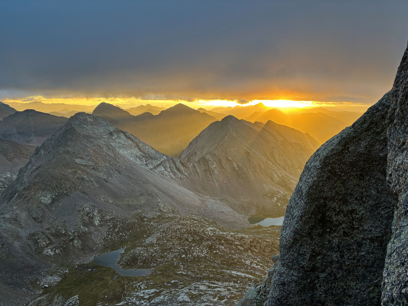
While I was disappointed my salvation didn't arrive at dawn, I did get confirmation from both SMR and Garmin that the team had been dispatched and were en route so I should only have to wait a little bit longer. Finally around 8am I heard a helicopter approaching and shortly afterwards saw it come into view: It circled the area a few times so I wasn't sure if the crew manning it knew where I was (or if there potentially was another rescue going on), but I eventually saw it landing in the basin probably about 10 minutes later. If I remember correctly, I believe it dropped off two people, left, and came back like 40 minutes later with two more. So after 14+ hours of being on the ledge and about 13 hours from the time of SOS activation to boots on ground, enduring the relatively freezing night given what I had on, dealing with dizziness and repeatedly falling asleep standing up because I never sat down once, rationing 0.25L of water through the night, and enduring stomach cramping and nausea from not being able to use the bathroom, and remaining completely uninjured, my means of rescue had finally made it and were making their way up to me! It was just a matter of waiting for them to get to me, like I'd been up there 14 hours so what's another 45 minutes? Lol so insert random hiker. I was standing on the ledge waving and calling down to the helicopter to try to better announce where I was and all of a sudden I see someone coming up chimney 2 below me! At first I was like did they already have a team on the ground from somewhere else that made it up to me that quickly?! But when he called out to me it was clear that he was just up there randomly, which is crazy seeing that I'd been out there three days without seeing a soul but here someone shows up out the blue on day 4. He asked about the situation and I told him how I got there and how long I'd been up there and was mainly just waiting for SAR, but then he tells me he has an extra rope that should be able to get me down. Part of me really didn't want to try anything because the plan already in motion was for me to wait there and being up there for 14 hours both dehydrated and hungry, I really didn't feel like I had any energy to get back on the rope on a whim. Still, being thrown a rope felt like a lifeline and seeing that it was long enough to reach the bottom after attaching it to my rope kind of gave me a boost of energy to actually think this was worth a try. After throwing the spare rope up to me, the hiker continued up the chimney and I began preparing myself to get off the ledge and get on rappel. By the time I finally had all my stuff packed up, was on rappel, and was ready to commit to it, all of a sudden I felt some slack in my rope?! I look up and I hear the hiker calling down to me from the summit saying that he's removed the rope, assuming that I had rappelled of the ledge by now lol. So yeah, that's a testament to my level of energy in that moment and the speed of that hiker--in the time it took me to get back in climbing mode and get on rappel on the ledge, the hiker had already gone up chimney 2, 3, the traverse, the summit chimney, and summitted! But yeah, I yelled back up to him that I hadn't finished the rappel yet and to please put my rope back, so those of you that summited in the days that followed and took pictures of my rope in a position secured to both anchors, that's how that hiker put it back after removing it. Lol so now I'm a little nervous as my rope has been disturbed--error of using a single anchor aside, I knew how I tied my rope in was secure and was hoping that was still the case. Fortunately it was actually MORE secure now that it was through both anchors, though it would definitely no longer be retrievable with a pull cord (which really didn't matter anymore). Once I felt my rope was secure, I finally stepped to the edge of the ledge to commit to the rappel and soon as I leaned back into it I felt myself free falling not knowing what was going on. It was likely only a couple seconds, but it felt like an eternity. Eventually the hiker's rope does catch me and I'm in a position to continue to rappel to the bottom, but not before getting all kids of banged and bruised with my left ankle getting the worst of it. I had heard a pop but didn't think it was anything that severe, kind of just figured it was a sprain and finished the rappel the remaining short distance down to the base, relieved to finally be off the ledge. When I took myself off rappel and stood up in chimney 2, my ankle was definitely in pain but I was ambulatory and figured it was something I'd just have to nurse on the way down. As for what happened with the second rope, perhaps in the excitement of seemingly being thrown a lifeline I didn't do my due diligence on properly inspecting the tension in that rope as that rope stretched considerably before finally catching me. Like I knew my rope had minimal stretch in it, but this rope might a well have been a rubber band in its past life despite outwardly appearing normal. Definitely a lesson learned! Lol the spiderhiker eventually glided his way back down to me because it's mindboggling how quickly he made it up to the summit and back using the standard route both ways! Absolutely fearlessness this guy had, lol earlier he had even suggested the possibility of Tarzan swinging off of the ledge which to me was complete lunacy (especially due to the precise landing angle you'd have to hit on chimney 2 to not risk a steep tumble backwards) though probably a no brainer for someone like him who I'm sure had much more experience with that kind of thing. But yeah, once he got back to me he gave me a lot of cookies and water which was desperately needed. He saw I had injured my ankle and he helped me down to just below chimney 1 where we finally made contact with the first SAR team from SMR. There were two teams of two that had been brought down, with the first team down with the helicopter pilot still and the other team making their way up to me. When we made contact, we exchange details and the spiderhiker went about his day disappearing into the landscape as quickly and as randomly as he originally appeared lol. Even the SMR guys were astonished by how quickly he moved. But yeah, the sun was up at that point and it was progressively getting warmer but I was still involuntarily shivering from being cold so long and they had brought several layers to get me warmed back up initially. They put a pretty tight wrap on my ankle as well which at the time still looked normal, so I was still under the impression that it wasn't anything severe. We were still at the upper portion of the slabs, so quite a bit of non trivial terrain to descend still for which team 1 had brought plenty of gear up to do a series of rappels on the way down. 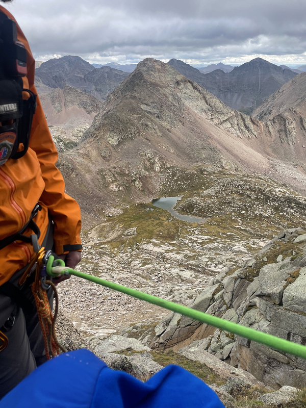
Some stretches they let me rappel on my own, some they assisted me down based on how I described my ankle pain level. Either way, this team was highly professional and highly skilled and I felt like I was very secure in their hands all the way down. Even though I didn't get any more pictures, you can see more that they took in their media release highlighting this particular incident: https://www.facebook.com/share/p/1Hm5UmPRuW/?mibextid=wwXIfr Lol I know I shouldn't be laughing, but I was amused by the attempt to hide my identity with the ambulance emoji! 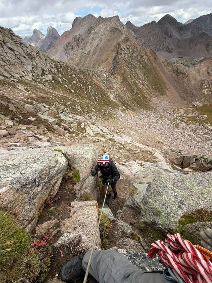
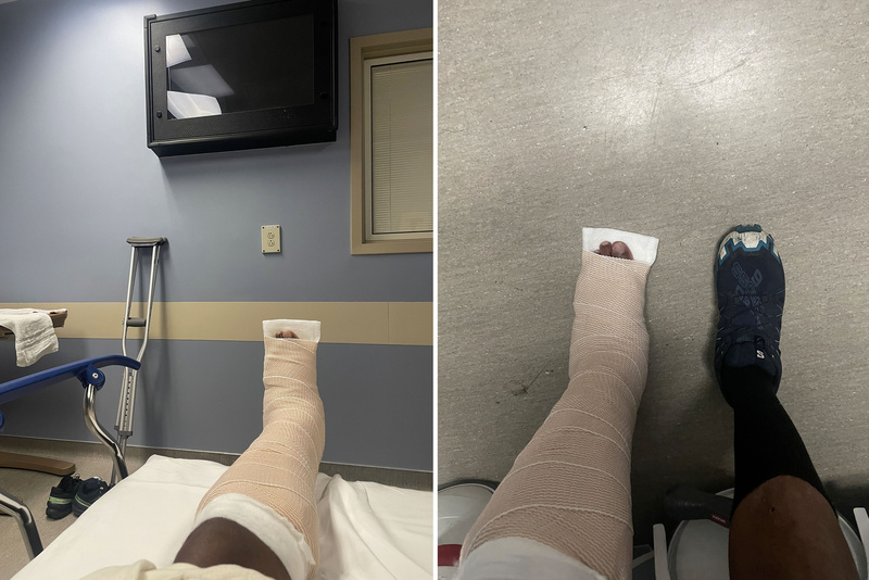
One thing to address from their media release that I saw someone asking about in my lost and found post. They mentioned rope pick-offs in their write up and there weren't any, unless they're referencing the segment in which they set me up to tandem rappel with one of the members of the team a pick-off (which I don't think it is). Based on the media release, I think it as written based on the planned mission rather than the executed one because if the other hiker hadn't gotten involved and I was still on the ledge, it is likely SMR Team 1 would have had to fully ascend to the summit, lower down to me, and do a pick-off from there. So I think they were planning and prepared to do a rope pick-off and whoever was aware of the mission when they left back at the office wrote the media release as such, but they ultimately didn't have to because I was off the ledge by the time they got to me. We continue to rappel down the slabs to a point where they level out enough to no longer need to be tied in. They had taken my pack to make it as easy as possible on me trying to navigate that terrain which was mostly easy scrambling, but admittedly far more difficult than it should have been due to my ankle and occasionally they took turns helping me where I appeared unstable. SMR Team 2 had made it up to us by that point who looked at my ankle again, checked for pain and range of motion, and rewrapped it. From that point on, the five of us gingerly (lol as in they were moving at my gingerly pace) made it down the rest of the way to the helicopter. I originally thought that this was the first helicopter I'd gotten to ride in my life, but upon further reflection I remembered that when I deployed to Iraq back in 2010 they flew us from Kuwait to Iraq in a chinook so technically not the first time lol. That was way different though, this for sure was my first time in a "normal" helicopter and it was awesome to experience even though it was unfortunate to have to be under these circumstances. Lol I couldn't help but be amused by how peaceful the No Name approach looked as we were flying out knowing full well how much suffering it's caused me for two years now. Seeing the Chicago Basin peaks or Pigeon and Turret or Vestal, Arrow, and the Trinities off in the distance from that vantage point gave an entirely new sense of scale to these peaks and made them that much more awe inspiring! The flight wasn't that long as we were only going to Silverton. At that point the offered to take me on a second helicopter flight to the hospital, but seeing as I would still walk (in a lot of pain, but could still walk) I figured it was something I just had to nurse and worse case follow up with a local hospital when I got back to the Springs. A couple of the members of Team 1 where headed back to Durango, so they offered me a ride back after giving me some much appreciated pizza! They had mentioned the possibility of another crew potentially getting the gear from my campsite on the No Name Basin side, but unfortunately they weren't going to be able to mobilize for that which prompted my lost and found post. They dropped me off where I was parked at the train station, I gave them my eternal thanks, and we went our separate ways where now I was left trying to pick up the pieces of this week of 13ering I had planned that just got blown up lol. I started running wrap-up errands and realized after all that, I REALLY would like to sleep in a bed and think I will break my own practices and spend ACTUAL MONEY on a room?! Lol I think the universe said not so fast because when I tried to book something on Expedia, VRBO, Airbnb, even ChatGPT, EVERYTHING in Durango was sold out?! Don't know if there's some kind of event going on in Durango over Labor Day weekend that would cause that, but not a single vacancy in sight! Lol serves me right though for having the audacity to even entertain paying money on a room on a wilderness trip, backseat yet again in the Walmart parking lot it would be :). Problem was in the midst of recivilizationizing myself with things like getting gas or eating at Denny's with my seasoned fries swimming in ranch dressing and five glasses of Pepsi, my ankle pain was actually getting worse as the hours went on to the point that I figured it'd best to call the VA and get their opinion. When I described what had happened and the level of pain, they told me to go to the ER which I felt much more comfortable doing under the VA's direction. I drove to Mercy Hospital's ER which was a literal ghost town, emptiest ER I'd ever been to but at least I was seen immediately. They took x-rays and sure enough they confirmed that my ankle's broken. Lol before the reality of my season being over even settled in, I remember my internal kneejerk reaction being "damn this means I can't do the incline for a while, life's about to suck" knowing that's my default hike I do every week before any mountain enters into the equation outside of Pikes. But yeah, they proceed to splint my ankle, give me crutches, and let me know to follow up with an orthopedic surgeon within a week. 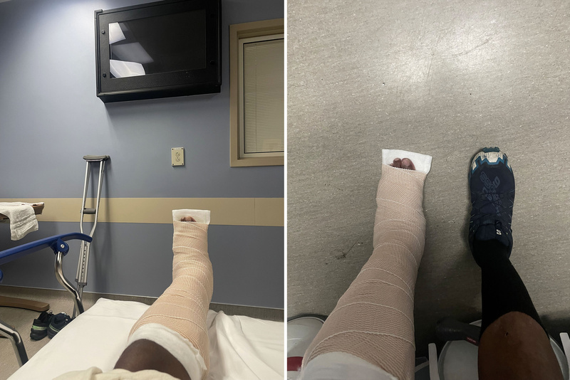
So yeah, unable to get a room I sleep in my backseat in the Walmart parking lot one more time though this time with this bulky splint, so that was interesting. The next day I head back to the Springs very fortunate that the injury was to my left ankle and I could still drive myself around and once I get home, I quite happily plant myself in my bed and I was out lol. The Recap So what are my biggest takeaways from this experience? There are several lessons here and things I could have done differently, but these two really stood out for me:
A few honorable mentions as well:
And one key lesson I did not learn on this outing, but learned on a previous one that ended up proving to be a lifesaver here was to: CARRY AN INREACH OR SOMETHING SIMILAR!!! For years I kept telling myself it was too expensive and I didn't want to drop $400-500 on a device when I was reasonably confident in my fitness and navigational ability and always felt it was "unlikely" I'd get lost or need assistance. I did all of the CO 14ers and three of the traverses by myself (would have been Bells too, but I was rained off of my original attempt and I did finally have an Inreach when I went back for it) and never "felt" like I needed one... until I started working on the CA 14ers. I don't know why it took nearly a decade, but there was something about being alone in the wilderness in another state on my way up Mt. Russell that hit me over the head like a ton of bricks and made me realize that if something happened to me out there, I'd be in a world of hurt. I did Mt. Russell in September of 2021, got an Inreach (a refurbished 66i actually) as a Black Friday deal a couple months later, and have carried it on all of my Centennial and CA 14er efforts since. It's been nearly five years of never having to use its emergency functionality, but it's one of those things that's better to have and not need as opposed to needing and not having. For this trip, I needed it AND I had it and I'm thankful I was finally able to learn the lesson in time that however expensive I "thought' it was, if I'm going to continue participating in this hobby I can't afford NOT to have it! With this being my first rescue experience, it definitely gave me a whole different perspective on what all was involved from all the different parties to all the pieces that need to be in place to initiate a mobilization. Yeah 13+ hours from request to boots on ground definitely seemed like an extreme amount of time to be waiting and by the end of it the even the ankle pain paled in comparison to the torture being up there so long had become, but I believe that they did the best they could as far as the logistic side of things went and ultimately sent their A+ team out to me as quickly as they could. I suspect if weather or freezing temperatures were moving in or if I was already injured, they would have tried to push for a night rescue. But given that this was class 5 terrain deep in the wilderness and was going to be a complex mission no matter what, I understand the decision to wait till morning. Though the one thing that's going to eat at me is how I injured my ankle. Like I literally endured all that for over 14 hours in total on the ledge (counting the time before I initiated the SOS) and remained uninjured with the rescue crew on ground and en route, and I suffer an injury due to factors entirely external to the operation already in motion :(. I am very appreciative of the Good Samaritan efforts and good intentions as the food and water afterwards were most welcomed, but I think a general rule of thumb should be if you come across a rescue operation already in motion to not intervene unless requested or you notice something dire and in immediate need of attention. And please if you share equipment that someone's safety could depend on, make sure it's good equipment! Like if SMR hadn't landed or dispatched yet and I broke my ankle the same way, that'd be way easier to accept because I could rationalize it as desperation and feeling like I had to try something as I had no idea when or if they were coming. But they were literally there, and I was like an hour of doing nothing away from emerging from this situation unscathed. Lol perhaps it was fate intervening saying I didn't deserve to get out of this unscathed and giving me a reminder that will stick with me to better hammer home all the other lessons from this ordeal, because I have been known to be stubborn and learn my lessons the hard way. So I guess we finally get to the elephant in the room: DOES IT COUNT? Lol overwhelmingly the people I was initially speaking to including SMR were saying I topped out, I absolutely should count it. But I feel something about not making it out on my own effort is going to eat at me in the long run, not to mention getting a surprising amount of pushback from a friend who got me thinking if this person feels that strongly there's probably a sizeable chunk of the community that feels equally as or even more strongly that I need to go back and probably just hasn't said anything yet so as to not beat me when I'm down. Lol this was likely the position I was going to settle on anyway once I got over being butthurt about this year's ordeal stacked on top of last year's weather ordeal. On some level it's probably a blessing in disguise that it played out this way. Say hypothetically I don't run into weather last year, I more than likely summit. Say I try the same thing I did this year and my rope gets stuck in the same spot (it may not have seeing as I had paracord instead, but lets say it did). I make the same decision to continue to rappel down the rope, only I don't get stuck on the ledge because I actually had a 70M last year. The only thing I lose is my rope. But having successfully summited, I don't think I learn the lesson I need to learn about needing to be a much better upclimber than I am as emphatically as I did this year. I likely get false confidence, go try something more challenging, and potentially find myself in a worse situation than I ended up in here. So as hard a experience was to go through, I think the lesson came through more loudly and emphatically than it would have otherwise and hopefully leads to more successful outings going forward. But yeah, getting sidetracked again lol. I think I'll treat this similarly to how I treated Bierstadt and Blue Sky which originally were my 8th and 9th 14ers. After doing the Sawtooth, I ended up joining up with people to hike back down CO-5 instead of hiking back through the willows which was my original plan. We all hiked quite a ways, and I'd ultimately logged ~16 miles starting from the Bierstadt side until we were finally picked up by one of the hikers' moms who drove us back to Guanella Pass. Given how big of an effort that was, I always felt secure in counting them. But being a 3K purist when it came to the 14ers, I remapped out what we had done that day and realized we never came anywhere close to descending 3K from where we were picked up so immediately that put an asterisk next to Bierstadt and Blue Sky that I only went on to correct between #57 and #58 to ensure my finisher claim was fully intact. They remained #8 and #9 on my list even though I had to unasterisk them later. I will leave Jagged in place as my 81st Centennial (28th Centennial 13er) seeing as I summited, got pictures and videos from the summit, and signed the summit register. But I will keep an asterisk next to it and sometime before I go for #100, I will make sure to clear any asterisks so I don't have anyone out there thinking my Centennial finish is "less than." Jagged, we will meet again! 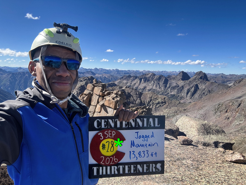
So I guess that's a wrap! Lol 7 years without writing a trip report and I come back with one that's like 13,700' words, I almost matched Jagged's elevation! Before I go though, there are some people I have to thank:
Update Lol seeing as it's taken me two weeks to write this, I've had time to follow up with the orthopedic surgeon. Fortunately it's just my lower fibula that's broken which apparently is the best-case scenario, as the tibia and other bones and ligaments weren't damaged (likely why I was still able to be ambulatory and bear weight on it for so long after it broke).
I won't need surgery, but they upgraded me to a boot which I will need to be in for the next few weeks so it's going to be life on easy street for a bit. I've even started capitalizing on the newfound perks of my situation :). (Lol I'm only including the GPX for visualization purposes, I'm not sure how beneficial this particular track will be to people) Thumbnails for uploaded photos (click to open slideshow): 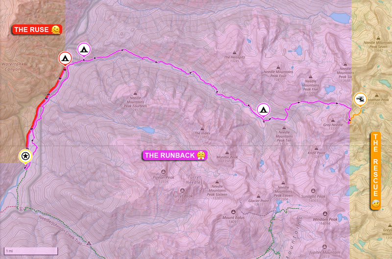
|
| Comments or Questions | ||||||||||||||||||||||||
|---|---|---|---|---|---|---|---|---|---|---|---|---|---|---|---|---|---|---|---|---|---|---|---|---|
|
Caution: The information contained in this report may not be accurate and should not be the only resource used in preparation for your climb. Failure to have the necessary experience, physical conditioning, supplies or equipment can result in injury or death. 14ers.com and the author(s) of this report provide no warranties, either express or implied, that the information provided is accurate or reliable. By using the information provided, you agree to indemnify and hold harmless 14ers.com and the report author(s) with respect to any claims and demands against them, including any attorney fees and expenses. Please read the 14ers.com Safety and Disclaimer pages for more information.
Please respect private property: 14ers.com supports the rights of private landowners to determine how and by whom their land will be used. In Colorado, it is your responsibility to determine if land is private and to obtain the appropriate permission before entering the property.



.jpg)
 Download GPX file used in this map