| Report Type | Full |
| Peak(s) |
Pigeon Peak - 13,977 feet Turret Peak - 13,837 feet Mt. Eolus - 14,087 feet Jupiter Mountain - 13,838 feet Windom Peak - 14,089 feet Sunlight Peak - 14,061 feet Jagged Mountain - 13,833 feet Trinity Peak - 13,816 feet Vestal Peak - 13,867 feet Arrow Peak - 13,817 feet Rio Grande Pyramid - 13,825 feet |
| Date Posted | 08/20/2026 |
| Modified | 08/21/2026 |
| Date Climbed | 08/01/2026 |
| Author | SpeedWalker |
| Wemi Cents in 45 Hours (+Midnight Jagged) |
|---|
|
Weminuche Wipeout FKT Alex "SpeedWalker" Walker Background After completing the Centennial Elks Traverse FKT in July 2026, all my attention was on another unrepeated Andrew Hamilton linkup: the Weminuche Wipeout. When first completed during his 2021 Centennial record, this route connected the 9 ranked Centennial peaks in the Weminuche Wilderness, from Rio Grande Pyramid all the way to Chicago Basin and out to Purgatory. In the years since, LiDAR has uncovered two new Centennial peaks in the Weminuche: Arrow Peak and Trinity Peak. Andrew actually climbed Trinity Peak during his attempt as a backup, leaving Arrow Peak the only addition required to maintain the original vision of the route. The monsoon came in very suddenly after my last FKT, which offered a nice reprieve from the smoke, but wasn't favorable for a multiday linkup. However, a surprise weather window appeared at the beginning of August, with the forecast showing a rare 0% chance of rain for every hour of the day. I immediately started contacting everyone I knew to act as a resupply/overnight support crew at the halfway point of the route. It was a tough ask: a long drive to 32 miles of remote backpacking with less than a week of notice. Though many people were more than willing to help, no one could make it work right away during this perfect weekend weather window. Fortunately, my parents were at least willing to drive 7 hours to the San Juan with me, drop me off, and pick me up at the finish 4 hours away. I reluctantly left behind my overnight gear and shoved my heavy second day of food into my tiny running vest. I decided eastbound was by far the better direction, as you get all the harder peaks out of the way in the first half, leaving the long trek to Rio Grande Pyramid for the end when your pack is almost empty. It would also allow climbing *almost* every peak in the daylight, while starting at sunrise as to not sacrifice any sleep beforehand. We camped a few minutes from the trailhead Friday night and I managed to sleep fairly well, for once. Day 1 Turret Peak & Pigeon Peak I topped up my phone battery and stuffed my pockets full of as much extra food as I could carry, and after a quick false start without my trekking poles, I officially set off at 5:01 AM. Despite the full moon, the first mile was a little rough as I stubbornly refused to start with a headlamp. I guess 5 AM starts work a little better in June than they do in August. Though I definitely noticed the extra weight on my back, it was absolutely lighter than any time I've backpacked this trail, plus I was relieved knowing for once that I wouldn't have to hike back up to Purgatory at the end. 
I made a number of improvements to Andrew's 2021 route. Rather than using the long Needle Creek Trail to the Chicago Basin peaks and backtracking towards Pigeon Peak, I started with the more direct North Pigeon Creek approach. If you know where the "trail" is, it's a steep but straightforward route with minimal bushwhacking compared to, for example, Ruby Creek. The timing was perfect to largely avoid the heat of the sun until I was above treeline. I stashed my heavy pack at the bottom of Pigeon, balancing it carefully on a trekking pole to dissuade critters, a maneuver that I would repeat numerous times through the effort. With some brief Class 3, I finished out the 13 mile and 6,000 ft climb to my first summit a little before noon. 
After connecting up patches of scree for an easy descent back to my pack, I began the quick traverse to Turret Peak. With another pack drop, the Class 2 route was even more straightforward than I remembered. I ran out of water on the descent, and was concerned that I hadn't seen any for a couple hours. No more than 5 minutes later, I stumbled across a perfect trickle to fill up at. I set out into unfamiliar terrain above New York Creek, contouring along the steep flanks of Turret and Fifteen on a nifty game trail. 
North Eolus & Mount Eolus Colorado weather can be pretty unpredictable, but when the forecast confidently says 0% chance of rain all day, it's usually correct. I guess today was the exception! I took out my rain jacket as I got sprinkled on for a few minutes, but found it was too hot to even justify putting it on. Luckily I wouldn't need it for the remainder of the effort, despite the much higher chances of rain on Sunday afternoon. I made it to the Little Finger saddle, a familiar sight after climbing Peak Fifteen last year, and continued up the seldom-traveled West Ridge of North Eolus. It was surprisingly easy but loose Class 2-3, and my route choice ended with a brief but spectacularly exposed foray onto the upper summit ridge. 
Within minutes I was down to the busy saddle and headed across the Catwalk to Mount Eolus. It seems like it's impossible to take the same route twice through the maze that is Eolus's upper face. After my descent back to the saddle I was on the best peak trail I would experience throughout the entire route. Though I was otherwise feeling great, my stomach took a major turn for the worse here. I immediately knew this was due to my experiment of adding protein powder to my drink mix, which so far hadn't given me any trouble on long single-day hikes. I guess the slightly higher intensity was my downfall here, but luckily I still had plenty of other types of calories, for now. 
Jupiter Mountain, Windom Peak, & Sunlight Peak I split off from the Twin Lakes junction and contoured to the bottom of the North Face of Jupiter, which actually looked smaller and less intimidating than I expected. It went about as easily as a dry Class 2 couloir can: loose and rocky but not overwhelmingly precarious. This was actually my second-least recently climbed 13er out of my entire list of 500+, having last climbed it on the exact same day 6 years ago in 2020. Funnily enough, of the 6 Centennials I climbed on August 1, 2026, I had previously climbed every single one on either August 1, 2020 or August 1, 2021! 
After descending from Jupiter, I had a choice to make. Every single trip report I had read took a circuitous route to Windom's gentle saddle with Peak Eighteen before following the entire ridge to the summit, but there was also a much more direct but cliffy-looking line that gained the ridge right in the middle. I chose the direct route, and was relieved to find that it turned into a horrifically loose but otherwise workable Class 3 gully. Soon enough I was on and off the highest summit of the trip as the sun was racing towards the horizon. 
I was hoping to hit Sunlight Peak in the remaining sunlight as I raced across the basin and up the familiar scramble. I hit my head on the roof of the tunnel section in the same spot as both my previous ascents, glad to be wearing a helmet as usual. I remember being completely unfazed by the summit block's exposure during my first ascent at age 18, but it definitely gets my attention now. The moves still hardly feel like Class 4 though, at least with grippy shoes and long legs. 
Before long I was back down and putting my headlamp on. The moths up here were unlike anything I've ever seen; you could summon them by the dozens just by pointing a light, and walking through them looked like a peaceful nighttime snowstorm (until one flies straight into your eye). I made it up to the small pass where a marmot had eaten my sleeping bag last year (leaving my food bag untouched), and began making my way down towards Sunlight Lake. Last time I was here everything was covered in snow and would've made for a great glissade, so navigating the steep rocky terrain in the dark for the first time made for slow going. At one point near the bottom I got completely cliffed out in otherwise gentle grassy terrain, realizing I had missed the random gully that provides safe passage through. After an hour or two I finally reached the trail where my support crew would have been located, but I instead continued ahead into the darkness. Day 2 Jagged Mountain For a speed record, it almost seems cruel that Jagged would be so isolated right in the middle of the core group of peaks. I suppose you could start so early at Purgatory that you summit Pigeon at sunrise and make it to Jagged by sunset, but then you'd lose sleep and have to do the entire Vestal group in the dark. Alternatively you could get a super late start and plan to do Jupiter/Windom/Sunlight in the dark in exchange for Jagged at sunrise, but then you're trading prime morning hours for extra darkness later in the effort. Going for maximum efficiency, the only logical answer (and by far the most epic one) is to climb Jagged at midnight. 
On my way up to the base of the peak, I was surprised to pass a group of climbers descending around 11 PM. They apparently were coming down from their own late climb of Jagged, and I'm sure they were very confused when I said I was heading that way too, with no backpacking gear in sight. I had only ever approached the peak from Jagged Pass to the north or via Jagged Couloir when the entire basin was covered in snow, so the unfamiliar slabby approach was a little challenging in the dark. As usual I threw some snacks, water, my phone, and my inReach in my pockets and stashed my pack at the familiar starting point of the climb. 
The first crux is a short steep Class 4 sequence to an downward-sloping rubble-covered ramp that I hadn't actually climbed before, but I was pleasantly surprised to find it quite easy. The bulk of the route is then just a maze of grassy ledges through otherwise near-vertical terrain, which certainly felt more intense in the dark. Before long I clambered up an awkward but secure Class 5 crack to get past the second crux. After a bit more zig-zagging I stashed my trekking pole at the base of the third crux, a longer Class 4-5 section with more traditional climbing holds and movement. I couldn't work out the last move for whatever reason and ended up just mantling up the loose grassy ledge, which felt very insecure. My least-favorite part of the route is what I would call crux 3.5, a technically easy but horrifyingly exposed gap with no great way across: the first time I just jumped (yikes), the second time I dropped into the gap and crawled back up the other side, and this time I found some decent handholds and just scrambled right through the middle. Finally the fourth and newest crux is the chockstone chimney, which looks intimidating but really just involves using counterpressure to scootch your entire body inch by inch up the crack. It's physically demanding but feels quite secure and takes very little precision. After a couple more contemplative Class 3-4 moves, I made it to the dramatic summit, lit only by my headlamp and the full moon. 
I drank my last sip of water on top and wasn't feeling too great. I had taken a caffeine pill a few hours ago and it was making me feel super jittery on top of being exhausted, which wasn't an ideal combination for consequential downclimbing. I relaxed for a few minutes while recording my midnight solo in the summit register, and very carefully started reversing my way down. Luckily the chockstone chimney is actually easier on the descent, but I spent a long time at crux 3.5 unable to repeat my secure method back across. I eventually gave up and resorted to the "crawl down into the gap" method, which was freaky looking straight ahead into the dark abyss, but worked well enough. Luckily I found a much better technique to descend the third crux, and had no issues getting down the remainder of the climb. The first crux is definitely a little spicier on the descent, but making use of grippy shoes, I was back to my pack in no time. 
I contoured along the familiar route back to Jagged Pass and dropped down the scree slope towards the unnamed lake, which should be called Noname Lake. The sane thing to do here would be to go around its west side to a small pass, from which you can follow a series of game trails past Balsam Lake to reach the Vestal group. However, I needed a second ascent of Peak Six for silly 13er list reasons, and I really didn't want to come all the way back here anytime soon, so up I went to grab a bonus summit. Though it requires no additional distance and only a few hundred extra vertical feet, I estimate this little detour cost me around an hour. The narrow couloir off the top filled with rotten snow was especially nasty, and the long subsequent contour required some creative cliffy routefinding. Trinity Peak, Vestal Peak, & Arrow Peak After finally reaching the base of the Trinities, I began the tedious trek straight up Roach's "standard" gully route on Trinity Peak. Unless you're going for a Centennial-based speed record, there's really no reason to ever do this route, as it turns a classic Colorado scrambling linkup into one of the most unpleasant slogs imaginable. The gully is full of large talus just steep enough to constantly shift under your weight, making it always feel like one wrong move away from a broken ankle. The scrambling becomes steeper and more interesting once you intersect the standard route beyond the saddle. Roach calls this portion "Class 2+", which is clearly nonsense; I'm usually pretty reluctant to call things Class 3, but unless I was totally off-route, this definitely was. 
I reached the summit just in time to turn off my headlamp. Rather than reverse my route all the way back to the bottom like Andrew did, I decided to descend the West Ridge, which saves considerable distance and elevation. The routefinding was a little confusing on the descent, but I was glad to find the Class 4 chimney was much easier than I remembered. Eventually I found the best place to drop off the ridge and make my way around West Trinity Peak. Though slightly more technical, this would make for a much better and quicker route for doing Trinity Peak alone from the Vestal area. The ridge to Vestal Peak was a little longer and more scrambly than I remembered, but soon enough I was in its loose backside gully heading for the top. 
If I had done this trip westbound, I would have loved to ascend Wham Ridge like Andrew did. This is probably the biggest downside to going eastbound, so I reluctantly reversed the my route down the backside and across to the infamous "Dues Collector" slope. The first time I descended this way, I went down at the first opportunity, and it felt extremely precarious as a comparatively inexperienced climber. The trick is to just go way further west than you think, past where the rock changes color, which avoids all the nasty steep stuff. After a few false starts I eventually found the correct ramp for Arrow Peak and headed up. The balls of my feet were killing me at this point from so much steep climbing, and these last couple thousand feet certainly didn't help. 
The scrambling on Arrow Peak is easy but feels disproportionately consequential given its unrelenting steepness, so I was especially careful descending on such tired legs. I drank my last sip of water at the bottom and refilled at Vestal Lake, then set off towards the saddle between East Trinity and Peak Three. Instead of descending all the way to the Colorado Trail and up a series of high passes like Andrew did, I found a much shorter route that started by descending the Trinity Creek drainage. My feet were thrilled to have miles of easy trail ahead of me, although mentally I knew that the single peak I had remaining was still significantly farther than a typical day hike. 
Rio Grande Pyramid I passed my first several people of the day while descending the overgrown mess of a trail along Trinity Creek. Eventually I just gave up on it and started contouring along a series of game trails, where I stumbled upon a stunningly picturesque waterfall. I finally reached the Vallecito Trail, massively relieved to no longer have to think about where I was walking. I wanted to keep playing podcasts to entertain my sleepy mind, but my phone was now down to just 10% battery after using it to recharge my GPS watch and inReach. I took another caffeine pill, which paradoxically made me feel like I was crushing the steep climbs while simultaneously not being sure if I could stay awake for another step. With relative ease I made it onto the Continental Divide Trail and up the pass near Mount Nebo, where I got my first good view of Rio Grande Pyramid. 
You can cut off over a mile by leaving the CDT early and shortcutting straight to the East Ute Trail. In my delirious state, I wasted several minutes fighting some willows for no apparent reason before giving up and walking around them. Ironically the flat ground was what finally started to destroy my legs as I trudged mile after mile to the junction that just seemed to keep getting farther away. I shortcutted another mile to reach the West Ute Trail and soon broke off for the direct climb up Rio Grande Pyramid. Checking my watch, I was surprised to find that it was already 7 PM, meaning I would now be racing the sunset to the top. Running low on energy, I opened my very last food item from my once overwhelmingly heavy pack: an unappetizing roll of crackers. My phone died just before I could grab a summit picture in the last sliver of daylight, and my inReach died as it tried to send out my summit message. Within a few minutes of turning on my primary headlamp, it too ran out of battery. 
When I went to grab my backup headlamp from my pocket, I was horrified to find that it was already on! Besides my dim watch face (which now was on just 20% battery), this was my only remaining device that could produce light, and for all I knew it could've been draining its battery in my pocket all day. I put it on the lowest setting and started stumbling down the eastern side of the mountain, which looked completely unfamiliar in the dark. I wasted about half of my watch's remaining battery just checking where the route was before finally making it down to a recognizable trail. I was reasonably confident I could find my way back to the trailhead from here, so I completely turned off the navigation to preserve my watch's last 10% battery. I probably lost the often-faint trail at least a dozen times, but eventually made it back to the well-maintained Weminuche Trail, where I was finally home free... so long as my headlamp could last 2 more hours. Luckily it did, although my watch decided it call it quits about a half mile from the finish line. With no more map, food, or any form of communication, and only the world's dimmest headlamp, I made it to the Thirtymile Campground at 1:33 AM (per my dad's watch). Talk about cutting it close! 
Strava Link: https://www.strava.com/activities/19582191962 FKT Link: https://fastestknowntime.com/fkt/alex-walker-weminuche-wipeout-co-2026-08-03 Stats
Splits
Final Thoughts This was the longest single-push unsupported effort I have completed... by over double! In a way, it almost felt more like a backpacking trip, just without any of the backpacking gear. It was also my longest effort without sleeping by about 16 hours, which gives me a lot of confidence for future long projects. Needless to say, this was probably my most well-executed FKT effort yet. The combination of extreme endurance, long hours on rough scrambly terrain, technical climbing, navigation, logistics, etc. will make it a tough record to beat, but it's certainly possible. Simply jogging all the flat runnable miles would probably save 3-4 hours, not to mention the free hour to be gained by avoiding Peak Six. Regardless, it was one of the most fun linkups I've done and probably one of the best FKT routes in Colorado. I think a slightly more sane variation would be from Needleton to Elk Park, removing Rio Grande Pyramid to cut the distance in half while still retaining all the fun vertical scrambling. Thanks to Andrew Hamilton as usual for coming up with such a fantastic route, and huge thanks to my parents for driving! Thumbnails for uploaded photos (click to open slideshow): 


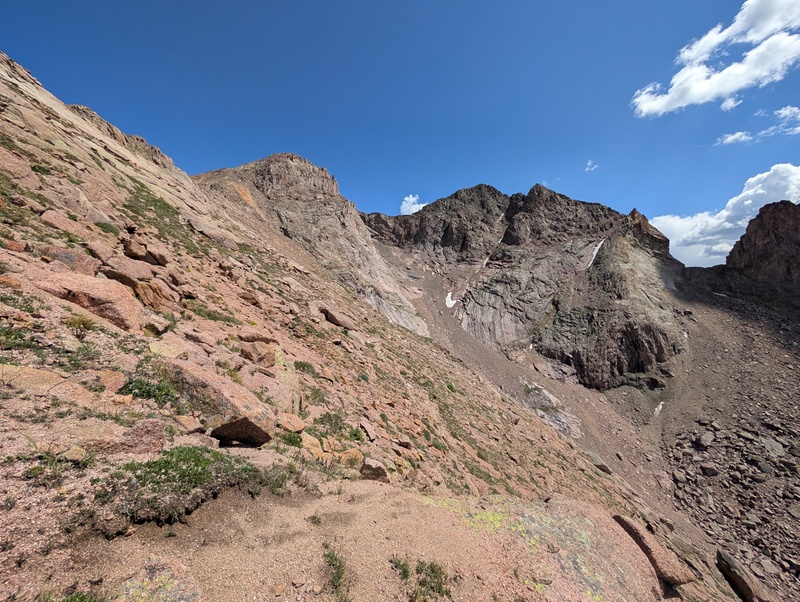


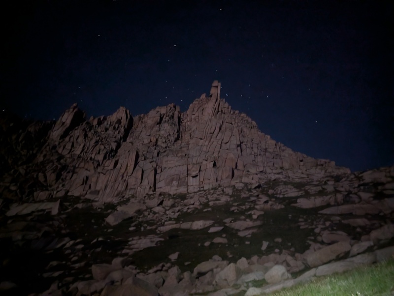


|
| Comments or Questions | ||||||||||||||||||
|---|---|---|---|---|---|---|---|---|---|---|---|---|---|---|---|---|---|---|
|
Caution: The information contained in this report may not be accurate and should not be the only resource used in preparation for your climb. Failure to have the necessary experience, physical conditioning, supplies or equipment can result in injury or death. 14ers.com and the author(s) of this report provide no warranties, either express or implied, that the information provided is accurate or reliable. By using the information provided, you agree to indemnify and hold harmless 14ers.com and the report author(s) with respect to any claims and demands against them, including any attorney fees and expenses. Please read the 14ers.com Safety and Disclaimer pages for more information.
Please respect private property: 14ers.com supports the rights of private landowners to determine how and by whom their land will be used. In Colorado, it is your responsibility to determine if land is private and to obtain the appropriate permission before entering the property.