Download Agreement, Release, and Acknowledgement of Risk:
You (the person requesting this file download) fully understand mountain climbing ("Activity") involves risks and dangers of serious bodily injury, including permanent disability, paralysis, and death ("Risks") and you fully accept and assume all such risks and all responsibility for losses, costs, and damages you incur as a result of your participation in this Activity.
You acknowledge that information in the file you have chosen to download may not be accurate and may contain errors. You agree to assume all risks when using this information and agree to release and discharge 14ers.com, 14ers Inc. and the author(s) of such information (collectively, the "Released Parties").
You hereby discharge the Released Parties from all damages, actions, claims and liabilities of any nature, specifically including, but not limited to, damages, actions, claims and liabilities arising from or related to the negligence of the Released Parties. You further agree to indemnify, hold harmless and defend 14ers.com, 14ers Inc. and each of the other Released Parties from and against any loss, damage, liability and expense, including costs and attorney fees, incurred by 14ers.com, 14ers Inc. or any of the other Released Parties as a result of you using information provided on the 14ers.com or 14ers Inc. websites.
You have read this agreement, fully understand its terms and intend it to be a complete and unconditional release of all liability to the greatest extent allowed by law and agree that if any portion of this agreement is held to be invalid the balance, notwithstanding, shall continue in full force and effect.
By clicking "OK" you agree to these terms. If you DO NOT agree, click "Cancel"...
Thanks to Mick for patient technical climbing training and leading the climb/rappel, we summited Jagged Mountain and rappelled the north face.
Vallecito Crk Trail –
We drove to the Vallecito TH on Thursday morning and then started the hike shortly after arriving.
As you head north on Vallecito Crk Trail to Sunlight Crk, the trail is well maintained, and you can move along without deadfall getting in your way. The second bridge was washed away in October so that gives an additional location you need to ford Vallecito Crk. This was about 5 miles up the trail.
Second bridge
We detoured about 150ft north of the second bridge where we made the first creek crossing.
Continue north on east side of Vallecito Creek about 150ftAfter crossing the creek, the trail is about 20ft up from the shoreline
Continue north on the Vallecito Crk Trail and after a couple of miles, you’ll need to cross the creek a second time where a third bridge was long ago washed away (about 7 miles north of the Vallecito TH). Hiking poles were useful for both creek crossings.
The second creek crossing is about 7 miles north of Vallecito TH
After the second crossing, it’s about 2 miles to Johnson Crk where we camped. A lot of hiking to Johnson Crk is easy without significant elevation gains.
There are good camping spots at Johnson Crk
Sunlight Crk Trail –
From Johnson Crk continue north on Vallecito Crk Trail about 3.5 miles to the Sunlight Crk Trail.
Mick and Marty at the turn onto Sunlight Crk Trail. There are a couple of cairns marking the start of Sunlight
Turn west onto Sunlight Crk Trail and in a short distance you'll cross Vallecito Crk a third time
The beginning of Sunlight Crk Trail
The third crossing of Vallecito Crk.
From the third creek crossing it is about 4.5 miles up to a camping area. Sunlight Crk Trail is not maintained, and you encounter deadfall (never needed to remove packs) and areas through willows where the trail is less obvious and a few creek crossings with rocks or logs to step across. Sunlight Crk Trail was a pain but not as painful as North Pigeon Crk Trail if you ever hiked that packed with camping gear!
Camping at the top of Sunlight Crk Trail
Camp to base of Jagged north face –
On the third day it was about a 2-mile hike from our Sunlight camp to the base of Jagged Mountain north face.
Jagged from near our campHiking to the north face
North face of Jagged
Starting climb to first crux
Mick leading the first crux.
Thanks Mick, for the following details and thoughts on gear, the climb, and rappel –
Gear:
· The rack/draws recommended by kempenjn in his trip report (https://www.14ers.com/php14ers/tripreport.php?trip=21993) is very good. Where I deviated from it, I was generally wrong – but there are a couple tweaks I would make. Here is what I would bring if I did it again:
o Cams
§ A few very small cams (0.3 and less)
§ Single 0.4, 0.5, 0.75
§ Double 1 – 3
§ A #4 would be useful if you want to carry it in
o Stoppers – small selection of small to medium
o Couple of cordelettes
o Few extra biners
o I would say 6 to 8 alpine draws, partly because sometimes the draws themselves can be used to wrap chockstones and such.
o Plenty of webbing and rap rings. There are ample opportunities for rap stations, and who knows what condition they will be in.
o Climbing knife
o Radios
· We brought in twin/half 60 meter ropes, and they ended up being very nice to have for the rappel. We got down in 4 rappels, which are detailed below.
Thoughts and beta on the climb:
· Maybe I was off route, or having an off day, or just not a very good climber (or all three), but IMHO, this climb is sandbagged at 5.2. There were 2 or 3 moves – all on the north face sections – that I thought were easily 5.5 or 5.6.
· Lots of pebbles, grass, and sloping ledges on the north face – not surprising I guess. I found the climbing there to be challenging and interesting, but I wouldn’t call it fun.
· Lots of places where I ran into rope drag issues on the north face. The rock is very course and sharp, and any single twist or turn often created a ton of rope drag.
· We unroped for the section between pitch 1 and the start of crux 2. I think most people do that. I felt very secure unroped on this section, and I’m usually more cautious than others on class 3 or 4. I would say that is only class 2+.
· The south side ledge traverse, chimney, and final summit scramble actually *were* fun. The rock here is solid and cleaner. Again, not surprising for north face vs. south face.
· We roped for the traverse across the south face, and this went quite well – just a little rope drag. Lots of protection opportunities, with the airy step across being protectable for both the leader and second. Our 60 meter rope was just long enough to get all the way to the chimney in one lone traverse “pitch”.
· We found the chimney to be very straightforward. We removed packs and had our backs on the climber’s right wall. This made it easy to transition from the chimney to sitting on the boulder. We brought all the packs up with the rope before the last climber ascended the chimney.
· The chimney is protectable for the leader. I had a good stance and was able to throw a long draw over the small chockstone. I’m not seeing anyone else doing this, which surprises me because it seems fairly obvious. I would have worried less about leading this section if I had known good protection was available.
· In general, climbing in the crux sections on the north face was slower, harder, and less fun than I anticipated. The south face sections were more enjoyable.
Approaching the second cruxOn the second crux looking back at the tiny little saddleMarty approaching the notchAt the notchMe starting the south face traverse. Thanks to Mick roping the traverse, making it much easier for me and MartyMick climbing the chimney. Back to the right side worked well with a platform to sit on just above Mick's left hand
On the summit. Congrats Marty (left) - #100 Centennial Finisher!!
Thoughts and beta on the rappels:
We had twin/half 60 meter ropes, which gave us a full 60 meters of rappel length. This made things much easier and more comfortable on the descent – we only needed to downclimb about 30 feet of class 2+. It’s a lot of rope, and I spent time untangling things sometimes on the rappels, but I would do that same system over again.
A couple of general thoughts first:
· Watch out for loose rock on the rappels and rope pulls. That’s probably obvious with the amount of loose rock overall on the north face, but still worth a reminder.
· The ropes pulled more cleanly than I expected – a very pleasant surprise.
Here are descriptions of the 4 rappels and the associated rappel anchors:
· Rap 1 (station: bolts on the summit)
o We rappelled straight down from the summit, taking the path of least resistance. About 30 meters down, I found remnants from a previously used rap station, just off to climber’s (or rappeler’s) right. There was a nice ledge about 20 feet climber’s left of that station on which we felt comfortable waiting unroped. Going from that ledge to the rap station was secure – so no need for everyone to be clipped into the rap anchor.
Mick getting ready to rappel from the summit
· Rap 2 (station: 30 meters below summit)
o We rappelled down and very slightly right, taking us down the steep water-stained cliffs, past the start of crux 2 (just below the Tidy Little Saddle), and down into the gully below (off the climbing route). This gully was loose but not steep. We rapped the full 60 meters, then came off rappel and downclimbed about 30 additional feet (maybe a little more) on class 2+ to the next anchor, which is skier’s right of the gully. This location was good for three reasons: 1) There is an absolute bomber anchor setup, wrapping a huge arrowhead shaped rock with webbing, 2) it is a huge, very comfortable ledge, and 3) it is out of the way of rockfall from the rappel above.
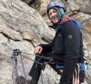
Me on the second rappel from my #98 peak
· Rap 3 (station: huge ledge with bomber arrowhead rock)
o This rappel is slightly tricky but works great if you pay attention. For this rappel, angle to climber’s left. You don’t need to angle so much that it is awkward – just enough to get yourself on the left side of a large rock. If you do this, and go the full 60 meters, you reach the anchor for the top of the first pitch of the climb. I used every bit of the 60 meters to do this.
· Rap 4 (station: anchor at top of first pitch of climbing)
o This is the simplest rappel, as you’re just going down the first climbing pitch. Using the full 60 meters took us all the way down below any class 3 or above difficulties.
Vestal-Arrow-Trinity peaks from the summit. Great views in every direction.
Thumbnails for uploaded photos (click to open slideshow):
Glad to see the creek is crossable near the new washout. Granted, it's August of a very low snow year, but I was concerned the creek would be particularly difficult to cross there. Thanks for posting!
Patrick, the current was somewhat strong on the first two crossings, but with a heavy pack and some slippery rocks I was glad to have hiking poles to stay upright.
Glad to see the creek crossing is realistic - seems unlikely we'll get a new bridge there anytime soon.
Also happy to hear my TR was somewhat useful. Finding room in the pack for a #4 after everything else can be tough, I would rather have a few extra small cams + alpines like you suggest.
We were in there the same weekend. About 200 yards before and downstream of the former bridge there’s a big log across the river. You can easily walk across it so no need wade there at least this season.
Caution: The information contained in this report may not be accurate and should not be the only resource used in preparation for your climb. Failure to have the necessary experience, physical conditioning, supplies or equipment can result in injury or death. 14ers.com and the author(s) of this report provide no warranties, either express or implied, that the information provided is accurate or reliable. By using the information provided, you agree to indemnify and hold harmless 14ers.com and the report author(s) with respect to any claims and demands against them, including any attorney fees and expenses. Please read the 14ers.com Safety and Disclaimer pages for more information.
Please respect private property: 14ers.com supports the rights of private landowners to determine how and by whom their land will be used. In Colorado, it is your responsibility to determine if land is private and to obtain the appropriate permission before entering the property.