
| Report Type | Full |
| Peak(s) |
Eagles Nest - 13,419 feet Mt. Powell - 13,556 feet "C Prime" - 13,140 feet Black Benchmark - 13,133 feet "West Partner Peak" - 13,058 feet "East Partner Peak" - 13,057 feet "Mt. Solitude" - 13,085 feet "Grand Traverse Peak" - 13,063 feet "Mt. Valhalla" - 13,202 feet "Mt. Silverthorne" - 13,361 feet Red Mountain - 13,911 feet "Climber`s Point" - 13,022 feet "Peak C" - 13,228 feet "North Traverse Peak" - 13,085 feet "Peak H" - 13,101 feet |
| Date Posted | 07/15/2026 |
| Date Climbed | 07/02/2026 |
| Author | Geckser |
| Additional Members | arthurspiderman |
| Gore Range Grand Tour |
|---|
Gore Range Grand Tour FKT
During the 2026 Fourth of July weekend, Arthurspiderman (Arthur) and I climbed the Naa Ohn Kara Grand Tour, or as I will be referring to it here, the Gore Grand Tour. While people have been running the Gore Range Traverse for quite some time, we took inspiration from Chris and Ben Dewey, who completed a traverse from Eagles Nest to Buffalo Mountain in 2020. They posted this route on the FKT website, and we took their objectives and general plan and used them for our own. A huge shoutout to both of them—it is a fantastic line that takes you through some of the most beautiful and remote parts of this fine state. Arthur posted a more formal FKT submission on that website, including splits and more map information (https://fastestknowntime.com/route/naa-ohn-kara-gore-range-grand-tour-co) The route set by Chris and Ben starts at the Surprise Lake Trailhead, goes up to Eagles Nest, and then hits 26 more ranked or named peaks on the ridgecrest until it ends at the Buffalo Mountain Trailhead right above Silverthorne. Their route took four days, covered about 35 miles and more than 25,000 feet of elevation gain, and crossed some of the most rugged terrain in Colorado. As many Gore lovers know, the ridge covers a handful of classic climbs: the Partner Traverse, C’s Northwest Ridge, the Zodiac Ridge, and Ripsaw. Ben and Chris did not hit all of these lines, and frankly, we didn’t plan on hitting all of them either. Our main target was speed; we wanted to put down a competitive time on the FKT, so we would be running the ridge when expedient but dropping down if we thought it would save time. In the name of speed, we also tried to go a lot lighter than Chris and Ben. We decided on no tent—just ground pads and sleeping bags. We chose to skip a cooking system and just go bar-for-bar over the trip. We only brought approximately as many water purification tablets as we estimated needing. While I did bring my climbing shoes and a simplified first aid kit, we ended up not using either. Arthur and I have been eyeing this line for years, waiting to feel sufficiently strong and get a perfect weather window. We had driven out in 2025 but bailed due to low spirits following an unexpected snowstorm at the Surprise Lake parking lot. We hoped this attempt would be different; the particularly dry winter had allowed most of the range to melt out a few weeks early, providing us with longer days to work with. The predicted weather was perfect, with essentially no chance of thunderstorms and low wind. So, we locked in to start our attempt on July 2nd. Our biggest concern pulling up to the parking lot was smoke. When we left my car at the Buffalo trailhead, the acrid smell of smoke was strong. Frankly, I was not optimistic that the smoke would be light enough for us to not completely fry our lungs. We drove down to the Surprise Lake TH parking area nonetheless and slept in until 6:00 AM, when we got rolling. To my surprise, while there was a bit of haze, it had appreciably cleared from the previous evening. Day 1Peaks Climbed: Eagles Nest, Powell, C, C Prime, D, E, F, G, H, Black Benchmark We hoofed it up to Upper Cataract Lake, where we took a short break. It was still clear, and the temps were perfect. We took note of some mosquitoes at the lake, making a point that we should camp high to avoid the bugs (again, no tent). We followed the large basin to the west of Upper Cataract Lake up to 11,800 feet, at which point we followed a grassy slope up to the North Ridge of Eagles Nest. We had hoped to take the North Gully to the ridge, but it still had an appreciable amount of snow. The North Ridge was a very pleasant alternative, providing some warm-up scrambling for the day to come. 


Once on the summit of Eagles Nest, we got another piece of good news. The North Face of Powell had a small gap in its snowfields that would allow us easy access to the summit from the basin between Eagles Nest and Powell. This was great news; we were prepared to do the ridge from Eagles Nest to Powell if needed, but we were confident that we would lose a few hours in the endeavor. We took a gully a few hundred feet below the summit of Eagles Nest, which provided us with a mostly grassy descent into the large and beautiful basin around Cliff Lake. We dropped to 11,800 feet and purified some water before bounding up one of Powell’s northern gullies, which was just melted out enough to get us up trivially. 


From the top of Powell, we got our first real view of Peak C. I had climbed Powell years ago and always remembered how imposing that Northwest Ridge looked; frankly, it was a bit intimidating knowing we would be going up it so soon. But we continued on, descending toward Knee Knocker Saddle. Unfortunately, the east side still had some snow, so we were forced to do some unpleasant scrambling up a rocky ridge to reach the pass while staying dry. 
From the pass, we saw our route ahead—generally dry with one exception: the first 5.2 pitch low down on C’s face was still full of an appreciable amount of snow. To avoid this, we followed a more direct ridge (which probably went at 5.4) with decently solid rock. The other two pitches were fun, but frankly, the rock quality is imperfect, and the exposure is about as significant as it gets in Colorado. This was definitely one of the cruxes of our line. We summited around 2:00 PM, but given that we wanted to finish up Ripsaw before the end of the day, we had no time to wait. 

We were hoping to take the fourth-class bypass around the northeast of C Prime to avoid a bit of climbing, but unfortunately, that was a touch too snowy and was still impassable. This left us with the ~5.4–5.6 route that Chris and Ben took. I am not certain if we took exactly the same line, but we followed the leftmost of three crack systems, and I found it to go at around 5.2. On top of C Prime, we were confident that we were done with the biggest mandatory technical crux of the trip. The other good news was that for the vast majority of the remaining trip, we would not have to deal with north- or east-facing couloirs and gullies. Because of this, this was the last stretch heavily impacted by snow. 
Now we were in Ripsaw. We had some beta from previous reports (big thanks to Merelyafleshwound), but mostly we were going into this section blind. A great deal of Ripsaw bled together for me, but I will say that the common advice holds true: "When in doubt, traverse West." Starting here and continuing for the rest of the ridge, we did a lot of traversing to the right. We had some amazing views and fun scrambling, so we kept charging along until we reached Peak H around 6:15 PM. 


From here, Chris and Ben dropped off into the large basin to the north after backtracking past Black Benchmark. Wanting to save on backtracking and seeing a very nice grassy slope down into the Piney River Basin, we opted to drop to the south directly from H. This went fairly easily, and we found a nice flat spot to set up camp. We were about 150 feet above Upper Piney Lake and had an unbelievable view—a great bivy site. Even better, there was a perfect grassy slope above us leading straight to our next objective, Peak J. 


Day 2Peaks Climbed: J, P, West Partner, East Partner, Vista Peak, Mount Solitude, Climbers Point, North Traverse, Grand Traverse, Palomino Point, Mount Valhalla, Sleet Peak Knowing this would be the biggest day of the trip, we started near first light, getting moving around 5:45 AM. From our campsite, the grassy slope provided easy access to Peak J. I will mention that this may be one of the steepest and most exposed grassy slopes I have ever climbed, and with a major cliff band in the middle, a slip would be just as dangerous as on the rock ridges above. The grass went all the way to a high saddle between J and P at 12,900 feet (much closer to J). From there, it was a fun and short scramble to the top of J. Seeing all the ridge infront of us, we kept moving along. 

The Jigsaw traverse was fun and went quickly. This was one of our favorite sections of ridge, though given how short it is, I am uncertain why it gets its own name. From the top of P, we got a great view of Rockinghorse Ridge, another one of the potential cruxes of the route. Ben and Chris had dropped ~700 feet off Rockinghorse and ascended East Partner. We hoped to save time by sticking closer to the ridge, which we had read goes at low 5th class. Generally, the ridge was not much more difficult than Ripsaw, but to get up near the Rockinghorse itself, there was a brief ~5.5 chimney we ascended. I am sure there is an easier way; we just didn't find it. Outside of that, this section went quickly, and we were on top of West Partner Peak around 9:00 AM—less than 2.5 hours after hitting the ridge between J and P. 


The Partner Traverse is another easy 5th-class traverse, but based on our reading, it could be pretty time-consuming. Also based on our reading, we determined the crux was a fairly short spine in the center of the ridge. However, while on top of West Partner, we saw two mostly connected grassy slopes that would let us completely avoid the crux spine. Somewhat dishonorably, we dropped down to 12,000 feet on a grassy slope to the west before cutting back up to the ridge proper, regaining the ridge at about 12,600 feet. From there, it was mostly 4th class up to East Partner. 

On top of East Partner, we looked towards Vista Peak. It looked far away, but we were happy to see a large grassy slope that went up the entire North Face of the peak with only minimal snow. After descending East Partner's South Ridge, we followed a grassy, east-facing gully down to 11,600 feet, where we filled up at the creek between the two peaks. We then took the slope up and were on top of Vista around 1:30 PM. The climb was uneventful, as was the pleasant walk to get over to Solitude and Climbers Point. 


The descent from Climbers Point was an unexpected crux of the day. Chris and Ben warned of a large cornice blocking the gully descending east from the saddle of Climbers and Skiers Points. We suspected this would be worse for us given the snow we had already come across, and when we reached the same gully they descended, we found the cornice was monstrous. To get around this, we took a heinously loose, rocky rib down about 600 feet to avoid the snow-filled gully. I would recommend anyone doing this route find any other way to do this, as it was scary, loose, and extremely unpleasant. Dangerous and unpleasant AVOID THIS. One of the easterly gullies closer to Climbers Point looked fairly dry, and this likely would have made for a better descent; we, of course, were unsure if this would go from the top, but it looked passable from below. 

The rest of the way down to Bighorn Creek was uneventful (outside of a brief glissade!), and we were at the creek around 3:00 PM. From here, we did our only split of the trip: I went up the Northwest Face of North Traverse, while Arthur followed the grassy slopes up toward North Traverse. The face was likely faster, but the grass was certainly more pleasant; both routes were uneventful, and we met back up at the summit. It was a bit after 4:00 PM at this point, and I had some doubts we would be able to make it to Snow Lake (our goal) before darkness fell or we completely ran out of gas. Nonetheless, we kept on trucking. 

After all the gendarme-dodging earlier that day, the traverse from North Traverse to Grand Traverse was a pleasant change of pace. There was something approaching a trail and cairns! We quite enjoyed this section, and we got on top of Grand Traverse around 5:30 PM. We didn't have time to rest if we were to make it to Snow Lake, so we kept on moving. The descent to the pass above Deluge Lake was easy and grassy (a nice change of pace), but looking toward Palomino, Valhalla, and Sleet made me skeptical. It looked to be a long way and seemed to require bypassing a great number of gendarmes. The good news was, as we found, that there was something like a trail all the way to Palomino and Valhalla. I really liked this section, and the final scramble to Palomino was surprisingly fun. It was also one of the most beautiful sections of the whole trip! 


Getting to Valhalla was easy, and we summited a bit after 7:00 PM. I was confident we could finish the last peak of the day (Sleet), but the stretch from Valhalla to Snow's saddle looked loose and technical from afar. Once again, I was happy to have a use path for about 80% of this; unfortunately, this ended in an insanely loose choss pile about 300 feet from the grassy-looking slope. We simply went up a rib to the ridge, which seemed to be the path of least resistance. 

With the last peak of the day in view, we finally took our feet off the gas a bit and started a slower traverse over to Sleet. The traverse was generally pretty efficient, and we made good time to the small saddle to Sleet's east. The summit block was fun, though loose, and the views toward Snow Lake were unbelievable with the setting sun. We backtracked the traverse and dropped down to Snow Lake, where we made camp on a small, grassy knoll to the east of the lake. We were both asleep by 9:00 PM. We knew this would be our hardest day, and we were happy we had hit all the peaks we had hoped to. 


Day 3Peaks Climbed: Hail, Silverthorne, Red, Eccles, Buffalo 
We only had five peaks to go on Day 3, and while these had less technicality, we knew there would still be quite a lot of mileage and vertical gain. Our first peak of the day was Hail. To avoid backtracking on the ridge, we took the less appetizing but more direct southern choss-filled gully rather than the grassy slope to the saddle between Hail and Silverthorne. The gully was fairly solid, so we were up the ridge and past the gendarmes quite early. From there, it was a simple scramble on dubious rock up to Hail's summit. While the scrambling was much easier at this point, there was still enough exposure that a mistake or loose rock could be disastrous, so we made every effort to stay dialed in. 
We traversed over to Silverthorne quickly, bypassing all of the gendarmes to the west/south (stop me if you have heard this before), summiting around 8:30 AM. We dropped down Silverthorne's large, grassy southern gully, which put us in the large basin just west of the Zodiacs, which we admired as we crossed. This was our last water fill-up, and we enjoyed the calm morning and the smoke-free skies. There was another grassy slope up the Northwest Face of Red. We took these slopes to Red’s ridgecrest, where we followed the trail to the summit. From Red, we went back down the ridge until the trail improved further. 


From Red Buffalo Pass, we followed the trail to Eccles Pass. From here, it was a walk-up to Eccles, and another, albeit longer, walk-up to the top of Buffalo Mountain. There were some storms coming in, so we were trying to stay quick despite having the finish line in sight. We were met by screaming mountain goats at the summit, and we both cheered, knowing we had finished the traverse. What an amazing route. We ran down the trail, which was surprisingly chossy at the top, reaching the TH at 2:37 for a total time of 2 days 8 hours and 43 minutes from the Surprise Lakes Trailhead. Beating the previous record by almost 2 days. 


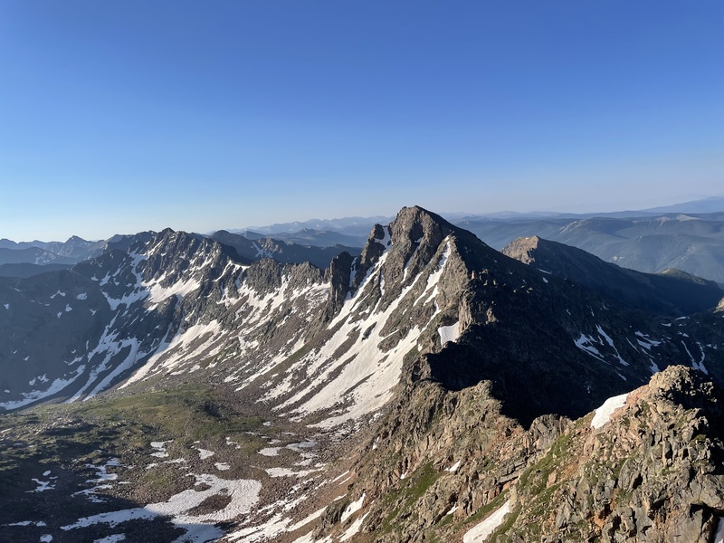
Final Notes While this traverse is amazing I don't know if I could recommend it to anyone. Just a lot of technical ridge on pretty good rock but falls would end disastrously on the vast majority of this route. I am very happy with our time but it is certainly beatable (or crushable?) but fully committing to speed and skimping on rest would make this already dangerous route even scarier. If someone is very experienced with Colorado terrain, well conditioned, and has a good weather window this route is definitely feasible but I was constantly thinking about the inherent risk of the endeavor, even with our perfect conditions. I think anyone who wants to attempt this should deeply consider the unusual risk before making an attempt. I have seen contrivance discussed repeatedly in relation to this route. I think that any route you design through the Gores will have some arbitrary choices on what peaks to hit and what (bumps?) to skip. I think the peaks chosen by Ben and Chris are fairly logical. They did not always follow their own rules (Red being off the ridge, Sleet being unranked, etc) but I was happy to be doing this traverse with specific peaks in mind and because of the peak choices I think the route flowed well. This may be a bit controversial but I found dropping into the basins to be an interesting way to spice up long days on the ridge. I think it gives you a better feel for the range to see the massive, beautiful lakes and alpine basins that dot the Gores. I think the route is well designed and Arthur and I are both very grateful to Ben and Chris for establishing the route we followed. While I am on the topic Alex Hene's Beta is amazing and made the unknown stretches of the ridge possible for us. The gores are really a remarkable place. Thumbnails for uploaded photos (click to open slideshow): 




|
| Comments or Questions |
|---|
|
|
Caution: The information contained in this report may not be accurate and should not be the only resource used in preparation for your climb. Failure to have the necessary experience, physical conditioning, supplies or equipment can result in injury or death. 14ers.com and the author(s) of this report provide no warranties, either express or implied, that the information provided is accurate or reliable. By using the information provided, you agree to indemnify and hold harmless 14ers.com and the report author(s) with respect to any claims and demands against them, including any attorney fees and expenses. Please read the 14ers.com Safety and Disclaimer pages for more information.
Please respect private property: 14ers.com supports the rights of private landowners to determine how and by whom their land will be used. In Colorado, it is your responsibility to determine if land is private and to obtain the appropriate permission before entering the property.


