
| Report Type | Mini |
| Peak(s) |
Mt. Sneffels - 14,155 feet |
| Date Posted | 07/10/2026 |
| Date Climbed | 07/09/2026 |
| Author | Wentzl |
| Blaine Basin Info |
|---|
|
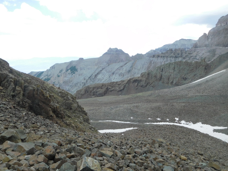
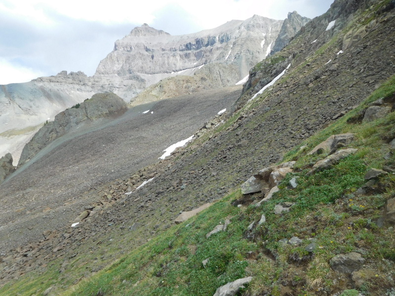
Back on July 17, 2009 I posted a report about hiking a loop on Sneffels starting at the Blue Lakes trailhead and going up the SW Ridge via Blue Lake Pass and down through Blaine Basin. I have done that loop many times, clockwise and counter-clockwise, in snow and on rock. Did another repeat yesterday, July 9, 2026 and was motivated to post this MINI report to fill in some of the blanks on that earlier report and provide information about Blaine Basin that I don't find elsewhere on the site. The information here only concerns the 2 or so miles and 1,500' vertical from Scree Col to the tree line in Blaine Basin where there exists a good trail back to the trailhead. There are two main takeaways. 1) This is most fun in done counter-clockwise in the spring when there is snow from the Col to the trees. These conditions provide multiple descent options and minimize the risk of getting lost or cliffed out. 2) If unfamiliar with Blaine Basin, strongly advise getting acquainted with the area by doing the loop in a clockwise direction. Getting lost and frustrated going up allows a hiker to go down. Getting lost and frustrated going down has a high probability of ending in an unexpected night out at best and a terrible decision to take a short cut that does not exist at worst! The first part of the descent into Blaine Basin is on scree on hardpack that gives poor purchase for footholds. I used a sort of controlled slide until I could get into the larger talus which I prefer walking on. It is a difficult and tedious several hundred feet and will take a toll. I don't remember getting through without some cut or scratch and yesterday no different. Once off the steepest sections progress is easier and more fun. 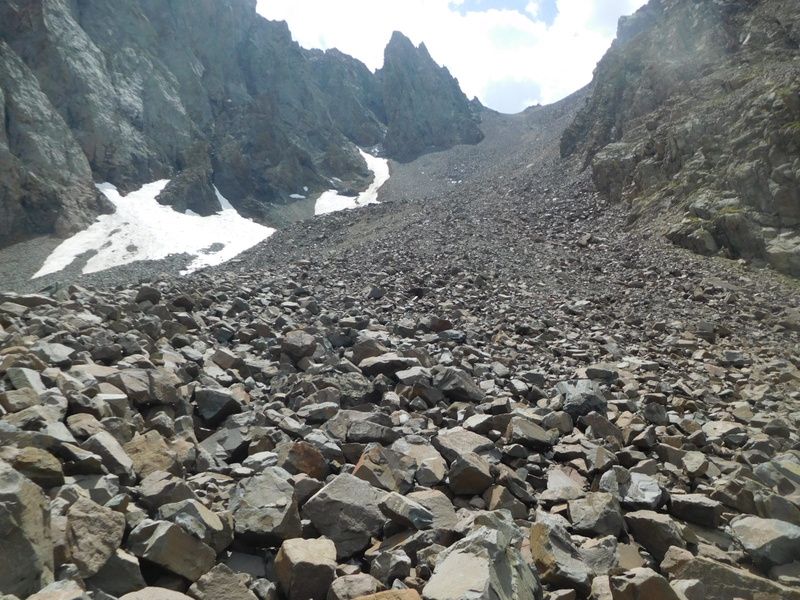
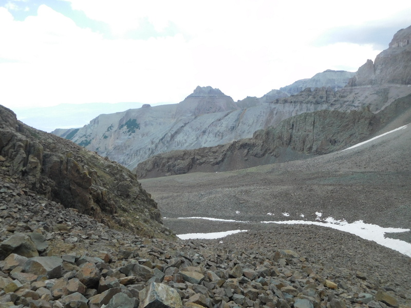
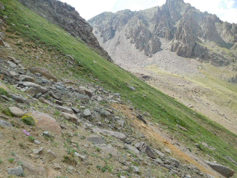
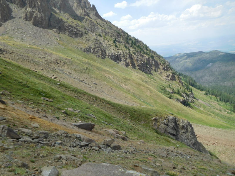
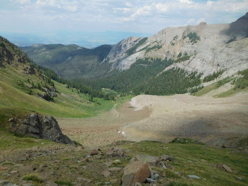
Getting to the place where the two previous photos was taken took almost an hour. Much more fun in the snow! From here you descend around the corner to the left. Lower Blaine basin will open up in front of you, but don't be tempted to head straight down toward it. View the final photo in this report to see why. When possible, start a traverse to the west at the base of the cliffs in grass. There used to be a really decent and well defined trail for this, but yesterday I found what looked like an intermittent game trail. The idea is to get across to the trail that leads up from lower Blaine Basin to the start of the Snake Couloir. These switchbacks are visible from a long way off, but what can not be seen is a huge gash making getting there difficult. Next two photo, first looking back at where I had come off the rocks and looking ahead, to where I finally spied the trail. 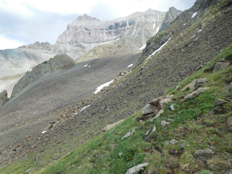
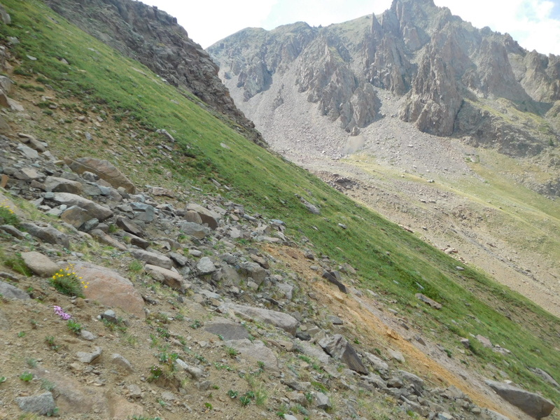
Again, stressing you have to stay high to get across the unseen gash. The switchbacks leading to the trees look close, but still work to be done. 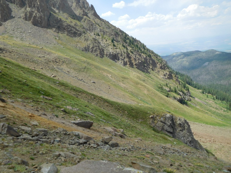
There are lots of places along the way where it appears there is an easier way. Don't "fall" for it. 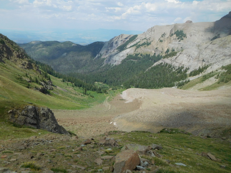
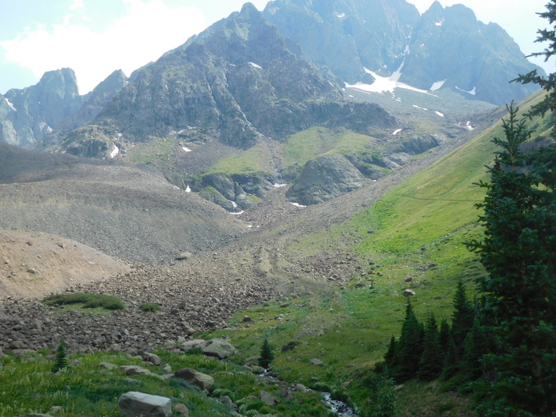
The last photo is looking back up once the good trail and treeline was reached. The snow in the upper right is the base of the Snake Couloir route. If going clockwise you have to get up most of the switchbacks to get high enough to make the traverse over to Blaine Basin work. The traverse described here is on the grass and rock below the triangle of rock to the left of the snowfield. The square block on the left side of the photo is Kismit, which you work your way over to, and under as you ascend to Scree Col. 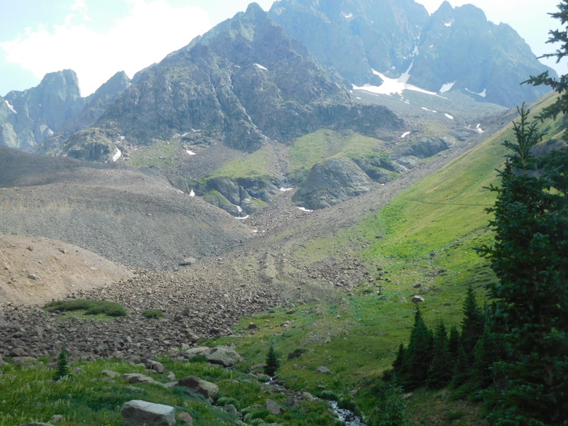
This is just about my favorite loop hike of all the 14ers despite the fact, or maybe because of it, that I usually leave some skin and blood behind! Final thought, if you are sporting Hoka shoes, as I was, expect to leave some of those behind as well. Thumbnails for uploaded photos (click to open slideshow): 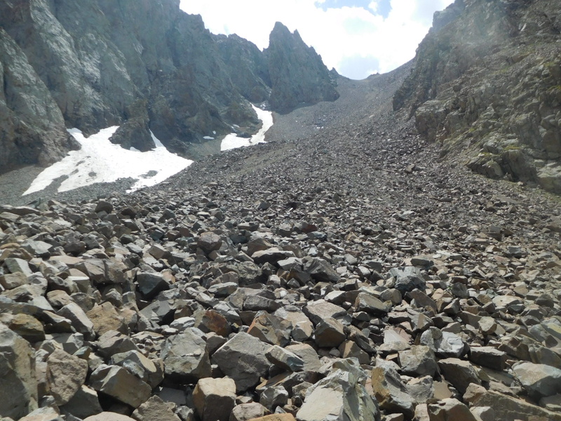
|
| Comments or Questions |
|---|
|
|
Caution: The information contained in this report may not be accurate and should not be the only resource used in preparation for your climb. Failure to have the necessary experience, physical conditioning, supplies or equipment can result in injury or death. 14ers.com and the author(s) of this report provide no warranties, either express or implied, that the information provided is accurate or reliable. By using the information provided, you agree to indemnify and hold harmless 14ers.com and the report author(s) with respect to any claims and demands against them, including any attorney fees and expenses. Please read the 14ers.com Safety and Disclaimer pages for more information.
Please respect private property: 14ers.com supports the rights of private landowners to determine how and by whom their land will be used. In Colorado, it is your responsibility to determine if land is private and to obtain the appropriate permission before entering the property.



 Download GPX file used in this map