
| Report Type | Full |
| Peak(s) |
Gannett Peak - 13,810' Pinnacle Ridge - 13,364' |
| Date Posted | 07/08/2026 |
| Date Climbed | 07/05/2026 |
| Author | soxfan249 |
| Additional Members | ktandgoose |
| Gannett and Pinnacle Ridge |
|---|
|
Gannett Peak, July 4th Weekend 2026 I've been chasing down state highpoints and lower-48 ultras after finishing the 14ers in 2022 and Gannett Peak Wyoming has been one of the more challenging peaks to organize for. No matter which way you approach it, it is a long slog in from the trailhead requiring snow gear and backpacking for several nights in the Wind River range. Through the CMC we found a group of 6 willing to go for it over the long weekend. We were originally going to take the southern/western approach from the Pole Creek Trailhead to Titcomb Basin. This is a relatively shorter approach, 46-8 miles round-trip, but requires an arduous summit day climbing up and over Bonney Pass and down across the foot of the Dinwoody Glacier before reaching the base of Gannett Peak. However, this approach sits at a relatively higher elevation, and the last clear Sentinel imagery we found (from 6/19) showed considerable snow remaining on the trail past Seneca Lake. This, combined with no trip reports on any of our usual sites and a pessimistic outlook on trail conditions from a call to to the forest rangers, caused our group to reconsider this route this early in the season. I suggested that we look into the northern/eastern approach from Trail Lake Trailhead along the Glacier Trail. This is the longer approach, 56-8 miles, but leaves you with an easier summit day as you can camp close to the moraine at the base of the Dinwoody Glacier. The trail sits lower in elevation compared to the Titcomb Basin approach, and Sentinel imagery was showing that it was pretty well melted out. Further research showed that most early-season attempts use the Glacier Trail for this reason, despite the extra mileage. However, another call to the ranger district resulted in some more pessimistic outlooks on the creek crossings, and the group ultimately decided to postpone the trip. Due to work schedules, a fantastic weather window, and perhaps a bit of a desire for a sufferfest, ktandgoose and I decided we would take a shot at the peak from the Glacier Trail regardless. In researching the maps, I realized that this approach would also give us a shot at two other Wyoming 13ers south of Gannett - Pinnacle Ridge and Woodrow Wilson. These peaks don't see a lot of summits, but looked like a good technical challenge for us, so we agreed on a "come-and-see" approach towards those peaks based on in-situ conditions and energy after the main Gannett objective. We quickly reorganized plans and prepared for a long weekend of long days. Gear List:
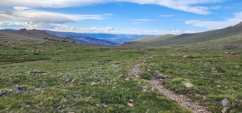
Friday July 3, 2026 I left Denver just after 6:00am to pick up ktandgoose and we made it to the Trail Lake TH after a lunch in Lander at about 2:30pm. We set out on a good trail at about 3:15pm and made it 11.5 miles to Double Lake at around 8:30pm. The main difficulty on this segment is the 28 switchbacks up to Arrow Pass from the Torrey Creek Basin. Arrow Pass is a very scenic open field with nice views of the Absarokas behind, but the spine of the Winds still remains largely hidden. 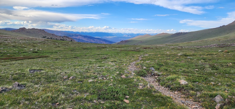
After descending through an interesting burn zone, we finally made it to a pretty campsite at the head of Double Lake late enough that the bugs weren't a terrible nuisance. 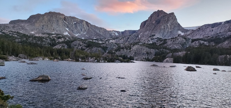
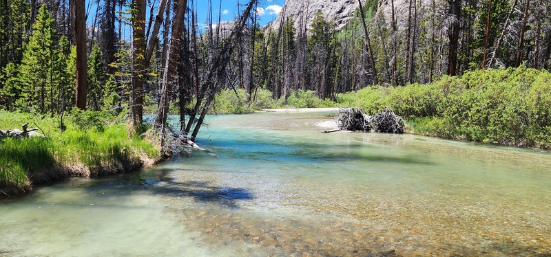
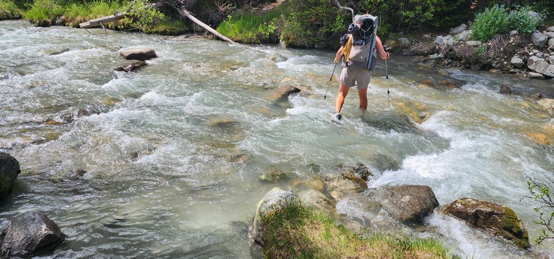
Splits (from Garmin): Saturday July 4, 2026 Since Friday was a long day with the drive and the first part of the approach, we decided to sleep in and didn't get on the trail until about 10:30am. Today's trail was to drop over into the Dinwoody Creek valley past a series of meadows to eventually reach Tarns Camp at the base of the Dinwoody Glacier moraine. The main difficulties we expected to encounter were the Klondike and Gannett creek crossings. We knew that the creeks would be highest in the afternoon, but since they were both 10+ miles from our first camp we didn't really think there was anything to gain by an early start - it would be afternoon by the time we got there anyway. We passed Double Lake and Star Lake before descending down Halfmoon Creek to get to Downs Fork Meadows. After a mile or so along the meadow we were presented with our first challenge of the day. I had checked the Google Satellite map layer and found a bridge across Downs Fork at 43.27972, -109.56562. Unfortunately, this bridge does not appear to exist anymore. Instead there is a "New Bridge Trail" that adds about another 1.25 miles further down the valley before crossing and coming back. ktandgoose and I took a look at the river and found a shallow section just upstream of an unmapped confluence and decided to ford the two tributaries instead of adding the extra mile and change. We made these knee-deep crossings by a horse camp at approximately 43.278499, -109.566777 and had lunch on the other side of the river. 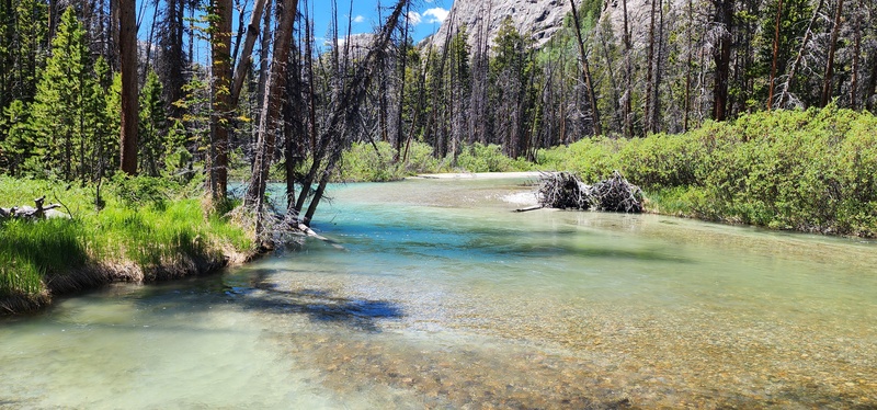
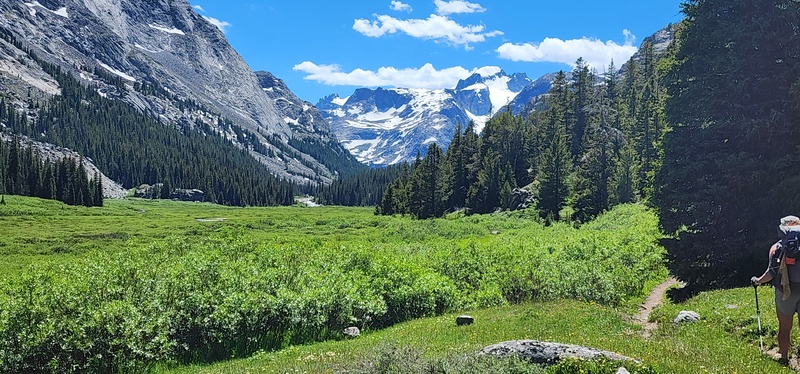
We then continued around a bend into Big Meadows and past the junction with the Inkwell Trail. After turning another corner perhaps 20 miles from the trailhead, we were finally greeted with a view of our weekend's objective. 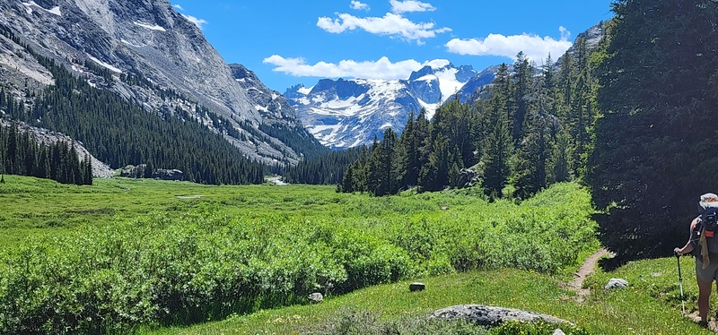
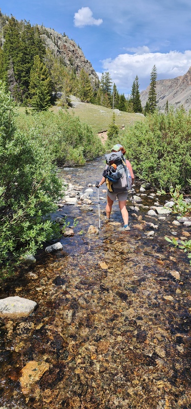
Now in the last valley, we were finally approaching the two notable creek crossings on the Glacier Trail. We also started to come across descending parties who shared beta on the snow conditions. Everyone we spoke to had good things to say about the snowpack, but warned us to start early due to quickly warming conditions. When we made it to Klondike Creek, we were a little confused by the trail disappearing into the willows around the stream, and we ended up venturing northwest to hop across some rocks at a steeper section of the creek. Once across, we rejoined the trail and found that the proper crossing involved walking upstream into the ankle-deep creek for maybe 150' or so at approximately 43.229487, -109.592790. We took this path on the way out and found it easier than the bushwhacking towards our riskier but narrower crossing onthe way in. 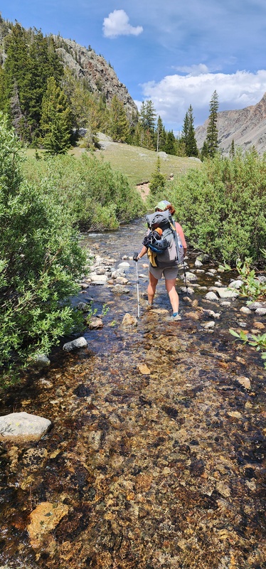
Two miles later, we made it to the Gannett Creek crossing. This one did not have any logs across, as I had seen in a few prior trip reports, nor did it have an obvious rock-hopping path as hinted at by another party we passed, but it did have a large cairn on the other bank indicating that it was a good spot to cross (approximately 43.207412, -109.614993). The creek was flowing strong, but was only knee-deep, and we made the crossing quickly with no issues. 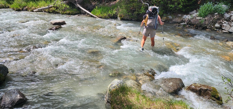
We were getting tired from the long day by this point, but decided to push all the way to Tarns Camp anyway with the hopes that it would give us a good view of the summit route we were to attempt the next day. After another few hundred feet of elevation and a mile and a half or so, we found a good camp with a view back across the creek. It was easy to rock-hop across the creek this close to the source, but I did smash my shin on a hidden rock punching through a snow bridge on the far bank. 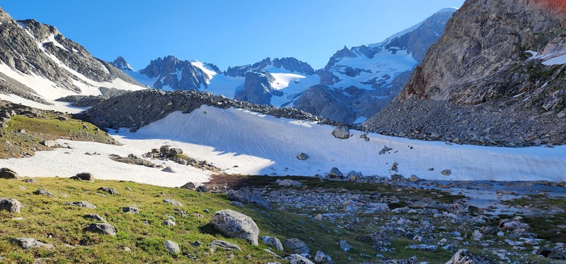
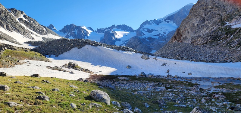
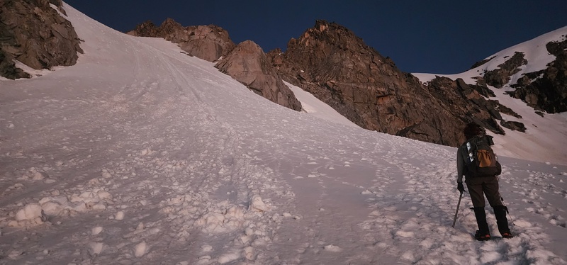
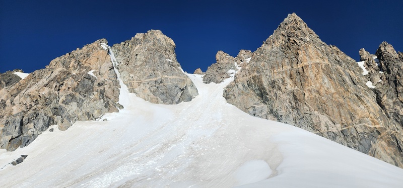
From our camp, we could see a bootpack sneaking underneath the Gooseneck Pinnacle, as well as some ski tracks coming down the looker's left side of the northern-most arm of the Dinwoody Glacier. We could also see that the middle arm of the glacier between Woodrow Wilson and Pinnacle Ridge, as well as the East Couloir up Pinnacle Ridge, appeared to be filled in nicely - but based on other trip reports I read, I knew that there would be unseen crevasses lurking high up on those snowfields. We set alarms for 2:00am and went to bed under clear skies excited about Summit Day after the long hike in. Splits (from Garmin): Sunday July 5, 2026 We woke up to a bright moon that washed out most of the night's stars. After breakfast, we broke camp at about 2:45am and made our way back across the creek via the lingering snowfield at the moraine's small headwall. It was a little tricky to follow the trail through this moraine in the dark - its large, loose boulders reminded me somewhat of the amphitheater under Pyramid or Kilpacker Basin underneath Wilson. When we could, we walked along flat snowfields, and eventually made it to the dry, loose 400' northwards ascent to the "Upper Bench" under the bergschrund. In my opinion, based on the conditions of the day, this was the hardest part of the standard Gannett climb. The loose, small rocks, wet dirt, and steep pitch reminded me of the unpleasant gullies up to the ridges on Challenger or Little Bear. At the Upper Bench, we donned our crampons and made our way up around the Gooseneck Pinnacle, to the area where the bergschrund would be. The snow was perfect - firm and secure, and continuous all the way to the ridge. We decided not to use the rope, and instead made quick work of the 200' climb. 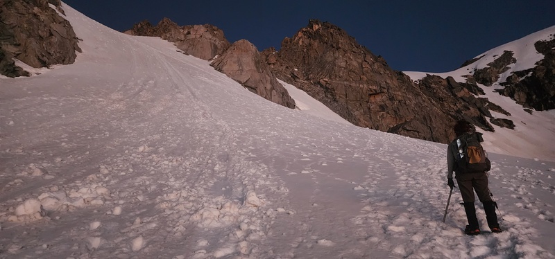
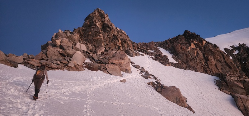
Once on this shoulder ridge, we passed through several more interchanging snowy and rocky sections before finally arriving at the base of the summit ridge. 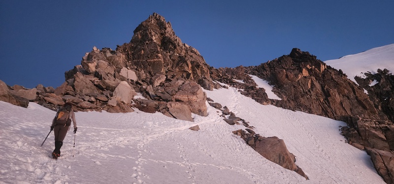
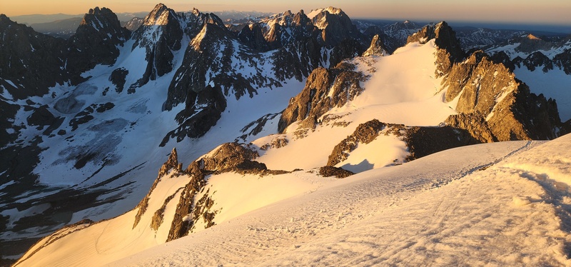
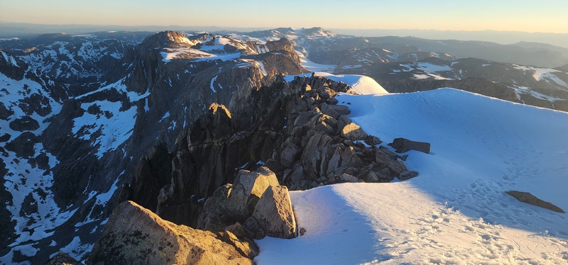
After an easy 300' up a moderate incline, we made it to the summit ridge. This section was wide and snowpacked, so we made quick work over to the summit and reached the top of Wyoming just before 6:15am. This early in the morning, the sun cast a wonderful golden glow on the snow and the rocks, so we quickly snapped some summit pictures. 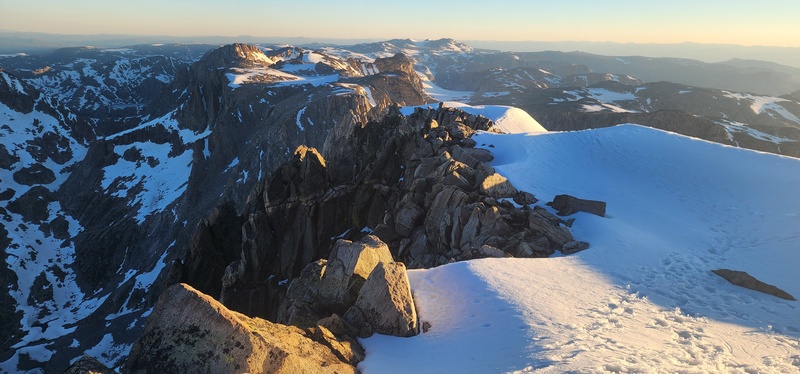
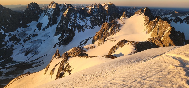
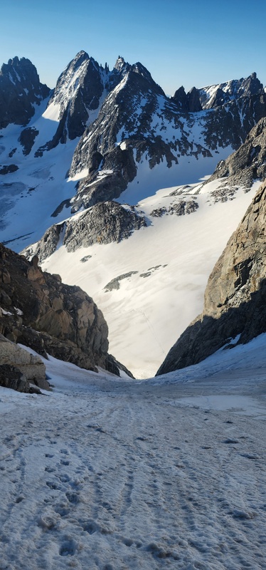
Since we had made such good time to the summit, and since the snow conditions were still perfect, we decided to start an attempt on the 13ers south of Gannett along the ridge. I had some cell service at the summit, so I pulled up John Kirk's LoJ report from August 2025 that included a few helpful pictures of the upcoming peaks. We backtracked halfway down the ridge and descended 100' to the top of the Southeast Couloir, which proved to be the start of the ski line we could see from camp. Descending this couloir was definitely the most dangerous part of the day. Due to its high surrounding walls, the sun had not yet hit the snow, leaving it rather icy in spots. The slope approached and possibly exceeded 45* continuously through the 600' descent, and we turned to downclimb face-in in places. We did not rope up or rappel in this couloir, but it might have been nice to have a second axe. Although it wasn't quite as steep as Old Chute up Hood, it felt more consequential due to the longer runout, and we were grateful to finally reach the Dinwoody Glacier at its base. 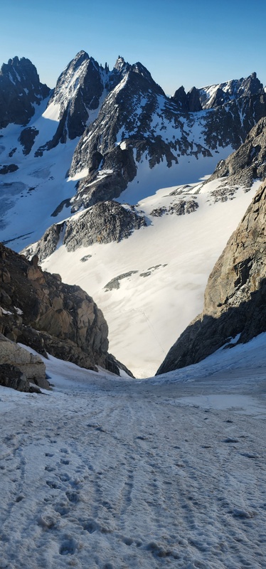
On the glacier, we roped up and quickly ascended to the base of the East Couloir on Pinnacle Ridge. 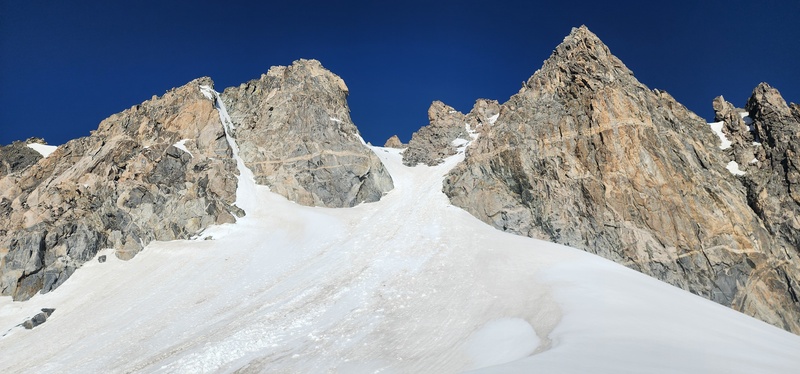
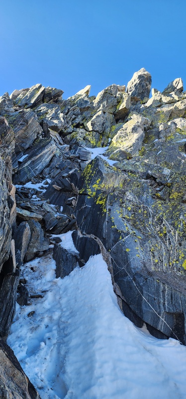
However, this eastern aspect was warming incredibly quickly. By the time we reached the top of this 40* couloir, at only 8:30am, we were sinking to our shins. We left our snow gear at the narrow saddle and scrambled up the icy 4th class gully towards the summit ridge. We didn't need to use the rock pro in this gully. The summit boulder is rather obvious, but reaching it smears the line between class 4 and low class 5 in my opinion. There is a 7' boulder just east of the summit pinnacle that requires precise foot placement and few hand pull options to climb. The moves aren't hard, but they are very exposed - aside from a 5x5' landing area, there are thousand-foot drops on either side. Once you are on top of this boulder, which fits 2 people, you can step over to the summit pinnacle, which fits 1. 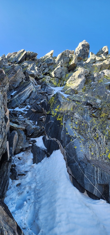
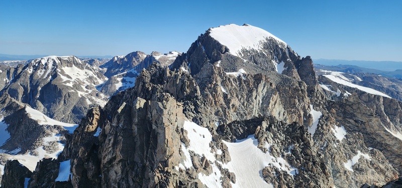
You get a very nice view of Gannett to the north and the Titcomb Basin 13ers to the south from this vantage. 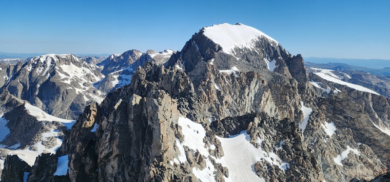
I didn't like the downclimb off of the second boulder, so I slung the rope and made a very awkward 7' rappel. ktandgoose simply slid down the rock until she got her foot to the blind hold and made a much quicker job of it. We did not rappel back down the gully, but there are plenty of places to build an anchor there if you want to. Back at the saddle, with deteriorating snow conditions, we decided not to climb Woodrow Wilson and instead descend the Dinwoody Glacier back to the standard Gannett route. The traverse to Woodrow Wilson would have involved dropping and regaining a few hundred feet on the glacier across 30* snow, and then an ascent up another steep, snow-filled gully. Instead, we threw the rope around a solid horn and rappelled down the top, steepest 60' of the East Couloir, kicking down roller balls and pinwheels in the warming snowpack. Once we got to a safer spot, we practiced building a few snow anchors. The ice screw blew immediately in the compact but soft snow, as we thought it would, but a vertical picket and ice axe held and ktandgoose made another 100' rappel. We roped back up at the base of the couloir and retraced our path back underneath the Southeast Couloir, then mostly followed the ski tracks down around a few crevasses and dry patch on the glacier. Past the steepest section, we opted to glissade a little until we reached flatter slopes where we could walk back to the standard trail on the moraine. We made it back to camp just before noon after a 9-hour summit push. Although we didn't get Woodrow Wilson, I was happy to have climbed a rather obscure, technical peak. We are probably the first 2026 summit party, as there were no sign of footprints up there nor any claimed ascents on Peakbagger or LoJ. Additionally, if I seriously pursue the rest of the Wyoming 13ers, Pinnacle Ridge would have been an awkward one to orphan. Splits (from Garmin): After an hour's nap, we packed up camp and started the long hike out. We made it as far as the horse camp on the other side of our shortcut ford and set up for the night. The mosquitos here were the worst we encountered on this trip. Splits (from Garmin): Monday July 6, 2026 We woke up at 6:30am on Monday, knowing there was a long hike out and a long drive home. After killing 50 mosquitos at breakfast, we were on the trail by 7:45am. From this camp, there was a long grind back up to Star Lake, and then a gentler climb back up to Arrow Pass. We ran into a few NOLS groups on the pass who were grateful for my outdated and inaccurate World Cup updates. The afternoon wore on uneventfully, but eventually our tired feet made it back to the car around 3:45pm. We drove to Lander for milkshakes and burgers, but the burger place had an hour wait that we couldn't afford. Instead I just got a second milkshake. We made it back to Denver at midnight after a long but satisfying trip, happy to have bagged a peak that's been on my mind for the last 4 years. Ultimately I think it's a shame that the rangers provided such negative outlooks. They clearly hadn't received any trip reports yet this season, but I can only imagine the snowpack will get more difficult as the season progresses and the bergschrund opens up. I think our larger group would have been able to find the same success that we did, but with a trip as daunting and far away as Gannett, its understandable to want to have a secure idea of what to expect. From the ranger's perspective, I suppose it is also understandable to err on the side of caution and make sure prospective climbers are well aware of the risks they face. But if you have a good weather window, confidence in your skillset and endurance, and nothing better to do over a long weekend, why not take a trip up to the Winds? You might just be rewarded for it. At the very least, the huckleberry milkshake in Lander might make it all worth it anyway. Splits (from Garmin): Thumbnails for uploaded photos (click to open slideshow): 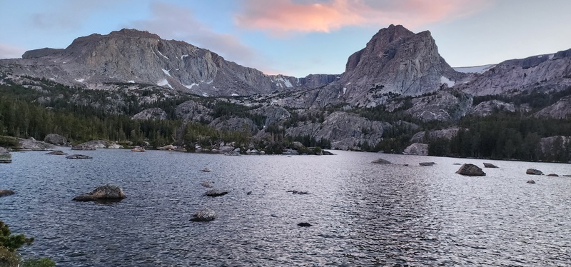
|
| Comments or Questions |
|---|
|
|
Caution: The information contained in this report may not be accurate and should not be the only resource used in preparation for your climb. Failure to have the necessary experience, physical conditioning, supplies or equipment can result in injury or death. 14ers.com and the author(s) of this report provide no warranties, either express or implied, that the information provided is accurate or reliable. By using the information provided, you agree to indemnify and hold harmless 14ers.com and the report author(s) with respect to any claims and demands against them, including any attorney fees and expenses. Please read the 14ers.com Safety and Disclaimer pages for more information.
Please respect private property: 14ers.com supports the rights of private landowners to determine how and by whom their land will be used. In Colorado, it is your responsibility to determine if land is private and to obtain the appropriate permission before entering the property.



 Download GPX file used in this map