| Report Type | Full |
| Peak(s) |
Organ Mountain - 13,808 feet |
| Date Posted | 07/08/2026 |
| Date Climbed | 07/02/2026 |
| Author | Stiffler_from_Denver |
| The Gash of Organ |
|---|
|
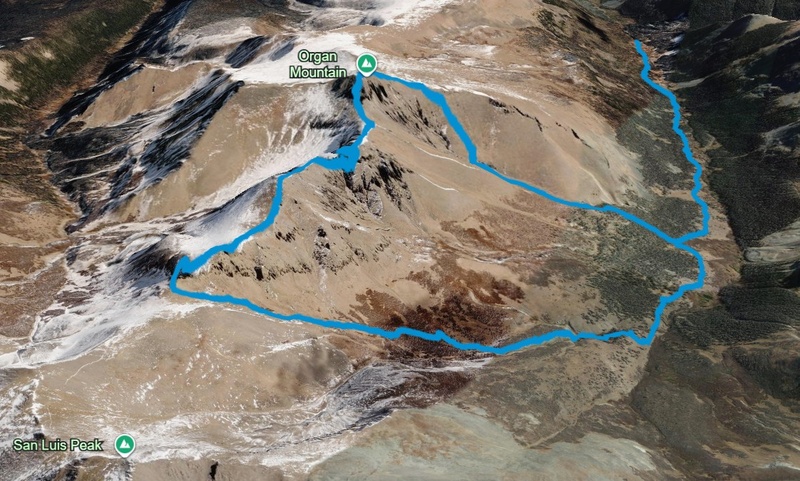
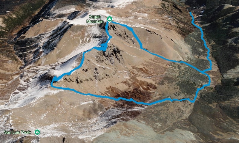
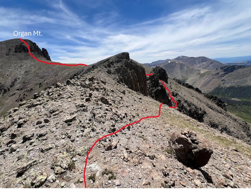
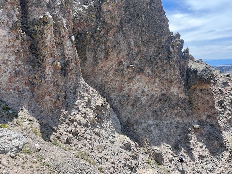
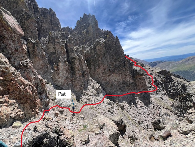
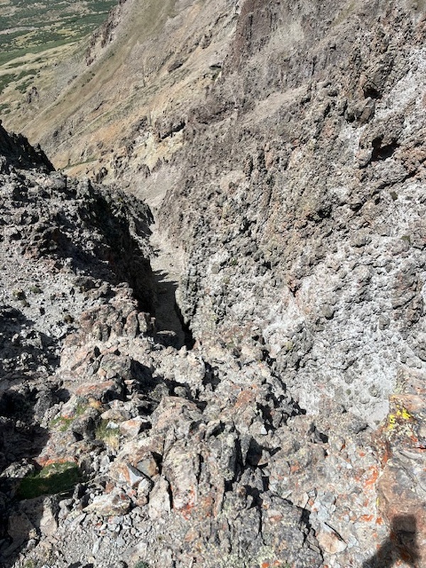
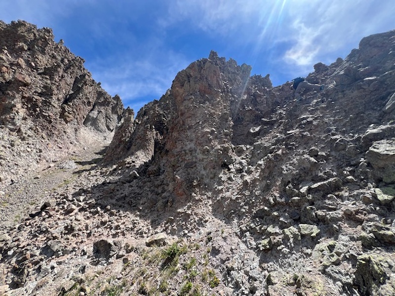
Purpose: Detail the route across the west ridge of Organ Mountain between the 14er San Luis. Ascent Party: Stiffler_from_Denver and Colorado Trail Patrick Itinerary: Day 1-drove from Denver to Eddiesville Trailhead; camped by Stewart Creek. Day 2- cleaned trees off Colorado Trail for 7 miles as part of my adopter obligations for Colorado Trail Foundation, camped 4.3 miles from trailhead. Day 3- climbed the southern slope variation route up Organ Mountain, climbed down West Ridge/Stewart Creek Cutoff Trail, packed out and drove home. Quick Notes about West Ridge between Organ Mountain and San Luis: * The rock looks like really enjoyable Crestone Conglomerate knobby fun climbing, but it is very loose. * We went up the class 2 southern slope variation route and descended across the west ridge which included the "gash." I think it would have been easier to ascend what we descended climbing around the "gash." If I did it over again, I'd ascend via the West Ridge then come down the easier East or South slopes. * We descended to 13,150 feet in elevation around/below the "gash" on the south side * Researching the route, I imagined the "gash" as a notch that you climb through, when in reality you lose a surprising amount of elevation to bypass it. * Despite its name, you don't climb through the "gash" like it's a notch in the ridge. Instead, you descend roughly 350 feet below the ridgeline, contour around the obstacle, and then climb back up. * You should be very comfortable with route finding. 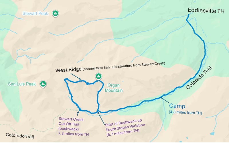
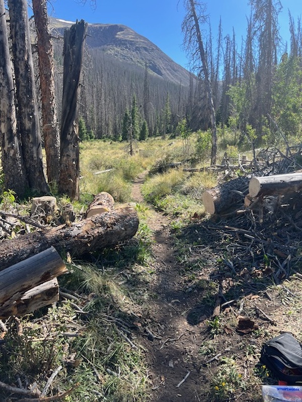
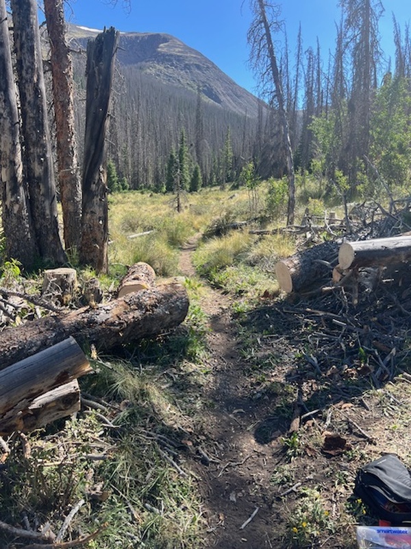
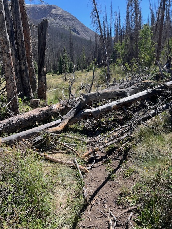
I became a Colorado Trail Foundation adopter of this segment in 2023 after I hiked the trail in 2022 and fell in love with thru hiker culture and the CT. I even wrote a book about it called "Trail Headspace; Finding My Best Self on the Colorado Trail." (It's a great read if you'd like to learn what it's like eating Poptarts for a month and hanging out with people with names like Caddyshack, Wangler, and Spoons.) As an adopter, I'm responsible for walking the section twice a year, keeping the down trees clear of the trail and the streams from draining on it. Here is an example of the satisfying work I did on the trail this trip. 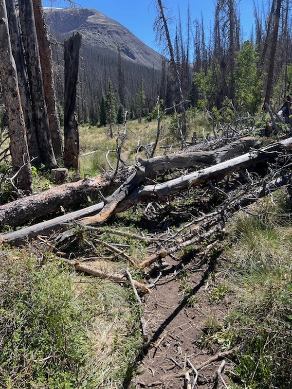
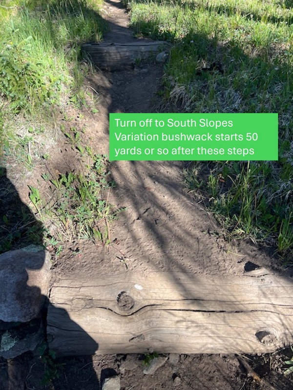
On summit day, we left camp at 7:10am. We hiked about 2.5 miles from camp on the Colorado Trail sticking close to the Cochetopa River until you get your first view of Organ Mountain on your right. The summit is blocked by a southern flanking ridge until then. The turn off to begin the bushwack through the trees comes right after you pass these steps. 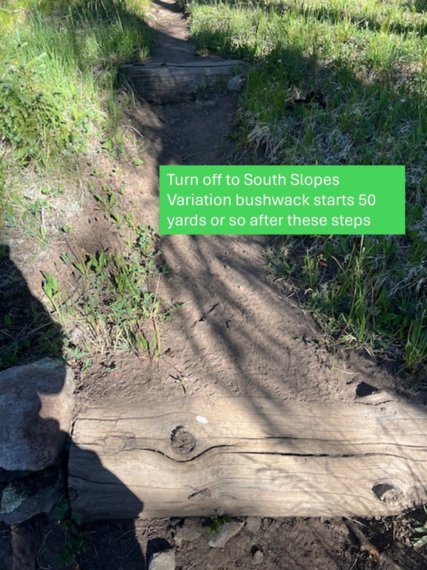
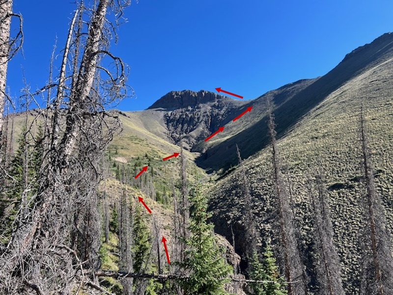
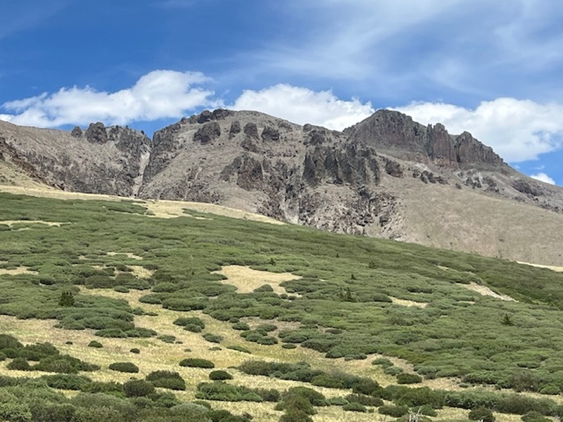
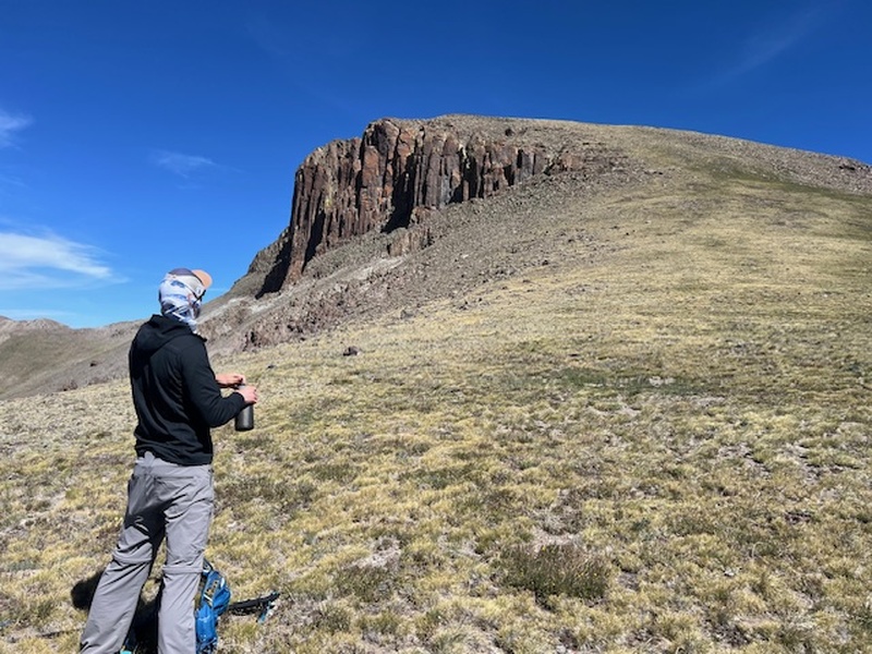
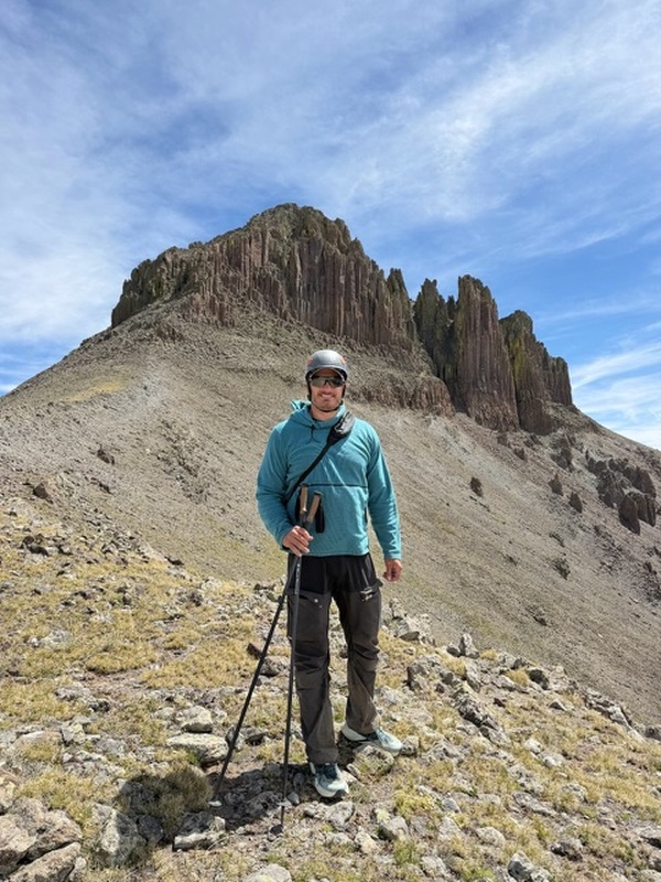
By Colorado 14er standards, this qualified as an easy bushwhack. It was more of a bush stroll. I've stumbled through other terrible bushwacks in the past that required crawling over deadfall, squeezing through willow thickets, and periodically stopping to reconsider every life decision that brought me there. It wasn't long before we had a great view of Organ's south face. 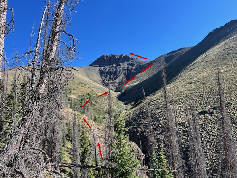
We gained the ridge after a steep slog at 10am. 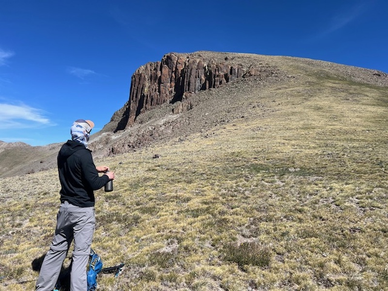
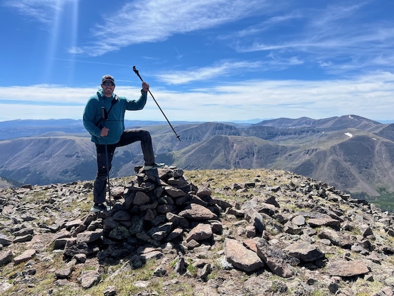
We were on the summit at 10:30am. 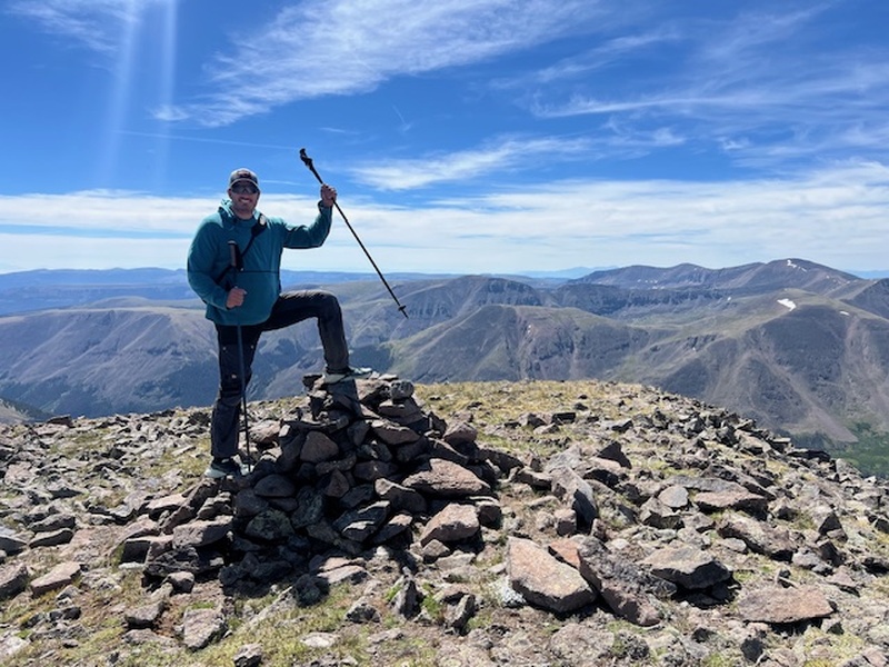
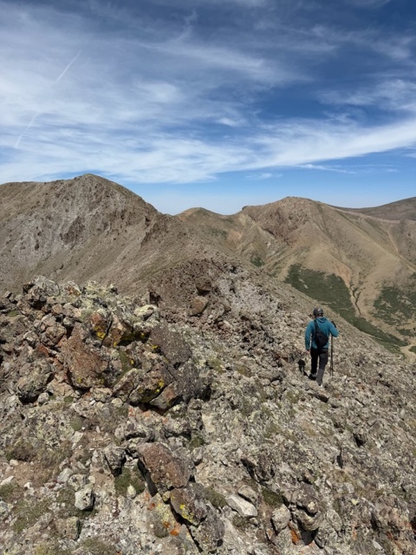
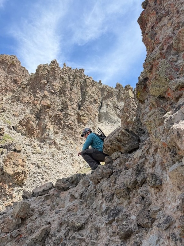
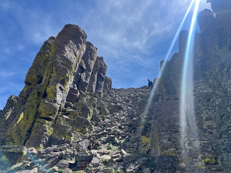
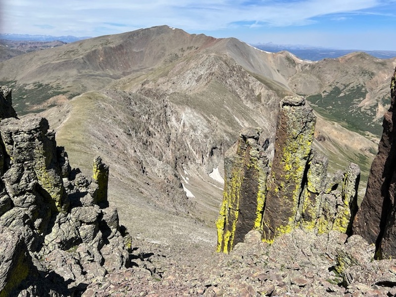
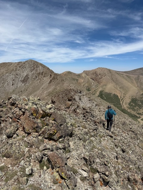
We chose not to ascend the West Ridge because of its reputation. We wanted to get a summit, evaluate the weather, and if possible, go research the West Ridge's "Ghastly Gash" as Gerry Roach calls it. Early in the day with great weather we descended the West Ridge. Here are some shots on the descent from the summit. A bit loose but great character. 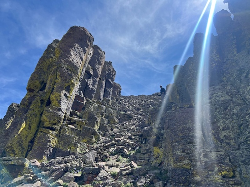
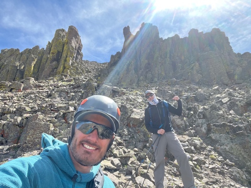
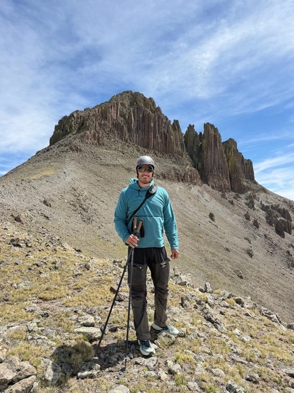
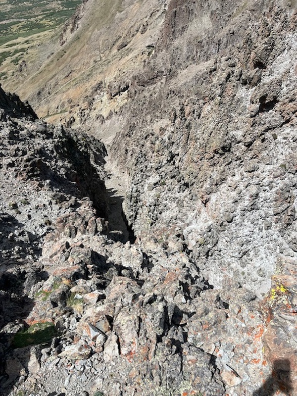
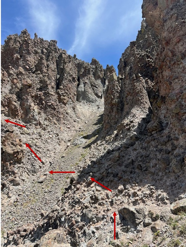
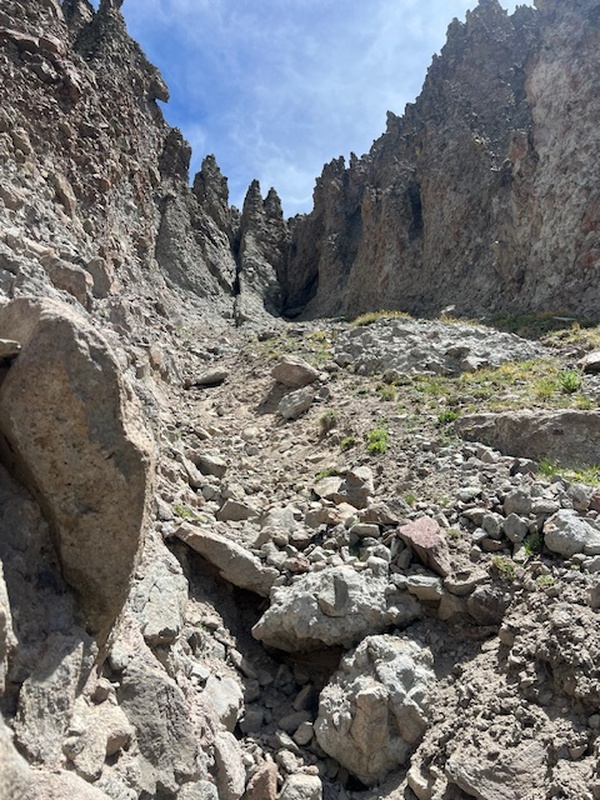
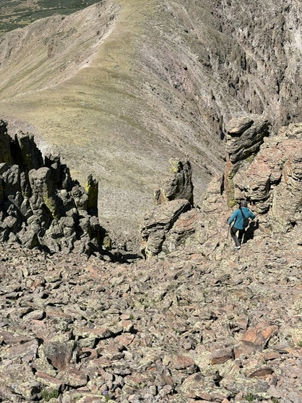
After checking out the gash, we retreated a bit easy on long the ridge and dropped elevation at that first tower. 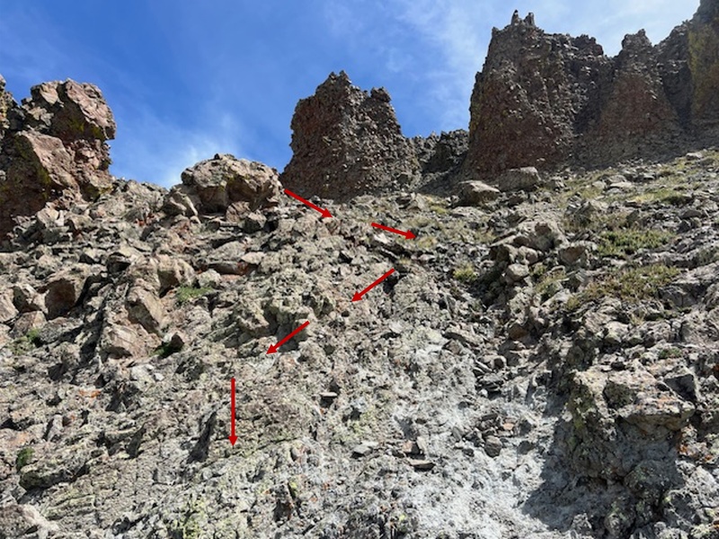
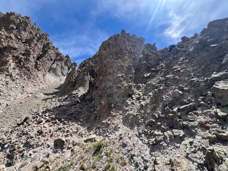
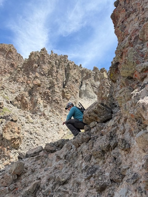
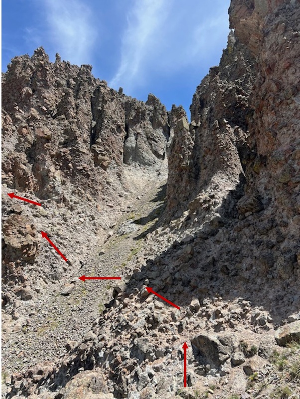
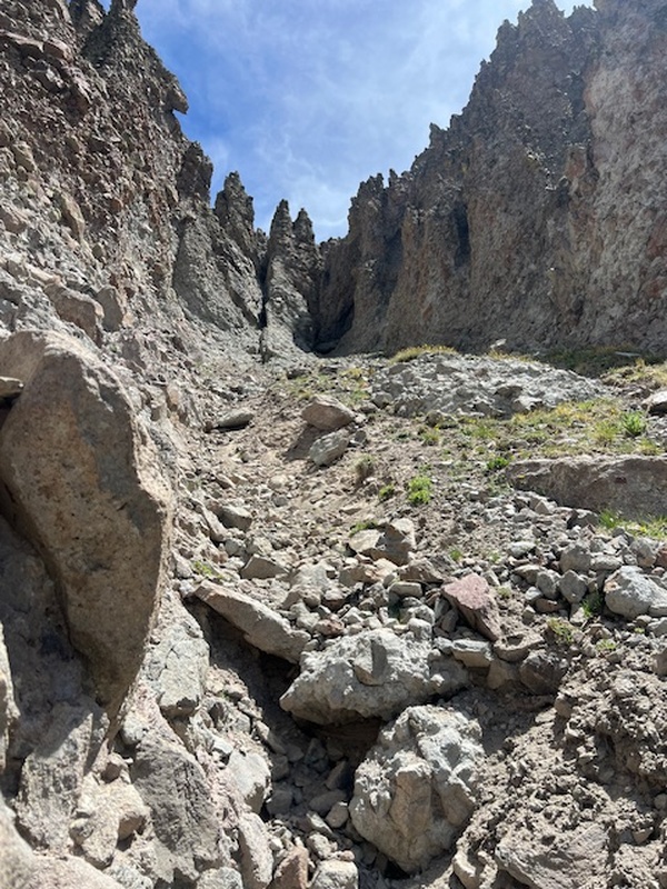 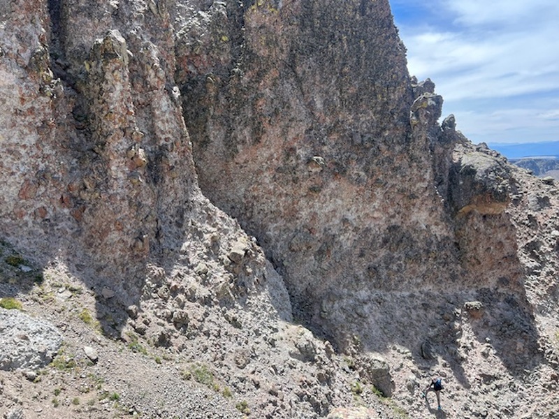
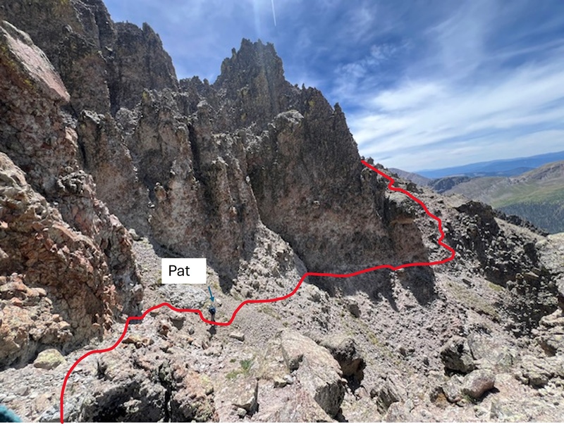
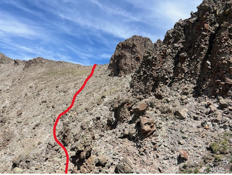
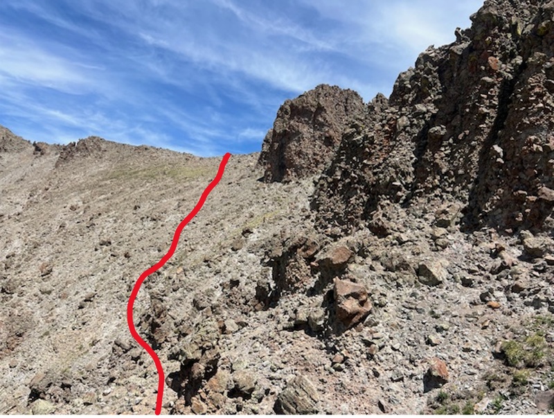
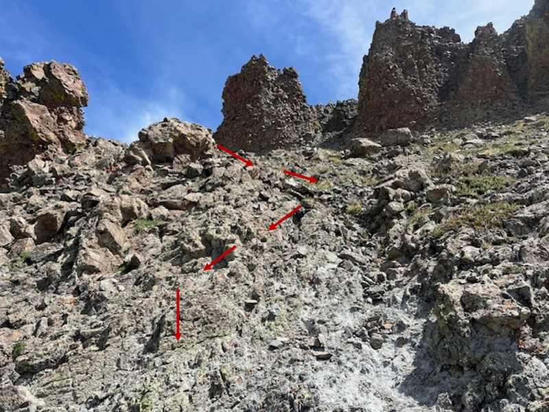
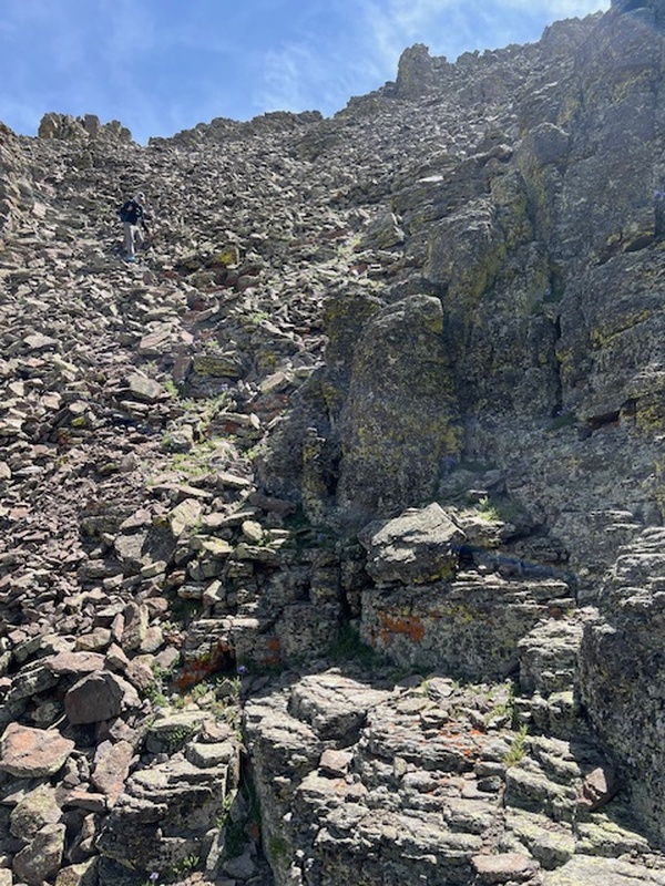
Here is the best beta I can provide of the route south of the Gash. If crossing from San Luis, I'd start angling down south at the boulder on the right. 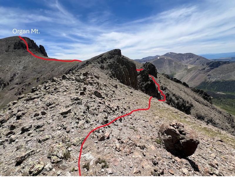
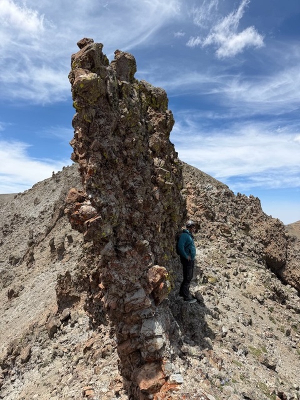
There is still some fun scrambling across the ridge once you're passed the gash. 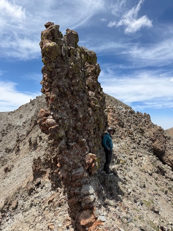
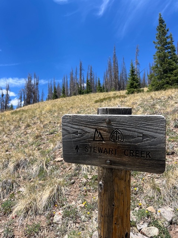
We met up with the standard route up San Luis and began our descent on the Stewart Creek Cut Off Trail. 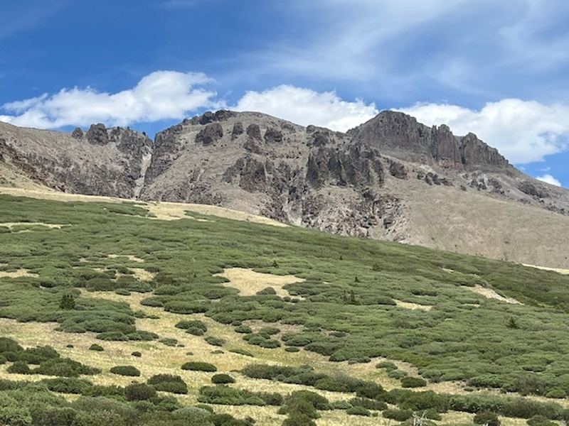
After some meandering through some willows, we followed the drainage back to Colorado Trail. 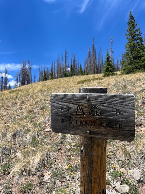
We were back to camp at 3:30pm. Thumbnails for uploaded photos (click to open slideshow): 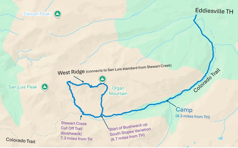
|
| Comments or Questions | |||
|---|---|---|---|
|
Caution: The information contained in this report may not be accurate and should not be the only resource used in preparation for your climb. Failure to have the necessary experience, physical conditioning, supplies or equipment can result in injury or death. 14ers.com and the author(s) of this report provide no warranties, either express or implied, that the information provided is accurate or reliable. By using the information provided, you agree to indemnify and hold harmless 14ers.com and the report author(s) with respect to any claims and demands against them, including any attorney fees and expenses. Please read the 14ers.com Safety and Disclaimer pages for more information.
Please respect private property: 14ers.com supports the rights of private landowners to determine how and by whom their land will be used. In Colorado, it is your responsibility to determine if land is private and to obtain the appropriate permission before entering the property.



 Download GPX file used in this map