
| Report Type | Mini |
| Peak(s) |
Mt. Alice - 13,319 feet |
| Date Posted | 07/06/2026 |
| Modified | 07/07/2026 |
| Date Climbed | 06/20/2026 |
| Author | Monster5 |
| Alice - Central Ramp |
|---|
|
Mount Alice Central Ramp, 5.8, 6 pitches, 1,200 feet. ~17 miles/ 5.5k'/ 14 hours RT from Wild Basin. Gear: standard double rack to 2 with optional 3. 60 m fine. Microspikes used in early season. Ax carried/ not used. 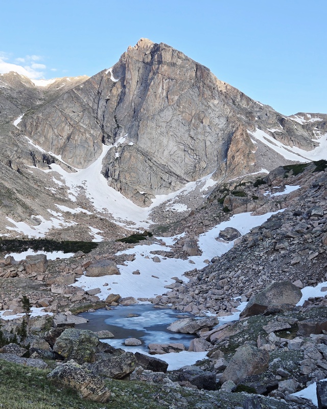
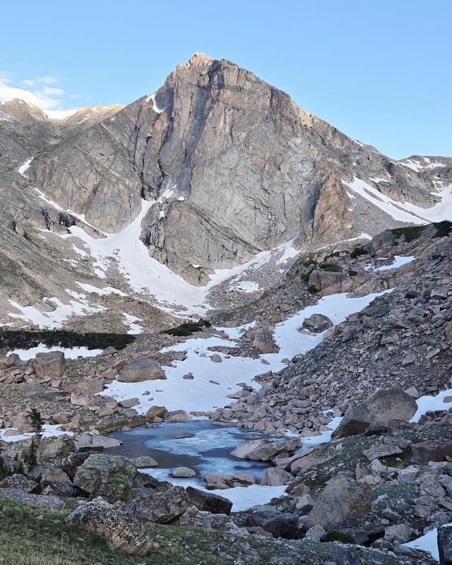
I thought this was a rewarding route - possibly the best < 5.9 moderate rock climb in all of Rocky Mountain National Park. I suspect the lackluster reviews are mostly due to route-finding and the long approach, so here are a few notes that may help. With a good forecast, my buddy Jake and I left Wild Basin Trailhead sometime around 5 AM. We promptly missed the campground turnoff on the right, adding about 0.5 miles to our approach by way of Ouzel Falls. It was scenic with ups, downs, bridges, waterfalls, and bonus mileage. I mostly passed the time probing Jake about his hidden blog, untouched by AI, and complete with trip reports of our past excursions. What kind of friend keeps a secret blog? While complementary, I'll just say some of his facts were a tad creative. We traversed in just above Lion Lake No. 1 near treeline, leaving the trail around 11,100 feet elevation and gradually gaining elevation in the basin. Scattered cairns and animal trails lead through, and the bushwack not too bad until the talus fields. We left one pack at 11,400 feet elevation, donned harneses, and strapped on microspikes for the entry snowfields. Several approach options are readily apparent from here: left on moderate snow, center by 4th class wet scrambling, or right via another reputedly loose left angling grassy ledge. The 4th class was more of the traditional variety, so perhaps stiff for Colorado. 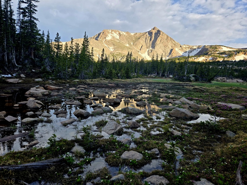
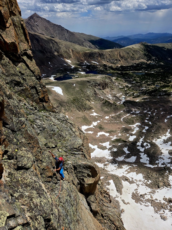
We scrambled up for a few hundred feet, gasping in the early season altitude with both of us having spent the last week at sea level, and angled left to the obvious start of the Central Ramp - a flatiron-esque cracked slab of southeast-facing granite bordering the steeper east face. I regretted forgetting to filter water, and sucked greedily at the snow melt. We scrambled higher, trying to pass snow to access the obvious 5.8 dihedral start on left, but a boulder came crashing down amidst a cloud of dirt, so we opted to belay from a convenient ledge and climb a Pitch 1 variation. 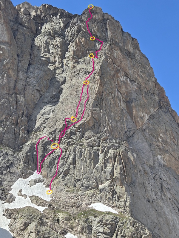
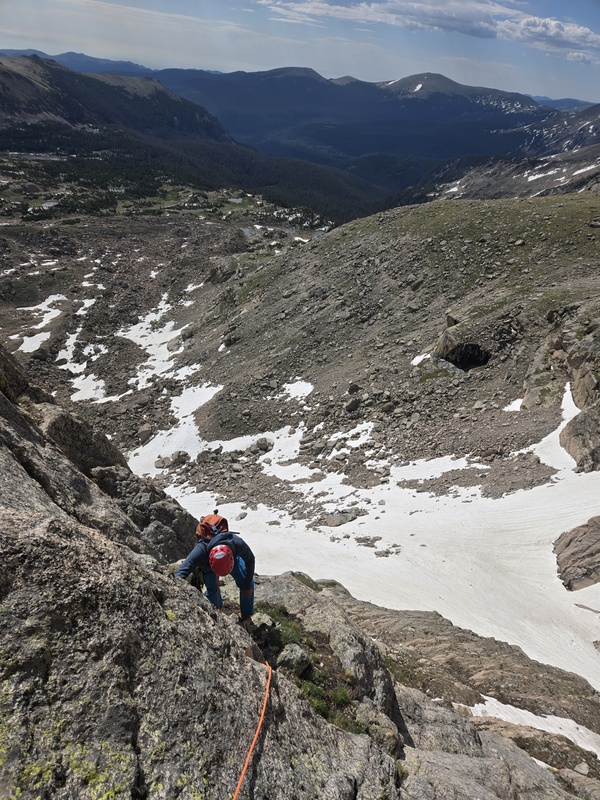
Pitch 1 (5.6-5.8, 200 feet). The left variation is a 5.8 dihedral, often with snow covering the access. At the end, it is important to step down and right ~100 feet to stay on the Central Ramp route. The center variation and perhaps standard is a 5.6 chimney, where one must step right again at the end perhaps 50 feet. The right variation climbs 5.7 flakes and chimney terrain and leads directly into the P2 chimney. We took the right variation and it seemed solid and good. 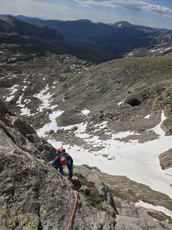
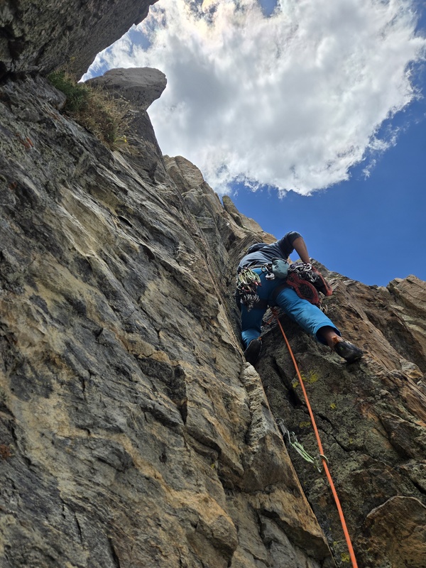
Pitch 2 (5.8, 150 feet). Climb up the chimney and step left at a neat roof (crux) to obvious bail slings. At the slings, surmount the roof and tiptoe hard right 20 feet on a friction seam to the base of an obvious dihedral on the flatiron proper. The actual start may gain the flatiron by staying right of the chimney, but I'm not sure. Either way, this pitch was high quality. 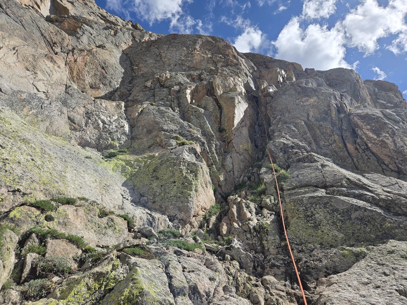
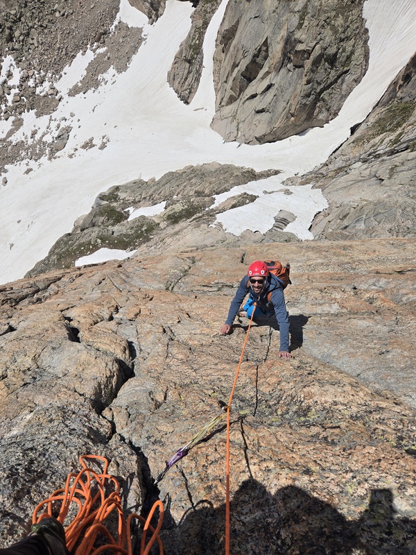
Pitch 3 (5.8, 200 feet). Follow the center-right side Lumpy-esque cracks up the ramp, with a couple potential variations of similar grade. As the cracks peter out or veer left, it is easy to slab straight up or slightly right to higher crack systems. 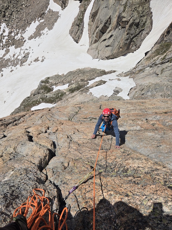
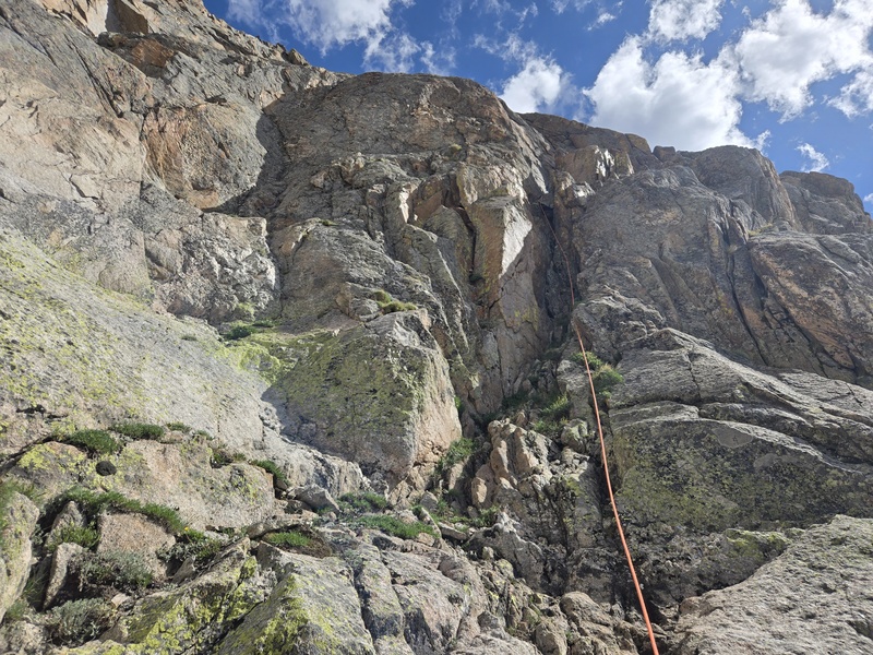
Pitch 4 (5.8, 200 feet). Continue up the cracks as the terrain becomes more broken, eventually reaching an obvious ledge and roof system. Belay high at the base of the steeper walls, and slightly right towards a gully system. Pitch 5 (5.7, 150 feet). There is really only one viable way to go at the grade. Continue slightly up and right in the gully system until reaching darker rock of banded schist, then tiptoe traverse left on the black bands to the base of a stembox dihedral with a brief hand crack on left. It's possible to climb straight up to this same dihedral as well. This is the left-most dihedral than can be accessed at the grade from the band traverse. If rope drag is manageable, continue 40 feet up the initial stembox at 5.8 and belay before a left leaning/facing dihedral. 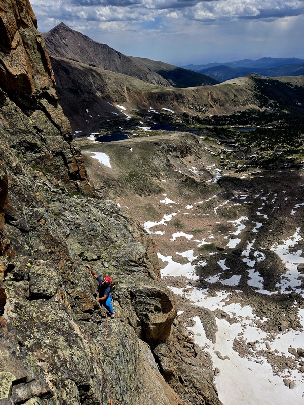
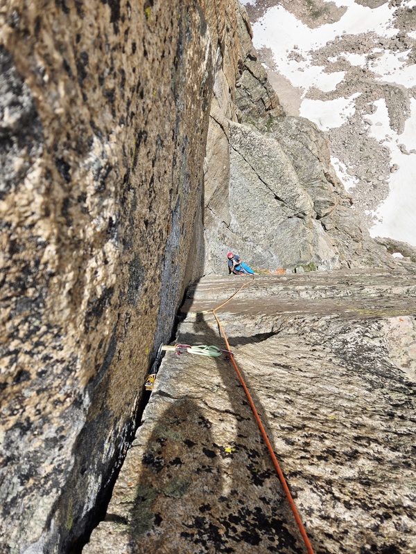
Pitch 6 (5.8, 200 feet). This is the money pitch, and may be better split as two pitches depending on rope drag management. Climb the initial stem dihedral until a beautiful white quartz left leaving/ facing dihedral. Once at the dihedral, a gorgeous splitter hand crack appears. While mostly perfect hands, there are a couple spots where thinner or wider hand sized pieces can be placed; especially helpful if your partner placed all the hand sized pieces in the belay! Above the dihedral (place a long runner), look right and up toward a basketball-sized chockstone resting in a chimney which in turn splits a roof and steep wall. Aim for the chockstone chimney, passing a juggy but steep section immediately below the chockstone. I was able to place good gear and chimney around the chockstone. Jake fully yarded on the chock and reported it solid. Another 30 feet of easy climbing leads to the top out around 12,950 feet elevation. 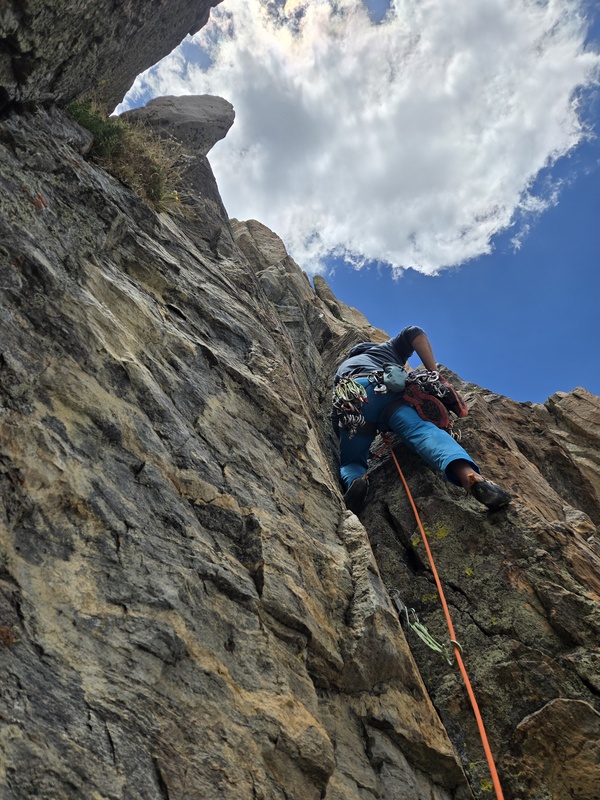
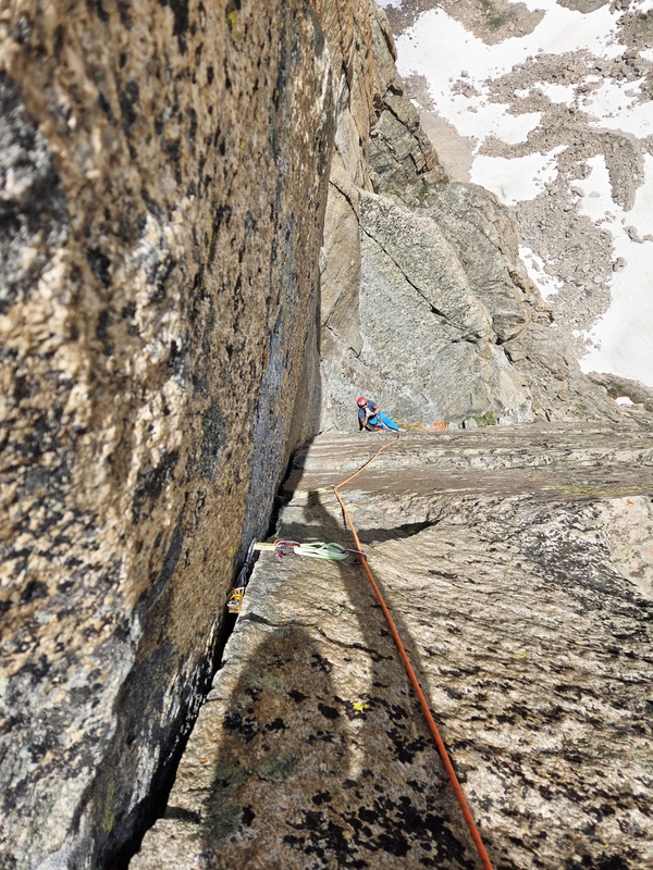
Continue up class 2 terrain to the summit. We were baffled at how gassed we were at the summit, and I once again disappointed to have brought only a few hundred calories. Descend down the class 2 south/southeast scree and tundra gully back to the packs and approach. If you did not leave anything at the base, descending south to the Boulder-Grand Pass at class 1 or north by the Hourglass Ridge at class 3 are also options. Still, the mostly downhill 8-9 miles out were relatively painless, and we moved faster than expected once back on the main trail. 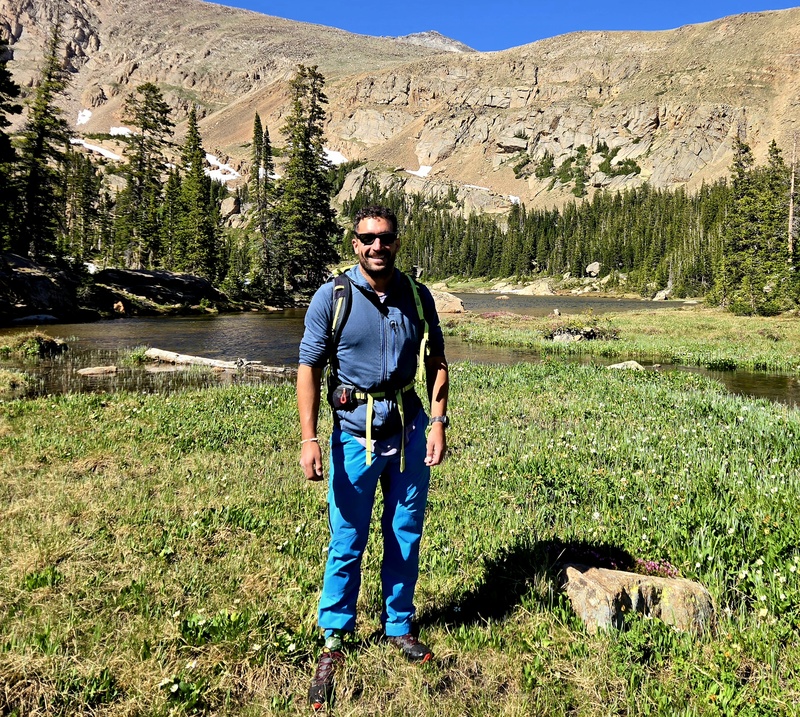
Thumbnails for uploaded photos (click to open slideshow): 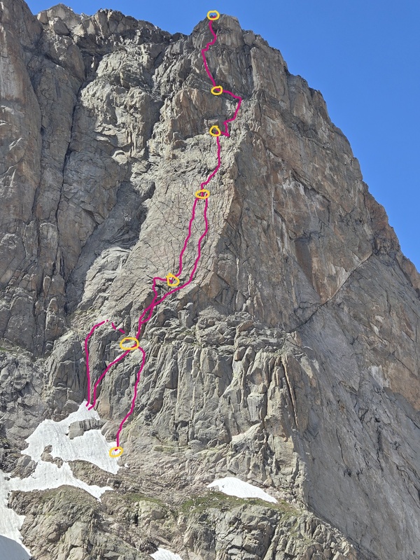
|
| Comments or Questions | |||
|---|---|---|---|
|
Caution: The information contained in this report may not be accurate and should not be the only resource used in preparation for your climb. Failure to have the necessary experience, physical conditioning, supplies or equipment can result in injury or death. 14ers.com and the author(s) of this report provide no warranties, either express or implied, that the information provided is accurate or reliable. By using the information provided, you agree to indemnify and hold harmless 14ers.com and the report author(s) with respect to any claims and demands against them, including any attorney fees and expenses. Please read the 14ers.com Safety and Disclaimer pages for more information.
Please respect private property: 14ers.com supports the rights of private landowners to determine how and by whom their land will be used. In Colorado, it is your responsibility to determine if land is private and to obtain the appropriate permission before entering the property.



 Download GPX file used in this map