
| Report Type | Full |
| Peak(s) |
Ama Dablam 22,349 ft Island Peak 20,305 ft Lobuche East 20,075 ft |
| Date Posted | 04/21/2026 |
| Modified | 04/23/2026 |
| Date Climbed | 10/15/2025 |
| Author | ericahlstedt |
| Ama Dablam, Island Peak, & Lobuche East - October 2025 |
|---|
|
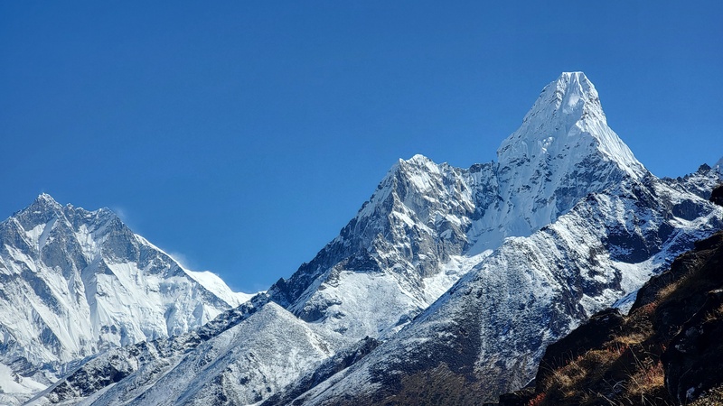
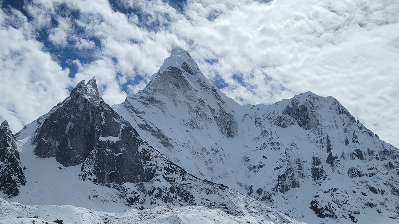
In October 2025 I traveled to Nepal to try to link Lobuche East, Island Peak, and Ama Dablam over 31 days, carrying all of my own gear and moving independently. It ended up being one of the most demanding and uncertain trips that I have done. In this report I'll break down how I approached my training, permits/costs, gear choices, and a full itinerary with daily recaps for anyone considering a similar objective. Feel free to AMA as well! The seed for this trip was planted in 2022 during the incredible and highly recommended 3 Passes Trek, where the formidable and captivating Ama Dablam dominates the skyline for days on end. I knew I wanted to come back to see if I was up for the challenge and the more I learned about it, the more it pulled me in. Ama Dablam means “The Mother's Jewel Box” in Sherpa, recognizing the huge hanging glacier as the jewel and the sweeping ridges as the mother’s arms cradling it. It's also known as the “Mountaineers Mountain”, the “Matterhorn of the Himalaya,” and the “most beautiful mountain on the planet”. Edmund Hillary, the first to summit Everest with Tenzing Norgay, famously said that Ama was “beautiful, but unclimbable.” That kind of reputation has a way of pulling you in. 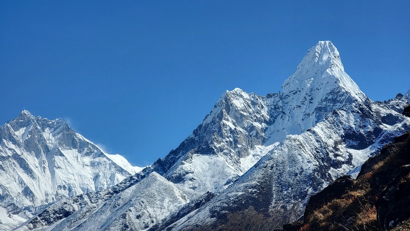
My strategy was a bit unconventional. Instead of using high camps and doing rotations up and down the mountain for weeks to acclimate, I acclimatized by climbing other peaks first and incorporated a variation of the 3 passes trek to see more and new parts of the Khumbu valleys. I let the progression of the trip itself handle acclimatization. This approach let me cover more ground, see less visited, quieter parts of the Khumbu, and arrive at Ama Dablam adapted to altitude. In hindsight, it worked mostly as I had hoped. Training/prior experience- My training was not structured in a traditional sense and that was intentional. I didn’t go to a gym, run, or follow a formal plan. I just stayed consistent with what I already do: long days in the mountains. Throughout the summer and fall I regularly climbed/scrambled/hiked 13er/14ers with a few bigger days aiming for 10,000ft of vert/20 miles in a day by doing bigger peak single day linkups, like the Maroon Bells traverse with Pyramid peak, the Longs Peak Radical Grand Slam, the Chicago Basin 4, Ellingwood Ledges into the Crestone Traverse. I racked up 20 different 14ers and 48 13ers over this time. I also mountain bike for cardio and rock climb outdoors (multipitch alpine trad leading to 5.8 which is great for developing route finding skills and comfort with exposure) regularly and do a bit of ice climbing leading to WI3. The biggest emphasis was time on feet, having fun on new peaks, vertical gain, and being comfortable moving all day through varied terrain. All of this was stuff I’d be be doing anyway; the side benefit was dialing in long-duration output, fatigue management, and nutrition. I did a few peakbagging multi day backpacks as well in the Weminuche to get used to carrying a heavier pack for multiple days. Going into this trip I had experience on a mix of high-altitude and technical peaks including Pico Orizaba, Cotopaxi, Rainier, Gannett & Granite, Grand Teton via Upper Exum, and Island Peak while doing the 3 Passes Trek. With the itinerary I had planned, I figured whatever deficiencies my lead up training had, would be fixed while getting stronger/conditioned as my trip progressed. In my experience, consistency, big vertical high mileage days, strong route finding skills, comfort moving on mixed terrain, and experience managing fatigue over long efforts matter more than a plan. None of it needs to look like a training plan to work. Permits/Costs- The total including flights was $8935; here is the breakdown.
Note: I arranged my permits while in Kathmandu, but one can acquire climbing permits in Lobuche for Lobuche E, and Chukkhung (Cafe de Imja Tse / Sunrise Lodge) for Island Peak. You can also hire a guide for those climbs there, as well as rent necessary gear. This is relevant if you are simply trekking in the area. Prices are much cheaper than going through most agencies. Gear- Since I had decided to carry all of my own gear, weight and versatility were major considerations. My setup leaned towards lightweight/minimal, but still protective enough for what I had planned and overall I was happy with how it performed and wouldn't change much.
The G2SMs were excellent for all 3 peaks, never had issues with cold feet. The Jimmies foldable sandals were nice for wearing in the teahouses
My clothing/layering system worked well by keeping me warm up high and cool at lower elevation on sunny days by avoiding sweating, which leads to being cold/wet/ and worst of all, stinky. I can’t speak highly enough of the La Sportiva Olympus Tech Belay parka, the weight to warmth ratio is excellent since it uses 1000FP down. I really like the ridge merino solstice pro for its ¼ zip and chest pocket for quick access items as well. Main takeaway is having a flexible layering system for a range of temps and conditions was key.
Have had good luck with the ex oficcio briefs for many days without becoming too funky
My strategy here was to have a clean pair of heavy & liner socks for Island/Lobuche, and Ama Dablam, as well as a rotation of trekking socks and a single pair of lodge/sleep socks.
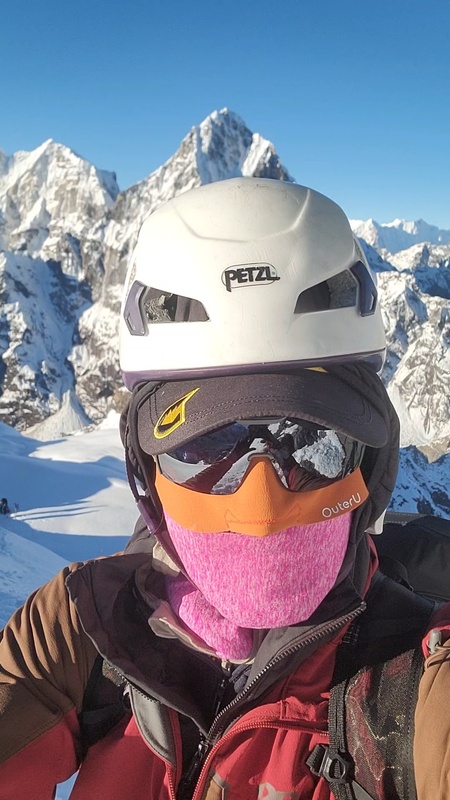
Sun exposure is no joke at these altitudes with much stronger UV radiation with less protective atmosphere. I saw many people with blistering and 3rd degree peeling sunburns. I was able to not get sunburned once by having a good full coverage system of varied glove thicknesses based on temps, sun hoodies with thumb holes, and the OuterU bala / faceglove system which is super cool since it has a face hole, and top of head hole to help with temperature regulation and the faceglove that attaches to sunglasses to protect the nose and cheeks. It might look sort of silly, but I'll take looking a bit like a goober over getting horrible sunburns anyday. 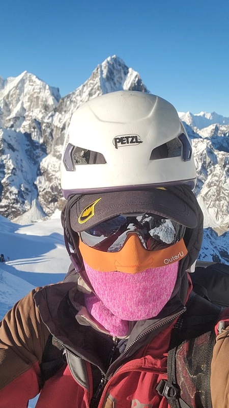
The unaweep handled the heavy load well and the ultralight matador pack was perfect for summit days. A cool feature of the unaweep is the talon attachment system that allowed me to carry my 6000m boots securely on the outside.
The polar ranger is another great item that weighs a bit less than other -20 bags and is more packable with unique features to retain heat and make it more user friendly.
Protip with ascenders is drilling a small hole in the thumb tab to put a piece of cord through to be a pull tab, makes it much easier to operate with thick gloves on.
I like the steripen for cleaning water if I am somewhere with uncertain viral contamination. The tabs are a lightweight backup option that I didn’t use. Having a pee bottle is convenient in the tea houses as well as basecamp tents. Next time I would have one larger than 1L though.
Baby wipes can be restocked in Dingboche along with other incidental items, its the last major village with shops carrying more items. I find baby wipes to be worth the weight, instead of toilet paper, which isn't nearly as hygienic on such a long trip. Lyocell Liteload Litesmith towels are tiny, only 17grams and 12.5x21.5in, but they are super absorbent, cost $2, and can be wrung out to continue more absorbing. Best travel towel out there for going ultralight and packable. Hand sanitizer is critical to help avoid getting sick. It's pretty much a miracle that I stayed in good health for the duration of this trip.
I brought basic meds and antibiotics for the area. Leukotape is the best blister tape in my opinion. Dexamethasone is a steroid that is used to treat HACE, i carried it for emergency use. Some people use Diamox to acclimate, I don't, it has its own side effects that don't sound that good to me and I trusted my itinerary to do the acclimatizing work for me.
I mostly brought the snacks that I know I like when fatigued to help fuel summit pushes. Most food came from the teahouses along the way. The GU roctane, overdosing it, gets 1000 calories in a liter which is great fuel.
Key takeaways -
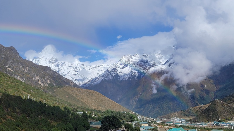
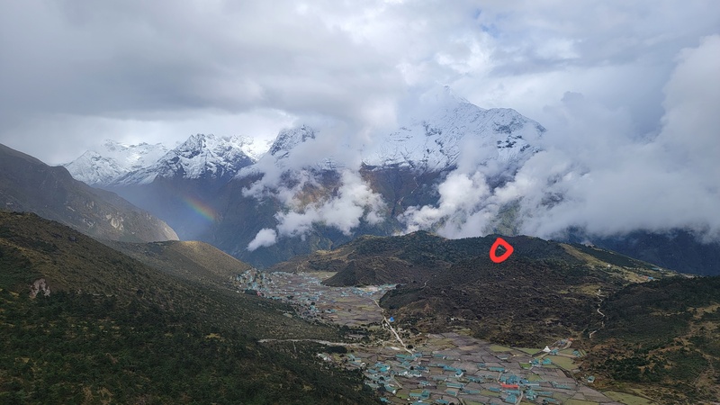
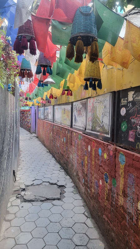
Itinerary- The following is a day-by-day breakdown of how the plan actually played out. Day 1- I drove to Denver from Durango the morning of Sunday Oct 5th and flew out at 5pm, arriving in Kathmandu at 9am Tuesday October 7th, about 35 hours of travel time, including 3 flights and 7 hours driving. Once in Kathmandu, I made my way to Wanderlust Hostel in Thamel to recalibrate after the long journey. Nepal is 11 hours 45mins ahead of Colorado, so you effectively “lose” half a day heading East, making your arrival be 2 calendars or more after your departure. Thamel is a chaotic & vibrant backpacker/traveler hub in the heart of the city; packed with people, shops, temples, aromas, sights, activity, and constant motion. After sorting out my climbing permits, I just wandered the streets. A few great places to eat are Dongfang Palace Beef Noodles, Forest & Plate, Yangling Tibetan. I had previously spent almost a week in Kathmandu so this time was just passing through, but the Pashupatinath temple, Durbar square, Boudhanath Stupa, Swayambhunath Stupa are all incredible and deeply historic sites worth visiting. Day 2- I headed to the airport early to catch a helicopter to Lukla, and then to Namche Bazaar (11,286ft), the main hub of the Khumbu/ Everest region. I opted for the more expensive helicopter because the alternative involves an overnight crammed full passenger van to the regional airport in Ramechapp, followed by 2 days of trekking from Lukla for most people. Most flights during the busy season to Namche are diverted to Ramechapp to avoid congesting the capital’s airport. I had done that on a prior trip to save money, but ended up getting sick from someone with bronchitis during the van ride (a miserable 5 hour super bumpy ride overnight sandwiched between coughing people)and it took a while to recover. Fortunately on this trip I was extremely lucky and stayed in good health for the entirety of the trip. I also wasn't that interested in repeating the same stretch of trail since it would be quite warm and I wanted to conserve my energy for the rest of my trip. Once in Namche, I went for a hike up Khunde Peak (13960ft) which offered incredible views, including a rainbow framing Ama Dablam in the distance. I felt so lucky to be where I was. I passed chorten memorials to Edmund Hillary and his family, who contributed significantly to the Khunde community, including founding a medical center there. Khunde and Khumjung are well known for every household having a member that is a climbing guide, with many Everest summiters. 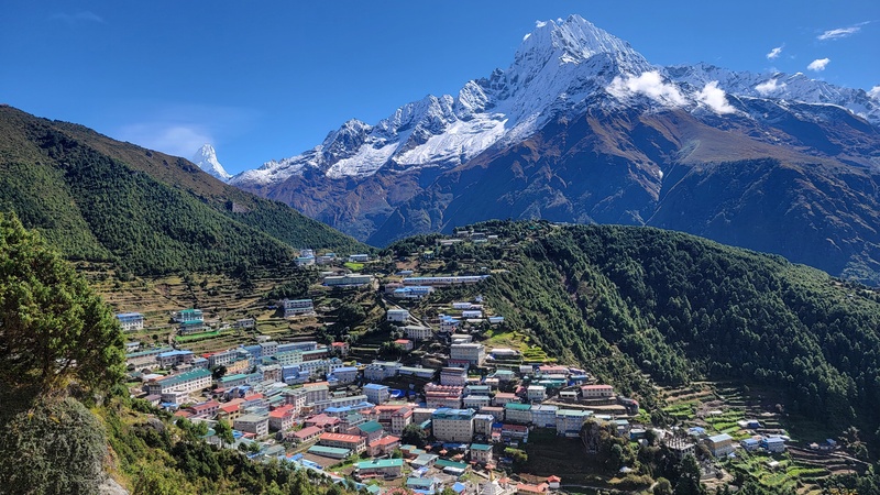
On the way down Khunde peak, I heard the sound of chanting and stumbled upon the Khunde gompa/monastery where the locals and monks invited me in as they were just about to commence a 3+ hour world peace ceremony (how fortuitous of a sign the rainbow framing Ama was, the energy was palpable) that was full of incense, horns, cymbals, chanting, milk tea, rice tossing (which my poor technique gave them all a good laugh) and they even gifted me a silk scarf as a blessing. It was such a special cultural experience and I felt lucky to be a part of it. It was a rare moment of stillness before everything became about movement and objectives. I left the monastery feeling excited for what other surprises would unfold on this trip. I ran back down the trail after sunset with just enough fading light to make it back to Namche for the evening. (5.85mi, 2580ft) 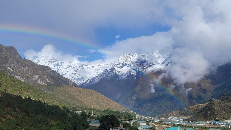
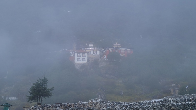
Day 3 – I realized I had lost my glacier glasses on Khunde peak somewhere, so I went back up in the morning to try to find them, no luck. To make the most of the day, I continued on a nice loop hike where I got on top of Jaro Ri “12945ft”(a scenic viewpoint between Khunde/Khumjung with a nice observation platform on top that has intricate Buddhist sculptures adorning it), through Khumjung (stopping at the delightful Ngima bakery café for some tasty treats and caffeine pick me up), by the Everest View Hotel and back to Namche to buy new glasses. (7.3mi, 2900ft) 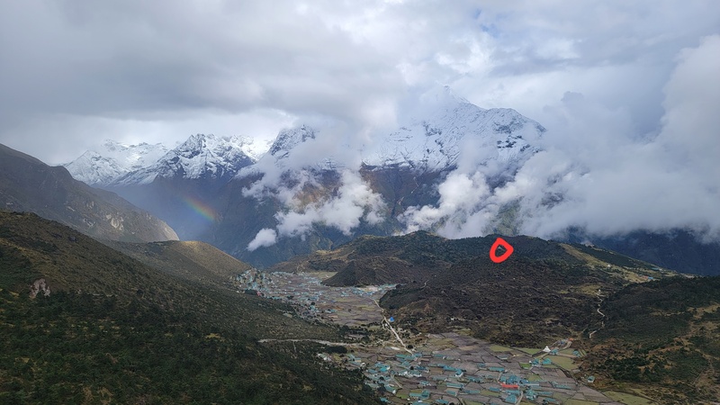
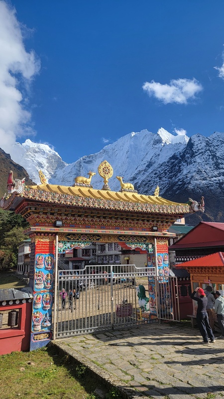
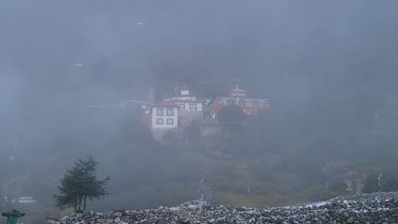
Day 4- I had a later start today waiting for the bank in Namche to open to receive a money transfer. From there I headed to Tengboche (12645ft), staying at the Rivendell Lodge, a newer teahouse with heated blankets, hot showers, good food and apple pie ( a staple in the Khumbu), and even aroma diffusers, true luxury out there! The hike is mostly flat along a hillside with great views for the first 4 miles, followed by a 2 mile 2000ft climb, a real calf burner with a loaded pack. If you are in Tengboche in the afternoon you can catch the afternoon puja/prayer ceremonies in the prayer halls at the Tengboche Monastery, a historical and stunning construction that has some super intricate and detailed, massive sculptures and adorned with Buddhist art done by artisan monks that came from other parts of Nepal, Bhutan, and Tibet. It’s definitely worth a visit and a truly special place. (6.5 mi, 2550ft) 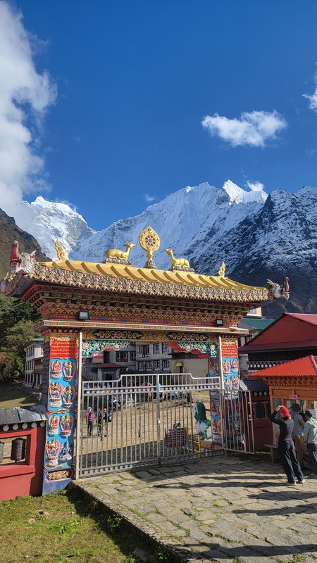
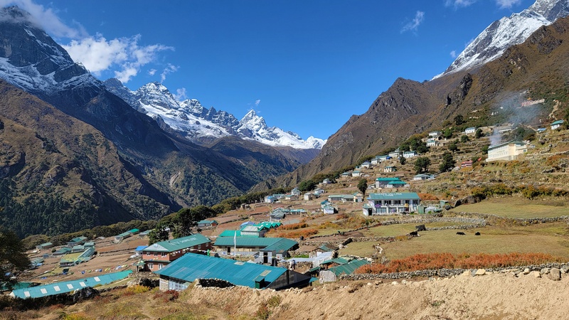
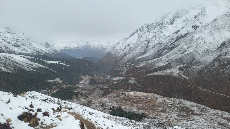
Day 5 – Leaving Tengboche, I made an attempt at Hamugon Peak (14960’), but turned around at 14k due to it becoming Very stiff class 4 that was covered in patches of wet snow over loose rock and dirt. The risk to continue higher given the conditions did not seem worth it to me, but if it's dry, it looks like an awesome summit and fun, spicy scramble. This was the first reminder that not everything would go to plan. The Tengboche monks will scramble up here to hang prayer flags. Monks/locals prioritize hanging the prayer flags higher up where the wind is stronger, since wind is the “messenger” that activates and carries the prayers, making the blessings and goodwill travel farther and more effectively. Even at 14k, it still provided great views of the whole valley and looking down on Tengboche. I then got off of the typical Everest Base Camp trail and continued on to Phortse (12,600ft), another village regarded for having the highest concentration of Everest summiteers and the home of the Khumbu Climbing Center founded in 2003 by Conrad Anker and Jennifer Lowe-Anker. The trails felt steep and taxing with a 55lb pack. (4.1mi, 2600ft) 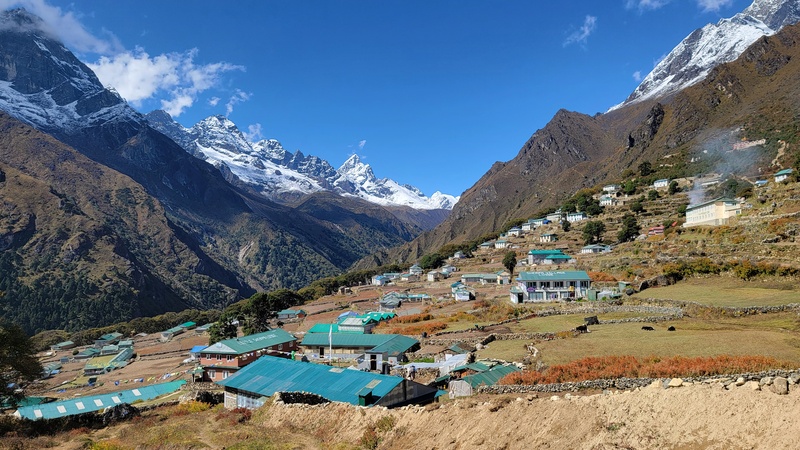
Day 6- From Phortse, my initial plan was to climb Luri Peak (17,000ft) but conditions weren't good, so I shifted gears and continued on toward the stunning Gokyo lakes. There are 2 options, the west side of the valley (going through Machermo & Dole), being more traveled and busier, or the east side of the valley, going through the small villages of Thare, Thore, and Nga. I opted for the East side, and didn’t see another person the entire day besides a few locals, farmers, and yak herders. It was very serene and tranquil to trek this quiet side of the valley and see traditional Sherpa life, away from the crowded EBC trail. I was the only person staying at the single rustic lodge in Nga ( 14,300’) with great views looking down the valley I had just come from. It was a peaceful evening. (6.4mi, 2500ft) 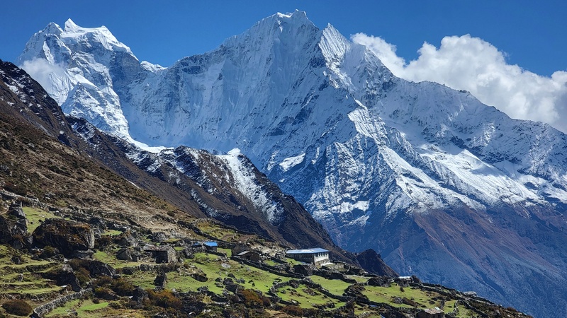
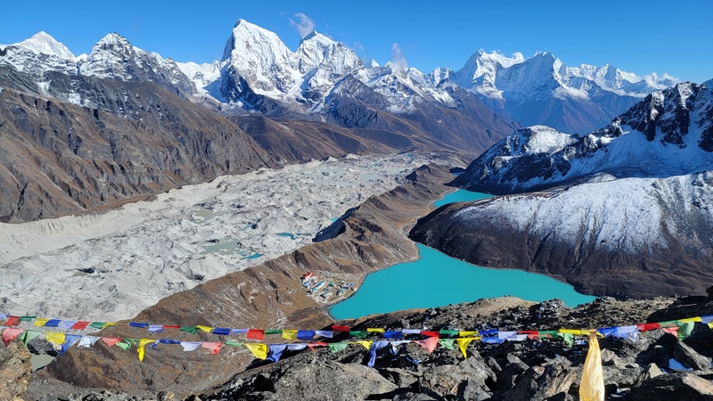
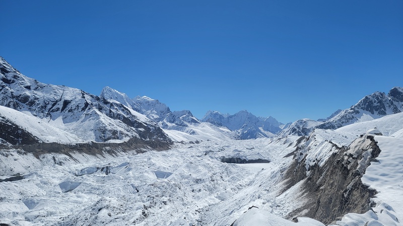
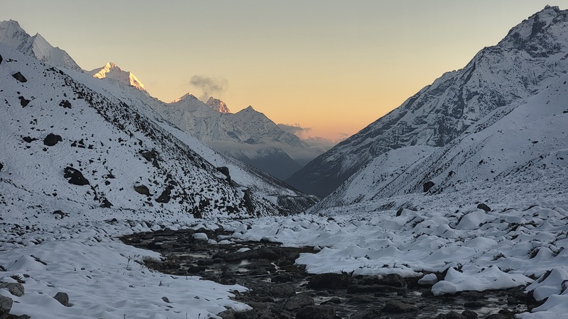
Day 7 - I departed Nga in the morning to make my way to Gokyo (15,584’). This is where the trail started to become much snowier than typical for this time of year. After passing turquoise Lake 1 and Lake 2, and ascending an endless calf-burning staircase gaining the moraine of the Ngozompa glacier, I arrived in Gokyo to find it totally covered in calf deep snow with paths still being shoveled out. Last time I was out here in October it was all totally dry. With climate change, October is no longer the guaranteed dry window it once was; November might be the safer bet for reliable conditions these days. After arriving at the Thanka Inn in Gokyo, I made a few friends and we hiked up a snowy Gokyo Ri (17575ft) for the sunset. Gokyo Ri has one of the best panoramic views on the planet, looking down on the Gokyo settlement, down the massive endless Ngozompa glacier (22miles long), and Gokyo lake, a brilliant large turquoise glacial lake, and alpenglow on Everest, Lhotse, Makalu, and Cho Oyu. This made for a really memorable evening. (5.5mi, 3200ft) 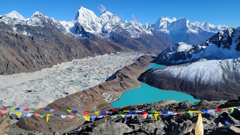
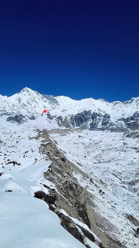
Day 8- After sleeping in and eating a large breakfast at the Thanka Inn, a new friend and I decided to make a day hike up to the 5th Gokyo lake which is near the Cho Oyu basecamp. The hike was pretty slow and energy-draining since the snow was unsupportable for much of it and the sun was super relentless. The views made up for the misery though, with more stunning views of the Ngozompa glacier and Mt. Everest. I wanted to hike up Ngozompa Tse (18,219ft),a viewpoint rumored to be even more incredible than Gokyo Ri, but didn’t feel like putting in the bootpack since nobody else had been up it yet. We returned to the cozy Thanka Inn for the evening, sharing travel stories with others and enjoying lots of tea. Thanka Inn is a great place to stay, right on the shore of the Gokyo lake, and it was constructed with insulation and double pane windows so it isn’t too cold inside, it also has a nice art gallery displaying Thankas (a beautiful style of Buddhist scroll painting)in the anteroom. (8.2 mi, 800ft) 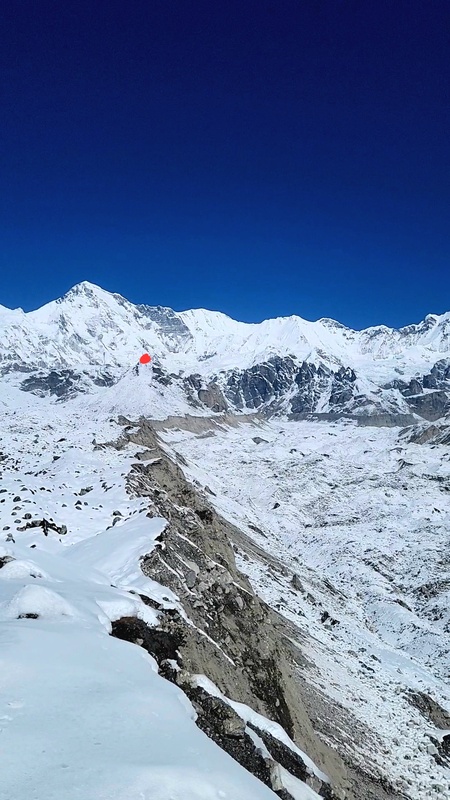
Day 9- It was time to leave Gokyo and make a crossing of the Ngozompa glacier to reach Dragnag (15420ft), the last settlement before crossing over Cho La Pass. Ngozompa glacier is a pretty crazy thing to cross. Full of loose rock, steep sidehills, and a wandery route that is rediscovered constantly by the locals of Gokyo and Dragnag. This was a short day to save energy for the pass crossing the next day. (2.3mi, 300ft) 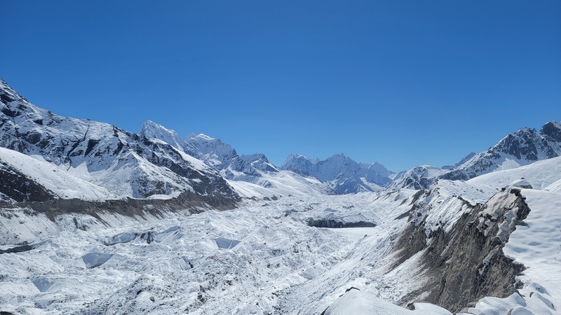
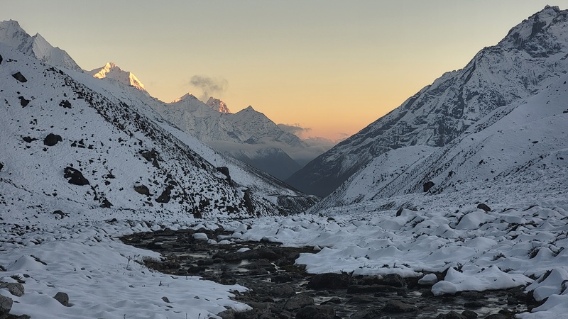
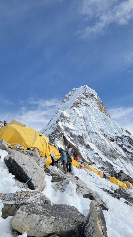
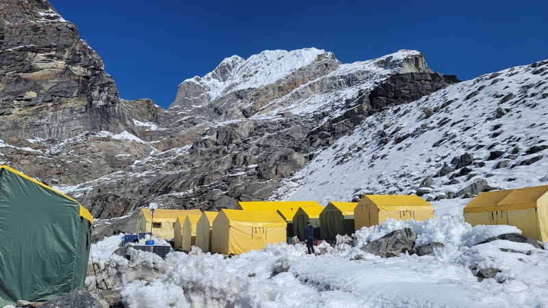
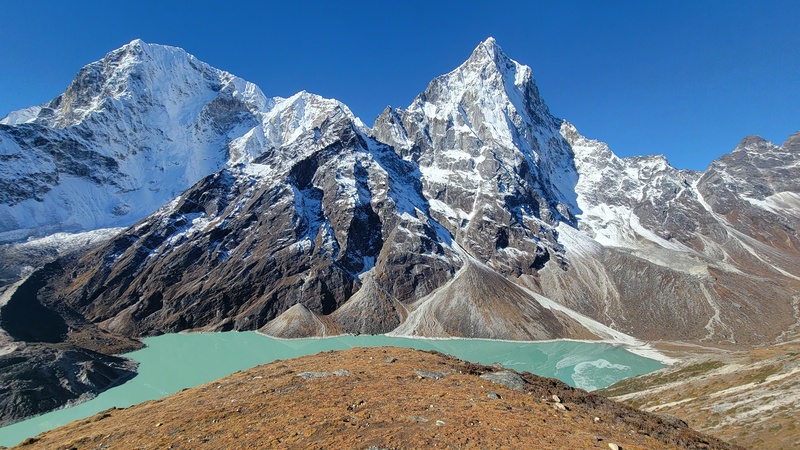
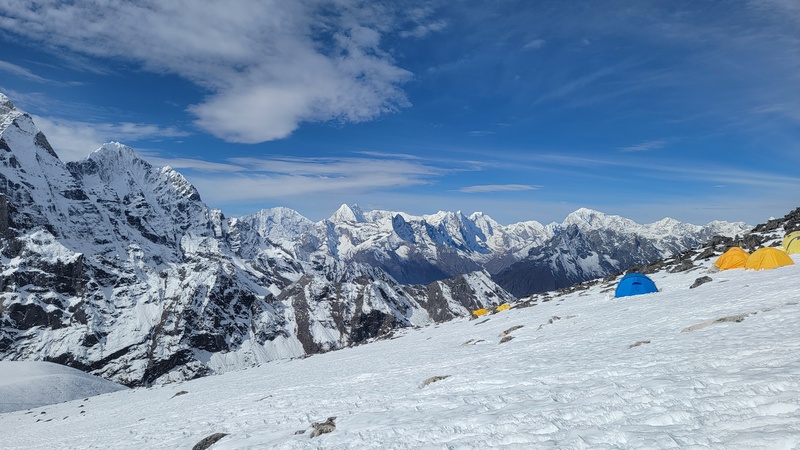
Day 10- I woke up early and made good time crossing Cho La pass (17,782). Most people cross the pass going the other direction, going counter-clockwise on the 3 passes trek, as it is more gradual and less demanding uphill that way, but I had wanted to spend time at Gokyo again so took on the steeper west side of the pass. It was quite challenging with my pack, but eventually I reached the top and soaked in the views. I could see Lobuche in the distance, my objective in a few days. In Dzongla (15850ft), the next village after the pass, I stayed at a brand new lodge, the Cholatse Guesthouse, which had great full wall windows looking down the valley and reasonably comfortable accommodations and good food. Speaking of food, I mostly ate vegetable egg fried rice and vegetable egg fried noodles. Meat options are not recommended out here due to being respectful of the local culture and lack of refrigeration (5.4mi, 2500ft) Lobuche E Day 11- Today I made it to the Lobuche high camp. This is a bit confusing because the high camp is the base camp. It is situated at a small lake at 17,060 feet. There is a lot of conflicting information online about this. Maybe it moves year to year, but this season, this was the only base camp/ high camp. It is a semi-permanent tent city with the Sherpa cooks staying there for months at a time, tending to camp and attending to climbers. The route is fully snow covered which isn’t typical. This ended up making things quite easy for me. Nobody else was in my camp. Other camps were a bit busier with guided parties planning their climbs, I believe the Nims Dai Elite Exped camp even has a starlink set up for those that need to stay connected (2.1mi, 1600ft) 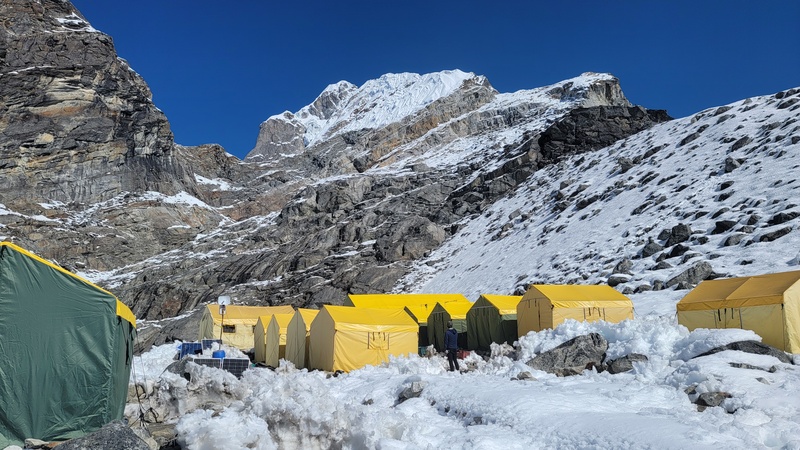
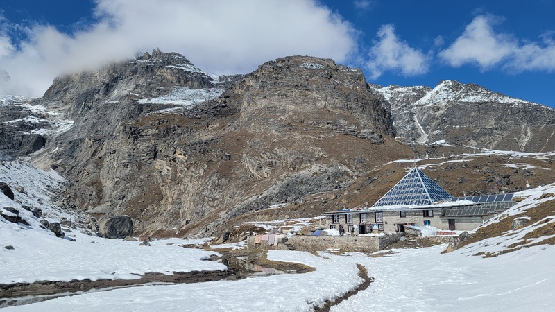
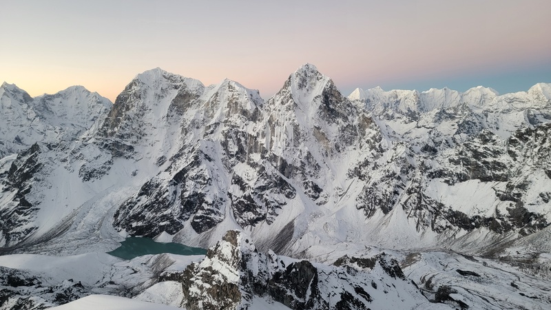
Day 12- I had an alpine start, waking up at 115am, had a breakfast of oatmeal and tea at 130ish, got ready, and started up at 215. I returned to base camp at 0730am. I had read online this climb would take 10-12 hours, so I was pretty stoked it only took about 5 for me. The sunrise on the summit was next-level with insane views of all of the Himalayan giants covered in the golden glow of the morning sun coming up and the climb itself was a pretty straightforward snow climb. Usually it's a lot more exposed rocks and scrambling, so the snow coverage may have made things faster than normal. There were a few fixed line sections that I just used as a hand line, or a forearm wrap, since kicking steps was plenty secure for me, I didn’t see a need to clip into them with an ascender. One interesting thing about Lobuche East is that most people don’t actually summit, and stop at a point/ false summit on the ridge that is at around 19,600ft, or just shy of 6000meters, so it is advertised a bit falsely for almost every guided operation that I have seen. When I got there, this is exactly what I found, prayer flags, anchors, and a guided group calling it, with the guides saying nobody goes higher. I noticed the ridge clearly continued higher, but there were no signs anyone had been up that way and I didn’t feel like it was worth the gamble solo to break trail in the deep and steep snow. Apparently this is standard practice as the true summit is another 2-4 hours round trip due to the route becoming a steep, narrow, exposed, corniced ridge that might involve a rappel to navigate a gap in the ridge. I think I made the right call being alone, because it looked like the loose unconsolidated snow might not be stable enough to continue to the true summit. The pack lunch that the cook had given me had some hard boiled eggs, a bottle of coke, and a snickers bar. I didn't end up needing any of it on the climb since I made it back in time for another breakfast. After resting in camp for a few hours, I got my stuff together and made the descent down to the iconic Lobuche Italian Pyramid , a historic research center that used to supply a lot of the Everest expeditions with electronics and gear back in the day. (7.7mi, 2800ft) 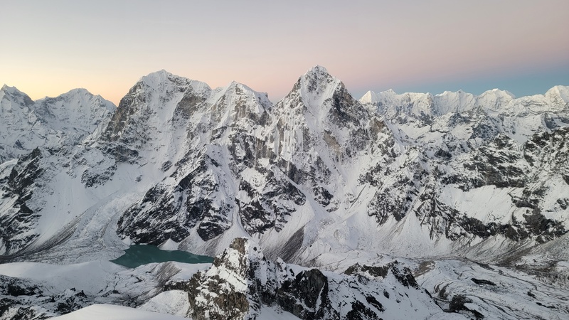
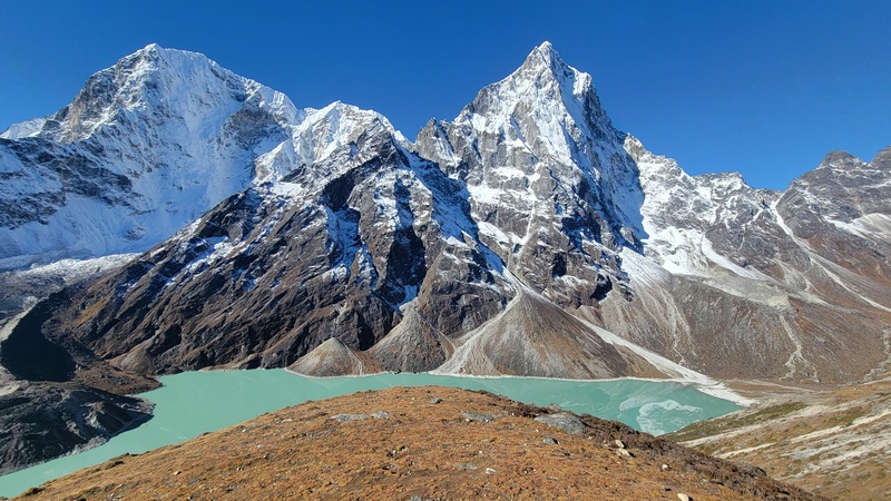
Day 13 - I just took a zero day at the Italian Pyramid (16,220ft). It was overbooked, so I ended up staying in the very tip top of the pyramid, in the research center’s computer/control room. I mostly hid out there because of all of the coughing and sick trekkers in the crowded dining area. 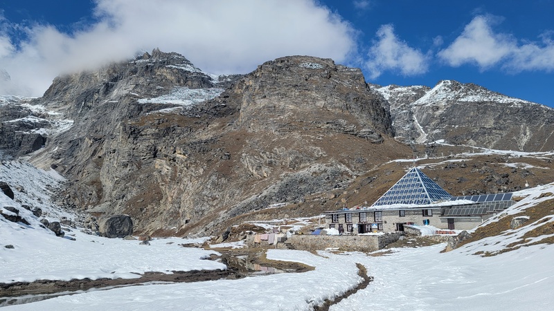
Day 14- I had plans to cross Kong Ma La pass from this direction to reach Chukkhung (15518ft), and climb Pokalde peak (19000ft) on the way to Island Peak base camp, but the pass was super buried and there were no reports of anyone crossing it yet, plus I had already been up it coming from the other side, so to save energy once again, I went around down valley on part of the EBC trail to go around the pass to reach Chukkhung and skip Pokalde. I also noticed some severe winds in the forecast for when I was going to climb Island Peak, so I moved it up by a few days to optimize the weather/conditions adding a bit of complexity to my overall plan (7.7mi, 1400ft) 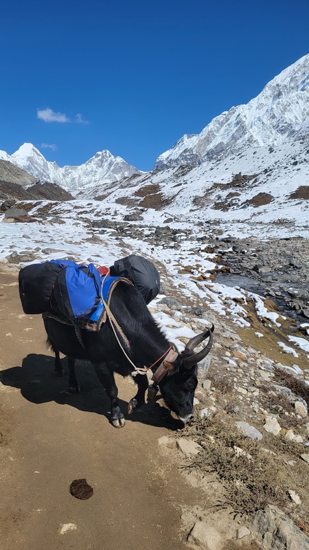
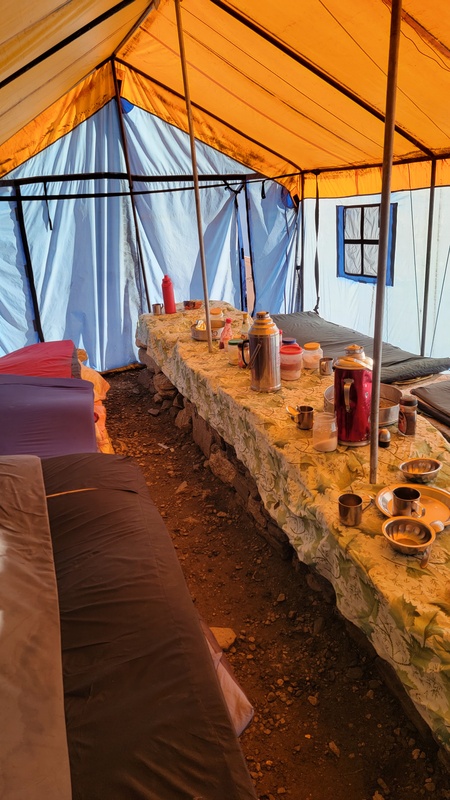
Island Peak/ Imja Tse Day 15- I made it to Island peak BC (16732ft) and was treated to a fun cosmopolitan group at dinner of Russians, Poles, Romanians, and a Venezuelan, all from different teams, but sharing the dining tent. I thought it was super cool how we were from all over the world, and despite our countries political differences, we could bond over the shared objective we had set. It’s pretty special how outdoor pursuits and mountaineering can bring people together like that. Mountains can have a way of flattening differences. (4.1mi, 1300ft) 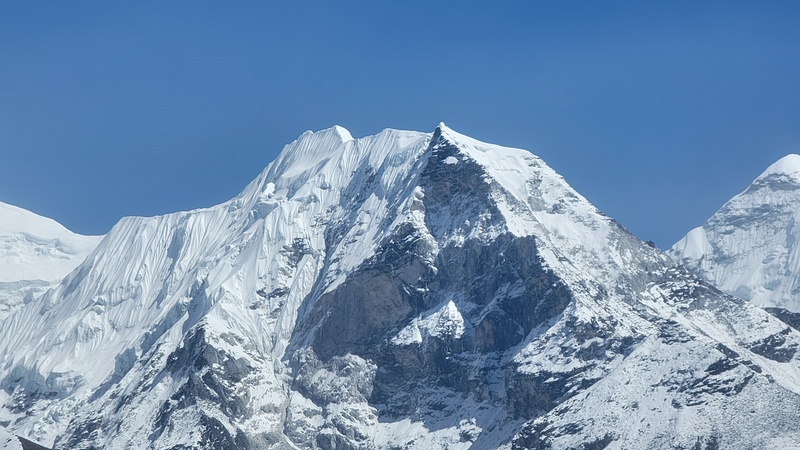
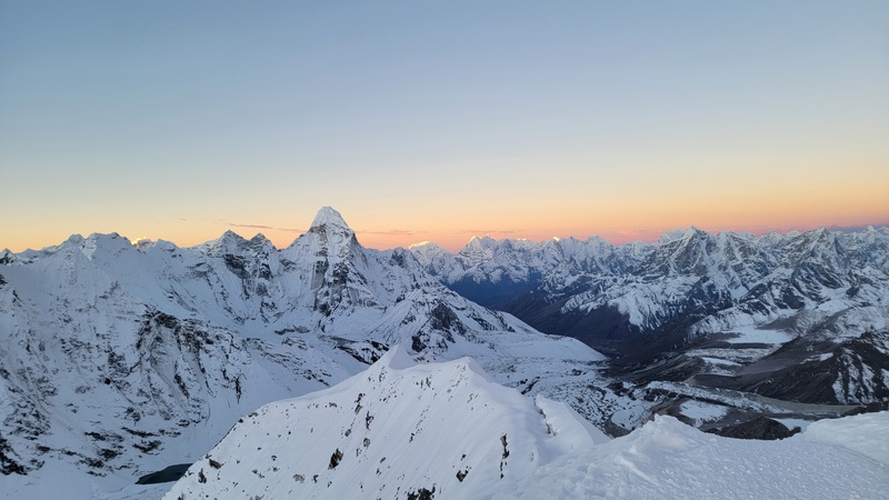
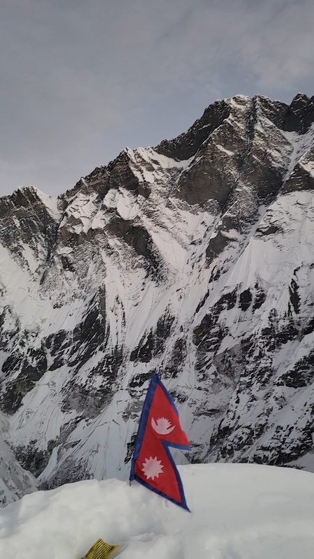
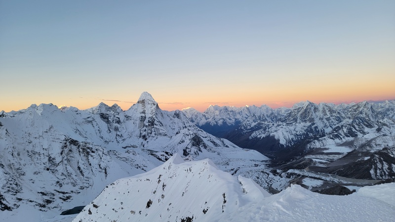
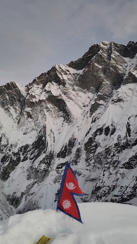
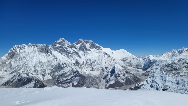
Day 16- Another alpine start, starting my ascent at 1am, I climbed through the night and summited for sunrise around 540am, making it back to camp at 830am, a bit faster than expected. The first part of the climb is just a steep hiking trail of loose rock. After 1000ft or so, it's time to put on crampons and navigate the glacier. The final headwall had fixed lines on it which weren't really needed for going up, but nice to rappel down. Reaching the summit for sunrise was absolutely spectacular. Last time I was up here it was a whiteout and I couldn't see anything, but this time, the views of the upper Khumbu were mind-boggling. The humongous Lhotse wall dominates part of the skyline (a sheer wall of ice and rock thousands of feet tall that looms over Island peak, which is wild since Island peak at 20226ft feels tiny under it.) Looking out over the Imja Valley, Ama Dablam, and the surrounding glaciers in the early morning light was easily one of the highlights of the trip. On the way down, all of the groups that I had passed were making their way up those fixed lines and were jamming both of them up, leaving me waiting a while for a gap to make my rappel down. With the recent snows, the headwall was mostly covered in snow, but I have heard since I last went up in 2022, climate change has warmed things up enough that the headwall is now usually a bunch of loose and dangerous rock, particularly hazardous if there's other people above you. I was once again stoked on my time since I had read it would be more like 10-14 hours. Overall, Island Peak felt pretty straight forward in good conditions, but crowding and changing headwall conditions could significantly increase objective hazard. I rested in basecamp for an hour or two and then took off down the valley for Dingboche (14470ft). (11.1 mi, 3200ftup, 5900ft down) 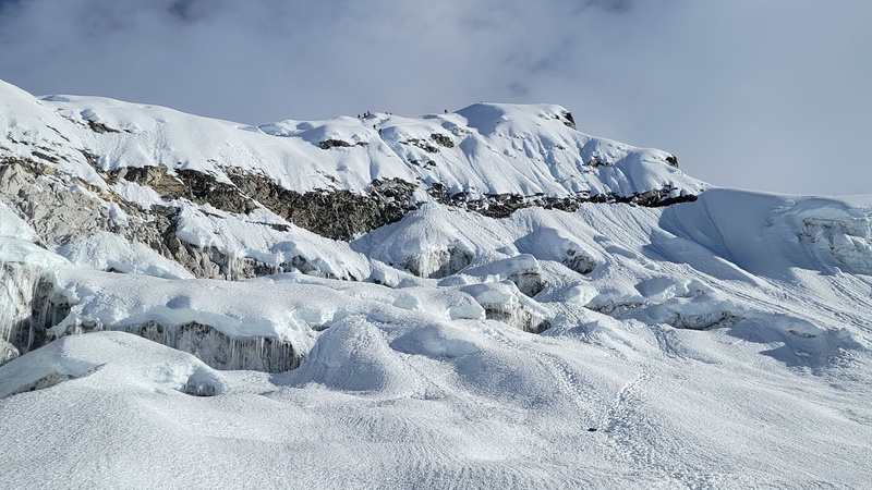
Day 17- I took a zero/rest day in Dingboche, feeling pretty gassed after doing two 6000m peaks in the past 5 days. Dingboche is a good village to rest in since it has plenty of decent food options, bakeries, and cafes. I went on a full bakery tour loading up on calories in the form of brownies and apple pie. I also tried sea buckthorn juice, a town specialty. It was tangy, refreshing, and some sort of superfood harvested from the plants in the area. 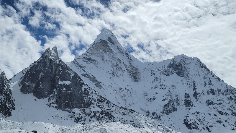
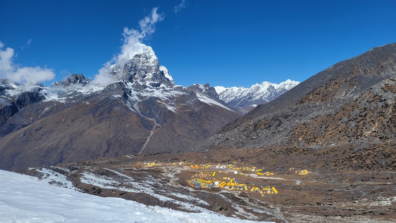
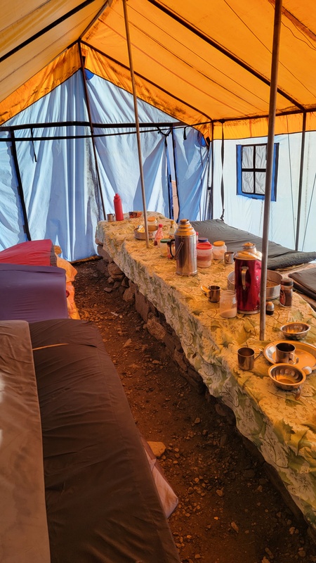
Ama Dablam Looking at the forecast I realized that I only had a narrow window to climb Ama Dablam. After a brief lull in the winds, a storm system from Cyclone Montha out of the Indian ocean was expected to move in, bringing significant snowfall for 4 or 5 days. This meant I needed to adjust my climbing plans, because I definitely did not want to risk being above 20,000 feet in a blizzard with the fixed lines all becoming buried. This felt like the highest stakes decision of the trip. Day 18- Loading up on more brownies in Dingboche, I then took off for Ama Dablam Basecamp Lodge (15,100ft). This is a teahouse that sits near the tent city basecamp and charges a flat rate that is all inclusive for $1000 USD, no matter the number of nights you stay. For some people this ends up being an okay deal while waiting out weather or doing typical rotations up and down and back to basecamp; for me, it was not a good deal since I only ended up staying there 3 nights. That being said, it was worthwhile because they also have tents set-up at Camp 1 and 2 (where space is very limited), which saved me having to carry a tent the prior 17 days, as well as use of an MSR Reactor stove to melt snow at Camp 1. The size of the basecamp was much larger than it was in 2022 when I hiked up to check it out, it now looks like a small festival campground, sprawling out with big dome tents full of luxury items like turf grass flooring and espresso machines. Amazing that this is all carried up by porters, they are total beasts. 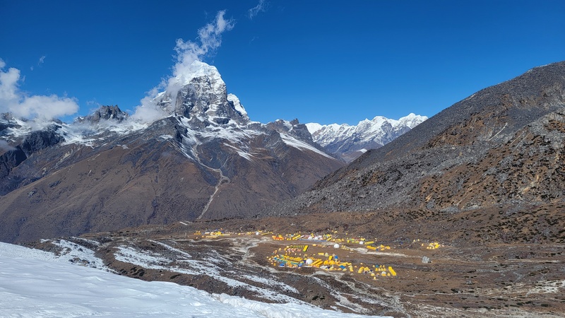
Once at the lodge I had to make some decisions. My initial plan was to go up to Camp 1 (19,000ft), stay the night, and in the morning recon/scout the crux of the route, The Yellow Tower, a notorious section of ridge that goes at 5.9 for about 50 vertical feet near 20k feet, on the way to Camp 2 (where the iconic perilously perched tent photos are from at 20,000ft), and then return to the basecamp lodge to rest and recover for a few days. After being fully rested and recovered from Island Peak and Lobuche I would then go back to Camp 1 and summit from there, returning to basecamp the same day. With the incoming storm, I realized I wouldn’t have time to do any scouting and needed to get moving on my summit push immediately the next day if this was going to happen. I also made the decision to skip Camp 2 and 3 because Camp 3 is situated in the line of the fire of the hanging glacier, the dablam, and has been the location of multiple fatal incidents over the years. It seems best to minimize the amount of time spent there as much as possible. Camp 2 is extremely unsanitary (people don’t use wagbags), overcrowded, and no way anybody can sleep well there given the lopsided, tilted tents on top of uneven rocks at that altitude. Minimizing time at both felt like the right call. (4.7mi, 1600ft) Day 19- I slept in, trying to rest at the teahouse, while I deliberated my decision making about rushing the ascent and trying to get a read on multiple weather models / forecasts. I was looking at the windy multi model, mountain-forecast and meteoblue forecasts. They all seemed in agreement that the snow would start nuking in 2 days, but the models were mixed on the wind. I either take a gamble now, and go up hoping the winds subside enough to summit without doing any route recon with daylight, or I wait for a week or more, for the snowstorm to pass, and the fixed lines to reopen. Waiting around sounded miserable. I committed to going. 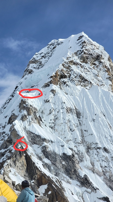
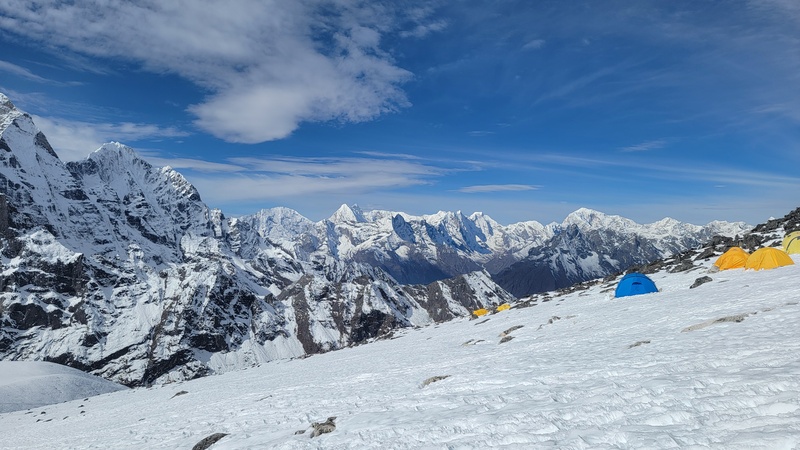
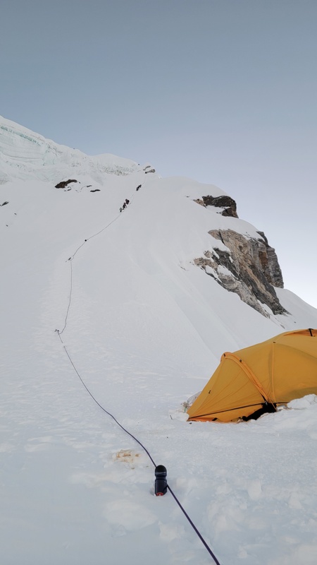
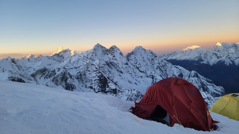
I packed up my bags and made my way to Camp 1, arriving later in the afternoon where I melted some water to fill up my bottles, stashing some in my tent for after my summit push. The tents at Camp 1 are just plopped on top of a jagged, uneven, and steep talus field basically. There isn’t a chance in hell anyone can actually get decent sleep there. The positive thing was that with all of the unusual snow, there was plenty to melt right around Camp 1, saving a lot of effort from carrying water from basecamp or harvesting snow from higher on the mountain and carrying it down. I made my best effort to go to sleep around 630pm after enjoying an incredible sunset view from the ridge that Camp 1 is perched on. I had a true alpine start by “waking up” just a few hours later at 1030 and commencing my summit push at 11pm. In truth, I didn’t sleep at all, filled with anxiety about the upcoming day. (4.1mi, 4100ft) 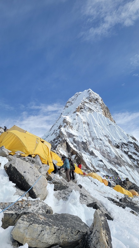
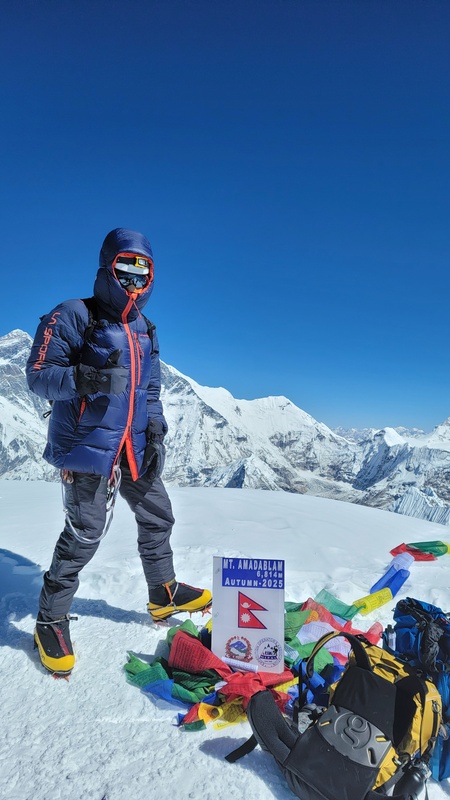
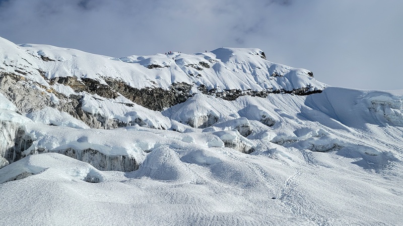
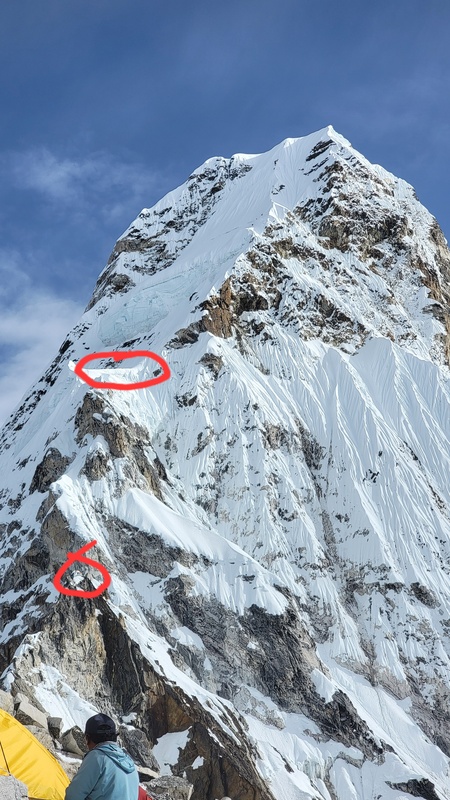
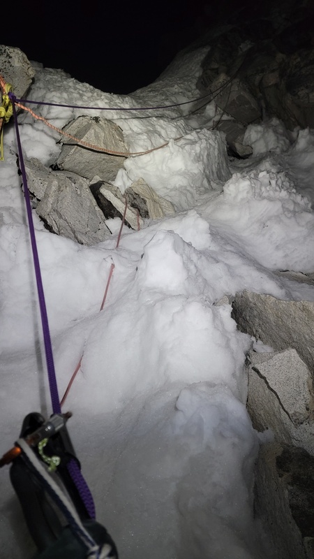
Day 20- Climbing alone through the night, the exposure didn’t fully register, since all I could see was in front of my headlamp. It was an entirely different mountain in the daylight the following day during my descent. Leaving C1 it starts off as straight forward and fun class 3 / 4 scrambling, dipping into easy 5th in places. From C1 there are fixed lines of various quality going all of the way to the summit. You have to be paying attention to pick out the newest lines since the old lines from past years are not removed. I mostly clipped in with a basic ascender, but in steeper sections, like the Yellow Tower, I backed myself up with a microtraxion on a 2nd line directly to my belay loop. Seeing as you can’t see how the ropes are anchored above, this seemed like a smart decision. Most anchors were good enough, but some of the protection was a bit eye brow raising and some downright dangerous. The Yellow Tower proved to be a real struggle, definitely going at 5.9, very tough for me in mountaineering boots. This was the first time fatigue really caught up with me on this trip. IP and Lobuche had felt smooth, relatively easy, but now the cumulative expedition fatigue, 0 sleep, lack of recovery days due to adjusting for weather, and altitude started to hit me. At 14,000 feet there is 43% less oxygen available than at sea level, at 22,000 it's 57% less. This is a significant difference in exertion, where on Island Peak at 20k I could climb at a reasonable pace, towards the top of AD I was drastically slowed down, sucking in as much O2 as I could. My estimates on time for this route were entirely off. I figured Camp 1 to the summit is only 3350 feet, how long could that take considering my strong times earlier in the week? In the end, the round trip from C1 to the summit and back took me nearly 20 hours, crawling back into my tent at 11pm the next day. One reason for the bad estimate were a few traffic jam spots that added hours to the total. I passed through Camp 2 at some point in the dark, and reached Camp 3 (20,700ft) shortly after sunrise at 6am; my highest altitude to date. C2 to C3 wanders through a stunning section known as mushroom ridge, relentlessly exposed and steep rime ice towers that are a bit of a labyrinth that the fixed lines weave through while continuously ascending higher. From Camp 3 I saw about 10 people above, moving very slowly up the fixed lines. I figured I would catch up to them shortly so I decided to duck into an empty tent for a power nap of 30 minutes. Afterwards, I began the arduous and slow climb up to the summit, which I reached at 11am, 12 hours after leaving C1. From Camp 3 it is 1650feet of very steep snow to the summit at 22349ft. 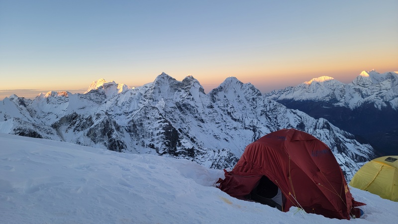
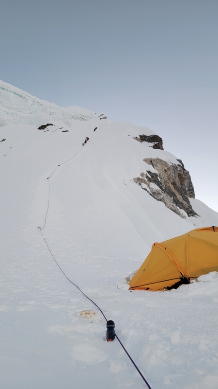
The altitude is no joke, above C3 I caught up to the climbers who had started from C2 and C3, passed a few, but couldn’t muster up the energy to keep making passes, as it was taking 2-5 breaths at times just to make a single step. Somewhere around 22,000 feet the fixed lines crossed over an open bergschrund that was steep on both sides. The lines, to be honest did not seem tight enough or anchored well enough to protect the jump across, but I mustered up some confidence and energy and made the leap up and over what was probably 3 feet wide and 60 feet deep at the crossing point. I almost turned around here, but decided this was within my abilities so I made the leap. It was the clearest go/no-go moment of the climb. On the way down, this obstacle ended up costing me an hour because a client with 2 guides spent almost an hour trying to coax him to make the leap. I was not keen on coming off of the fixed lines so I had to wait. I also got jammed up between guided groups where remarkably it appeared people did not know how to rappel on their own and had to have their guides set up their figure 8s. It was surprising to see how dependent some climbers were on guides for fundamental skills like rappelling. Arriving on the summit felt totally surreal after climbing through the night mostly alone, almost non-stop, in windy and cold conditions, with a temp feel of -40F, through the relentless and steep terrain that took constant mental focus to pick out the correct fixed lines and not fall. The views were absolutely jaw-dropping, but the main thing I was looking at was how far away basecamp looked and thinking “oh shit, that's gonna take forever to get back to.” The technical nature of this route, at this altitude, was super draining, and the retreat was just as dangerous as the climb, requiring focus and good decision making to not make a rappelling mistake and get on safe, secure lines. 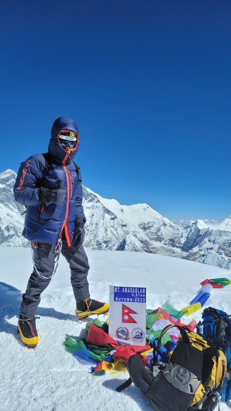
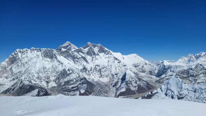
For my retreat I made it back to Camp 1 after countless rappels into the night and passed out completely exhausted in the tent. I really wished I had been able to make it back to basecamp, but I needed to rest and recharge my body battery to go any further. I have never been so completely spent in my life. 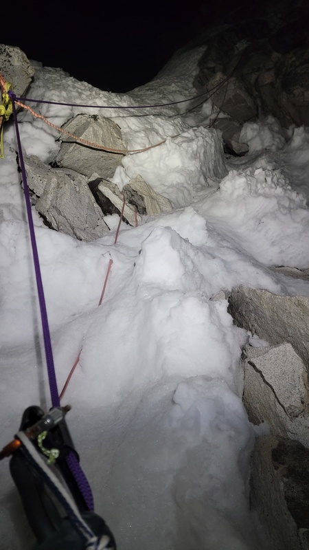
Day 21- I arrived back at the basecamp lodge in the morning, promptly demolished a massive plate of vegetable fried rice, rehydrated, took a hot shower, and took a long nap. There were people in the lodge discussing going up to Camp 1 later in the day. I showed them the forecasts showing significant snowfall starting overnight, their guides told me that it doesn’t snow this time of year, so they went up. I sure was glad to be safe and warm down in basecamp and not up on the mountain like other people still were. The teahouse baked celebratory summit cakes for me and two other successful climbers. It was a really nice touch that made for an enjoyable evening. In the afternoon you could see a lot of climbers still high on the mountain above camp 3, many more people pushing for the summit than the day prior, just on the edge of the incoming storms. This actually looked pretty dangerous to me because that amount of traffic on the route would expose one to significant overhead hazard. Tragically a climber was hit by a piece of icefall from above C3 and died. I also found out that another had a fatal heart attack near C3 on the very day that I began my climb to C1, which explained the helicopter I saw while passing C3 on my way up that I thought was doing a rescue was actually doing a body recovery. I sat with that for a while. I'd been on the same ropes, in the same weather window, making judgment calls that felt solid but were never guaranteed. The mountains have a way of making that very clear. It was definitely a tragic and sobering reminder of how powerful, difficult, and fatal these peaks can be. This is a serious high-altitude peak with a lot of objective hazards. Day 22- It was snowing quite heavily in the morning so I decided to take a zero day at the lodge. Later in the morning the people who had gone up to C1 the prior day returned to BC and told me all about how their tents ended up buried, collapsed, and the miserable hike down from Camp 1 in deep snow, breaking trail the whole way. I was absolutely exhausted from the exertion the past few weeks, so I simply ate loads of food and hibernated to recover. It was quite snowy, so it seemed like the best thing to do… at the time….There was news that a helicopter had crashed nearby in Gorak Shep attempting to land in the blizzard, everyone thankfully survived. Day 23- In the morning the weather lightened up enough to make a reasonable break back to Namche. After I made it back to Namche, I negotiated my way onto a helicopter for the following morning to return to Kathmandu. I then headed straight to the classic worlds highest Irish pub to enjoy celebratory drinks. I ran into several people I had crossed paths with over the prior weeks at the pub and had a great celebratory evening with them. (12.5mi, up 1600, down 5600ft) 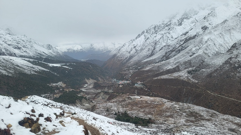
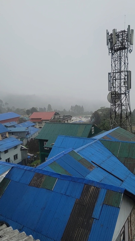
Day 24- I was able to make it to Lukla in the heli, but all flights were grounded the rest of the day due to the cyclone which set in thick the next 4 days. In hindsight, if I hadn’t taken a 0 day at the basecamp lodge, I would likely be in Kathmandu right now, instead the next few days were quite miserable and difficult to keep spirits up with the constant heavy downpour, totally overcrowded village due to no transportation being able to happen, and lack of food options in Lukla. Namche Bazaar would be a much better place to be marooned in drinking the highest elevation Guinness in the world. Day 25,26,27,28 – These days were all characterized by hoping to get on a flight to Kathmandu, waiting at the heliport, getting hopes up, and the storm not letting up to allow that. It was quite miserable to be honest to go from very engaged, objective oriented, adrenaline fueled, to languishing away in Lukla, day after day. The mental difference began to really affect me by the end. The contrast from constant movement to complete stagnation was brutal. At least I was lucky enough to have a bed in Lukla. The lodges were all at over capacity and people were being turned back and told to hike back to Namche as well as people just sleeping on the floors of overcrowded tea houses in the main rooms. On day 28 some flights started to happen, but as a solo traveler without connections, there was no chance I was going to get on one of them. It was really bad higher up where people were stranded due to the deep snows that happened, mud slides lower down, and general weather disasters occurring throughout the country. Cyclone Montha was really no joke at all and I was able to weather it out pretty decently which was pretty lucky all things considered. 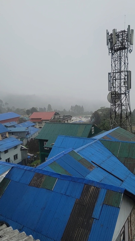
Day 29- I was able to get on one of the first helis to leave Lukla in the morning. Once in Kathmandu, I sorted out a few paperwork items related to my climbing permits, bought a fresh set of clothes for the plane ride home, and then got on a flight home in the evening. 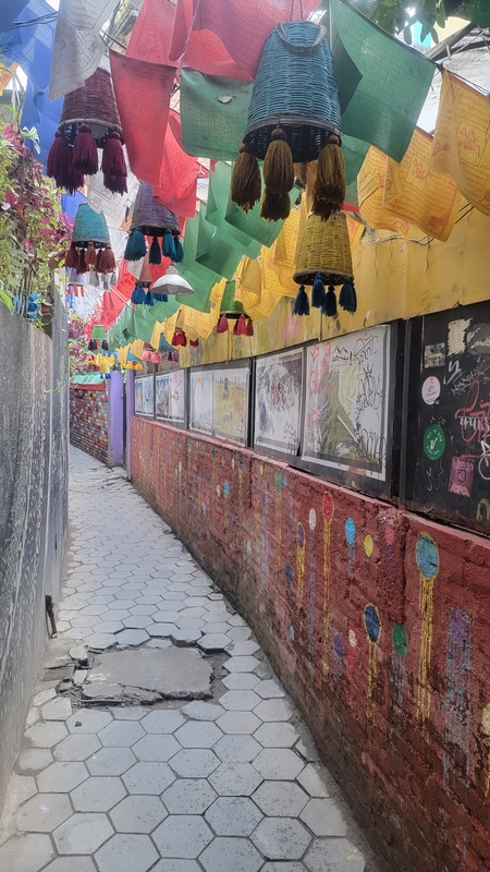
Day 30/31- arrive in Denver and drive back to Durango. Looking back, this trip pushed me further than anything I’ve done before, not just physically, but in decision-making, risk management, and dealing with uncertainty. Going solo meant every call was mine, from adjusting objectives to committing to the summit push on Ama Dablam with limited information and no margin for error. In the end, the strategy worked as I had hoped, but it felt far from guaranteed at times and was not without risk, fatigue, and a lot of on-the-fly decisions. Climbing these peaks alone forced me to rely entirely on my own judgement, pacing, and preparation. It was one of the most demanding and rewarding experiences I’ve had in the mountains. I came away with a deeper respect for altitude, conditions, timing, and a clearer understanding of my limits. I also met a lot of great people along the way, and those experiences and conversations are just as meaningful as the climbs themselves. Somewhere on the descent from Ama Dablam, completely spent and still hours from camp, I remember thinking that this was exactly what I'd signed up for, not just the summit, but the full weight of it. The decisions with no one to defer to, the weather that doesn't care about your timeline, the mountains that are indifferent to how prepared you think you are. That's the thing about going solo: there's nowhere to hide from any of it, and that's precisely what makes it worth doing. Nepal still has so much more to offer; there are objectives out there I haven't even begun to scratch the surface of. If this report sparked something for you, feel free to reach out. Happy to answer questions or just talk mountains. Thumbnails for uploaded photos (click to open slideshow): 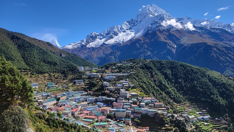
|
| Comments or Questions | |||||||||
|---|---|---|---|---|---|---|---|---|---|
|
Caution: The information contained in this report may not be accurate and should not be the only resource used in preparation for your climb. Failure to have the necessary experience, physical conditioning, supplies or equipment can result in injury or death. 14ers.com and the author(s) of this report provide no warranties, either express or implied, that the information provided is accurate or reliable. By using the information provided, you agree to indemnify and hold harmless 14ers.com and the report author(s) with respect to any claims and demands against them, including any attorney fees and expenses. Please read the 14ers.com Safety and Disclaimer pages for more information.
Please respect private property: 14ers.com supports the rights of private landowners to determine how and by whom their land will be used. In Colorado, it is your responsibility to determine if land is private and to obtain the appropriate permission before entering the property.



