| Report Type | Full |
| Peak(s) |
"S 6" - 13,455 feet "S 4" - 13,256 feet |
| Date Posted | 04/20/2026 |
| Modified | 04/29/2026 |
| Date Climbed | 04/18/2026 |
| Author | yaktoleft13 |
| Additional Members | jprinner |
| Optimized |
|---|
|
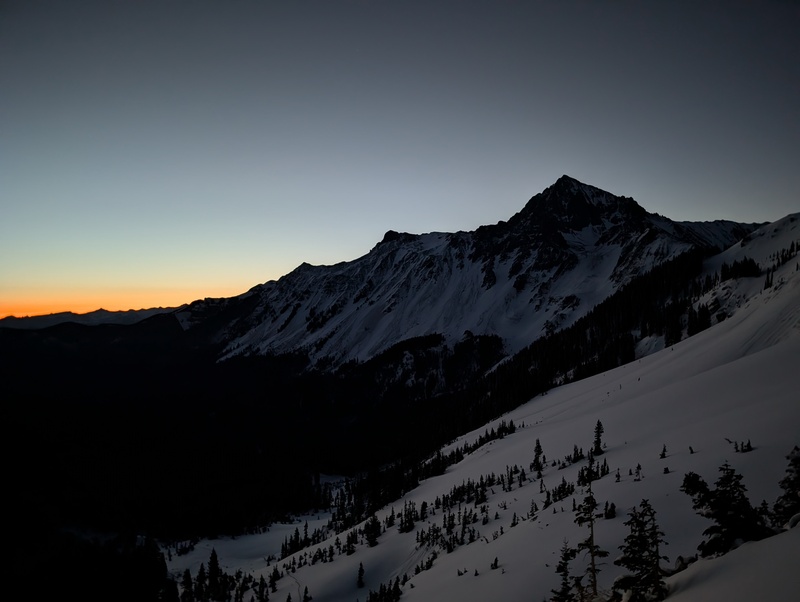
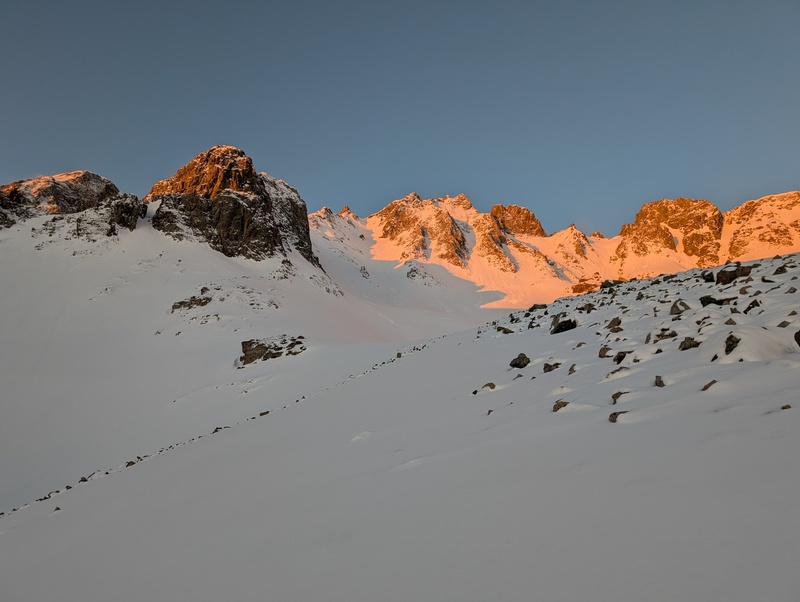
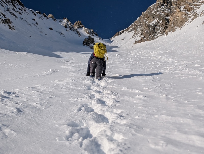
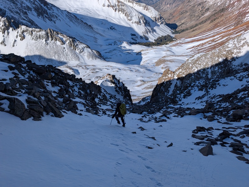
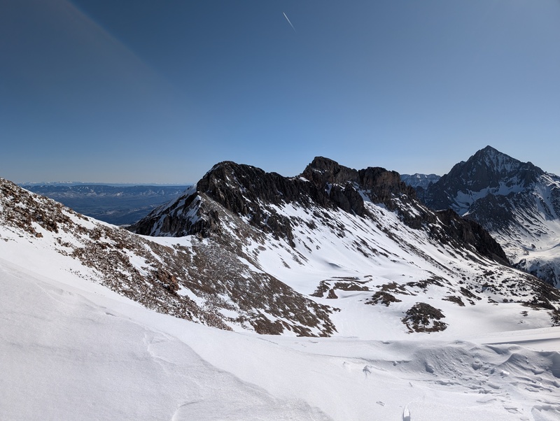
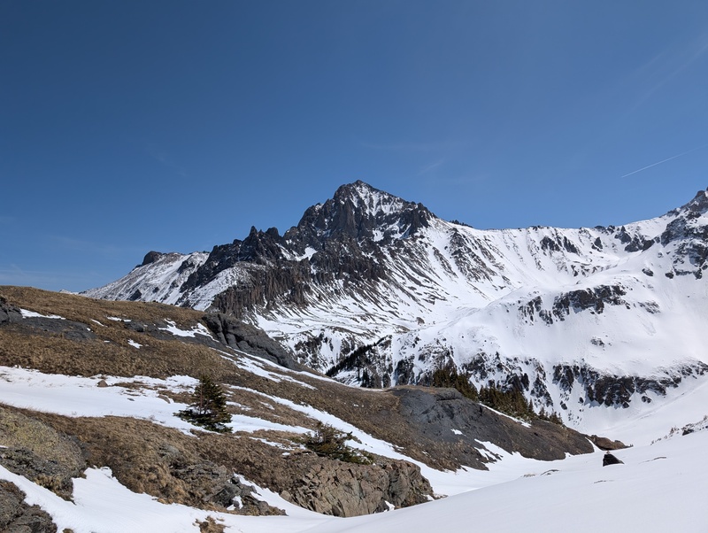
Route: S6 N Couloir -> S4 South Face Trailhead: Blue Lakes Mileage: 10.5 Vert: 5,450 Time: 9:45 Class: 3, moderate snow "S6" and "S4" are two formidable peaks of the Sneffels range. The "S" in their names stands for "snow", because you definitely want snow to climb these peaks. It also stands for "stupid", as in you'd be "stupid" to choose to climb these peaks dry. I guess it also stands for "Saturday", since that was the day of the week we climbed them. As it turns out, a lot of relevant words start with "S", so feel free to assign your own meaning to the letter. I had aimed to climb these peaks last year with Marshall, but a week freeze forced a successful audible to drier pastures around Lake City, so the S's got pushed back a year. But they didn't get pushed out of mind, so when a free weekend day aligned with a strong freeze and green avy conditions (despite the recent snow the range received), the S's sprung to the top of the list again. I reached out to Jessi, whose proximity to the range makes the drive almost walkable, and she was in! We set a primary goal of S6 and S4, with a stretch goal of T0, and agreed to meet at the Blue Lakes trailhead Friday evening for a thoroughly alpine start the following morning. The range received a couple of inches of fresh snow Friday, but not enough to really complicate anything to do with our day. We were up early, and after I pounded my liquid IV and french press coffee (I've gotten bougie this winter I guess), we put boots on the ground at 4 AM, immediately missed the Blue Lakes trail turn, and went a quarter mile in the wrong direction. Oops. We course-corrected by backtracking nearly to the trailhead, found the very large sign that we somehow missed, and finally started going the right way. Gear-wise, we elected to forego snowshoes, hoping the strong freeze and generally low forecasted temps would keep the snow supportive. We had crampons and two axes each. Ben's report said the topout of our intended couloir reached 50 degrees, and we wanted to be prepared for potentially steep bulletproof conditions at the top. We chatted our way along the trail, which was covered in a couple inches of fresh powder, our stiff-soled mountaineering boots thunking us forward. Before too long, we reached a stream crossing near 10.4k and turned off the large trail into the unbroken snow of the forest. The good news: the snow was as frozen as we had hoped, and we applauded our decision to go sans snowshoes. Also good news: this may have been the most sparsely-forested part of the north side of the Sneffels range. I've had a nasty bushwhack not far away the prior year and read many other horror stories, but this area was downright open! It made travel surprisingly easy. We ascended a few steep slopes, generally staying just left of the trees and just right of the too-steep slopes of the north spur ridge of S5, never really needing to put on crampons. A couple of sections pushed the limits of booting, but we managed. One section in particular forced Jessi into the trees to the right to find reasonable purchase, while I attacked (and regretted attacking) a loose, sketchy 3rd class rock rib. Eventually, the sun began to rise, and we charged up one final steep slope and got a full view of S6's north couloir, our beautiful ascent route. 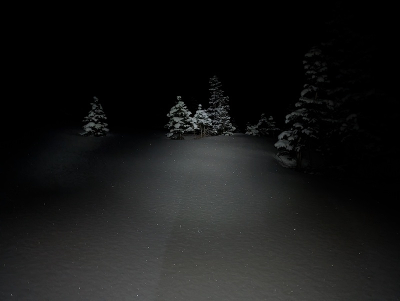
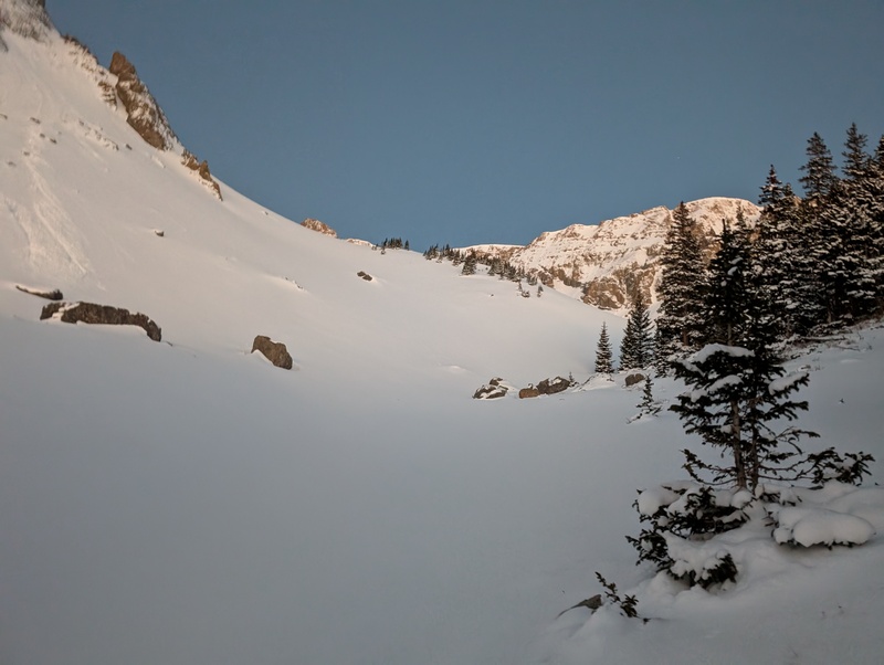
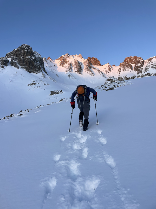
We booted to the bottom of the line and stopped to get helmets on, crampons out, and axes strapped. We could tell there wasn't much of, if any, cornice at the top, and the whole of the couloir looked pretty moderate at the most, so I kept one pole out and just grabbed one axe. Jessi went with two axes for double the climbing power. Also, she somehow decided that today was the best time to break in brand new mountaineering boots...? But it also worked out and she didn't blister and crushed the day...? Talk about a win. Anyway, back to climbing. After our transition (and the first food and water of the day), we were absolutely frozen. Jessi asked to go in front to, and I quote, "get the engine going." I was like sure, I'm happy to follow for a bit. And then next thing I knew, she was topping out the couloir in like 20 minutes, leading every single step. Beast mode! Easiest couloir I've ever climbed, since I just had to climb the ladder she put in for me. 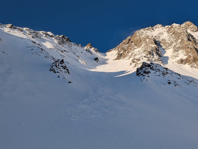
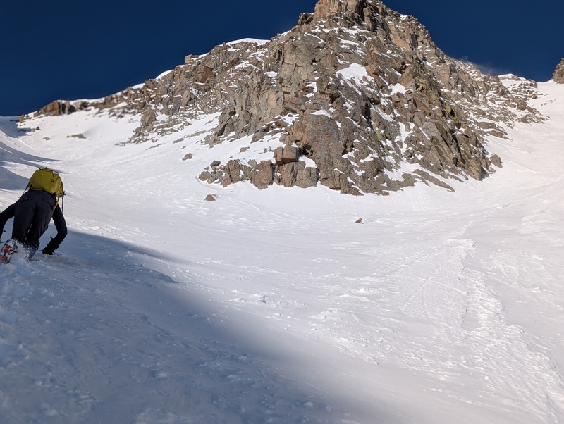
The couloir itself didn't have perfect snow conditions, but climbed well enough. The bottom third had some deeper wind-deposited snow that required a bit of swimming to get through. We zigzagged a bit to the right and to the left to find the best conditions. It was clear that the snow from earlier in the week had consolidated well, but the snow from the day previous was fluffy and had, at points, been wind-loaded into a half inch thick slab. We set off a couple very small releases of this inch thick slab; not enough to be concerning, but certainly enough to keep our attention. We swerved around to avoid these slabs and any deeper drifts and did so pretty well. When we reached the topout, which had been steep a few years ago for Ben, we found nothing steeper than 45 degrees, and quite fluffy snow. We postholed our way up the last few feet and topped the couloir, just a hundred or so feet from the summit. 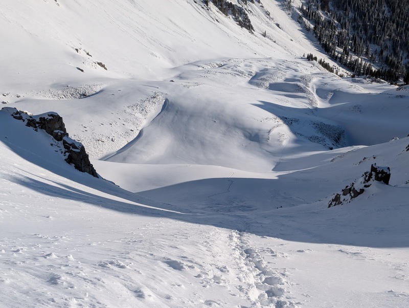
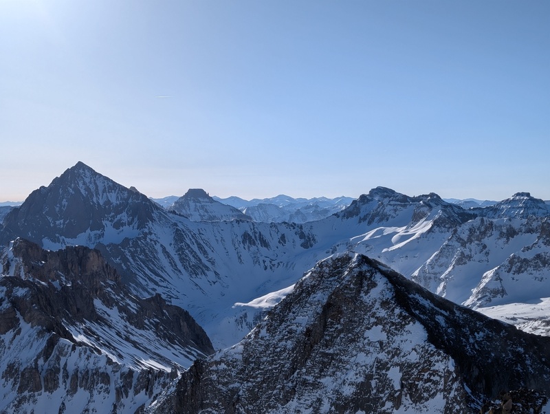
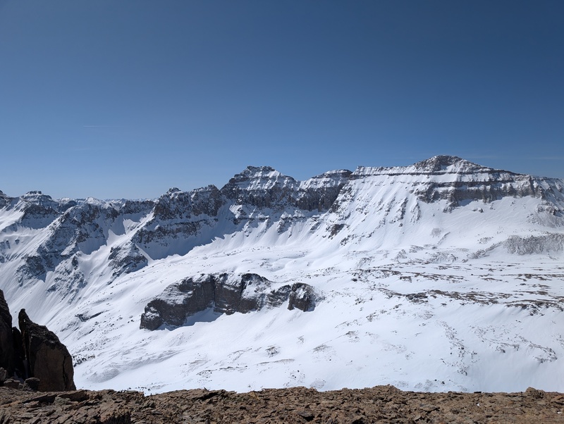
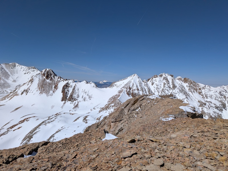
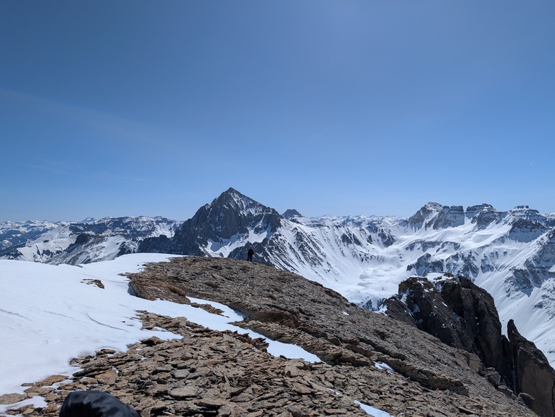
After topping the couloir, we turned to the right and scrambled up to the summit, half on rocks and half on the edge of the cornice. We topped out somewhere near 4 hours after leaving the car to huge views of Sneffels and friends. 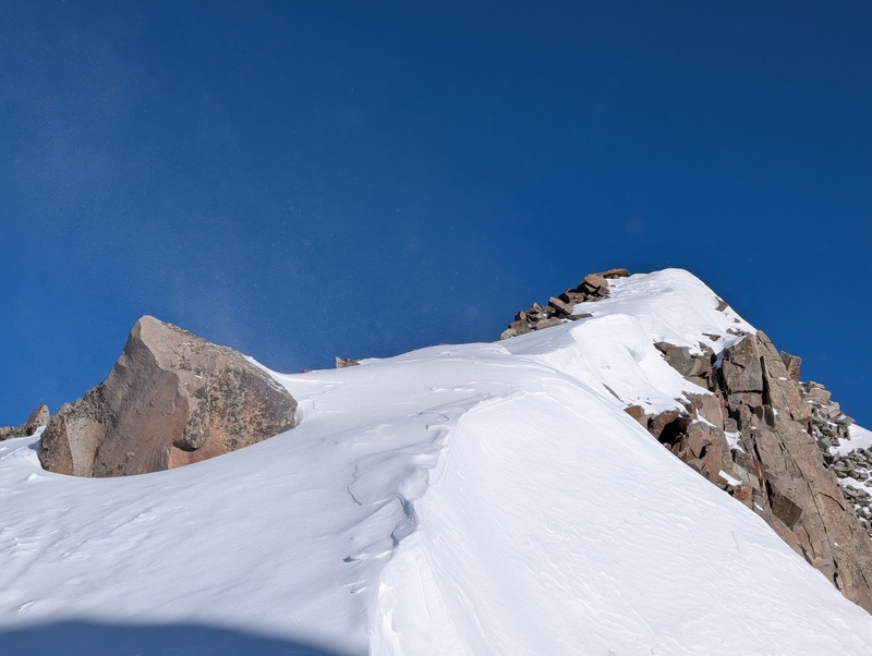
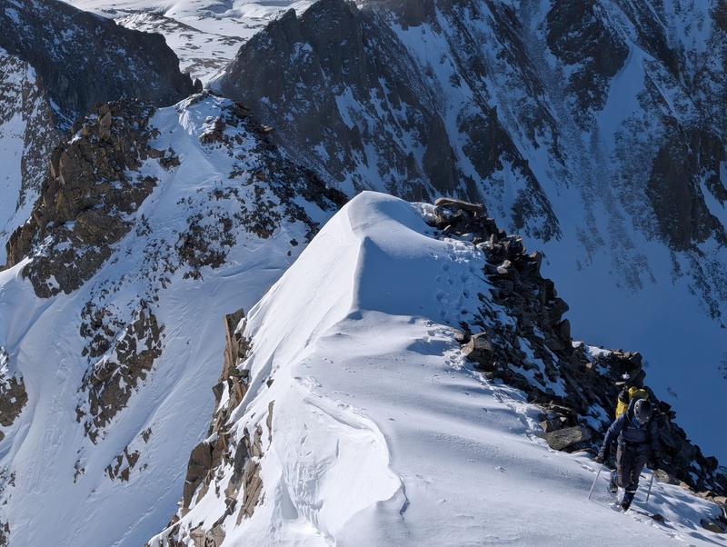
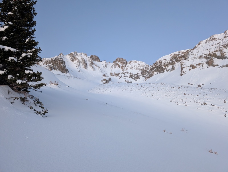
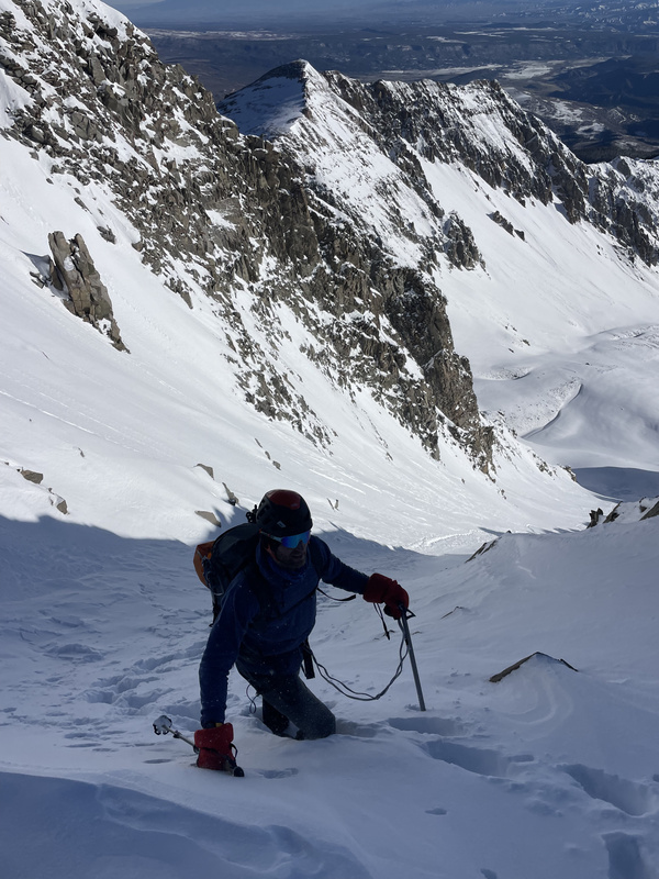
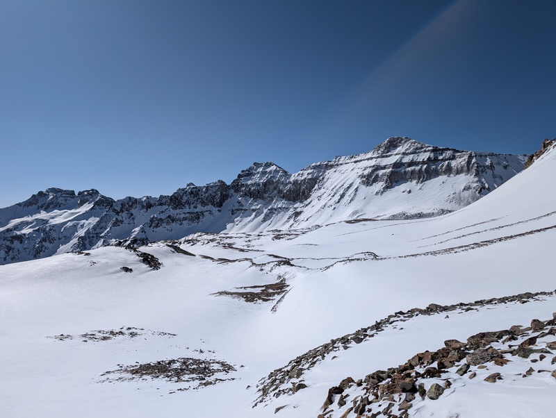
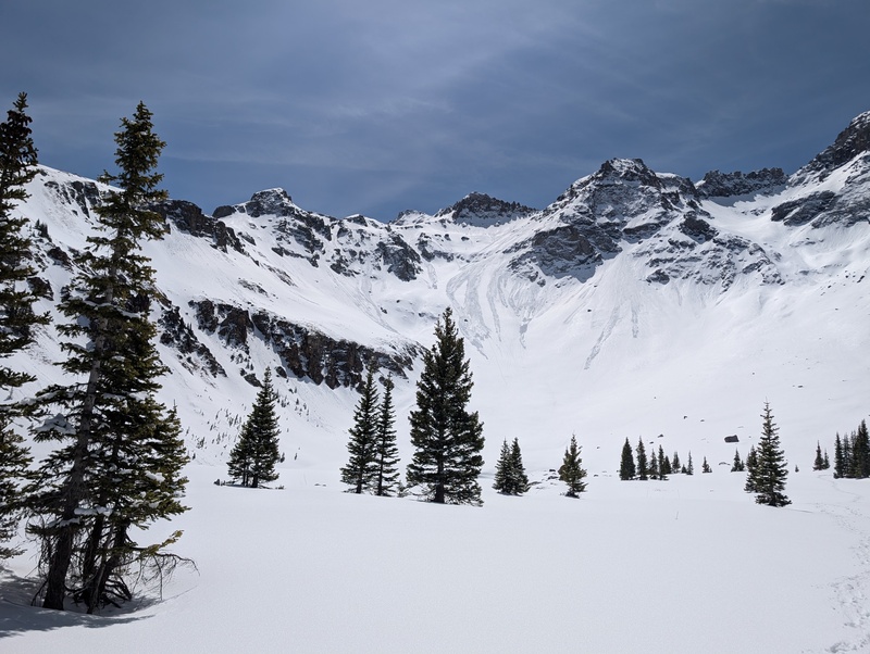
After a well-earned break, we headed down, knowing we had some convoluted terrain to navigate to hit objective #2. The plan was to reach a well-defined coulor on S6's south face, descend under some cliffs, up to the S3-5 saddle, down to the upper Blue Lakes basin, and head up S4. But getting off S6 proved to be a little more complicated than originally thought. The southern aspects of this range were quite dry, and it left a lot of loose, steep, ugly talus to navigate to reach this couloir. Also, the south side of S6 is steep, so figuring out exactly how to enter the couloir was an undertaking in itself. We eyed some options lower down, but all of those left some unknowns and some steep, loose, 3rd class knowns, so we spied a semi-sketchy but short and relatively unexposed snow traverse near the top of the couloir that we thought would limit the suck. We took this on and we found the snow good, and despite the steepness made it into the couloir without incident. 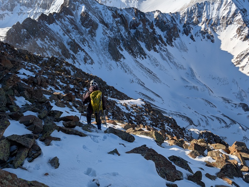
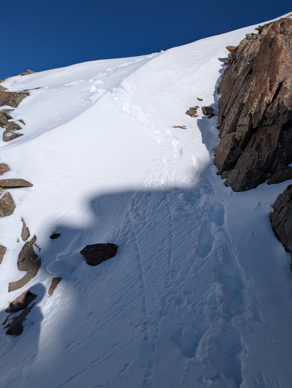
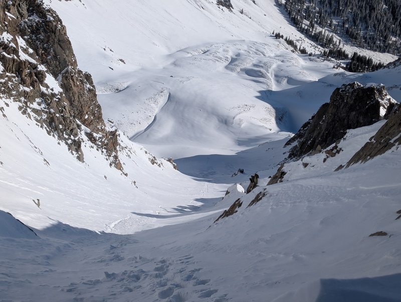
Unfortunately, the dryness of the year reared its head here, because rather than a nice plunge-steppy descent, we had a lot of exposed rocks to navigate, which we did using a technique we dubbed "scramponing". Lots of skritch-scratching ensued. We kept trying to find a place to veer out of the couloir toward the saddle, but the ultimate answer is that going all the way to the bottom is the way to go. So we did, and even when we got there, there was still a bunch of the S's finest choss to sidehill across to reach the climb up to the saddle between the unranked S3 and 5. But we eventually did, and we were able to link up snow nearly to the top of the saddle (some of which was quite bulletproof) to reach the top and a view of the next peak. 
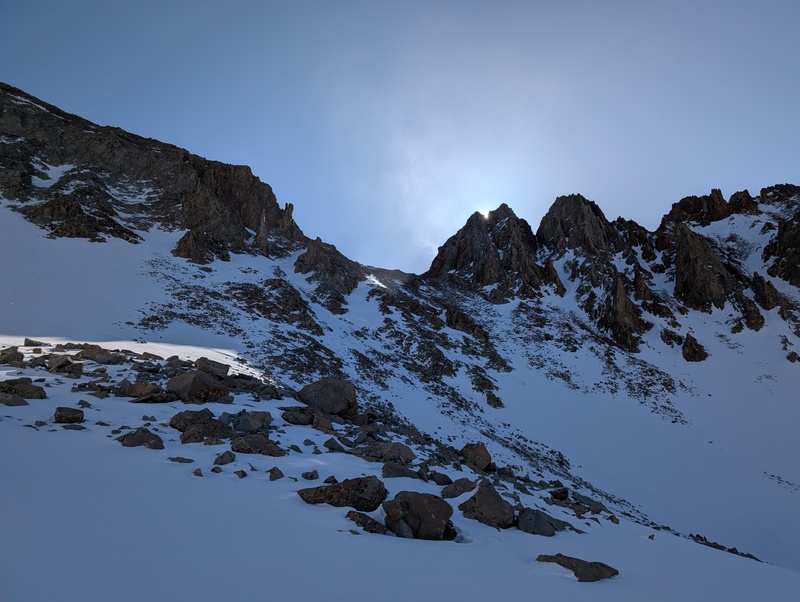

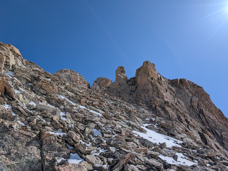
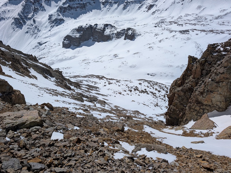
After refueling again at the saddle (and putting away my ice axe), we descended the snowy but gentle eastern slopes of the S3-5 saddle toward S4. We aimed for a broad slope (hard to call it a gully) that formed a gap in the formidable cliffs guarding the upper reaches of the peak. There were a couple of more defined gullies to the left of the obvious gap that would have worked, but they were all somewhere too far to the right on the "melted out" spectrum. As it were, our slopes were also entering the "melted out" zone, and had it not been for the reapplication of snow earlier in the week, probably were pretty far gone. We linked up sections of snow, still having to clack our way through occasional bare dirt and talus, as the gap in the cliffs swung back toward the west a bit. We topped out a more robust snowfield and found ourselves with a decision to make. 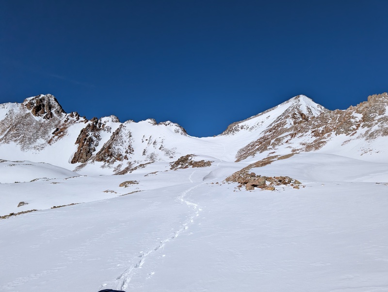
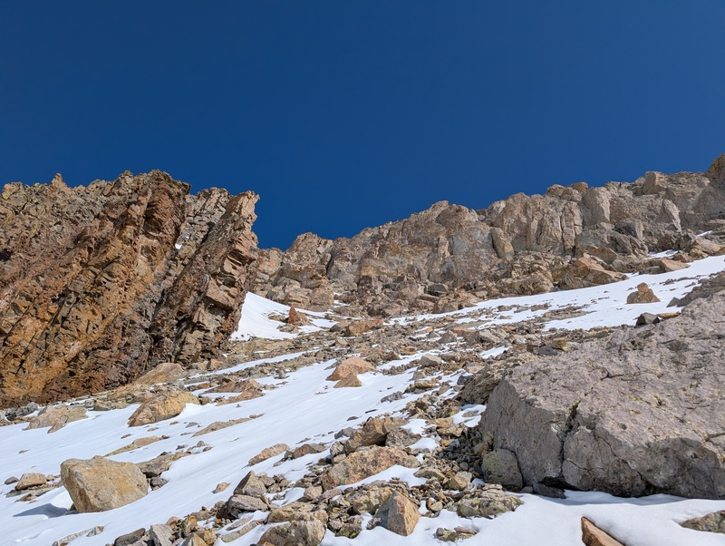
We surveyed the scene in front of us and saw two options. To the left was a bit of elevation loss, then a nasty sidehill across the top of the loose gully that I think was the one Furthermore described ascending in his report. It was largely melted out and looked loose as can be. In short: dog doo-doo. Option two: to the right we spied a small chute, maybe 3 feet wide, that seemed to cleave its way up behind the cliffs and lead generally toward the ridge. Cliffs blocked its terminus from our view, so whether it went to where we wanted it to go or not was kind of a question mark (or an interrobang, which I just learned is a real thing). But at least it didn't look as sucky as trying to cross the red gully of death! And even if it did end early, the rock above it toward the ridge seemed like a reasonable scramble, at least from a distance. So chute it was! 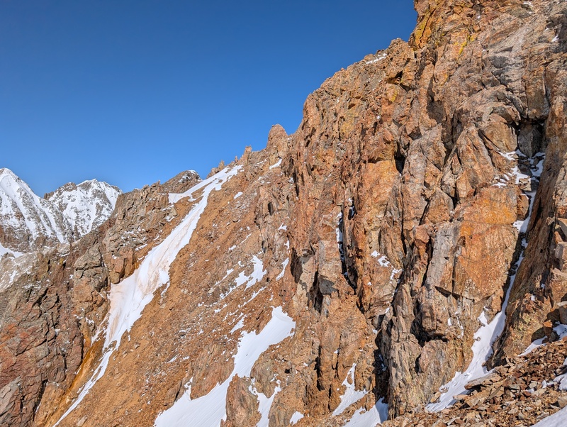
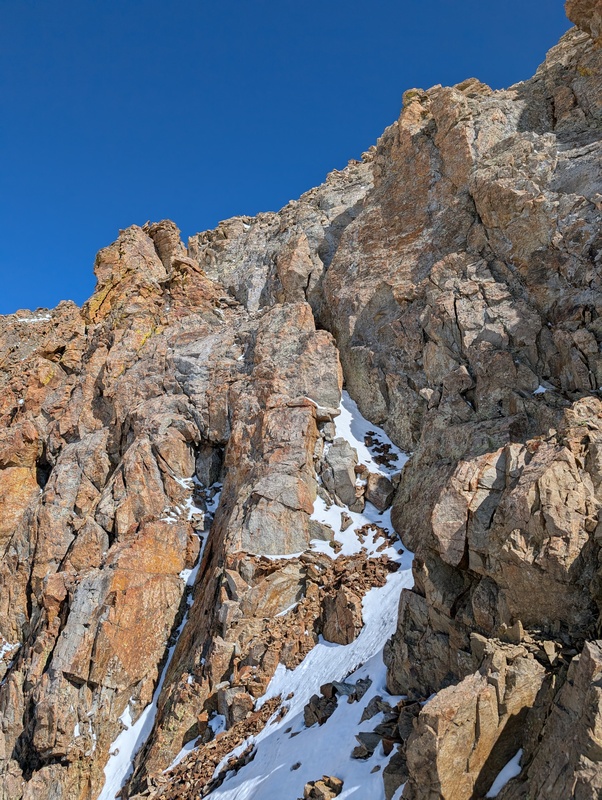
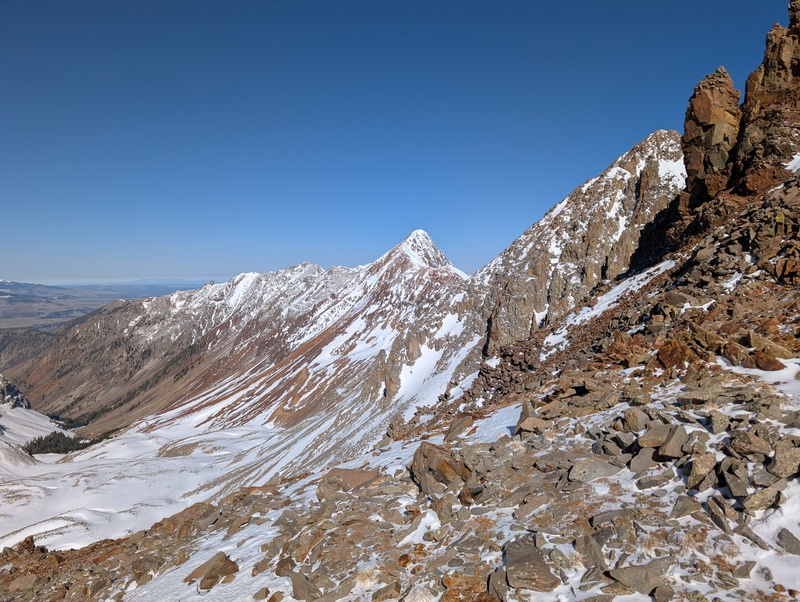
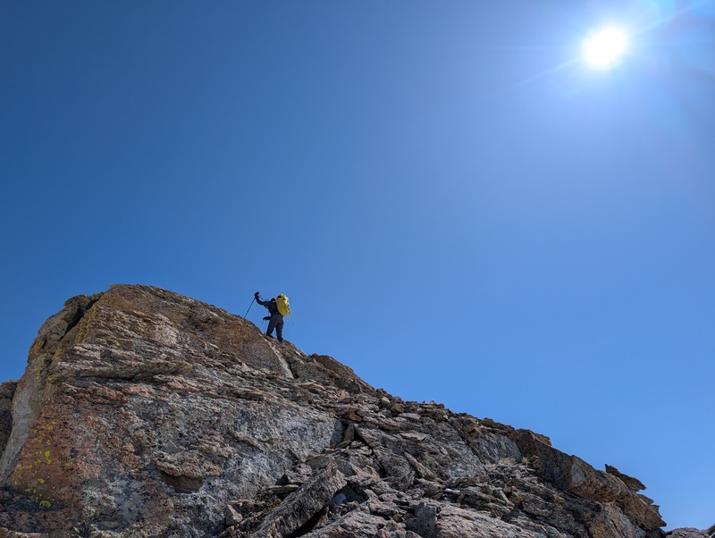
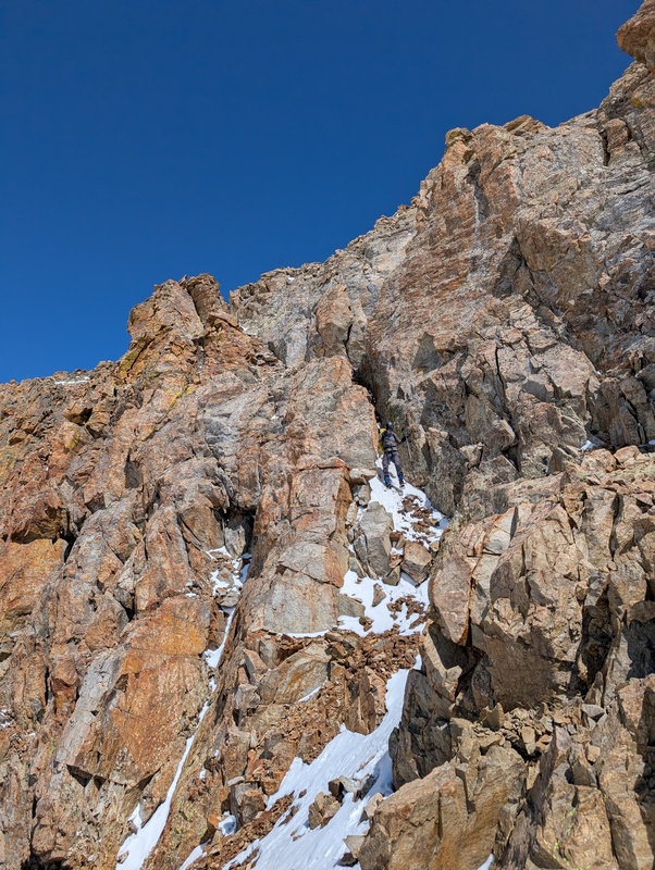
And the chute didn't make us say "shoot!" It was actually a gift from the heavens. A little loose, though sporadic snow cover in it helped, and definitely 3rd class at points (with one easy section of exposure), but it shot us up 100 vertical feet right to the ridge crest, where we turned right and scramponed up some third class blocks to reach the summit block! 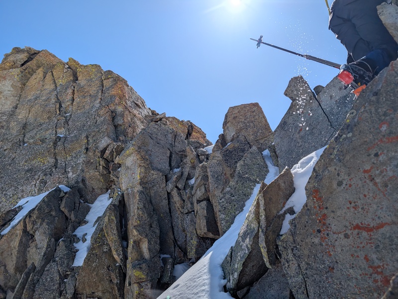
At last, we reached the crux. A 10-20 foot section of 3rd class rock, depending on which side you went at it. Jessi chose left, opting to squeeze into an angling crack I could not fit into with my pack. There was a 3rd class slab right in the middle that would have been my preference had I not been wearing crampons, and a broken, chossy 3rd class chimney on the right, which I found the most appealing with my current shoe game. All options were fine, and once above this section we had nothing but a short walk on dinner plate rocks to reach the wonderful summit of S4! 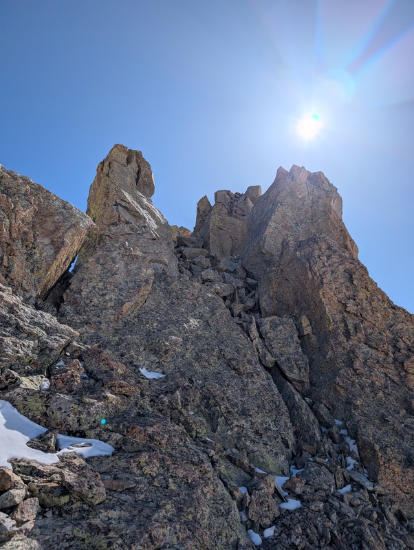

We took a long break up at the top. Jessi explored some descent options to the east, while I sat on my butt and ate food. We agreed that based on what she saw, the best decision was to backtrack down the chute and S4's southern slopes, then follow the gentle terrain down to Blue Lake, where hopefully someone in the other cars that were in the parking lot had trenched the trail for us (they had not, the bastards). So we did. We shot down the chute, dispatched S4's south slopes, nonverbally agreed that our stretch goal of T0 was not happening (it's so close on the map and so freaking far away in the wrong direction in real life), and linked up snow patches to reach the low point of the terrain above Blue Lakes. While everything in the area seems to indicate that the low point should be a stream, we encountered no running water and instead found supportive snow, which led all the way to the lake. We joked that this was the I70 of the Sneffels range (but with way less traffic). Once at the lake, we deemed it safe to take off our crampons and helmets (can't be too safe I guess) and enjoy trail life back to the car. 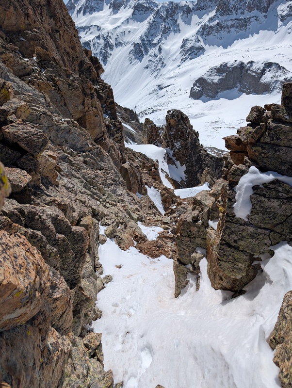
Unfortunately, as no one had been kind enough to trench the trail for us, we (Jessi) had to do it ourselves. We eventually found very faint tracks from before either of the snows of the week prior, which helped keep us on track, but it did little in terms of making it less work for us. Also, this trail had some weirdly exposed class 1 sections that were covered in snow, where one slip would send you sliding a hundred feet down a 35+ degree slope. We laughed about taking our crampons off too soon, then thought a little too seriously about actually doing it, but we made it without incident across in just boots. Once we reached our turnoff from 8 hours earlier, travel improved greatly, and the only thing holding us back was how uncomfortable my mountaineering boots were. Much of the dusting of snow had melted by this time. 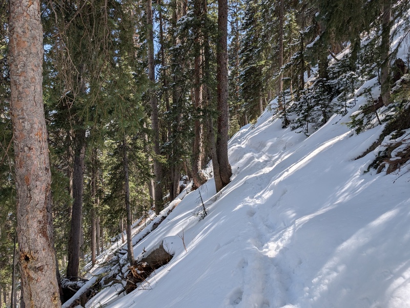
We kept plowing along and came to the terminus of the Blue Lakes trail, which we realized in daylight was like 50 feet from the parking lot (we did not realize that when we backtracked in the dark that morning). We sauntered up to the cars almost exactly 9 hours and 45 minutes after leaving them that morning (wrong turns included). These peaks lived up to the reputation: rugged, loose, and convoluted. However, I think our route on them is the optimal way to get them done. If done with good snow conditions, the north couloir on S6 is a classic, and that combined with a snow-covered southern gully would eliminate most of the nasty talus-choss of the peak. Plus, if there was still snow on the southern aspects, the chute or the couloir to the west of it give options to suit the climber's preferences. This is also the shortest and most efficient way to combine these two peaks. For a record-low snow year, not a bad way to climb some snow! 
Thumbnails for uploaded photos (click to open slideshow): ")
")
")
")
")
")
")
")
")
")
")
")
")
")
")
")
")
")
")
")
")
")
")
")
")
")
")
")
")
")
")
")
")
")
")
")
")
")
")
")
")
")
")
|
| Comments or Questions | |||||||||||||||
|---|---|---|---|---|---|---|---|---|---|---|---|---|---|---|---|
|
Caution: The information contained in this report may not be accurate and should not be the only resource used in preparation for your climb. Failure to have the necessary experience, physical conditioning, supplies or equipment can result in injury or death. 14ers.com and the author(s) of this report provide no warranties, either express or implied, that the information provided is accurate or reliable. By using the information provided, you agree to indemnify and hold harmless 14ers.com and the report author(s) with respect to any claims and demands against them, including any attorney fees and expenses. Please read the 14ers.com Safety and Disclaimer pages for more information.
Please respect private property: 14ers.com supports the rights of private landowners to determine how and by whom their land will be used. In Colorado, it is your responsibility to determine if land is private and to obtain the appropriate permission before entering the property.


