Download Agreement, Release, and Acknowledgement of Risk:
You (the person requesting this file download) fully understand mountain climbing ("Activity") involves risks and dangers of serious bodily injury, including permanent disability, paralysis, and death ("Risks") and you fully accept and assume all such risks and all responsibility for losses, costs, and damages you incur as a result of your participation in this Activity.
You acknowledge that information in the file you have chosen to download may not be accurate and may contain errors. You agree to assume all risks when using this information and agree to release and discharge 14ers.com, 14ers Inc. and the author(s) of such information (collectively, the "Released Parties").
You hereby discharge the Released Parties from all damages, actions, claims and liabilities of any nature, specifically including, but not limited to, damages, actions, claims and liabilities arising from or related to the negligence of the Released Parties. You further agree to indemnify, hold harmless and defend 14ers.com, 14ers Inc. and each of the other Released Parties from and against any loss, damage, liability and expense, including costs and attorney fees, incurred by 14ers.com, 14ers Inc. or any of the other Released Parties as a result of you using information provided on the 14ers.com or 14ers Inc. websites.
You have read this agreement, fully understand its terms and intend it to be a complete and unconditional release of all liability to the greatest extent allowed by law and agree that if any portion of this agreement is held to be invalid the balance, notwithstanding, shall continue in full force and effect.
By clicking "OK" you agree to these terms. If you DO NOT agree, click "Cancel"...
Wait... that's not the right graphic. Let me try again.
There we go! If you happened to read my French and Casco trip report, then you already know that Oklahoma is the one that got away on a weekend when my friend Andrew and I were trying to do all three. So we went back.
Getting There
Once again, we were bopping along Halfmoon Creek Road, but this time when we got to the junction for Forest Service Road 110J, we swung a right. It was already dark, so when we got to the infamous rock obstacle I had to be careful about picking a good line. I'd never been up this way before, and the obstacle was more beefy than I expected! I'd always wondered what people were talking about. Ok, it's pretty legit, and in the dark it's a little spicy. But, my stock 4Runner did just fine going slow through a good line. We were the only people at the trailhead.
To the Stats, We Go!
Total mileage: 8.38 miles Total elevation gain: 3,333' (whoa, cool)
Mileage splits: Mile 1 = 341' Mile 2 = 394' Mile 3 = 469' Mile 4 = 1,315' Mile 5 to the end = 814'
The Hike
Lightning wasn't on the docket until the afternoon, and the forecast prior to that was along the lines of "possibly going to be a bit miserable" - cold, damp, maybe rain, maybe snow, maybe both, but nothing wild. We calculated our ideal window and start time accordingly. Well butter my biscuit! Shortly before our targeted start time a rabid downpour came out of nowhere. Sigh. We both had all our proper rain gear, but who wants to hike in a downpour right out of the gate? Luckily, it stopped soon enough, but to say we started the hike with great skepticism would be a fair statement. And of course, all the foliage was drenched, so we were glad to be head-to-toe in rain gear.
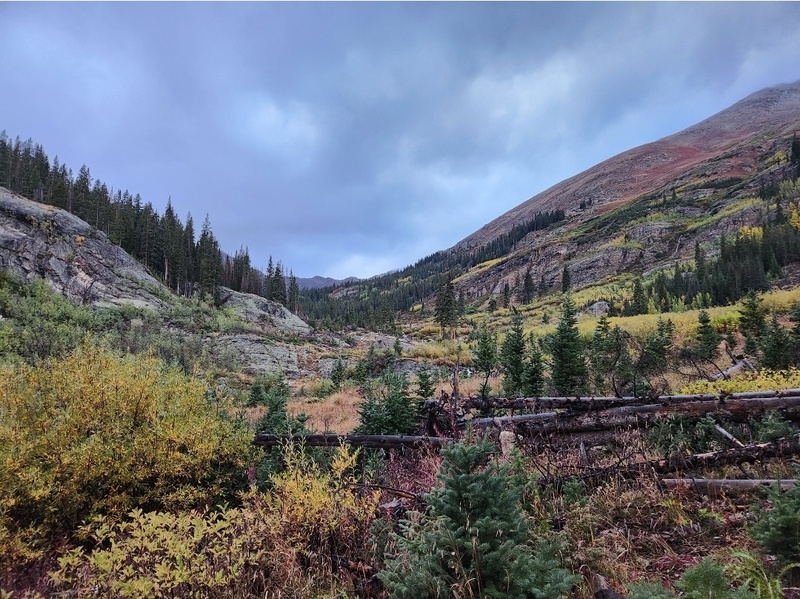
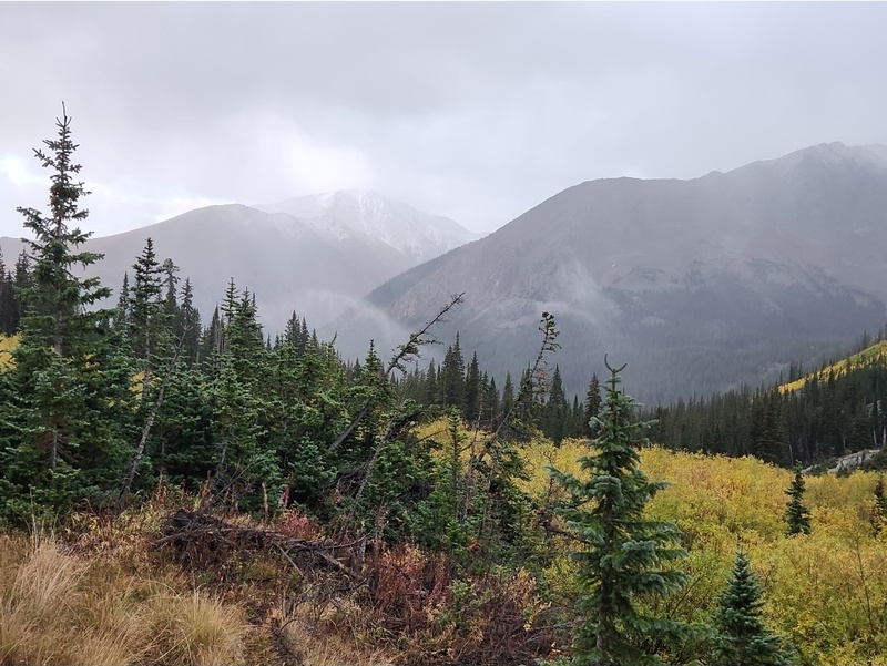
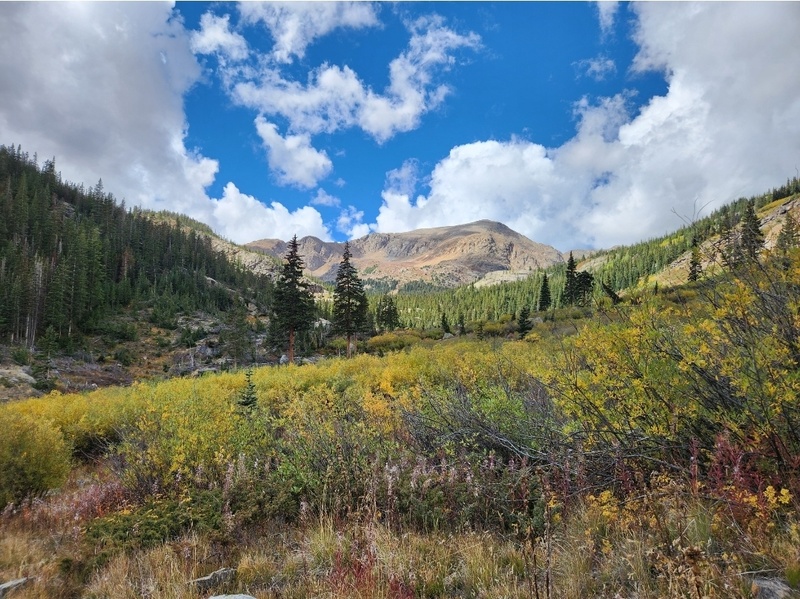
The hike starts by following the North Halfmoon Lakes Trail which is easy to follow. I wasn't sure how I was going to do, physically. I had some mild altitude issues all night, so I slept for a whopping .001 hours and felt extremely fatigued when we hit the trail. But, the conditions of my surroundings were a bit of a treat for me, so I think it put some pep in my step. It doesn't happen a lot, but sometimes there are moments here in Colorado that remind me a lot of my region of origin, the Pacific Northwest. This morning was one of those times. The moody weather allowed the fall colors to pop; the air smelled crisp; and the foliage gave off a variety of sweet scents, like the soft sweetness of snowberry bushes. So I quite enjoyed the dampness and moody-ness.
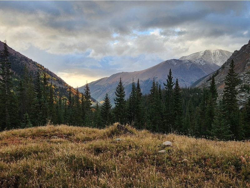
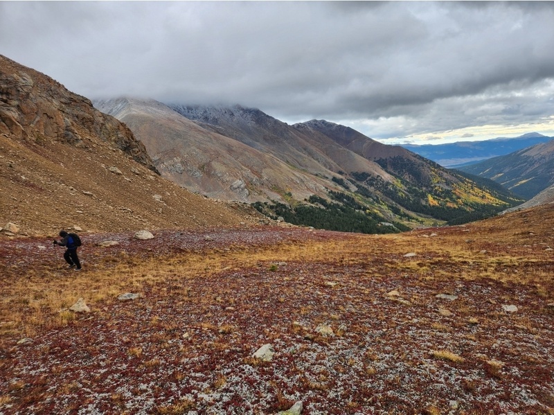
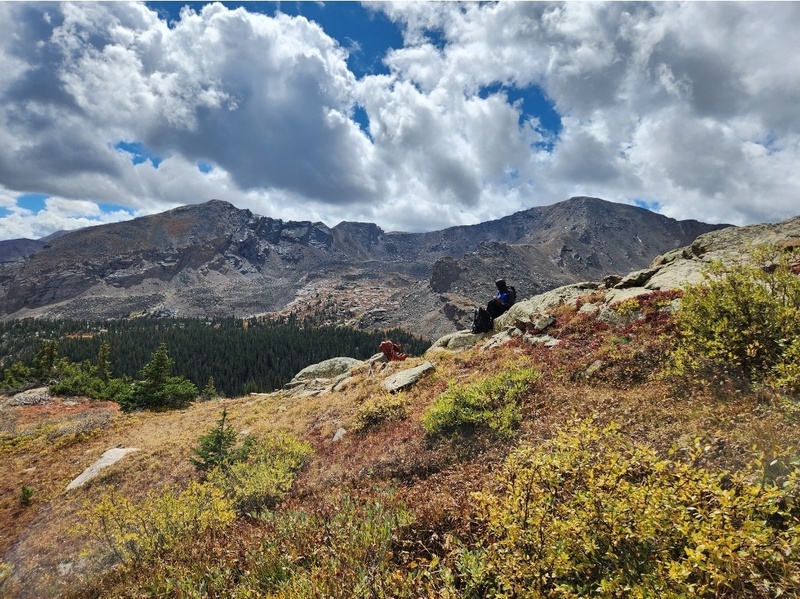
Things were moody over Elbert behind us which also had a dusting of snow.
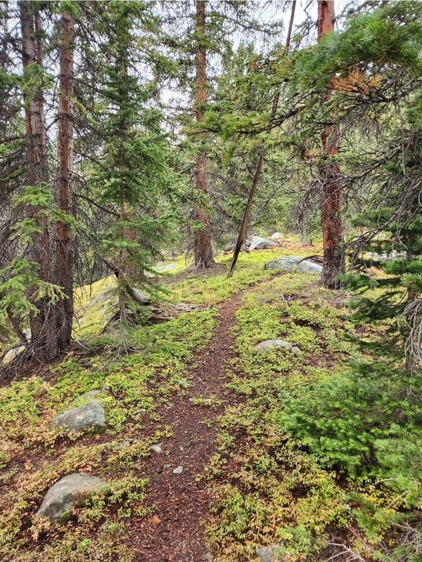
As long as you're on the trail, there's not much to navigate, and the published route description was accurate. This signage is helpful. Obviously, you just keep going straight.
The published route description mentions skirting to the right of a giant rock slab. The views were nice from on top of the slab, and beyond. The clouds kept changing pretty rapidly, but luckily any semblance of rain clouds passed us by without activating more rabid downpours.
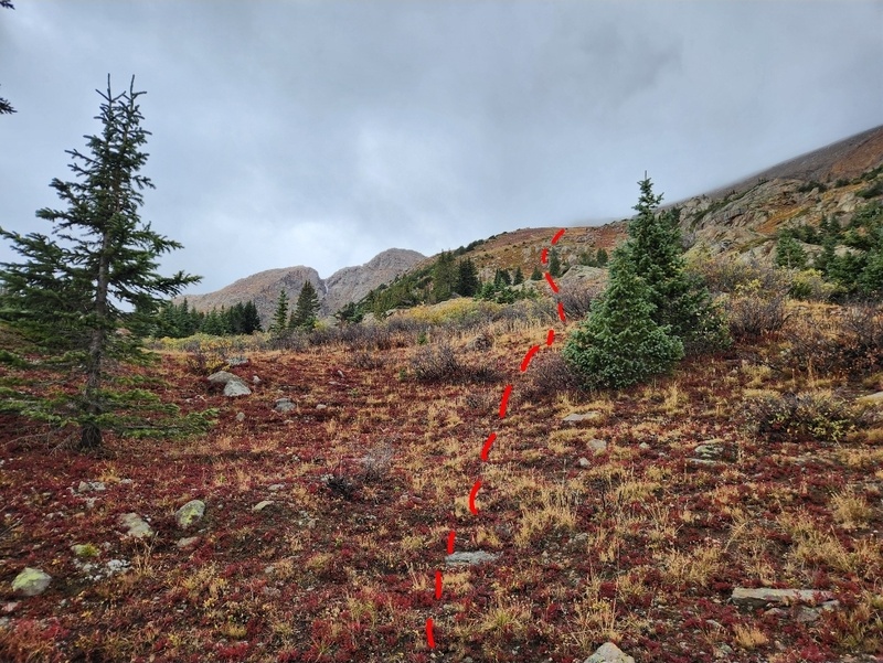
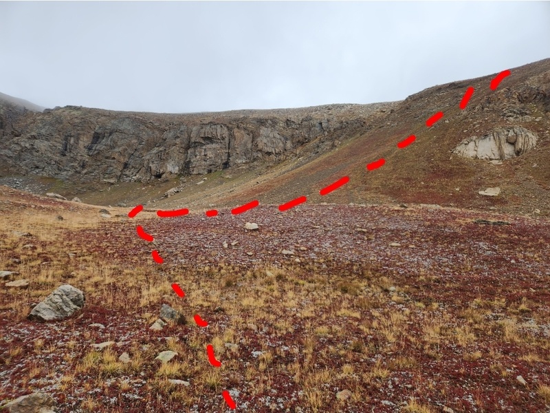
On our return trek, we followed a social trail all the way back to its connection with the North Halfmoon Lakes Trail. But on our approach, we didn't see that social trail. So leaving the NHL Trail around 11,600' was not super intuitive, but I dove into the [extremely wet] grasses to head toward the sound of the creek since I knew we had to cross the creek. Now is a good time to explain the following graphic:
What happened was we got to the creek and found a log to cross, and being the person in front I thought I picked up bits and pieces of a social trail that seemed to go in the right direction, but they never remained continuous. So I ended up dropping us more southerly than needed, and it was a bit steep "recovering" from that. So highly recommend doing a better job pinpointing where the social trail is, or if you don't, maintain a more direct-westerly trajectory. (The "non-oops" northerly section of the GPX track was on the return and was 100% on a social trail the whole time.)
This is the log to cross the creek.
Once we had aimed more distinctly northwesterly after dropping too far south, we intersected this extremely obvious social trail which proved helpful the rest of the way of its existence.
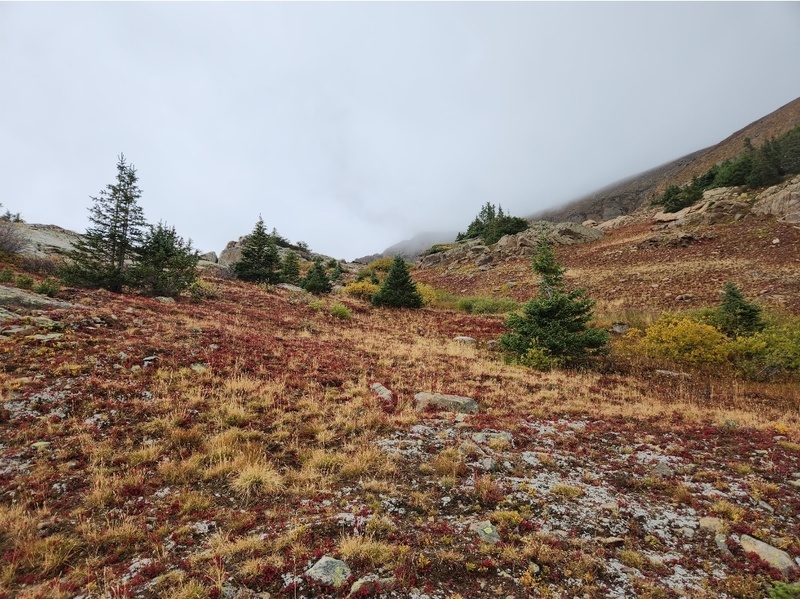
Once out of the trees with visible landmarks again, as well, and visibility to the ridges and slopes, keep maintaining the northwesterly trajectory, and upward. Prior to the area below, the social trail ended, so you just choose your way up the next sequence of slopes. It's all tundra hiking now until you get to a wildly screetacular slope which I will reference shortly.
Instead of doodle dots, this time I have opted for impeccably doodled dashes. Hahaha.
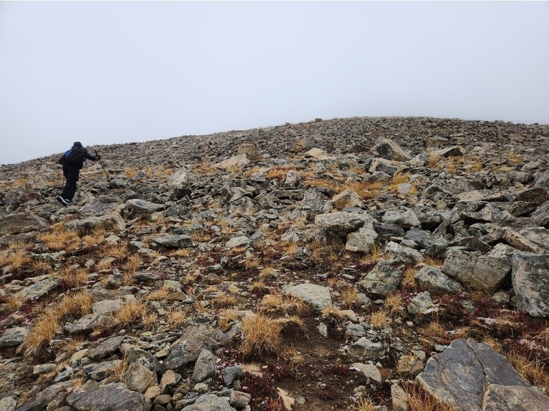
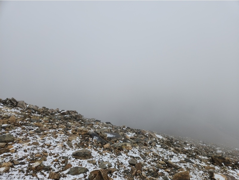
This is a look from closer to the top of the aforementioned slope - and when reality started settling in that we were quite unlikely to get any summit views.
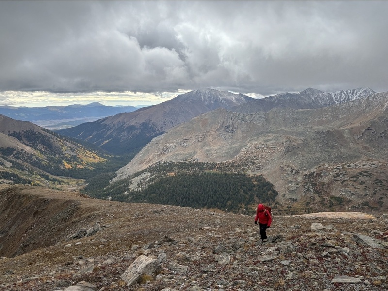
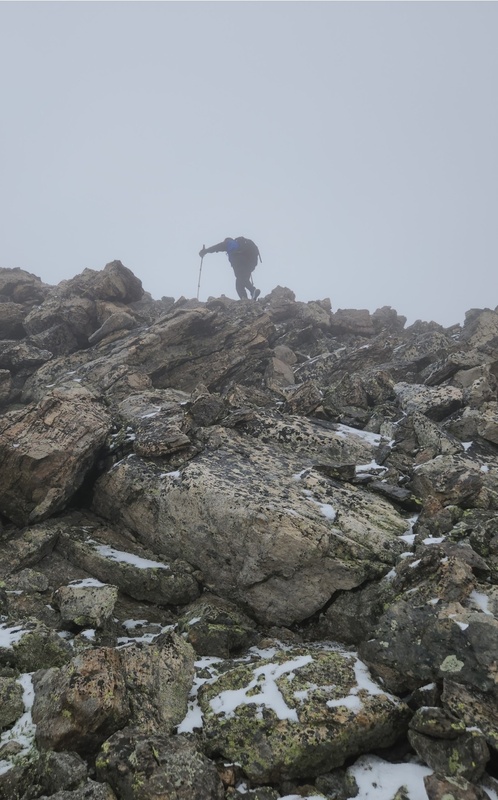
The fall colors were delivering as Andrew continues making his way up this slope.
With as many peaks as I've done by this point, I've been on a decent amount of crappy scree. And it's like every scree slope is in competition with each other to see which one can be the most miserable. I would certainly rank this slope to the ridge as one of the worst stretches of scree I've ever grunted my way through, the kind where with every step you slide backwards with ease. I don't really cuss, but this slope inspired some words. Andrew took a much different line up, but this was a classic "six of one, half dozen of the other" situation; no way to avoid the scree. THAT said - this slope is only 50% bad if you enjoy scree skiing, which I do. So descent wasn't bad at all.
O so screetacular.
My legs were pretty happy to be off that slope! And wow, that cloud ceiling is super cool.
Once on the ridge, it's a straight shot. Just keep going up until there is no up to keep going.
Andrew making his way into the clouds. The rocks would become progressively more slick, and eventually frost-covered. So we definitely had to be careful especially coming back down.Bye bye, views!
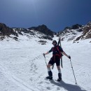
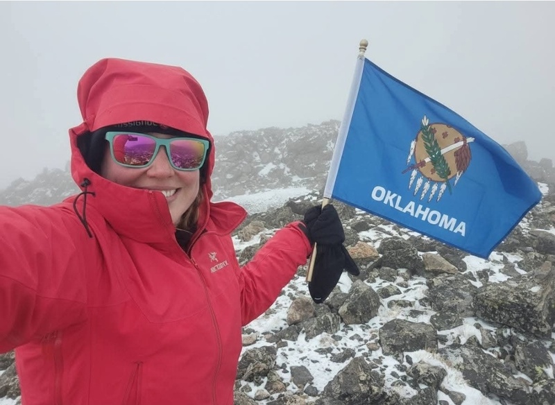
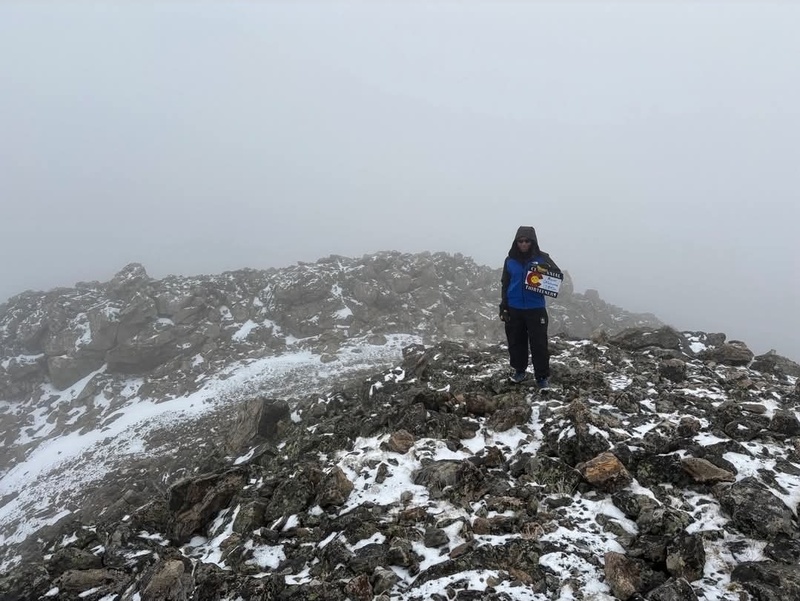
And at long last - the summit and all its glorious views! Ha. And no, I didn't really have a flag; I enlisted help from AI. One of my climbing partners of many years is from (and lives in) Oklahoma, so a picture like this was mandatory.
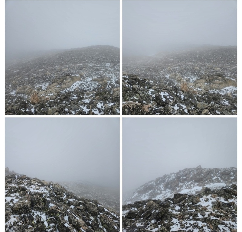
ALL THE AMAZING VIEWS FROM THE SUMMIT!! WILL WONDERS NEVER CEASE???
Oooooh, aaaaaahh..........
Andrew is working on the centennials. This was centennial 13er #24 for him. Whoo hoo!!
I haven't really mentioned this yet, but it was decently cold all day, and once on the ridge the temperature dropped quite a bit more. The summit, especially, was extremely cold and windy. As badly as I needed a snack, this wasn't going to be the kind of summit or ridge we'd stay and spend time on. So we began our careful descent in a timely manner.
Once we were out of the clouds again, it was like a whole different atmosphere started taking shape. Sunshine?! Everything looked beautiful! And the more we descended, the more sunny it got, and that super thick layer of clouds moved on. Pretty interesting weather day!
We finally sat for a fair bit of time snacking, relaxing, and enjoying the warmth of the sun. It didn't seem like the clouds were stacking up to produce the storm activity that was in the forecast, so we didn't have to be in a hurry.
It was a little crazy how different (and warm!) it was compared to when we'd started just a few hours earlier. That's Colorado for you, though - as we all know.
Hello, Elbert.
Oh, Oklahoma. I see you! You can't help but to laugh at the effort to get to a summit just to have no views whatsoever, but then not too long after everything magically clears up.
Bonus Content
I guess 2025 was the year of Oklahoma for me! The month prior to Mt. Oklahoma, I summitted the high point of the state of Oklahoma. Got to the top by sunrise which was super beautiful. The whole trek was actually way more interesting and scenic than I expected. Highly recommend!
My GPS Tracks on Google Maps (made from a .GPX file upload):
I agree with Darin - I think the views from OK are some of the best in the Sawatch. You need to go back...
And, as a postscript to your report title - I was stationed in south Texas for a while when I was in the Navy and as you may know, Texans and Okies love to tell jokes about each other. My favorite Oklahoma joke that I learned there is "Do you know why the license plates in Oklahoma say "Oklahoma is OK" ? Answer - They can't spell mediocre..."
@andrew85 - Casco is still the winner of the trio!
@d_baker - Coming in here with new rules, I see. ;) Hahaha.
@Jay521 - That is hilarious! I'm going to send that to my Oklahoman climbing partner right after I click submit on this. Real curious to hear the Texas joke!
@Veory - Oh wow! I mean, you still ended up on a peak, so that's a story that ends well. Haha. I'm a little curious to know at what point you realized you were on K49 instead. I bet that was a funny moment!
I seem to remember bailing on a nearby 13er on this day only to see it clear up, then deciding to do a nearby 12er and again bailing on that as storm clouds bubbled back up. Good times in this hobby, I think that's the only time I had 2 separate outings end unsuccessfully due to weather in the same day! I do agree that the OK summit affords better than OK views!
@Tornadoman - That's a funny coincidence! If I recall, you were also nearby the day we had that weird super early storm activity on French. As it was, for Oklahoma, it also seemed the forecasted lightning storms never came to fruition at all. We took our sweet time getting back to the vehicle. Just a weird weather day, once again. Gotta love it!
Thanks for an entertaining report. I remember looking for those trails. Fun times.
Here's another joke that I used to hear in San Antonio:
Why doesn't Texas fall into the Gulf of Mexico? Because Oklahoma sucks.
Cheers
The absolute best place to be in Texas is smack dab in the middle because no matter which way you go, you're leaving...
Caution: The information contained in this report may not be accurate and should not be the only resource used in preparation for your climb. Failure to have the necessary experience, physical conditioning, supplies or equipment can result in injury or death. 14ers.com and the author(s) of this report provide no warranties, either express or implied, that the information provided is accurate or reliable. By using the information provided, you agree to indemnify and hold harmless 14ers.com and the report author(s) with respect to any claims and demands against them, including any attorney fees and expenses. Please read the 14ers.com Safety and Disclaimer pages for more information.
Please respect private property: 14ers.com supports the rights of private landowners to determine how and by whom their land will be used. In Colorado, it is your responsibility to determine if land is private and to obtain the appropriate permission before entering the property.


")
")
")
")
")
")
")
")
")
")
")
")
")
")
")
")
")
")
")
")
")
")
")