| Report Type | Full |
| Peak(s) |
El Picacho del Diablo, 10,154 |
| Date Posted | 02/03/2026 |
| Date Climbed | 05/26/1978 |
| Author | gore galore |
| Nostalgia - Climbing Baja California El Picacho del Diablo, 1978 |
|---|
|
Nostalgia - Climbing Baja California's El Picacho del Diablo, 1978 by gore galore The December 2025 trip report by mrgooseskin on climbing Mexico's El Picacho del Diablo reminded me of my own climbing trip to the mountain from forty-eight years ago. I first came to know of the mountain in the 1970s from reading some articles about the Sierra mountaineer Norman Clyde who climbed the peak in 1932 and 1938. The mountain assumed an aura of mystery and adventure for me along with its character and history that was something outside the popular realm of the Mexican volcanoes. When I came upon a guide service in California in 1978 that guided the mountain, I was a willing participant. El Picacho del Diablo was little known then outside of the southern Californians and the Desert Peak section of the Sierra Club. It probably still retains its insularity although today there are more southern Californians and Desert Peak section climbers. It is probable that only a handful of the 14ers.com site members have climbed the peak or have any familiarity with it. After climbing the mountain, I wrote a report mostly for myself where it stayed in an envelope at the bottom of a drawer for almost fifty years. The recent trip report describes the modern-day approach from the San Pedro Martir National Park and a climb of Pinnacle Ridge. It notes that a minority now approach the mountain from the long and arduous Canon del Diablo. Upon reaching the base of Pinnacle Ridge the report comments on looking “down into the impressive Canon del Diablo.” Unfolding the pages of my long-ago trip report from its envelope and reading those pages again, I decide to post my nostalgic report describing that impressive Canon del Diablo approach leading to the summit of El Picacho del Diablo. My words are unchanged as I wrote them in 1978. El PICACHO DEL DIABLO El Picacho del Diablo, 10,154', Baja California's highest point, is one of the outstanding mountain climbs in the southwest. Located in the Sierra San Pedro Martir mountain range, approximately 125 miles south of the California border, it is a remote and rugged mountain, and a challenge to climb. El Picacho del Diablo's twin summits are part of a pinnacled ridge that projects outwards from the eastern side of the mountain range and is separated from the main range by its notorious Pinnacle Ridge and the 3,800 foot deep trench of Canon del Diablo. Its most popular ascent route is from the east, across the San Felipe desert, through the fourteen mile long Canon del Diablo, and a third class ascent on the west face of the peak. The ascent involves long approaches, continuous boulder hopping and innumerable stream crossings, several bypasses up cliffs to get up and around waterfalls, and most frustrating of all, never knowing exactly where the peak is until it is almost climbed. Early Spanish explorers knew the mountain as La Providencia (The Providence) as they saw its snow covered summit a gift of moisture to the desert below. The Mexican government and maps name it Cerro de la Encantada (Mountain of the Enchanted One), but to those who climb it, it is most always referred to as El Picacho del Diablo (The Peak of the Devil). I have heard of the mountain for several years, and the desire to climb it is a strong one. I decide that the climb may involve too many hazards for a solo attempt, and am fortunate to learn that Pacific Adventures of Riverside, California sponsors a climbing trip to the mountain. We meet in a parking lot on the University of California Riverside campus during the last week of May and drive southward through California's irrigated Coachella and Imperial valleys, through Mexicali and into the bareness of the Baja. We are – six southern Californians – Alan Ehrgott, co-director of Pacific Adventures; Pete, a retired school teacher and administrator and his son Phil; Lowell, a semi-retired university professor; Fritz, a tool and dye maker; Jim, a carpenter - and myself. 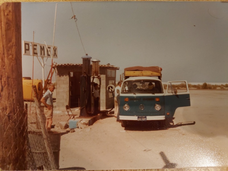
We turn off the main highway, following tire tracks across the desert that lead into a dry lake bed, past a primitive rancho, and to its end at the mouth of Canon Diablito. El Picacho del Diablo towers overhead until it is obscured by its furrow creased foothills. We will not see the mountain again until we stand upon its summit, three days later. We hike northward for about a mile and a half until we come to the broad wash at the mouth of Canon del Diablo where we make camp for the night. The fourteen mile long Canon del Diablo is shaped somewhat like a fishhook. With its opening on the eastern side of the range, its first few miles head westerly where it turns southward to its terminus on the west side of the peak. We will take two days getting through the canyon to our base camp near its upper end at Campo Noche, where we will make the climb. Near the opening of Canon del Diablo is its greatest obstacle. A four foot waterfall flowing into a pool at least head high or more and paralleled by high, slick, and smooth canyon walls blocks the way. Morning finds our party at the waterfall. Fortunately someone has placed a bolt and fixed rope on the canyon wall on the left side. We are able to pendulum across the base of the canyon wall and over the waterfalls. Once above it, we encounter other falls where we must climb up small cliffs to get around them. Sometimes we must take our packs off and haul them up first. 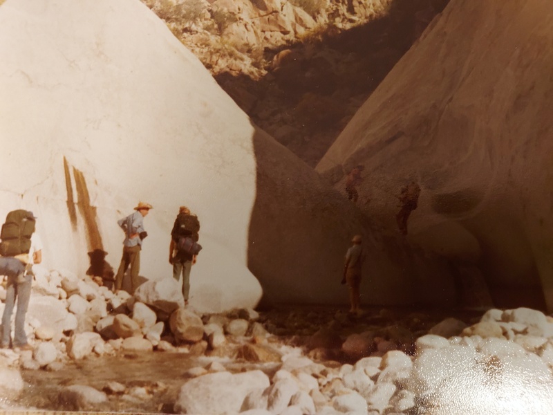
As the canyon turns southward we leave the waterfalls behind and boulder hop our way. The sun shines brightly out of a clear blue sky and reflects off the bleached white rocks. We are fortunate though for several breezes and mild temperatures and we have plenty of water to drink from in the stream. We camp that night on a gravel bank above the stream about half way through the canyon. More boulder hopping and countless stream crossings greet us the next day. Near 4,300' on the map we are confronted by a large waterfall. We haul our packs up on the cliffs on the left side and then climb up. We pass over colorful bedrock, the stream flowing over and staining the rock. We pass a steep gully on the left, McClain Wash, the route followed by Donald McClain to the north ridge and the summit on the first ascent of the peak in 1911. 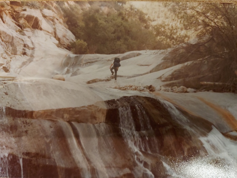
The canyon begins to steepen, becomes brushy, and the continual boulder hopping is tiresome. Phil decides to take a dip in an inviting pool of water. I am wondering when we are going to reach Campo Noche. We are strung out in the canyon. Alan, Fritz, and I reach Campo Noche, some cleared spots among cedar trees on the left side of the stream at the western base of the mountain. The others come into camp and we are finally in a position to climb El Picacho del Diablo. We have hiked fourteen miles in two days, from the opening of the canyon at 2,000' to Campo Noche at 6,300', an elevation gain of 4,300 feet. Tomorrow we will climb the peak, an elevation gain of 3,800 feet, in no more than a two mile lineal distance. The following morning we lighten our existing packs or switch to day packs. Directly above Campo Noche is a steep gully, so-called the Night Wash. We climb up the thousand feet to its top where we are met by the sight of the west face of the mountain – rock slabs, small ridges dividing drainages and washes, huge boulders and rock debris, all covered by manzanita and assorted brush and topped by craggy picachos, somewhere behind which hides El Picacho del Diablo. We find Slot Wash, a hanging canyon that leads upward to the peak. In places ducks left by other parties help us find our way. It was not always like this. Until 1955, most ascents of the peak began from the west, crossing the Sierra San Pedro Martir plateau, descending into the upper reaches of Canon del Diablo, and then by a process of trial and error picking a route on the west face of the peak, many a climb ending on Pinnacle Ridge. A Californian, Bud Bernhard, after several attempts found the most direct route to the summit, the Slot Wash route via Canon del Diablo. 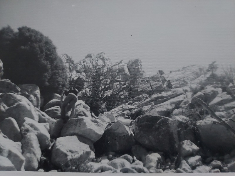
We follow the route ever upwards, Canon del Diablo receding farther and farther below us and the Sierra San Pedro Martir plateau becoming more level behind us. Over 9,000 feet we turn left into a wash that becomes narrow and steeper as we ascend, cliff walls on each side with the appropriate name of Wall Street, above it huge rock slabs lead skyward. We are somewhere near the top but the peak is unrecognizable. I see Fritz who is a few minutes ahead of me sitting down. I yell at him. It is the top. I scramble up the last few feet to the summit of El Picacho del Diablo. 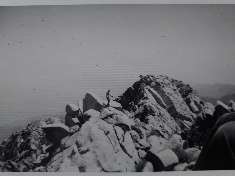
The steep escarpment on the east side plunges 8,000 feet to the desert floor. Several canyons wind their ways upwards into the flanks of the peak. A short ways away but longer to get to is the south peak, two feet lower. Both peaks are connected to the forested Sierra San Pedro Martir plateau by Pinnacle Ridge. Within the hour our whole party is on top. It has taken the first of us five hours and fifteen minutes. We are tired and fatigued but rewarded with such a climb as we descend the peak to Campo Noche. We have climbed El Picacho del Diablo but we have not conquered it, for the peak will demand the utmost in stamina and endurance from most any mountaineer. ADDENDUM Upon our descent we camped that night at Campo Noche. The following day we hiked about halfway down the canyon and camped. The next day we returned to the van in the afternoon and were back in Riverside by 9:00 p.m. POSTSCRIPT Along with the report I kept a log of expenses, and it is interesting to look back at some prices in 1978. Inflation was 7.6% that year. Pacific Adventures guide fee for four-day climb - $96. Round trip airline, Denver to Ontario, CA on Continental/United - $116. Motel 6 in Riverside - $13.67. Dinner, Azars restaurant in Riverside - $2.84. Breakfast, Azars restaurant in Riverside - $3.42. Dinner, Ontario Airport - $4.01. Parking Fee, Stapleton Airport - $19.50. Miscellaneous - $3.50. Six-day trip cost - $258.94. AFTERWARD Alan Ehrgott was the leader of the trip and founded Pacific Adventures in 1973 and for the next ten years led a wide spectrum of various outdoor trips. In the early 1970s Alan had hiked the Pacific Crest Trail from Mexico to Canada and with his brother became the first to hike the length of Baja California. In 1989 he founded the American River Conservancy and was the executive director for some thirty years until his retirement. I know nothing more of the others on the trip other than we were all successful in climbing and safely returning from the Peak of the Devil. Thumbnails for uploaded photos (click to open slideshow): ")
")
")
")
")
|
| Comments or Questions | |||||||||
|---|---|---|---|---|---|---|---|---|---|
|
Caution: The information contained in this report may not be accurate and should not be the only resource used in preparation for your climb. Failure to have the necessary experience, physical conditioning, supplies or equipment can result in injury or death. 14ers.com and the author(s) of this report provide no warranties, either express or implied, that the information provided is accurate or reliable. By using the information provided, you agree to indemnify and hold harmless 14ers.com and the report author(s) with respect to any claims and demands against them, including any attorney fees and expenses. Please read the 14ers.com Safety and Disclaimer pages for more information.
Please respect private property: 14ers.com supports the rights of private landowners to determine how and by whom their land will be used. In Colorado, it is your responsibility to determine if land is private and to obtain the appropriate permission before entering the property.


