| Report Type | Full |
| Peak(s) |
Mt. Marcy - 13,504 feet De Anza Peak - 13,391 feet Gibbs Peak - 13,577 feet |
| Date Posted | 02/09/2026 |
| Date Climbed | 01/31/2026 |
| Author | yaktoleft13 |
| To Whack or Not to Whack |
|---|
|
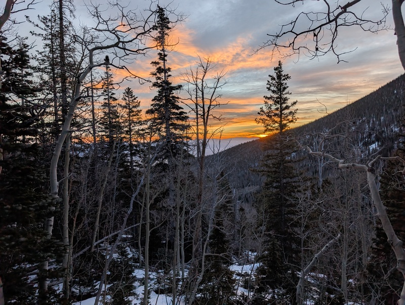
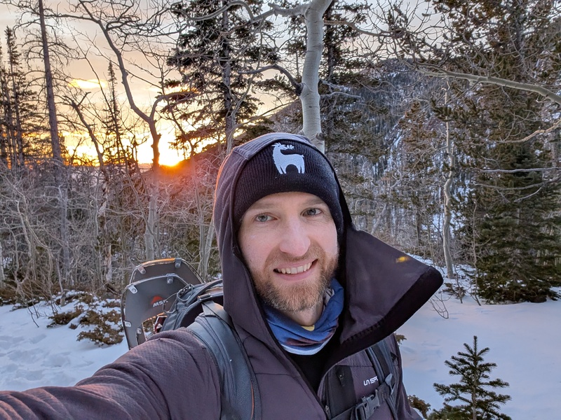
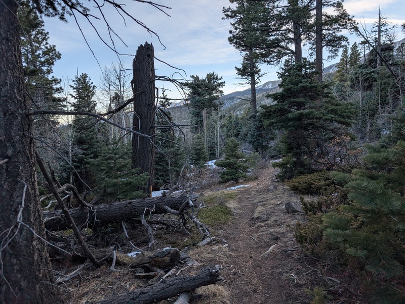
Route: Swift Creek -> Marcy south slopes to ridge -> De Anza -> Gibbs -> Gibbs east ridge descent to Texas Creek Trailhead: Gibson Creek Miles: ~18 (my watch froze for the first hour so guessing a bit on distance/vert) Vert: 6500-7000 Time: approximately 12 hours Difficulty: mostly class 2 It had been a few weeks since I'd forayed into the mountains, so I was getting eager to go. I'm rapidly running out of reasonable winter 13ers that are new to me, but I'd saved this trio for a couple of years until the timing seemed right. During a normal snow year, I'd spied the southern slopes of Marcy's ridge while headed up Silver and it was dry, so I figured that this could be a viable route most times. Well, coupling that with the fact there is just absolutely no snow, I figured this might be a downright fun, and dare I say easy, day? I linked up with Emily (bigfoot1) for this climb. We settled on a start time around 5:30 (too late for me, too early for her, so probably just right), and after a reasonable night's sleep at the Gibson Creek Trailhead and some jetboiled coffee, we were ready to go. Unlike last time, we collectively didn't miss the turn for the Rainbow Trail and took it to the Swift Creek turnoff, where we were immediately met by a downed tree. Fortunately, this was not a harbinger of things further up this trail, and while a dusting to a few inches of snow appeared, the Swift Creek trail was in great shape and we made quick time. As usual, I stopped to take too many sunrise pictures. 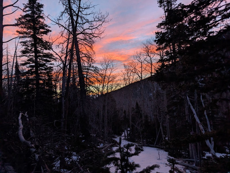
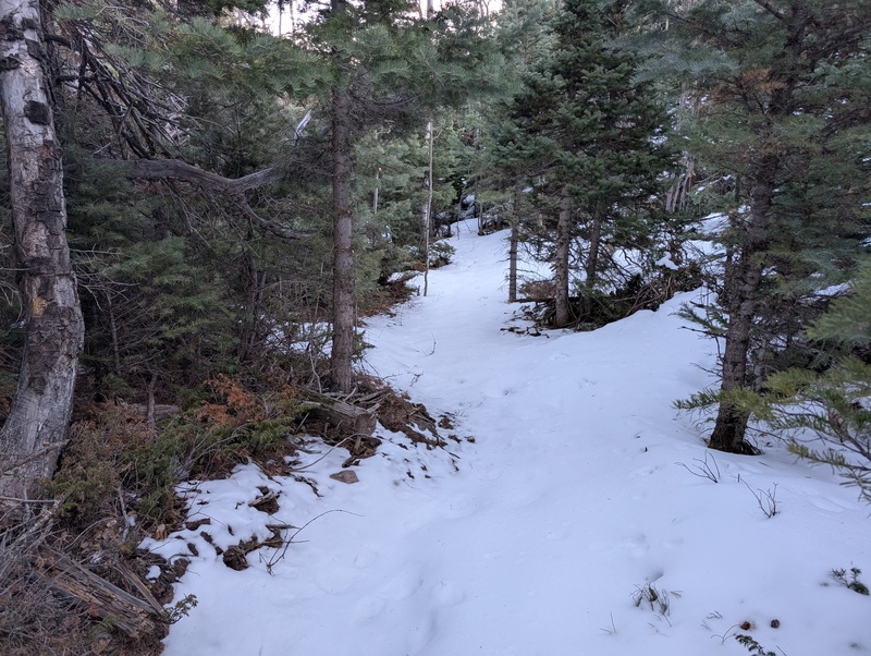
The trail had one set of recent tracks in it, which really aided our ascent. Eventually, those tracks stopped, perhaps a half mile or so before the waterfall. Beyond that, a faint trench from earlier in the season continued on, but the conditions warranted snowshoes for ease of travel (except when it was randomly dry and didn't, then did, then didn't, then did, then didn't, then...). Emily tried switching a couple of times before relenting to snowshoe life; I kept mine on the whole time and click-clacked my dull snowshoes up the trail, swapping trailbreaking duties along the way. 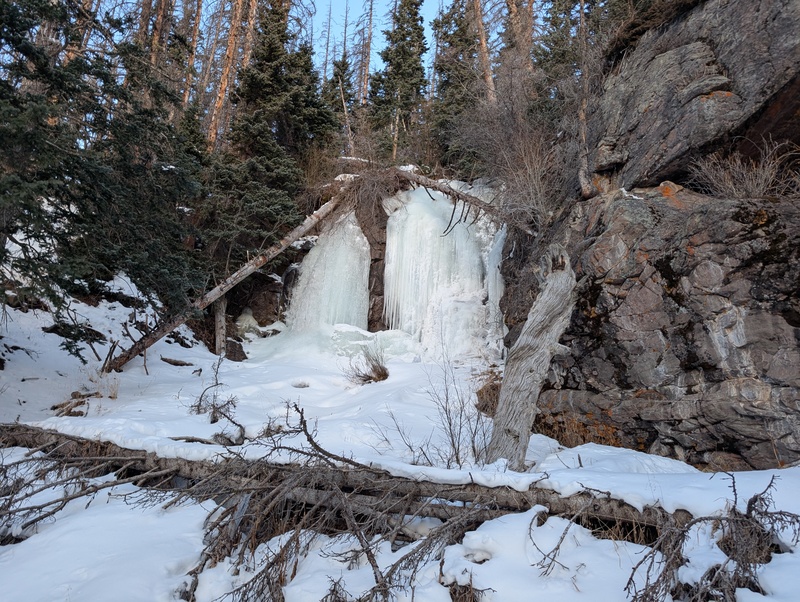
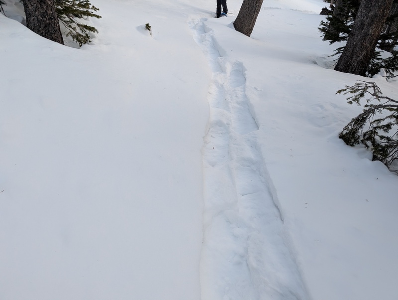
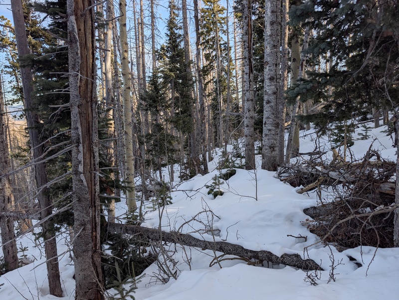
Shortly before reaching the lower Lake of the Clouds, we veered off the main trail and headed west/northwest up into the trees, looking for the easiest way to reach the south/southwest slopes leading up to Marcy. This was somewhere around 11.4k. The moment we stepped off the main trail, the trenching began in earnest, and for the first time this year I had snow past my knees. We fought our way through variably deep snow and up some steeper slopes, trying to pick as direct a line toward treeline as possible while staying on as southern of aspects as possible for snow quality. It did get fairly steep, but the snow became more supportive as we angled more directly toward the ridge, and we popped out at treeline below a largely bare rocky slope leading to the ridge. Unfortunately, Emily had broken in some new ski boots a few days before and had blistered on her heel, and while she took efforts to bandage it up, the steep trailbreaking popped the blister wide open. As every step was painful and making it worse, she made the tough decision to call it at treeline. We bid each other adieu, promised to get after it again soon, and headed in our respective directions: me up, her down. 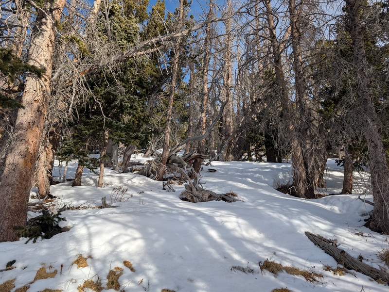
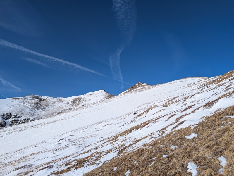
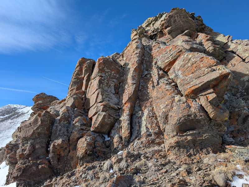
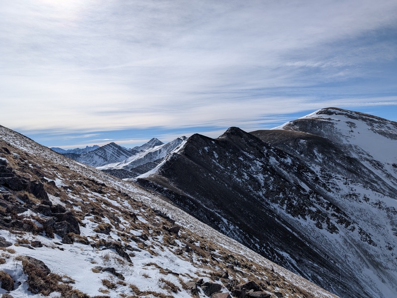
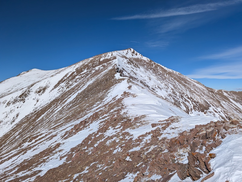
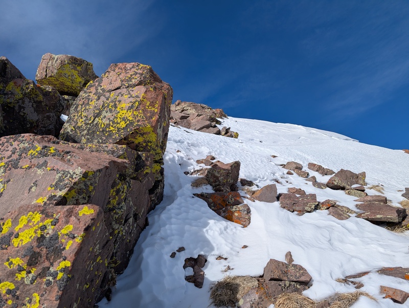
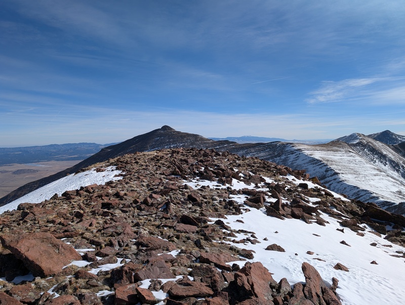
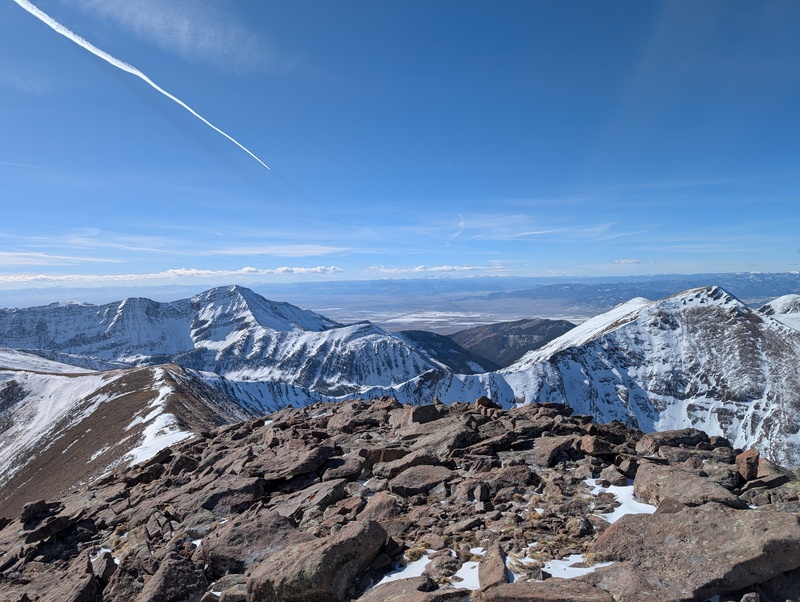
I took off the snowshoes, loaded them up on the pack, and began the climb up to the ridge. I made good time, as the legs were feeling surprisingly fresh for not having climbed in a month, and popped out on the ridge at 12,600 in just a few minutes. It was clear on the way up that there were several ridge bumps that were not necessary to climb, as they gave up all their elevation on the backside, so I tried skirting around all the unnecessary points. All too often, the natural route to avoid the high points led me upwards, and close to, if not all the way to, the top of the bumps anyway. After a few, a final drop in elevation led to what clearly was the start of the final climb up to Marcy's southern false summit. I was mildly surprised to find a short but legitimate 3rd class section, which I dispatched to the left side, but that was the only surprise. The snowfield visible on the ridge just below the false summit ended up being no big deal, and there were some jagged, scrambly rocks that climbed quite easily that led to the top of the false summit. 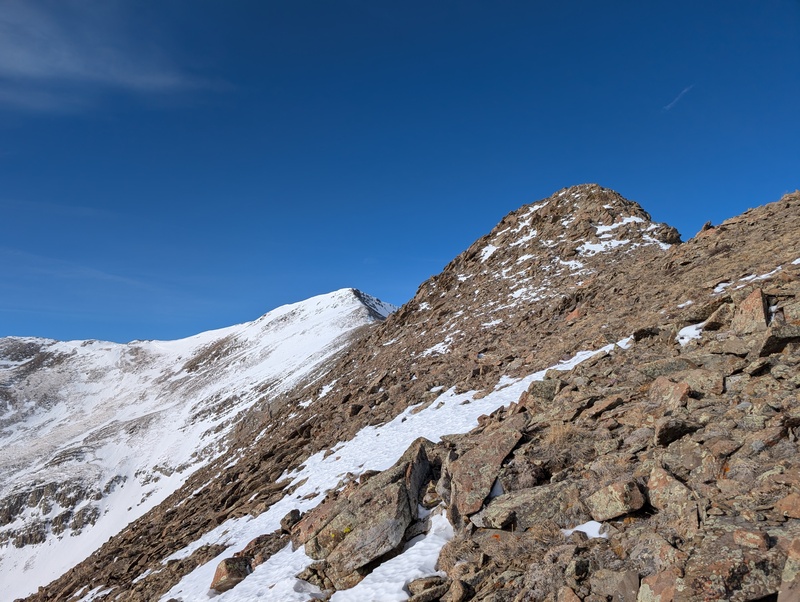
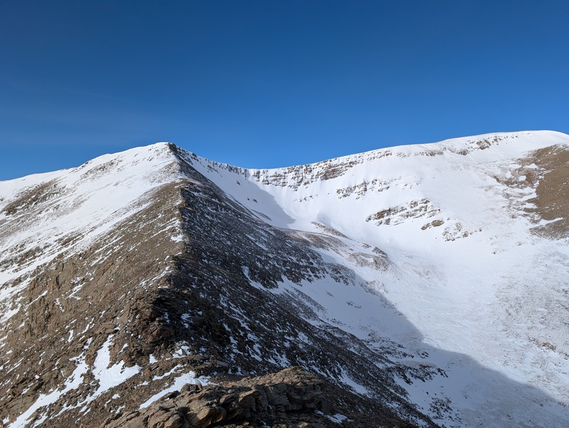
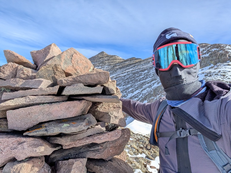
From the top of the false summit, the route to Marcy was essentially dry. There was a highway of tundra and talus to follow...so I did. It was a quick and gentle ascent, and I arrived at the summit of Marcy under beautiful sunny skies! 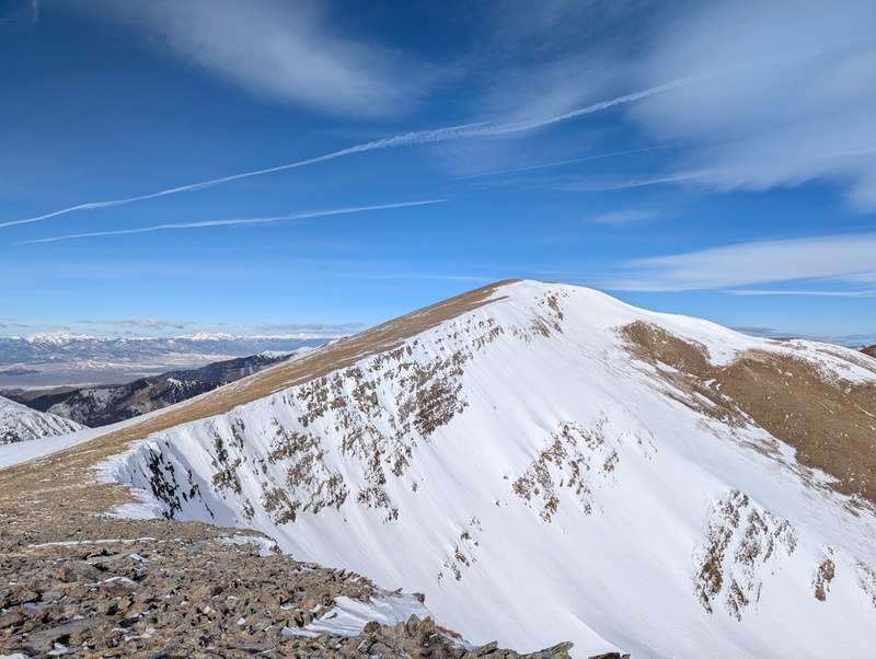
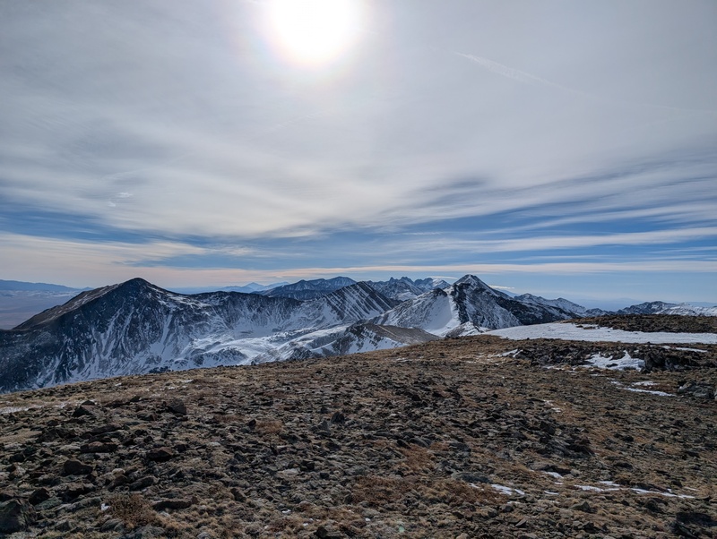
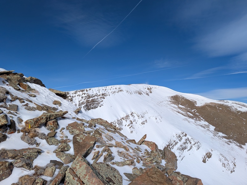
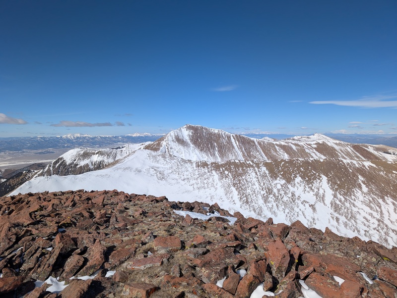
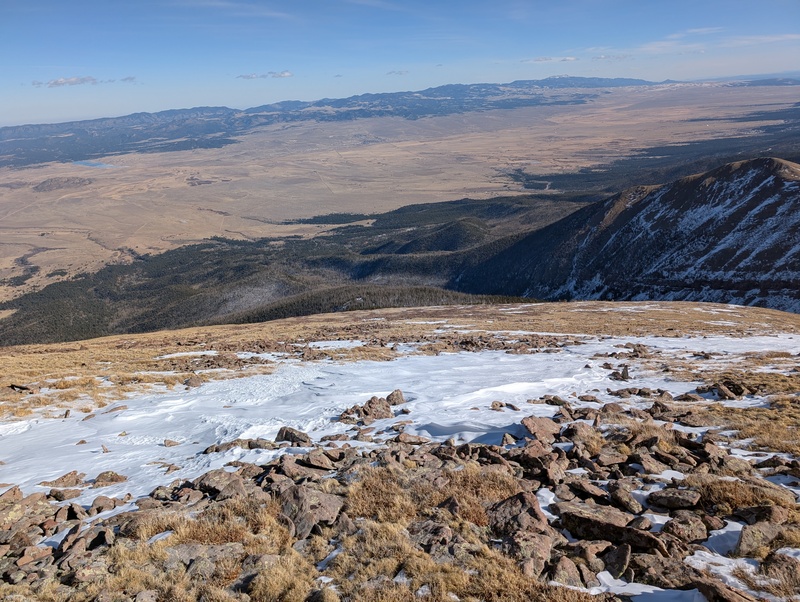
I ate some food and drank some water, but seeing how far the other peaks looked away from me, I didn't linger long. The initial descent off of Marcy held a bit of rocky scrambling, though nothing really hard (and though I didn't have him with me, nothing my dog couldn't handle). There was a bit more consistent snow patches as I slowly dispatched the up and downs of the ridge, but it was all low consequence and low angled, so onward I went. There is a large hill leading up toward the "Y" intersection between Marcy, De Anza, and Gibbs, but rather than climb it, I figured I could skip most of it by cutting across the southwestern side of the point. That worked pretty well, but there eventually was a steeper, loose gully that looked trickier to cross, so rather than engaging it directly I climbed the 50 extra vert back to the ridge and navigated the wind-loaded snow on the ridge crest. 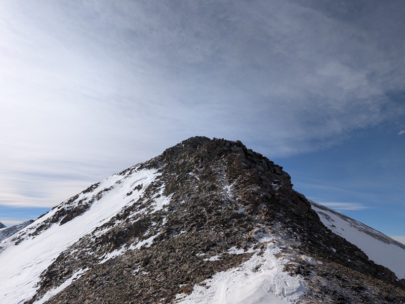
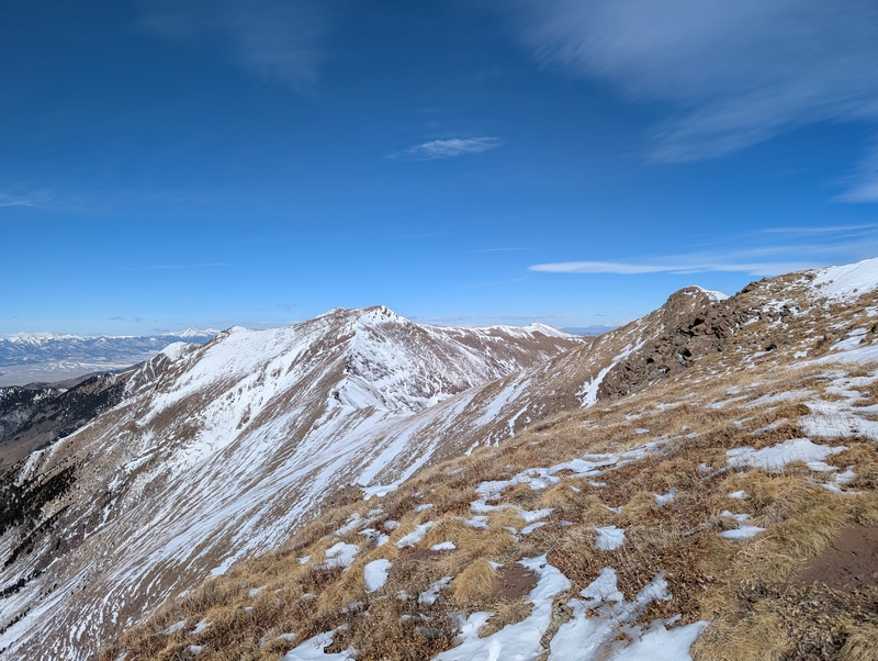
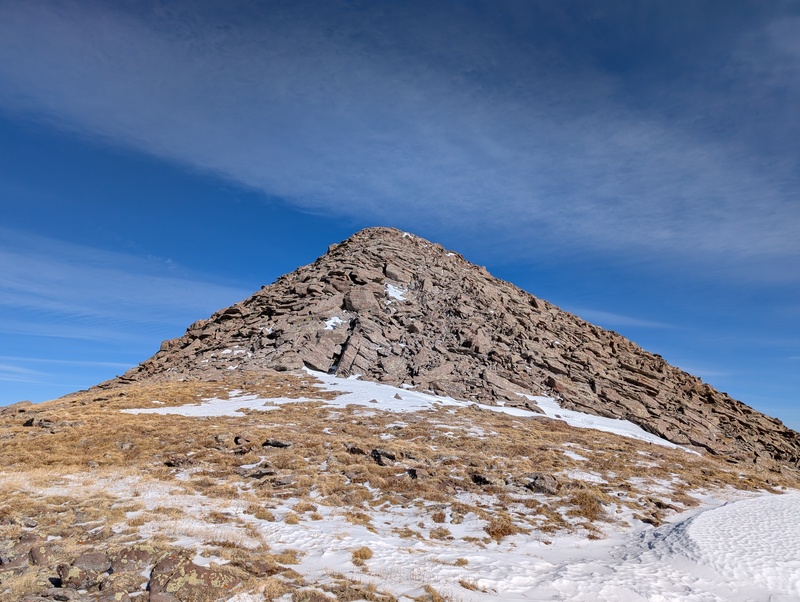
Once I reached the actual ridge to De Anza, I decided that should there be deep snow, I'd just wallow through it, so I stashed my snowshoes for my return to De Anza. A long, gradual descent led to the annoying low low point between De Anza and Gibbs, around 12,700. There was an imposing looking tower just beyond the saddle, but after descending to it and beginning up, It was quite easy to dodge it on the southern side. The ascent up De Anza looked snowier than a lot of of the route thus far, but everything held firm and a surprising amount of rock was exposed and climbable. As I approached the steepest part of the climb just below De Anza's summit ridge, there was some steep snow, but another staircase of talus bisected it, making for easy climbing. From there, a short jaunt up mostly rock led to De Anza's summit, number 2 of the day! 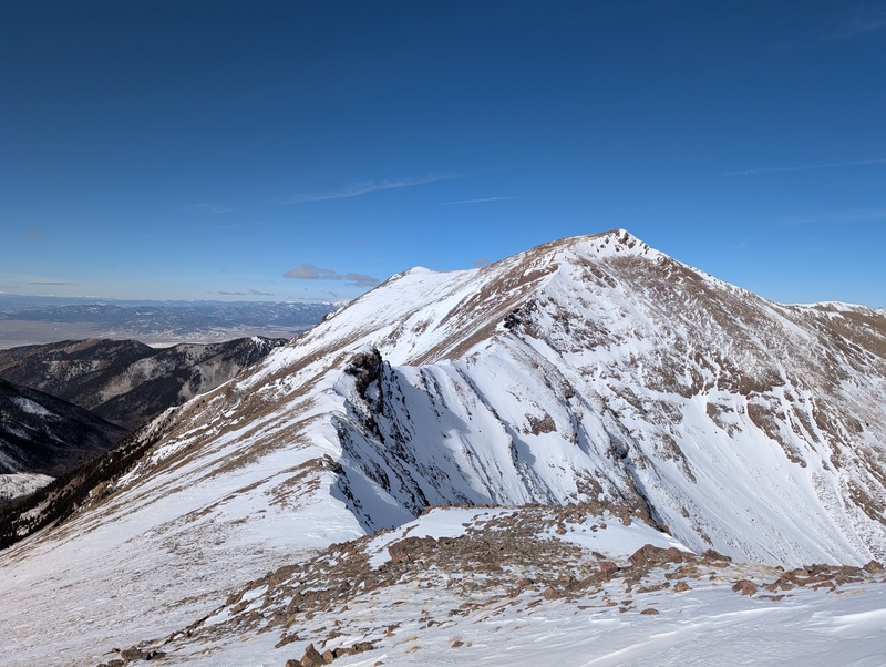
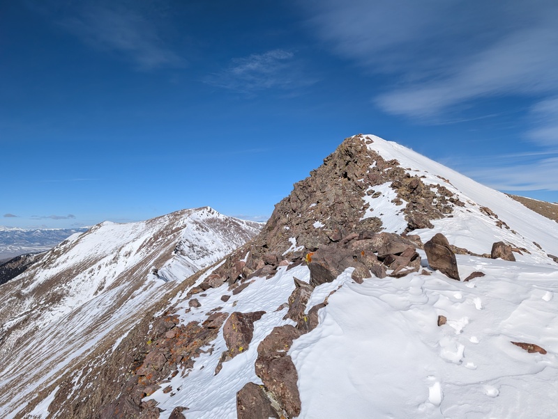
Knowing there was one more peak to go, I headed back down the ridge, backtracking for the first and really only time on the route today. I knew that heading up toward Gibbs wasn't going to be technically difficult, but from the low point to the summit of Gibbs was going to be upwards of 800 vert, and I already had quite a bit on my legs already. I stopped to take some pictures of a cool overhang on the ridge, dispatched the tower again, and trudged up to the snowshoes, lamenting the extra 4 pounds going on my back again. 
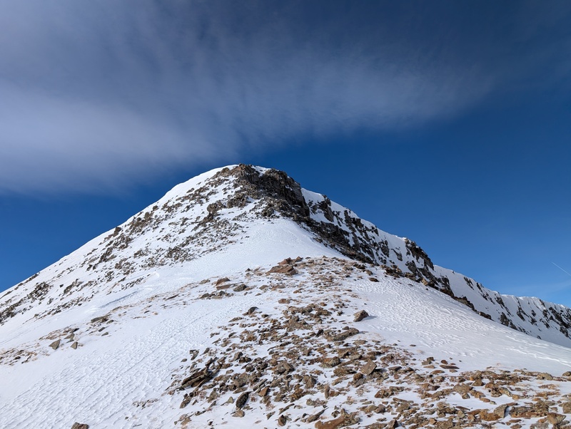
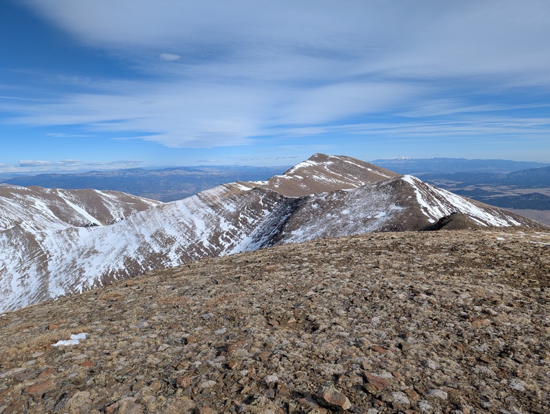
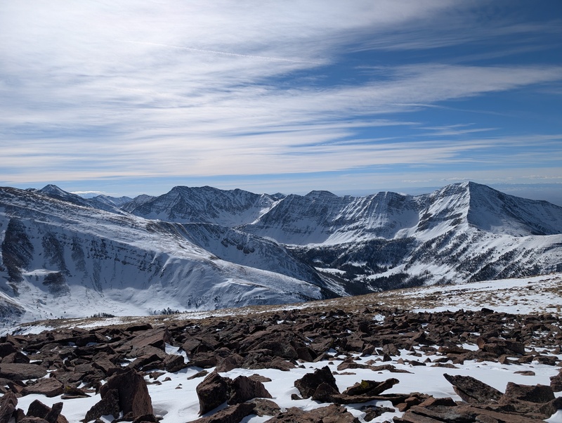
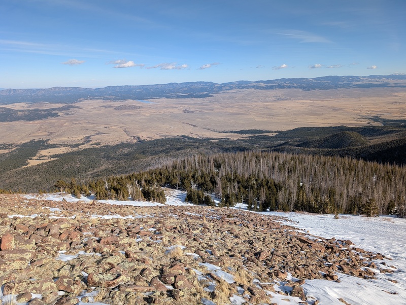
I loaded up the snowshoes and kept on climbing. I was definitely starting to feel the effort of the day at this point, but with only one peak to go, determination kept me going onward. There were a few miniature cliff bands to overcome to reach the Y junction, but none posed a large challenge. Before long, I reached the Marcy/Gibbs ridge and got my first up-close view of the last real uphill of the day. 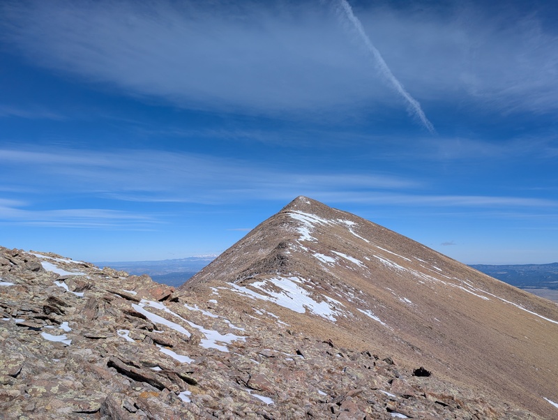
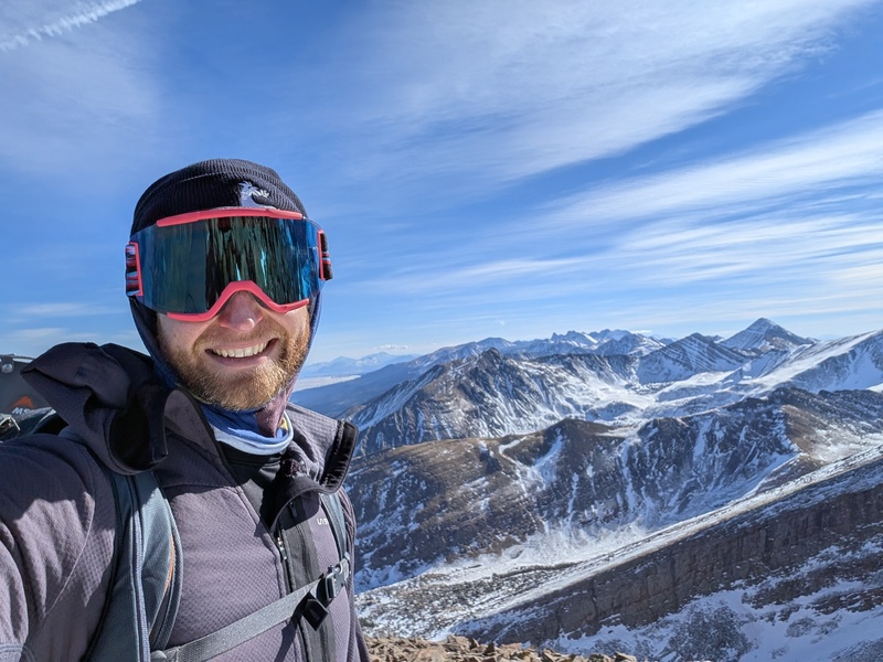
There was basically no snow to consider on this ridge. All there was to do was put one foot in front of the other until there was no more uphill to go. The final bump to the summit of Gibbs was a little steeper and more slabby, but still class 2 and entirely dry. I topped out on summit number 3 and found a spot out of the wind to take a well-deserved longer break. 
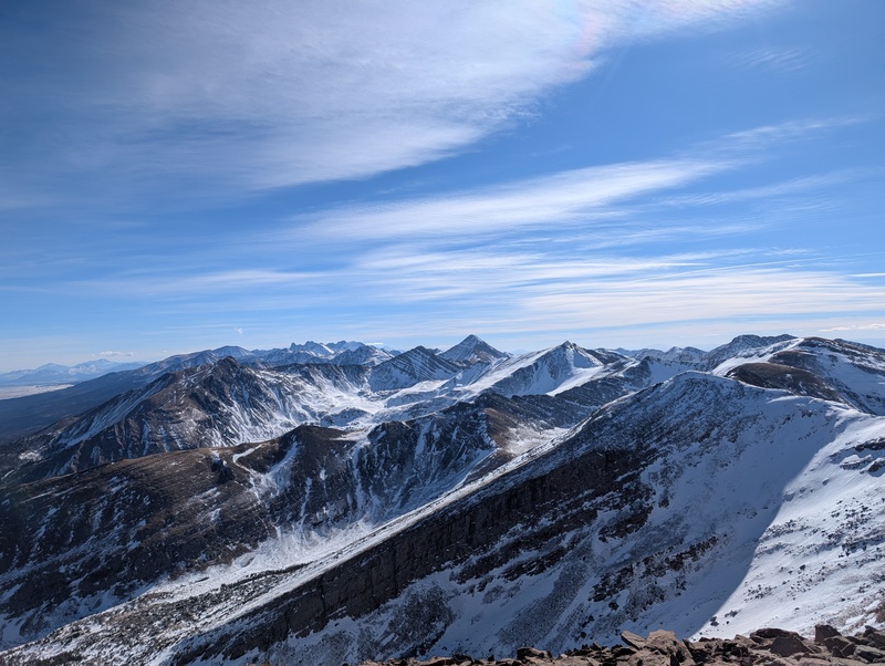
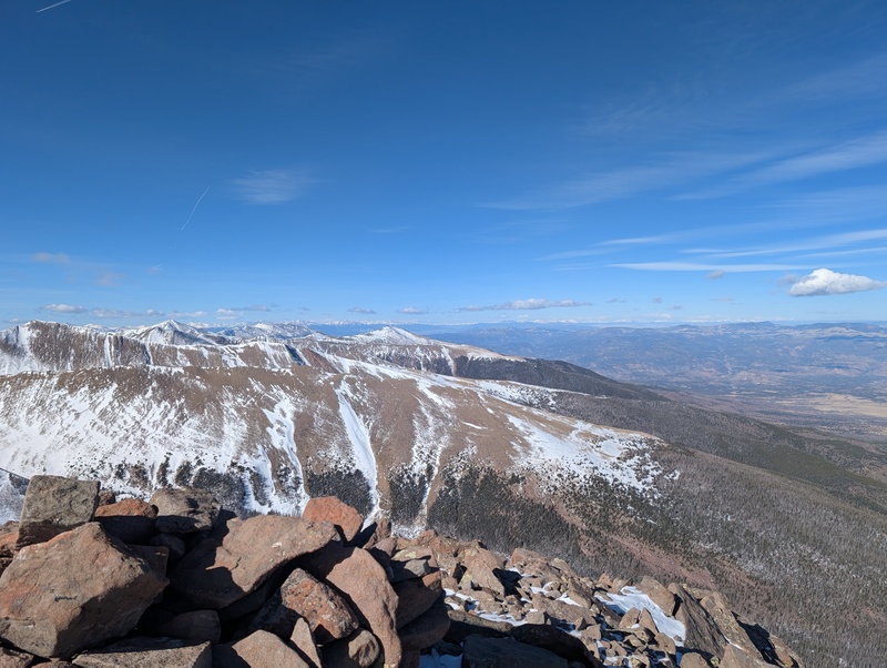
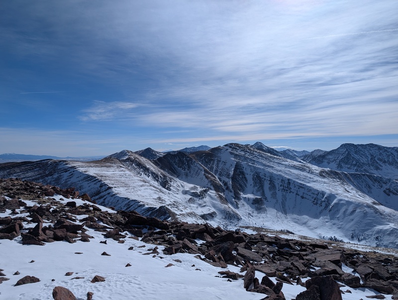
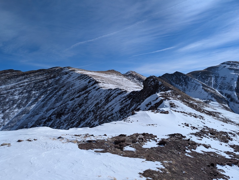
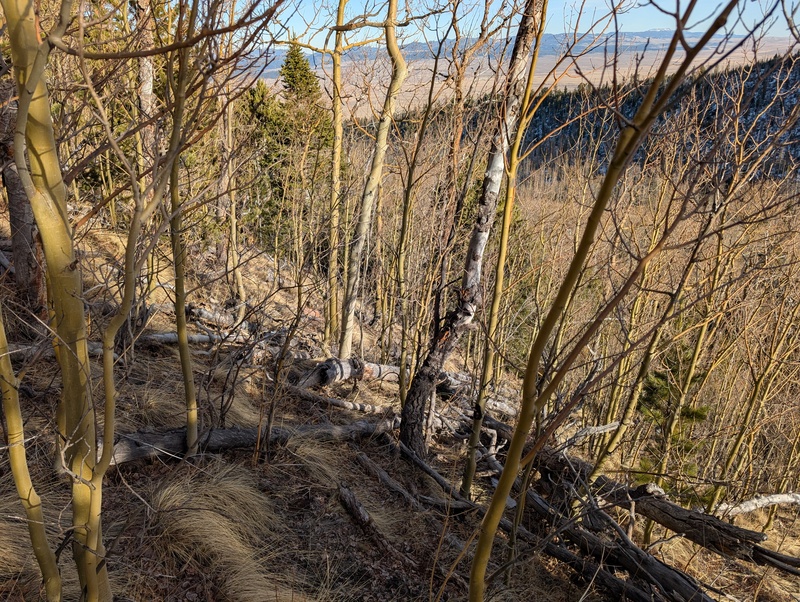
I'd reached a decision point. There were two options to descend: head down Gibbs' eastern ridge into Texas Creek into what I've heard is one of the worst bushwhacks around, or backtrack over Marcy and descend the Swift Creek trail, which I knew was in good condition. For perspective, a friend of mine tried to climb Gibbs last winter via Texas Creek and made it to only 9500 after five(!) hours of hard effort. Going back over Marcy was sounding pretty tempting.... But Emily sent me a picture of the east ridge of Gibbs and it looked wildly dry. I also figured I'm a pretty seasoned bushwhacker, so this couldn't be any worse than some others I've encountered. Gibbs extends off the main Sangres ridge to the east, meaning mileage-wise it was less distance to reach the Rainbow Trail than it would be had I gone back to Marcy. Plus, the thought of an extra 700 or so vert to get back to Marcy was not enticing. I decided to send it down the east ridge and hope the bushwhack was overblown. Above treeline, it was cruiser. This was a massive, wide, long ridge, which consisted of tundra, interspersed talus, and the occasional snowfield. It seemed to go on forever, but it eventually led to the trees around 11.8k, where I immediately put on snowshoes. This section wasn't bad at all, with a sparsely forested ridge and semi-supportive snow, sinking in no deeper than my knees for the most part. I cruised down the ridge, fearing it would get worse but optimistically hoping it wouldn't. 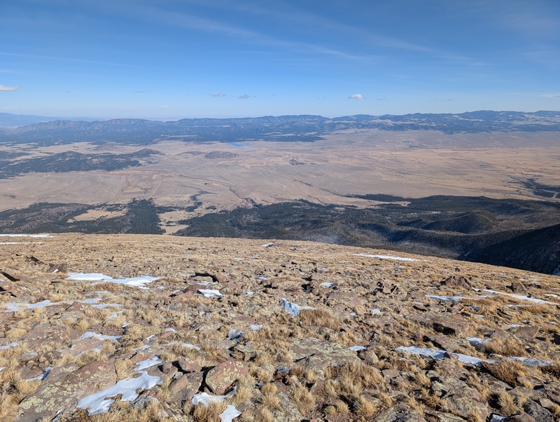
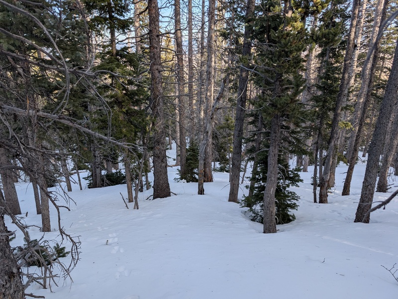
Well, it did. It was a slow descent into hell, but I found myself among the flames nonetheless. It started by having some new growth pop up through the snow, which needed some navigation. Then the occasional downed tree appeared. Then a few more. And I finally reached the point where I realized I was spending more time looking around for a clear route than I was actually moving. The ridge seemed to be blocked by down trees at every turn, so I figured the optimal move would be to leave the ridge and descend the south facing slopes to the valley floor of Texas Creek. 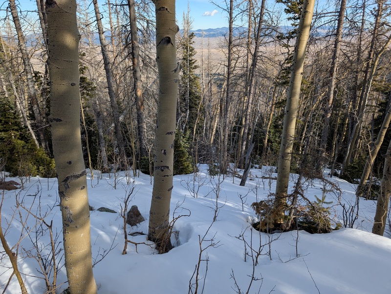
Like everything else with its name, Texas Creek sucked. The sidehill to the valley was somehow the easiest to navigate, perhaps because some of the fallen trees had rolled down to the bottom of the slope, so I tried to milk the sidehill for as long as I could. Plus, the slope was dry, as it gets quite a bit of sun. But eventually, I reached the bottom and found perhaps the biggest maze of downed trees I've ever encountered. My bushwhacking philosophy is this: the longer you stop and look around, or look at your phone, or try to find a trail, the longer you're in the shit. The only way to get out of it is to move, so why waste time trying to stay on a gpx track or a trail when moving your legs is the best way to get out? So I keep moving no matter what, trying to link up open areas where travel might be easier, but not caring whether I'm anywhere close to the track. As long as I'm moving generally in the right direction, I'm pleased. I think this is the best and quickest way to get out of these areas. And I think I did navigate this area pretty efficiently using this technique. That being said, this still sucked, and hard. The open areas I tried to link up would be 10 feet long, then there would be another series of waist-high trees that required climbing around or over. I pushed through a lot of narrow gaps between trees, and managed to rip the fleece I was wearing 4 times. I didn't even think to stop and take pictures of the worst areas, so what you see below were the better spots. In the worst areas, I just put my head down and went. 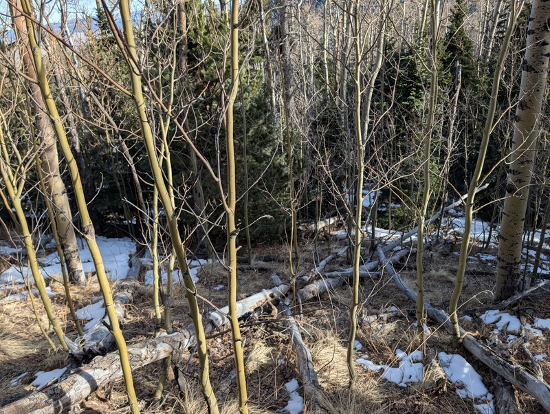
Eventually, somewhere around 9.8k feet, I found what seemed to be fox tracks in the snow. I decided that the animals probably know better than I do, so I followed them, and while they certainly snuck under some logs that a human can't, I made my way back to them and found travel was slightly easier. And the further down the valley I got, the stronger the trail became and the less deadfall required avoidance. After following my fox friend's trail for 15 or 20 minutes, it evolved into a downright robust trail, probably the fabled Texas Creek trail that was now unmaintained, and I was able to zoom down the exit of the valley to finally reach the Rainbow trail. While it's possible staying on the ridge may be better than dropping into Texas Creek where I did, this trail probably saved me 30+ minutes of bushwhacking, so if you try to stay on the ridge longer than I did, you still do want to head down eventually. 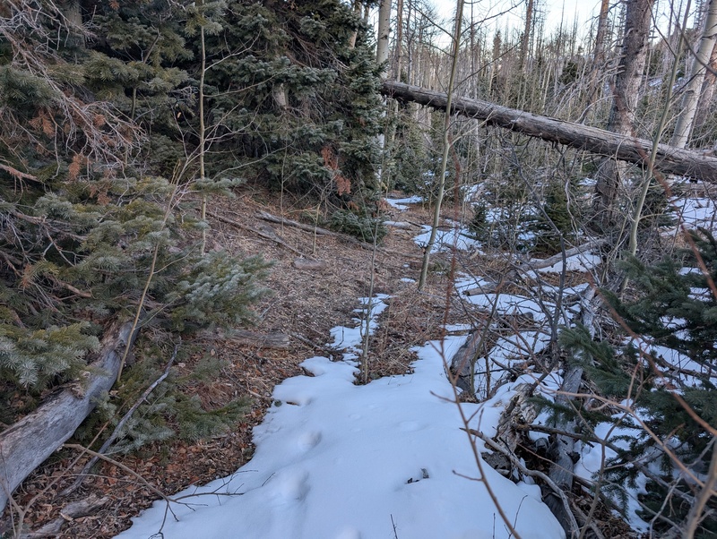
The one downside to coming down Texas creek is that you pop out almost 3 miles away from the Gibson Creek trailhead, and the Rainbow trail is not flat. However, just being on a trail felt good, so while I was a bit wary about my decision as I encountered 3 severed deer legs spread across a mile on the trail, the well-maintained trail made all the effort worth it. After close to an hour on the Rainbow Trail, I reached the turnoff we took in the morning just a few hundred feet from the trailhead, turned left, and saw my car. 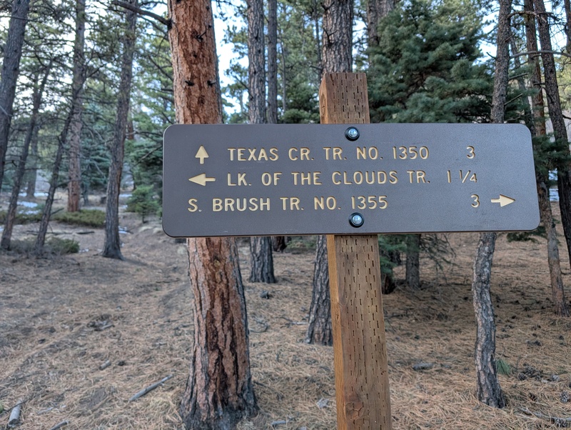
Though I wish Emily could have completed this route with me, I had a blast up there on a quite warm and pleasant winter day. Though these peaks don't get done all that much in winter, especially as a trio, this route is a very viable option in all but large snow seasons (but don't worry, those don't exist anymore). As for whether I recommend the Gibbs descent or a reascent of Marcy? Up to you, boo-boo. Thumbnails for uploaded photos (click to open slideshow): ")
")
")
")
")
")
")
")
")
")
")
")
")
")
")
")
")
")
")
")
")
")
")
")
")
")
")
")
")
")
")
")
")
")
")
")
")
")
")
")
")
")
")
")
")
")
")
")
")
|
| Comments or Questions | |||||||||
|---|---|---|---|---|---|---|---|---|---|
|
Caution: The information contained in this report may not be accurate and should not be the only resource used in preparation for your climb. Failure to have the necessary experience, physical conditioning, supplies or equipment can result in injury or death. 14ers.com and the author(s) of this report provide no warranties, either express or implied, that the information provided is accurate or reliable. By using the information provided, you agree to indemnify and hold harmless 14ers.com and the report author(s) with respect to any claims and demands against them, including any attorney fees and expenses. Please read the 14ers.com Safety and Disclaimer pages for more information.
Please respect private property: 14ers.com supports the rights of private landowners to determine how and by whom their land will be used. In Colorado, it is your responsibility to determine if land is private and to obtain the appropriate permission before entering the property.


