Download Agreement, Release, and Acknowledgement of Risk:
You (the person requesting this file download) fully understand mountain climbing ("Activity") involves risks and dangers of serious bodily injury, including permanent disability, paralysis, and death ("Risks") and you fully accept and assume all such risks and all responsibility for losses, costs, and damages you incur as a result of your participation in this Activity.
You acknowledge that information in the file you have chosen to download may not be accurate and may contain errors. You agree to assume all risks when using this information and agree to release and discharge 14ers.com, 14ers Inc. and the author(s) of such information (collectively, the "Released Parties").
You hereby discharge the Released Parties from all damages, actions, claims and liabilities of any nature, specifically including, but not limited to, damages, actions, claims and liabilities arising from or related to the negligence of the Released Parties. You further agree to indemnify, hold harmless and defend 14ers.com, 14ers Inc. and each of the other Released Parties from and against any loss, damage, liability and expense, including costs and attorney fees, incurred by 14ers.com, 14ers Inc. or any of the other Released Parties as a result of you using information provided on the 14ers.com or 14ers Inc. websites.
You have read this agreement, fully understand its terms and intend it to be a complete and unconditional release of all liability to the greatest extent allowed by law and agree that if any portion of this agreement is held to be invalid the balance, notwithstanding, shall continue in full force and effect.
By clicking "OK" you agree to these terms. If you DO NOT agree, click "Cancel"...
With an incoming storm at weeks end, I was looking to get one more climb in before conditions changed. My hope was to make another attempt at San Luis since I had been turned back a week earlier. I was really itching to go back to take advantage of the hard work we did trenching. Alas, I couldn't find a partner for it though, but I did have one for Handies so I switched gears and headed to Lake City. I had just done Handies in August, but I was happy to be giving it a go in winter.
Handies can be tricky to time just right in snow season because the most common winter route is not especially avy friendly. We currently had a green avy forecast though thanks to the "winter killer" high pressure dominating the west. Very little snow had fallen over the last few weeks, so this was the perfect opportunity for us.
Day of Climb: Wednesday, January 21st 2026
Peaks: Handies Peak
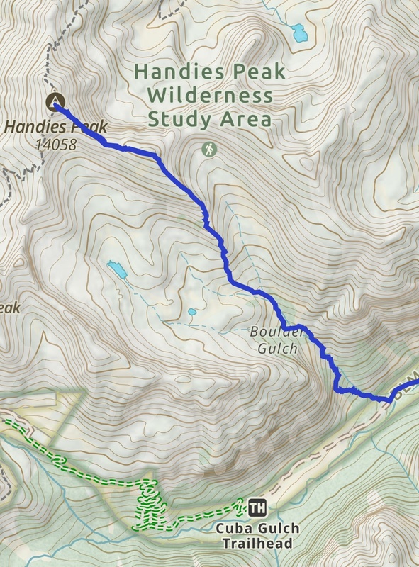
Trailhead: Cataract Gluch
Mileage and Elevation Gain: Approximately 8.6 miles and 4058 feet of gain.
Gaia track from start of Boulder Gulch.
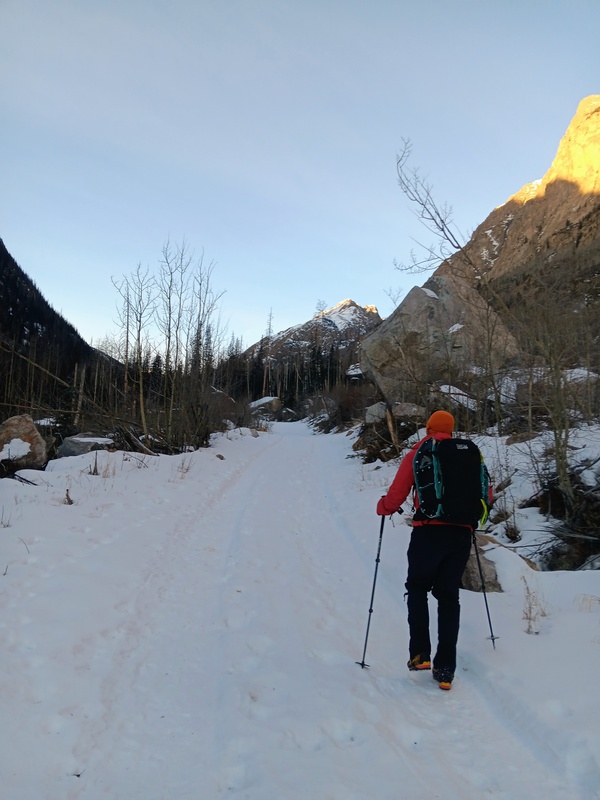
After getting a few hours of sleep in a pull-out at the edge of Lake City, I met Alec in Sherman at the Cataract Gluch Trailhead around 7. This was gonna be a late start for a winter 14er. The conditions were favorable though so we weren't worried and it's not a long route. Alec has a very capable 4x4 so I jumped into his truck and he managed to skillfully drive us nearly a mile up the jeep road.
We geared up and were hiking by 7:30 from 10,000 feet on the jeep road. It was about another mile to our turn-off at Boulder Gulch. We actually walked by it initially, blindly following footsteps going further up the road🤦♂️. We then backtracked a bit and started up the gulch. From the start of Boulder Gulch to Handies summit it was 3.1 miles with 3,458 feet of gain. The heart of this route was the final section going up Handies Southeast Ridge, aka Upchuck Ridge. This name comes from it's appearance in the Hardrock 100 race back in 1999 and 2000 after Charles Thorn, who first proposed this route.
Walking the Jeep road.
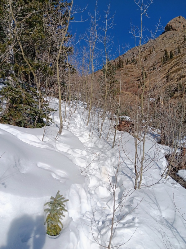
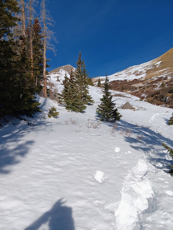
Boulder Gulch started as a bushwhack without any discernible trail. There was a maze of human and game tracks in the snow criss-crossing throughout the lower section. None seemed to be better than others. The gulch was a steep climb though for it's entirety with plenty of snow and many annoying postholes. We followed whichever trench seemed best switching from one to another at a moments notice. We stayed mostly left of the creek, but once, we crossed to the right briefly for drier terrain.
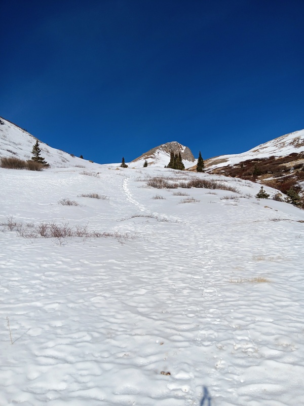
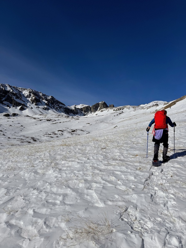
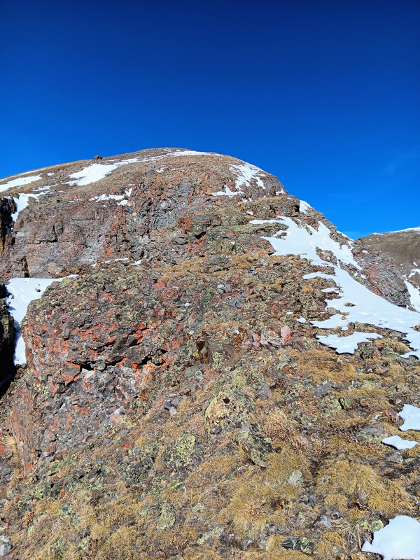
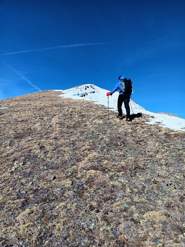
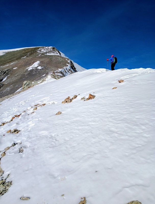
At around 11,800 feet we topped out of the gulch and had a clear view of Upchuck Ridge. It was close with some more moderate terrain to cross before reaching it's base. We put snowshoes on though for this section to avoid anymore postholing and made our way to the ridge, surprisedly, we passed someone descending here. I think his name was Carter, who had made a much more timely start than us and got the early summit.
Lower GulchUpper Gulch and first sighting of Upchuck Ridge. We put snowshoes on here.Easy terrain to Upchuck.Getting close to the ridge. Photo by Alec.
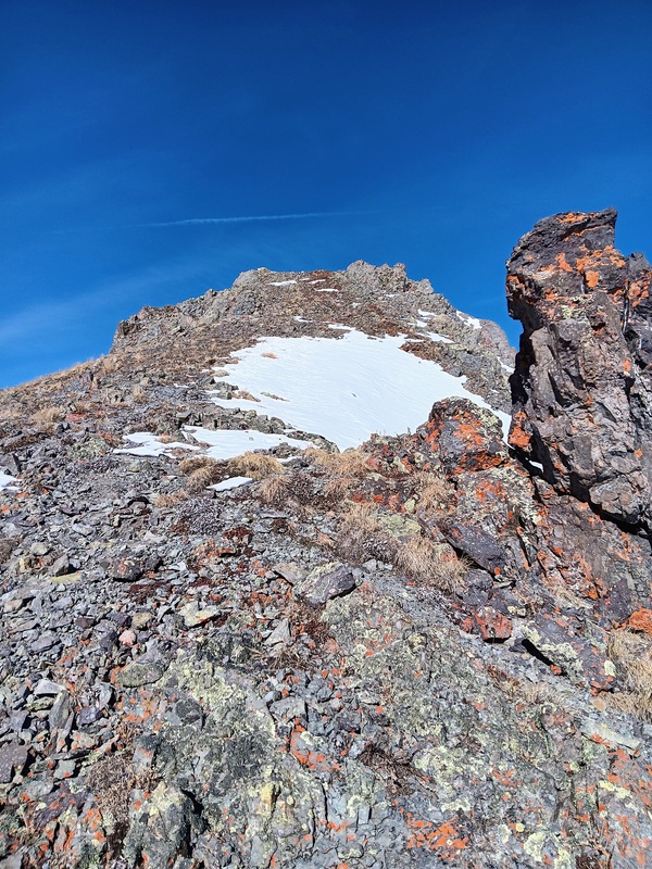
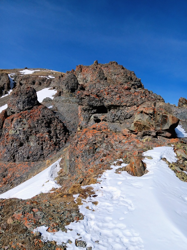
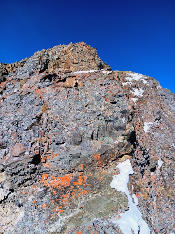
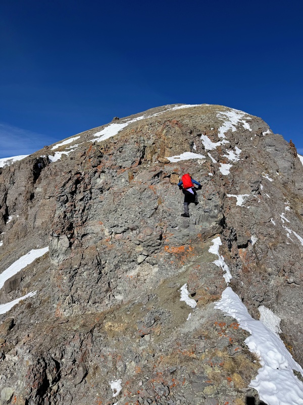
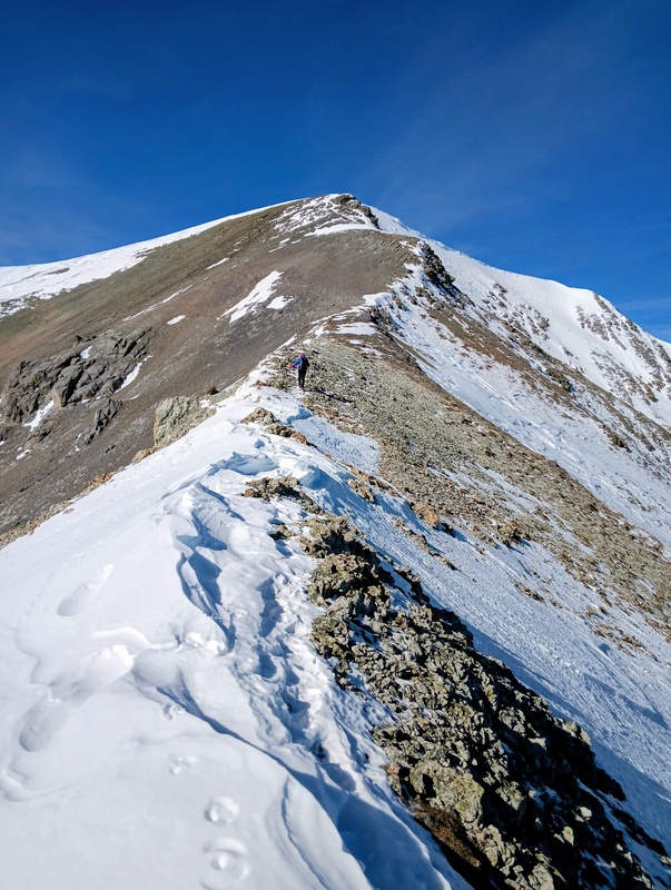
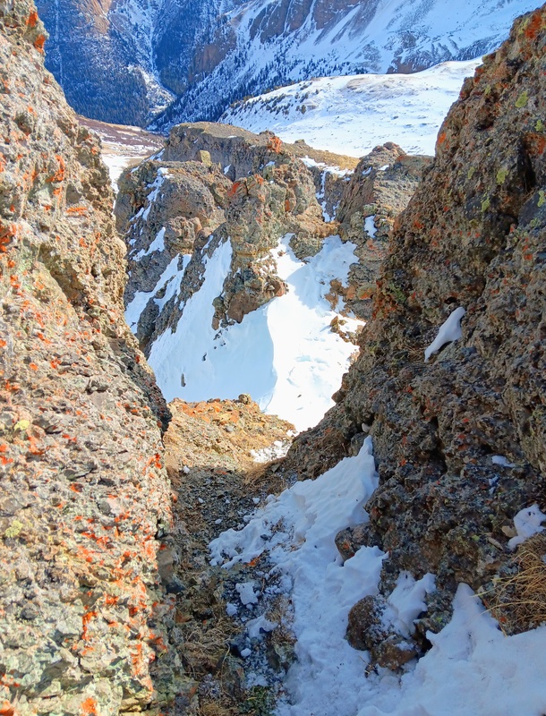
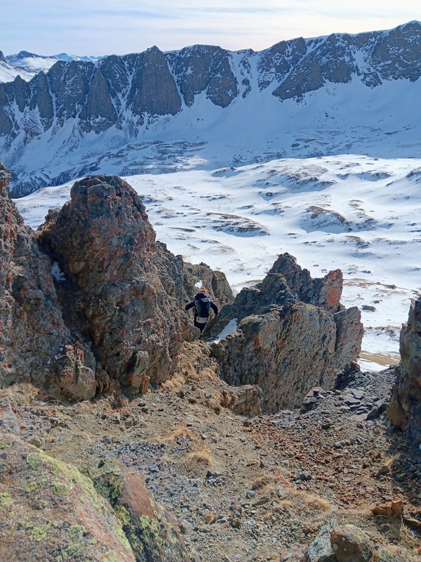
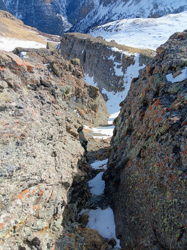
At the base of the ridge we stashed our snowshoes since they wouldn't be needed for the remainder of the route. From here, we climbed steep terrain to a rocky out-cropping which marked the crux of the route.
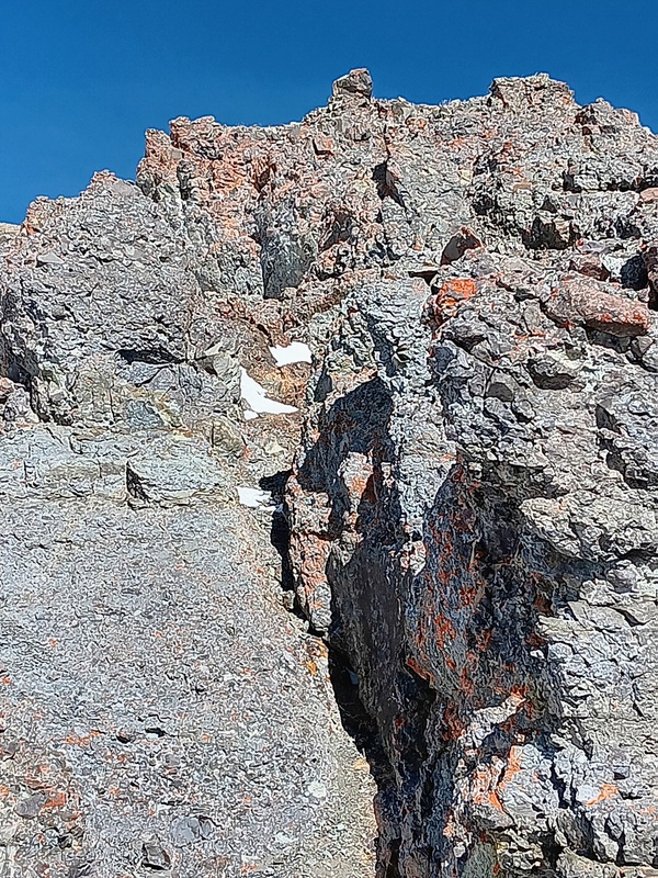
The crux was a fun section and not overly difficult. It started with some route finding through a maze of low angle chimneys as the ridge slowly narrowed. This was followed by a class 3 wall. It was short and only required 3 or 4 brief moves and was maybe 8 to 10 tall. The rock was pretty good for the most part. I think I only found one bad hold. A second very small wall followed and then the ridge opened wide for easy climbing on tundra with very little snow.
Steep, rocky climb to the crux.Beginning of crux section.Maze of chimneys.Alec coming out of the chimney area.Steep climb to the crux wall.Crux wall and second smaller wall above.Me climbing the wall. Photo by Alec.Alec topping out on the first wall. Quarter and Half Peak can be seen in the distance.Easy tundra walk.
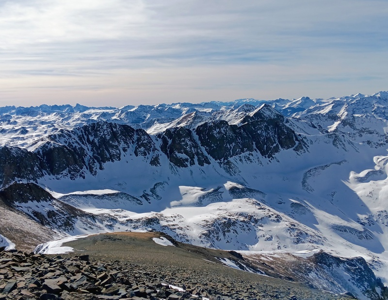
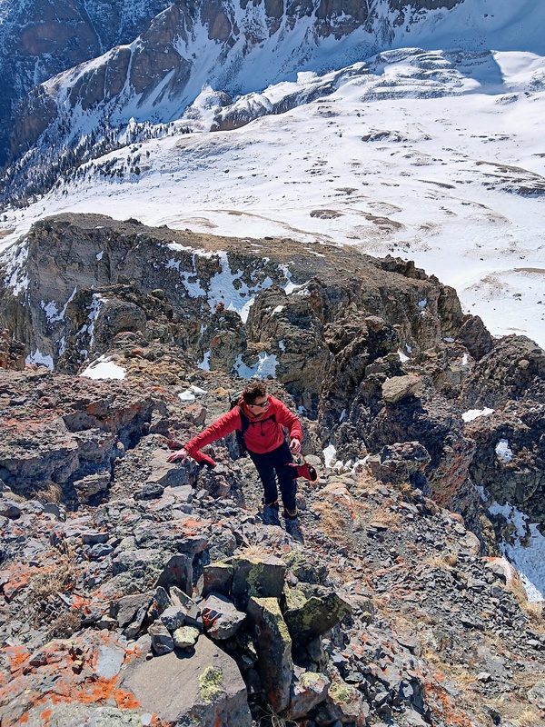
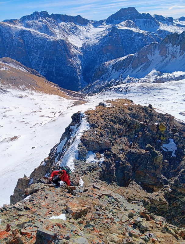
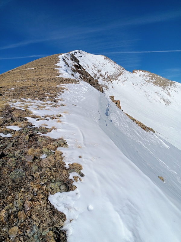
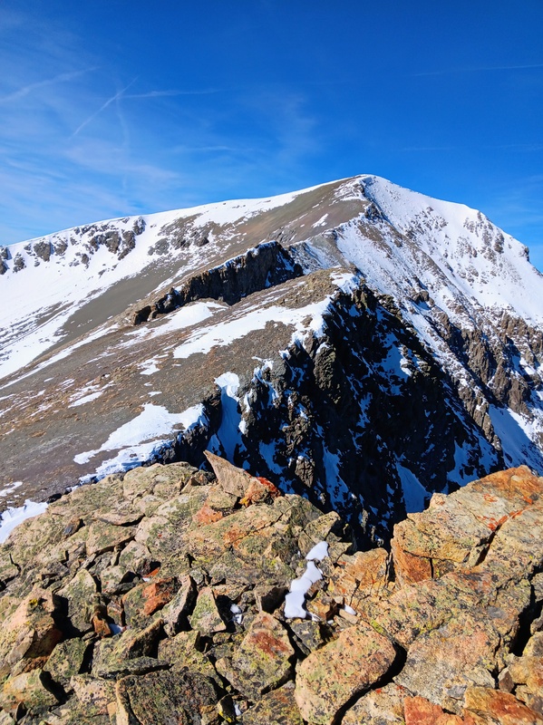
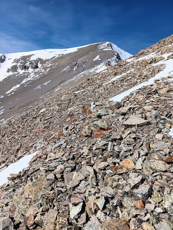
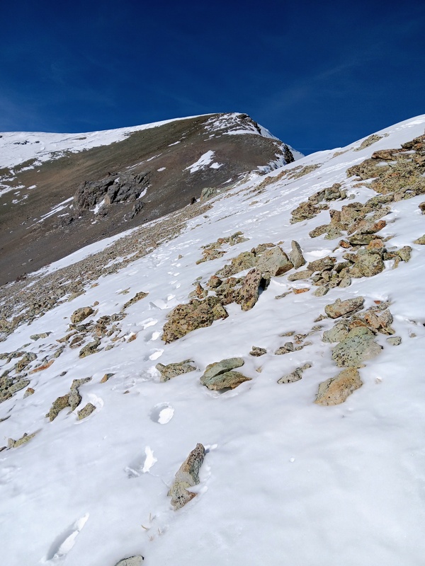
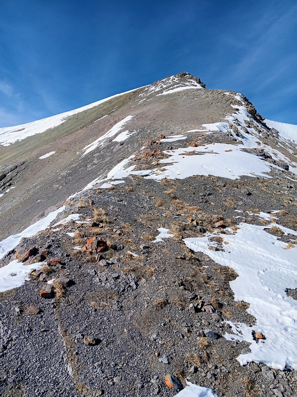
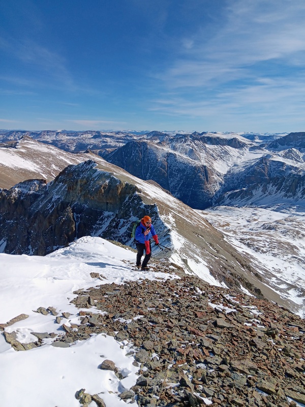
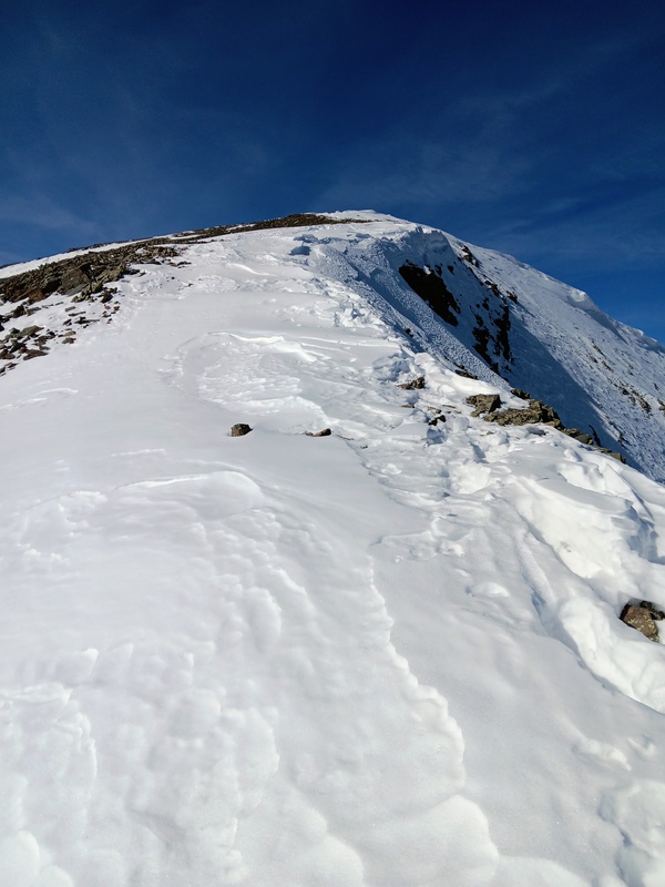
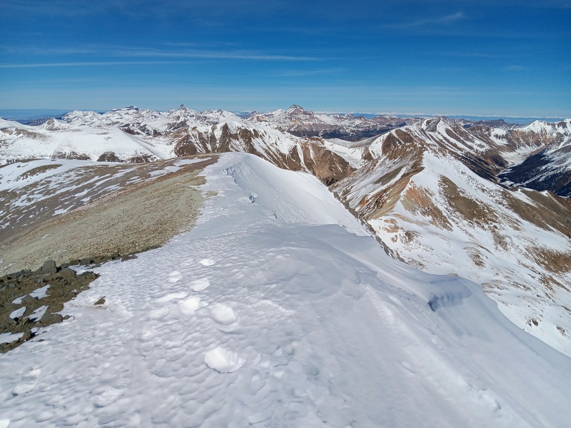
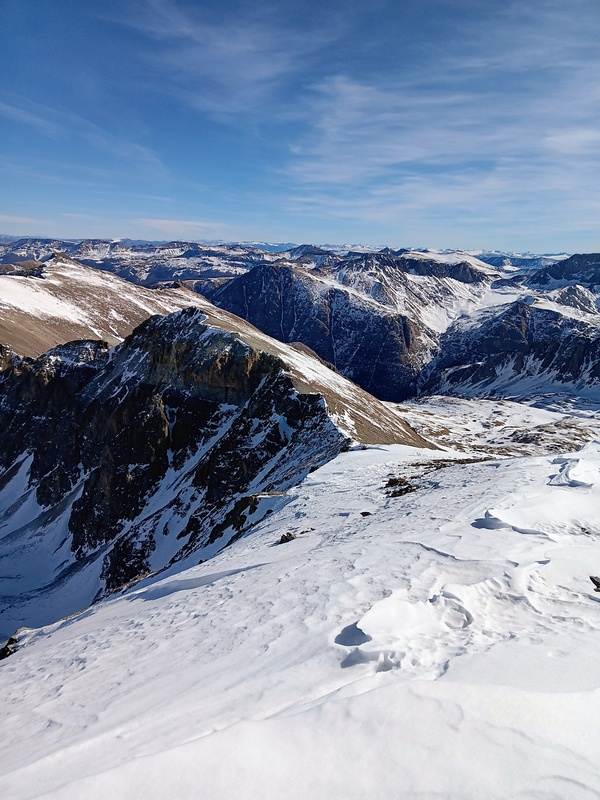
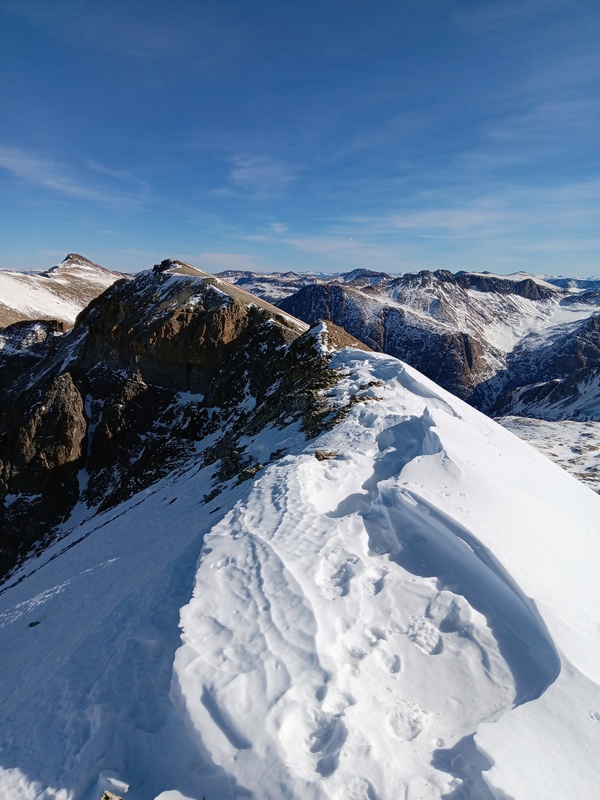
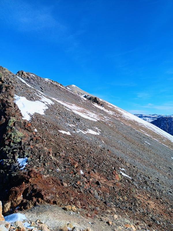
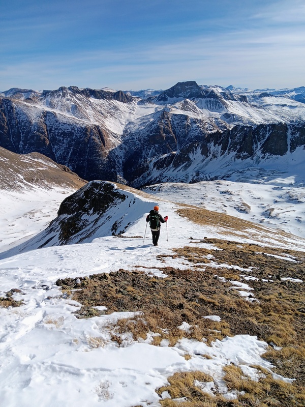
The remainder of Upchuck Ridge was easy class 2 although there was still plenty of ground to cover and the summit was not yet visible. From the crux at 12,900 feet we climbed steeply to nearly reach a sub-peak at just over 13,700. We skirted just below it though, but were still afforded a spectacular view of Handies summit and the rest of Upchuck Ridge. The ridge looked very dramatic from this vantage, but we knew it was all easy climbing.
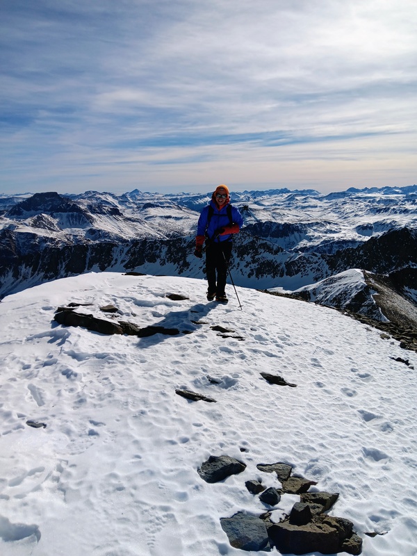
After the sub-peak we took a long sidehill under a couple lower ridge bumps and then regained the ridge proper about 500 vertical feet below Handies summit. There was a short narrow ridge section here then we climbed steeply from there to the summit. It was exciting to finish yet another winter 14er, especially one as elusive as Handies. The views all around were fantastic! Handies never seems to disappoint.
Climbing towards sub-peak.View of Handies summit from a rocky out-cropping just below the sub-peak.Sidehilling.More sidehilling.Regaining the ridge proper.Starting the final climb to the summit.Getter closer. This section was very steep.Almost there.Alec finishing.Photo by Alec.View of Uncompahgre and Wetterhorn.
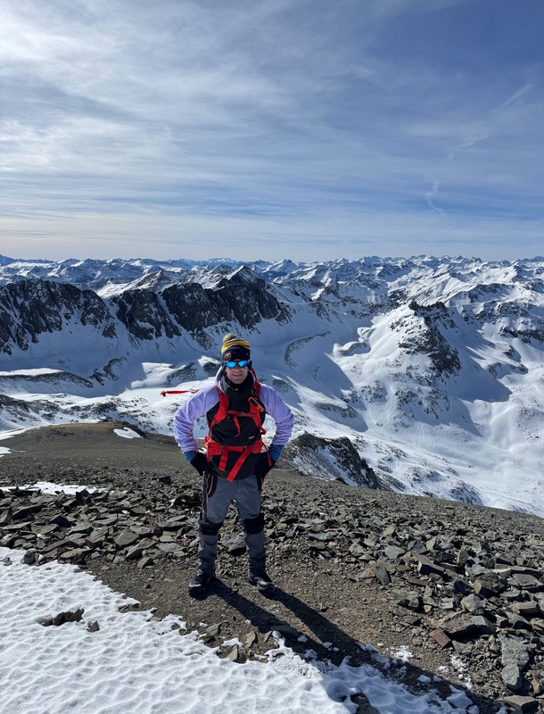
We took an extra long summit break eating snacks and enjoying what we accomplished. Winter summit views in the San Juans are some of the best! We then returned the way we came. The descent went much quicker and we got back to our vehicles well before dark.
Upchuck Ridge is a great route. I might even recommend it for summer if you're looking for a less crowded alternate way to climb Handies. Avoiding that long bumpy drive out to the standard trailhead would be a huge bonus. I even noticed a few marked dispersed camping spots along the jeep road. Thanks for reading!
Starting our descent.Back to the short narrow ridge section before the sidehilling begins.Sidehilling.Descending towards the crux.Beginning of chimney maze.
Thumbnails for uploaded photos (click to open slideshow):
I’ve been trying to find a way up Handies that avoids that terrifying shelf road! I did Red Cloud and Sunshine, but don’t want to drive up that again! Do you have a trac you can share? I’ll be doing it in summer conditions, and wondering if there’s an obvious trail, since it seems not many people know about it. Thank you!!!
Of course! I'm not sure if there's an obvious trail in summer. I think it's mostly a bushwhack to treeline. Then gaining the ridge is obvious. You can avoid class 3 section by going around to the left. Just follow class 2 ridge to summit.
Caution: The information contained in this report may not be accurate and should not be the only resource used in preparation for your climb. Failure to have the necessary experience, physical conditioning, supplies or equipment can result in injury or death. 14ers.com and the author(s) of this report provide no warranties, either express or implied, that the information provided is accurate or reliable. By using the information provided, you agree to indemnify and hold harmless 14ers.com and the report author(s) with respect to any claims and demands against them, including any attorney fees and expenses. Please read the 14ers.com Safety and Disclaimer pages for more information.
Please respect private property: 14ers.com supports the rights of private landowners to determine how and by whom their land will be used. In Colorado, it is your responsibility to determine if land is private and to obtain the appropriate permission before entering the property.
")
")
")
")
")
")
")
")
")
")
")
")
")
")
")
")
")
")
")
")
")
")
")
")
")
")
")
")
")
")
")
")
")
")
")


