| Report Type | Full |
| Peak(s) |
Tijeras Peak - 13,612 feet Grizzly Mountain - 13,722 feet Carbonate Mountain - 13,662 feet Unnamed 13712 - 13,712 feet Garfield Peak - 13,778 feet "Anderson Peak" - 13,637 feet Whitney Peak - 13,286 feet Unnamed 13786 - 13,786 feet Pole Creek Mountain - 13,722 feet "Northwest Pole" - 13,670 feet "Every Mountain" - 13,698 feet "Cooper Creek Peak" - 13,694 feet |
| Date Posted | 05/01/2026 |
| Date Climbed | 01/16/2026 |
| Author | blazintoes |
| When it does not snow | ||
|---|---|---|
|
When It Doesn’t Snow Seems cyclical. About every six years the mountains decide to cosplay as winter, and since I’m clearly very reasonable and not at all impulsive, I’ve decided this is the year to knock out as many winter bicentennials as possible. I’ve heard tales of climbers who put tasteful little asterisks next to peaks from years like 2012 or 2018, fully intending to come back in a real winter season like 2013 or 2019. Did they? TBD. So yes, faux winter '25/'26 was the time. Get yo’ peaks while the snow pack is thin, the rules are blurry, and moral clarity is optional. I’m happy to accept help, encouragement, or peer pressure. And when and if the snow starts piling up, I’m going to petition the community to go out and pre-trench for me so I can finish this project. And yes, I used a bike. Some will call that cheating. I call it maximizing forward progress per unit of suffering, which last I checked was still allowed. 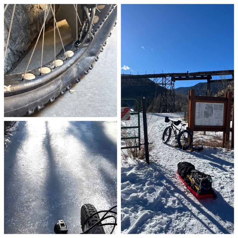
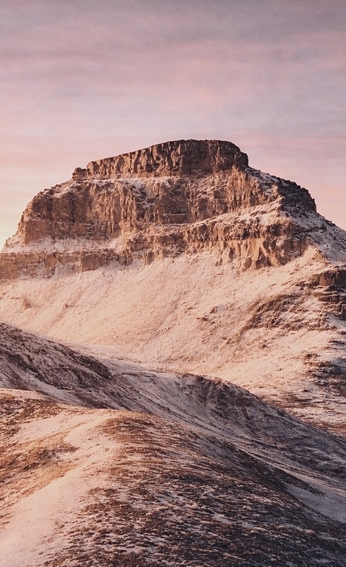
I was slightly obsessed with figuring out a better route on Fifteen and also getting Oso in winter after getting shut down last year. After back-to-back success and still making it home for Christmas I decided to head south for a New Year’s Eve attempt on Tijeras. I biked the road until snow and conditions shut things down, then continued on foot. Early alpenglow immediately justified the effort. And the moon was nearly full. 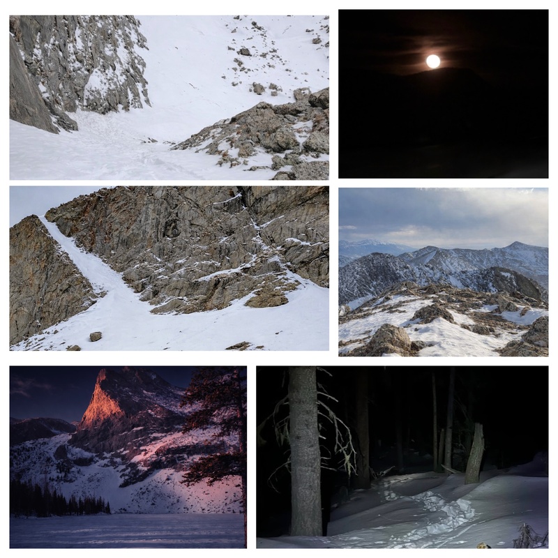
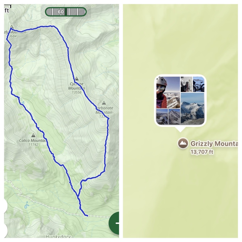
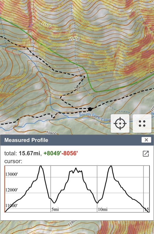
I’ll acknowledge the obvious: returning to the Sangres (which I generally prefer dry) just to tag another faux-winter summit isn’t exactly logical. Add unknown conditions and an ankle that feels like an ancient rubber band, might hold, might not and it’s an even grayer decision. But winter climbing is always a gamble. Managing proximity, timing, and energy matters more than fairness. Conditions ended up better than expected. The ramp leading toward Tijeras where years ago we formed a human chain during a summer ascent was filled in nicely. Snow coverage was deeper than anticipated for the Sangres, but quality was good and supportive. Spikes bit well, travel felt secure, and nothing raised red flags. Just enough to add traction without slowing progress, making this section feel relatively easy and secure. From there, the route continued up the non-technical northeast side of the peak with uncomplicated winter travel and no technical challenges. In the trees, there was some existing snowshoe trenching that helped with efficiency in otherwise unconsolidated snow. On the drive and approach, I expected a few downed trees along the road after Grape Creek, but nothing that prevented access, just minor obstacles to navigate. Stats: ~15 miles round trip ~5,000’ vertical gain Overall, a mellow and enjoyable winter climb with cooperative conditions, good movement, and scenic lighting throughout the day. Despite preferring Sangre scrambling without snow, winter went smoothly. I eventually reached the summit and was rewarded with the classic Sangre view, wide, familiar, and beautiful. From the top I could see nearly everything I’ve climbed in the range, with only one remaining. A quiet and reflective summit moment. I returned the way I came and didn’t log anything per usual, deleted a lot of pictures then sent a brief message to Marc, who tells me to keep better logs. Sure, I say and took my time hiking out while listening to a good audio book. A low-key New Year’s Eve outing with decent snow, good light, and conservative decision-making. And back in time to kiss my Captain. Lo-Carb and friends January 3rd Fat Bike + Alpine Conditions Report. Jennings Creek → Grizzly → Low Carb Ridge → Carbonate → Return. This was a short, efficient winter outing combining a fat bike approach with a dry-feeling alpine ridge. The ride up Jennings Creek on the fat bike was smooth and uneventful, making for a fast approach to the climbing. From there, I headed straight up Grizzly. Snow coverage was thin but grabby enough to cause snow to ball up and stick to my microspikes, which made footing awkward at times despite generally benign conditions. From Grizzly, I climbed the Low Carb Ridge and continued over Carbonate. This section stayed easy and relatively dry, with plenty of exposed rock and scoured terrain keeping travel direct and efficient. Snow was present but never problematic, and route-finding was intuitive throughout. Erie low layer clouds blanketed the valleys. Overall, it was about 7.5 miles of climbing with roughly 4,200 feet of vertical, plus a fat bike approach and exit on the road. The only thing wintery was the cloud inversion and typical annoying wind. This was quick enough I decided to head over to Jones 13,712 via the new trail up and around Shavano, which made travel efficient and despite what my friends who have climbed this and like it say, I think this traverse isn’t that much fun. I dunno. I'll show the snowy pictures so it looks like winter. 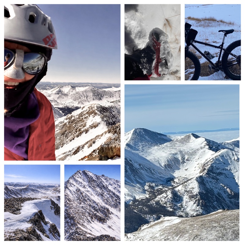
Garfield – Anderson Ridge Winter Linkup January 4th The ride up McNassar Gulch went better than expected thanks to sections of a well-packed road from a tracked side-by-side accessing the cabins; info I was privy to from the local Elbert crusher Andrew. Thanks buddy! Where the track held, riding was efficient; where light snow and wind had drifted back in, progress slowed but remained reasonable hence, hike a bike.Garfield’s road itself would be fully fat-bikeable with little or no new snow, making this a surprisingly viable winter approach overall. The climb up Garfield was its usual blunt but sustained grind, with snow coverage varying by aspect and wind exposure. 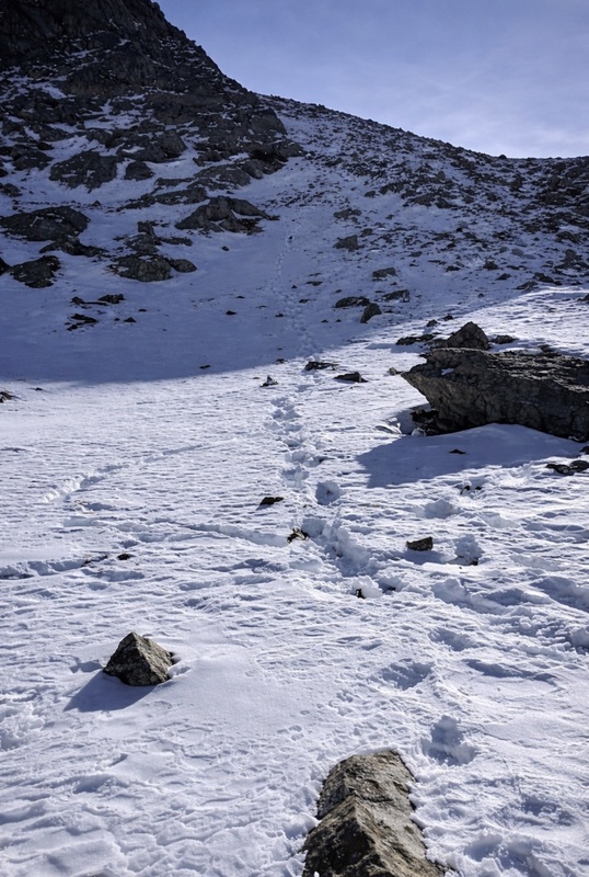
The traverse over and descent into Lincoln Creek showed more wind effect and inconsistent snow. This section required greater attention to footing and line choice, especially where snow had been scoured or drifted unevenly. I’ve been down these west faces before in summer and sometimes they can be efficient and sometimes terrifying. I got lucky. 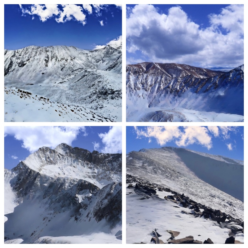
I stayed high in the Lincoln valley hoping to avoid crossing the creek like I did a couple summers ago. Luck persisted. I chose to climb a shallow line on Anderson’s east face that proved mentally taxing due to intense sun reflecting off the snow. Light conditions were strong enough to verge on blinding, making eye protection essential. A light dusting of fluffy snow sat on top of a generally firm, supportive base, just enough to tease that, with more coverage, this face would be a skier’s dream. Despite the glare, conditions allowed for steady and secure upward progress. I didn’t spend any quality time knowing the return back up and over Garfield would add to the cumulative fatigue of the day, but snow conditions remained consistent and predictable. The final descent back to the bike was fast and enjoyable where the road stayed packed, with a few softer sections developing as the day warmed. 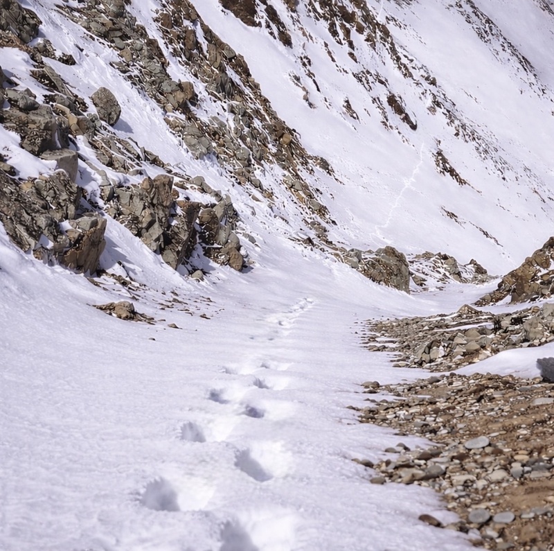
Overall, the day covered approximately 16 miles and 8,000 feet of vertical. A big winter endurance outing, efficient where conditions allowed, demanding where they didn’t, and a solid example of classic mixed faux winter travel day. This would not have been possible in a real Colorado winter with it’s typical scary snow pack. 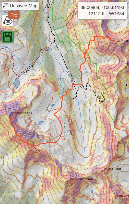
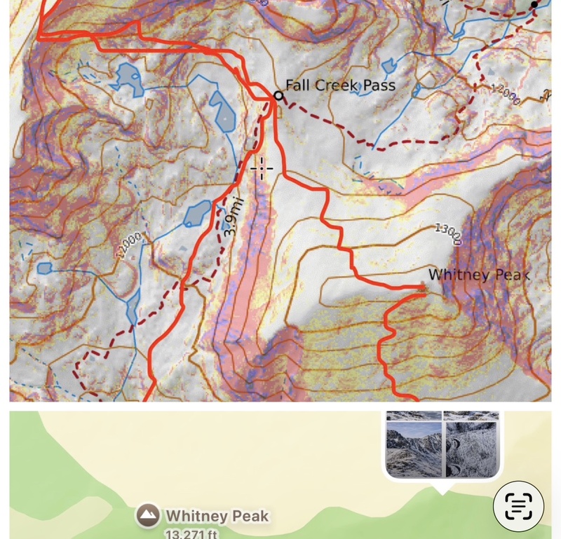
The 5th This outing was a comparatively easier but still a full-value winter day, totaling about 14 miles with roughly 5,900 feet of vertical. I started at 2 a.m. due to a predicted weather change later on, which proved to be the right call. The approach up Mount Whitney via its south side went smoothly overall, though the lower section initially involved negotiating a fair amount of downed timber. I chose not to bring snowshoes, which felt appropriate given the generally supportive snow and the efficiency gained by moving light and fast. Even so, I punched through the snow frequently, especially in shaded areas, requiring steady attention to foot placement. From Whitney, I decided to drop toward Fall Creek Pass, wrapping around the Seven Sisters Lakes before gaining the cross ridge to an unnamed 13er. Travel along the ridge was typical nonsense winter alpine terrain but featured plenty of “trap doors”, thinly bridged pockets that I avoided as much as possible by sticking to scoured ribs and wind-affected sections. While exposed in places, the ridge never felt overly complex, and the day stayed firmly in the “keep moving” category rather than demanding careful problem solving. Hollenbeck and I had a similar outing a few Octobers ago where we shuttled cars and climbed the entire ridge with plenty of trap doors so this outing was very familiar. The long descent down French Creek brought everything back together, funneling cleanly to the bike and closing the loop. Overall, this was a solid endurance day with good flow: less taxing than bigger linkups, but still substantial enough to feel earned, especially given the distance, sustained elevation gain, early start to stay ahead of the weather, and the need for constant terrain awareness in variable winter conditions. The clouds looked ominous and it snowed off an on all day with wild winds that kept my mind wild. I don’t prefer days where I keep my head down, don’t take breaks and don’t really enjoy what I’m doing just to tick a list. Maybe someday I’ll look back and think it was worth it. At least the snow made Whitney easier, just like stacking rocks. 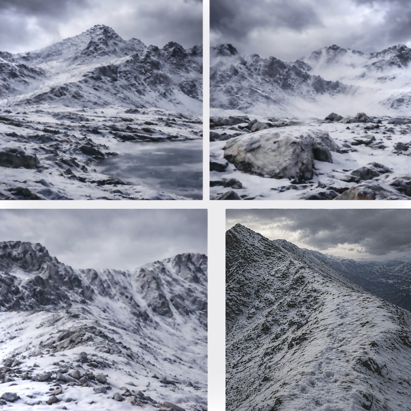
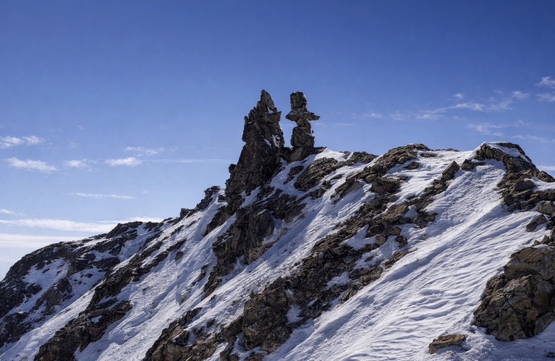
January 10th Wind sometimes turns me around. Cold is far more effective. With the recent weather, I was concerned about temperatures in Lake City, especially given its proximity to Gunnison, one of the colder spots in Colorado. The usual strategy applied: leave the night before, car camp about an hour away, then start early and warm. This worked well and helped keep the snow firm. Conditions were ideal for the fat bike. We made quick work of the road to Matterhorn Creek, and I was reminded that I apparently suffer from selective memory loss related to winter ascents specifically Wetterhorn. I don’t recall how I reached this trail head in winter before, but I can safely assume it involved a bike. Despite recent snowfall, coverage was thinner than expected. Matterhorn was my bicentennial finisher with Marc on a truly textbook day. I wrapped around to Silver and 13,684, but that option proved far more feasible on paper than in reality. This was one of those days where my eyes were bigger than my belly and spent a lot of time via headlamp. I can fail or succeed. I've done a lot of both but if I don’t try, I will never know. Long days like this is where I’m not having fun and my motivation falls so I slow way down. 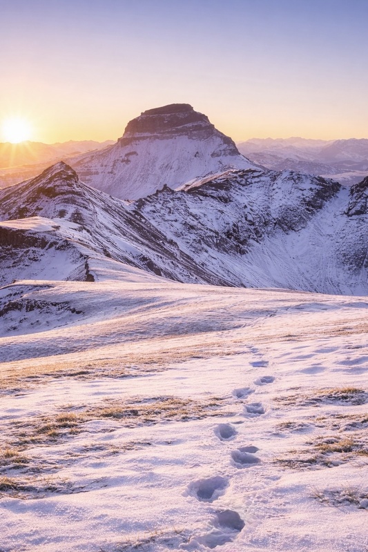
It was a low-drama day overall: no whomping, no cracking, and no audible snow pack feedback. Likely a function of the cold temperatures. My objective was simple, move efficiently and get back to the bike. One upside: I never have to climb Wetterhorn in winter again. Conditions edged toward WW terrain in spots, but I came prepared with an unconventional tool, a window scraper. The wiry brush worked surprisingly well for clearing snow off rock, preserving gloves and keeping hands warm. Not quite a potato masher, though I briefly entertained whether it could serve double duty in a glissade. Probably not. 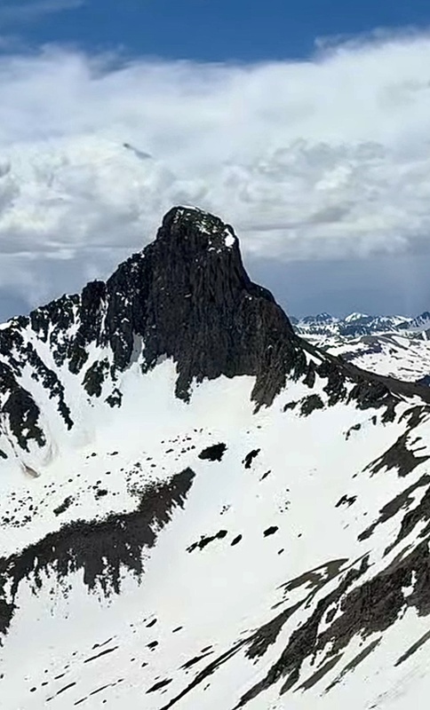
January 11th Cataract Gulch was not an area I had forgotten. My spirits were low from yesterday and also PTSD from a solo winter ascent of Half Peak in 2019 remains one of my harder centennials not for technical difficulty, but for the relentless waist-deep snow that left me completely spent. This time, conditions were the opposite. The trail was well tracked by recent ice climbers and hikers to the Colorado Trail, making travel efficient. A loop I completed two summers ago to tag the bicentennials in this part of the Rio Grande has since become one of my favorite areas, with wide-open tundra and short, enjoyable scrambles on solid San Juan rock. This winter felt forgiving by comparison: minimal snowshoeing, no bushwhacking, and a supportive snow pack even though the northeast side of Half had the ripples that I reported to CAIC. Travel was fast and easy on the body. I had the peaks entirely to myself, with calm conditions and no wind, something I’ve only experienced once before on a winter summit on Mt. Elbert in 2012. One lesson learned: downhill snowshoeing does not agree with my ankle. Still, it was a beautiful day, and on the way out I could see that Cinnamon Pass Road was completely dry. 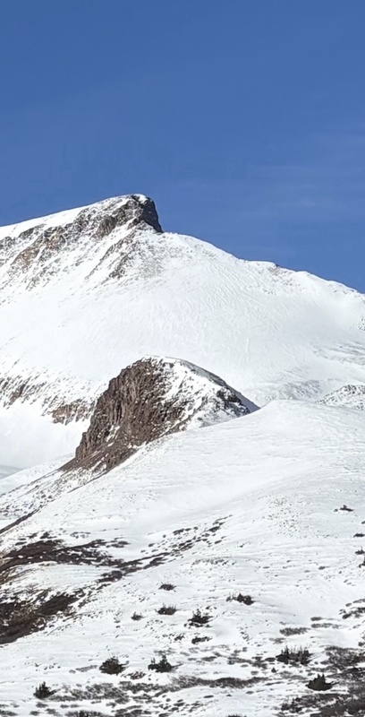
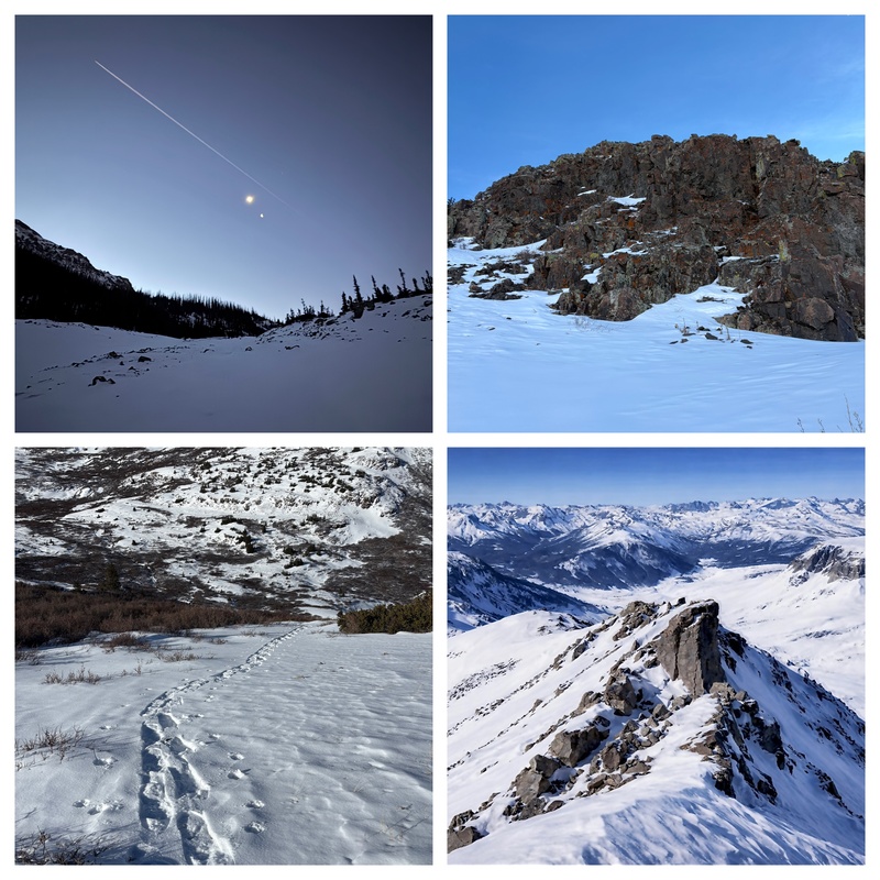
12th This day ended up longer than expected. I considered approaching via Henson Creek, knowing it was tracked, but with Cinnamon Pass Road dry it made more sense to cruise to Cooper Creek. And poaching trenches isn't my M.O. I like to suffer. I also remembered the unpleasant ridge between Every and 13,169 a smaller but similar version of the Wood to 13,702 ridge, which I had little interest in dealing with in winter. In earlier years I would have taken on linkups like Half to Quarter Peak without much hesitation. That choice felt inappropriate these days as I’m less interested in ego-driven linkups and more in making efficient decisions. It was 4°F when I started up the road. Near Silver Creek I took a break and noticed tracks heading up the drainage. More people seem to be getting out lately, and while I once felt inclined to critique styles or “rules,” I’m now content to mind my own business and appreciate seeing others out enjoying the mountains and working through their own lists. I forgot to lock up the bike but continued up Silver Creek, eventually committing to the re-ascent from Every back to Cooper, an easy scree walk as I remembered. Once again, I was rewarded with expansive views, calm conditions, and no wind. Seeing the ridge I had avoided confirmed it was the right choice. On the exit, Fatso picked up a flat tire. On the drive home I noted that Williams Fork trail head was also completely dry. Under current conditions, accessing the Points would've been straightforward. 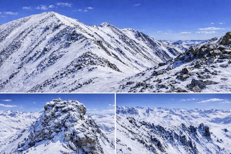
1/20 Top secret weekend warrior mission. 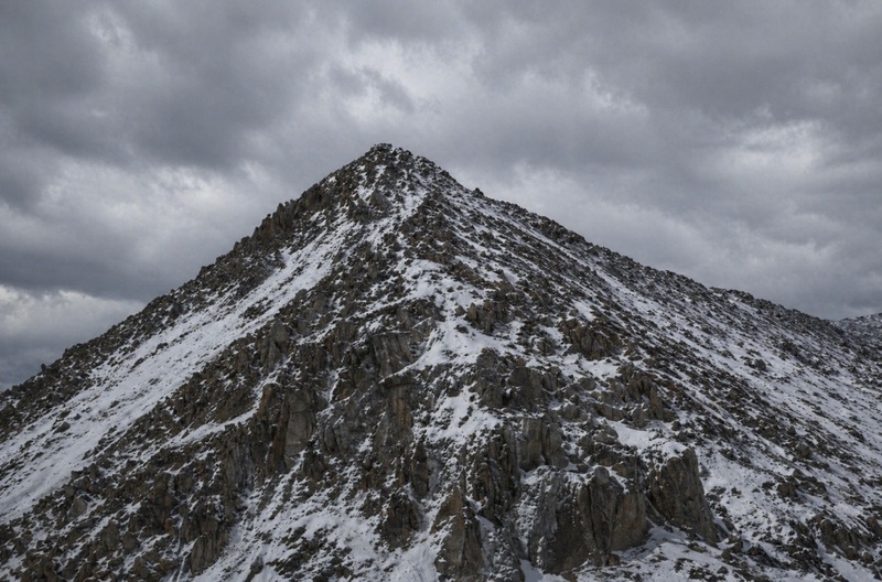
1/21 Sayers BM--Skipped this on my way back from Garfield and the jeep road up to its NW side was enticing but the fact that you can drive to the summer TH in Windfield this year and then having a bike with studded snow tires means I can attempt at least two peaks back here. Also, I would rather attempt this peak from the East ridge route I figured out a couple years ago vs. be anywhere on it's north avy prone side. This year is weird. The places I have seen avy prone slopes, they were easy to avoid and not once had I experience whomping, cracking or even any avy debris. I suppose global warming is good for something. Colorado peak bagging. Last winter, I drove to the Missouri Gulch TH for Irving and Blaurock on day one. Their south slopes were mostly dry. The next day I went up and over, once again, Elk Head pass for Magdalene. Devin and I attempted it from Frenchman Creek a couple weeks prior but I punched through the creek in my skis and soaked my skins. This non winter year I decided to stick with my usual accouterments of snowshoes, studded snow bike tires and crampons. Even if any one of these things fail I'm not totally screwed. The weather was good for the next couple days and with time off from work I was able to prance up the east ridge of Sayers. There's no way anyone will get to ski these peaks any time soon. The crux came at the final prominence around 13,100’, again sticking left (south side), where careful movement mattered more than strength. It’s not technically overwhelming, but in winter, everything feels a little less forgiving. The final 600 feet to the summit was a grind up large, loose talus snow filling gaps just enough to keep things interesting. Every step required intention. 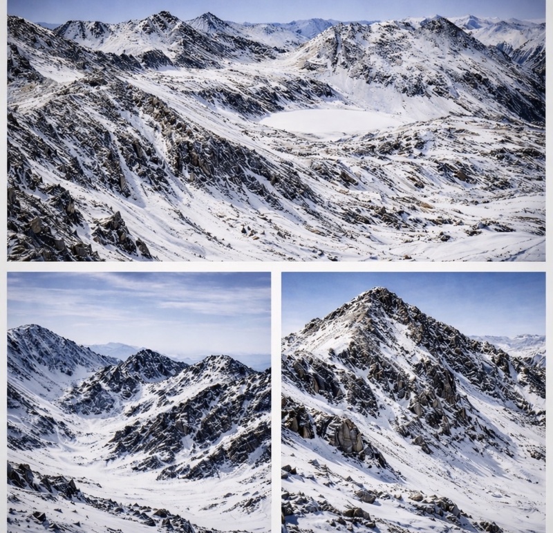
1/22 West apostle I've fat biked all the way up to the upper TH for S. Windfield in low snow years like this and it can save time. This time I got lucky I suppose and found tracks. On my way up I was hoping I would find MadDadMikes summit carins for B&B like I did last time there were tracks back here but he says he has no interest in the winter bicentennials. None of my friends do. It takes a while to get to the upper basin and it is one of the more beautiful places in the Sawatch, which are underrated. I love saying, I hate your guts because I’m loving every minute of it. I love being back here. As I hiked up toward Lake Ann I lost the tracks and looked around at the unnamed orphaned 13ers, which means I will get to drag one of my buddies back here with me in the future. 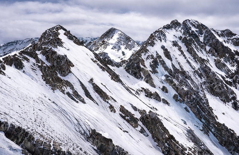
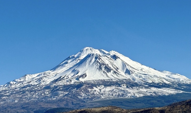
1/24 Shasta California seemed to be having the same drought winter Colorado had because despite all my anxiety from all the horror stories I've read about Shasta, this was an amazing snowflake. 7000' vert and lotsa miles but there were tracks everywhere. When I started at midnight there were at least 3 people in the parking lot getting ready as well. I chose the Casaval Ridge up and the West Face Gully down because circles are better. I was in crampons the entire time and just following boot steps of the hundreds of others that came before me. Guess how many humans I counted on my way back to the car? 153. It was noisy. I had hoped to convince my Oregonians to meet me there but too short notice. I waved to Elijah on Hood. Was'sup buddy! 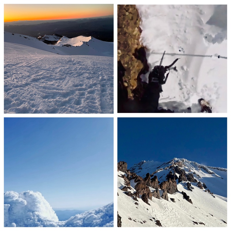
2/3 13,801 Again, there were tracks up 13,801 from a Handies ascent. It seemed Lake City was in a vortex of calm. Yearning to get back to my Lake City peaks because I think the bicentennials in this area are unmatched. Good rock, easy access, beautiful views and you are buried in one of the most beautiful places in Colorado. The ice climbing is amazing, the community is friendly the only thing that is scary is a lot of animals on the road. It was a little maddening that others were easily walking up Handies that was my winter 14er finisher and almost killer but I do remember feeling pretty rad finishing on that peak so kudos to everyone that was able to get up the 'elusive' one. 
2/4 Carson/13,587 I chose Cataract Gulch again, better the devil I know. Once you top out on the mesa around 12,400’, the wide-open tundra is visually stunning. I’ve biked Cataract Gulch before, and it’s not enjoyable. Carson, on the other hand, is grueling up and down, but at least predictable. In winter, though, a fat bike isn’t limited by ice, it’s limited by downed trees and snow drifts, and I assumed there would be plenty of both. No bike today. Looking over, Cinnamon Pass was dry again. Carson’s west ridge went quickly, easy money. 13,587 looked more intimidating from a distance, but I know its secrets. Someday I should be smart and take the full ridge, but for now, I don’t know enough about it. 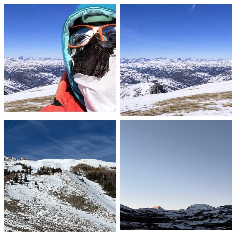
2/5 Animas Forks/13702 I’ve ridden Cinnamon Pass a few times and it can be a grind, so I wasn’t sure what to expect with the road or the peaks. The ridge toward Animas Forks has a thin spine, but I didn’t remember anything loose. I also considered dropping over Denver Pass for 13,702. The reason this day worked was simple: there wasn’t much snow. In a real winter, these peaks would be dangerous. I imagine the cornices on Animas would collapse, and Denver Pass would almost certainly slide. The alternative would be a long skin up Engineer Pass into Hurricane Basin, but that route cuts through plenty of avalanche terrain. Coming in from the Silverton side might’ve been the smarter option in a low-snow year. But I’d been having success out of Lake City, and I’ve learned to stop when things are going well. And they were. 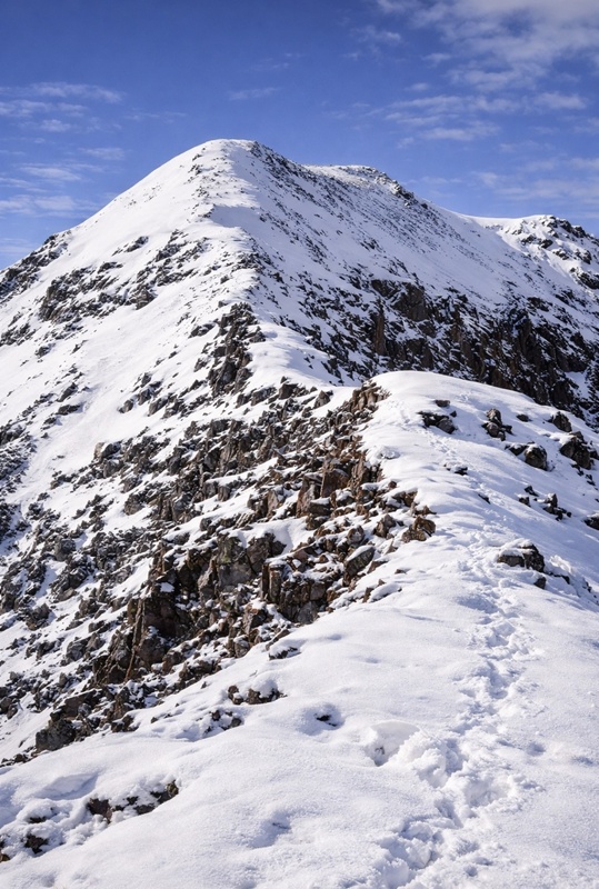
3/19 Cho Yahoo/E. Crestone I finished the season on two peaks that didn’t really make sense to climb, which felt fitting, because climbing the bicentennials in winter doesn’t make much sense in the first place. The remaining peaks are all in the San Juans and will require time I didn’t have this season. At least I have one fan. Every time the inReach Mini beeps, I look up, catch a contrail, and take a photo knowing he’s out there, paying attention. I’ve come to like the beeps. So thanks to the beepologist for making them sound so good. 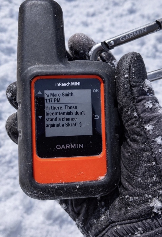
End Notes: The winter bicentennials were easier than expected as it seemed that winter never really showed up. I’ve been physically frail, but never weak. It was a strange paradox: in a season with a light work schedule, moderate free time, and unusually good conditions, I still couldn’t get to everything I wanted because of a torn ankle tendon. Tired, yes but I’ve learned that fatigue is as much perception as reality. It can dull you or sharpen you. It’s a mindset.There was no real hard trail breaking and overall everything was in good shape.This was the year to move efficiently. An exceptionally dry season for better or worse in the context of climate left the mountains bare in places, even as the calendar still said winter. However, it was still winter. Less daylight hours with long periods of suffering through the cold. Winter alpinism is much like flying an airplane with hours and hours of boredom followed by brief moments of terror. When moving light in the cold you gotta keep the body moving. My strategy has never been go ballistic and see how fast as I’ve learned to never red line in the mountains especially in winter conditions. I climb in control and summit with tons of energy to spare. The margin of energy is vitally important while alpine climbing. As the cliché goes, the summit is only halfway so you best not arrive exhausted. You can slap the chains at the top of a rock climb and then rappel to the ground but there’s no slapping the chains in alpinism, only the long way out. And even then, nothing is guaranteed: a flat tire, a misstep into a creek, an elk in the road. The effort doesn’t end until you’re home. 
I used to be cool. Nowadays, I have caviar taste on a sardine budget. The sum of the small things can eventually lead to the big thing. 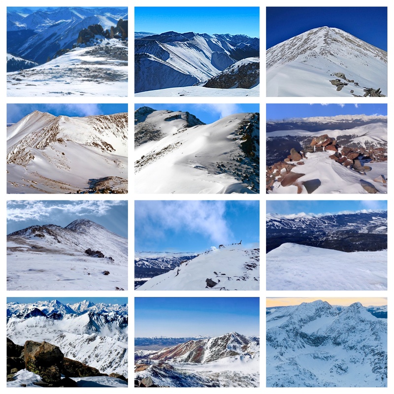
On History, Lists, and the Illusion of FirstsBefore winter ascents were tracked, before lists were formalized, before anyone cared about “firsts,” people were already climbing these mountains in the cold. Some were surveyors. Some were miners. Some were just curious enough to keep walking upward when everything in their body suggested otherwise. According to my coffee table books, by the early 1920s, climbers like Carl Blaurock and William Ervin completed what became the first recognized list of Colorado’s 14ers, unintentionally creating a framework that generations would follow. Around the same time, Eleanor Davis was climbing extensively in Colorado and beyond, well ahead of her time, and largely outside the spotlight history tends to preserve. Then came the winter climbers. In the 1960s and 70s, teams began deliberately seeking out peaks in full winter conditions: Capitol in January, the Maroons in February, the Crestones in March. These weren’t record attempts. They were questions: Can this be done? And more quietly: What happens if it goes wrong out here? Some of those names were written down i,e, Lou Dawson, Reinhold Stammberger, and others but many were not. And even when they were, the record is incomplete. Dates blur. Details conflict. Entire ascents likely disappeared into silence. Which makes any modern claim “first woman,” “first solo,” “first winter” inherently uncertain. Not meaningless. But incomplete. It’s easy to mistake documentation for truth. The reality is simpler: people have been moving through these mountains, in all seasons, for far longer than we’ve been keeping track. Some were faster. Some were bolder. Some just didn’t talk about it. I’m not a great record keeper. Never have been. I don’t use location tracking. I don’t take many good photos, and I don’t post much outside of this. It’s not a statement it just feels cleaner that way. Which also means there isn’t much proof, and over time, most of this will be forgotten anyway. So this project isn’t about being first. It’s about being part of that lineage briefly, imperfectly, and with full awareness that whatever we write down now will eventually become just another partial record. I’m doing it for me. For the freedom in it. The sense of power, and purpose, that comes from moving through these places on my own terms. All I know is that any time I use Fatso or any bike, I go solo. It’s faster. But fast toward what? There are no chains out here. No clean finish. You don’t clip an anchor and call it done, you just keep moving until you’re back at the car, and even then nothing is guaranteed. I might finish this project. I might not. It doesn’t really change anything. The only place I’ve consistently found myself is out here among the trees, on mountaintops, and especially in the silence of snowy fields. The mountains will still be there. Hopefully, so will I.
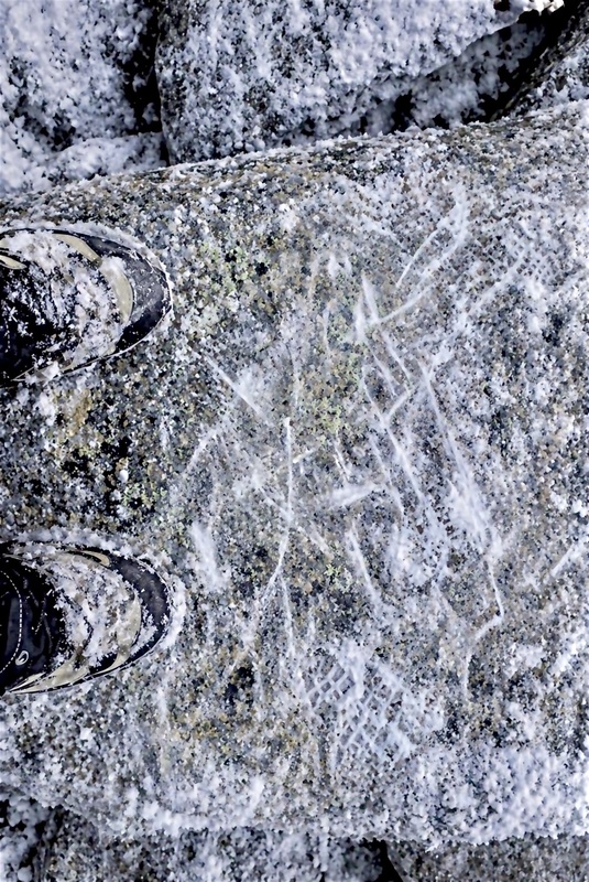
Thumbnails for uploaded photos (click to open slideshow):  Someday I’ll climb this face")
 Excited about next obsession")
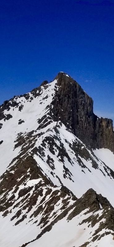
 Not really excited about this face")
 Tijeras adventure")
")
 Winter bicentennials")
 El Fatso")
 Garfield to Anderson")
 High Lo Carb")
 Carb route")
 Whitney route")
 Up Garfield")
 Perfection")
 Anderson track")
 Garfield to Anderson stats")
 Carson")
 The Poles")
 Every to Cooper")
 Silver sunrise")
 West Apostle")
 MadDadMike cairns")
 13801")
 Sayers")
 Ripples")
 Animas Forks")
 Whitney to unnamed")
 Snow folly")
 Hub tracks")
 Only fans")
 Shasta")
 Up Shasta")
 Whitney boulder")
 Large Marge")
|
| Comments or Questions | |||||||||||||||
|---|---|---|---|---|---|---|---|---|---|---|---|---|---|---|---|
|
Caution: The information contained in this report may not be accurate and should not be the only resource used in preparation for your climb. Failure to have the necessary experience, physical conditioning, supplies or equipment can result in injury or death. 14ers.com and the author(s) of this report provide no warranties, either express or implied, that the information provided is accurate or reliable. By using the information provided, you agree to indemnify and hold harmless 14ers.com and the report author(s) with respect to any claims and demands against them, including any attorney fees and expenses. Please read the 14ers.com Safety and Disclaimer pages for more information.
Please respect private property: 14ers.com supports the rights of private landowners to determine how and by whom their land will be used. In Colorado, it is your responsibility to determine if land is private and to obtain the appropriate permission before entering the property.


