| Report Type | Full |
| Peak(s) |
Whale Peak - 13,080 feet |
| Date Posted | 12/30/2025 |
| Date Climbed | 11/27/2025 |
| Author | MaryinColorado |
| Additional Members | d_baker, Jordan123 |
| A Whale of a Good Time |
|---|
|
Whale Peak Thanksgiving is usually all about turkeys, but Thanksgiving 2025 was all about whales. Step aside, turkeys! 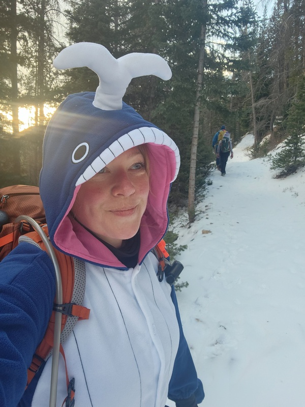
I don't actually remember the entire origin story of my humpback whale onesie other than I bought it years ago as a joke to play on whoever my Whale Peak partner would be. I remember opting for the more scientifically accurate humpback whale since killer whales - in scientific classification - are actually dolphins, and scientific accuracy is paramount when one endeavors to achieve such shenanigannery as this hike required. In the years that I haven't done Whale Peak, I have worn the onesie twice as a CFI volunteer at a zoo event, so there has been some peak-adjacent crossover. Haha! And why did it take me so long to do Whale Peak? I wasn't about to solo it; that would defeat the onesie's porpoise. Another .commer extended an invite and was willing to endure whale shenanigans, but our schedules didn't align. Then there's Darin who successfully dodged the whale onesie bullet a couple times, but with Jordan in full support of my plan, Darin's avoidance came to an abrupt end. Before I Start "Spouting" Off, To the Stats, We Go! My tracking cut out for a very brief period of time, so these stats are a little off but are close. Total mileage: 7.91 The Drive The road was in very good condition and pretty non-problematic until the creek crossing. While Jordan and I stared at the creek wondering how deep it was running, Darin was busy looking at the giant tree blocking the road just past the creek crossing. Jordan and I had yet to notice it, but it sure took the guesswork out of driving further, so I backed into a clear spot, and away we went. This added a couple extra easy road miles to our hike. 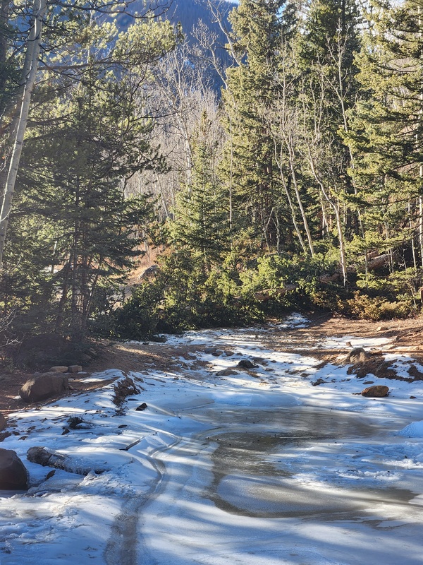
Before we knew it, we were at the Gibson Lake Trailhead and heading to the left to pick up the obvious trail. 
The snow was fairly contiguous but easy trekking from here to the lake with the occasional sneaky patches of ice. Not much to be said, route-wise. 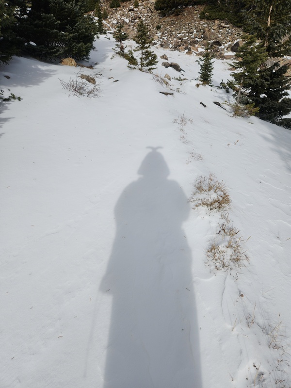
Soon, the summit objective comes into view along with the infamous Whale Tale Couloir. 
It was a beautiful day, albeit a bit cold, and the wind kept threatening to pick up, but we seemed decently shielded from a lot of it. 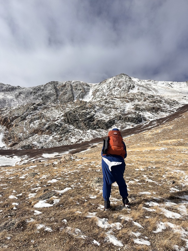
Trail ends close to the lake, and it's your adventure from here! As you can see from my expertly-drawn doodle dots, the route is fairly straightforward with basically two slope endeavors. First slope (dry in this pic) is short-lived and not terribly difficult with too much sustained steepness, but the second slope (snowy in this pic) is much more sustained steepness. I found it to be arduous, but that's to be expected if you're a whale. 

The view down onto frozen Gibson Lake is really beautiful! I like this little basin. 
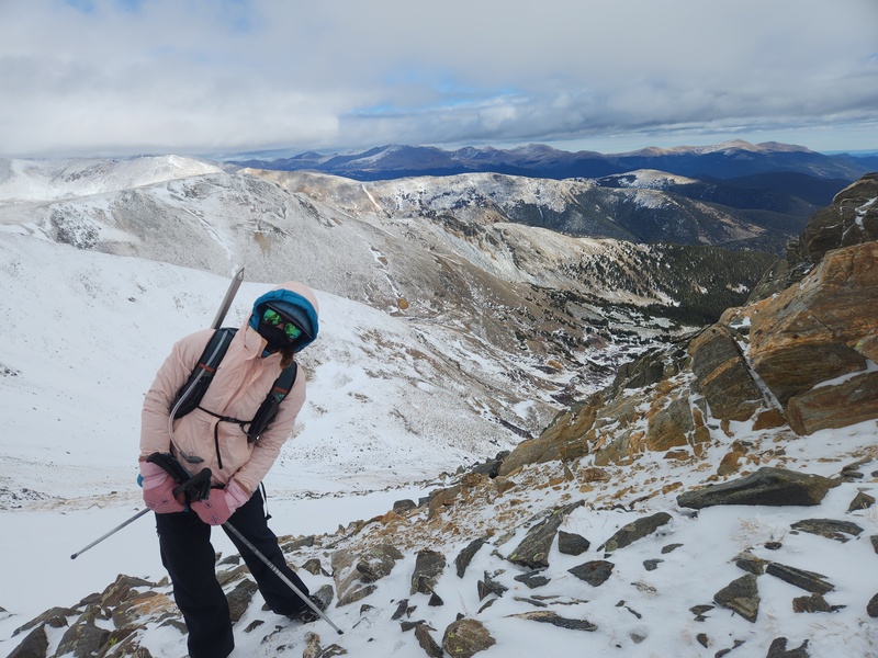
The snow on the second slope was my least favorite kind: thin and unconsolidated. It was hard to get purchase sometimes since the snow made the tundra slick, but then if you went through the rocks instead, the rocks were Wobble City. It was a "pick your poison" kind of situation the whole way up. Summit is always in sight, so route-finding is easy and straightforward. No truly tricky terrain, really. 

Jordan was very much in the lead, little speed demon that she is. Darin was slightly behind me for a good while, so unfortunately he was subjected to perpetual views of my whale tail. 

We saw Jordan gain the summit, but then we saw her quickly ditch it and weren't sure why. The deeper snow-crossing of the day was brief and right before the summit; not a big deal. 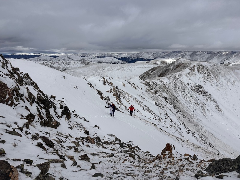

Once we caught up to Jordan she relayed that the summit (literally feet away) was brutally cold and windy. And it was! I walked another several feet, and it was like walking through a wall. Things went from cold-but-tolerable to suddenly massive wind, slightly hard for me to stay upright, lots of rime everywhere, and just the most brutal, intense cold one could hope for. 

That was, officially, the shortest amount of time I've ever spent on a summit, I think. I took a hasty summit video, snapped a few pictures, and we got our summit picture. But then we all dove off summit pretty darn fast and back through the wall. I don't think I've ever experienced such a harsh weather transition before, a true "0 to 60" (literally). It was not a good time on the summit, but our objective for the day was met, and we were happy about that. 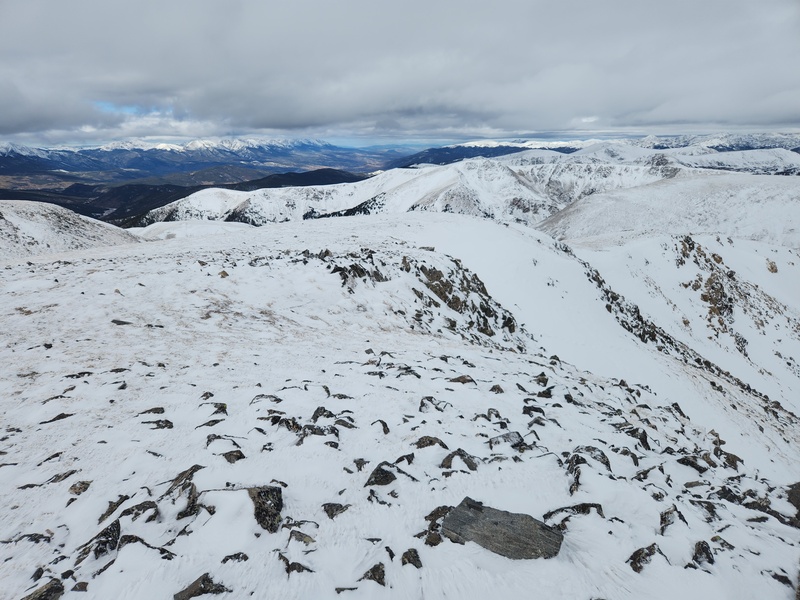

Surprisingly, descent was not as rough as we were thinking it was going to be. Strategic side-stepping for the win for SO much of the descent! So, thankfully, this whale didn't end up going for a swim downslope. 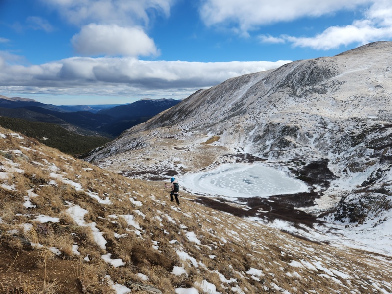
Once we were back to Gibson Lake, it was time for shenanigans! I would like to thank Jordan and Darin for their encouragement and support (and tolerance) of my whimsy. Also, there was an attempt to recreate the infamous George Costanza boudoir photo pose; however, we later realized all three of us remembered the pose incorrectly. Oops. 

And Jordan being the queen of handstands, we had some shenanigans on the frozen lake, as well. None of it makes sense, but it was fun, so that's all that really matters. 
Our trek back to the vehicle was anti-climactic. It was a wonderful way for us to spend Thanksgiving, and in the spirit of gratitude, I'm always so thankful for the gift of friends that are not only good-hearted people but who also make for fun, trusted hiking partners! Darin and Jordan, thank you for a beautiful day and the gifts of time and meaningful companionship. And I promise I'll be back to wearing my normal hiking clothes next time we're out! Final Thoughts Delightful, easier 13er. Route-finding isn't tricky. Views are okay en route to the summit, but definitely from the summit (as briefly as I saw) the views are really great. I think next time, conditions permitting, it would be fun to pursue Darin's idea of gaining the ridge early by following the first slope all the way up to the ridge and then ridge all the way around to the summit. This would allow for a longer time up high to soak up the views. Thumbnails for uploaded photos (click to open slideshow): ")
")
")
")
")
")
")
")
")
")
")
")
")
")
")
")
")
")
")
")
")
")
")
")
|
| Comments or Questions | ||||||||||||
|---|---|---|---|---|---|---|---|---|---|---|---|---|
|
Caution: The information contained in this report may not be accurate and should not be the only resource used in preparation for your climb. Failure to have the necessary experience, physical conditioning, supplies or equipment can result in injury or death. 14ers.com and the author(s) of this report provide no warranties, either express or implied, that the information provided is accurate or reliable. By using the information provided, you agree to indemnify and hold harmless 14ers.com and the report author(s) with respect to any claims and demands against them, including any attorney fees and expenses. Please read the 14ers.com Safety and Disclaimer pages for more information.
Please respect private property: 14ers.com supports the rights of private landowners to determine how and by whom their land will be used. In Colorado, it is your responsibility to determine if land is private and to obtain the appropriate permission before entering the property.