| Report Type | Full |
| Peak(s) |
Picacho del Diablo 10,154' |
| Date Posted | 12/11/2025 |
| Modified | 12/19/2025 |
| Date Climbed | 11/08/2025 |
| Author | mrgooseskin |
| Picacho del Diablo via the Pinnacle Ridge |
|---|
|
Picacho del Diablo is a peak that is well known in Mexico and in California peakbagging circles, but not much beyond that. It is the highest point on the peninsula of Baja California, one of the most remarkable peninsulas in the world. It is an ultra-prom and the highpoint of the Mexican state of Baja California Norte. The general idea of climbing this mountain began when I was very young, much like other mountains that stuck in my mind, by having seen it labeled on an old road atlas. I fantasized about what the top of such a mountain could be like. The 10,157 foot, twin summitted peak sits perched atop a jumbled knot of craggy granite spires and ridges that jut out from the main massif of the Sierra San Pedro Martir, a classic “sky island”, common throughout the middle North American deserts. Guarded by steeps gullies and deep canyons, adjacent to a massive escarpment that rises dramatically out of the parched desert floor, this area provides a wealth of potential for extreme desert mountaineering on amazing granite. As with any tall and steep mountain range, ecological zones change drastically in a short distance. The mountain contains on its slopes a number of biomes including scrub desert, oak woodland chaparral, and coniferous pine forests. It is fun to think of the strong possibility that the peak may have seen prehistoric ascents by members of the Cochimi or Kiliwa tribes, who inhabited this region from as early as 11,000 years ago. The first known ascent occurred in 1911 by Don McLain, likely by the route that would later become the standard way to ascend the peak. It wouldn’t be climbed a second time until 1932 by Norman Clyde and company via the Canon del Providencia route. Since then, more than 15 routes have been established, most of which are very obscure. It seems that the vast majority of climbers summit this peak via the class 3 Standard Route (also called Western Wash Route) from the nearby San Pedro Martir National Park, with a smaller minority approaching the same route from the desert floor via Canon del Diablo. The former approach grants relatively easy access from a paved road, yet involves significant elevation loss/regain. The latter approach avoids the elevation loss, but is a long arduous slog up the canyon from the desert floor, and has a long dirt road drive to the trailhead to boot. These two approaches meet at Campo Noche, a nice campsite that has water, several flat tent sites, and shade. 
The most difficult established route, technically speaking, is the Pinnacle Ridge. It is a direct route that avoids the 3000 foot drop into the canyon during the approach from the national park. A mountain such as this with a moderate, yet mysterious technical ridgeline to the summit was enough to get Ryan signed up for the trip, and Will would be a great addition to join due to his extensive experience of traveling all over Mexico and master of the Spanish language. Beta on this route was hard to come by, and this intrigued us even more to try out the Pinnacle Ridge. From what we could gather, previous ascents of this route involved many rappels off many pinnacles, with reportedly lots of moderate rock up to about 5.7, all done via multi-day efforts. All three of us were cautiously confident that most of the technical pitches encountered would be at least few number grades easier than 5.7 and we felt that we could certainly shave off time by soloing much of the route. We briefly entertained the idea of doing it in the style of previous ascents by bringing bivy gear and making an overnighter of it, but after some thought, and looking at the stats, it seemed a lot more fun to do it in a day, albeit a very long one, something which we couldn’t confirm had been done in the past by any parties. While the peak does seem to receive heavy traffic via the Standard route, particularly from large guided groups from Tijuana and elsewhere in Mexico, there seemed to be surprisingly few parties that do the peak in a day, even via the Standard Route, which involves around 16 miles and close to 10000 feet of gain from the regular trailhead in the national park. I had known of 14 hour daytrips in the past, and certainly people have done it much quicker than that car to car. Getting to the trailhead is a simple affair, by way of a nice drive down the Baja coast approximately 5 hours south of San Diego. A road that is miraculously paved penetrates deep inland, providing access to the National Park, which occupies the “sky island” of the Sierra San Pedro Martir. The outing would involve a 4.5 mile entry hike among rolling forests on a good use trail to the Botello Azul (Blue Bottle) Saddle, at the edge of the precipitous eastern escarpment of the range. The big Picacho lies coyly out by itself, away from the escarpment, connected only via the wild looking Pinnacle Ridge. It’s at this juncture that climbers doing the Standard Route must drop 3000 feet into Canon del Diablo to the north to gain less technical ground heading up to the summit, only to have to re-gain that on the way back. Pinnacle Ridge, while much more technically challenging, avoids this unappetizing loss of elevation. On Friday morning Will and I picked up Ryan at the San Diego airport, grabbed some breakfast burritos, and drove the short, traffic-free jaunt down I-5 to the San Ysidro port of entry into Mexico, reportedly the busiest land border crossing in the world. Driving into Mexico is surprisingly informal and quick; you could almost do it by accident if you aren’t paying attention. Upon entering the maze of on/off ramps that greet you as you drive into Tijuana, we somehow found ourselves approaching the line of cars waiting to go back into the US. Not wanting to get stuck in an inescapable queue, and much to the amusement of Ryan and Will, I quickly checked my rearview and hurriedly reversed the 4Runner about 100 yards and was able to get onto the ramp that led into Tijuana and away from the border. Hopefully our navigation skills would be better on the mountain than in the concrete jungle… 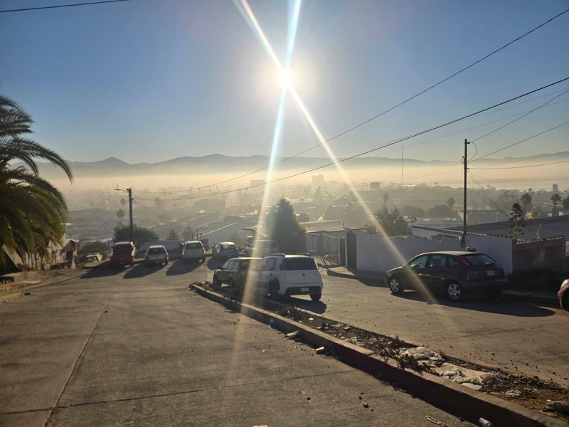
The drive to Ensenada from Tijuana follows a wonderful, oceanside 4 lane divided highway with 3 or 4 toll booths enroute, with tolls totaling around $8 USD. Not bad for a scenic stretch of about 50 miles. Coming into Ensenada, the limited access toll road ends, and you are dumped out onto regular roads with the usual traffic. We stopped at the beach to stretch our legs and grab a bite to eat and chow down on some fish tacos. After a quick stop at Smart & Final to pick up some last minute provisions, we headed further south towards our objective. It was about 2pm and we were eager to get going since darkness was already starting to creep in early at this point in November. At this point in the journey the traffic and population density drops significantly, and we enjoyed the open road as it weaves through picturesque canyons, through Mexican “wine country”, and eventually comes back out onto a coastal plain with a lot of agricultural activity, reminiscent of the Salinas Valley in Alta California. We topped off gas in San Vicente and drove a little further to the conjoined towns of Ordaz/La Providencia, where we saw our turn off, signed for San Medro Martir National Park, 100km. This road ascends from practically sea level to over 8000 feet in about 60 miles. This is when we all started getting giddy as we all do whenever we turn off a major road onto a much less trafficked mountain road. Within a few miles, the road passes through a gap and enters another world, totally separate from the ocean plain. The land turned more desert-like and we passed through the small villages of San Telmo and Hacienda Sinaloa. Beyond the last village, the road goes through a broad valley that is home to a couple of ranchos that double as bed and breakfasts. Our hope was to be able to stay at one of these the night following our climb, providing we finished up at a decent hour. The historic Rancho Meling, along with the Coyote Ranch are in this area, and both offer nice lodging accommodations. As we ascended the windy road up into the mountains, the sun was getting closer to setting and the golden light cast a brilliant hue over the land as we made our way up the impressive mountain range, views becoming more dramatic by the minute. 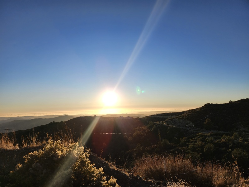
After some time, the road crests onto the main plateau of the range and hits the park boundary, where we arrived a little bit after sunset. There was a large entrance gate here, with an armed guard standing to the side, and a park docent coming out to greet us. The guy was equal parts stern and aloof, not super concerned about what our plans were in the national park, but quick to point out that we needed to pay up and only camp in designated campsites. He also cautioned us to drive around with our hazards lights on at all times (or something like that, that part was lost in translation). We paid our park fees (about USD $9 per person per day). We only paid for 2 days, as we figured we would be out by the following day after the climb. With the last few moments of usable light, we drove the remaining distance up the paved road into the park, where we saw our objective for the first time rising in the distance, catching the evening’s final alpenglow. Upon seeing the peak itself, we all got really stoked. 
We found the turnoff to the dirt road that leads to the trailhead, and after about 10 minutes of easy driving, we pulled into the large trailhead area just at last light. The trailhead is signed for “Uso Diurno”, but that did not deter us from spreading out our bivies. I brought my camp stove so we were able to cook up a decent feast of pasta, mixed veggies, and kielbasa sausage. After eating we all packed our packs, splitting up the gear as best as possible and discussing how much water we were all to carry. Knowing that water was not going to be available until very late in the outing, I opted to carry 3.5 liters. This ended up being just barely enough. Gear wise, we carried one 60 meter 8.5mm rope, a single rack of cams from .1 to #2, a half set of stoppers, 3 micro tractions (for simul-climbing) and 6 alpine draws. We crawled into our sleeping bags around 9pm, with Ryan and I cowboy camping, and Will in his one-person bivy mini-tent. I was a little chilly in the night, with temperatures that dropped well into the 30s. The alarm went off at 3:30 am, and in the same manner we’ve all done countless times before, we all forced ourselves out our comfy beds into the cold blackness to prepare for the day. After a quick breakfast of hot coffee and warm oatmeal, we shoved off at 4:10 am. The first 1.5 miles of the route involved walking up a sandy wash, which warmed us up very quickly. After the wash, the route weaves in and around small rises and gullies in the forest, all on a well-defined trail. Through some Strava sleuthing, we were able to download a GPX of our route from a woman from Tijuana, Sofia, whom we would later learn guides this peak frequently. For the forest stretch, the track wasn’t needed, but we were very grateful for this track later in the day when we were on the ridge proper, as well as the descent and deproach. 
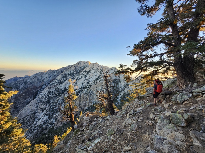
Slowly it became light enough to see some our surroundings, and we could make out Scout Peak looming above us as we passed beneath it. It was light enough to turn off the headlamps when we turned left and began to ascend the final broad gully that would lead us up to the Botello Azul saddle. Here we lost the trail for a few moments, and we ended up bushwhacking a little bit through some manzanita, but it didn’t majorly affect our progress and we soon found ourselves approaching the saddle and edge of the main escarpment of the mountain range, eager to get a glimpse of the big Picacho. We passed a nice looking campsite, crested the range, and sure enough were greeted with a magnificent view of the peak bathing in the first rays of sunlight. This was the first time we could see our intended route up close (most of it anyway), a very aesthetic ridgeline dancing atop complex mazes of gullies, cliffs, spires, and slabs. The main ridgeline itself looked fairly friendly from this angle, and we took no hesitation in charging ahead towards what looked to be a good starting point to access the ridge 

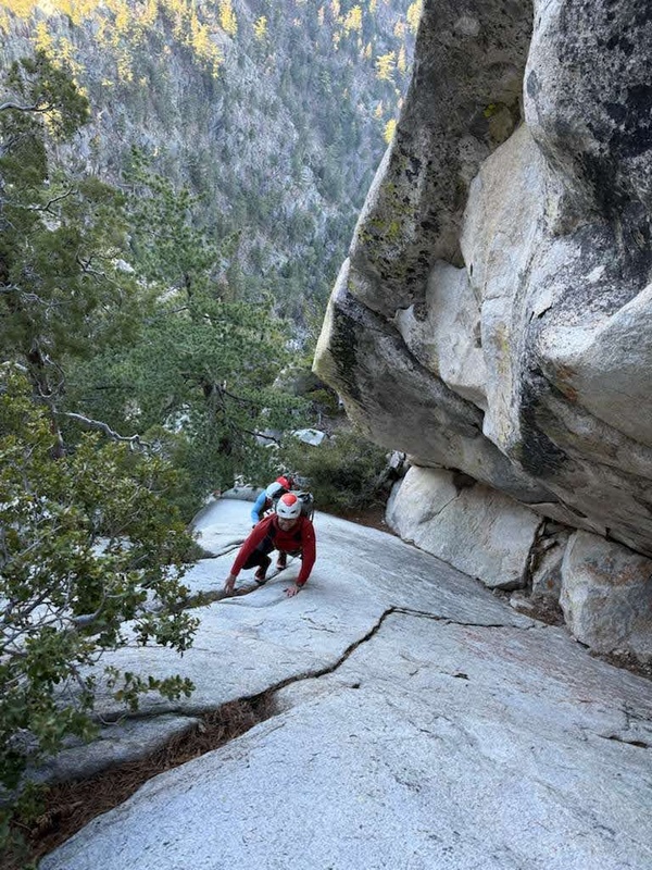
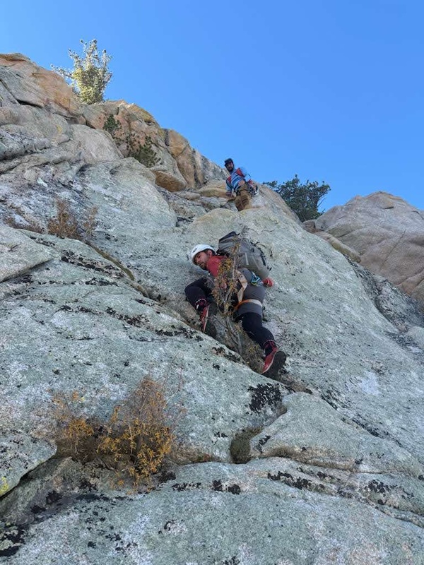
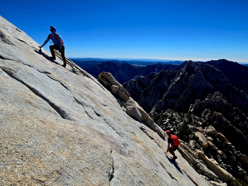
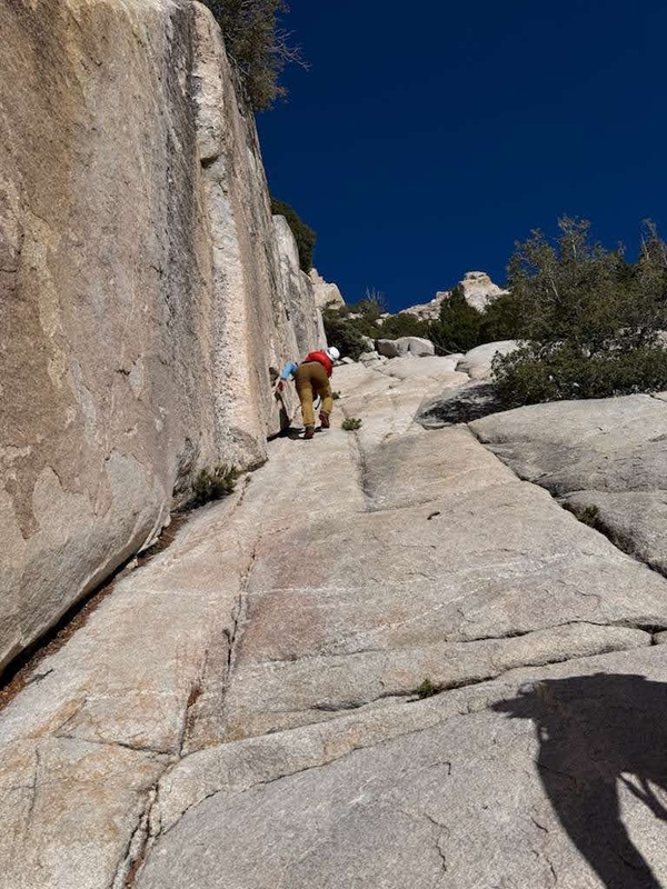
It was also at this point where we could look down into the impressive Canon del Diablo, the depths from which we would eventually need to slog out. Filing that away as a “later in the day problem”, we broke off the main use trail and started picking our way through brushy talus towards a large amphitheater formed by the ridge’s southwestern terminus. After some discussion of how to best get onto the ridge proper, we narrowed down the choices to a gulley on the far left that looked decent (which is where Sofia’s track seemed to venture towards), or tackling the rock straight ahead. We decided to take a look at the straight-ahead option. There were a couple of ways that certainly looked like they would go. I spied a hidden ramp up on the left, and after some brief discussion, I quickly got my harness on, grabbed the gear, tied in, and had Will put me on belay. It was shortly before 8am. 
I was able to climb up to a good ledge about 20 feet above the ground, place a good piece, and make an awkward, reachy move to get established on the ramp, from where I was able to follow a shallow, flaring crack filled with pine needles to a short steeper section with some grainy rock, and up into a small alcove just below easier terrain. I didn’t bother with putting on climbing shoes, as my approach shoes worked better for jamming the flaring crack. After placing an anchor, I fixed the rope and Will belayed himself using the micro traction. Ryan came up last, cleaning the gear as I belayed him in normal fashion. We all agreed the pitch felt about 5.7, Ryan and Will lamenting on how they weren’t in the Flatirons anymore, having to reacquaint themselves to that oh so sweet California alpine granite. For the duration of the approach I had been jealous of Will and Ryan’s choice of wearing trail runners, but now it was time for the sticky rubber on the approach shoes to shine, and I was happy to have chosen the footwear I did. After moving around one exposed move squeezing between a bush and the rock, we found ourselves ambling up easier but very high quality scrambling up a sheltered slab within the confines of the upper amphitheater. Not knowing if there were going to be more roped pitches ahead, we all kept our harnesses on, but the rope was put away as the climbing here was easy and secure. 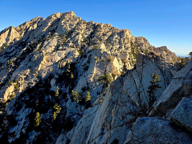
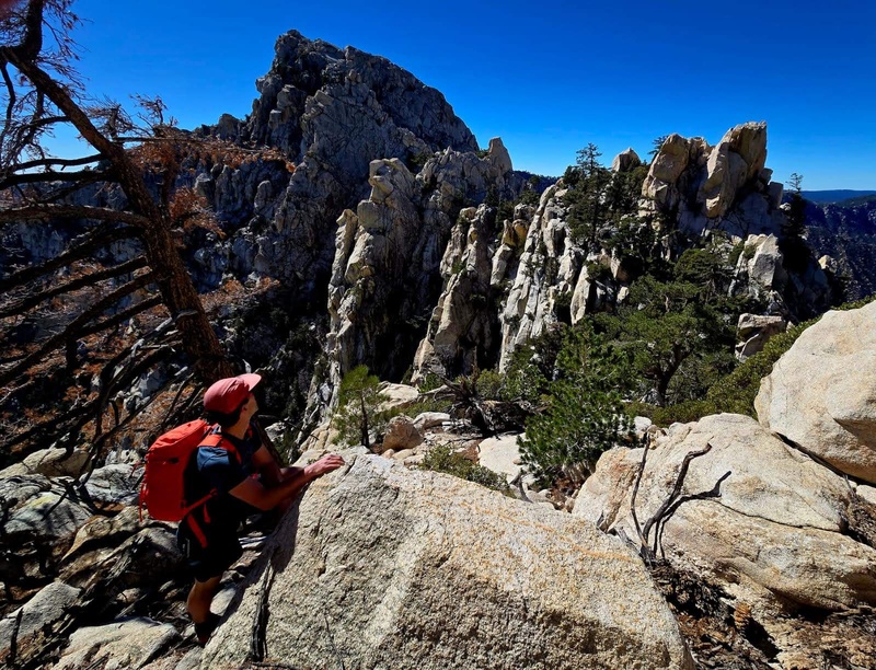
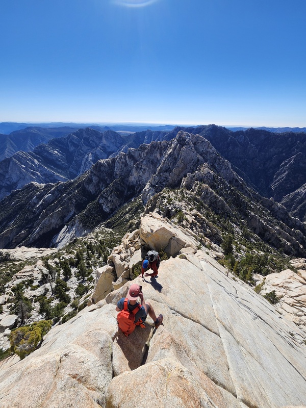
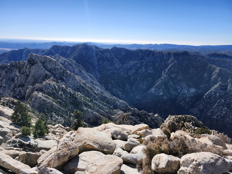
At the top of the amphitheater we got onto the ridge proper and were able to feel our exposed position. Approaching a narrow gap in between huge slabs, we could peek down the steep eastern side, and for the first time, see the expanse of the Baja desert far below, and the Sea of Cortez beyond. Amazing scrambling up through towering blocks, slabs, and a knife-edge ridge brought us to the top of the first of many Pinnacles. 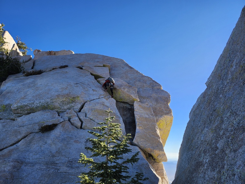
From here we could see a good chunk of the ridge unfolded before us. We took a few minutes to study what lay ahead; we could see that staying on and just adjacent to the ridgeline proper would be the way to go in all but only a couple of small sections, where it seemed like dropping into/around some gullies along the side would be necessary 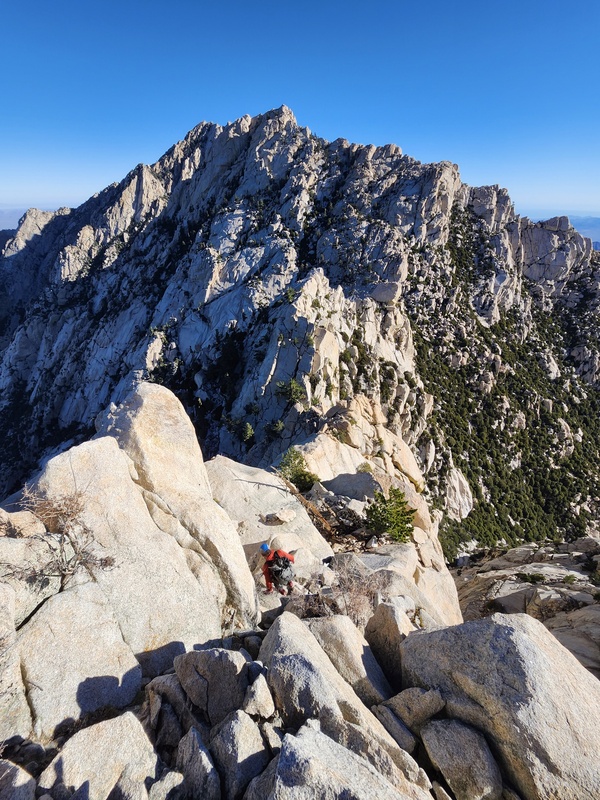
First came the issue of descending off the Pinnacle we currently stood atop; we all gingerly made our way down the ever steepening ridge, past a short downclimb onto an awesome pedestal-like promontory formed by the ridge. A rappel would be necessary to descend further, but Will noticed a large tree and ledge system to the north, off on the other side of the Pinnacle. If we could reach the tree from the hidden aspect, we’d be able to continue along without rappelling. Judging this worthwhile to check out, Will and I quickly regained the Pinnacle summit, looked down the opposite side and quickly yelled back to Ryan how chill it was. Ryan rejoined us and we made our way through enormous blocks to the before-unseen tree and followed class 3 ledges down towards one of several saddles found along the ridge. The route finding was manageable with our experienced party of 3. Every moment there seemed to be a choice of options to make navigationally, Will, Ryan and I would deviate from each other for a few moments, each of us poking our heads around corners to see “if it goes” and yelling back to one another our findings. We frequently found Sofia’s track dropping off the ridge proper and though it was warranted in some spots, we found that sticking to the crest mostly yielded very enjoyable scrambling, so that’s what we stuck with. 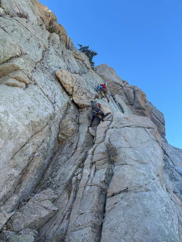
The ridge was class 3 or easier for the most part, but there were more serious sections for sure, particularly a few short, but exposed downclimbs that felt to me about 5.5. What obscure trip reports we could find about this route all mentioned many rappels, but so far we had found none. The ridge dips down low after the first Pinnacle, and while we did manage to stay on the ridge proper for the majority of the day, this section had us descending a gully about 300 vertical feet to make our way around another Pinnacle. It was in this gully that we came to what seemed like a short rappel. While Will and I hemmed and hewed on whether to rap or not, Ryan, looking around with more motivation to not use the rope, quickly found a trivial traverse linking the ledges that would make this rappel extremely optional. Will and I were already committed by the time Ryan found out, so we ended up doing the short 40 foot rappel off a tree since we brought the rope all the way up there and had barely used it thus far. A bit more downclimbing got us to the lowest point along the entire ridge, a saddle with a bivy site and no water. 
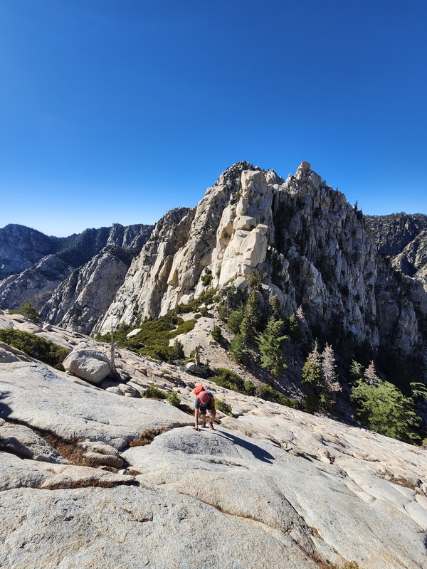
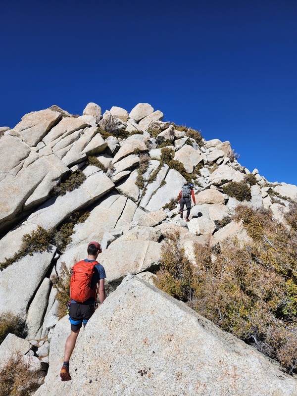
The scrambling went from awesome to world-class. Above the saddle we followed some supreme slabs, nothing generally harder than class 3, for about 700 uninterrupted feet. The ridge becomes more of a broad shoulder in this section, so we trended diagonally up and left towards where the ridge became more ridgelike again. As we gained the top of this section, we could see we were coming up to another Pinnacle; Ryan got ahead and out of sight, yelling down to us something about a tricky move and to check if there was passage around to the left. Will and I briefly took a look, but quickly realized that way cliffed out, so we returned up to where Ryan was and sussed out the move. Other than the roped pitch, this may have been the single most difficult move on the entire ridge, with a couple of slopey horizontal handjams and a long reach up and left to a horn, with not much for feet. It felt about 5.6, and soon we had joined Ryan atop the Pinnacle and could see the remainder of the route; we still had a ways to go. 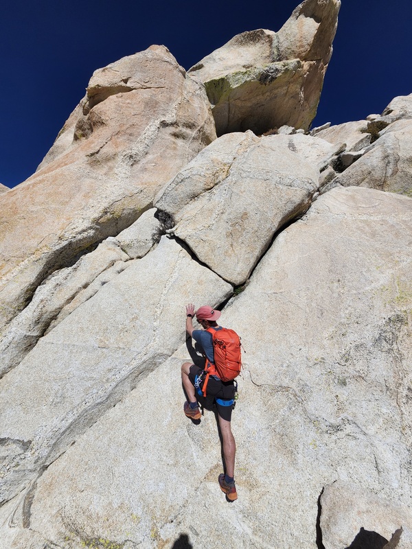
By now it was mid-morning, and we continued to move at a steady but not overly quick pace. Several more Pinnacles were negotiated and before long we started up the final bit of ridge up to the south summit of Picacho del Diablo. This section had some of the best scrambling on the entire route, following a blunt arete with impressive exposure down to the right towards the desert, clocking in around 5.4. It was in these moments that we could really bask in the grandeur of the position we were in on such a special mountain. 

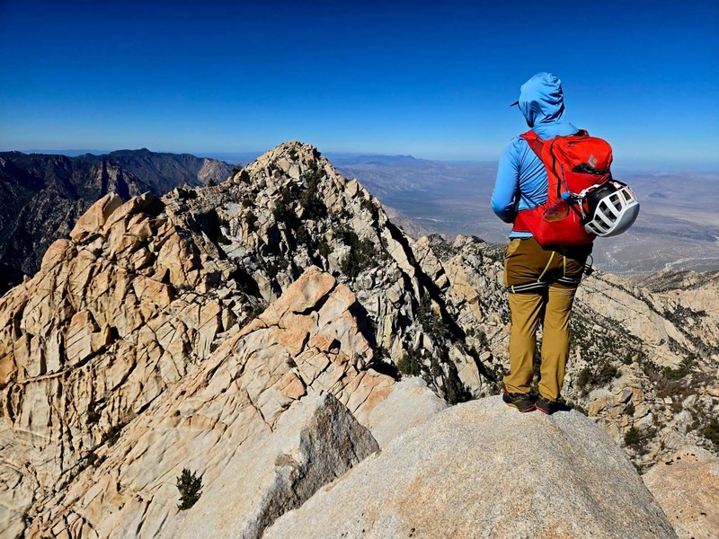
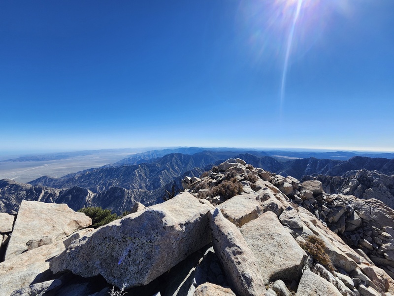
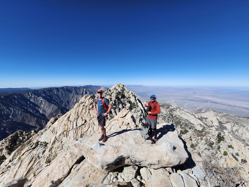
We reached the south summit at 12:30, about 4.5 hours after we began the ridge. The Sea of Cortez’s brilliant blue color stood out in contrast to the brown and beige deserts in the east. To the west, the edge of the Pacific was just hidden under the marine fog layer, but otherwise the views were great. While Ryan tried to futilely determine if the south summit was indeed higher than the north using what little water remained in his bottle as a rudimentary level (I don’t believe Lidar has settled this argument yet), I studied the traverse to the north summit that was supposedly no more than class 3. 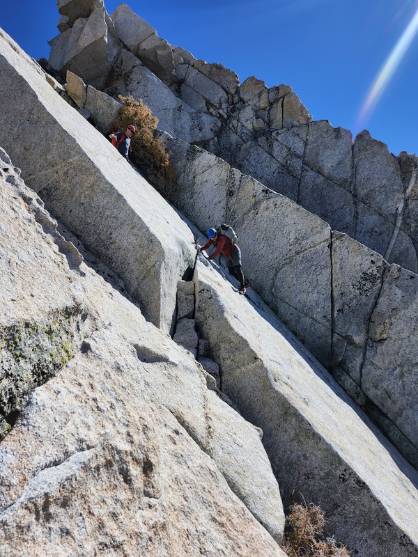

After a few minutes of studying the traverse from above, we all dropped off the summit via some connecting ledges that led out onto a short knife edge descending towards the saddle between the two summits. A very improbable yet conveniently placed narrow ledge traversed across an otherwise blank slab that gained us access to the saddle. An impressive block guarded the last stretch to the final summit pyramid, and Will found a hidden large ledge that took us directly across to one final tricky move before gaining the home stretch. We traversed straight across on easy slab and intersected the standard route and followed the final steps up to the summit just after 1pm, where quick congratulatory hugs were dished out. Ryan immediately went digging through the beefy register, which was essentially a large pelican case. In it, we found many entries of mostly Mexican climbers, including several from our very own Sofia, who we learned can be crowned Senora Picacho del Diablo, for she had climbed the mountain over 100 times, by all routes, even boasting of one ascent while 8 months pregnant. After seeing these entries from her, we were confident that her GPX track would not lead us astray on the return. 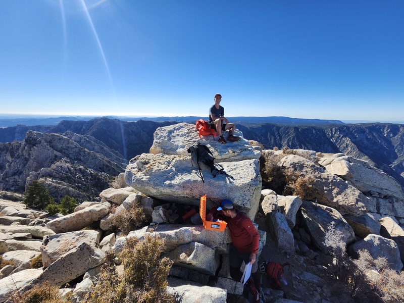

The summit feelings were jubilant enough, but we did not let out of our minds the prospect of the involved deproach that we were up against. Ryan had finished his water at this point, and Will and I weren’t too far behind in that regard. Knowing we had a good track to follow, we did some calculations and already determined that we would be hiking back in the dark at some point, so we made haste in descending off the summit, hoping to at least be out of the canyon and back to Botella Azul Saddle by nightfall, by which point only mellow forest walking would remain. We were pleased to find an easy to follow trail leading steeply down the mountain into the depths of Canon del Diablo. Before we knew it, we had already descended 1000 feet in a matter of 25 minutes. At this rate, we would make it down the remaining 3000 feet to Campo Noche in no time, where we hoped to find water and an established path out of the canyon back up 3000 feet to Botella Azul. All this was wishful thinking, for as we descended further, the brush grew thicker and the trail harder to follow. Even with the GPX track, we inevitably would slightly venture off and end up in an adjacent gully or ledge system, having to backtrack slightly up the hill a couple of times. We eventually came across the massive open book dihedral Wall Street, the crux of the Standard route, and I was surprised to find it as tricky of a downclimb as I did. 
We followed cairns through boulder fields and down small slots, with one particularly slick and steep section guided by a fixed rope. Soon enough oak trees appeared, and the trail snaked its way through thicker forests until the final 1000 feet into the canyon floor could be seen. For the first time that day, we had to be careful to avoid spikey desert plants. We finally heard the rush of flowing water and stumbled down into Campo Noche just before 4pm, 2.5 hours after leaving the summit. Water was flowing nicely and we wasted no time refilling our fluids, with Ryan downing 2 liters right from the get-go. I had ended up carrying just the right amount of liquid, as I still had a few sips left in my bottle at this point. The 4000 foot descent off the top wasn’t as straightforward as we’d anticipated, and it was clear now, after the time we needed to take to rehydrate, refill, and eat food, that it would be dark well before we would reach Botella Azul Saddle 3000 feet above where we sat. This made us gather the water we needed in earnest, gulp some down, refill, eat, and be on with the slog. More wishful thinking that the gully climb up to Botella Azul would be straightforward. By 4:30 we were making our way up from Campo Noche, realizing much to our chagrin that we should have filtered our water a ways above the camp, as evidenced by the strewn toilet paper along the creek above where we had just filtered water moments before. We had about 45 minutes of usable daylight, and we did our best to make time but were soon slowed by large slick boulders, and several drainage junctions, not at all obvious which one to take without taking out our phones and confirming where Sofia’s track went. We were very grateful for the track in this section. 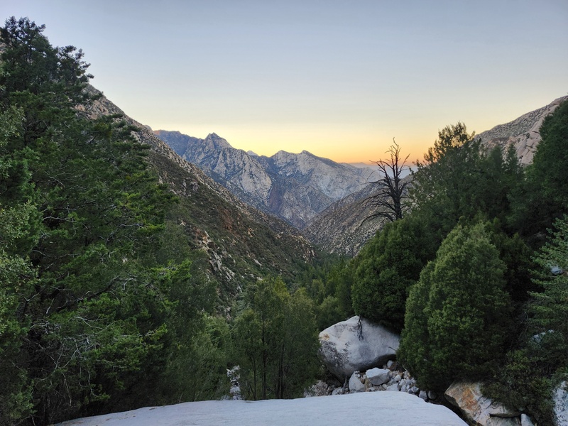
Soon enough the headlamps came out and we continued up the ever steepening mountainside. Luckily, as we gained elevation, the brushy riparian biome slowly gave way to more sub-alpine forest, which meant a clearer understory and easier to follow path, and before long we all fell into full night mode, just focusing on anything within our little bubbles of illumination in an otherwise pitch-black world. The darkness compounded the remote feeling of this area, for other than sporadic clusters of lights seen somewhere out in the distance perhaps up to 70 miles away, there was no other human presence. By now all three of us were feeling the stats of the day catching up with us, but we all managed a very solid pace until we could sense the trail flattening out and approaching the Botella Azul saddle, which would mark the entrance back onto the forested plateau of the range and final 4.5 miles of relatively flatter forest walking back to the car. We crested the escarpment around 6:30pm. Down the gulch we went, this time following the actual path on the north facing aspect of the gulley, as opposed to our manzanita bushfest on the south facing slope we had taken that morning. Before long we found ourselves plodding along the dark path in the forest. The final few miles were uneventful, and when we dropped down into the final mile of sandy wash, we all expressed how excited we were to eat some food and go to sleep. We knew it was too late to drive down to the rancho lodges that night, so we had hoped the park service wouldn’t be too perturbed by us overstaying our usage fee by a day. We returned to the car just after 8pm, marking the full day’s outing at just under 16 hours round-trip. Average stats from our recordings came out to around 16 miles roundtrip, with somewhere between 8500-9000 feet of total gain. After a restful night, we woke to a nice morning and a still empty trailhead. We wanted to check out the observatory but it wouldn’t open until 10am, and not wanting to wait around knowing we had a lengthy drive, we headed back out of the park (without any confrontation from the docent), and down the mountain back to lower elevation. We stopped at the Coyote Ranch on the way out, a nice villa and serene spot for lodging. An abuela cooked us up some burritos before we were on the road again driving back to the highway and then north towards Ensenada. The drive was uneventful, save for the military checkpoint just south of Ensenada where we were stopped by a stern bureaucratic woman scolding us for apparently not getting the proper paperwork for the car (or something like that). After some minutes of back and forth, she took photos of our passports, stating that she was going to “put us into the system” and upon our exit of Mexico, would be flagged and we would need to pay a fine. Not sure if she was trying to solicit a bribe from us, but with Will’s help, we all held firm on our understanding of the rules, and eventually she let us go. Spoiler alert, we obviously we were not flagged when we departed Mexico the following day. We spent the evening in a nice apartment in Ensenada, going out for many tacos, walking around the waterfront in the evening (which was bustling with several concerts and parties), and checking out the infamous Hussong’s tavern. It was nice seeing the city during the evening in the slow season, without the cruise ship tourists. Locals were out in full force, which provided a much more authentic and cultural experience. Monday morning had us up early and driving north towards Tijuana, wanting to get into the border line as early as possible. Before we left though, we needed one more taco fix, so we stopped at a great spot in Rosarita before hopping back in the car and getting in line back to the US, which only took about 55 minutes. The border guard waved us through without much fanfare. An hour later, after dropping off Ryan at the airport and Will at his friend’s place in Encinitas, I was heading back up north to LA. 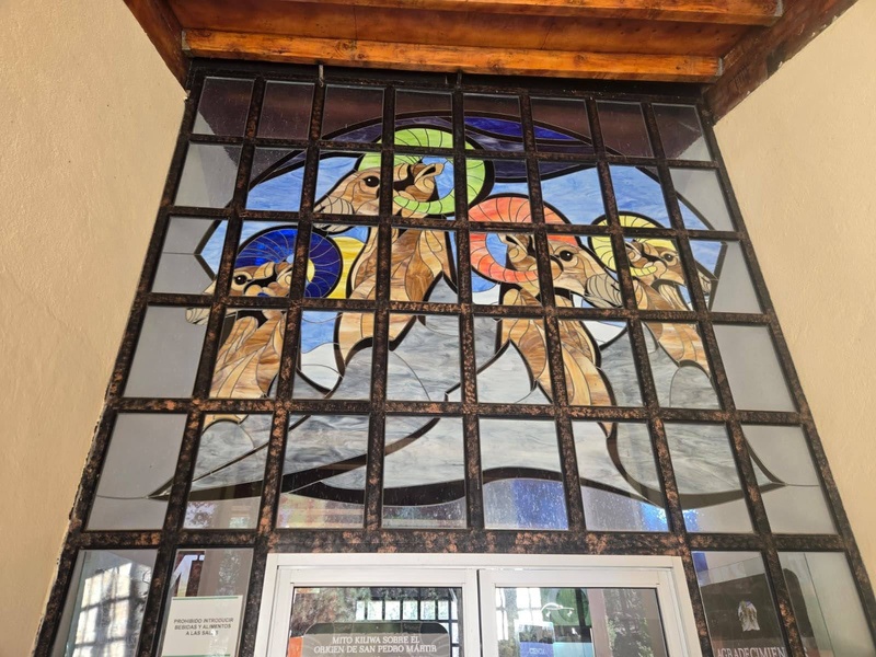

Thanks for reading! All photos were taken either be me, Ryan, or Will. 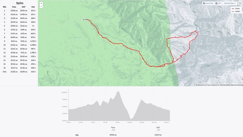
Thumbnails for uploaded photos (click to open slideshow):  Afternoon light driving up to the trailhead")
 Morning Light looking into Canon del Diablo")
 The boys relishing the view")
 Will and Ryan scampering towards the route start")
 Ryan ascending the")
 View of the ridge from the first Pinnacle")
 Delicate downclimbing")
 Beautiful slab section")
 Endless class 3")
 Will at the 5.6 move")
 Slabbbbb")
 Climbing the blunt arete approaching the top of the South Summit")
 South Summit, view north")
 South Summit, view south")
")
 Looking back along the traverse between the south summit and north summits")
 Approaching the north (true) summit of Picacho del Diablo")
 Will happy on the summit, as Ryan digs through the register")
 View SW into Canon del Diablo. We would descend to the bottom of the canyon, only to have to climb up the other side.")
 Last light after leaving Campo Noche, slogging out of the canyon")
 First light in the canyon")
 First soloing of the day.")
 Tricky downclimb")
 Tricky downclimb")
 Downclimbing")
 Mellow class 3 above the final saddle.")
 Me and Ryan making our way up the blunt arete of the south summit")
 Ryan and I scampering up a fun crack")
 A lot of the ridge involved class 2 rubble such as this")
 Cool stained glass at the National Park Visitor Center")
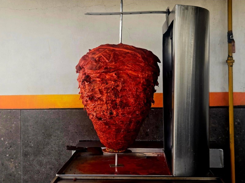
 Mmmm, tacos!")
 First glimpse of the peak after entering the National Park")
 Looking back at a typical stretch of ridge")
 Al Pastor, my favorite!")
 Ensenada")
 Descending the upper portion of the Standard Route. Tedious.")
 Looking at the peak from early on the ridge.")
 Looking back from whence we came. Our route took us down the shaded face (lookers right) to the saddle below.")
 A nice shady spot")
 Looking back along the ridge")
 Will looking back.")
 View down into Canon Teledo")
")
 Exquisite slab high up the south summit.")
 Staring down the final traverse to the north summit.")
 Me climbing the hidden ramp. This would be the only roped climbing of the day.")
 Some of the namesake Pinnacles")
 The peak in all its glory. Our route is visible as the obvious ridge coming up from the")
 Three stoked dudes at the top")
 Track map, profile, and splits")
|
| Comments or Questions | |||||||||
|---|---|---|---|---|---|---|---|---|---|
|
Caution: The information contained in this report may not be accurate and should not be the only resource used in preparation for your climb. Failure to have the necessary experience, physical conditioning, supplies or equipment can result in injury or death. 14ers.com and the author(s) of this report provide no warranties, either express or implied, that the information provided is accurate or reliable. By using the information provided, you agree to indemnify and hold harmless 14ers.com and the report author(s) with respect to any claims and demands against them, including any attorney fees and expenses. Please read the 14ers.com Safety and Disclaimer pages for more information.
Please respect private property: 14ers.com supports the rights of private landowners to determine how and by whom their land will be used. In Colorado, it is your responsibility to determine if land is private and to obtain the appropriate permission before entering the property.


