| Report Type | Full |
| Peak(s) |
Engineer Mountain - 13,225 feet Darley Mountain - 13,275 feet Unnamed 13549 - 13,549 feet Boreas Mountain - 13,083 feet Mt. Tweto - 13,683 feet Dyer Mountain - 13,861 feet Mt. Evans - 13,591 feet Mt. Bierstadt - 14,066 feet "Golden Bear Peak" - 13,005 feet Quandary Peak - 14,272 feet |
| Date Posted | 12/20/2025 |
| Modified | 01/06/2026 |
| Date Climbed | 09/14/2025 |
| Author | matt_foco |
| Additional Members | cloudkicker |
| My Road to Recovery- Ruptured Achilles and Torn Peroneal Tendon. My First 12 Peaks Back! |
|---|
|
Well, it's been a journey. This will be my first report I have posted on 14ers.com, and it's been a long time coming. Some of you may have met me through various circles within the community, but since my injuries, I have removed myself from most social media. On August 1st, 2024, I ruptured my left Achilles playing softball after a sunset hike of Grey Wolf, right before my 30th birthday. I had planned on finishing the 14ers that fall, with a birthday trip planned on the 18th to Chicago Basin and then a climb of the Grand Teton. Its suffice to say that both trips didn't happen, although I was still optimistic to go until I was shown the X-rays. I was just laid off from my law firm at the time, and with my injury, I had to move back home to Fort Collins. I then had my 8-year relationship fall apart with my significant other, family health issues besides my own, and had promising federal jobs lined up that were subsequently revoked. To top it all off, I then tore my Peroneal Tendon in my right ankle volunteering at the Larimer County Food Bank in February. This left me once again confined to my boot, crutches, and wheelchair through early May. This second injury still bothers me to this day from acute tendonitis and week-long flareups that leave me couch ridden. To say this year has been the worst time of my life should go without saying, but many of us have had it far worse. 

To have two injuries that left me on a scooter, crutches, or a wheelchair most of the past year has been humbling. Setback after setback, flare-ups, lost months of progress, and severe pain in either leg had left me broken; thinking I would never get back to even easy peaks. Yet I kept pushing, from slow walks with crutches on grass, to slight hill walks, to flyfishing on my feet in short stretches. Day by day, week by week I began to feel my progress. Most of the summer I spent time down at the Headwaters of the Rio Grande at my family's property, helping manage the fishery as an advisor. We removed a hundred thousand white suckers during the spawn, (destructive invasive species) built habitat for trout in the lakes, and devised future plans for restoration. I also have been working hard with Wildlands Restoration Volunteers as a Volunteer Crew Leader in between my fishery work, as much as my legs allow me. Through WRV I have found an outlet to get my legs moving again and at the same time be able to do quality wildfire restoration, reforestation, creek restoration, native species reintroduction, and native plant restoration through plantings/collections. Alas this is besides the point, but if you know me, being I am a big advocate for natural resource stewardship. These projects gave me confidence in my legs again and courage to attempt my first peaks back. PEAKS 1 AND TWO - ENGINEER MOUNTAIN +DARLEY MOUNTAIN 09/2025 - 5 MILES RT, 950 FT GAIN Okay, thats enough with the sob story. I wanted to share my first 13ers and 14ers back, this is a trip report after all! After a wonderful summer full of Wildland Restoration projects, I had time to finally play once again in the San Juans. I was able to fly fish to my heart's content, sein invasive species, build habitat, and plant trees on my neighbor's property the valley over in the 2013 West Fork Complex Scar. However, the highlight was soon to come. With Cloudkicker as my sensei, I decided to give my legs a shot In Mid-September. On a beautiful Sunday following the first snow of the year, Cloudkicker and I decided to go up Engineer Pass for Engineer Mountain and Darley Mountain. We originally had planned to go for the Skywalk of Souls between 13,708 and Animas Forks Mountain, but the early season snow the night before plus my concern for my legs negated that option. After a quick and beautiful drive up the pass, Cloudkicker and I began hiking westwards along the pass towards Engineer Mountain. Engineer Mountain, like other trip reports state, is a short, straightforward and steep push off the pass. There is a steep, closed 4wd road just across from OMG point as the pass makes a big bend southwards. After adjusting to the frigid wind, We followed this steep road up about 200 feet, and then hung left to the summit. The views from Engineer Mountain were incredible, with absolutely stunning scenery in every direction. Wildhorse, Uncompahgre, Wetterhorn, Sneffels, Ice Lakes Basin, Weminuche, etc; all coated in a wonderful first snow with passing clouds painting a picturesque scene. For me, to be back above 13,000 feet was a very emotional moment. I had so much pain, failure and setbacks in all aspects of my life the past year. To be somewhere again, to feel that summit serenity and peace; I can't put it to words. Although my Achilles and ankle felt tight with slight pain, I was able to manage. I mean, with these views its hard to think about the pain and protests coming from my tendons. 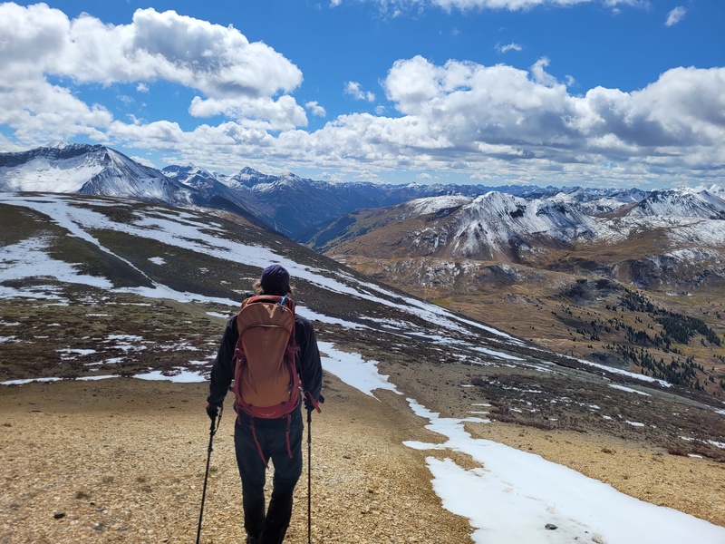
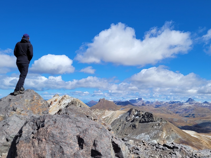
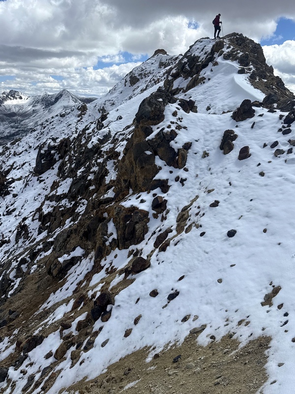
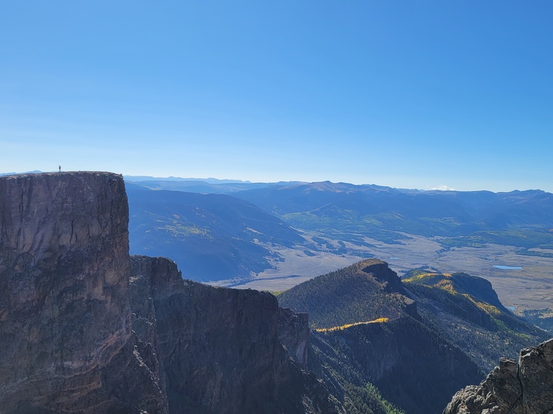
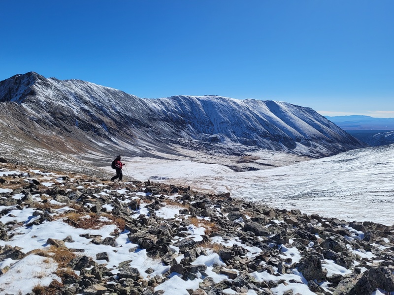
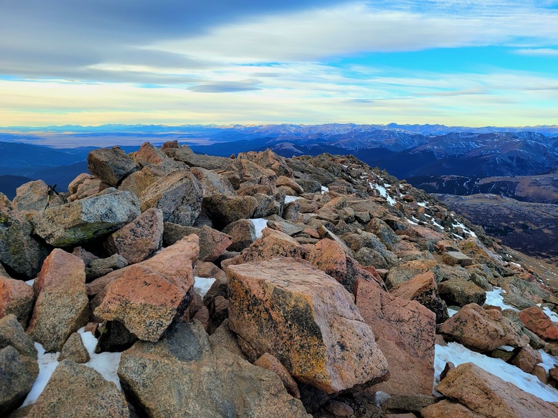
After a short and easy descent back to the road, we made our way over to Darley Mountain. We had a lot of gawkers who could not believe people would be hiking peaks in the cold, let alone be outside a vehicle. I guess that's what you get from the usual Alpine Loop crowd. Now, from what we read online from other trip reports, some people found Darley to be complicated or difficult in terms of route finding or terrain, while others found it to be fun hike. We were the latter. Darley was a wonderful hike for both of us, with unique vantage points and relatively short periods of incline. Even the final false summit did not feel strenuous or annoying to one with a double injury. With Darley, I think it's best to try and stay on ridge proper. If you go too low, you run into scree/steeper slopes at points, and would cliff out on the final summit ridge walk. By staying ridge proper, you are treated to cool outcroppings, some fun exposure, and classic expansive San Juan views. There are two notable steep pushes, one at the beginning to reach the first bump on the ridge, the second up the final false summit. At the beginning of Darley right off the pass, just push up the steep 200-300 feet incline right along the ridge proper. This will save you time and has an established goat trail that we used on our descent. The second steep push was only a 200 foot incline or so on scree to the final false summit. (Pictured below) At this point you will cross between the two multicolored tan and gray rock outcroppings pictured below. There is a path between them but be weary of really loose footing and handholds if you chose to hold on to the rocks. Beyond the last false summit, you will find a meandering ridge. This is the "scariest" part of the day, which is a mini, not so narrow skywalk between the final false summit and summit. This little ridge and the push to the summit goes class 2. If you are looking for an interesting peak with incredible views, Darley is the way to go. 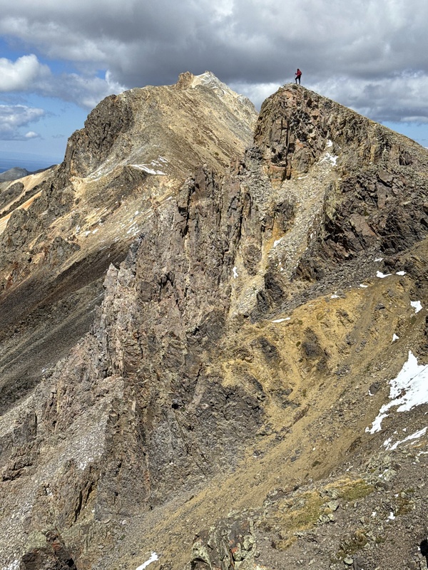

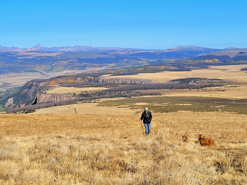
After a brief summit chow and running into a superhuman acquaintance on their 6th peak of the day, Cloudkicker and I returned to the Pass, backtracking our route. This was relatively easy, although I had to be super careful on the two steep sections for my own safety. With a quick jaunt down the false summits, we arrived at the ole wagon and had our previously cooked breakfast burritos from the night before. From there we cruised back to my place between Creede and Lake City off Spring Creek pass for some nice relaxation, chicken sausage, and gaming at 10,000 feet. Who knew my Wi-Fi at the headwaters of the Rio would be better than back home? Cloudkicker was able to work from my cabin while I went fly fishing the next day. Just another beautiful weekend in the San Juans. PEAK 3- Bristol Head- 12,706 feet -09/2025 2.75 MILES RT, 700 FT GAIN After Cloudkicker departed, I once again was left to enjoy some alone time with flyfishing, wildlife watching, and fishery restoration work. Day by day, the aspens changed colors and the mornings grew colder. There was more red his year, maybe due to the drought, but it certainly never gets old. For a few days a late monsoonal storm dumped 4 inches, knocking out the power in our valley, which forced me to stay inside for once. After a week, my mom decided to come up to the cabin with our two daschunds for a nice escape. Since I was able to get my first 2 13ers back, we both had decided to hike Bristol Head together, the guardian of the Rio Grande. We used to do it every year since I was a kid, but with us both suffering injuries, it had been 3 years since our last summit together. Bristol Head is a lesser known 12er in the hiking community, (but popular in the 4WD community.) It has a major, 2,000 foot plus cliff that drops all the way down into the valley, with stunning vistas of the San Juans. Furthermore, if you look east by North Clear Creek Falls, the cliffs of Bristol Head look like the side portrait of the famed Ute chieftain of old. Despite having a popular 4wd road to the summit, hiking it is viewed as a strange choice in Hinsdale/Mineral County. It's long, broad plateau before the summit, with a road of nothing but with sharp, knife shaped rocks for miles on end, really dampen the chances for a decent hike for most. Despite this, my family dating back to my grandparents have been hiking it for decades. This would be my tenth summit of Bristol Head to be exact. 
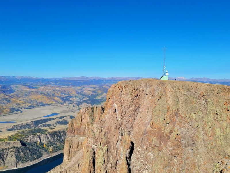
Taken from my rockslide flyfishing perch in our valley. Ater a 6am start from our valley, we crossed North Clear Creek above the falls, and then proceeded the long, hour and a half drive to our parking point (the horse stable below the summit.) Despite being so close to our valley, the drive feels like forever. The road is terrible, and every time I take my truck on it I question my sanity. There really isn't any need for high clearance, but boy make sure you have good tires that are aired low. This would be the worst possible place to get a flat. The road winds and winds up, slowly across the plateau. Eventually, we reached our usual starting point at 7:50am at 12,030 feet. From this spot the push to the summit is a steep 700-foot incline, or you can walk the road to the summit. We usually push up the 700-foot summit hill, spreading out to minimize tundra damage. After a slow and safe push up, we intersected the dirt road to the summit and took shelter from the winds behind the cellphone towers. The views from Bristol head are spectacular, with views into the heart of the La Garitas, southern peaks such as Summit and the Unicorn, and expansive views over towards the Weminuche, Handies, Redcloud, Sunshine, and Uncompahgre. 

After these quick shots, we descended as fast as we could to our car. Both of us started to feel our prior injuries on the descent, and after another white knuckle slow drive out, we spent the rest of the day meeting with our relatives in the valley and watching the Rockies get massacred yet again on T.V. PEAKS 4 AND 5 - P.T. 13,512 AND U.N. 13,549 - 09/2025 - 3.9 MILES RT, 1,210 FT GAIN Originally, I had planned for these peaks to be my first summits back with my longtime childhood friends. During the summer, I spent a lot of time pondering what would be the best peaks back that would fit my criteria: 1 - "Easy" access, 2 - Remotish solo summits, 3 - Beautiful views. I decided that P.T. 13,512 and U.N. 13,549 would be perfect after reading trip reports, scouting in 3.D google earth, and having previously hiked Cinnamon Mountain after my previous long-term injury. (Microfractured left ankle sustained on the summit Holy Cross in June of 2020; I hiked out on it. Don't ask, it's a long story!) I invited my pals to come hike these peaks with me on September 19th. These goofballs and I have hiked since we were kids in RMNP, and have done countless peaks together, including the San Juan 14ers. Now that we're older, it's hard to find time to hang out, but we were determined to go now. They were supposed to go with me to Chicago Basin the previous year. After day teaching my friend Auzzie to fly fish and leaf peeping around the valley, we awoke the following morning at 4am to drive up Cinnamon Pass. Now, I have not been up to the top of Cinnamon Pass since 2020, but I do know the trouble spots. I have unlifted 2008 Ford F150 XL and have grown up 4 wheeling in the San Juans. Four-wheel drive is also a consistent part of my restoration volunteering and fishery work. However, I knew it was going to be a challenge to get up and down the Jaws section. I will say, the road to Grizzly Gulch is now wonderful. This first section of the pass is now 2wd, with the boulders from previous avalanches and mudflows having been cleared. Beyond Grizzly Gulch was typical 4wd with a need for good clearance, even up the turnoff to the pass beyond American Basin. The only issue I had was at the forementioned Jaws. I took the wrong line up on the right and bottomed out. Thankfully, I did not puncture anything, but it was a nerve-wracking moment. After a quick break to check for damage, we drove the rest of the pass to the summit at sunrise. We had the entire pass to ourselves; a welcomed rarity as we watched the world wake up at 12,600 feet. After my friends took photos while I prepped my legs for the day, we hit the old southern mine trail up the rocky pass between P.T. 13,512 and Cinnamon Mountain. 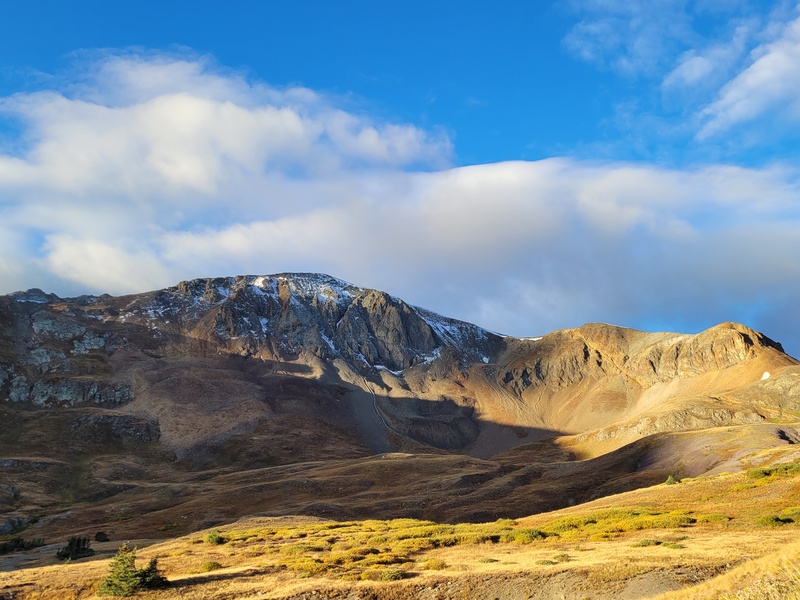

From the pass, the route to P.T. 13,512 is straight forward as well; a long, meandering hike over gentle tundra and short periods of unstable rock. Generally, the summit is in view the entire time. It was a decent push at the time for my legs, but I could tell physical therapy was paying off! I was ahead of my friends who have normal functioning legs and no asthma! Outside the occasional twinges of pain in my Achilles, I was handling this hike well. 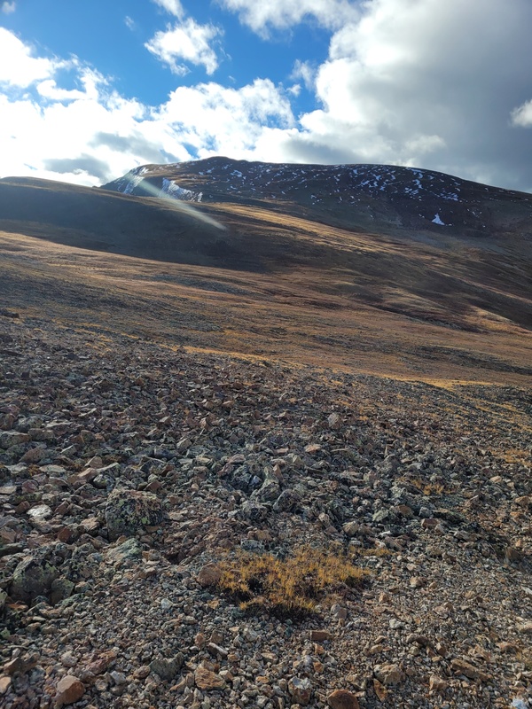

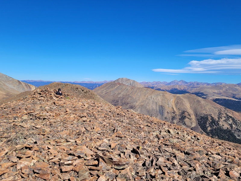
The summit of P.T. 13,512 was absolutely stunning and had some of the best views of any peak I have stood foot on. For being so close to a pass, we couldn't hear a single soul or vehicle, just the light fall breeze echoing in our ears and the passing call of a raven. The views of American Peak, Jones, and Niagara were just breathtaking. The fall colors glowed brightly against the tundra in passing vibrations of blue, green, yellow and teal. I will have to get some of these photos framed. Again, to be back on another peak just felt the world to me, especially with some of my best friends. These goofballs have always been there for me, and to have us 3 reunited on a peak was cathartic. We did get a kick out of the hoard of folks across American Basin on Handies though. We yelled and danced on our summit while they yelled and danced back :) 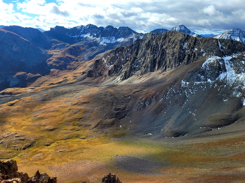
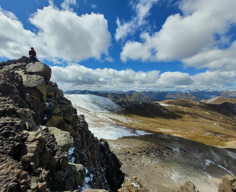
After a summit break taking in the scenery, we decided to finally trek out for U.N. 13,549. There were forecasted snow showers after noon, but it seemed to be holding back for the moment. The journey over to U.N. 13,549 is again, self-explanatory. You stick along the ridge southward, dropping a couple hundred feet or so on class 1 terrain, before you hang a left and push up class 1/class 2 tundra. Its pretty simple, with only periods of small rocks to the summit and one small bump in between. The pictures below should do the talking. 


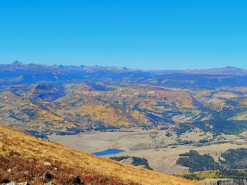
The views on the summit of UN 13,549 were likewise, stunning! We had a deeper view into the Animas Forks Valley, and the Weminuche giants of old, sentinels of rock of a geologic time far past. At this point clouds started to roll in, and we had a few brief stints of snow showers on the return journey. We returned the way we came, cracking jokes and doing brain rot dances. By the time we reached my truck at the pass, it had begun to rain. Thankfully this rain turned out to be a blessing. On the way down at the dreaded jaws, I finally hit the right line with a bit of luck. In 4wd low, I hit the far-right edge and let the rain and slick rock drift my truck over the ragged, protruding jaws without bottoming out! With that complete display of total "master skill," we made our way back through Lake City to Hermit Lakes for some flyfishing, moose watching, and steak grilling. It was another successful day in the mountains, a nostalgic filled adventure with my longtime friends. What more could you ask for? PEAK 6 - BOREAS MOUNTAIN - 10/2025 - 3 MILES RT, 1,700 FT GAIN As September rolled into October, I began to really hit the second peak of Restoration Projects. I led multiple weekends of reforestation projects in the Cameron Peak and High Park burn scars, as well as some fall seed collections. I also did some endangered species stocking (Greenback Cutthroat) with Trout Unlimited, CPW, and USFWS, which unfortunately jacked up my truck. After some quick repairs and never ending projects, I needed a summit again that would continue to test my legs. This time, Cloudkicker and I settled on Boreas Mountain. My friend Colorado Kid, who just joined me in the San Juans for P.T 13,512 and U.N. 13,549 also decided to come. Now we formally had the the 3 Musketeers together. Boreas seemed to be a nice test; an extremely steep but short tundra push with some class 2 rocks near the summit. With a warm and windy forecast, we set out from the top of Boreas Pass, heading straight up the peak. Now, the 14ers route and other trip reports of these peaks are very solid. There is a minor trail with a few cairns heading up the steep slope, aiming for a small bump along the ridge. The only minor detour I think that works best is a little deviation into the summit cauldron after heading over the first rocky bump(see below.) Walk on the moonrock trail in the cauldron, and then head up to the left onto the obvious ridge (furthest northeastern point in the basin) with a quick right turn to the summit. This not only provides some shelter from the wind, but also reduces elevation gain, provides more time on an actual trail, and less time spent on meandering loose side trails marked by cairns. Anytime theres a trail v.s. going over loose rock, I'm gonna take it. Boreas is a self-explanatory peak, and my legs held up well, a relieving feeling. I love being on the Mosquitos and Southern Front Range, it's just a unique experience to view that peak prominence over the vast grasslands of South Park. Whoever built the summit shelter, you are incredible. The shelter saved us from cold 50mph straight-line winds, and we were able to snack, talk and watch fantasy football on our phones comfortably.) 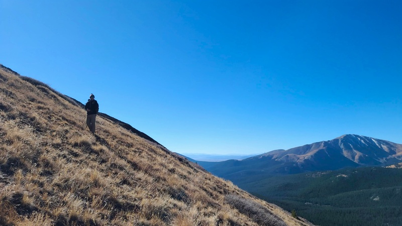

With a quick descent out of the wind, we found ourselves down at Boreas Pass, lounging out in canvas chairs and eating breakfast burritos at noon. It was a wonderful little hike, one that pushed my legs again to see if they could withhold some consistent, steep elevation gain. After stopping in Jefferson and Bailey for some flyfishing, I slogged back to Fort Collins, falling into a deep sleep before the next day's High Park Reforestation project. PEAK 7 - MT. TWETO 10/2025 - 6.5 MILES RT, 2,150 FT GAIN After another Reforestation project crew lead, I wanted to further my leg tests with my first bicentennial back. I had been looking at Mt Tweto for a while, since it is a peak I have orphaned previously in The North Mosquito Creek Basin. I gathered one solid commitment from my friend David, a longtime social media acquaintance and PT guru. We had been trading beta, success stories, and jokes for over 8 years on Facebook, although our prior attempts to hike together have fallen through. David has been a saint in teaching me new tricks to deal with my tendon flare-ups, and I was pumped to finally hike with the man. Lucky enough, David and I were both committed to getting Tweto this time around. With an iffy forecast predicting varying levels of snowfall, David went ahead and scouted our route the night before. His photos showed low levels of snowfall on the ridge between Treasurevault and Tweto, and a dusting in the basin. With this great beta report, it was 100% percent go time the following morning. After a quick drive from Fort Collins, we met in Fairplay at 5am, eager to reach the trailhead. Now, both of us have been dealing with injuries, and there was some trepidation from both of us. Yet after finding a snow free trailhead and starlit morning with a guaranteed crimson/gold sunrise, the trail beckoned us on forward. We set out up the old switch backing mining road to the base of Mt Buckskin. This road was wonderful, and easy to follow as it winds its way up. At the end of the mining road, we cut left over a long-forgotten trail next to some mining ruins in 1-3 inches of snow, avoiding the boulder field below Buckskin. As other trip reports have noted, there is an obvious saddle between Treasurevault and Tweto. There are few minor sections of 20-150 feet of steep incline, but for the most part the rise to the saddle is gentle, only with the last 60 feet being on easy rock and scree (see below.) 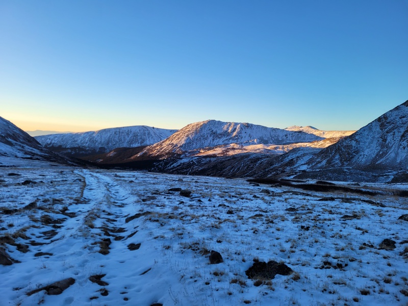
After the saddle, the route stays fairly obvious, but a little more strenuous. The rocks are larger in person than the posted 14ers.com official route photos, with some of them being quite loose. The conditions plus our injuries made it a little more difficult as well. There were high winds, a layer of ice/black ice on every rock, and trapdoors were quite common between the rocks. I was fairly intimidated at this point, but I found courage in David's drive and ability to rock hop safely along the class 2 boulders. 
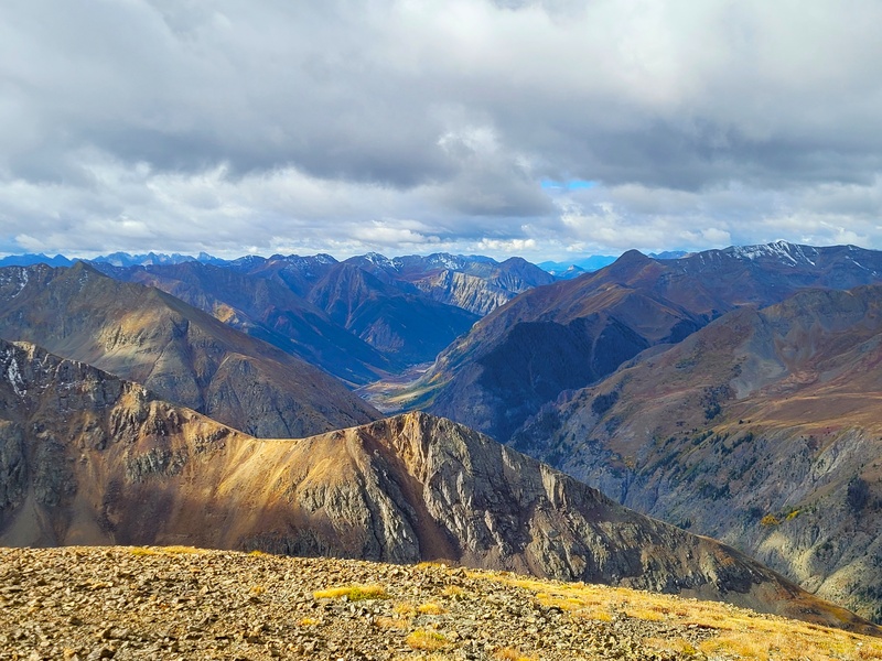
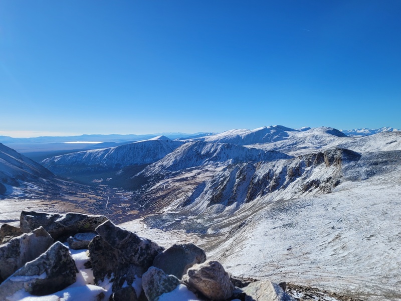
Eventually, in a zigzagging motion mostly on the right side of the ridge, we made it to the summit. My next recovery challenge had been achieved, an official Bicentennial in early winter conditions of a new 13er summit! I had done Buckskin and Arkansas in the official winter of 2020, but this one felt the most special of the 3 on this ridgeline. The exposure down into the Headwaters of the Arkansas was breathtaking, and the one I was looking forward to the most; I love me some big cliffs. The view over to Democrat, Quandary, and Grays and Torreys providing a never-ending landscape of Colorado's giants, a welcome site of old friends. Furthermore, the views Southwest towards the vast Sawatch was incredible, with the first snow on all the Leadville/Twin Lakes peaks. It just felt special to be on a cold summit with a great hiking partner in peace and quiet, accompanied by another lone raven. Odin must be watching over me. 

After some photos, snacks and water on the summit, David and I returned the way we came, picking our lines carefully and generally zigzagging just on the eastern side of the ridge. Eventually, we found ourselves jaunting out on the old mining road, sharing life stories and jokes on our way down to my truck. It was a stunning day, with the layer of snow really highlighting the dynamic layers of the surrounding peaks; not to mention the crisp baby blue sky above. Shout out to David for being a great partner on this journey. We made the peak feel like a breeze together, and we kept our legs safe despite the slick conditions on the homestretch. Let's hike again soon, I need to get you on some more peaks! PEAK 8 AND 9 - DYER MOUNTIAN AND EVANS B VIA DYER-RHEA RIDGE. 11/2025 - 8 MILES LOOP RT, 2,275 FT GAIN Feeling the summit high and wanting to continue my escalating challenges in recovery, I figured it was finally time to challenge my legs on my return to some scrambling. With the weather being unseasonably warm and dry, the extension of shoulder season provided another opportunity to meet that next challenge. I had a set parameter of factors that I was looking for: an easier Centennial with an additional summit potential, some fun scrambling, and a total distance below 10 miles. After sharing some ideas with Cloudkicker, our discussion of Dyer's class 4 ridge broadened my mind to explore the nearby ridge from Dyer to Evans B. On 14ers.com there is very limited beta on this ridge, with only 2 trip reports discussing this route. From these reports, it looked like a great welcome back to scrambling, a nice sturdy class 2+ / class 3 with some potential for extra spice on a few towers and an easy descent either way. I will make a more detailed report specifically on this ridge to provide some decent beta on a fun way to tag a Centennial and Bicentennial. If we could lineup a carpool scenario where we could start and finish without having to loop back, then this route would be prime. After finessing out the details, Cloudkicker and I were set to go. Eventually, Cloudkicker and I found a decent date and forecast to hit this route, with the finishing car parked at the bottom of the western side of Mosquito Pass and the starting car up at the top of Iowa Gulch. I invited my friend Bennett, a man of many abilities including sport climbing, with a burning desire for mountain summits. He was a part of my crew at Summit Lake this fall for alpine wildflower seed collections, and we had done a few wildfire reforestation projects together as well. While he had done a few 14ers already, this would be his first exposure to the world of 13ers. After a 5am pickup, Bennett and I cruised to Leadville, meeting up with Cloudkicker at 7:40am. We then quickly hopped in my truck and headed off to Iowa Gulch, parking at the top below the cliffs of Sherman. The forecast was beautiful, sunny with warm temps, with the classic shoulder season high winds up top. 
After cruising up the steep rocky scree slopes of Dyers Southeastern slopes in quick succession, we found ourselves on the homestretch of Dyer's southern ridge. We quickly dawned extra layers after the classic fall winds said hello, and pushed to the summit on some stable class 2 rock. 
After taking in the summit views of the vast Sawatch, along with the backside of Sherman, and the Mosquitos, we pushed off towards Dyer-rhea ridge to Evans B (not pictured is me doing some brain rot summit dances along with terrible, out of tune flute music.) Most trip reports descended along the ridge proper to the west off Dyer, but we descended east off the summit to drop down to 13,200. Cloudkicker had spotted an easy descent gully about 100 feet off the summit to the right towards Gemini. This would save my Achilles from steep, boulder hopping along the western edge of the ridge. The descent gully then curves back onto flat terrain, cutting across Dyer's lower slopes over some minor rock hopping to the ridge proper. 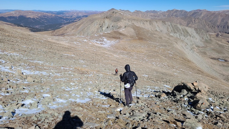
Now based on the previous two trip reports on this ridge, this ridge was supposed to go class 2+, with only one or two class 3 moves. What we found the ridge to be was a relatively decent length, fun ridge scramble with multiple options for class 3/4/5 moves. It mostly can be done just as a class 2+ class 3, but where is the fun in that? By sticking ridge proper, or just on either side of the ridgeline, one can find some really fun scrambling. For example, Cloudkicker performed a class 5 downclimb off the pillar pictured below to stay along the ridgeline However, there is a class 3 gully and crossover off the left side of this pillar to get back onto the ridge proper. It's a make it your own adventure and was an incredible welcome back to scrambling. Plus, there was some descent exposure on both sides of the ridge, providing that much missed "Spicy" factor that we all love. In fact, I was able to perform my first class 4 move back, a little gully section with an overhang move up the final headwall towards Evans B. This ridge is spectacular, and I am surprised there are not more reports on it. I highly recommend it for those looking for a little extra spice that is rare to find in the Mosquitos. 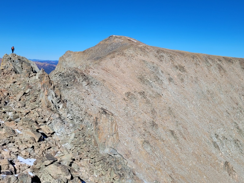


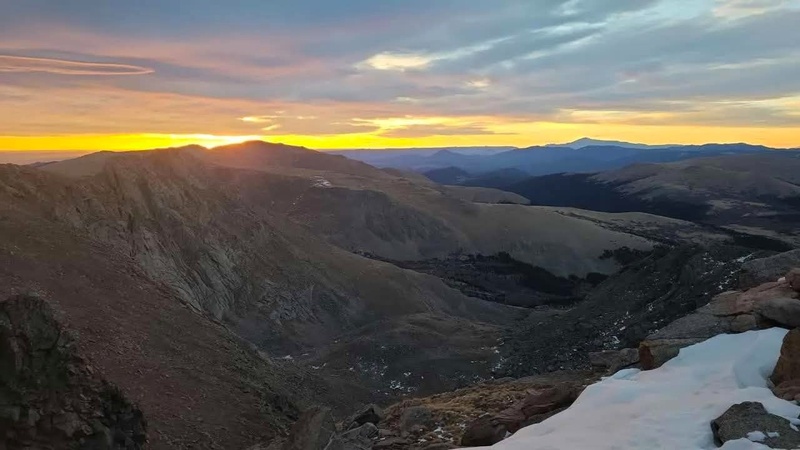
After all the excitement was over, we pushed up the last 300 feet of incline tundra walking to the summit of Evans B, my second Bicentennial back from injury. After a quick rest stop for food/water, along with being blessed with the presence of a fuzzy Mountain goat, we descended off Evans B and down Mosquito Pass. It was a windy day, but we made short work of the pass, soon finding ourselves right back at Cloudkicker's car. All in all, we made it around a 6-6 1/2-hour day via the loop between cars, a pretty good time for us and my nagging legs. This trio was a ton of fun to hike with, keeping it lighthearted along the way and giving good call outs for me to keep my Achilles and right ankle safe from injury. I only had one little minor ankle roll the whole day, that was solved with just some rest and Advil. The worst part of the day was the drive home for Bennett and I, as my back right window got stuck all the way rolled down from Iowa Gulch to Fort Collins. It made for a chilly and wind tunnelesque drive home to say the least. 137th and 138th 13ers in the bag! PEAK 10- BIERSTADT 11/2025 - 7.25 MILES RT, 2,800 FT GAIN After resting up a bit to allow time for both of my tendons to recover, I decided it was finally time to make my return to 14,000 feet. With the weather remaining terrifyingly dry and a clear forecast, I decided to push for a solo sunrise summit of Bierstadt. Bierstadt is always a great peak, despite the cattle trail to the summit and the crowds. To avoid this mess, I decided to start at my favorite time of day for hikes, pre dawn of course. With a 4:30am start time, I pushed my way through the willows and up onto the ridge to 13,000; taking a 15 minute break to stretch my protesting legs. Both of them were not enjoying the day so far, with some tightening and cold shocks in both of my Achilles. However, after this quick rest, some massaging, and Advil, I headed back up. At this point I had the entire mountain to myself and could only see one headlamp beginning to stir at the trailhead. Yet, I was determined to make it in time for sunrise. At 13,300 I put on my micro spikes as ice and snow appeared on the trail, as this made the ascent easier. For as easy as Bierstadt is for some of us, it reminded me that it was still a 14er. I began to feel the elevation and my asthma kick up. However, using my breath training and positive affirmation training, I made it to the summit just in time to watch the sun peak over Rosalie. 
To be back above 14,000 feet, at sunrise with a solo summit is an all-time favorite hiking experience; but this time it was special. After my year from hell, to just take in the sites of familiar peaks from the Sangres to the Sawatch, across to the Mosquitos and Front Range was very emotional. I just sat there, letting the waves of feelings wash over me as I absorbed the gorgeous colors painting the landscape. I spent an hour on the summit alone, a rarity for Bierstadt nowadays but one I always strive to achieve. Bierstadt is a funny peak. Usually, it's a lot of folks first 14er, other times it is a lap peak for those training for big mountains. But for others such as myself, its redemption and achievement. Surprisingly, out of my 5 summits of Bierstadt, I actually made it in good time in comparison to a few pushes, (1:58) despite my Achilles and right ankle acting up along the way. Physical therapy and hiking are really starting to pay off in terms of leg strength. After the second hiker ascended the summit, I headed off on my descent. Along the way down I passed out advice and timing to summit guesses to the first timers. I had to stop and give Advil, electrolyte chews, and some first aid to a gentleman that had slipped on some rock. I hope you are doing well sir if you are reading this report, and you made it to the summit! After a breakfast burrito in the parking lot, I fly fished my way home. I landed a nice 22-inch rainbow along the North Platte, but I am not telling you where! A good angler never reveals his honey hole! PEAK 11- GOLDEN BEAR- GOLDEN BARE CHEEKS- 11/2025 - 6 MILES RT, 1,900 FT GAIN After a few more weeks of various Restoration projects along with my first time back on my local training foothill, Horsetooth, I was once again feeling the hiking bug gnawing away at my brain. With a few small passing clipper systems in late November, I was eager to get back into the alpine snow and throw on the microspikes. I have had Golden Bear circled out for a while, but every time I have thought of it as a potential option for a hike, it just did not seem that interesting. However, given my legs, it was time to finally reach its "golden bare cheeks" summit. On this hike I once again invited my friend Bennett, his BAMF wildland firefighter friend Jon, and my WRV friend Danny. Danny and I have been on several WRV projects together, and he is an incredible human being. Funny enough, we ended up being Crew Leader of the Year and Volunteer of the Year for WRV respectively. It was a fun full circle moment as he was my trainee back in June for a Cal Wood Scar BDA project, and where he received his crew leader knighting! This would be his first peak above 13,000 feet, and I was anxious to make it a good one for him. Anyhow, enough humble bragging, and back to the trip report. With a stellar forecast of no wind, and great temps, we set out to the I70 tunnel for a 6:30am start. The trailhead is a little strange, but not difficult to find. Just take the semi exit immediately on the right through on the western side of the Eisenhower tunnel and its along the far concrete barrier in the back, to the left of a maintenance road. Please make sure to park head in and not horizontally; that way you save a lot more space for others at the trailhead. To reach the actual trail, you head right up this paved side road for about 150 yards, and then turn left up the valley at well distinguished mark. The summit should be in view at this point already in the back right. After starting at the bone dry I-70 parking slot, we followed the easily noticeable trail through the willows, eventually meeting a T split. The southern direction leads up the old natural gas line road to the saddle above the tunnel; the other is a loop trail that heads north up to the saddle between Golden Bear and Coon Hill; a shortcut for those heading to Hagar. We may have made the wrong choice and decided to stick with the standard road route south to the saddle above I70. Almost immediately we were met with knee to waist deep snow, which was unexpected. 
The drifting up here did wonders, and this may have been the only place in North Central Colorado where this snow depth could be found. Bennett and I became Boromir and Aragorn, plowing a trail up the pass of Caradhras for the others. Eventually, we saw that there was going to be no end to this snow depth, and the mountainside had only a thin layer of snow. About 2/3rds along the road, we cut up straight up the mountain, taking a left northward once on the ridge towards the summit. The ridge was a mellow and casual stroll, bumping over occasional false summits on class 1 terrain. There was absolutely no wind up top, a beautiful day for a hike. We pushed up the last 20 feet to the summit and immediately chowed down on Bennett's homemade cookies as a summit reward. Golden Bear's summit surprised me with its vistas, and I am happy I had saved it to hike with such wonderful company. 
From the summit we pushed north, heading along the small class 2+ downclimbs along Golden Bears north ridge to reach the saddle with Coon Hill. We were thinking about heading to Hagar but decided against it. There were a few trapdoors on these various 50 foot class 2+ downclimbs in the snow, but we made it down safely. At the ridge intersection with Coon Hill, we pushed west down to the low saddle point, having spontaneous snowball fights along the way. Eventually we intersected the quick but steep saddle trail that leads down to the T split and the trailhead. Thankfully there was less snow here, and a few folks heading for Hagar had put in a boot pack. We made short work of the descent and were back at the I70 trailhead by 11:30 am. What a textbook, fun day in the snow. I am so happy we kept the spirits light hearted the whole time and made sure it was a great intro 13er for all involved. Golden Bear was a nice and easy day, and one my Achilles greatly appreciated! 
PEAK 12- QUANDARY- 12/15/2025 - 6.75 MILES RT, 3,450 FT GAIN Finally, my last peak of my recovery so far was an old friend, Quandary. I have done most routes up this mountain, with North Quandary Couloir and Cristo Couloir being some of my favorite memories in Colorado. The time had come to push my legs above 3k gain in a single hike. After doing a few 2k gain hikes up the Poudre that week (Greyrock, Young Gulch) and a Wildlife Fencing Project the day before, My friend Bennett wanted to go at another 14er. The weather forecast looked perfect, with 5mph winds on the summit and sun all day. Just when I thought I was out, he pulled me back in. I was concerned over my calfs being pretty tight following the project out in the Pawnee Grasslands, but the green goblin inside me wouldn't let the thought of another milestone summit go. The last time I had done an ascent of the standard East Ridge was in February of 2016, which turned out to be a spectacular day. This infectious thought of repeating another picturesque winter summit 9 years later spread like a wildfire in my brain. It was go time once again. After only getting an hour of sleep, I spent the entire morning foam rolling, stretching, and massage gunning my legs, before meeting Bennett at the Mammoth Lot at 5:30am. With a 6:40am start time at the trailhead, Bennett and I cruised up (as fast as my calfs allowed) the east ridge trail. There was a well-defined, packed down trail the entire way to tree line, making it easy to slog along with just spikes. At tree line, due to our dreadful snowpack status, we followed the bone-dry winter route up the first false summit, intersecting the ridge proper. From there it was a well-defined boot path along the rock and ice to the summit. At this point a well-trained, beautiful Huskie had followed us up and decided to hike with us. As I took it slow to keep myself from injury due to the tightness of my calfs and the lack of sleep, this goodest boy stayed by me. It felt as if he was watching over me, making sure I stayed safe as I slowly made my way to the summit. 
Eventually I crested onto the summit ridge, with Bennett having summited before me. As usual, Quandary's summit was stunning. The prominence of the mountain, along with the views out to the Elks, Sawatch, Sangres and the Front Range is one you don't forget so easily. Again, I was overcome by emotions, as this was the next step up in my recovery. I tend to be very hard on myself, and Bennett really brought it home for me in a lot of aspects of how far I've come during this past year despite the setbacks; both as a natural resource steward and physically after two tendon tears in a year. Out of the 6 summits I've had on Quandary, this one meant the most. As I took photos of Bennett on my favorite summit pose spot, I heard a familiar voice call out my name behind me. Sometimes, the mountains bring people together in strange ways, and you remember how small of a world it is. Turns out this was my ski and couloir climbing friend Lee! Since I have been off social media and tend to be a ghost with texts, running into him was special. We hugged on the summit for a long time, catching up on life and smiling profusely. He was hiking with another acquaintance, Kat, who I have been social media friends with for a long time. They are all great friends and hiking partners of Cloudkicker as well. Furthermore, turns out my guardian doggo was Kat's huskie named Briscoe! He is without a doubt the best doggo in all the land. This was the best reunion I could have imagined, and it was unplanned! We all bothered Cloudkicker at work via facetime and texts, just for the heck of it. You just never know in the mountains who you will run into! 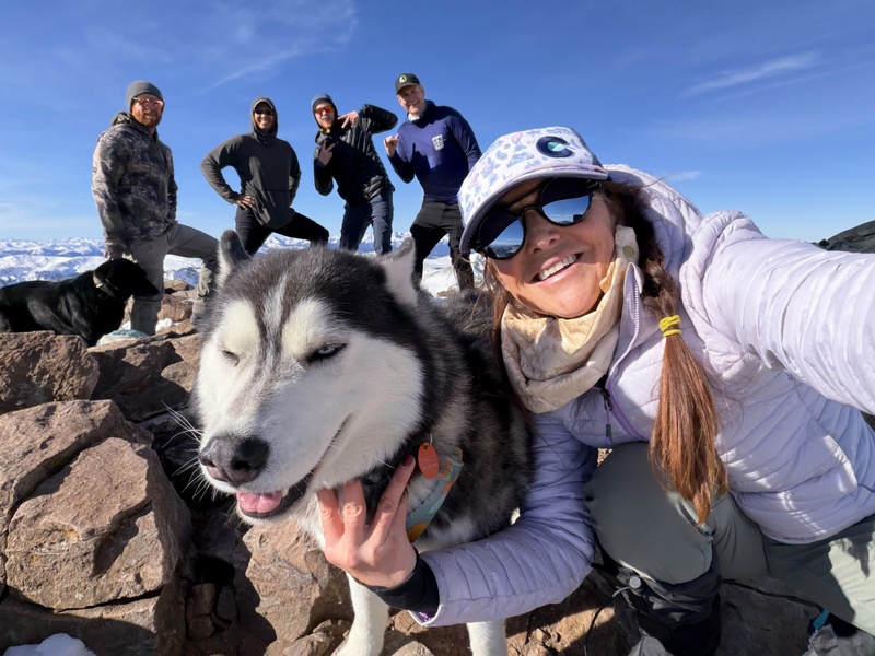
After spending more time on the summit with them, drinking non alcoholic seltzers, and taking in the views, we all headed down. The journey down was slow going for me, as I took a careful approach to prevent injury. The sun was shining, and we had to mountain descent to ourselves. The evening glow lit up the surrounding peaks, casting vast shadows and golden hues across the valley. After identifying various pines and pinyons within the tree line for fun, Bennett and I headed home after a wonderful day. I am happy for him to have experienced a perfect Quandary summit. 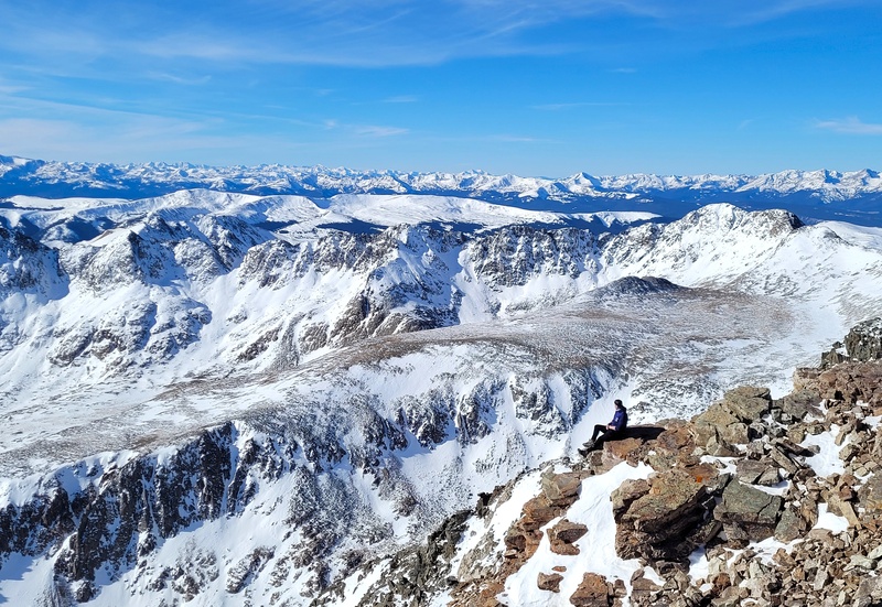
If you are still here or even bothered to read half of this trip report, thank you. I should have posted more on the page or have been more active in the community prior. My season is not over, and I am hoping to get a couple more 13ers before the New Years. I want to end with 1 repeat 12er, 11 new 13er summits and 2 repeat 14er summits since mid-September. Right now, I sit at a 1/10/2 split. All of them were low stat days, but thats all I can handle for the moment. It's not much, its honest work. After a year of pain, setbacks and kicks in the gut, to finally be able to move again is a blessing. It really drove home how privileged we are as a community to be able to take in the wonders of our state and have that ability to do so. I learned a lot of valuable life lessons this year, including not taking one's mobility for granted. You never know when it can be taken away from you in an instant. Thirty was beyond dirty, but I am hoping to go from my lowest dungeon to the highest peak as I progress through 31. To my sisters, my parents, my friends, and to all of those who have helped me through this year, I cannot thank you enough. You kept me sane and inspired me to get back out there. When I was hopeless, you gave me hope. When I was down, you picked me back up. When I was quiet, you reached out to me to see if I was okay. I cannot ask more from you all, and I hope I could do the same for you all if the tables turned. Little things like singing happy birthday to me from a summit while I recovered from my achilles surgery that very day, sending me songs you produced, updates on your life, and sending photos of your hikes meant the world to me. Furthermore, thank you to the new friends I have met this past year. You opened my eyes to new perspectives while raising my self-esteem. I found strength in our mutual determination to restore this land and not just take from it. I won't lie either, it is a lot of fun to have your trust to lead you through the vast array of Colorado peaks, and to see that glint in your eye as the hiking bug takes ahold of your souls. Next, I would like to thank Wildlands Restoration Volunteers. This is bar-none the best organization I have ever been apart of. I never thought I would find my tribe, but the friendships and connections WRV has provided truly made my year. WRV has allowed me to not only work through my injuries safely, but grow as an environmental steward by expanding my skillset and confidence. This group is one of a kind, filled with passionate outdoors folk who do the nitty gritty hard work that Colorado's natural resources desperately need, while also providing a welcoming community to all. Finally, thank you to my physical therapists at OCR. You have not only provided me guidance in my recovery along with confidence in my legs, but also provided friendship in times when I was at my lowest. I am expecting another year of recovery and physical therapy to return to my old self, but I will get there in due time. Thank you to all of you for being there every step of the way, you really do not know how it much it means to me. Happy Holidays everyone and see you on the trail! Marmatt Thumbnails for uploaded photos (click to open slideshow):  Sunset on Grey Wolf, my last hike for over a year.")
")
")
")
")
")
")
")
")
")
")
")
")
")
")
")
")
")
")
")
")
")
")
")
")
")
")
")
")
")
")
")
")
")
")
")
")
")
")
")
")
")
")
")
")
")
")
")
")
")
|
| Comments or Questions | ||||||
|---|---|---|---|---|---|---|
|
Caution: The information contained in this report may not be accurate and should not be the only resource used in preparation for your climb. Failure to have the necessary experience, physical conditioning, supplies or equipment can result in injury or death. 14ers.com and the author(s) of this report provide no warranties, either express or implied, that the information provided is accurate or reliable. By using the information provided, you agree to indemnify and hold harmless 14ers.com and the report author(s) with respect to any claims and demands against them, including any attorney fees and expenses. Please read the 14ers.com Safety and Disclaimer pages for more information.
Please respect private property: 14ers.com supports the rights of private landowners to determine how and by whom their land will be used. In Colorado, it is your responsibility to determine if land is private and to obtain the appropriate permission before entering the property.


