| Report Type | Full |
| Peak(s) |
McNamee Peak - 13,784 feet Traver Peak - 13,856 feet Clinton Peak - 13,866 feet |
| Date Posted | 12/26/2025 |
| Date Climbed | 11/22/2025 |
| Author | CaptainSuburbia |
| The McNamee Three - Clockwise |
|---|
|
The McNamee Three - Clockwise 
I've had these peaks on my radar for a few years now as a fall climb. I knew they were still very manageable with some snow and there wouldn't be much additional difficulty. I decided to tackle these going clockwise hitting Traver first and then to McNamee and finally Clinton. This way I could have Wheeler Mountain in my back pocket in case I wanted to add it at the end of the day. Wheeler was a long shot though with time and conditions being the ultimate factors. I arrived at the Montgomery Reservoir trailhead around 6:30 in the morning after the long drive from Fort Collins. The road was gated at the north corner of the reservoir with plenty of parking available. I was the only car there thus far. I later found out that this is a very popular trailhead for ice climbing and fishing as well. There were probably 10 to 15 cars there on my return at the end of the day. I even bumped into a climbing buddy who showed up to ice climb just as I was leaving. It was about 7 when I finally started hiking up the road. Day of Climb: Saturday November 22nd, 2025. Peaks Climbed: Traver Peak, McNamee Peak and Clinton Peak. Trailhead: Montgomery Reservoir Mileage and Elevation Gain: Approximately 11 miles and 3,000 feet of gain. 
I set a good pace up the old mining road to make up for my late start. After a few minutes the road turned northwest and then passed by the decaying Magnolia Mill. This structure was originally built in the 1860's and later rebuilt in 1930 after a fire burned it down. There was once even a bustling town here, as well, which was swallowed up by the creation of the reservoir. I continued up the road towards Wheeler lake. I had read many condition reports describing the road as more of a river, but all water on the road was easily avoidable or covered in ice and snow. It was mostly an enjoyable walk with great views. North Star Mountain towered above to the right and Lincoln on the left with Democrat also seen further up. The last few miles to the lake were totally snow covered but never more than ankle deep. 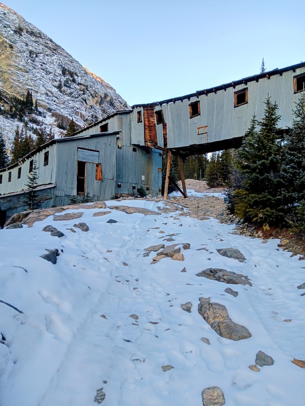


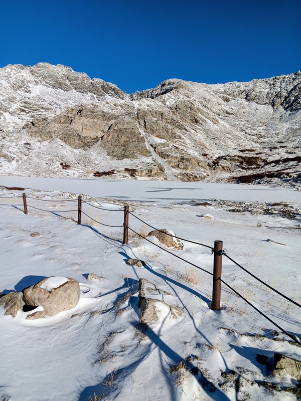
It was 3.5 miles and 1,265 feet of gain to the lake. I had been following tracks to the lake and those ended here. I circled around to the west side of the lake and then started up a steep gully towards the upper basin. I followed the buried trail as best I could and eventually lost it altogether. It didn't matter though, the terrain was not difficult and the trail breaking up the gully into the basin was minimal. 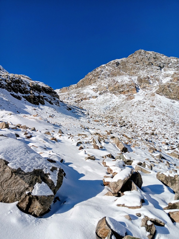
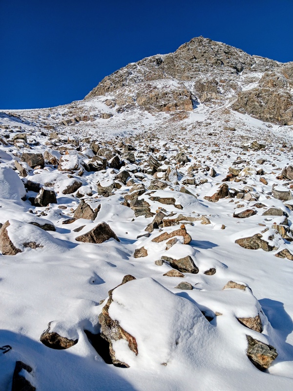

The terrain mellowed once I reached the basin and this is where I split from the standard route to Clinton. I veered more sharply southwest and headed towards the northeast ridge of Traver Peak. Then it was a talus climb up a moderate slope to gain the ridge. I didn’t need or use spikes but the snow did slow me down some and was annoying as there was some deep pockets I would occasionally step into. 


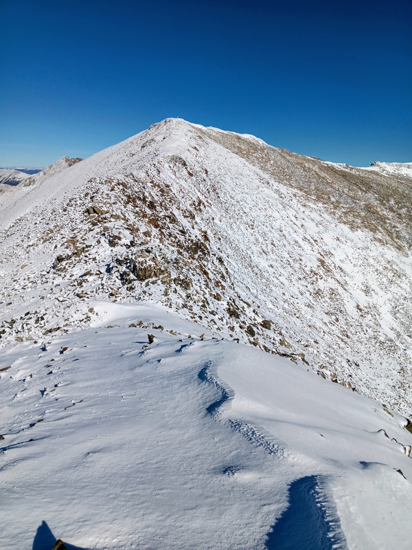
The ridge was a welcome relief and was a cruiser to start. I couldn't believe the weather I was getting. I had been expecting some wind at some point, but still nothing and the blue sky was beautiful. I kept moving at a quick pace. I was still hoping to add Wheeler, although this was in doubt. There was more snow than I had expected which was slowing me down considerably. Also, I was thinking this added snow would complicate the class 3 finish on Wheeler. The rest of Traver was pretty routine. The nice mellow ridge did eventually steepen though and the talus returned for the final slope to Travers summit. 


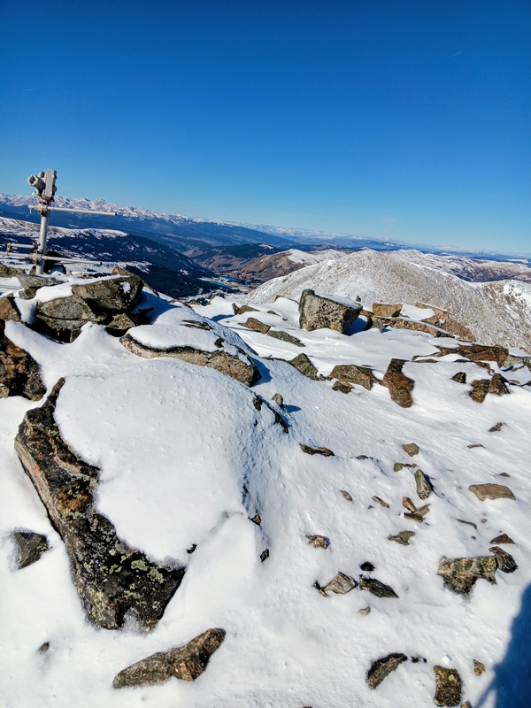

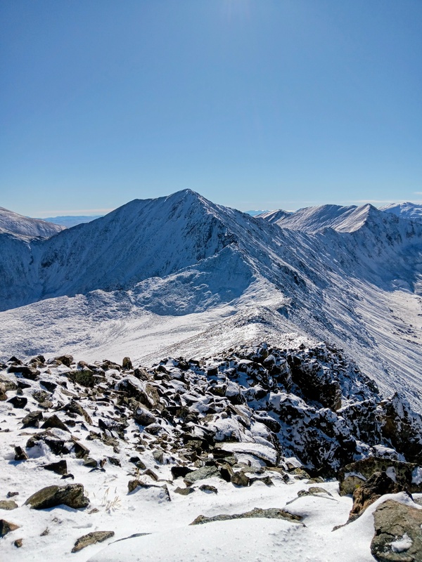
I hit the summit at last and really enjoyed the views the bluebird day was providing. I could see snow covered summits for miles in all directions. I had more peaks to go though, so I took a few quick pictures and started my climb over to McNamee. The snow completely buried any hint of a trail off Traver as I dropped off the summit to a slightly lower summit. The ridge proper from here looked like a jumbled mess of big boulders and talus covered in snow. So, rather then trying to figure that out I went a little low to the right here and found it easier going. I then slowly worked my way back to the ridge proper and quickly found myself at the large saddle with McNamee. The descent was only about 255 vertical feet. I quickly crossed the saddle and scampered the 170 vert feet to McNamees towering summit. It was nice to reach my second summit of the day so quick and with minimal effort. There were more great views from McNamee plus an interesting look at Bartlett Mountain and The attached Climax Mine. I had driven by the mine so many times going over Fremont Pass, so it was cool to look down into it's belly. It's kind of an ugly scar, but it's production of molybdenum is vital to our economy. During World War II the Climax Mine was even desginated a top priority for the war effort. Bartlett Mountain though, looks like it's days are numbered as a 13er as they are slowly chipping away at it's summit. 


I had a short stay on McNamee and then started towards Clinton Peak. The descent to the saddle was brief and I crossed it quickly. The ascent up Clinton wasn't much longer at probably less than 200 feet of gain. There was one rock out-cropping to work through and the rest was an easy mixed talus-tundra slope. Clinton was the highest summit of the 3 on the loop and the good views all around continued. This would be my last peak of the day as I decided not to go for Wheeler. The day was getting long and the conditions were not prime for a late day snow scramble on tired legs. 


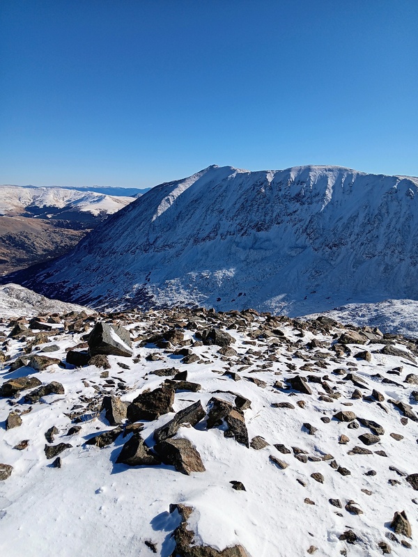
With another summit in the books I was ready to end this long ridge run and head down. I departed down Clinton's East Ridge and then dropped down it's steep South Slope. It was pretty wind scoured but there were occasional pockets of snow. The steepness made for a quick descent and I was back in the upper basin in record time. I was happy I went down that slope rather then up if I had gone counterclockwise. From here, I retraced my steps back to Wheeler Lake and then did the long road-walk back to my truck at the Montgomery Reservoir. That wraps another great day in the mountains. Thanks for reading! 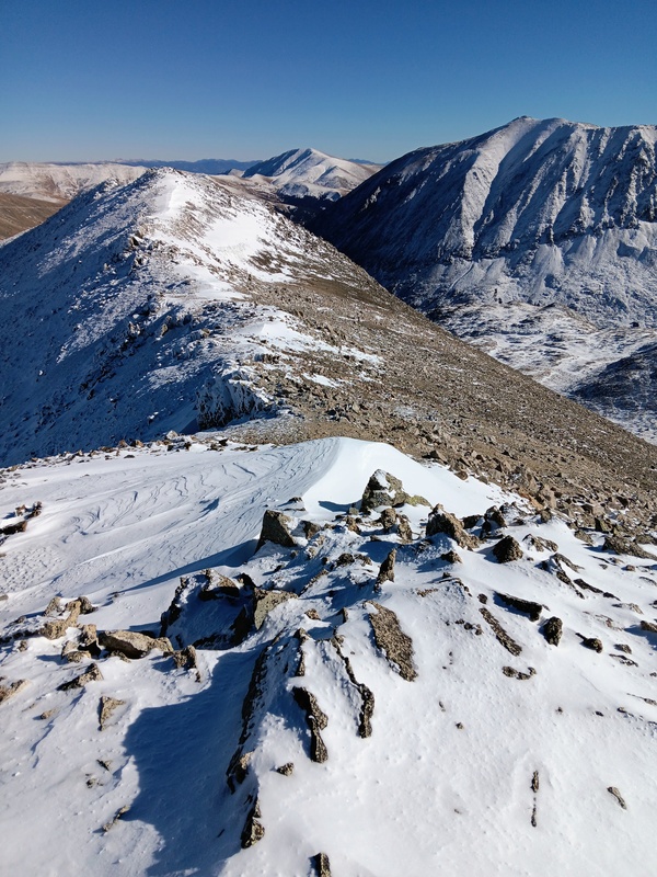


Thumbnails for uploaded photos (click to open slideshow): ")
")
")
")
")
")
")
")
")
")
")
")
")
")
")
")
")
")
")
")
")
")
")
")
")
")
")
")
")
")
")
")
")
")
")
")
")
")
")
")
")
|
| Comments or Questions | ||||||
|---|---|---|---|---|---|---|
|
Caution: The information contained in this report may not be accurate and should not be the only resource used in preparation for your climb. Failure to have the necessary experience, physical conditioning, supplies or equipment can result in injury or death. 14ers.com and the author(s) of this report provide no warranties, either express or implied, that the information provided is accurate or reliable. By using the information provided, you agree to indemnify and hold harmless 14ers.com and the report author(s) with respect to any claims and demands against them, including any attorney fees and expenses. Please read the 14ers.com Safety and Disclaimer pages for more information.
Please respect private property: 14ers.com supports the rights of private landowners to determine how and by whom their land will be used. In Colorado, it is your responsibility to determine if land is private and to obtain the appropriate permission before entering the property.