| Report Type | Full |
| Peak(s) |
Mt. Kazbek - 16,581 |
| Date Posted | 01/02/2026 |
| Date Climbed | 09/15/2025 |
| Author | katielyons |
| Additional Members | gunnison_garrett14 |
| Mt. Kazbek - 16,581 |
|---|
|
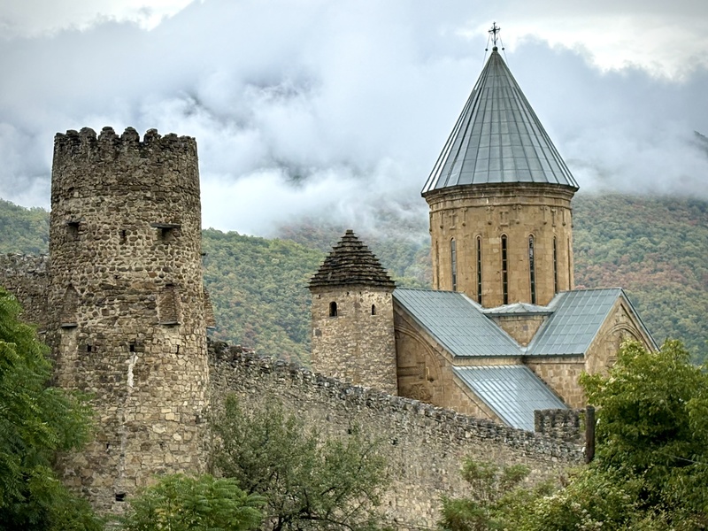
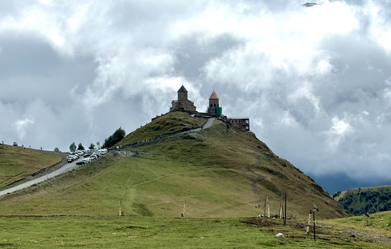
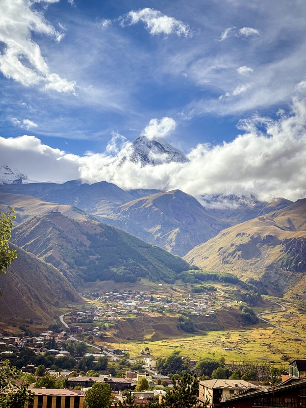
Mt. Kazbek is a 16,581’ (5043m) dormant stratovolcano in the Caucasus Mountains that straddles the Georgia/Russia border. My mountain partner/husband, Garrett (gunnison_garrett14), and I did a guided expedition on this peak from Sept. 13-15, 2025, though a speedier, unguided ascent would be totally possible for those with sufficient skills and fitness. As someone who has done a good handful of 13ers and 14ers, this was the perfect peak to both tune and expand my skillset while setting a new altitude PR in one of the most beautiful places I’ve ever visited. Getting to the Trailhead We began our hike from the traditional starting point at the Gergeti Trinity Church, just a few miles outside of the small town of Stepantsminda, approximately three hours from Georgia’s capital city, Tbilisi, and less than 10 miles from the southern Russian border. The drive* to Stepantsminda** from Tbilisi was scenic, with many interesting stops along the way including the Jvari Monastery (a UNESCO world heritage site), the Ananuri Fortress, Gudauri Ski Area, and the Russia-Georgia Friendship Monument. 
Once in Stepantsminda (elevation: 5709’) the remaining miles to the trailhead were paved, 2WD, and easy to navigate. *As a side note, while the road from Tbilisi to Stepantsminda is paved the entire way, it’s not uncommon to see sections of road washed away from landslides, even on the primary highway. Our rental Subaru Forester handled the drive perfectly, though it might be a little bumpy for a lower-clearance car. **As a second side note, the drive from Tbilisi to Stepantsminda was honestly a bit nerve-wracking. This route travels the Georgian Military Highway, which is one of the main commerce routes between Georgia and Russia. As such, there are many commercial vehicles on the road, and very, very few passing lanes, particularly once you head north past the town of Ananuri. It’s not uncommon to see drivers attempting dangerous passing maneuvers to get around long lines of vehicles, and you may need to do some stressful passing as well to keep the flow of traffic moving. Garrett is an excellent, defensive driver, whereas I am more timid. He handled the entire drive very well, but I would’ve opted to hire a driver if I were solo. Trip Report Day 1: Approach (Sept. 13) We met with our guide, Misho, at our AirBnb in Stepantsminda on the morning of Saturday, September 13. After he inspected our gear and let us borrow some pieces we were missing (harnesses and carabiners), we grabbed some snacks at the Spar supermarket in town and drove from Stepantsminda to the trailhead at the Gergeti Trinity Church. We parked a few hundred meters away from the church at a grassy pull-off, and we were able to leave our car here for the duration of our climb without issue (though we were warned that the free-roaming horses that frequent the area might use the sides of our car to itch themselves). From here, we were off on our climb. 
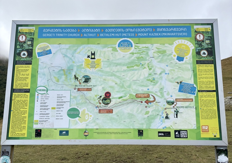
Our starting elevation was right around 7100’, but coming from Crested Butte, we felt right at home at this altitude. It was easy to find the start of the trail (this is a popular day hiking location for those hoping to ascend to the foot of the Gergeti glacier), and we were soon on our way to the first stop of our journey, the Bethlemi Hut. 
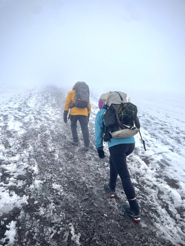
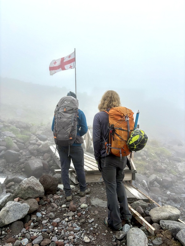
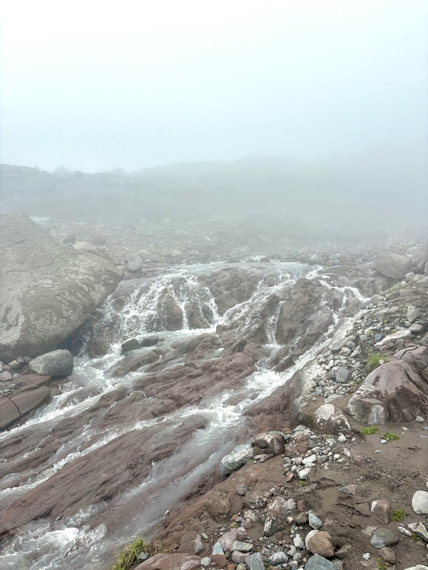
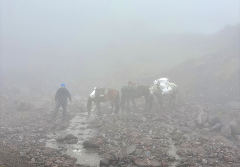
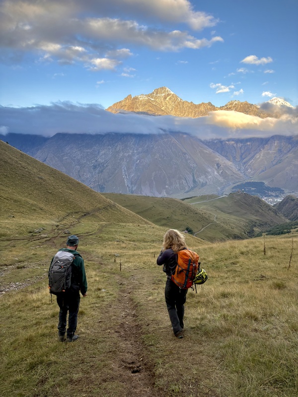
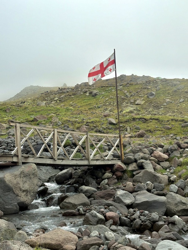
The braided trail was steep but easy to follow, though it was full of sticky mud from the preceding days of precipitation. We enjoyed making our way uphill through grassy hillsides where we made friends with a trail dog who was happy to enjoy lunch with us while watching shepherds tend to their flocks of sheep. Weather was unsettled on day one of our ascent, and we spent much of the day hiking through a thick sea of fog that engulfed us on all sides. We passed by trail landmarks like Cafe 360, a small restaurant, and the Altihut, a restaurant/hotel, both located at just under 10,000’ elevation. From here, the terrain transitioned from rolling, grassy hills, to rockier terrain that followed a lively glacial stream. 

Occasionally, trains of horses would emerge from the mist, guided by the yips of their wrangler. It came as a surprise every time since the fog was so thick we usually couldn’t see them until they were only a few dozen feet away. 
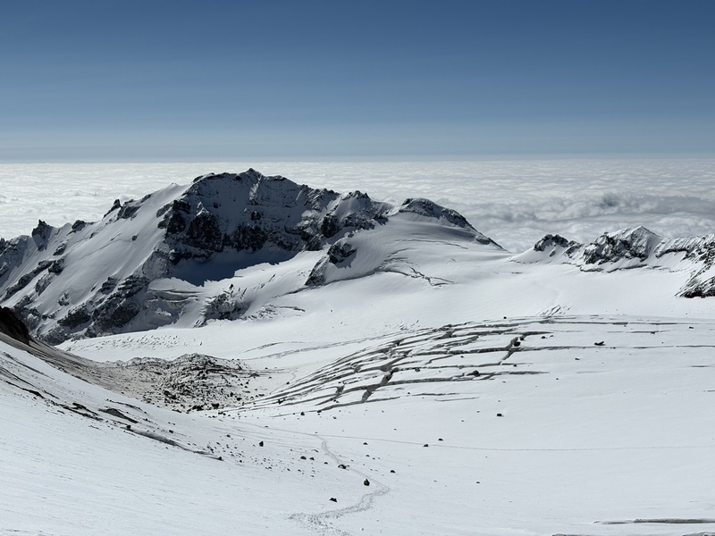
We arrived at the Gergeti glacier after about four hours of hiking, and found it covered in a thin layer of fresh snow. I had worn my mountaineering boots since the start of our climb, and Garrett decided here that it was a good time to change into boots instead of using his trail running shoes. While he did so, I got to spend some time rockhounding for lovely cubes of pyrite that were sprinkled all over the ground. We opted not to put crampons on for this section of glacier travel since the ground since the fresh snow offered sufficient traction, and we also opted not to rope up here, which is standard for this part of the route. 
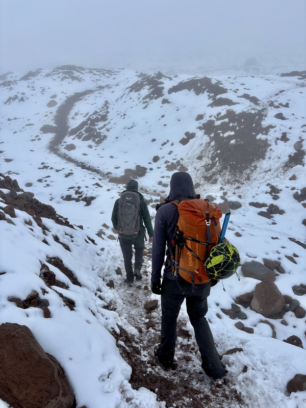
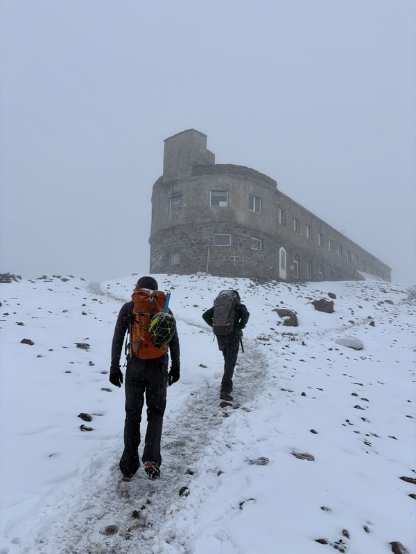
After a short while on the glacier, we transitioned back onto an easy-to-follow, snow-covered trail. It was actively snowing at this point and the temps were dropping as we made our way higher onto the mountain’s lower flanks. 
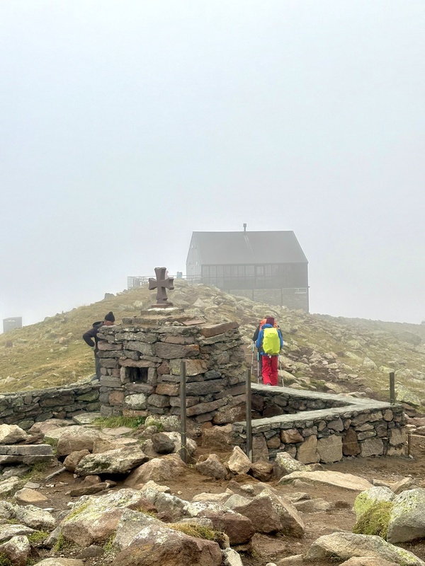
Finally, in the distance, the Bethlemi Hut revealed itself amidst the thick clouds, and we arrived at its doorstep just a few paces later. 
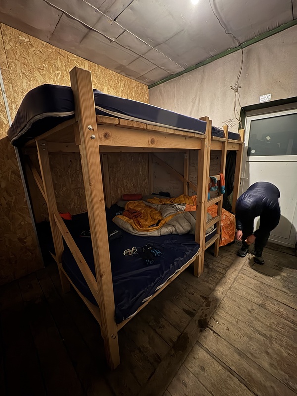
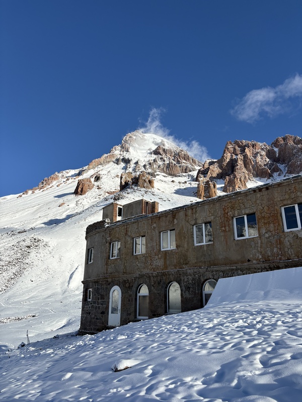
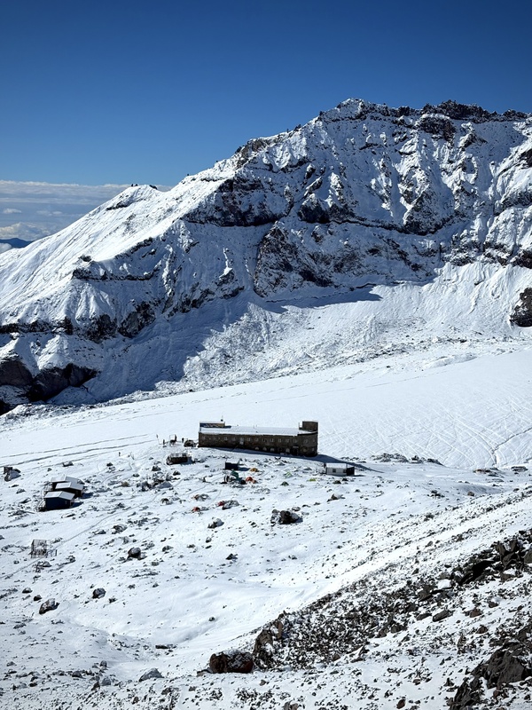
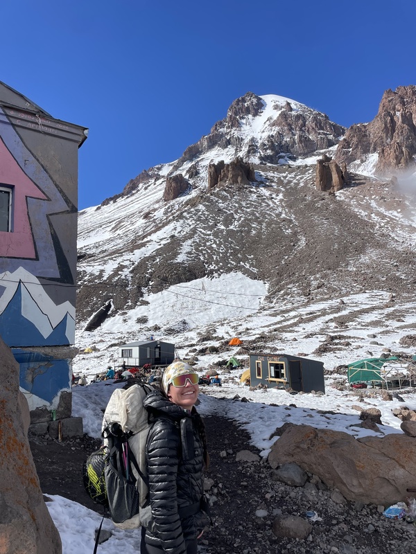
The Bethlemi Hut, located at an elevation of about 12,000’ was first constructed in 1933 and has served as a climber refuge for nearly a century. It could be described as “rustic,” and while it doesn’t provide a luxurious experience, the bunk beds were comfortable, there was electricity, and it offered warmth and protection from the elements. Garrett and I were the only people staying in our dormitory-style bunk room, though in the busier season earlier in the summer, it wouldn’t be uncommon to share a bunk room with other climbers. We saw a couple mice, so hanging our gear and food on the provided hooks in the room was essential. 
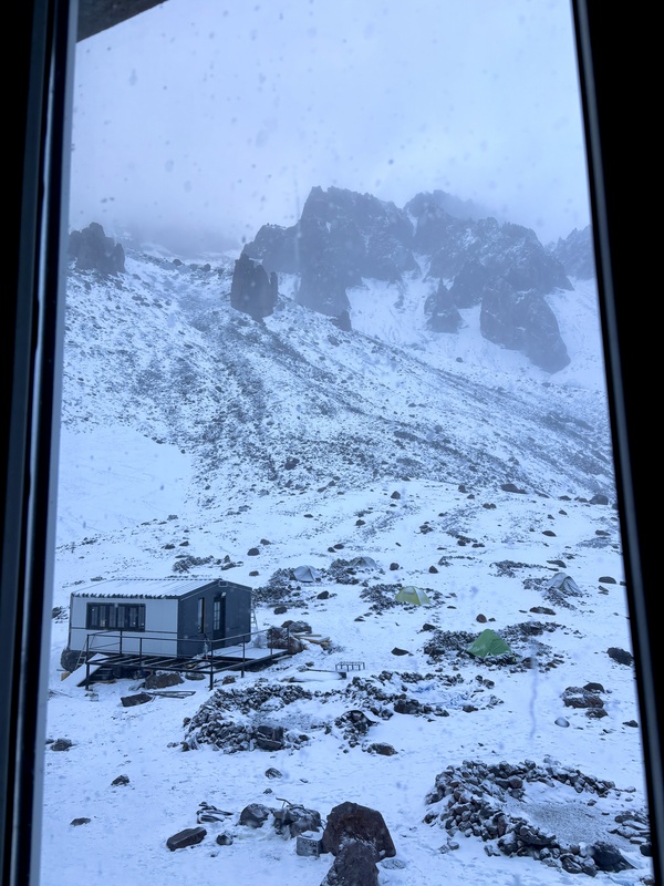
There is no running water or indoor bathroom facility at the hut, but the outdoor bathroom stalls did lock and provide a sense of privacy. The hut also had two small dining facilities where food was available for purchase. The menu had both hot and cold food items for sale, but they were somewhat expensive even by US standards, given that it isn’t easy to transport and prepare food in such a place. There was a spring of meltwater used for drinking, but we purified our water using our Katadyn Be Free filter to be on the safe side. The hut cost 60 GEL (~$20 USD per person, per night), which we paid to the hut manager upon our departure. Camping is also an option, and there are a few designated sites just a few steps away from the hut. Some sites looked rather comfortable, positioned on relatively flat ground with windbreaks constructed a few feet high, whereas others were on slanted ground and didn’t appear as though they would offer a great night of sleep. All sites are on a first-come, first-serve basis, and while not free, were fairly inexpensive (maybe right around 20 GEL or $6 USD per night). After making it to our room in the hut, Room 12, and organizing our belongings, we spent the next couple hours getting our bearings around base camp, prepping dinner with our camp stove, and making plans with Misho for the following morning. 
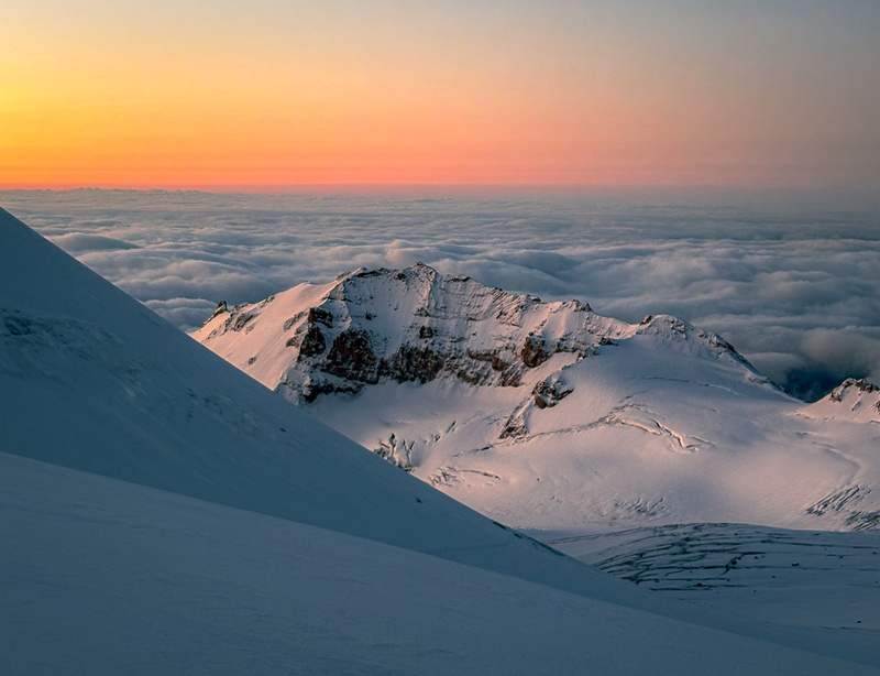
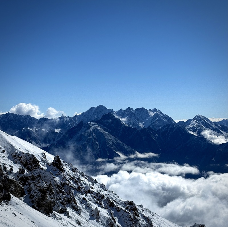
Our total mileage for the day was 5.85 with just over 5k of climbing. It had taken us a little over 6.5 hours from the trailhead, hiking at a relaxed pace with a few breaks along the way. We were off to a great start on our adventure and excited for all the coming days would bring See Strava map here. Day 2: Acclimatization and mountaineering skill practice (Sept. 14) The precipitous, cloudy weather broke sometime overnight and we were greeted with a beautiful cloud inversion the following morning. It was breathtaking to see the rugged, imposing Caucasus Range towering above the sea of clouds, and the panoramic views in every direction are something I won’t soon forget. As it often goes, photos could never do these views justice, which means you probably should start looking at flights from DIA to Tbilisi if you really want to experience how grand they were. 

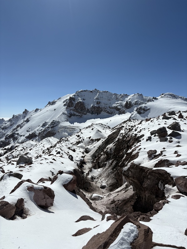
Additionally, we were almost able to see Kazbek’s summit from where we stood, and it looked surprisingly close. So close, in fact, that I assumed our summit must be hidden behind the large peak that loomed above us. While the true summit was just out of view from the hut, much of the remaining elevation we’d need to cover was within view. 
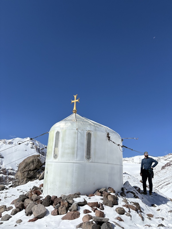
It was a stunning morning, and we spent lots of time taking photos of the scenery before meeting Misho to hike to the Bethlemi Church around 8:30 a.m. The Bethlemi Church is the highest church in Georgia, perched at just under 13k in elevation, and is a popular acclimatization outing for those hoping to summit Kazbek. 
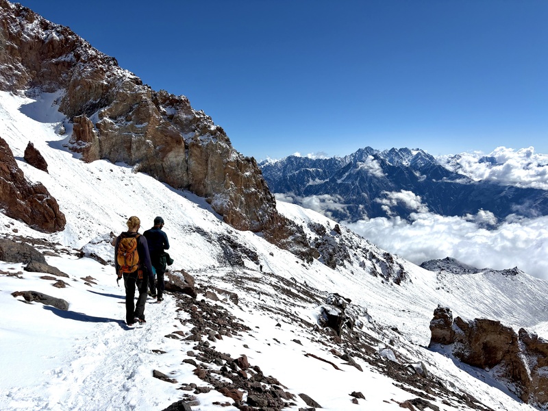
We climbed about 750’ along a snowy Class 2 trail from the hut, and arrived at the tiny church about an hour later. Here, the elevation once again wasn’t anything we weren’t used to from our time in Colorado’s mountains, but we were grateful to check out such a cool landmark, and do an easier hike ahead of our big summit day tomorrow. While we were at the church, Misho used a finger pulse oximeter to see how we were faring at that altitude. Garrett’s reading came in at 89%, Misho’s read 84%, and I couldn’t seem to get a reading at all. Upon reading Garrett’s O2 level, Misho joked that he hadn’t expected to guide vikings from America. We took a few moments to admire the views that were even more beautiful than they had been at the hut before making our way back downhill. 

After lunch, we met with Misho again in the afternoon to practice mountaineering skills on a nearby hillside. We spent about an hour practicing walking as a rope team, self arresting from all kinds of different fall positions, and ensuring we had a plan in place in case any worst case scenarios occurred. Garrett had some previous glacier travel experience from a previous trip to Rainier, as well as a good bit of snow climbing practice, so much of this was review for him. I. however, had never traveled on a rope team or done any glacier travel, and besides two ascents of the Grand Couloir, haven't spent much time snow climbing either, so this was a great way to learn some important skills that I'll certainly use in future mountain adventures. After we felt sufficiently practiced and prepared, we had a short conversation about gear and logistics for the our summit attempt, and went back to the hut. I was feeling nervous for the following day, and spent much of the afternoon fretting over the unknowns of the route and considering what it might be like to fall down a crevasse. That evening, we organized our gear, putzed around base camp, and got dinner at Cafe Mkinvartsveri. After checking weather, Misho let us know looked like our summit day was going to be chillier than usual for this time of year (0 degrees, with windchill), and we anticipated we’d use nearly, if not all of the gear we had brought along. Luckily, the weather looked clear and dry at our elevation and the only elements we’d be fighting would be some light wind and the unseasonably cold temps. As night fell following a beautiful Caucasus sunset, we fell into a fitful sleep as we anticipated our early wakeup time. 
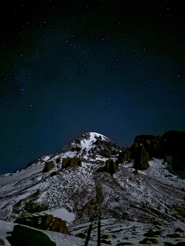
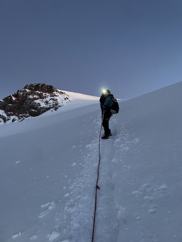
Day 3: Summit and deproach (Sept. 15) We awoke without alarms from a not-too-restful sleep around 2:30 a.m., gathered our gear, and eagerly prepared for the day ahead. We met Misho at the hut’s foyer just after 3 a.m. and after sharing a few words with other summit hopefuls, we were out the door and on our way. The first part of the route from the Bethlemi Hut hikes next to the Gergeti glacier on a dirt trail, and we therefore started out unroped and without crampons. We crossed over small frozen streams, meandered through the rocky hillsides of glacial debris, and took in the incredible views of the thousands of stars that hung above us in the sky. 
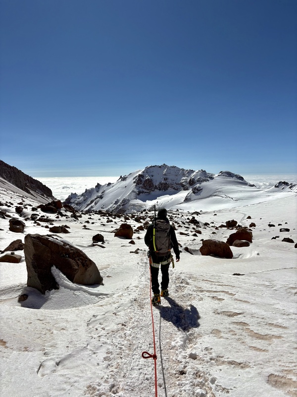
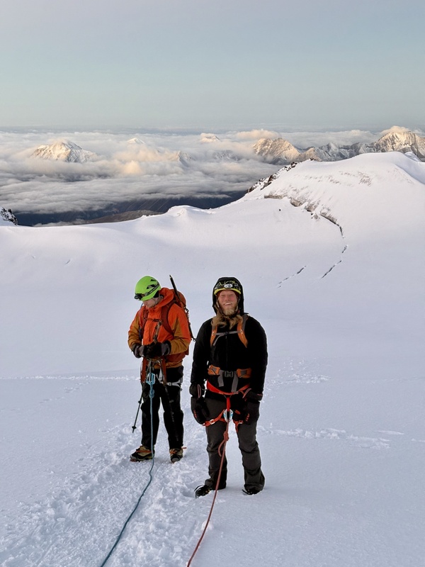
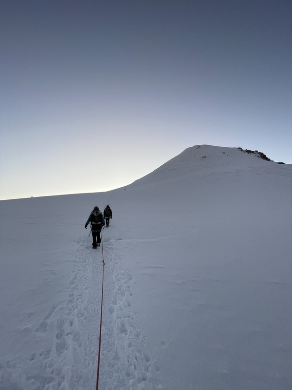
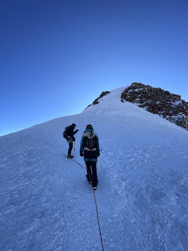
We covered ground efficiently, and arrived at the glacier’s edge well before sunrise. Here, we put on crampons, switched to some warmer layers, and clipped into our rope system. Misho led our rope team, I was next, and Garrett brought up the rear. The route was fully snow-covered at this point, but the path was firm and easy to follow. As we continued along, now strung together by a rope, the early morning air was brisk, but nothing worse than the temperatures we were used to experiencing on many winter mornings in Colorado’s backcountry. Regardless, I was still glad to have handwarmers already in my gloves as well as a pair of insulated mittens in my pack that I could put on, just in case. 
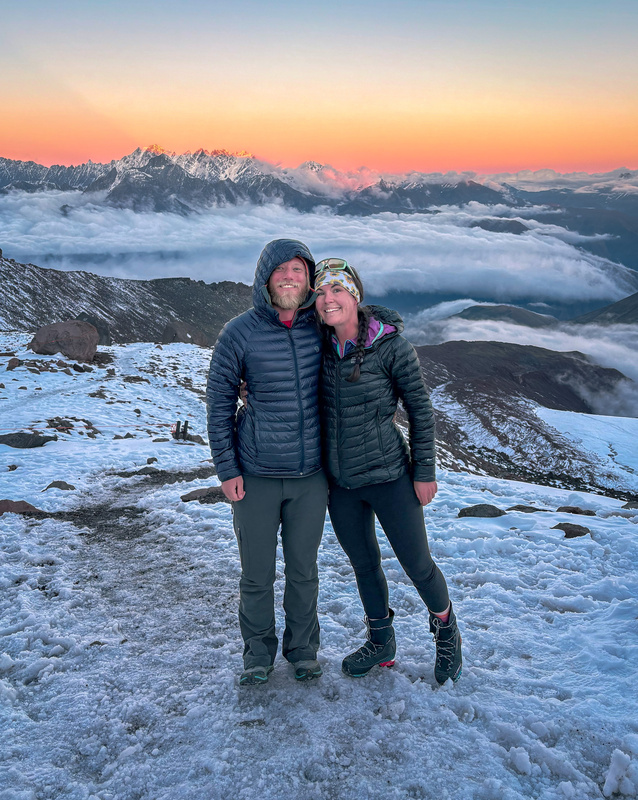
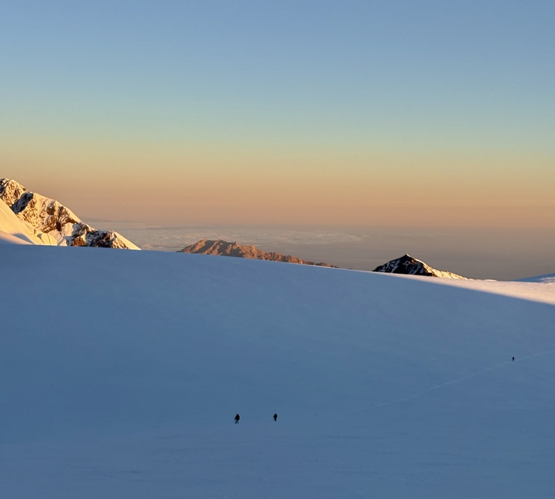
Around 5am, the sun had just barely risen as we arrived at the part of the route where we’d need to navigate a few thin snowbridges spanning some narrow crevasses. We nimbly hopped across, and I realized, much to my relief, that the odds of my falling into one of these glacial abysses were rather slim. It was shaping up to be a good day, and it only improved when the sun crested above the horizon, warming the temps slightly and blanketing the surrounding frosty landscape in a warm, peachy glow 
So far, the hiking had been nothing more than a walk with a rope, minus the aforementioned crevasse hops. It was easy to see most of the remaining route, as other parties snaked their way up the mountainside. 
It was around here that we officially crossed over the Russian border and stood on the ground of a new country. Though there wasn’t any signage noting it, we knew we had officially crossed into Russia because my watch GPS, which had been working consistently up until that point, suddenly began glitching out. Misho explained to us that GPS devices often malfunction in Russia due to widespread and intentional GPS jamming and spoofing, a tactic used to disrupt enemy drones and create general electronic chaos, especially near sensitive areas and borders. My Strava map was a chaotic mess, with pings being placed all over, but quite frequently in the Russian border town of Vladikazkav. This map ended up serving as an interesting souvenir from our very brief time in a country we may never have the chance to visit again. 
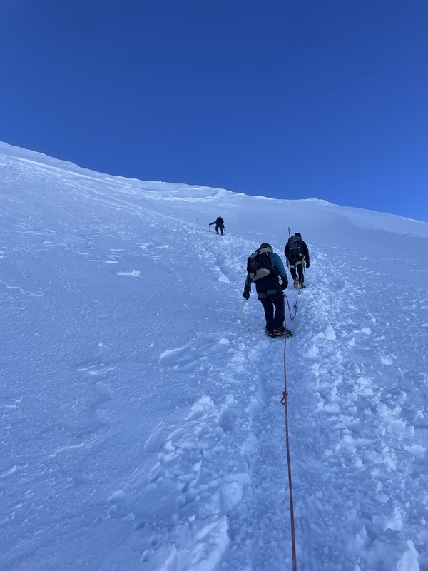
By this point, we had passed all of the crevasses we would encounter on the route, and had reached just about 15,000’ in elevation. We were moving rather slowly so I wasn’t too impacted by the altitude, but I knew we still had well over 1000’ of climbing left before we’d reach the summit. 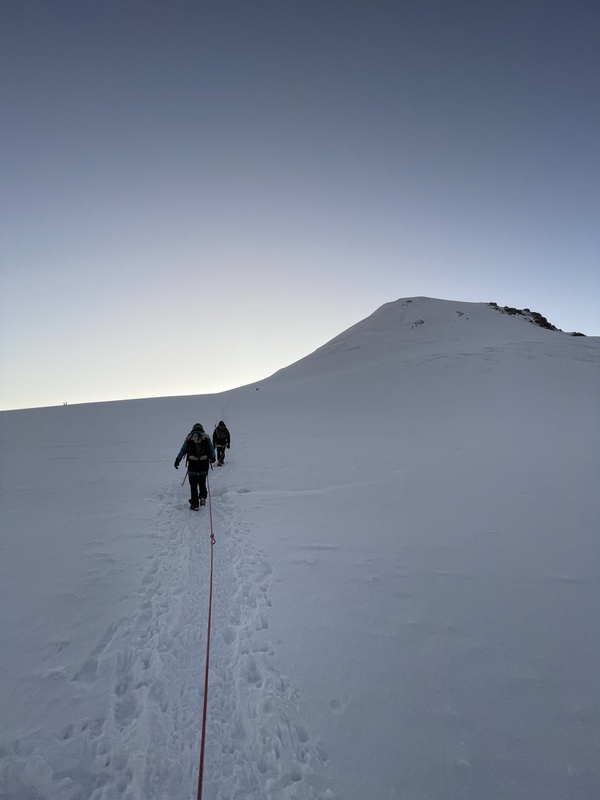
As we reached higher and higher elevations of the mountain, the air became substantially thinner and my chest became tighter. It wasn’t anything overly debilitating, but it was certainly noticeable. Each step required a little more effort, I felt like I got less out of each breath, and the rest breaks which I hadn’t been overly eager to partake in earlier on in the climb were feeling more and more welcome each time. Garrett didn’t seem to feel any effects of the altitude (or so he claims), and forged ahead with very little negative impact from the thin air. 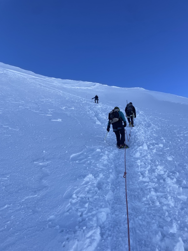
When I’m climbing with a group, I hate to ask any question in the realm of, “Are we there yet?” But as we continued to ascend the mountain and appeared to have very little terrain left to cover, I pointed to a rounded lump and asked Misho, “Is that high point close to the summit?” “That is the summit,” he answered; I couldn’t believe how in reach it was from where we stood! 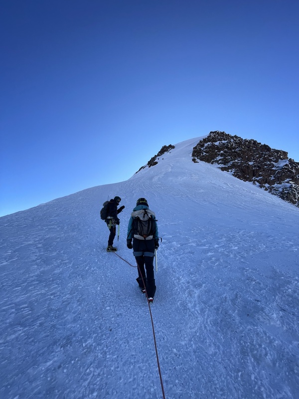
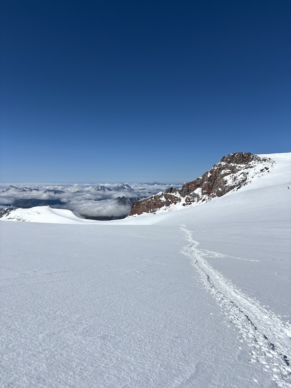
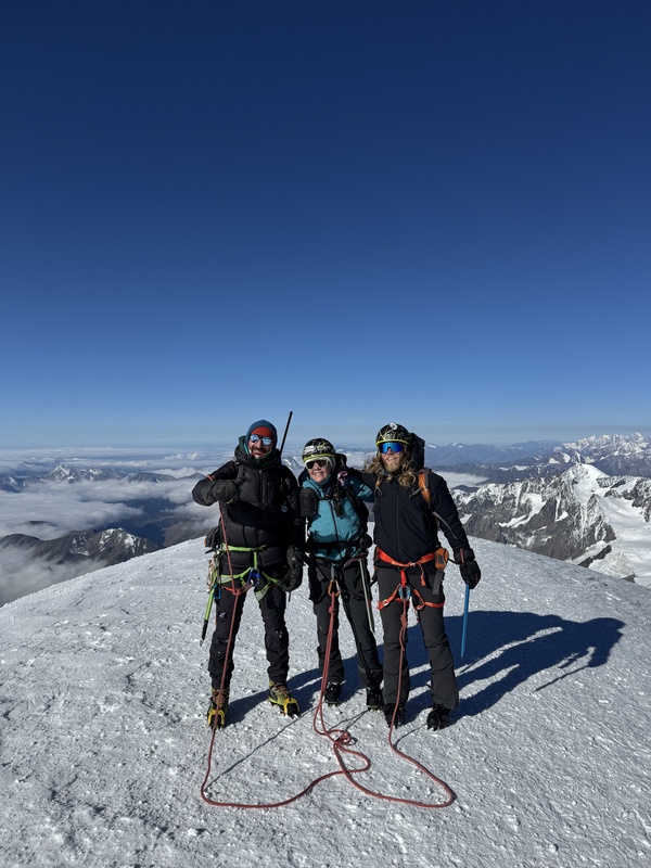
We labored up a couple hundred more feet of frozen snow before being dropped onto a saddle where the final pitch was in fully view. It was an approximately 35-40 degree snowy slope with a well-defined, switchbacking path up its side. It took us approximately 20 more minutes of climbing, and one careful negotiation around a roped team of approximately 9 people on their descent before we reached the glorious, beautiful summit of Mt. Kazbek at just after 9:15am. 
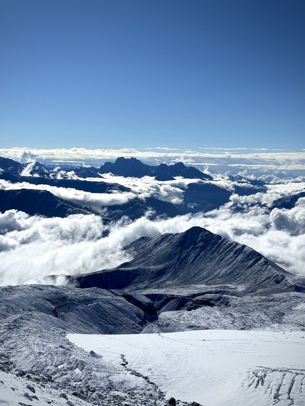
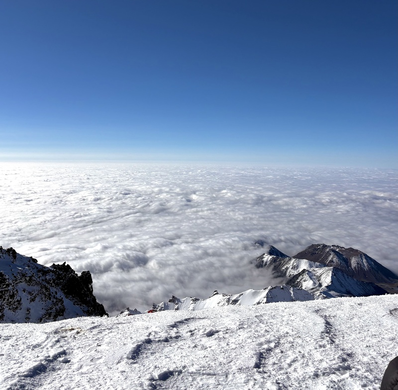
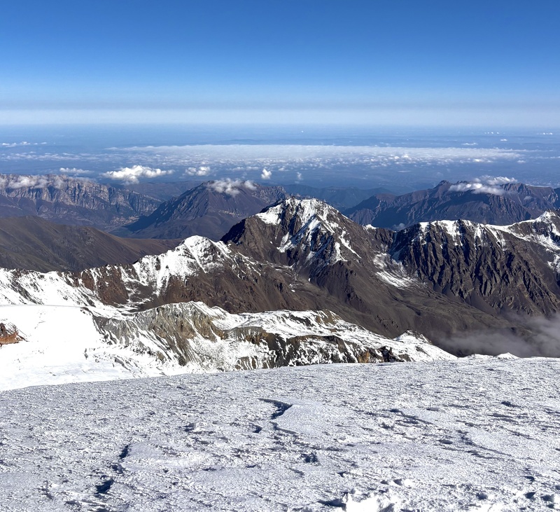
A thick cloud inversion stretched out like an endless white sea below us to the south, blocking any view of the valleys and glaciers we had ascended in the preceding days. To the north, it was entirely clear, save a few small puffs of clouds that floated gently around the summits of nearby Russian peaks, providing a stark juxtaposition in visibility from the two aspects of the mountain. The scenes were stunning and standing atop a new mountain in a new country with my husband was an emotional, soul-filling experience. 

We hugged on the summit, snapped a few photos to commemorate our time, and looked out toward the incredible views that surrounded us. We were not the only people on the summit at the time of our arrival, and it was just before descending that we noticed our fellow summiters, both of whom were wearing enormous mountaineering parkas, had with them a small clipboard. They flapped their hands to stay warm, looked at an occasional watch, and intermittently peered over the side of the mountain, as if they were looking for something. We weren’t sure exactly what they were up to (“science?” we guessed), and after taking a few final seconds to admire the views, we started our descent back down the way we had come up. While we were still descending the final pitch, we noticed a person in a thin pair of running tights on their way up who was pushing his pace to the absolute max. Upon stepping aside to let him continue, we noticed he had a tiny mountaineering kit, as well as a racing bib. Following his passing, we saw a few more athletes, also with small mountaineering packs and race bibs. It appeared there was some kind of race originating from the Russian side of the peak to the summit of Mt. Kazbek, and we realized that our fellow mountaineers at the summit were there to record finisher placements. It was fascinating to watch dozens of people take on this high-altitude feat, which, no offense, looked way cooler than the Pikes Peak Ascent. We had no problem stepping aside to let them pass as often as needed, taking care not to slip as we moved off the main path. We tried our best to find out more about the race once back in town, and made it as far as finding the race website. Unfortunately, my Duolingo Russian did not get us far in learning about all the details of the event. Regardless, we found what little we were able to learn about the event fascinating, and we were happy to have encountered it during our summit. 
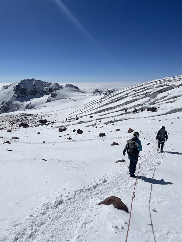
Overall, the first part of the descent from the summit, even at elevations greater than 15-16k in elevation, was relatively easy. The day was warming up nicely, the sun was shining, and our path was, generally speaking, pretty mellow. It was definitely easier on the lungs and legs to go back downhill than it was to ascend! At a certain point, my GPS functionality returned to normal and our encounters with racers ceased, indicating to us that we were officially back in Georgia. 
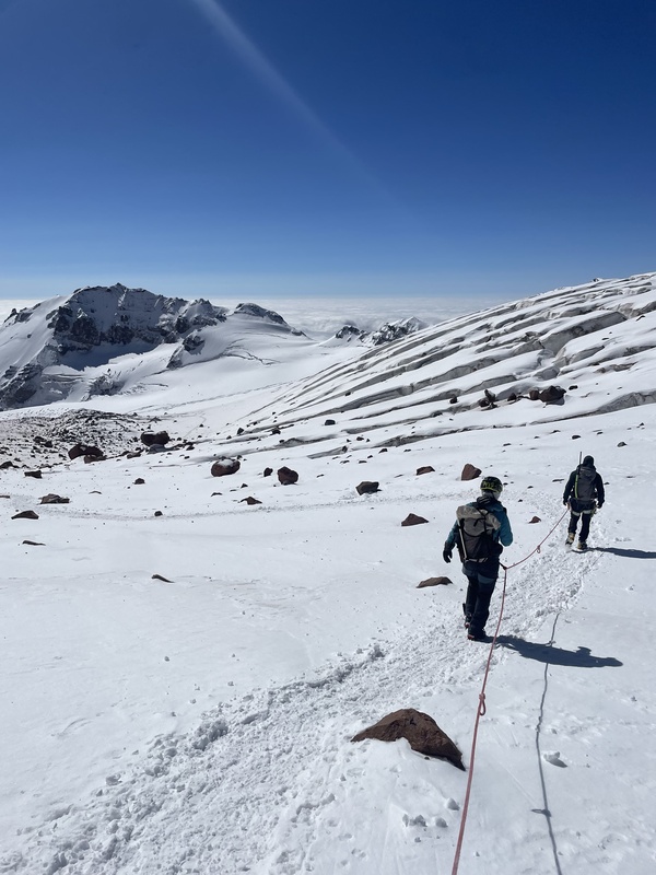
After navigating the crevasse section and making it to the edge of the Gergeti glacier, we unclipped from our rope system and continued navigating our way downhill. The mountain seemed to come alive around this point, as melting snow sent boulders, some as large as microwaves or even bigger, tumbling down the hillside and toward our hiking path. We weren’t overly concerned about getting hit, as the boulders needed to clear a large ravine before they would reach us, but the noise from the never-ending rock fall served as a proper reminder that, even in countries across the world, the geologic time is now. 

After crossing through miles of moraines and over terrain that had transformed from snowy to muddy over the course of the morning, we finally found ourselves nearing the Bethlemi Hut once again around 12:30pm. While some teams opt to spend the night at the hut following their ascent, we were hoping to make it back to Stepantsminda so we could continue on our journey through Georgia the following morning (and truthfully, we really wanted to get back to town to get shawarma at a place in town that we had been thinking about for the past three days). 
Back at the hut, we celebrated our successful summit with bottles of coke, packed up our belongings in Room 12, and paid the hut manager for our stay in the small staff office where guiding officials headquartered. Here, a guide from another company offered us shots of homemade “chacha,” a strong Georgian grape brandy similar to vodka. We obliged and took a shot, thanked him for his generosity, and made a move to depart from the office. As we got up to leave, he said something to Misho who translated his words to be something along the lines of, “You can’t leave yet. When you’re in Georgia, you take shots in sets of three or more!”. We were exhausted from our morning efforts and were sitting at a current elevation of 12,000’, but we’ll never say no to a good time, especially with a group of expert Georgian mountaineers who were excited to celebrate our summit with us. They toasted to our good health, a long and happy marriage for us, the country of Georgia, and anything else they could think of worth celebrating (they had no problem thinking of many things to toast to). 
After four rounds of chacha, we were ready to start making our way back downhill around 2:30pm. It was a very...carefree (but quite enjoyable) descent. Shortly after leaving the hut, we reached the elevation at which the cloud inversion we had observed from up high started, and similar to our ascent, we made our way down the mountain, in the cool, humid swirl of clouds. We navigated the Gergeti glacier with Misho, and after about an hour of walking, arrived back at its toe. 

The landscape became progressively more lush as we descended, once again passing notable landmarks like the Altihut and Cafe 360. Upon reaching the lowest flanks of the mountain, we broke through the floor of the clouds, and found ourselves looking down at the Gergeti Church and, even lower, the town of Stepantsminda. We spent the final kilometers back to the parking lot reminiscing on our adventure and feeling a deep sense of gratitude and accomplishment for the challenge we had completed. 
I’ve always been deeply fascinated by big mountains. I first started exploring Colorado’s 14ers as a freshman in high school, and I quickly found that the inspiration and draw I felt to these peaks only increased the more I experienced their magic. A foreign, glaciated summit above 5000m felt out of reach, despite the practice I had put in over the years. To have been able to rise to the challenge (with help from Garrett and Misho, of course), and experience the kind of mountain I had only ever read about in books was truly incredible, and has already spurred me into taking action for my next international summit, which I look ahead to with a deep sense of purpose and anticipation. 
A little bit of additional info for anyone interested… Guided or Unguided? This is highly dependent on you and your party’s skills and fitness. Because Garrett had minimal glacier travel experience and I had none, we opted to do this climb guided. We found Misho through the Explore-Share website and had an excellent experience. Not only did he guide us along the entire route, he also rented us harnesses, helped us book accommodations at the Bethlemi Hut, and helped us practice glacier travel and snow safety techniques. I had never practiced traveling on a rope team or self-arresting with an ice axe, so this was excellent experience to gain under the supervision of an IFMGA guide. Additionally, it was great to connect with a Georgian local and learn more about this incredible country’s culture and have someone there to help us navigate language barriers. Could someone do this route unguided? Absolutely, and it’s not uncommon. Sufficient research, glacier travel/crevasse rescue skills, and a high degree of fitness are essential, but this was not a technical or difficult to navigate route, in my opinion. From an objective perspective, it’s rated as “PD” (peu difficile) on the SAC Mountaineering Scale. What’s the Weather Like? This is obviously extremely dependent on when you’re hiking. As mentioned above, we hiked in mid-September, and conditions were quite chilly! It was actively snowing when we arrived at the Bethlemi Hut on day one, and I was grateful to have hand warmers during our final couple miles to the summit. Be prepared to hike in conditions that could feel wintery by Colorado standards even during the summer season. Gear List I used darn near everything I brought, and was grateful to have all of it. All of my gear is relatively lightweight/minimalist and it worked well for me.
This certainly was the adventure of a lifetime, and a wonderful first international peak. Grateful to have experienced this unique and beautiful route! Thumbnails for uploaded photos (click to open slideshow): 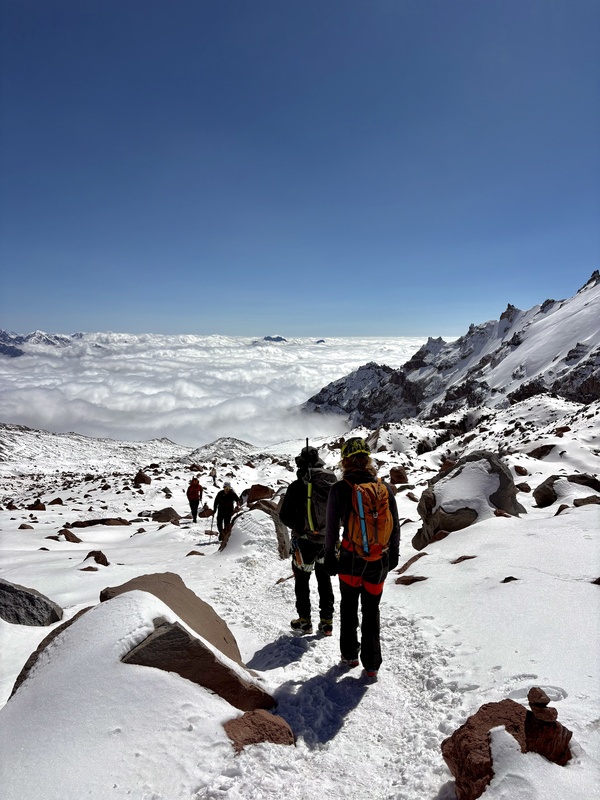
|
| Comments or Questions | ||||||||||||||||||
|---|---|---|---|---|---|---|---|---|---|---|---|---|---|---|---|---|---|---|
|
Caution: The information contained in this report may not be accurate and should not be the only resource used in preparation for your climb. Failure to have the necessary experience, physical conditioning, supplies or equipment can result in injury or death. 14ers.com and the author(s) of this report provide no warranties, either express or implied, that the information provided is accurate or reliable. By using the information provided, you agree to indemnify and hold harmless 14ers.com and the report author(s) with respect to any claims and demands against them, including any attorney fees and expenses. Please read the 14ers.com Safety and Disclaimer pages for more information.
Please respect private property: 14ers.com supports the rights of private landowners to determine how and by whom their land will be used. In Colorado, it is your responsibility to determine if land is private and to obtain the appropriate permission before entering the property.