Download Agreement, Release, and Acknowledgement of Risk:
You (the person requesting this file download) fully understand mountain climbing ("Activity") involves risks and dangers of serious bodily injury, including permanent disability, paralysis, and death ("Risks") and you fully accept and assume all such risks and all responsibility for losses, costs, and damages you incur as a result of your participation in this Activity.
You acknowledge that information in the file you have chosen to download may not be accurate and may contain errors. You agree to assume all risks when using this information and agree to release and discharge 14ers.com, 14ers Inc. and the author(s) of such information (collectively, the "Released Parties").
You hereby discharge the Released Parties from all damages, actions, claims and liabilities of any nature, specifically including, but not limited to, damages, actions, claims and liabilities arising from or related to the negligence of the Released Parties. You further agree to indemnify, hold harmless and defend 14ers.com, 14ers Inc. and each of the other Released Parties from and against any loss, damage, liability and expense, including costs and attorney fees, incurred by 14ers.com, 14ers Inc. or any of the other Released Parties as a result of you using information provided on the 14ers.com or 14ers Inc. websites.
You have read this agreement, fully understand its terms and intend it to be a complete and unconditional release of all liability to the greatest extent allowed by law and agree that if any portion of this agreement is held to be invalid the balance, notwithstanding, shall continue in full force and effect.
By clicking "OK" you agree to these terms. If you DO NOT agree, click "Cancel"...
This is the first of what I hope are many installments in my quest to claim (haha) unnamed 13ers for my family. I am a person of whimsy, if you can't tell from other TRs, and the nugget of this silly idea started years ago. When I summitted my first unnamed 13er, The Artist Formerly Known As UN 13,550, I "claimed it" - or so I thought. But to claim a peak, doesn't there need to be a flag involved? That seemed like an unforgivable deficiency.
So I ordered an Irish flag bearing my family crest and started over. Congratulations, UN 13,385, you are henceforth O'Malley Peak A - at least within the confines of my own little heart.
Let's take a closer look at this truly lovely jaunt!
To the Stats, We Go!
Total mileage: 6.42
Total elevation gain: 2,487'
Mileage splits:
Mile 1 = 617'
Mile 2 = 1040'
Mile 3 = 476'
Mile 4 to finish = 354'
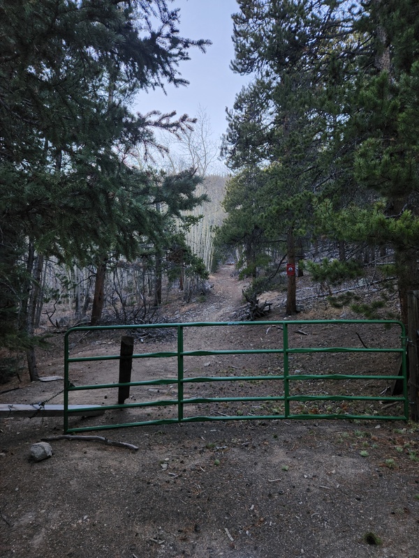
The Road In
Darin and I followed the directions provided in Trotter's TR: slightly north of Buena Vista, turn left on CR 386, right onto CR 387, left at unmarked T intersection, keep going until the gate. I agree with Trotter about the steep inclines. While Darin kept his 4Runner in 2WD and did just fine, I suspect 2WD vehicles with less clearance and power would struggle. And certainly any semblance of snow, mud, or ice would make those inclines pretty interesting.
The Hike
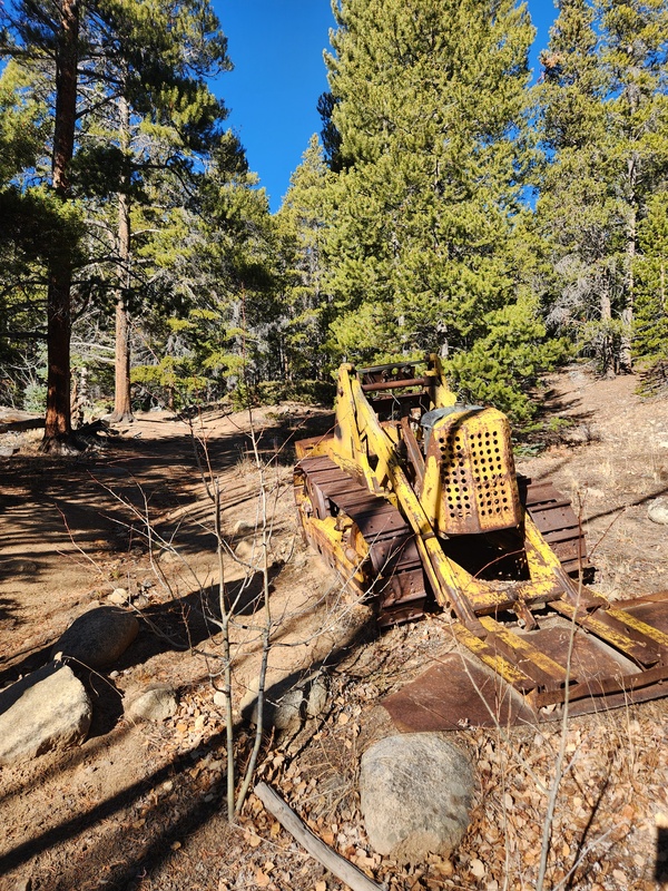
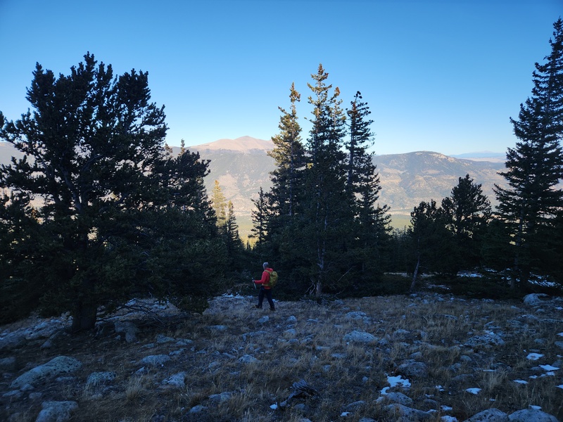
Begin at the gate and just travel the road for a bit. It's quite pleasant, and you pass a small artifact in the form of a mini bulldozer.
Arrive at the end of the road, and views open up, also revealing a lot more mining structures. This is where you get your first glimpse of the Buffalo Peaks which - spoiler - will become a common navigational comment throughout this TR.
Up until the end of the road is ever-so-slightly SSW. From here, though, we turned right up the hill onto the Wapaca Trail past the cabin and headed distinctly NW. You don't stay on the Wapaca Trail long at all because it starts heading the opposite direction. Per the map, it looks like you can follow the meandering of the Wapaca Trail until it spits you out onto the Colorado Trail (CT), then you could continue trail-less upward from there. However, this appears very inefficient and adds significant amount of hiking.
So dive into the trees, and just head on up aiming distinctly SW.
We didn't encounter anything problematic in the bushwhack to the CT. Dare I say, it was quite manageable and not terribly unpleasant.
But about the Buffaloes... I look behind me a fair bit for navigation purposes, so on our way up I would catch glimpses of the Buffaloes, and I thought to myself, "Self, those are a very distinctly helpful point of orientation, if needed."
The Buffaloes peeking through the trees right at the appearance of the CT; squarely in the center of your line of sight.
After a bit, a big clearing signals an upcoming encounter with the CT, which you will cross, not follow.
Crossing the CT
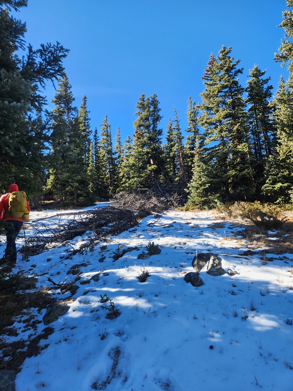
Continue your southwesterly mission uphill. The next phase of bushwhacking was as non-problematic as the first. We encountered a little more snow, but it was no big deal.
You'll emerge into another clearing, and leftward you'll see a pointy-ish pile of rocks. You want to aim to the right of those rocks in whatever fashion makes most sense to you.
Time for another look back at the Buffaloes. Yep, they're still there!
Columbia's ridge barely starts coming into view and is also a good directional point of reference because you don't want to head in its direction, you want to curve away from it, really. So at this point, I'm just going to vaguely say "keep going up". Being out of the trees at this point, it's fairly easy to visually navigate. Though, admittedly, UN 13,385 itself stays out of view for quite some time.
Play some willows Frogger here as you head up
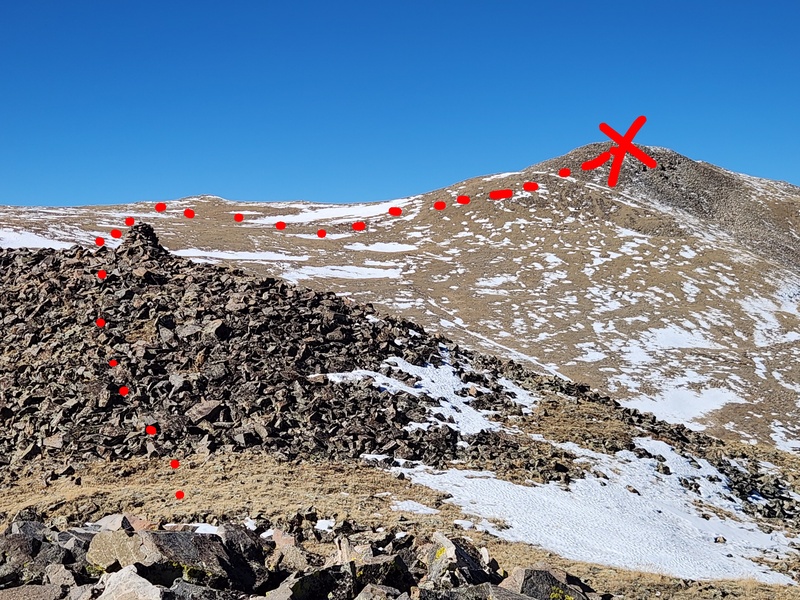
We headed toward this rocky section. Once you get to the top of it, 12,800' comes into view. You're going to go up and over that, so navigationally the route is pretty simple from this point onward.
Expertly-drawn doodle dots to illustrate how to gain 12,800'
Somewhere en route to 12,800', we took a snack break, and this nearby pika stood watch. Pika and Princeton.
Once UN 13,385 comes into view, there's a bit of temptation to just sidehill around 12,800', but I can almost guarantee you it's a craptacular endeavor to go that way. Up and over 12,800' was great, and you barely drop at all coming off 12,800'. So there's no major elevation loss that would make the side-hilling around worth it.
Over yonder is the summit finally in view!
From 12,800', the remainder of the route is very obvious and very straightforward. X marks the spot, a.k.a. the summit.
More expertly-doodled dots
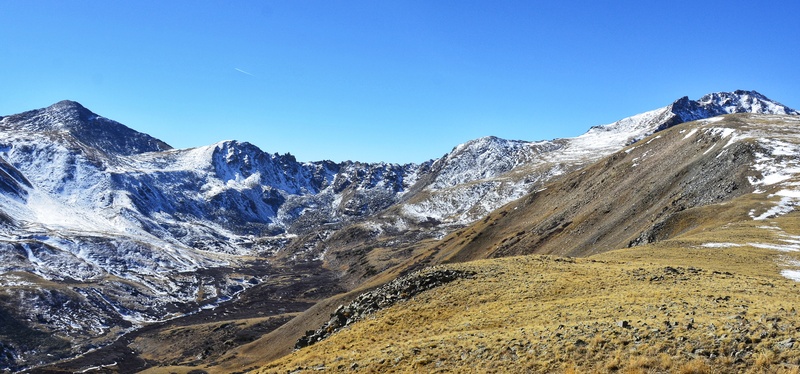
Views of Columbia and Harvard become more prominent, and it's amazing! And now you're really curving to head northerly again.
Columbia left, Harvard rightMore broad view of Columbia
This is a first for me; we came across a relatively fresh elk kill! Seemed obvious a hunter got it, and I appreciate that it looked like other animals were also benefiting. Kind of a cool find if you're into this sort of thing.
Straight shot to the summit from here. The final couple hundred feet is rocky but not in any terrible sort of way.
Be sure to go uphill in style! Aim to impress the Buffaloes; they're watching your every move.
Ironically, though, I have never earned style points on any of my hikes. Hmm. I am not sure why.Darin on the rocks, Columbia's ridge and the Arkansas Valley looking on
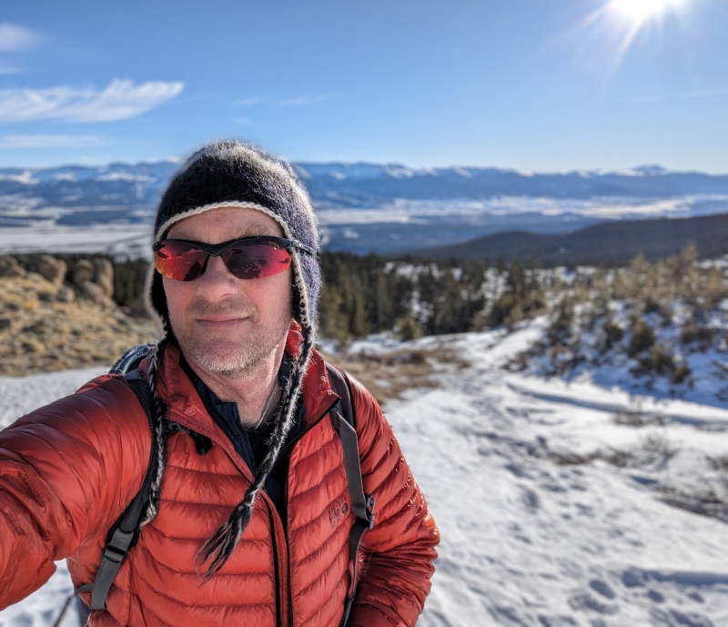
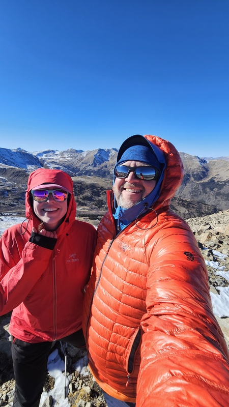
On summit, claiming it and naming it with flag on display! Haha. O'Malley Peak A, you did not disappoint.
After a long long time of schedules not lining up, it was great to be on a peak with the d_baker, once again!Absolutely love the views from the summit and especially of Harvard from this vantage point. Wow! I dragged my DSLR along and had zero regrets.Oxford, Belford, and Missouri - I see you!
The summit register proves this is not an oft-visited peak. Per the norm, we enjoyed looking through it and spotting names we know. It's like stalking, but different.
Views? Impeccable. Columbia, Harvard, Oxford, Belford, Missouri... you're surrounded by greatness and can see beyond to Elbert, Massive, and even Holy Cross.
For descent, if I were without GPS, map, etc., the Buffaloes are visually very useful if you paid attention to them on the ascent. Aim toward, not away. And this is the last time I'll mention them, I promise!
Final Thoughts
This was a VERY pleasant 13er! I'm a big fan. I do understand why it's not visited often, though. When Darin suggested we do it, I immediately pulled up a map to see what's nearby to connect with. Oh... there is nothing. This peak is a very tall island nowhere near other 13ers, so you really have to want to be there. It makes for a lovely day on its own, and the views are definitely worth it.
As always, leave no trace wherever you roam. Love the pikas; preserve their home.
My GPS Tracks on Google Maps (made from a .GPX file upload):
Mary/Darin, for all the silliness that was imparted on this trip, I am VERY disappointed in the lack of shenanigans. And you're Irish!! Next next, you need more shenanigans...and cowbell wouldn't hurt either. And Darin is wearing my jacket.
Great trip!
Also, this was post-Halloween. I insisted it was too late for shenanigans and costumes and I wouldn't play a part to her props.
I lost out on Thanksgiving to the no-props demand!
Good day out, Mary!
It was satisfying to clean up a Sawatch eRphan. Several more to go!
Thanks for joining and sorry (not sorry) that I scared you when I passed cars on the way home....lol
4runners can safely go 90mph, it's okayyy
I feel like you must have needed to get some of that out of your system, Darin. 😂 Yes, it was a great day out! Even better by getting there the right way thanks to your watchful eyes, lol.
And now I know that a 4Runner can even go that fast. I probably wouldn't have discovered that on my own, as we know. Bahaha!
I am very much in favor of this twinsing. Although, it also makes me feel like I need a new jacket. Lol!
Caution: The information contained in this report may not be accurate and should not be the only resource used in preparation for your climb. Failure to have the necessary experience, physical conditioning, supplies or equipment can result in injury or death. 14ers.com and the author(s) of this report provide no warranties, either express or implied, that the information provided is accurate or reliable. By using the information provided, you agree to indemnify and hold harmless 14ers.com and the report author(s) with respect to any claims and demands against them, including any attorney fees and expenses. Please read the 14ers.com Safety and Disclaimer pages for more information.
Please respect private property: 14ers.com supports the rights of private landowners to determine how and by whom their land will be used. In Colorado, it is your responsibility to determine if land is private and to obtain the appropriate permission before entering the property.


")
")
")
")
")
")
")
")
")
")
")
")
")
")
")
")
")
")
")
")
")
")
")
")
")
")
")
")
")