Download Agreement, Release, and Acknowledgement of Risk:
You (the person requesting this file download) fully understand mountain climbing ("Activity") involves risks and dangers of serious bodily injury, including permanent disability, paralysis, and death ("Risks") and you fully accept and assume all such risks and all responsibility for losses, costs, and damages you incur as a result of your participation in this Activity.
You acknowledge that information in the file you have chosen to download may not be accurate and may contain errors. You agree to assume all risks when using this information and agree to release and discharge 14ers.com, 14ers Inc. and the author(s) of such information (collectively, the "Released Parties").
You hereby discharge the Released Parties from all damages, actions, claims and liabilities of any nature, specifically including, but not limited to, damages, actions, claims and liabilities arising from or related to the negligence of the Released Parties. You further agree to indemnify, hold harmless and defend 14ers.com, 14ers Inc. and each of the other Released Parties from and against any loss, damage, liability and expense, including costs and attorney fees, incurred by 14ers.com, 14ers Inc. or any of the other Released Parties as a result of you using information provided on the 14ers.com or 14ers Inc. websites.
You have read this agreement, fully understand its terms and intend it to be a complete and unconditional release of all liability to the greatest extent allowed by law and agree that if any portion of this agreement is held to be invalid the balance, notwithstanding, shall continue in full force and effect.
By clicking "OK" you agree to these terms. If you DO NOT agree, click "Cancel"...
Most 14er enthusiasts know that Huron peak has the best views/effort ratio in the entire state. The north faces of the apostles look like a mini-Teton range and hold snow early and late and are photogenic af. From that summit so many years ago I learned that if I wanted views of snow-covered faces, I should look for viewpoints that had big views south. Additional points could be found if the route to said viewpoint was on a southern aspect as that would keep it dry when the surrounding terrain is snow-covered. And lastly, extra bonus points if the peaks sit outside of Wilderness Areas so that it's legal to fly a drone from their summits.
Ervin/Blaurock sit at the north end of the valley that opens up south of Winfield, and their approach is even shorter than Huron (if off-trail). Any high-clearance vehicle can drive to the base of the ridge to create what looks like a short day on paper and be treated with expansive views south of the entire Clear Creek area. They also sit outside the Collegiate Peaks Wilderness and the route to gain the ridge is entirely on south-facing terrain. Goldilocks pair of 13ers if one could catch them right after a big snowfall event early enough in the season that the valleys are dry enough to keep the road to Winfield and beyond open.
Blaurock's majestic north face.
Watching the weather from Texas, the weekend of October 25/26 looked promising as it approached. A storm mid-week looked set to dump some big snow mostly on the Sawatch before clearing out for the weekend. I waffled between the Ervin group or driving further north to the Frasco group, which features most of the same characteristics (outside wilderness, scrambly ridge-line, south-facing slopes to gain ridge, easy approach on the road, etc) but ended up picking the Ervin group because I wanted to add Emerald/Iowa on the second day of the trip. The views also looked better from their summits.
Drove up after taking a half-day at work on Thursday 10/23. Lots of lightning and rain beginning in eastern NM and continuing all the way up to Buena Vista, with the originally forecasted clear weather on Friday 10/24 sort of changing to snow lingering in the morning but clearing out by the afternoon.
Car-camped in one of the many pullouts on the way up to Winfield as snow continued to fall, and woke up to heavy overcast skies and a few inches of new snow on top of the Subaru. I was tempted to get up and go for it, as being high in the alpine as a storm breaks up usually makes for the best photographic conditions one could ask for with swirly clouds and snow on all aspects. But with the near-guarantee of good weather the following day on 10/25, I didn't want to risk getting cold or tired or injured by heading out in sub-optimal conditions, so went back to bed. This call ended up being the right one: it snowed off and on the entire day. I drove up to Winfield early in the afternoon and couldn't see the tops of the peaks for more than a few minutes at a time between squalls. I also tried driving the road up past Winfield to the "trailhead" for Ervin but got sketched out on some angled deeper snow near the Winfield cemetery. Opted to play it safe and just hike the short extra mileage from Winfield the next morning.
The morning of 10/25 I fought the lethargy hard and snoozed several times, finally leaving Winfield around 430am. Within a few minutes of walking up the road, I found a ton of melt had occurred overnight despite the car thermometer showing 26 degrees, so walked back to the car and ended up driving those last 1.5-ish miles up to the base of the route, where I was suddenly very tired again so opted to take a 10 minute nap to try to reset my energy.
I finally left the car around 6am still pretty low-energy and started up the faint remains of a road which I followed into the forest. There's no clear place to leave the road and begin the bushwack, so I chose a spot that had more openings between the trees to start up. This dead-ended pretty quick into very thick foliage and fallen trees that I had no interest working through, so I headed back down to the road and continued a little further east before again plunging into a bushwhack north. This time I got luckier and could find a path up and through the thick branches without tearing up my Nano-Air that was keeping me warm.
Plenty of space between trees.
Within ten minutes of the uphill slog, I was completely awake, warmed up and enjoying the peculiar pleasures one finds in this sort of suffering. I wanted to be at treeline to photograph the alpenglow and given my slothful start to the day, I had to hustle to make this happen.
Why is this fun? Why can't I be satisfied just hiking on a trail?
That view looking down this valley is what I came here for.
At treeline I stopped for second breakfast and enjoyed the colors and calm morning. The lack of wind portended a very comfortable day.
Blue hour just above treeline.
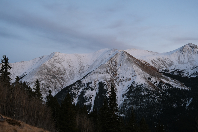
Alpenglow on what I think might be Sayres B.M.?
Above the trees, the angle eased back, or maybe it just feels like that because one is no longer having to thrash through trees to make progress. The talus, however, was covered in a layer of frosty ice, making footing very slippery. I considered putting on microspikes here but just didn't want to stop and fuss with it, despite knowing better. The angle stayed low enough so that a slip here wouldn't include any rolling or bouncing, so I just stayed careful with foot placement (mostly between rocks instead of on direct flat surfaces) and cruised up to the crest of the ridge where the views really open up.
First rays.
The ridge.
No matter how often I get out in the hills, it remains a fascination of mine how quickly south facing slopes lose their snow. Over the course of this warm, sunny day I would watch these slopes become completely dry before sunset, but even early in the morning, it was clear they just hadn't held on to most of the snow that had fallen the previous two days.
Virginia group.
The ridge all the way up to a point between Ervin and Blaurock goes class 1 or easy 2 if you want. I found a few places where staying ridge-direct could offer some easy scrambling and opted to take those just because.
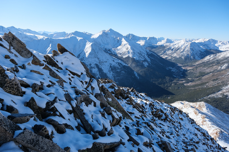
This high there was finally some snow sticking around on south aspects, which made for easier movement than the frosty lower slopes.
Jumping to the north side of the ridge crest found an entirely different world of powdery snow.
Such a pleasure to see the usually wind-blown slopes of the Belford group completely snowed over. It never seems to last long on them.
Once on the ridge-proper, the routes both east to Ervin and west to Blaurock looked fairly intimidating in all the fresh powder.
Blaurock at the end of this ridge in front of La Plata. Loose talus with trapdoors as the first obstacle.
The view to Ervin. More stable rock, but also towers.
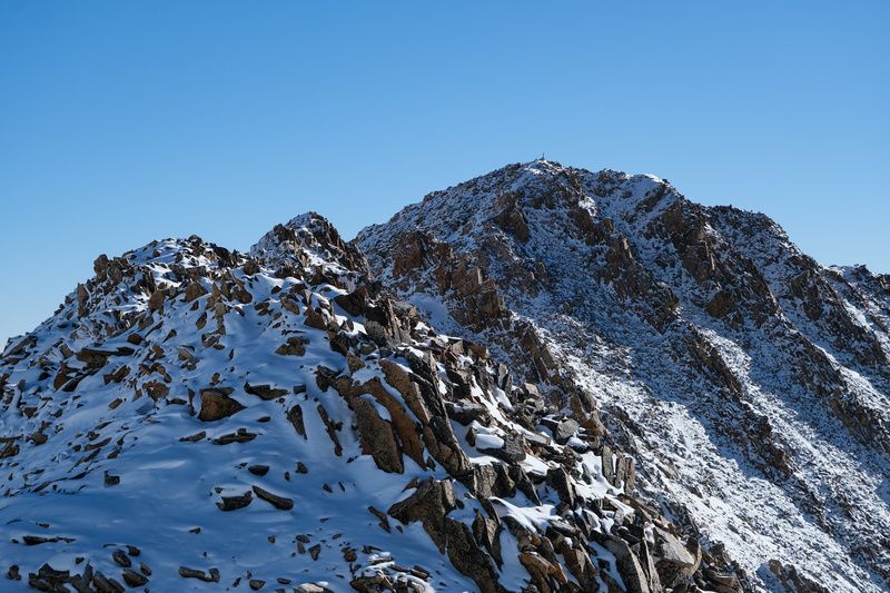
Ervin was first. I through on microspikes and they ended up staying on all the way back to the car. The summit seemed very close, but it was slow going moving carefully along the ridge crest, which continued to narrow as it works up and over some towers that form ribs running down the south face. Shortly before the summit the ridge narrowed dramatically, and I couldn't tell how gnarly the downclimbs were on the backside of the last two towers before the summit. I had the route photos from 14ers.com saved to my phone and had looked at all the other TRs for this route, but was surprised to find this exposed catwalk up here and so didn't want to assume easy downclimbs on those towers in the current snow conditions.
Looking back at the easier 2/3 of the ridge. A lot of melt already happening on those east-facing slopes in the background.
The Ervin catwalk, photographed later in the day on the way back.
The final obstacles with unseen downclimbs behind them.
I opted to drop off the ridge to skirt around the towers and work around the base of the rock ribs, which would end up costing me a few hundred feet of elevation to get around the bottom of them. The rock here was loose and unpleasant, but the holds on the steeper parts were all solid.
Looking back up the ridge after downclimbing from it.
After skirting around the bottom of two rock ribs, a final grind up loose rock in the summit gully brought me to the summit.
Looking up the gully directly south of the summit.
Looking back down said gully. The snow probably held a lot of the rock in place and made it easier.
Overview of the two ribs I worked around from below before turning north and reclimbing to the summit.
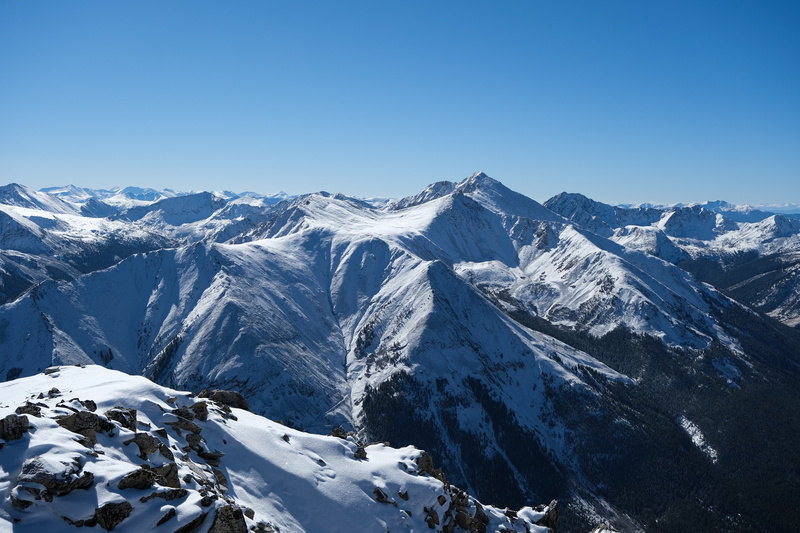
From Ervin's summit, I could see the downclimbs from those towers would be fine in the current conditions. The weather was flawless, with not even a whisper of a wind, so I was in no hurry to move on, and ended up hanging out up there for over an hour enjoying the stellar views of the central Sawatch from both my Fuji camera and the DJI drone.
Summit of Ervin.
The connecting ridge over to Mt. Hope.
Gentle giants of the Sawatch.
Looking down at winter on the north side of Ervin.
Long shadows on the north side.
Ervin's north face is out of character for this part of the Sawatch with how steep it is.
I wasn't interested in following my ascent route for the descent and now felt more confident about staying on ridge crest after seeing it from the other side. The return hike to the saddle between Ervin and Blaurock was much more pleasant and I only dropped off the ridge at one point to again skirt a point on it's south side to avoid a class-4 scramble down from the ridgeline. The crux was surprisingly airy and exposed with some wobbly blocks, but it went quickly.
Crux moves.
The route over to Blaurock is pretty non-eventful comparatively, at least until the first of several false summits. I stopped on the way to put on the long 300mm lens and take pictures of some familiar landmarks as they revealed themselves the further west I hiked.
A lot of melt off by mid-afternoon.
Apostle glimpse. Somebody's track visible on Brown's or Huron's west slopes bottom of frame.
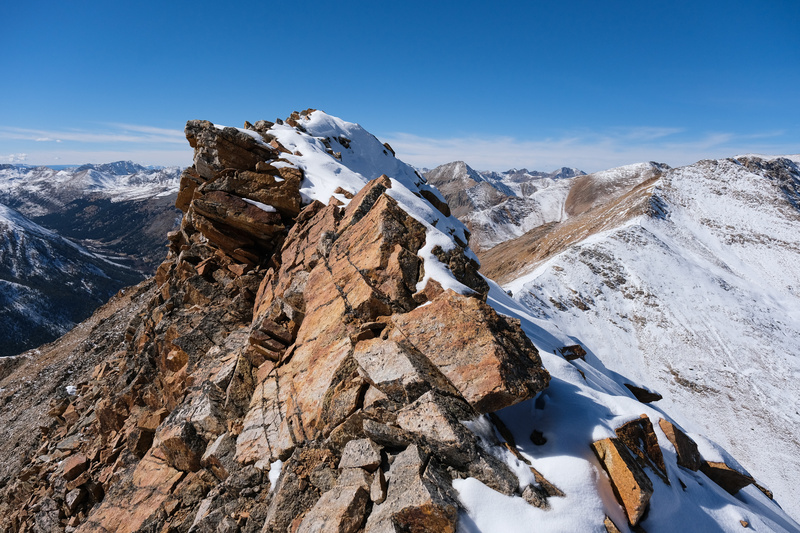
Bright orange rock.
A very different view looking at Blaurock than from just a few hours ago.
Looking back up the crux of the traverse, which was just dropping down from the top of Ervin's south ridge. Loosest blocks of the day.
Easy scrambling up to Blaurock's false summit.
Afternoon light from Blaurock was probably the best of the day.
I knew Blau had a false summit and was expecting it, but I wasn't expecting the view from it to show another point needing to either be skirted around or climbed over before reaching the true summit. These undulating Sawatch ridgelines can go on forever. But the weather was perfect. A few more downs and ups brought me to the top of Blaurock.
Willis Gulch with it's stack of lakes leading down to Twin Lakes.
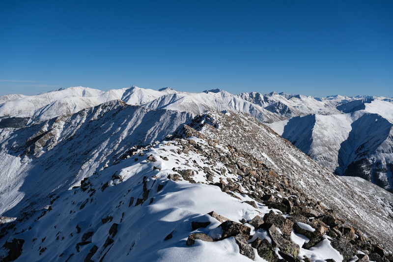
Sawatch ridges.
Collegiates.
Looking back at the long ridge leading to Blaurock's summit.
Silhouetted Elks forming a castle wall to the west.
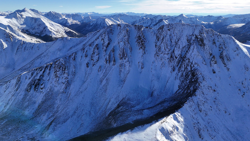
The drone flight from Blaurock's summit was even more scenic than from Ervin. Blau's north face caught my attention from Rinker a couple years ago with a couple of couloirs that punch all the way to the summit from below, and it was cool to see them from up close and directly after a winter storm.
Blaurock caked in snow.
Looking down one of Blau's couloirs.
The long ridge that is Mt. Blaurock.
With the sun now setting, I got sloppy on the exit. I'd been on the hike for about ten hours at this point and the terrain was pretty inconsequential if tedious to get back over the false summit before descending Blau's south ridge, parallel to the Ervin south ridge I'd ascended that morning. While scrambling back over it, a ledge I stepped onto collapsed under my weight, but I caught the fall with my left arm as I was using it for balance on some higher rocks to my left. It wasn't a big fall at all, but the angle of my arm and the surprise of the sudden shift of weight popped my left shoulder out of it's socket. It was only out a second as it popped right back in when I landed on the next ledge a few feet lower, but that one second was enough to change the whole character of this day.
I dislocated this same shoulder via a bigger fall at a Skate Park in 2022 (a long, embarrassing story..) and knew that dislocations there are now much easier after it happens the first time, but was still shocked at how minor a fall was needed to pull the joint out. The shock and pain from the event were enough to wake me up and get me refocused enough to finish the climb back up and over Blau's false summit with just my right arm before descending, very slowly and carefully, Blau's south ridge, doing everything I could to not use my left arm as it felt very weak and I didn't want to risk popping it out again.
Blau's false summit top in fading light. This kind of terrain is where I took the dislocating fall.
What should have been a pleasing victory lap down Blau's south ridge turned into a methodical and slow descent with a lot of shooting pain in my left arm whenever I moved it a particular way. The sunset was still beautiful enough for me to stop and take pictures with just my right arm though.
Blaurock's south ridge below the scrambly part.
Evening shadows on Huron and company.
A little bit of light on the Apostles before the sun slips away.
Virginia group under some wispy clouds.
Evening from treeline.
A much easier bushwack through some aspen groves at the base of the ridge brought the climbing part of the day to a close. I was so grateful I had moved the car up that morning and saved some tedious road mileage with a wounded appendage at the end of this day. Between the drone flights and slow descent, I set the slowest-known-time for this pair, clocking them in 13 hours, and making for the longest and most exhausting sub-six-mile hike I can remember. Strava showed 5.58 miles and and 4,655' of gain.
Needless to say, there was no follow-up hike of Emerald and Iowa the following day. After visiting with my doctor, we're taking a wait-and-see approach to the shoulder pain before deciding on further diagnostics to see if surgery is needed to repair the rotator cuff. I certainly won't be back to the hills in 2025.
The most interesting part of walking around in a sling the past several weeks was all the judgment by non-climbing society. It's amazing how hurting oneself at a skate-park elicits real sympathy but doing the same thing in a climbing fall gets that condescending smirk from so many people when they ask what happened and you tell them. There's a psychology thesis waiting to be researched somewhere in there..
Thumbnails for uploaded photos (click to open slideshow):
About shallow things. Mainstream or familiar activities elicit more sympathy, while niche or elite pursuits, like climbing, often provoke judgment or condescension. And there’s more judgment within the niches of climbing i.e., projectors vs. FA’s vs. boulders…. But back to injury with activity, social perceptions of injury are shaped not only by the harm itself but by the cultural status and perceived legitimacy of the activity. I got a lot of sympathy from my bike accident and a lot of judgement from falling head first off Jagged Peak in winter and zero sympathy. Both reactions cause anger. I don’t need or want sympathy, empathy or pity. That’s enough pontificating.
Your pictures are sweet! You did this with a drone?
I climbed Blaurock last winter because it was south facing and was hoping for warmth. Got what I wanted but then the clouds came and I froze on the descent. Went for Magdalene the next day since I didn’t dislocate my arm but it was so cold. Last year was a weird cold sleeper type winter. It seemed gentle at first but it almost always made me pay my penance. The penance you paid for these two peaks and not getting Emerald and Iowa seems unfair. Anecdotal observations suggest that injuries sustained in socially familiar or mainstream activities like a car accident
elicit sympathy and concern, whereas injuries from niche or elite pursuits (e.g., climbing) often provoke condescension.
I was at the doctors office recently and while waiting for my appointment I overheard another patient who had her arm in a sling lament about her broken humerus and the car accident that happened made me think one thing, I’m surrounded by morons. Hope this makes you laugh.
But, you got it done though! Stellar pictures. Looks like the 'Swatch' has more snow than it looked from Salida. All that class-2 with snow makes for good training (foot work). Nice work in getting these two done. And like Amy said, people are ALWAYS quick to hop on the band wagon to critique someone for doing a risky sport or hobby. But say nothing of [skating] or driving I-25 through the Tech Center mid-week at 5:00 pm. Don't let the turkey's get you down!! While "they're" at home watching this stuff on the news or in a movie, you're out there living it!Just remind yourself of that.
Keep up the good work, heal your shoulder and keep posting more!
Amy, I'm in awe of anyone even getting to the base of Jagged in winter. I have a hard time imagining any climber being judgmental about other climbers having misfortune in the hills, but perhaps I'm just not accomplished enough to have developed an ego or aura of invincibility out there. But for non-climbers, yeah, the judgment is real. I stopped trying to explain myself to "more rational" people years ago. Some people "get it." Most don't. I wondered aloud on my descent of this pair why I couldn't be satisfied with going golfing on the weekends.
Keifer, thanks for the love.
Caution: The information contained in this report may not be accurate and should not be the only resource used in preparation for your climb. Failure to have the necessary experience, physical conditioning, supplies or equipment can result in injury or death. 14ers.com and the author(s) of this report provide no warranties, either express or implied, that the information provided is accurate or reliable. By using the information provided, you agree to indemnify and hold harmless 14ers.com and the report author(s) with respect to any claims and demands against them, including any attorney fees and expenses. Please read the 14ers.com Safety and Disclaimer pages for more information.
Copyright: Route information, text, risk factors, maps, GPX files, charts, photos, 14ers.com-created map imagery, flythroughs, and other content provided in this route description are copyrighted by 14ers.com and may not be copied, reproduced, republished, distributed, modified, or used to create derivative works without prior written permission.
Please respect private property: 14ers.com supports the rights of private landowners to determine how and by whom their land will be used. In Colorado, it is your responsibility to determine if land is private and to obtain the appropriate permission before entering the property.