Log In 
Report Type 
Mini
Peak(s)  "Black Mountain"  -  13,197 feet
Date Posted  11/09/2025
Date Climbed   11/09/2025
Author  ProfetaP
 Short & Sweet   

Starting at Loveland Pass

Miles 7.28

Elevation Gain: 4,452

Moving time: 4 hours

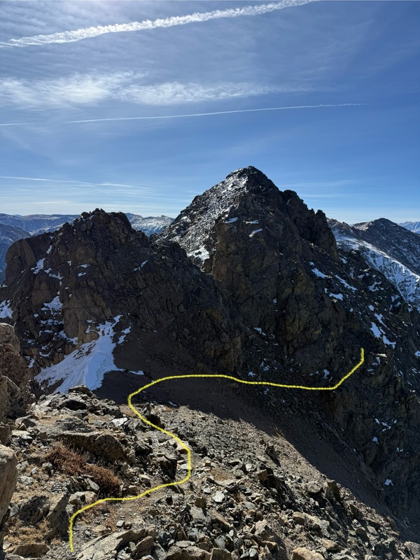
This report is intended to assist you with route finding on Black Mountain. That being said, there will be very few words, and hopefully the photos help you scramble this ridge and summit a fun mountain.

Personally, the mountain seemed class 3 with maybe one or two class 4 moves - however, you could easily add some spice and make this harder if you wanted to. If you don't want to, I felt that route finding was not too difficult, and you could easily keep it class 3/easy 4. On the ridge, I got cliffed out once (super easy to back track a few feet), and then dropped too low on the way back (easy to tell because the rock quality turns bad pretty quickly).

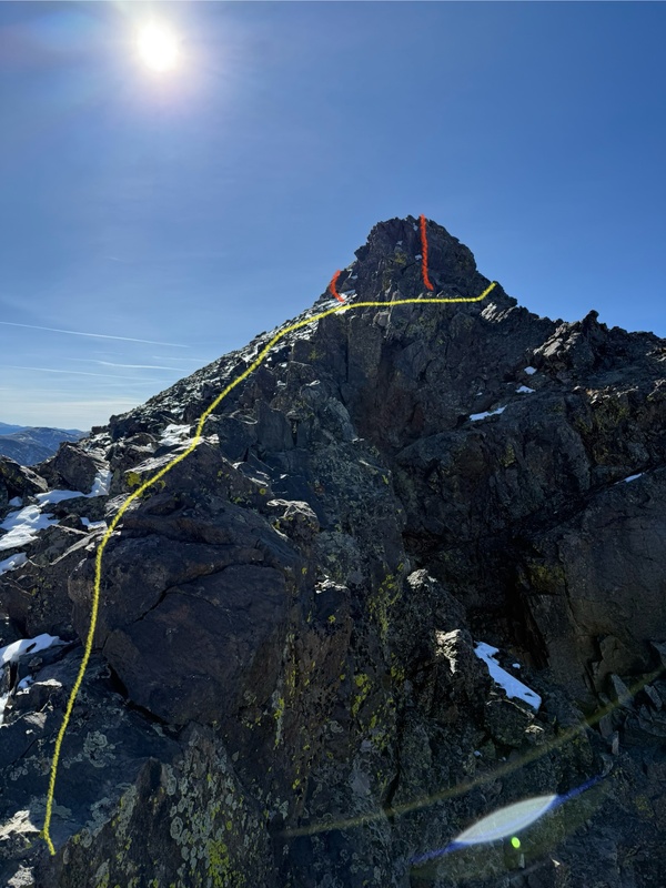
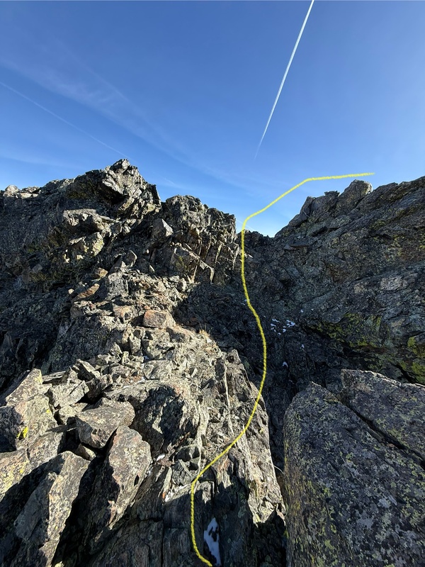
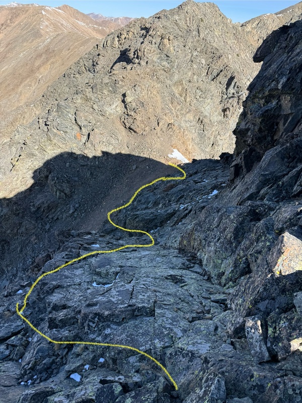
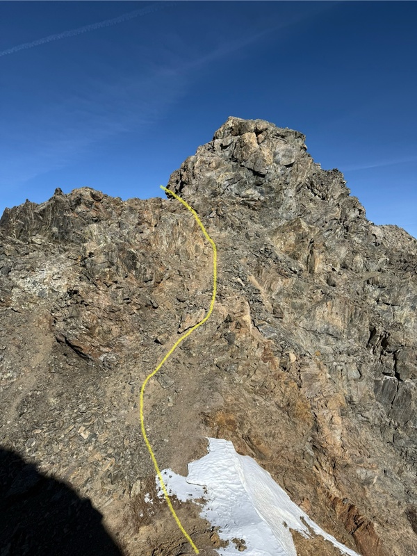
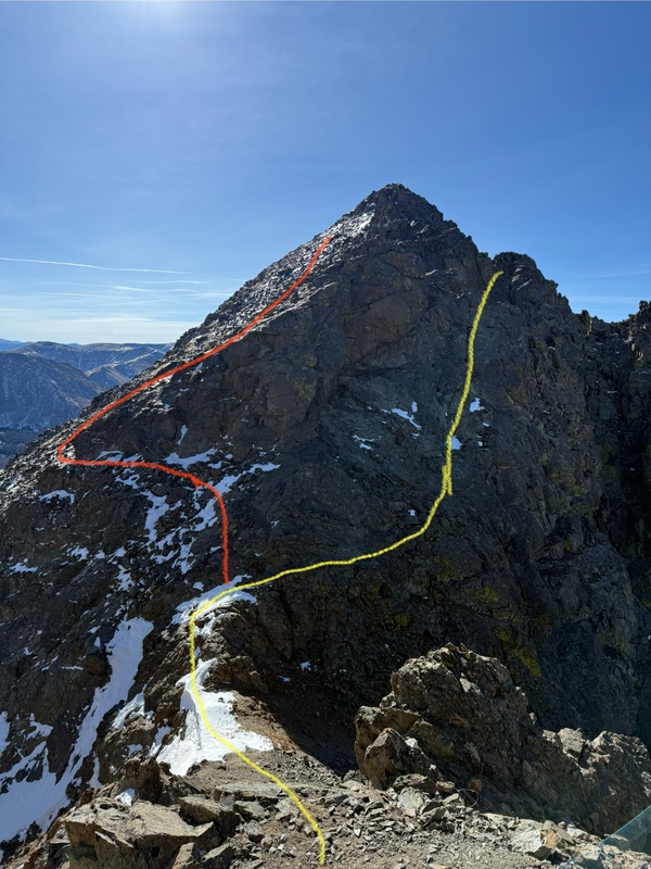
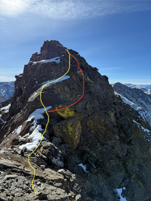
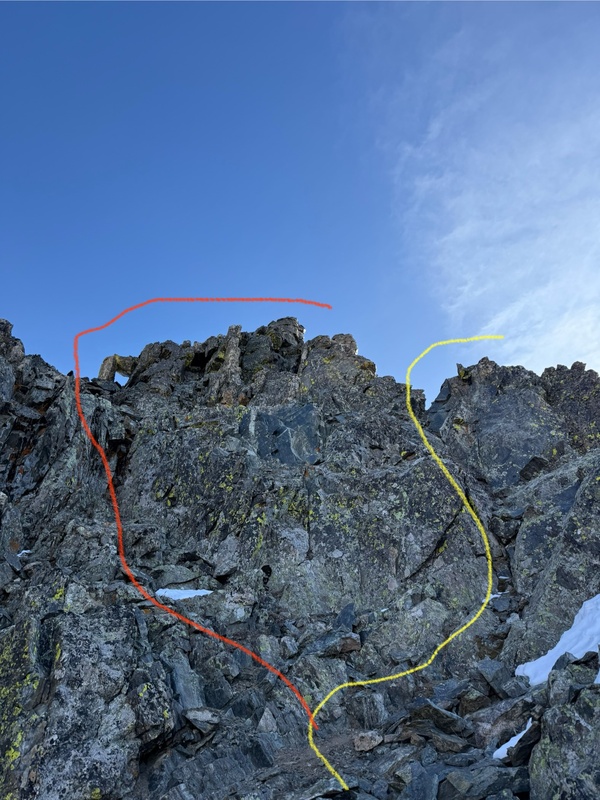
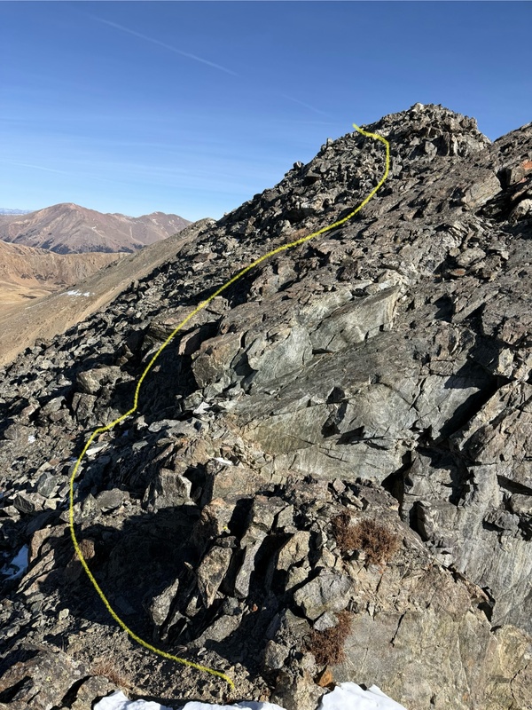
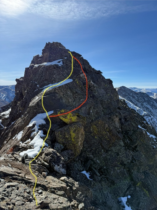
The yellow line is the route I took up, and the red line is something I tried on the way down, or thought the line would go pretty easily (I'm about 90% confident in my drawing skills - I drew them when I got home... but, next time I will draw them right after taking the photo.

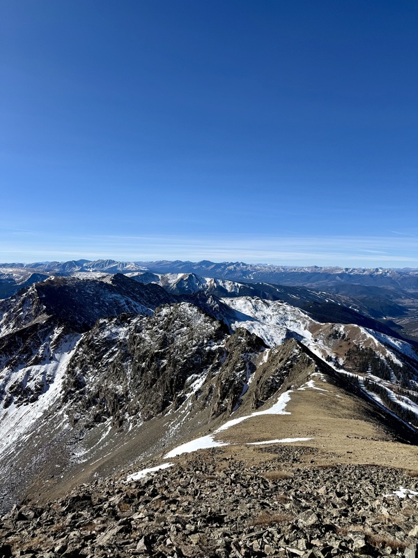
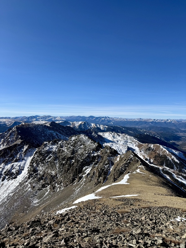
View of the ridge. Quite picturesque - looks worse than it is.
23340_14

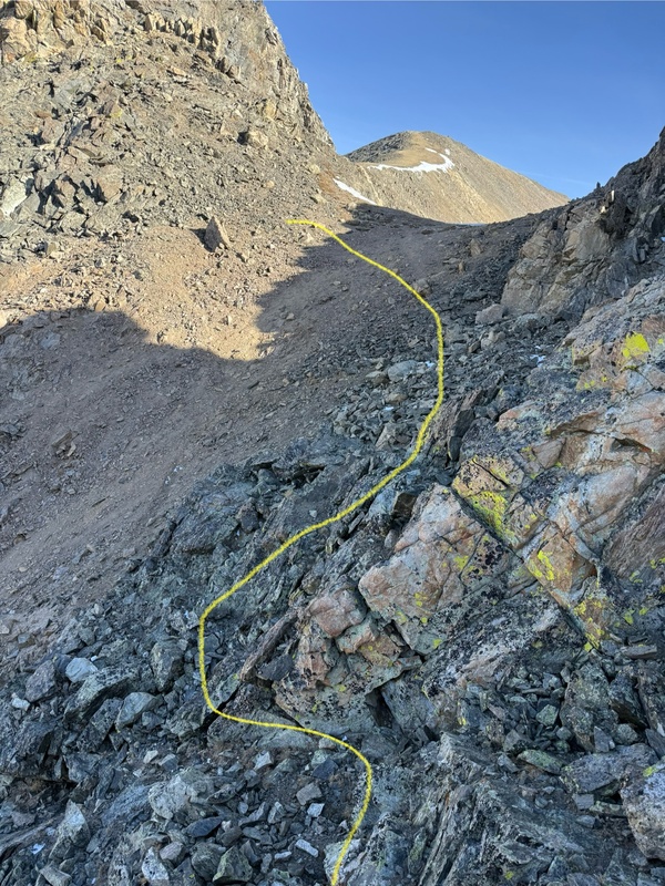
I didn't get photos of the very beginning... If you cannot make it to the photo below by yourself, you shouldn't be on this ridge.
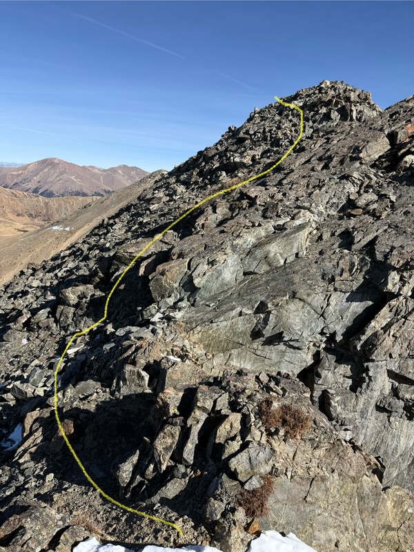
23340_15

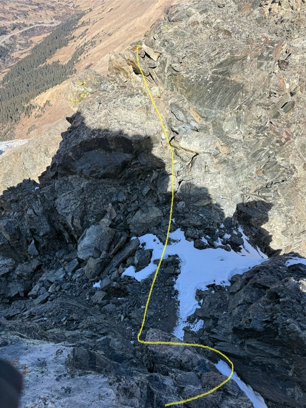
My first (and last) cliff out below... Stay lower and to the right
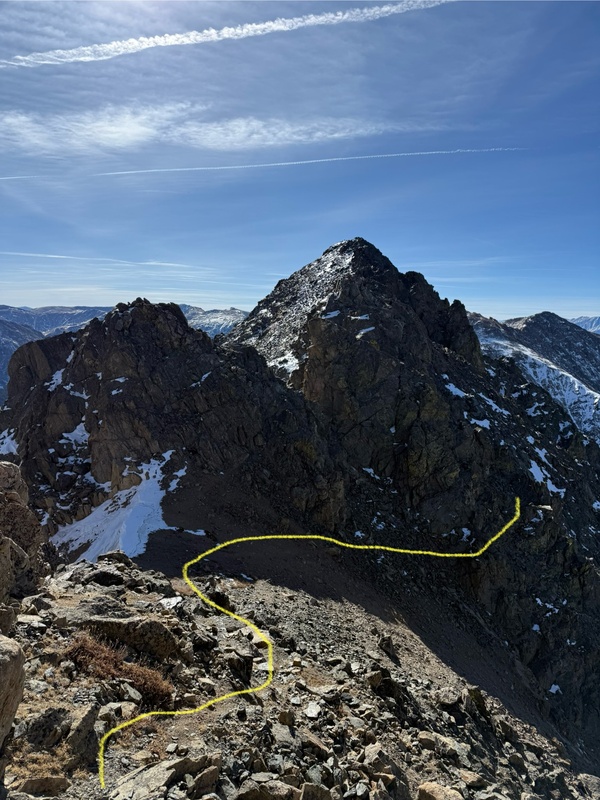
23340_13

Looking back at the notch you just dropped into (cool shot of Grizzly)
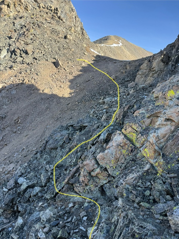
23340_12

Once you wrap around and head left towards the ridge, you can take either of the two lines (whatever looks more fun to you)
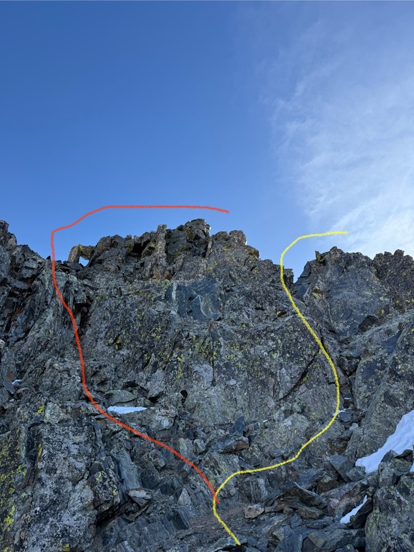
23340_11

Drop down into another little notch and straight up and over. I think the picture makes it look scarier than it is - see the next photos for reference
23340_10

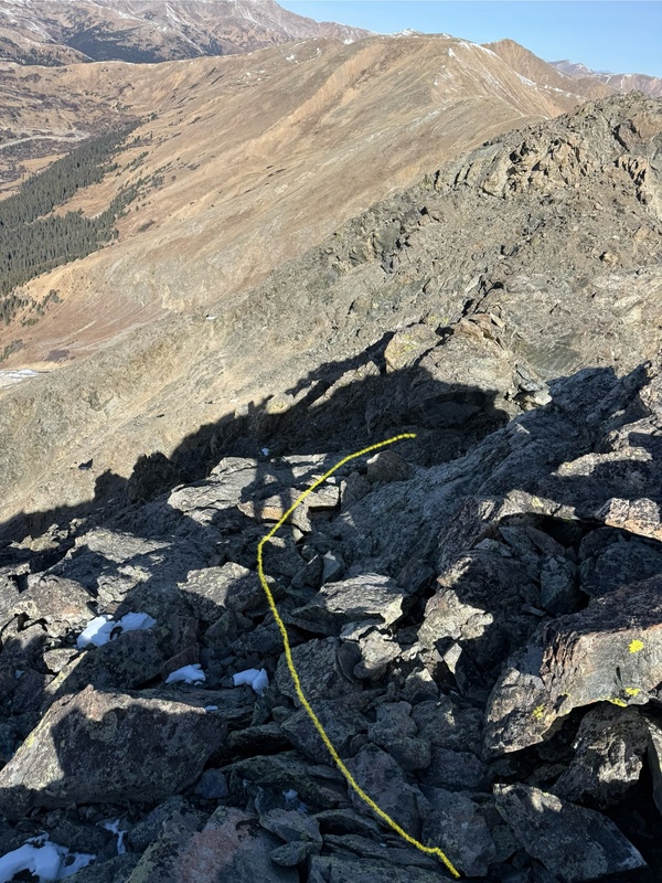
I didn't feel the need to face the rock going down. But look back at where you came from.
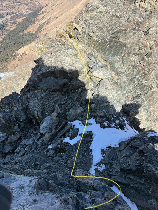
23340_09

After the little climb up, you come around this little corner (it is looking back where you came from)
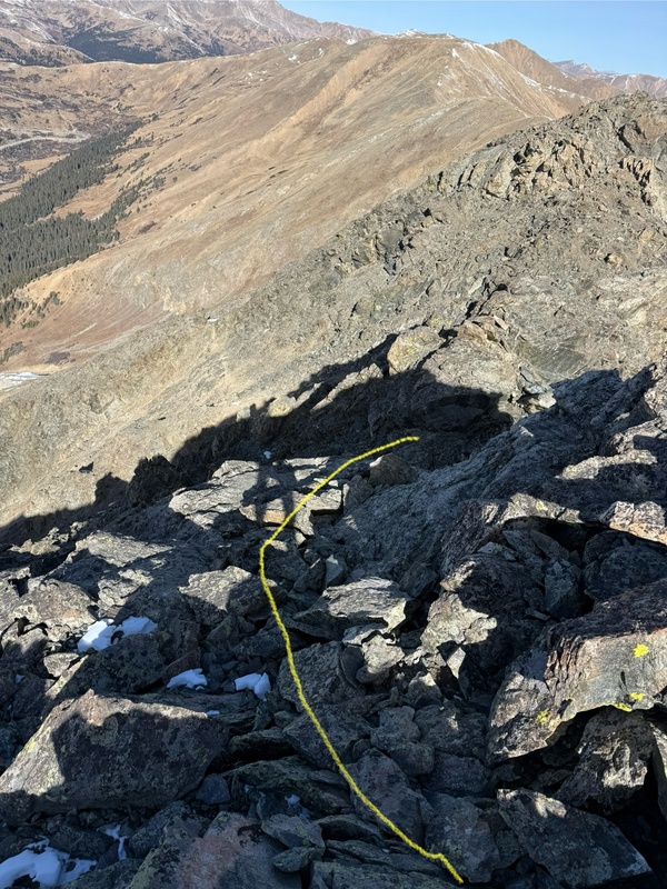
23340_08

After getting back onto the ridge, look to your right, and you will see a little gully - Climb down this a few feet and then go left. (Gully is class 3/4)
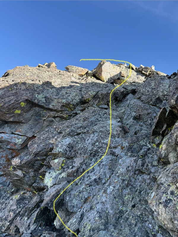
23340_07

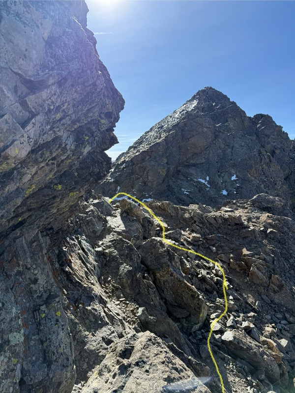
Below is where you take a left, drop down into the notch, and the last scramble to the summit awaits.
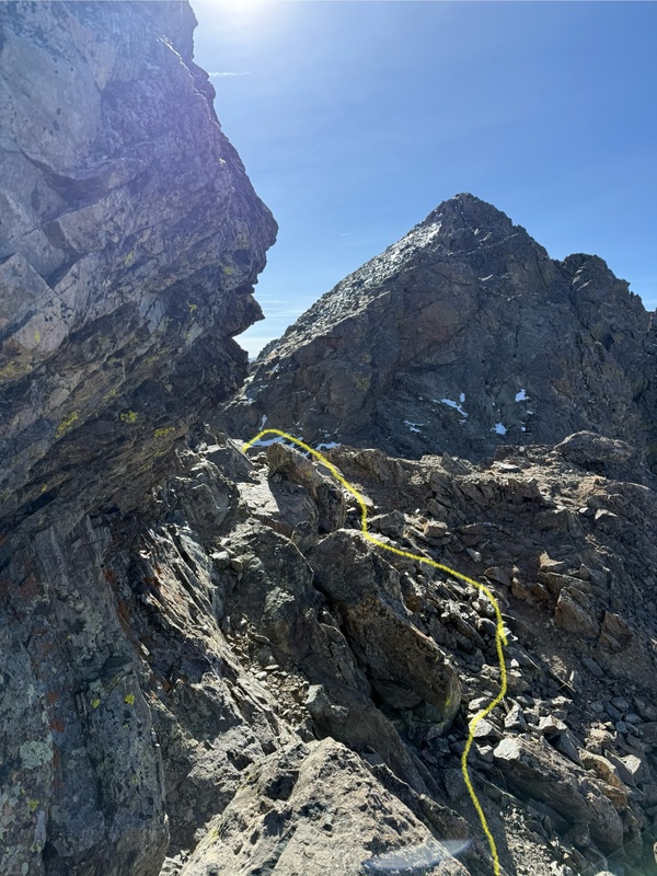
23340_06

Looking back at the route that took you into the notch.
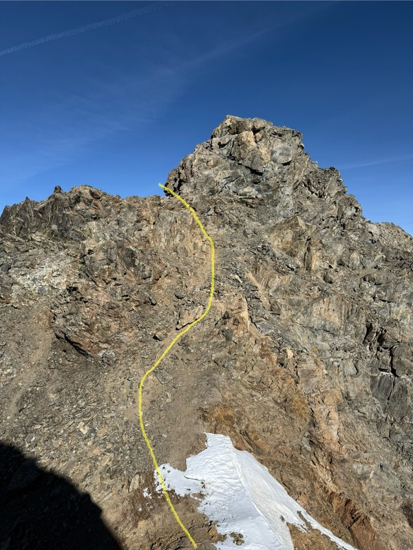
23340_04'

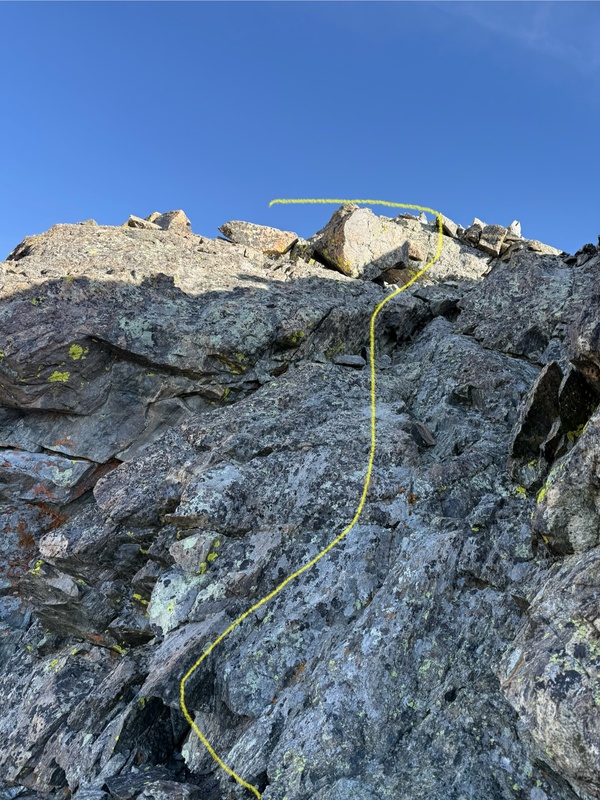
So, the yellow takes you up some class 3 slab (I took this line. The red, I did not try, but looked like an easier route)
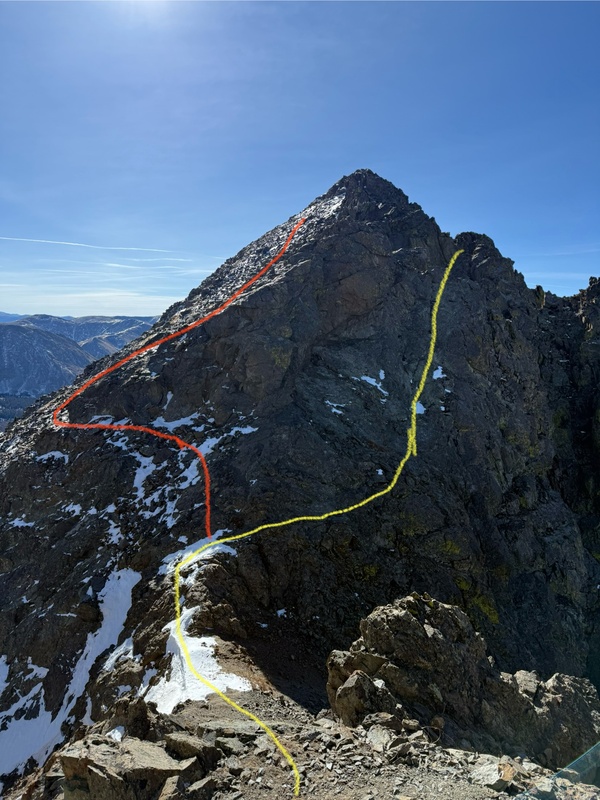
23340_05

Looking back at the notch, and an idea of the slabby rock you will be going up/down.
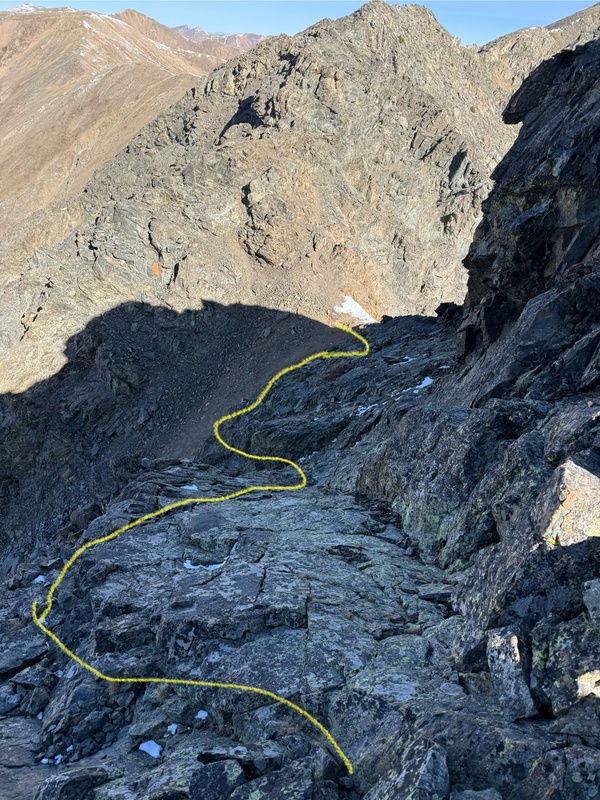
23340_03

Turn left at the top of the slab and jump back on the ridge.
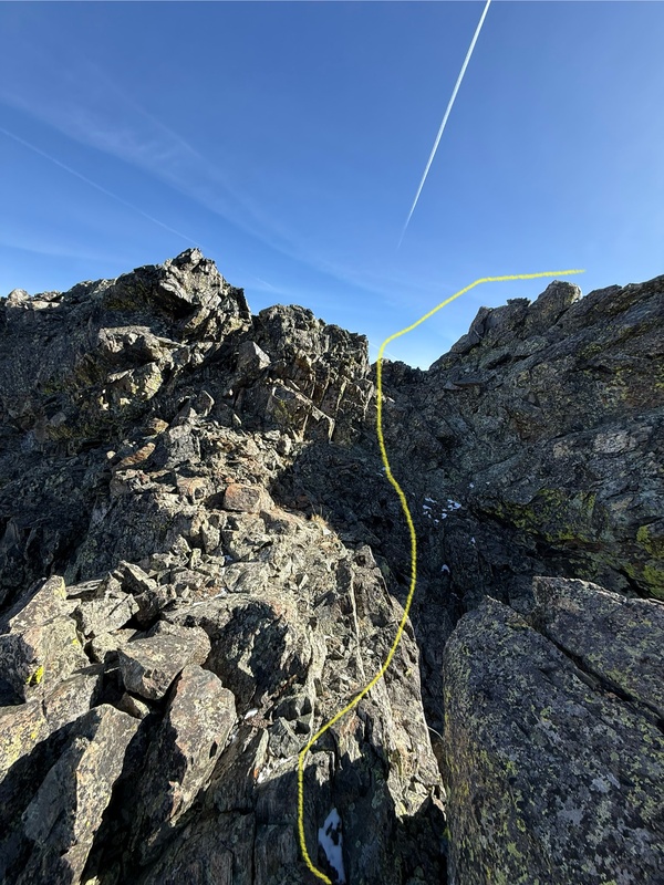
23340_02

Back on the ridge, and you can see the remainder of the route. Going up, I took the yellow line, and on the way down, I went straight over. The red line to the left looked like the easier option.
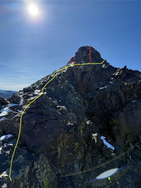
23340_01


GPS Track(s) on Google Maps (made from a .GPX file upload):


Thumbnails for uploaded photos (click to open slideshow):
1 2 3 4 5 6 7 8 9 10 11 12 13 14 15


Comments or Questions
davebks
User
worth it?
11/13/2025 6:42pm
I was looking for something fun to do on saturday. Would you suggest this peak? Looks like fun... Did you need spikes at all? I am guessing its a no on crampons...


ProfetaP
User
Maybe...
11/14/2025 12:56pm
Always having fun when you are climbing a mountain! But, I think it depends.. Getting to the TH is super easy, being Loveland pass, and the total round trip is pretty short. That being said, I am not 100% confident the juice is worth the squeeze as you have to bag Cupid/Grizzly to reach the peak (unless you go the a-basin traverse). Nothing wrong with re-bagging those peaks, they are just not very eventful or secluded. Now, you will find seclusion on Black Mtn with some good scrambling, but it is very short-lived. Ridge scrambling is my favorite, and I did enjoy this one, but I personally would choose a mountain where the scrambling lasts longer (ex: Pacific, Dyer, Father Dyer, Helen to Father Dyer)

Crampons were not needed, and I did not wear spikes. Spikes could have helped a little coming down Grizzly if you stick to the trail, but it can be avoided


   Not registered?


Caution: The information contained in this report may not be accurate and should not be the only resource used in preparation for your climb. Failure to have the necessary experience, physical conditioning, supplies or equipment can result in injury or death. 14ers.com and the author(s) of this report provide no warranties, either express or implied, that the information provided is accurate or reliable. By using the information provided, you agree to indemnify and hold harmless 14ers.com and the report author(s) with respect to any claims and demands against them, including any attorney fees and expenses. Please read the 14ers.com Safety and Disclaimer pages for more information.

Copyright: Route information, text, risk factors, maps, GPX files, charts, photos, 14ers.com-created map imagery, flythroughs, and other content provided in this route description are copyrighted by 14ers.com and may not be copied, reproduced, republished, distributed, modified, or used to create derivative works without prior written permission.

Please respect private property: 14ers.com supports the rights of private landowners to determine how and by whom their land will be used. In Colorado, it is your responsibility to determine if land is private and to obtain the appropriate permission before entering the property.