| Report Type | Full |
| Peak(s) |
Mt. Massive - 14,427 feet South Massive - 14,157 feet "South South Massive" - 13,637 feet |
| Date Posted | 11/09/2025 |
| Date Climbed | 07/01/2025 |
| Author | BigNick21 |
| Mt. Massive - Southeast Ridge |
|---|
|
Mt. Massive SE Ridge -> East Slopes
Hello everyone! This is my first stab at a trip report, so bear with me. Ever since I had gotten my hands on Gerry Roach's book I had my eyes set on this route, and this past summer I finally had the opportunity to climb it. Being from Minnesota this was much more intense than anything I have at home. My Dad and I got up around 4:00 am and left the VRBO that we were staying at in Leadville. It was just beginning to become light enough to see without a headlamp when we set off from the trailhead. We hiked a mile up the Colorado Trail before leaving the trail to the west (hikers left). Around a mile of wooded ridge stood between us and tree line, and I was pleasantly surprised to find that the forest was not excessively dense; the hiking up the gentle ridge was relatively unobstructed and easy. A few gaps in the trees provided spectacular views of Mt. Elbert, which me and my family had climbed two days prior. 
After a mile of off trail hiking, we popped out of the trees and I decided it was time to put some sunscreen on. I heard the thunder of hooves and I looked down to see an elk bounding toward me. It stopped around 60 ft. away from me and just stood there watching me. After a few seconds it turned and started bouncing off back into the trees. 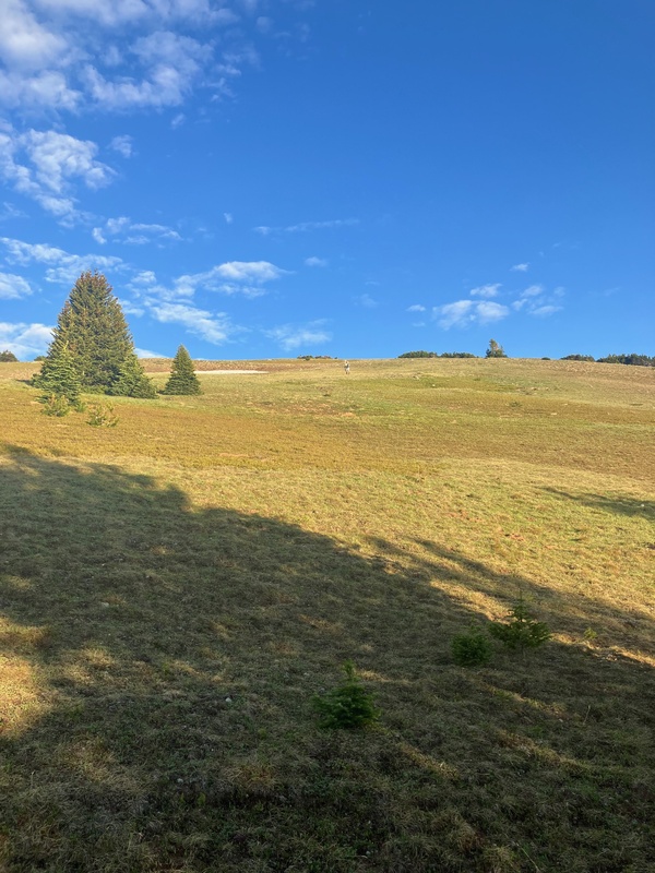
We ended up skirting the summit of Pt. 12,381, and before long the 1,400 foot climb up the SE face of South South Massive came into view 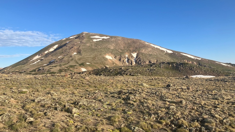
On the way down to the saddle there are a few rocky outcroppings that are easy to navigate around. 
The route we took took followed the grassy, more gentle slope to the right, and then switch back to the left to stick the grass and dodge the snow. The route is quite straightforward, just pick whatever you find easiest. 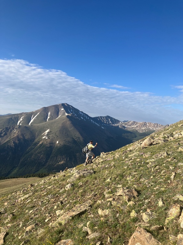
We took a few breaks on the climb of SSM; it was certainly a beautiful place to soak in the views. 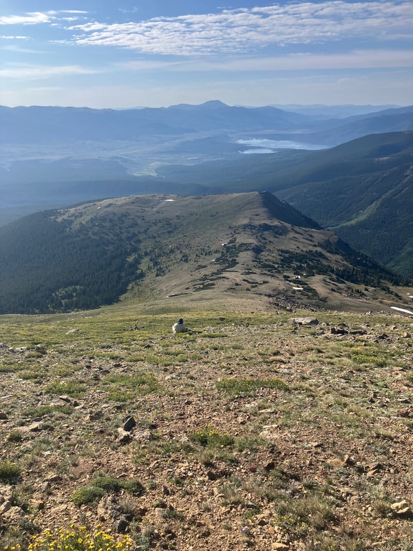
Finally we emerged from the shadow of SSM and we stood upon its broad summit. The ridge up to South Massive finally came into view. I was not expecting it to look as rugged as it did, but I trusted that it would stay class 2. I would say that there was one part of a cliff band that we climbed through that would be rated easy class 3, but even with my limited experience with exposure (thanks Minnesota) I was still able to handle it. 
The route followed the ridge down to the saddle between SSM and South Massive and eventually made its way to the gap in the snow below the cliff band. Right above the gap in the snow there was a nice ramp that led up into a cliff band and then up to a relatively narrow ridge. While descending off of SSM we saw an Elk that was around 13.5K and watched it bound all the way down into the basin and get lost among the trees. It was certainly not the place I was expecting to see and Elk. 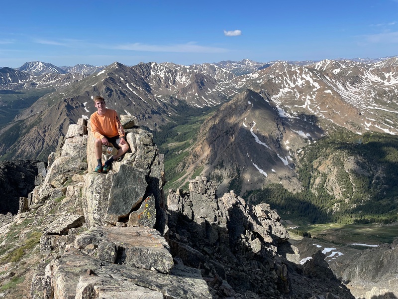
There was a little notch where you could cross over the ridge to find easier terrain on the west side. After this there was the crux of the route: an easy class 3 chimney to reach easier terrain. 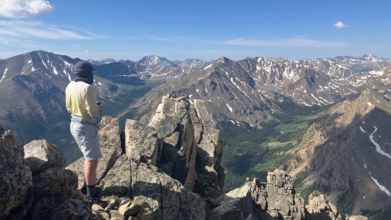
Above the crux we cracked the 14,000 foot mark for the first time of the day. After a short class 2 walk we stood on the summit of South Massive. 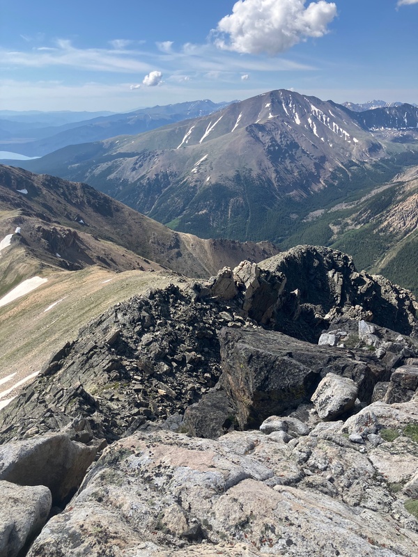

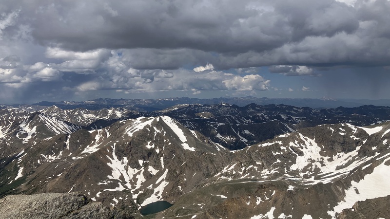
Amazingly we hadn't seen any other people since the moment we left the trail, but once we descended to the South Massive - Mt. Massive Saddle and got back onto the main Mt. Massive trail we started to see the traditional 14er deluge of hikers. It was nice to have a well established trail again, and after a short break for lunch we continued up the ridge and made it to the summit of Mt. Massive at 11:06 A.M. We didn't hang around very long because we could see a storm brewing to the west. 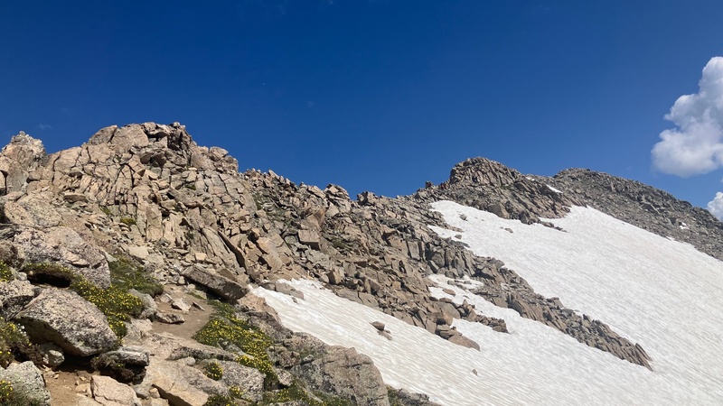
On the way down we alternated between speed hiking and running until we got back to the CO trail junction to try and minimize any time spent in the incoming storm. 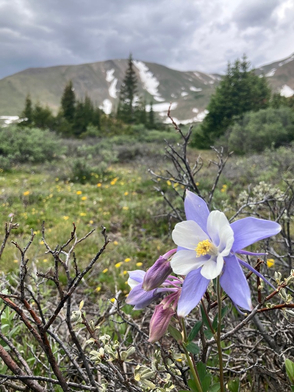
Once back into the trees we stopped running and settled into a nice consistent pace (around 17:30 per mile). We felt the first couple raindrops a quarter mile from the trailhead, and were very happy that we had ran when we did. 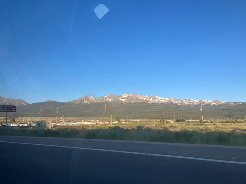
This was my fist foray into and off-trail 14er route, and I was very impressed with how beautiful and rewarding it was. I loved the amount of solitude that we got vs. what we would have gotten on the standard route. This route was an exceptional warmup for the big day I had planned on Mt. of the Holy Cross a few days later. I would recommend this route if you are confident with your off trail navigation, and have exceptional fitness. For reference, I run Cross Country in high school, and do lots of hiking around my home, so I would describe myself to be in good shape. Be prepared for a long day above tree line, so only attempt this route if you have a good weather window. Above all, be smart, because ultimately you are responsible for yourself in the mountains. I thank you for reading this and I hope that you gained some valuable information if you want to climb this route yourself. Thumbnails for uploaded photos (click to open slideshow): ")
 Looking up the slopes of Pt. 12,381")
 SE face of South South Massive from near the summit of Pt. 12,381")
 Looking up the face")
 My Dad climbing South South Massive with Elbert watching on.")
 Looking down from near the summit of SSM")
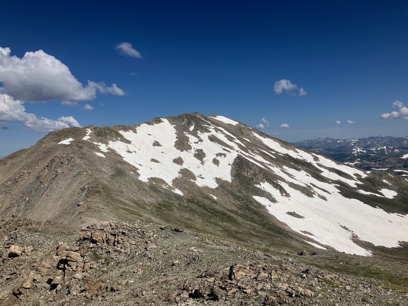
 South Massive and Mt. Massive from the summit of SSM")
 Me on the narrowest part of the ridge leading to South Massive")
 My Dad standing in the notch")
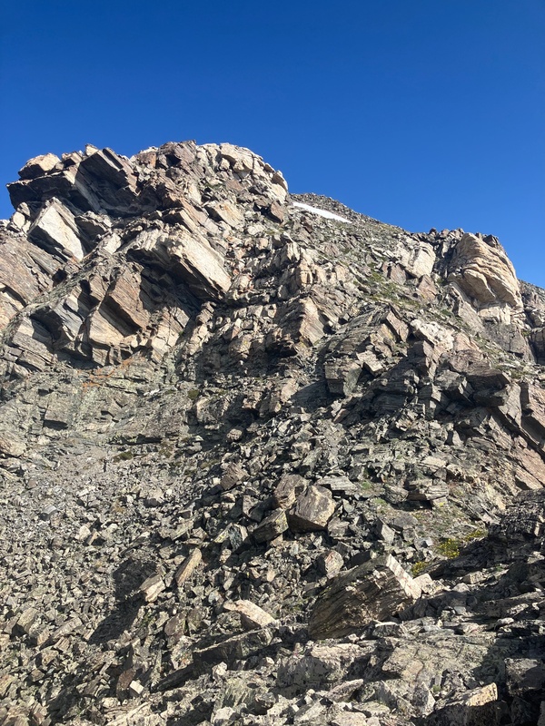
 Looking up at the crux of the route")
 Looking back on the ridge leading to South Massive")
 Looking SE from the summit of South Massive")
 Looking at the remaining route to Mt. Massive")
 Summit Ridge on Massive")
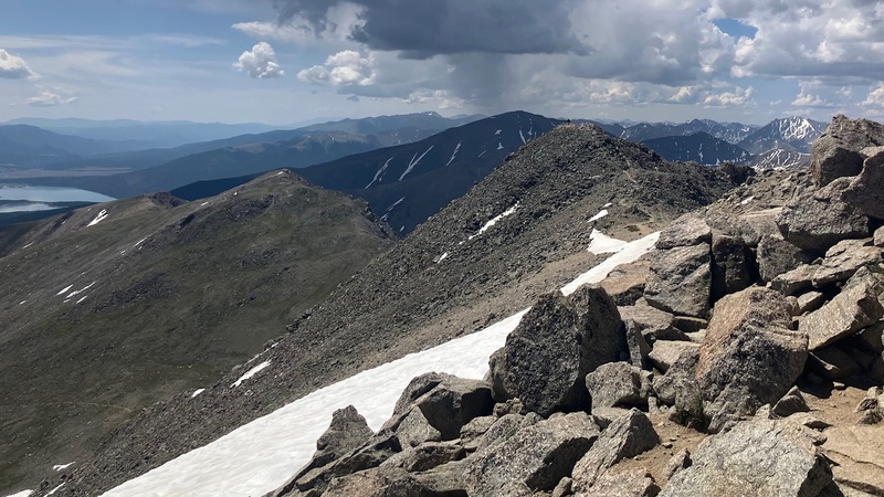
 Looking down the SE ridge of Mt. Massive. SSM and South Massive are visible.")
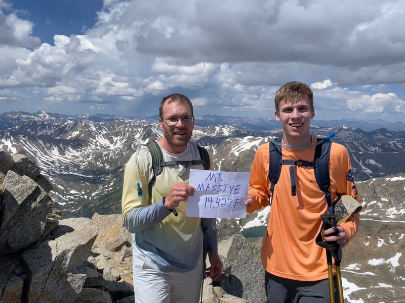
 Me and My dad on the Summit of Mount Massive!")
 Columbine with SSM in the backgound")
 Picture of our route taken from the car the following day")
 Looking out over the Sawatch and Elk Ranges")
|
| Comments or Questions |
|---|
|
|
Caution: The information contained in this report may not be accurate and should not be the only resource used in preparation for your climb. Failure to have the necessary experience, physical conditioning, supplies or equipment can result in injury or death. 14ers.com and the author(s) of this report provide no warranties, either express or implied, that the information provided is accurate or reliable. By using the information provided, you agree to indemnify and hold harmless 14ers.com and the report author(s) with respect to any claims and demands against them, including any attorney fees and expenses. Please read the 14ers.com Safety and Disclaimer pages for more information.
Please respect private property: 14ers.com supports the rights of private landowners to determine how and by whom their land will be used. In Colorado, it is your responsibility to determine if land is private and to obtain the appropriate permission before entering the property.

