| Report Type | Full |
| Peak(s) |
Mt. Massive - 14,427 feet Mt. Oklahoma - 13,843 feet Deer Mountain - 13,763 feet Unnamed 13738 - 13,738 feet Mt. Champion - 13,645 feet Casco Peak - 13,905 feet Bull Hill - 13,758 feet "Massive Green" - 14,311 feet "North Massive" - 14,337 feet |
| Date Posted | 09/27/2025 |
| Date Climbed | 09/25/2025 |
| Author | Shuaby |
| Halfmoon Traverse (Massive - Elbert) |
|---|
|
A Mere Mortal Attempts the "Halfmoon Traverse" Some stats for the day: 27.17 miles, 11,286 vertical, 18 hours and 18 minutes, average elevation of 12,877ft. A short disclaimer: This is my first trip report, so hopefully it doesn't suck. This report isn't of much use if you are looking for beta on this ridgeline. I outline my experience on the route but won't be covering many actual details of the difficulties. The gpx file is too big to upload here. If you want to view the route you can check out my strava here. In February I came across a blog post by Justin Simoni which detailed a truly inspiring outing: traversing the entire ridge connecting Mt Elbert and Mt Massive. While looking into the route more I found a similar trip report on stavislost.com, who I was also very familiar with. I was immediately persuaded and within days I was meticulously planning the route. Knowing that both Stav and Justin are endurance monsters, I began to wonder if this was even feasible for me to do. Justin holds some absolutely insane fkts and Stav has summited over 2500 peaks across America in just 11 years! I was just an amateur and it had only been 8 months since my very first summit (Fall Mountain). My goal was to train my endurance as much as possible and hope that by the time September came, I would be ready. Side note: If you haven't checked out stavislost.com or justinsimoni.com I highly recommend giving them a look. Both Justin and Stav are super impressive and there are endless awesome route to read about. Fast forward 7 months and it was already nearing the end of September. The weather was starting to deteriorate, and I had not found the time to take my shot at the traverse. “Oh well, I’ll have a go next year” I thought. I didn’t want to try to attempt a choss-fest of a ridgeline with snowy conditions. That is until one morning I woke up and suddenly the motivation I had felt in February surged through my veins again. Within 2 days I was driving down towards Leadville to set up camp and attempt the traverse. I decided to go from Massive to Elbert in order to tackle the harder scrambling early on when I was fresh. I also elected to avoid the west ridge of Frasco as it sounded horribly difficult and bypassed the only possible water source on the route.I awoke the next day at 2:30 and was on the trail by 3:00. After getting past the tree line, it began to get bitterly cold. Luckily my pack was filled to the brim with as many warm layers as it could carry. I made it to the summit of Mount Massive for a romantic sunrise with a view of Leadville in the distance. 

However, there was no time to rest. I had a long day ahead of me, so I pushed on after a couple minutes of watching the sunrise. Heading over towards North Massive, I got my first glimpse of the rest of the route. From what I could see, it looked disheartening. Much of the north and west aspects appeared to be snow covered and I was worried about the practicality of traversing the entire ridge in a timely manner. Nonetheless, I continued along the ridge. Areas of consolidated snow required some class 4 moves on the traverse to Northwest Massive. The beta I had read up on turned out to be not so helpful as the snow got final say in what I could do. 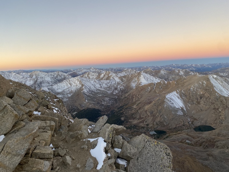
The first half of the traverse to Mount Oklahoma was delightful scrambling on relatively solid rock. The ascent up to Oklahoma turned out to be a nightmare. Ridge proper consists of sloping slabs that go at class 2, but they had become too icy to safely manage. I was forced onto the west face, where I had to navigate a snow-covered talus field. Each step I either had to dig around in the snow and feel for a foothold or step onto an uncovered rock and pray it wasn’t loose. Given that this is the Sawatch, most of the uncovered rocks were indeed loose. I soon found myself on the summit of Oklahoma, 6 hours in. Despite the conditions, my pace was where it should be. 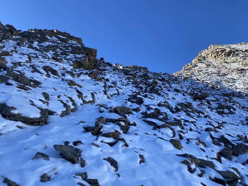
After a short break, I pushed on towards Deer Mountain. The north ridge of Deer was a simple walk up a steep snow slope. Not necessarily fun, but not too difficult. After a few class 3 moves I found myself on a sub-summit. Once again, icy conditions forced me off ridge proper and I had to attempt to cross a snow covered talus field. This last bit up to Deer Mountain turned out to be the crux of my whole day. Each step required me to fully submerge my foot in snow while clinging to freezing rocks with my bare hands. My shoes became filled with snow, and my hands grew increasingly cold. The slope was steep, but it felt right at the edge of my comfort zone. After 20 minutes of this nonsense, I stumbled to the top of Deer Mountain, out of breath with soaking wet socks. I began to scope out the rest of the route while allowing my socks to dry. 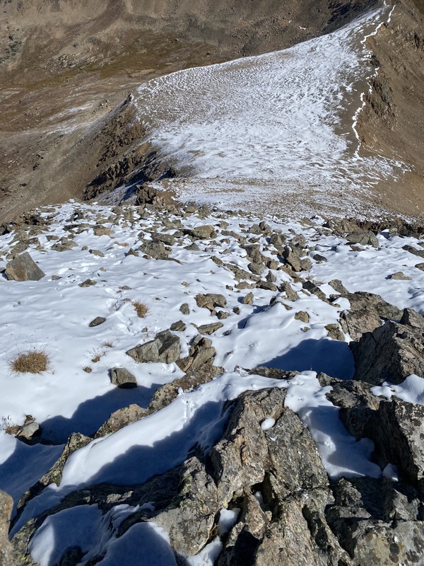
Luckily, the conditions began to improve. The snow was still present but easily avoidable. The route from Deer to Mount Champion was mainly filled with delightful, yet loose, class 2 scrambling. I soon found myself enjoying a nice lunch at a small lake Southwest of Frasco Peak. I was 12 hours into the day at this point, and I felt great. My energy level had remained high, and my legs hardly felt tired. I was feeling rather impressed with the physical state that I had achieved. Nine thousand feet of vertical and my legs felt fine! 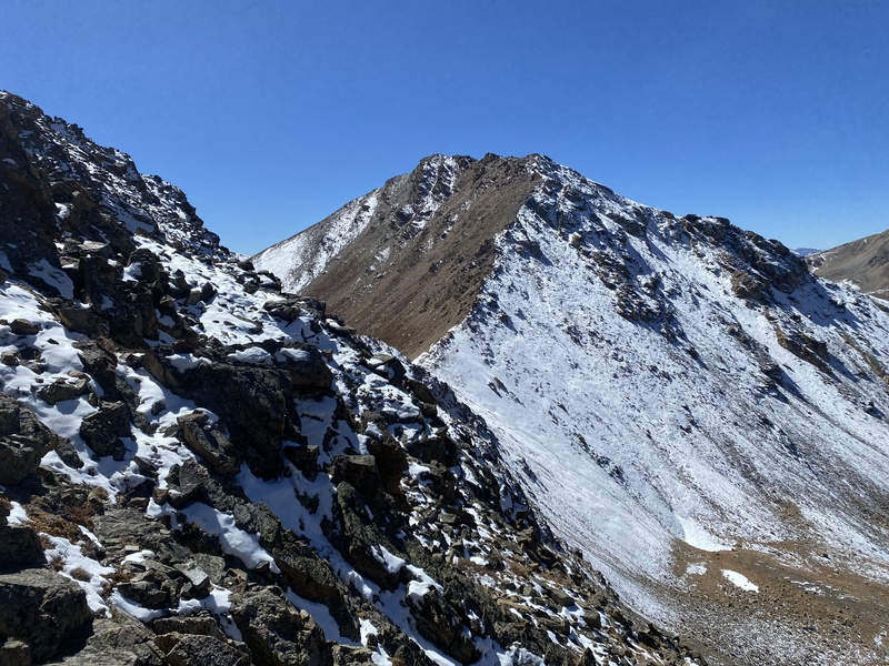
My spirits were soon crushed by a god-awful ascent to regain the ridge north of Casco Peak. The steep slope combined with the mixture of loose dirt and scree quickly reminded me how much I still had ahead of me. I felt the fatigue start to hit me on the way up Casco peak as I began to make some minor route-finding errors. I kept finding myself on unnecessarily hard scrambling and had to make a series of short backtracks, losing some time. I didn’t bother stopping at Casco peak as I still had a long way to go and only a few hours until sunset. 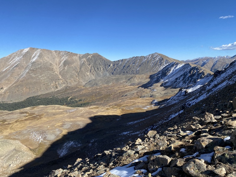
On the walk over towards Bull Hill I began to feel worse physically. It felt as though I was dehydrated but my capillary refill time was at a normal range, so I decided to push on. As I began the final 700-foot ascent to Bull Hill madness descended upon me. I began to suffer from some considerable heart palpitations and made the decision to turn around and bail down the nearby valley. My deteriorating physical and mental state was worrisome and I questioned the safety of ascending to higher elevation. I enjoyed a sunset on top of Bull hill while reflecting on the day. I thought back to when I first dreamt up the traverse and laughed at the naivete I held. I assumed that if I trained my legs to handle this much hiking, I could certainly pull this off. In the end my legs were well prepared for this hike, but sometimes things just don’t go the way you want. As I trudged through willows to the road back to my camp, I felt nothing but joy. I had not finished the ridge, but I had done an absolutely amazing job and had fun almost the entire day. 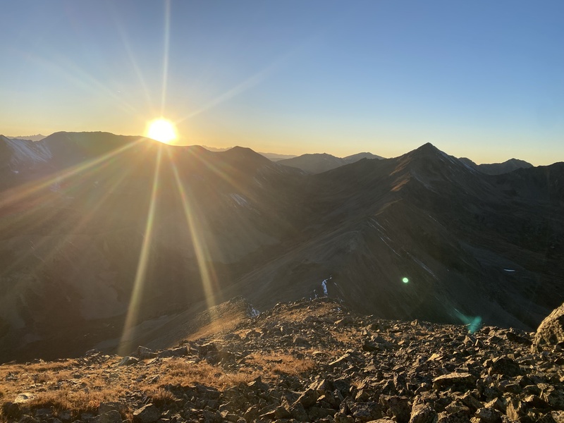
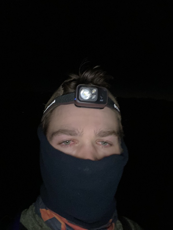
This day was a good reminder that a peak is just some place on a map. I love going after mountains because I love experiencing nature and all it has to offer. At the end of the day, I got to spend 18 hours in the mountains, and I call that a win. Thumbnails for uploaded photos (click to open slideshow):  Finally learned how to take a selfie with a headlamp on. Exciting times!")
 The sun begins to crest over the mosquito range")
 Pretty cold to say the least. Luckily I was prepared")
 Moments like this always bring out the childlike wonder in me")
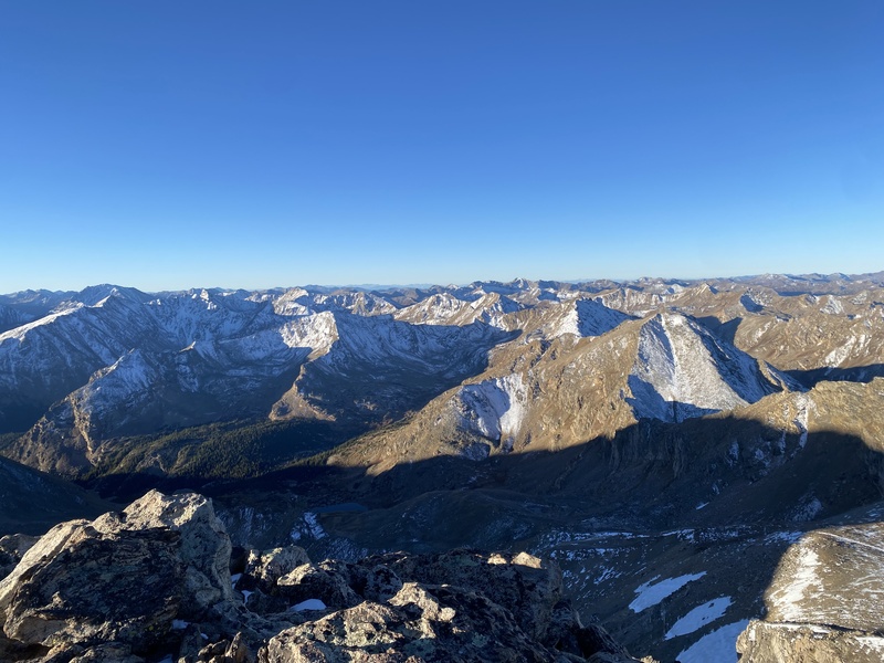
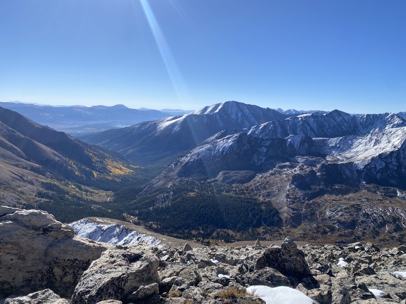
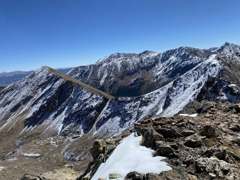
 My first view of the remaining route.")
 Snow conditions look questionable.")
 On the ascent to Mount Oklahoma.")
 A view of Mount Elbert from the top of Oklahoma.")
 The north ridge approach to Deer Mountain.")
 Crossing this snowfield turned out to be the crux of my day.")
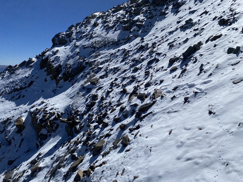
 More slogging through snow to obtain the summit of Deer Mountain.")
 A view of K49 from Deer Mountain.")
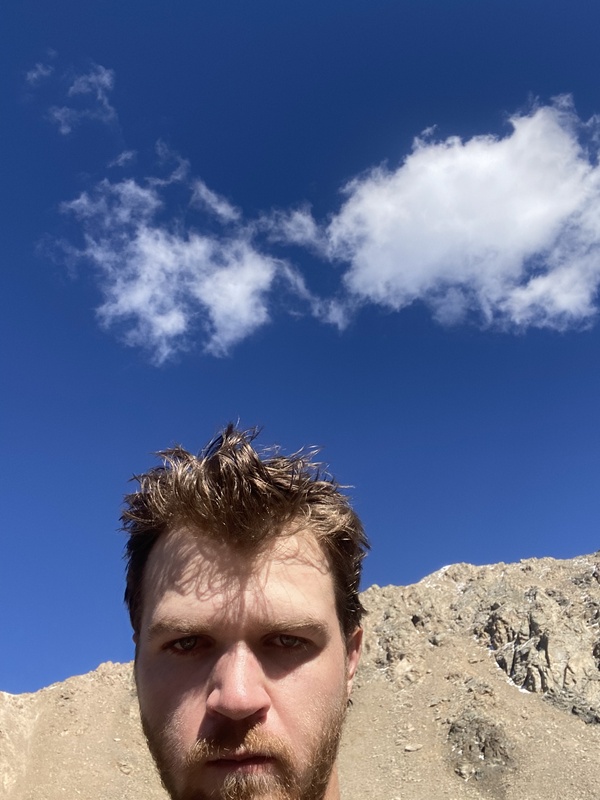
 A divorced dad selfie for the fun of it.")
 The view of my remaining route from the saddle north of Casco.")
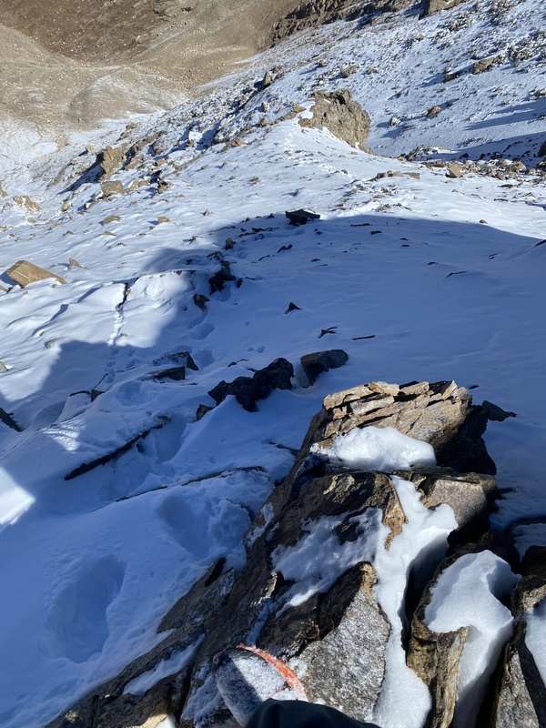
 Looking south on the ridge between Deer Mountain and Peak 13738")
 The sun setting as I sit on Bull Hill.")
|
| Comments or Questions | |||
|---|---|---|---|
|
Caution: The information contained in this report may not be accurate and should not be the only resource used in preparation for your climb. Failure to have the necessary experience, physical conditioning, supplies or equipment can result in injury or death. 14ers.com and the author(s) of this report provide no warranties, either express or implied, that the information provided is accurate or reliable. By using the information provided, you agree to indemnify and hold harmless 14ers.com and the report author(s) with respect to any claims and demands against them, including any attorney fees and expenses. Please read the 14ers.com Safety and Disclaimer pages for more information.
Please respect private property: 14ers.com supports the rights of private landowners to determine how and by whom their land will be used. In Colorado, it is your responsibility to determine if land is private and to obtain the appropriate permission before entering the property.


