Download Agreement, Release, and Acknowledgement of Risk:
You (the person requesting this file download) fully understand mountain climbing ("Activity") involves risks and dangers of serious bodily injury, including permanent disability, paralysis, and death ("Risks") and you fully accept and assume all such risks and all responsibility for losses, costs, and damages you incur as a result of your participation in this Activity.
You acknowledge that information in the file you have chosen to download may not be accurate and may contain errors. You agree to assume all risks when using this information and agree to release and discharge 14ers.com, 14ers Inc. and the author(s) of such information (collectively, the "Released Parties").
You hereby discharge the Released Parties from all damages, actions, claims and liabilities of any nature, specifically including, but not limited to, damages, actions, claims and liabilities arising from or related to the negligence of the Released Parties. You further agree to indemnify, hold harmless and defend 14ers.com, 14ers Inc. and each of the other Released Parties from and against any loss, damage, liability and expense, including costs and attorney fees, incurred by 14ers.com, 14ers Inc. or any of the other Released Parties as a result of you using information provided on the 14ers.com or 14ers Inc. websites.
You have read this agreement, fully understand its terms and intend it to be a complete and unconditional release of all liability to the greatest extent allowed by law and agree that if any portion of this agreement is held to be invalid the balance, notwithstanding, shall continue in full force and effect.
By clicking "OK" you agree to these terms. If you DO NOT agree, click "Cancel"...
Let me start off by saying - With all due respect fuck Spread Eagle East ridge route lol. It's very steep and after you leave Gibson creek trail there is no trail whatsoever and the forest is thick. The definition of bushwhacking. You gain almost 4k elevation within 3 miles most of that thru a dense forest. Going up wasn't that bad, it's the way down that really sucks. I highly recommend if you start from Gibson trailhead take the established trail to the lake of the clouds and then climb the saddle between Spread Eagle and Peak of the clouds. It's a couple extra miles round trip but probably faster since you don't have to bushwhack. Or if you have a capable vehicle you could start from hermit pass.
PainRIP my toes
Well now that I got my complaining out of the way let me show y'all how absolutely beautiful it was yesterday. Made it just in time for peak fall colors. And the weather was perfect.
False summit of spread eagle from the road in
I've been thinking about buying property out near Westcliffe and I was here on Friday looking around. Spread Eagle Peak caught my eye, and I thought it'd be a good idea to hike it this weekend and get a lay of the land. The first 1.5 miles from the Gibson trail head is a nice trail that runs along the creek all the up until you reach the forest of bushwhack hell.
Gibson creek trailGibson creek
Be warned without the GPX tracks it will be very hard to find where to break away from the trail and into the forest. The route is kinda obvious in the sense that you just want to head west up thru the forest towards ridgeline, but the forest is dense and once inside it is easy to lose sight of where you are going. As long as you head straight up you will be able to find your way towards tree line but will probably end up adding extra miles and elevation, so I'd recommend if you do this route to download the tracks. The way back to the trailhead I'd say is a little easier to get lost but as long as you head straight down and find the creek it will bring you back to the trailhead.
The first view of the real summitThick and steep
Now don't get me wrong the forest was very beautiful, lots of aspens and old growth pines. Saw a lot of elk tracks also. It was just very steep and tedious; the way up isn't that bad as long as you don't mind lunging up the mountain, which I don't but the way down is rough my poor pinky toes have blisters on them from having to hit the brakes, so I don't just tumble thru the woods and down the mountain. It was humbling not having switchbacks to follow to say the least.
Steep and thickPeeking thru the forest of hell
The first mile thru the forest is the worst but after that it levels out for a little bit before getting steep again. Once you get to tree line the route becomes obvious, and the views are amazing. The views of the Crestones and of Pikes Peak are awesome. I love this area of Colorado; the mountains just shoot right out of the valley floor. The people who live in the valley near Westcliffe have a crazy view, hopefully I can join them soon. Anyways once we got to tree line, we took a well-deserved break and soaked up the sun.
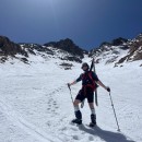
Views from tree line
The route to the summit is pretty easy, no trail and steep but it felt like a walk in the park not having to fight thru trees and bushes. No climbing required just a straight walk up the ridge.
The summit creeping behindSteep
The Crestones look out of place compared to all the big round Colorado mountains, Truly the "Alps of Colorado". There were some ominous clouds hovering over the Crestones all day and just made me think of Transylvania or somewhere you'd expect a big castle with a vampire living in it to be.
Crestones
Not sure why this peak is called Spread Eagle but I'm guessing because the false summit and the real summit are almost the same height and shape and the gap between them looks like spread apart butt cheeks? Or maybe my toes were the eagles, and they got spread apart and beat up hiking down the never-ending forest of steepness? who knows
False summitReal summit
Relaxed at the summit for a while, the weather was perfect barely any wind and lots of sunshine. If anyone else here knows about or plays RuneScape I got 99 Agility on top of the summit and made a cool video. If you see it floating around the 2007scape subreddit that's me
Howdy
The first photo of the lakes is the route I recommend, there is a trail that goes to the lakes from Gibson trailhead and then from the lakes you can just head up the saddle between spread eagle and peak of the clouds. Looks a lot easier than what we did, I think there is a little section you have to climb if you come from the west side of spread eagle but nothing crazy. I was debating heading down that way, but we didn't leave the summit until around 3:15 and I didn't want to hike out in the dark. Because of the location of the lake trail between the two ridges the sun would have set there within the next hour. So, we decided to sacrifice our knees/toes and head back down the bushwhacking hellscape. The second photo showing Peak of the clouds and Rito Alto has a road that goes to the top of hermit pass just to the south of Rito Alto. If you have a vehicle that can make it to the top you could easily hike all 3 mountains in a day. I saw what looked like a red F150 Driving up the road while we were hiking it's pretty far away, so I wasn't 100% sure but if so, looks like the road isn't bad.
Lake of the cloudsPeak of the clouds, Rito Alto Peak
Well after enjoying the views and making my cinematic masterpiece we headed down the steep route back to the truck. it was a long day but always a good day when you are playing in the mountains. And you know what they say something about a struggle builds character.
Ouch
After some more curse words and a couple branches slapping me in the face we made it back to the truck. Another beautiful day in the mountains, thank you mother nature I love you.
Thumbnails for uploaded photos (click to open slideshow):
I descended this way after coming up the Swift Creek trail to the Lakes of the Clouds. Descending the East Ridge made me very happy I hadn't ascended that way. And honestly, I'd just go back down the real trail if I were to do it again. No idea why this is considered the standard route up Spread Eagle.
I thought, aside from a small handful of moments from deadfall that this isn't really a bad way to go up, but descending would indeed be annoying due to the steepness. Continue to Rito Alto for a better time!
Not sure if you read my TR from some years ago which I can't seem to link into this comment, but I chose an even different - and perhaps unintentionally more difficult - route. But being an old Norwegian guy, I guess I just like to suffer as after it was all said and done, I actually had fun doing it.
That said, I really did enjoy your TR. Love the pix and I think I'll go back and do it again using your suggestion. Thanks for taking the time to post this.
I've done Spread Eagle several times from the Megan Lake trail. Far easier in my opinion, especially if you have a higher clearance vehicle to drive up to 9800', and there's a great trail to Megan Lake followed by a faint trail up the ridge on the east side of the lake to timberline. From there it's an easy walk up tundra to the saddle between Peak of the Clouds and Spread Eagle.
As for the name of Spread Eagle, I've always heard/thought that it was because of the snowfields that remain into the summer on the northeast face that look like an eagle in flight, but who knows.
Caution: The information contained in this report may not be accurate and should not be the only resource used in preparation for your climb. Failure to have the necessary experience, physical conditioning, supplies or equipment can result in injury or death. 14ers.com and the author(s) of this report provide no warranties, either express or implied, that the information provided is accurate or reliable. By using the information provided, you agree to indemnify and hold harmless 14ers.com and the report author(s) with respect to any claims and demands against them, including any attorney fees and expenses. Please read the 14ers.com Safety and Disclaimer pages for more information.
Please respect private property: 14ers.com supports the rights of private landowners to determine how and by whom their land will be used. In Colorado, it is your responsibility to determine if land is private and to obtain the appropriate permission before entering the property.