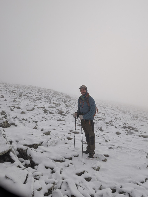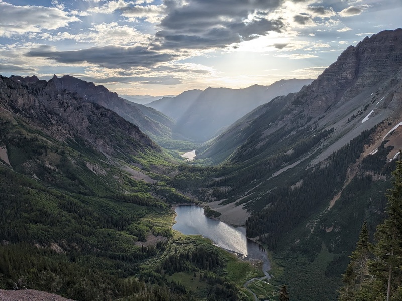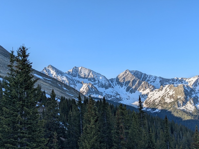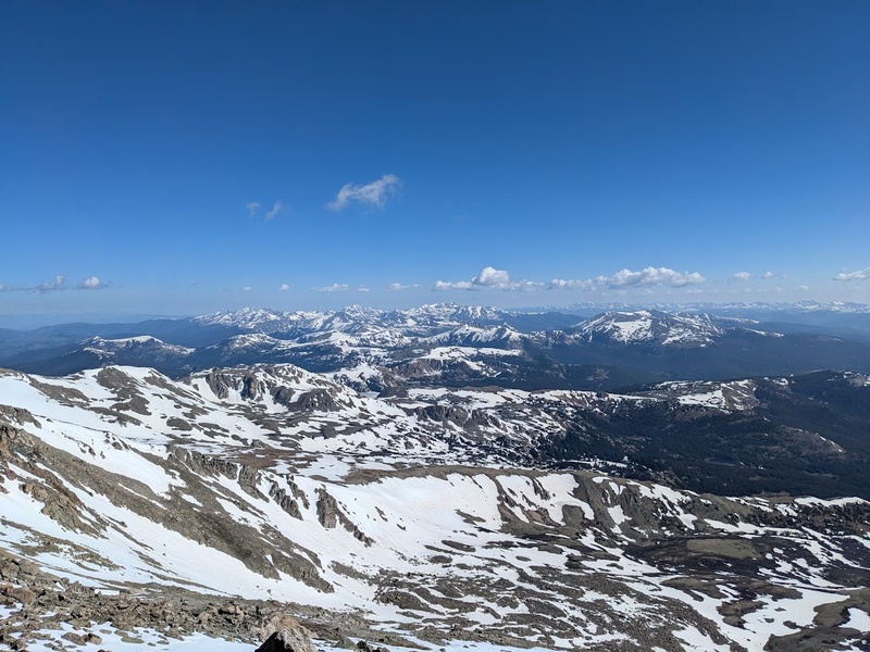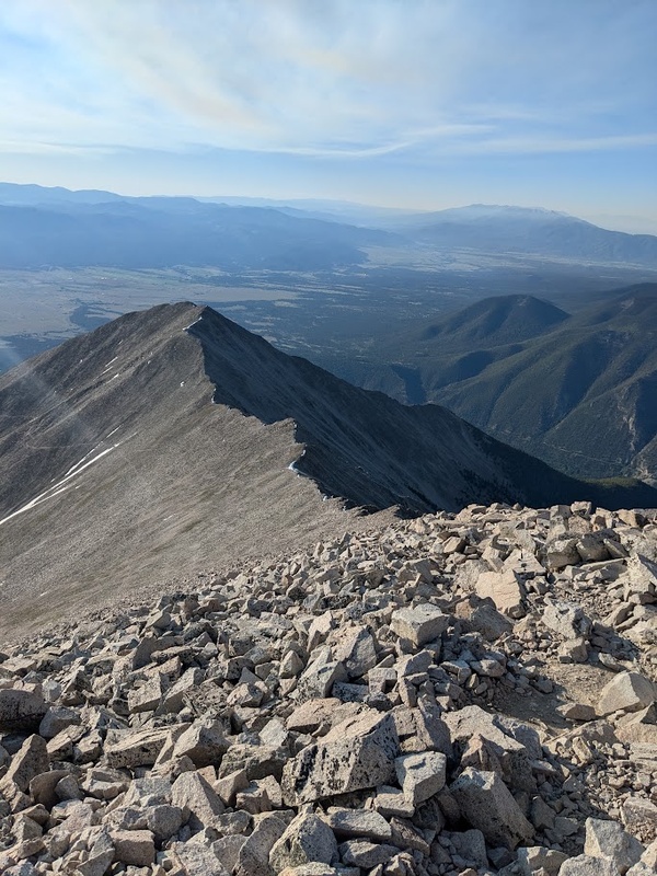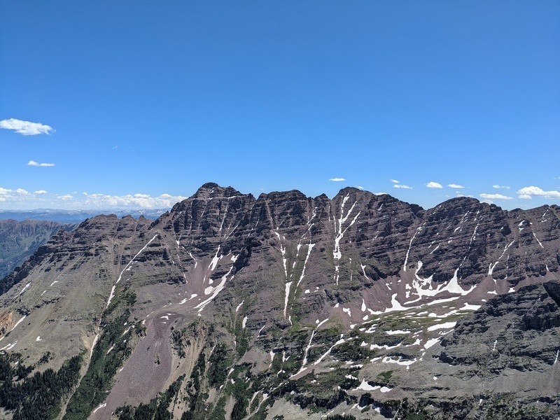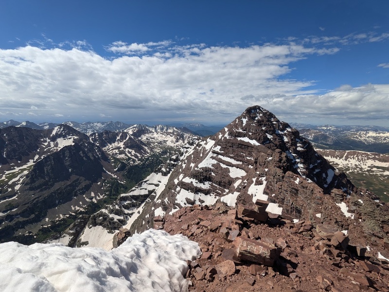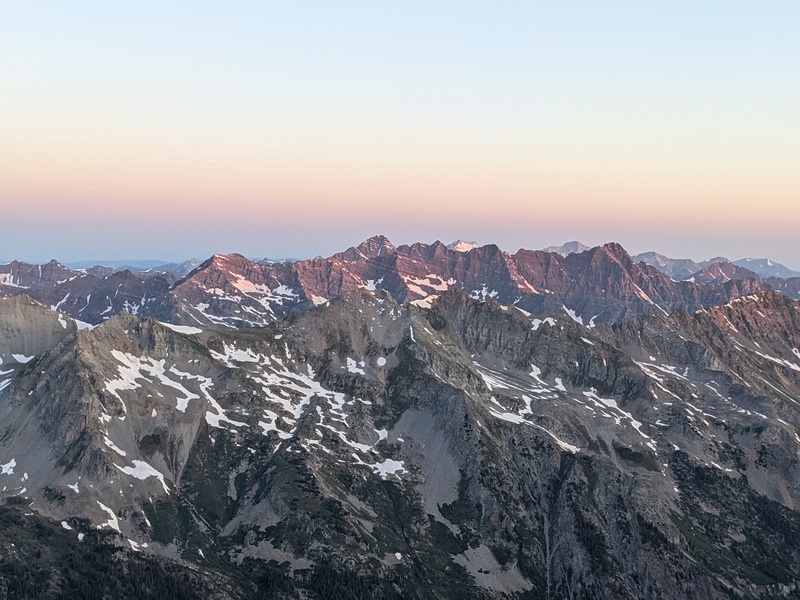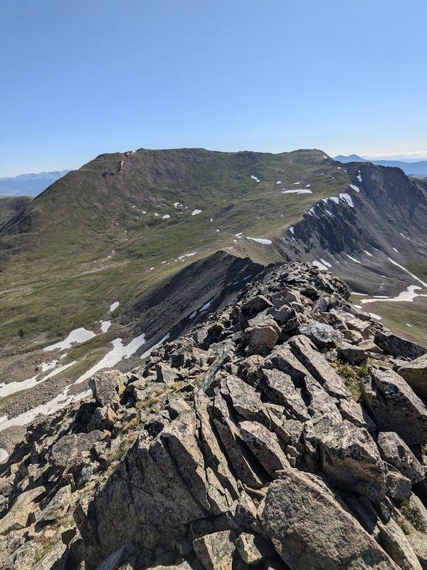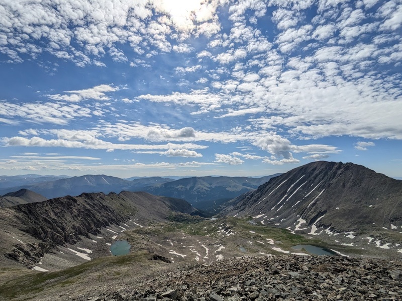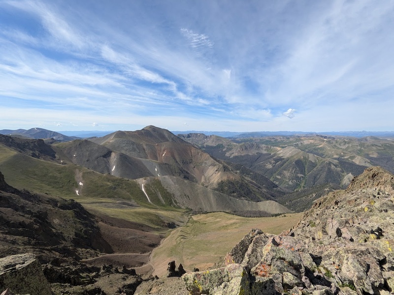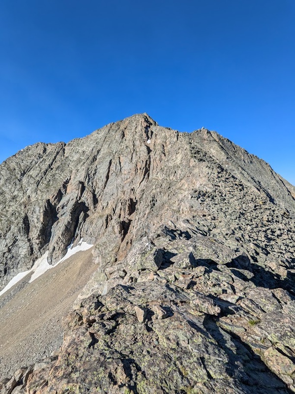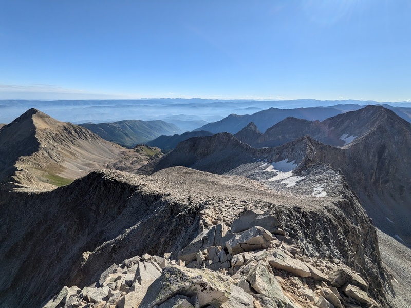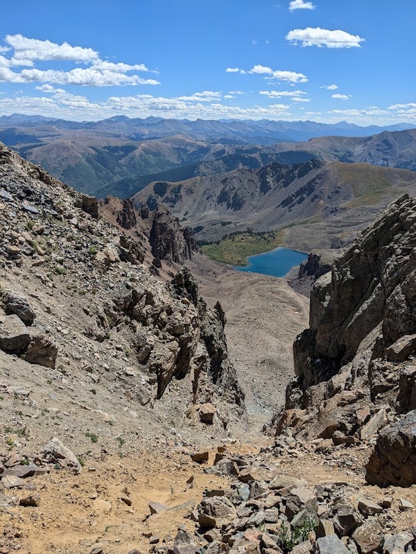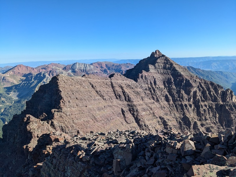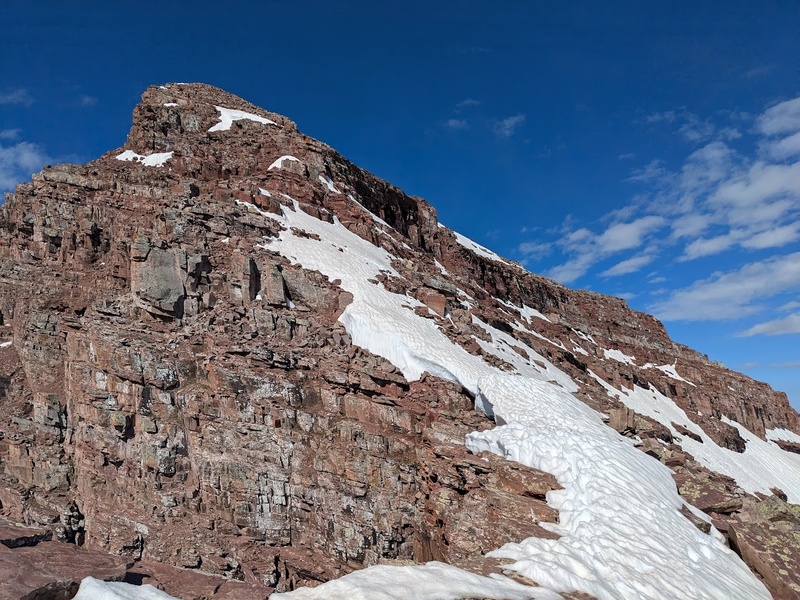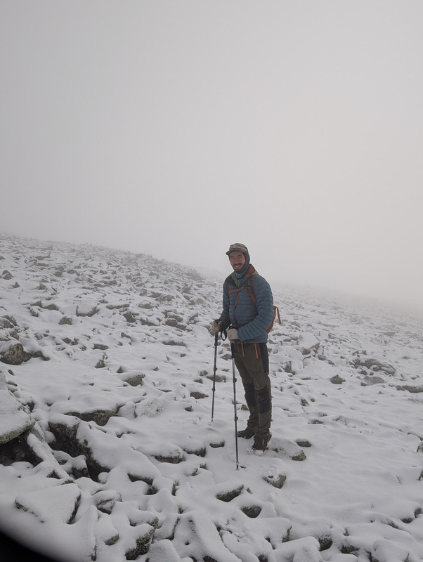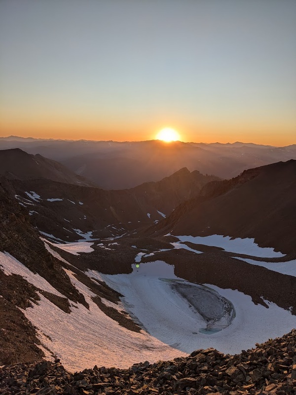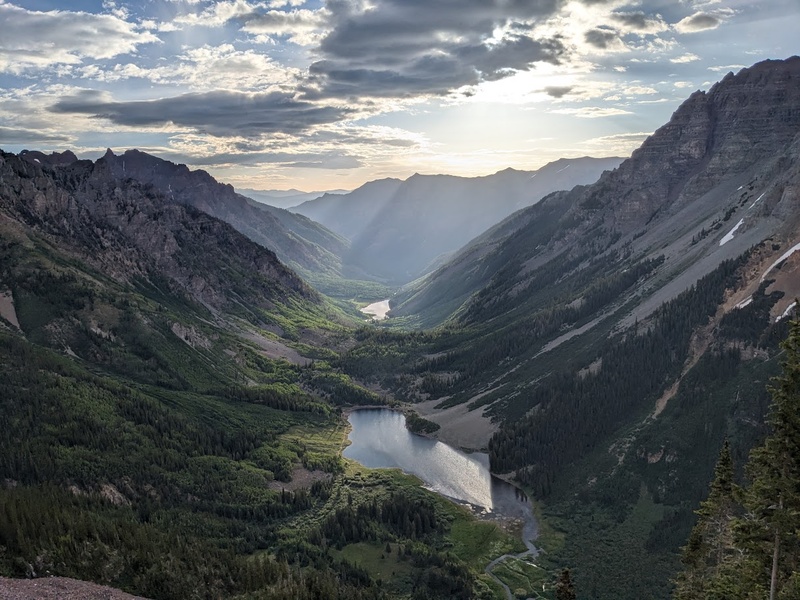
Chapter 3 of the quest begins as spring turns to summer: snow melts in the high country, days grow longer, forests liven with green vigor. Peak season opportunities awaken! Like most folks who climb the Colorado peaks, without a doubt, summer is my jam. While the quiet, uncrowded trails of spring and the skiing that comes with it are unmistakably magical in their own right, summer is a time for longer days, multi-peak ridge linkups, and pushing onto more technical terrain. The plan this peak season was to get out as much as possible and knock out as many of the class 3 – 5 routes I could before the snow started to fall in mid September. Some of the (extra ambitious) plans included knocking out the big eight in the “Weminuche Wipeout”, completing the remaining three great traverses, and climbing the Wham ridge on Vestal Peak.
While this summer was undoubtedly excellent and productive by all means, as fate would have it, I ran into a lot of hiccups, mostly vehicle related, that stifled my ambitious plans to be in the high 70s or low 80s for my peak count before the season ended. Unfortunately, I found myself at stranded at home, working on my vehicle a few more weekends than I’d like to admit. Alas, I’m injury free, having a blast in the mountains, and had the absolute pleasure of experiencing an astoundingly personal “watershed” climbing moment on Thunder Pyramid this summer. To the best of my limited abilities, I put it all out there this season and couldn’t be happier with how things played out. A few beautiful ridge traverses, some 5th class rock climbing, exploring infrequently trodden routes, and knocking out some of the classic tougher 14ers were some of the highlights from the past few months.
If you’ve been following along with the quest thus far, I sincerely commend and thank you! The opportunity to share my photos and experiences of this long-form mangled experiment of physical fitness, journaling, commitment to the mountains, creative expression, and personal growth has only helped me savor the experience as a whole even more. And so it would be, the Quest to 100 continues on with part 3. I hope you enjoy the ride!
Have fun and stay safe in the mountains!
My CalTopo Map: https://caltopo.com/m/KS1MKP5
6/7/25
– Huron Peak (14,006′) – Sawatch – Northwest Slopes II – Class 2 – #34 Personal – #52 Ranked
6.45 miles / 3,343′ gain / 3 hours, 29 minutes / ★★★
Solo
“The 4WD Road is the Crux”
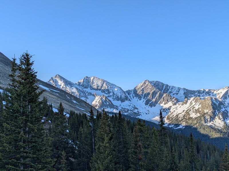
After some careful handling and very slow driving, I managed to make it up to the Lake Ann TH in my Honda CR-V in the darkness of Friday evening. This is pretty much the limit of my 6.9” clearance vehicle, but I m happy to say I made it the whole way without singing the oil pan blues. Surprisingly, I had a pretty quiet night despite all the commotion around the TH around 8 or 9PM and got started around 4AM Saturday morning. Sleeping near the creek made for an extremely cold but clear alpine start. I moved quickly (probably because of the sub-freezing temps) through the first coupe miles and crossed a terribly unsupportive snowfield above tree line, reassuring my decision not to ski today. Above the snowfield, I stashed my pack and poles and made a fast and light push up the ridge, scrambling over easy class 2 rock and snow. Upon the gaining the summit, the presence of the glorious Apostles dominated my view. Now those are some Sawatch peaks I’m so stoked to get on! I managed to get back to the TH by 7:30AM for a rapid and easy descent, long before most folks were even getting started, and made it down the rough road with no traffic jam issues. At less than 3.5 hours total, this is my fastest “hit and run” so far this year. With some better planning, it would have made sense for me to keep the car here for another night to hit the Apostles so I wouldn’t have to drive this heinous approach again, but alas, I’d be back later in the summer. Feels nice to knock out these popular Sawatch peaks before the summer crowds roll in.
6/8/25
Mount Massive (14,427′) – Sawatch – Southwest Slopes II – Class 2 – #35 Personal – #2 Ranked
11.16 miles / 5,525′ gain / 7 hours, 30 minutes / ★★★
Solo
Additional Summits: Massive Green, North Massive, South Massive
“Monotonous Ascent; Nice Summit Ridge and Sub Peaks”
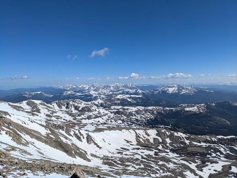
For Mount Massive, climbers have three main options for picking their line to the top: the east slopes standard route, the east ridge variation, or the non-standard southwest slopes that begins from the North Halfmoon Creek TH. Most folks, especially in Spring, will pick one of the east facing lines due to better skiing and more predictable conditions (though a lot more mileage), but I opted for the southwest slopes in hopes of also bagging Mount Oklahoma in the same day. As it turns out, this would be a pretty “ambitious” plan for the day that simply wasn’t happening after my long slog up Massive’s southwest slopes.
The night before, I managed to make it within .5 mile of the North Halfmoon Creek TH, where some pretty big ruts in the road held me back. Luckily, the troublesome spot was near a great campsite, so I set up for the night in a cozy camp just off the road for a surprisingly quiet night. The road leading up to the TH has to be one of the busiest dispersed camping areas I’ve ever been to so, again, I’m happy to be hitting this one earlier in the season. The next morning, I hit the trail at my usual 4AM start time and really enjoyed the first couple miles below tree line accompanied by the raging white noise of Halfmoon Creek. Once below the southwest slopes, the climbing honestly felt very slow going and monotonous. Basically, you look up at the huge slopes, see the top and pick your own line to get there. Not really any variation in scenery, climbing, or views and, personally, I found it a little boring. However, once upon the saddle, the mountain really revealed its unique character: the almost 3 mile long summit ridge that truly makes Massive, well… MASSIVE!
After a quick jaunt to the main summit, I decided that after my very monotonous ascent, I was far too demoralized to even think about losing and regaining the 4,000’+ of elevation gain to get Mount Oklahoma: it just was not happening today. Turns out, this decision was a blessing in disguise as I pivoted to climbing a few of Massive’s sub peaks while high up on the summit ridge. It was early in the day, I had the energy, and I thought it’d be fun to explore the very characteristic that makes Mount Massive what it is. Heading directly off the summit, I tagged two of the northern sub summits: Massive Green and North Massive, which made for some adventurous class 3 scrambling. And on the way back over the main summit to the southwest slopes descent, I additionally bagged South Massive, the southern most high point on the ridge. I’ve never really been much of a sub-summit guy, but today has really illustrated the joys of climbing these unranked points for me: less crowds, more adventure, and a lot valuable time high up in the mountains early in the day. I worked hard for that 5k of elevation gain to get up here, darn it, I might as well soak it up! All in all, Massive was pretty unremarkable, but getting to explore its never-ending summit ridge and sub-summits really transformed the day from forgettable to pretty darn impressive!
6/16/25
Mount Princeton (14,200′) – Sawatch – East Slopes II – Class 2 – #36 Personal – #19 Ranked
6.85 miles / 3,035′ gain / 3 hours, 46 minutes / ★★
Solo
“Absolutely Nothing to Write Home About”
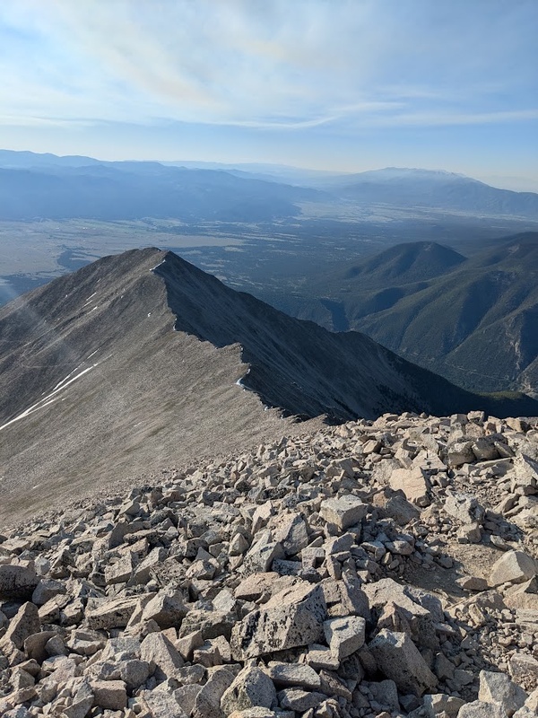
With my wife being on vacation out of the state this weekend, I was looking to climb something that was close to home and could be completed in a quick day trip to not be away from my pets for too long. Princeton turned out to be one of the few good options remaining and it would be nice to hit this normally busy summer peak on a weekday in shoulder season. I awoke an hour early at 1:45AM, walked my doggo, and was out the door by 3:45AM. Much like Huron, the most difficult part of Princeton was actually the drive up the narrow and seemingly never-ending 4WD drive road. Alas, my soccer mom SUV managed to make it to ~11,000′ just below the radio towers, where most folks will begin hiking the trail. You actually can drive further up the road, but the going gets tough and it shortens the mere 6.5 mile Princeton trail even shorter than it already is.
Today was the first day of the season I switched into my full summer kit and it ended up really paying off. I lost the mountaineering boots and gaiters in favor of light trail runners, ditched the snowshoes, and shed a few bigger layers due to sunshine and low winds. Finally it feels like summer in the mountains; I didn’t step on snow all day! In short, the Princeton trail is an uneventful hike up a talus covered slope on a less-than-memorable mountain, but good conditions made for an overall pleasant day.
6/23/25
Maroon Peak (14,163′) – Elk – South Ridge II – Class 3 – #37 Personal – #24 Ranked
11.8 miles / 4,928′ gain / 10 hours, 41 minutes / ★★★★
Partner: William Klausmeyer
“Loose as All Hell, Intricate Route Finding, and Spectacular Views”
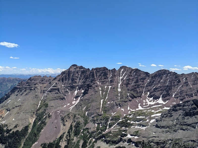
Due to late planning, the best reservations in the season I could find for the ever-popular Maroon Bells/Snowmass Wilderness were June 22 – 25. To be honest, I was lucky to even get these few consecutive dates with how late I booked so book your permits early and learn from my mistakes, folks! Late June is generally considered to be a little bit early to climb the Bells due to snow conditions, but this has been a low snow year and would pretty much be my only shot this season. The, much to be expected, very ambitious plan for the trip to was climb the Maroon Bells Traverse and the Thunder Pyramid Traverse over the course of three days, leaving one day for bad weather or rest/recovery.
If you don’t know anything the whole rodeo of getting around Aspen and the Maroon Lake TH, let me break it down for you really quick. You need a camping permit to stay overnight in the wilderness area as well as a parking permit to leave your car at the TH. Alternatively, you can also leave your car near Aspen and take the shuttle which runs every 20 minutes during peak season. We went with the latter option, though after coming back a few months later, I’d say there are definitely distinct pros and cons to each approach. After driving over Independence Pass, we parked our car at the Brush Creek Park and Ride (the only free parking within 45 minutes of town) just outside of Aspen, caught a bus downtown, transferred to another bus to Aspen Highlands, then transferred to a final bus that brought us to the Maroon Bells TH where we began our quest. Certainly a unique way to begin a trip, that’s for sure, but the experience was overall very efficient and easy.
From the Maroon Lake TH, climbing partner William (who you may remember from Lackawanna Peak) and I hiked in about 2 miles to our campsite just past Crater Lake off in the trees for a quiet night. As much as all of the bureaucratic red tape for camping in this area can be a turn-off, I can now say I truly understand and appreciate that this area is permitted because once that final bus stops running for the day, the area becomes really peaceful and silent, as only 11 sites are allowed to be booked around Crater Lake per night.
Monday morning we got started on trail at 4AM to make our way up Maroon Peak. Bathed in the dim illumination of our headlamps, we ambled along the path that follows the creek through brushy willows and forest before breaking off onto the infamous “2800 feet of suck”. I’d certainly agree that the section of the climb lives up to its notorious name: it’s slow going, steep tundra walking that seems to drag on into infinity. Upon reaching the saddle you finally get a great glimpse of the South Ridge and the exciting climbing up ahead. If you didn’t know by now, the Maroon Bells are known for their absolutely atrocious rock quality and difficult route finding and we certainly found this to be more true than ever! I’m really thankful I had the 14ers.com beta photos downloaded as the route to the top is not particularly well-marked or intuitive. I’d describe it as a complex maze through different hidden weaknesses on the mountain’s main ridge. A few hundred feet below the summit, we had to climb around some icy ledges and got slightly off route, but overall we were able to keep things very manageable and never any tougher than class 3. In my opinion, the sketchiest part of the climb was the terrible rock quality, not the ice. Luckily, we were the first party up, so there was far less of a concern of rockfall from above.
After what seemed like a pretty slow-going climb, we crested the summit for truly one of the most remarkable views atop any mountain in Colorado. While this vista is truly magnificent from the basin floor at Maroon Lake, seeing this epic panorama from the top was truly a once-in-a-lifetime experience: the epic Pyramid Traverse to the east, the amazing gray rock of Snowmass and Capitol in contrast with the red Bells to the west, and views in all other directions for miles upon miles. Upon reaching the summit, a very tired William pointed to the traverse and exclaimed to me:
“There’s no way I’m getting on that thing today.”
Funny enough, a mentor of mine had went through an extremely similar situation, almost play-by-play, on this very mountain years ago with his climbing partner. One guy is stoked to keep it going, the other: absolutely cooked. Even though I’m honestly disappointed to miss out on one the four “Great Traverses” (especially since I wouldn’t consider Maroon Peak a “repeat” mountain by any means), I don’t leave my partners behind anymore: it’s just not on the table for me at this point. Plus, with our current camping plans, that would still leave a day to climb North Maroon and another for the Thunder Pyramid Traverse so I was feeling like things would still come together. After a nice break on summit, we gradually made our way down to camp for well-deserved meal of dehydrated goop and oreos.
6/24/25
North Maroon Peak (14,022′) – Elk – Northeast Ridge II – Class 4 – #38 Personal – #48 Ranked
10.21 miles / 4,226′ gain / 9 hours, 54 minutes / ★★★★
Partner: Sunnie
“Maybe a Little Early for No Ice Axe”
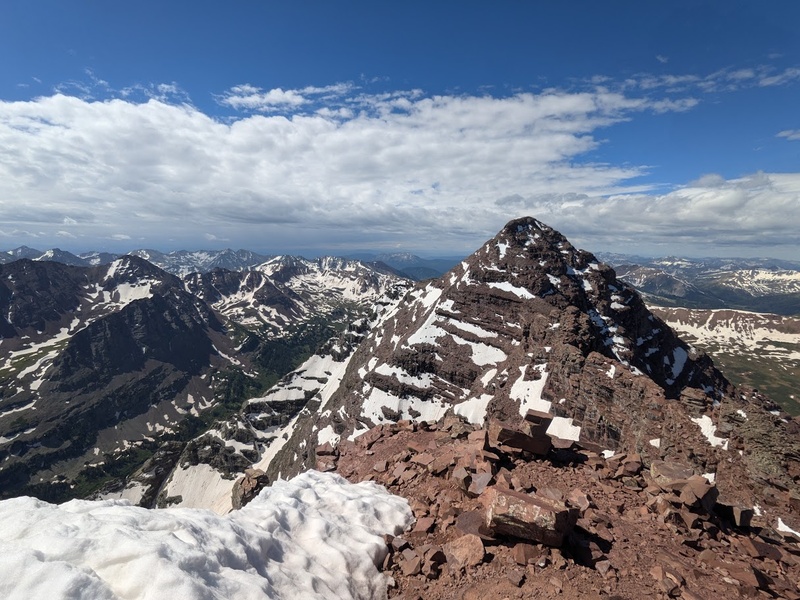
On our way down from Maroon Peak the day before, William and I had met another solo hiker who was looking to bag all the same peaks as us (with the exception of Thunder Pyramid because obviously… who climbs 13ers?) over the course of the same three days. We decided to group up for North Maroon Peak tomorrow as William decided to sit this one out so he could save his energy for Pyramid the next day. Sunnie and I planned our itinerary for our climb at camp after she made it back from her descent. Headlights donned, we met up the next morning at the moonlit shores of Crater Lake around 4:30AM to set out on our journey for North Maroon.
A few miles up the trail, the first red flag of the day presented itself: a decent sized snowfield just before crossing the rock glacier. Albeit, the snowfield wasn’t steep or difficult to cross, but with the route we were looking to climb having a north facing aspect and it being late June, snow at this low of elevation should have been a more noticeable red flag to me. We, however, itinerantly pushed forward. After turning the corner past the rock glacier, we arrived at the base of the first gulley, which I remember being steep, but not particularly technical, though the rock quality, believe it or not, was actually far worse than on Maroon Peak the day before. Speaking of far worse, the second gulley was definitively far worse than the first in terms of loose rock.
After some slow and deliberate climbing, we finally reached the ridge crest. To our dismay, early season snow covered the majority of the standard route still so we had to get a little creative with both some snow climbing (without crampons or ice axes) and more difficult, off-route rock scrambling. Funny enough, the standard crux chimney was mostly snow free and had a long dyneema sling hanging above it so we were able to haul our way up the final mantle moves pretty easily. The final few hundred feet on the precipice were pretty spicy with just micro spikes, but eventually, after 5.5 hours of climbing, we reached the summit of North Maroon. Maybe it was just that we had to work harder for it, but, in my opinion, the summit views were even more satisfying up here than yesterday. Snowmass and Capitol are far more striking from this angle, as are the alpine lakes below. After some celebrations on the summit, we embarked for another long five hours of down climbing back to camp at Crater Lake. Honestly, this was a lot more full-on experience than I was expecting for a class 4 route and, as my mother would always say, we certainly got our money’s worth!
6/26/25
Castle Peak (14,274′) – Elk – Northeast Ridge II – Class 2+ – #39 Personal – #10 Ranked
9.81 miles / 3573′ gain / 5 hours, 13 minutes / ★★★
Partner: William Klausmeyer
Additional Summits: Conundrum Peak
“Mining Scree Paradise”
Unfortunately, after some long deliberation (semi-painful deliberation, honestly), William and I had made the call to bail on our attempt for Pyramid Peak the following day. The storms were looking to roll in around 11AM which didn’t seem like enough of a safe window for us to get up and down the technical sections of Pyramid in time, so we pivoted our plans one day forward and would use today to set ourselves up and get into a good position to climb Castle Peak the following day. That morning, we slept in, had a slow breakfast and tear down and made our way back to the Maroon Lake TH for the first bus back to Aspen (6AM is sleeping in for us, okay?!). We enjoyed the best meal of the day, second breakfast obviously, ran a few errands in town, then headed back up into the mountains to the Castle Creek TH. From the 2WD TH, I managed to make it about 1.2 miles up the road in my CR-V before large ruts in the road made it impassable, but luckily we managed to snag a great parking spot near one of the dispersed campsites nearby. From the car, William and I backpacked our way another 2 miles up the trail to about 11,200′ and camped for the night at a flat spot just off the mining road. Since we’d be getting to bed so early, we chose to start at 2:45AM the next morning for an attempted sunrise summit of Castle Peak.
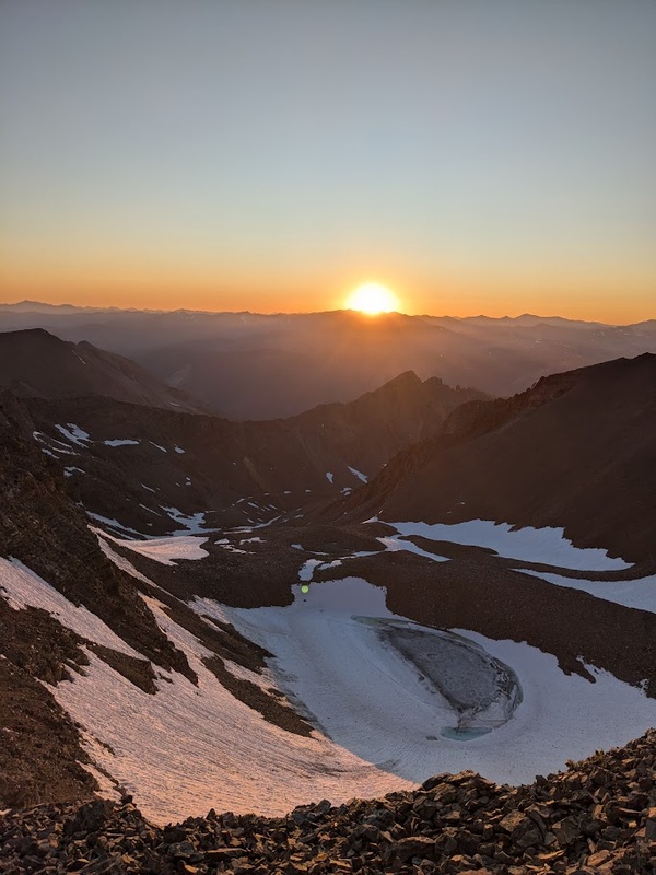
The trail follows a mining road up to about 12,800′ where it peters out and heads towards Castle Peak. From here we climbed about 600′ of very consolidated snow (it is 3:30AM, after all) to the base of the ridge. Since the snow was so solid and the route wasn’t so death defying, the climbing felt very comfortable in just spikes and poles, a stark difference from snowy exposed mush on yesterday’s North Maroon. From 13,400′ we gained the ridge and had a very pleasant headlamp scramble to the top of Castle. Arriving on summit at 5:10AM, we actually had beaten the sunrise by about 20 minutes so I opted to go for Conundrum, even though it’s not technically on my list.
Tangent:
For climbing the 14ers, I was never really planning on the “List of 58” upon initially planning the logistics for my Centennials project. It was always the “List of 53” that mattered, since those are the 53 that are included in the Centennial List. That being said, I’ve already got Challenger and Cameron under my belt, planning on doing the Wilson-El Diente traverse, and North Eolus is only a skip and a hop from the main summit, so I guess I’m gonna get the 58! It’s all fun and games anyway; I’ve had some of the most fun in the mountains climbing unnamed peaks, unranked points and ones not even remotely near my arbitrary, contrived list.
With the summit of Conundrum only being about .4 miles away, I managed to make it down and back up the ridge to the summit to catch the sunrise proper from the perfect vantage point. It’d been about two years since my previous sunrise on summit on San Luis Peak while I was hiking the Colorado Trail and this one, much like the last, absolutely did not disappoint. Certainly a great moment to take in all the silence and just laugh and the total absurdity of being on the top of a mountain at sunrise. Truly invigorating! Not after long, I resummited Castle and met back up with William for an easy descent down the ridge. A beautiful, crisp early morning trail run back to our camp provided the proverbial cherry on top to an already perfect day and conclusion to our first trip to the Elks. Nice to not be scrambling absolutely horrific rock today.
6/29/25
Mount Belford (14,202′) – Sawatch – Northwest Ridge II – Class 2 – #40 Personal – #18 Ranked
Mount Oxford (14,158′) – Sawatch – via Mount Belford II – Class 2 – #41 Personal – #25 Ranked
Missouri Mountain (14,071′) – Sawatch – East Ridge II – Class 4 – #42 Personal – #35 Ranked
14.72 miles / 6,470′ gain / 8 hours, 26 minutes / ★★★
Solo
“East Ridge on Missouri? It goes!”
Right around this time at the beginning of summer marks a major episode in the quest: the search for a new vehicle. Since my partner had recently gained new employment, my main ride, our extraordinarily reliable Honda CR-V, was now occupied for commutes, leaving me with our beloved, yet not particularly trailhead-worthy Toyota Yaris. After a few days of rest from climbing in Aspen, I was feeling fit and ready for another big day. I was originally looking to hike the Harvard-Columbia Traverse, but after spinning out on the steep dirt roads with my dinky tires, I decided to pivot to hiking the Belford group from the Missouri Gulch TH. I knew I’d be able to get there in my 2WD vehicle and it was still a nice big day that was close by, making for a great on-the-fly alternate. My attempted drive up to the Harvard TH in my Yaris was, however, a significant wake up call for me: it was seriously time for a more capable vehicle. More on that later.
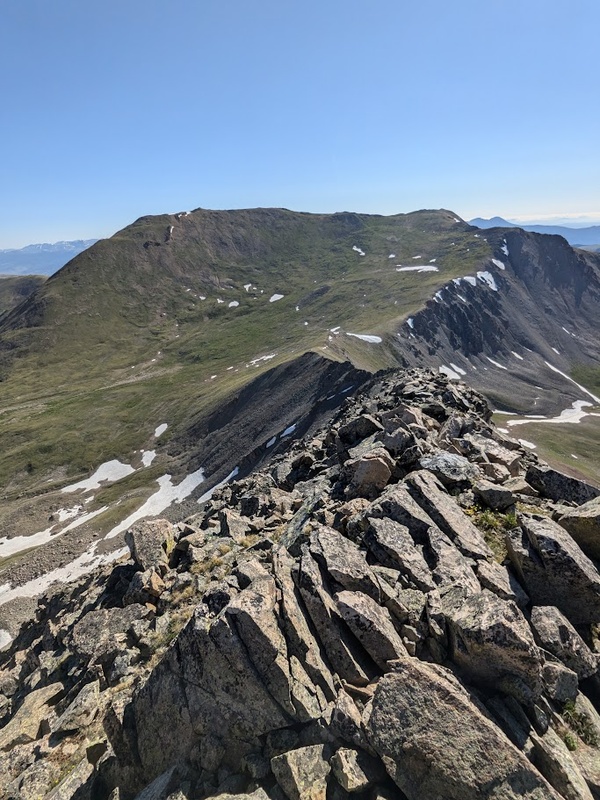
I got to the Missouri Gulch TH around 5pm and backpacked in about 2 miles up the never-ending switchbacks at the beginning to meadow where I set up camp just off-trail near the creek. It was cozy, quiet and the stars were absolutely phenomenal, seemingly alive on this crystal clear night. The next morning I got started around 4AM with a mile hike up the basin, following the creek to the base of Belford’s northwest ridge. The climb up the ridge was not particularly dramatic, but had a really fantastic, well-maintained trail that switchbacked up the grassy ridge. So lovely!
I arrived at the summit of Mount Belford just after sunrise and had a longer than normal summit break before heading over to the next peak. The up and down over to Oxford was mild, grassy and pleasant, and before long I had two in the bag by about 8AM. With the great forecasts today, that meant Missouri was definitely a go. I hopped back over to Belford’s summit ridge and eyed the standard route up Missouri. It’s pretty obvious to see why this is a pretty big mileage day to link these three mountains up because the trail has you backtrack significantly after dropping down to Elk Head Pass to merge with the trail up Missouri. Not that I didn’t want a big mileage day, but backtracking sucks and I like to avoid it when possible, especially when Missouri’s east ridge lies right before you as you descend to the pass. Upon examination it certainly looked like it would go but I remember reading about in the Gerry Roach 14er guidebook and him saying something to the effect of:
“Relegated to this author’s worst nightmares.”
– Gerry Roach
I’ve also heard it described by others like climbing broken dinner plates sitting atop marbles. So was I willing to give this thing a try given its bad reputation just for a shortcut up Missouri? Heck yeah! I’m confident on class 4 (which it was rated) and after just finishing off climbing the Bells a few days ago, I felt like there really couldn’t be any looser rock than that entire fiasco. Honestly, I was a little apprehensive getting on the first section of the ridge when feeling out the rock, but overall, I didn’t think the route was nearly as bad as North Maroon. Yes, the rock is godforsakenly awful but its climbable with patience and the right attitude! I seem to remember one 5th class move when turning and ascending a corner, but it might have been avoidable. Overall, I don’t think the loose rock on Missouri’s east ridge deserves all the negative hype it receives from Roach and the 14ers community, though it certainly deserves some; it’s definitely not a “good” route by any means. I would, however, say that it really should be considered if you’re a confident climber looking for some adventure and a shortcut up Missouri! Let’s give it a C- overall. Needless to say, the folks on summit were a little confused when I crested over the east ridge to join them for snacks. Either that or it’s my ridiculous looking Beeko-Cheeko face mask that makes me look like a bizarre bank robber/bird combo.
I’m falling in love with the northern Sawatch all over again. Views for days, a windless summit, and fantastic alpine walking (with a little bit of optional spice thrown in for fun) has made the Belford group one of my favorites in the area. From the final summit of the day, I descended Missouri’s standard route, had a nice run back to my tent, then out to the trailhead by 11:30AM making for a quick and fun morning in the mountains.
7/20/25
Pacific Peak (13,965′) – Tenmile – West Ridge II – Class 3 – #43 Personal – #59 Ranked
Crystal Peak (13,860′) – Tenmile – via Pacific Peak II – Class 3 – #44 Personal – #83 Ranked
Atlantic Peak (13,856′) – Tenmile – via Pacific Peak II – Class 2 – #45 Personal – #85 Ranked
10.72 miles / 4,872′ gain / 6 hours 53 minutes / ★★★★
Solo
“Some of the Best Traversing in the Tenmile”
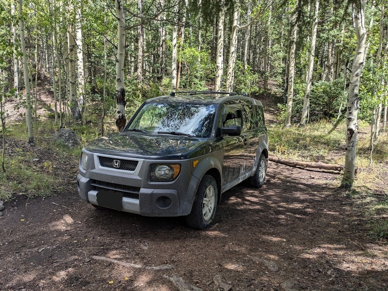
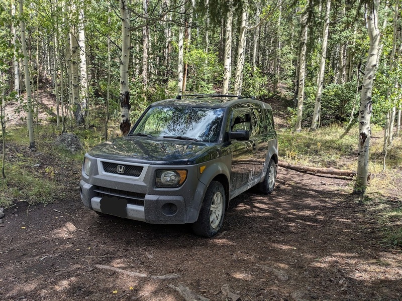
Unfortunately due to my car situation, I had to take a weekend off at the beginning of peak season to find myself a new vehicle that was trailhead worthy. Being that I live in middle-of-nowhere Colorado with a partner who also works full-time, the ability to easily find and test drive different vehicles on my days off was logistically pretty difficult. Just a couple of nights before I was about to desperately get on a bus to Denver and jump on the first good car deal I could find, my dream vehicle, the highly beloved Honda Element, magically appeared on a Craigslist ad only about 40 minutes from home. It was well within my meager budget, in decent condition for its age, had excellent records of recent maintenance, and most especially, I could pick it up quickly and without travelling far from home. And so it would be, I celebrated this year’s fourth of July weekend not with climbing peaks, but becoming a happy new member of the “Toaster on Wheels Club” and getting to the root of some of the mechanical and electrical issues with this well-loved 22 year old vehicle. I could probably go on all day about the various reasons of why I love the Honda Element, but perhaps that’s a blog post for another day… The following weekend I took a test trip to the Spanish Peaks Wilderness with my brother to do some backpacking and measure the new vehicle’s road-worthiness and, to my surprise, this thing really slayed on the way up to the Wahatoya TH. After a couple of weeks off from digging into the Centennials, I was chomping at the bit to get the heck back out there armed with this new (to me) vehicle by my side. Welcome to the family, sweet Harambe!
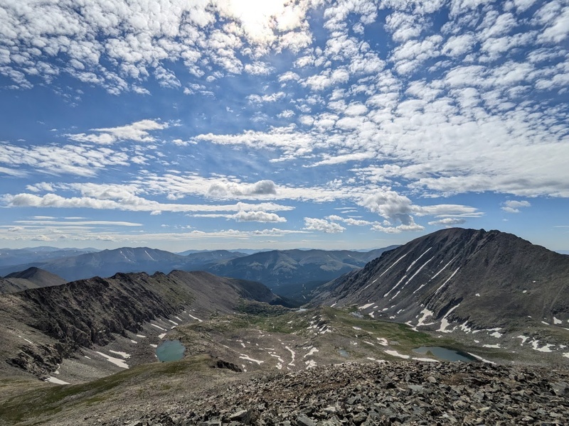
Friday evening, I packed up my day pack and car camping gear and set off for the much-anticipated Atlantic-Pacific-Crystal Traverse. After some research on how others who have completed these three peaks in a single push, I decided on the following route: climb Pacific’s west ridge, traverse to Crystal, resummit Pacific, traverse to Atlantic, then descend Atlantic’s west ridge. This particular route is probably the best way to approach this traverse as a whole because it allows you to ascend fun class 3 terrain and descend easy class 2 terrain without having to out-and-back the entire set of mountains. Since I was still testing the waters with Harambe on more and more difficult terrain, I opted to car camp at the Mayflower Gulch 2WD TH for the night to hike the remaining 1.5 miles up the 4WD road to the Boston Mine in the glow of my morning headlamp. I had a great sleep in this spacious new ride, but my memory of the approach the following morning was, for no particular reason, certainly not ideal (but still fine, all things considered). I took a wrong turn up the basin, fully submerged my foot above the ankle in the first creek crossing of the day, and desperately had to shit (for the second time god damn that morning, I might add) when I got to the base of Pacific’s west ridge at ~12,600′. Certainly not ideal, but life moves on as do bowels.
Pacific’s west ridge had some loose rock, but at this point, after the Bells and Missouri’s east ridge, I was feeling like a loose rock monster ready to eat it up! Overall, the ridge went at a mild class 3, but the reason I really loved it so much was the sheer length of the route. Getting the pleasure to be on that kind of terrain for the better part of 1200′ is truly pretty special and reminded me a bit of Kit Carson’s north ridge (though not nearly as good). As the fun ones always go, the climb was over before I knew it and I was atop magnificent Pacific Peak, flanked by Centennials on both sides, with Fletcher, Drift and Quandary also close by. Incredibly memorable positioning.
The descent down Pacific towards Crystal featured some of the spiciest, most exposed terrain of the day. Interestingly you have to climb up and down this large subsummit on the way over to Crystal, making for some pretty memorable sections of climbing. After the first few hundred feet of the descent, the terrain eases to class 2 for the majority of the traverse. This one felt like a little more of a slog, but I managed to get to the summit just before a group of hikers were coming up the other side. I quickly snapped a few pictures and set off back down the ridge the way I came. The infectious need to go fast once again took over: I’d take a break on the next summit.
It’s an interesting experience to ascend a route that you’ve just downclimbed; kind of the opposite experience of what usually happens, I guess. Yep, there wasn’t too much to note on my resummit of Pacific other than a nice long break with a lemonade and Bobo’s on top. The traverse over to Atlantic was mild, glorious and beautiful alpine walking with some of the best views of the day. The huge, almost iridescently blue alpine lake in the basin below along with Quandary’s magnificent west ridge in the periphery made me remember why the Tenmile is truly one of my favorite unique places in Colorado. Again, why would anyone climb Quandary when you could be on these objectively better, no-parking-fees-associated, truly memorable neighboring 13ers, but I digress. The wildflowers in the basin really popped off and took me by surprise as I descended; apparently it was really dark when I was coming up here! Also, good god, hundreds of folks out near the trailhead on a summer Saturday near Copper, but I managed to have the mountains pretty much all to myself today. Pure bliss out there on some of the best traversing of the season so far. To many more!
7/28/25
Stewart Peak (13988′) – San Juan – North Slopes II – Class I – #46 Personal – #55 Ranked
12.28 miles / 3,379′ gain / 4 hours, 17 minutes / ★★★
Solo
Addition Summits: Column Ridge, Baldy Chato
“Fantastic Class 1 Alpine Hiking and Views”
The weekend of July 26, Lee and I had plans to climb the famous Wham Ridge on Vestal Peak in the San Juans. After a day of backpacking our climbing gear in, Lee unfortunately had gotten pretty sick the morning of our climb and we opted to bail and head back to the car. On my way home from our defeat, I stopped in Gunnison for some Chinese food and decided to utilize the rest of my weekend to climbing nearby Stewart Peak. That evening, I meandered through the seemingly endless dirt roads on the way out to the Nutras Creek TH. Saguache County is incredibly vast: these roads appear to go on forever, connecting all the way from Saguache to Lake City. I arrived at a nice camp about a mile and a half mile below the trailhead just around dark. To my dismay, I had gotten a flat on the drive out and, to even more dismay, the spare in my newly purchased vehicle was not adequately beaded to inflate properly. Luckily, I had great cell reception at my campsite and was able to arrange Maggie to rescue me the next morning after I had climbed Stewart. Stranded 25 miles from the highway with no way of getting tonight, I tucked in for a nice evening of stargazing and relaxing.
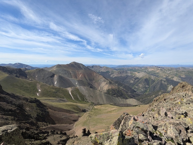
I didn’t get started on trail until 7:20AM, as Maggie wouldn’t be coming in for a rescue until later in the day and that means I could take my time. After my 1.5 miles of “extra credit”, I followed the Nutras Creek trail up a gulley until it petered out above tree line, leaving me with a dense forest of scrubby willows to navigate. The bushwhacking was not the best, albeit, very short. I remember going up not being too bad, but I got quite lost in the thick of it on the way down. My advice would be to stay closer to the ridge if possible. Above the willows, the beautiful, open alpine tundra completely opens up in all its glory. While none of the terrain from today’s adventure was remotely technical, the incredibly chill alpine walking once above the willows was some of the most relaxing and panoramic I’ve hiked all year. I opted to go straight for Stewart Peak, then hit any subpeaks on the way back if I had time. The trail dips back into the basin, then climbs the slopes below the saddle between Column Ridge and Stewart. Once on the saddle, its a mild class 1 hike to the top. Since I was making good time, I figured I would bop over and bag (unranked) Column Ridge, follow the ridgeline down to the basin and back up to my ascent path. From here it was only a few hundred feet to the summit of Baldy Chato, so I hiked my way up the grassy tundra for a little break on top.
The eastern San Juans and the La Garita Wilderness have a special place in my heart. I’ve had a lot of adventures out here and I find myself continually coming back again and again. Whether it’s backpacking out to the Wheeler Geologic Area or seeing moose on the Colorado Trail, my experiences here never fail to illuminate my imagination. The mild, rolling alpine tundra is more akin to the nearby Sawatch range in many ways than the rest of the more aggressive San Juans out west and south. Not to mention the sheer remoteness of the entire area really helps put you in a state of solitude. After my struggle through the willows on the way down, I made it back to my car, changed my flat, and proceeded on with the slowest 100 mile ride on a donut I’ve ever had. Pretty painful way to wrap up an amazingly chill day in the mountains!
8/3/25
Ice Mountain (13,960′) – Sawatch – Northeast Ridge II – Class 3+ – #47 Personal – #60 Ranked
North Apostle (13,869′) – Sawatch – via Ice Mountain II – Class 2 – #48 Personal – #77 Ranked
12.64 miles / 4,180′ gain / 6 hours, 38 minutes / ★★★★
Solo
“Why Would Anyone Climb Huron?”
I remember first seeing the Apostles while hiking the Colorado Trail back in 2023. While on the way up to Lake Ann, you split at the turnoff to the Apostle Basin just as these magnificent peaks come into view. Even then, I knew I wanted to climb them. My ascent of Huron a couple of months ago also greatly confirmed my desire to get finally get over there, so the evening of August 2, I was drove up the familiar 4WD road to the Huron TH and slept in the car for an early start Sunday morning at 5AM.
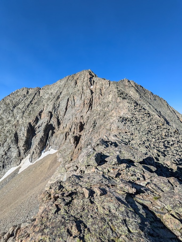
The approach follows the forest and willows and stays pretty flat until the final climb into the Apostle Basin. The basin below these massive peaks has a grandiose and spectacular feel to it, adding to its truly unique character. Above tree line, the hike follows scree fields as you cirque West Apostle then climb the gulley between North Apostle and Ice Mountain. From here, the views opened up considerably, revealing the nearby alpine lakes and Elks to the far northwest. I chose to climb the more difficult of the two peaks first: Ice Mountain. The ridge up Ice goes at a consistent class 3 and is surprisingly long. I was really delighted by the length of the route and general decent rock quality for scrambling. In my memory, the crux chimney just below the summit felt more difficult than class 3, but there’s a possibility I could have chosen a better line. Fantastic views of a busy day on Huron from here. I descended back to the saddle for a generally uneventful class 2 hike up North Apostle, then back down to the car. Easily 80+ people on Huron today, but only about 10 folks out climbing the Apostles. I truly believe Ice features some of the best scrambling in the Sawatch; go get after it and leave Huron for some good turns in the spring!
8/10/25
Capitol Peak (14,138′) – Elk – Northeast Ridge II – Class 4 -#49 Personal – #29 Ranked
18.18 miles / 5,539′ gain / 10 hours, 31 minutes / ★★★★
Solo
Additional Summits: K2
“Amazing Exposure; Lives Up to the Hype”
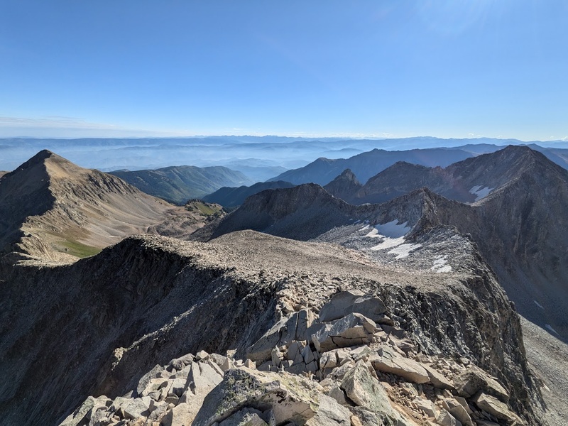
Since it’s peak season, I really wanted to climb Capitol on a weekday to avoid the crowds on this narrow route. Luckily, the weekend of August 9 worked out perfectly! I was able to drive up to the Capitol Creek TH Sunday evening, backpack up about four miles and camp just across the creek a few hundred meters from the trail. Without a permit, the four mile mark is about as far as you can legally camp. As I wrapped up for an early night, the massive, gray Capitol Peak in all its glory loomed above in anticipation for tomorrow’s climb.
By 5:00AM I was on-trail and moving fast. Most of these approaches in the dark below tree line seem to blur together. All I know is that I crushed the first two miles to the lake and soon found myself amongst the morning crowds of folks also looking to climb Capitol today. Determined to move fast, I pushed past most of the groups on the ascent up the Daly-K2 saddle. Once upon the saddle, I had the option to take the standard route, which drops you beneath the ridge on the other side of the saddle and follows scree fields to a gentle slope below K2, or the nonstandard route, which goes at class 4 and follows the ridge crest directly to K2. In retrospect, I should have picked the nonstandard route, but alas, the hike up to K2 went pretty smoothly. Once upon the summit, I surveyed the direct route to Capitol: the views and exposure were truly outstanding. On this infamous route, everyone seems to freak out about the knife’s edge: an exposed section of friction climbing at the beginning of the ridge that has you straddle a razor thin point on the ridge crest. While the climbing was great, I personally thought this section was overhyped. The exaggerated pictures and ridiculous fisheye lens videos one can find on the internet don’t really reflect the true nature of the crux. Yes, the climb is very exposed, but the rock is solid, the scrambling is easy and the section is only a couple hundred feet at the longest. For me, the real fun began after the knife’s edge when the route meanders its way up the side of Capitol’s main face. Compared to most other climbs in the Elks, the rock quality on Capitol is fantastic, not to mention easy route finding.
On the final few hundred feet of the climb, I was surprised to see three different parties getting short-roped up as they climbed. I’ll be honest, I’ve never seen anybody rope up for class 4, but it turns out these were guided groups (and the clients looked terrified). I quickly scrambled past them and I didn’t spend much time on summit since it was so busy, so I snapped a few pictures and I was off back down the way I came. The climb down was almost as fun as the way up! Regardless of my prior criticism, I thought Capitol was one of the most memorable 14ers I’ve had the pleasure of climbing thus far. It’s nice to get on a standard route that is engaging, steep and keeps you on your toes! I’m elated to have Capitol in the bag; it’s given me a lot of confidence to continue on with climbing harder objectives later down the line in the project, such as Jagged or Thunder Pyramid.
8/17/25
Cathedral Peak – Elk – Standard Couloir II – Class 2 – #50 Personal – #61 Ranked
9.43 miles / 4,087′ gain / 5 hours, 38 minutes / ★
Solo
“Ski it in the Spring, Folks!”
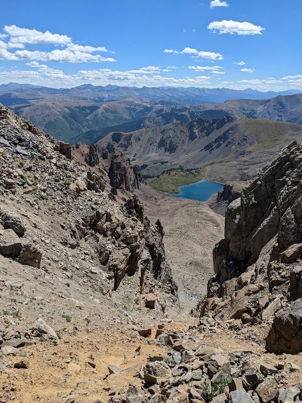
Speaking of Jagged and Thunder Pyramid, it was about time to tackle one of the more committing 5th class objectives that had been looming large in my mind ever since the conception of climbing all the Centennials. Since the top 100 list had been updated by the new LiDAR survey, it turns out I would not be climbing Teapot or Dallas, both of which are technical 5th class climbs in the western San Juans. For tough routes, this would leave: the Little Bear-Blanca Traverse, Jagged Peak, and the Thunder Pyramid-Pyramid Traverse. With the exception of Jagged, all of these routes can indeed by climbed via an easier route (Hourglass up Little Bear [class 4], Blanca Northwest Ridge [class 3], Thunder Pyramid White Gulley [class 3], Pyramid Peak Northeast Ridge [class 4]), but I was looking for some committing and challenging routes that would also lend themselves nicely to climbing these peaks efficiently. Since I already had a date with William in September to climb Little Bear-Blanca and I had planned to climb Jagged during my weeklong trip in the Weminuche, that left Thunder Pyramid on the table for the weekend of August 16. Planning for efficiency, I decided to leave a day before my parking permit at Pyramid and knock out nearby Centennial, Cathedral Peak as a warm up. Cathedral is an interesting one: most folks seems to go back and forth about whether the peak is better to climb in spring when the gulley is filled with snow or during peak season when the route is melted out. Spoiler alert: the gulley is awful and should avoided at all costs when its dry.
Saturday evening, I camped in my car at the Cathedral Lakes TH for a quiet night. I decided to sleep in and start at 7:30AM as the weather was looking good and I needed some time to kill before I set myself up for Thunder Pyramid the following day. It’s odd to start when it’s light out. The hike to Cathedral lake only took me about an hour and a half. I can see why this area is so popular with the fall leaf peepers too: the aspen groves are thick, tall and seemingly never-ending in all directions! The route follows the perimeter of the lake to the base of an infinite scree field which ascends to the infamous dirt and talus filled gulley leading to the saddle. The scree approach was already pretty slow-going and tough, but the gulley itself was a whole new definition of bad. Cathedral is the first peak I’ve bestowed the “one star” badge upon and, take my word for it, it deserves every bit of that awful ranking (though I’m sure it’s a hoot with snow). The loose dirt and small scree in the gulley had me feeling sketchier than I’ve ever felt on class 2 terrain. Hike a step up, slide a step down, repeat. The gulley was, however, pretty short all thing considered. The climbing on the ridge from the saddle to the summit was also considerably loose, but nowhere near as horrific as sliding down that godforsaken dirty gulley. Summit views of Cathedral Lake and nearby Pyramid and Bells were very notable. For such a shit climb, at least Cathedral paid off with some nice vistas on top. As I say in the title: ski it in the spring, folks! This one sucks!
8/18/25
Thunder Pyramid (13,944′) – Elk – White Gulley II – Class 3 – #51 Personal – #62 Ranked
Pyramid Peak (14,029′) – Elk – via Thunder Pyramid – Class 5.4 – #52 Personal – #46 Ranked
11.88 miles/ 4,662′ gain / 8 hours, 46 minutes / ★★★★★
Solo
“Horrifically Loose Rock, Ball-Busting Exposure, Unforgettable Crux Towers: True Mountain Insanity at its Finest”
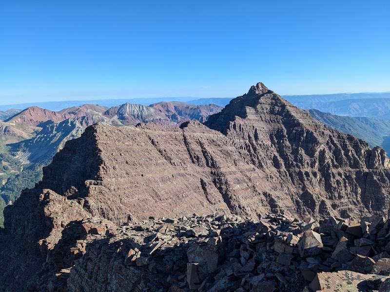
After getting down from Cathedral, I drove back down to Aspen, had some lunch, ran some errands, then drove back up Castle Creek Road to find a spot to call home for the night. Since I only had a midnight to midnight permit for the Maroon Bells TH, I legally wouldn’t be able to leave my car there overnight so dispersed camping it was. To my knowledge, the dispersed sites up Castle Creek road (a couple mile past the Cathedral Lake TH) are the closest legal campsites close to Aspen. From here, my drive to the Maroon Bells TH the next morning would be about 45 minutes. I tucked in for a cozy night, lying in wake of the great challenge that lie before me the following day. As it always goes the night before a big climb, the nerves of tomorrow’s commitment kept me up, tossing and turning in an anxious anticipation.
I awoke at 2:00AM, drove to the Maroon Bells TH, used their fantastic facilities, and got started with the approach by 3:30AM. The on-trail hiking up and past Maroon and Crater Lakes was beautiful and serene in the darkness. It seems as though I was the first one on-trail that morning: the luminous glow of the moon allowed me to hike the entire approach without a headlamp. After crossing Maroon Creek, I bushwhacked uphill through some scrubby willows, but I was above tree line at the crack of dawn before I knew it! Unfortunately, the White Gulley on Thunder Pyramid’s west face is, much like Cathedral, known for being quite loose and generally is considered by most to be a better snow climb. To my surprise, I found the scrambling above tree line to be pretty decent (by Elk rock standards, of course). The loose rocks in the gulley were much larger than the ball-bearing size nightmare scree of yesterday. Scrambling up the white rocks near the top felt like a bit of a slog, but before long, I found myself on the summit of Thunder Pyramid at about 8:30AM seemingly unable to rejoice as I nervously and dreadfully surveyed that winding and treacherous traverse that lie ahead.
It’s these kinds of experiences in the mountains that are quite ineffable to write to about. For me, so much mental work had been built up to get to this point: between my various years of climbing in the mountains, expanding my free solo comfort zone on shitty rock, and knocking out dozens of easier routes this year as a warm up to the big boys, it all weighed pretty heavy in that moment. To stand upon the top of that mountain and to really lay your eyes upon the kind of climbing that lie ahead was extremely daunting to say the least. While the option to call it while you’re ahead, bail and just get Pyramid via the significantly easier standard route was so tempting, the mental burden of turning around at this point really gnawed at a very primal, almost visceral feeling deep within me. Sure, some may call it “Summit Fever”, but the true nature of that complicated inner battle of whether or not to send it is deeply rooted, complex, and radically emotional. In my mind, the moments just before deciding to commit to something like this are uniquely rare, precious and truly character defining. It’s in these moments we must face the real test, take a hard look in the mirror and figure out if we are actually made of the stuff we think we are, or if it’s all just been some kind of joke or facade. While the anticipation was horrifyingly tangible, the reality of the situation was clear: it was early, there was a big weather window, and I was in the best physical and mental shape of my life, standing before one of the biggest challenges I had yet to face in my career of alpine climbing. After a few big deep breathes, I steadfastly strapped on my helmet and set out for the loose descent down Thunder Pyramid’s north ridge, bathing in that oh-so-familiar bittersweet uncertainty that truly is the embodiment of expanding the boundaries of what we as a climbers think we are capable of.
As I approached the first crux tower of the traverse, my mind sharpened, senses locked in. The line directly above looked steep, loose and difficult to downclimb in an emergency bail. As I scanned the tower for alternates, my eyes were drawn to a line on the climber’s right that ascended a steep corner about 30 feet adjacent to the ridge direct. Because stemming is a specialty of mine, I opted for this more-than-likely nonstandard line up the tower. This crux section was only about 45 feet tall, but felt a lot more difficult than 5.4 with an absolutely puckering death fall lingering just below. The loose rock also added to the complexity of the climbing. Multiple times during the crux, I found myself having to hold in a rest position so that I could peel off all the loose handholds before continuing up. While the climbing didn’t feel particularly pumpy, having to hold yourself on the wall while sloughing away layers of loose rock like dead skin really got my calves worked. As it goes with this kind of mental state, I was so locked-in that I seemed to just appear on top of the tower instantly, having almost no recollection of the struggles during the crux itself. Once above the first obstacle, I was happily relieved with a nice section of easy ridge hiking along the narrow catwalk that separates the first and second cruxes.
While downclimbing the catwalk, I opted to stick to the left side of the ridge as opposed to staying on the ridge direct. Since there is so little beta out there for this traverse (I’d guess the number of folks that have completed it are only in the double digits), I decided to let intuition take over and find the best route to the true low point in the saddle between Thunder and Pyramid. The downclimbing in this section felt easy, but also extremely exposed. Once at the low point, I encountered the second crux. This one I also opted to stay climber’s right and climb the least steep line to the top, and to my surprise, perhaps because I was warmed up to the climbing style and exposure, this one felt a good deal easier, maybe low 5th class. Atop the second tower, the traverse gradually climbs closer to Pyramid. Just as I approached the final pitch below the summit and that uneasy feeling began to subside, I took a gander at the final crux chimney and once again swallowed another fearful gulp of anticipation.
The final section just below the summit block is considered to be the true crux of the route: about 60 feet long, sustained 5.4 chimney climbing, all with a “you-will-definitely-not-live through-that” death fall looming just below. By no means was this pitch easy, but again, for some reason it had felt mentally easier for me than the first crux. To give you some kind of idea how steep this thing is, there is a rappel anchor above the chimney for climbers looking to tackle this traverse in reverse order as this section is just too steep for most folks to want to downclimb. I’m certainly happy I decided to go south to north as I would probably not choose to downclimb this if I was coming down Pyramid. After a nice, long fight up the chimney, I dragged myself upon the summit block, beaming with excitement that I survived the traverse (and that it was finally over). From the summit of Thunder Pyramid, the .7 mile traverse had taken me just over two hours to complete. As I walked the final few hundred feet to the top, climbers on summit that had just watched me climb the crux glared in confusion as they asked me:
“Where the hell did you just come from?”
– Climbers on the Summit of Pyramid
The real reward is truly encapsulated in the journey. The summit of Thunder was fine. Pyramid? Also fine. The style in which both were climbed? Truly a priceless climbing experience. Even a month and a half after I recollect on this climb, I find I still haven’t totally gathered my thoughts on the weight all of it. It’s not everyday we get to have these kinds of experiences that push the bounds of what we think we are capable of. Even though these kinds of moments are never easy, I really value being able to partake in a trip like this a few times a year. It reminds us of who we are, what we’re made of, and the kinds of decisions we are forced to make in times these of crisis (more like terror). While I don’t seek out this caliber of climbing objective with consistent regularity, I truly value the days when we are able to expand our palette of experience. Perhaps that’s what I love about climbing these peaks so much: every time you get out, you add just a little bit more spice to that to the proverbial climbing stew you’ve been cooking up your entire career. After Thunder, that soup tastes particularly spicier than before and has left me even hungrier for more! Thunder Pyramid truly feels like a watershed moment in the Centennials project for me. It’s crystal clear that I’ll be able to finish all 100 after this. And that excites me like no other for that lies ahead! And for that, I thank you Thunder Pyramid! To many more!
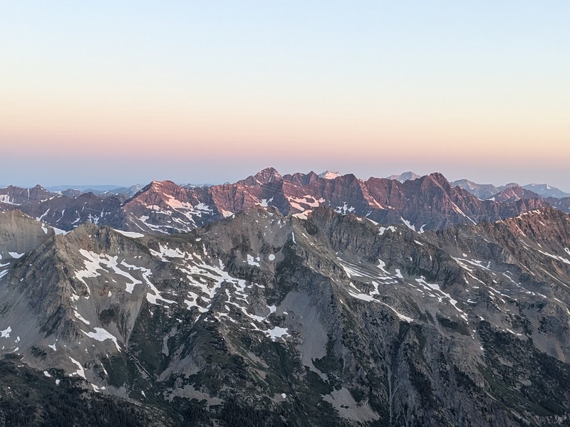
Even though climbing Thunder Pyramid felt like a natural chapter break in the quest, there are still a few weeks (maybe a month if we’re lucky!) of summer still to be had. The plan is to continue cranking through more of the San Juans while they are still dry and ice free. Even with a month of peak season conditions remaining, the overly ambitious original goal of bagging the remaining 100 in a calendar year was, very obviously and not to be understated, wholeheartedly unrealistic. Out of PTO, weekends commitments abound, and winter conditions right around the corner, I can honestly say, unmistakably, it will not happen. Six months to climb 48 peaks is semi-realistic for me in spring/summer, but in winter, things slow down in a big way: trailheads shut down, approaches lengthen, avalanche conditions create very small ascent windows, and climbing technical routes becomes a significantly bigger commitment. Without a doubt, climbing these peaks (especially the less frequented 13ers) becomes exponentially more difficult as we move closer to the end of the year.
My original mindset with the Quest to 100 was to set a goal that I felt I had an honest 50/50 chance at being able to complete. That being said, even if I went all-in, the maximum amount effort I could muster within my means, all my chips on the table, I still wanted that 50% chance. Sure, I could have reduced my list to climbing the remaining 14ers (which would have been 41 for me), but I honestly knew that I could achieve it. For me, the 100 represents a willingness to fail. A willingness to put it all on the line, sacrifice everything and try your absolute darndest for just a 50% chance of success. The odds are what entice me. The odds are what keep me coming back. With overly ambitious goals come triumph, overcoming struggle, beating the odds, and, most importantly for me, expanding the scope of what you believe you can do and what you can actually do. Exploring the proverbial uncharted labyrinths that is the complex interface between our mental and physical worlds has truly been at the heart of the quest since its conception. For me, the quest has been an opportunity to pivot, bargain with failure, to explore the boundaries of the possible, to absorb every moment of the journey, not the finish line. And for all of this, the medium is, simply, the mountains. That’s it: mountains. We’re just climbing mountains over here, folks; we’re not saving the world!
And so we carry on. Longs can wait. The Chicago Basin can wait. The Grenadiers can wait. Time carries on as it always does and I’m confident I’ll find myself on top of these majestic vistas before long. The train is coming and I’m still full steam ahead!
Thanks for reading and tagging along! See you in chapter 4 for, what I will guess to be, a lot of snow! Godspeed: go hiking!