Download Agreement, Release, and Acknowledgement of Risk:
You (the person requesting this file download) fully understand mountain climbing ("Activity") involves risks and dangers of serious bodily injury, including permanent disability, paralysis, and death ("Risks") and you fully accept and assume all such risks and all responsibility for losses, costs, and damages you incur as a result of your participation in this Activity.
You acknowledge that information in the file you have chosen to download may not be accurate and may contain errors. You agree to assume all risks when using this information and agree to release and discharge 14ers.com, 14ers Inc. and the author(s) of such information (collectively, the "Released Parties").
You hereby discharge the Released Parties from all damages, actions, claims and liabilities of any nature, specifically including, but not limited to, damages, actions, claims and liabilities arising from or related to the negligence of the Released Parties. You further agree to indemnify, hold harmless and defend 14ers.com, 14ers Inc. and each of the other Released Parties from and against any loss, damage, liability and expense, including costs and attorney fees, incurred by 14ers.com, 14ers Inc. or any of the other Released Parties as a result of you using information provided on the 14ers.com or 14ers Inc. websites.
You have read this agreement, fully understand its terms and intend it to be a complete and unconditional release of all liability to the greatest extent allowed by law and agree that if any portion of this agreement is held to be invalid the balance, notwithstanding, shall continue in full force and effect.
By clicking "OK" you agree to these terms. If you DO NOT agree, click "Cancel"...
I am writing this report on 13067 and Clark Peak to shed a bit more light on the routes for these peaks from Pierre Lakes basin using the Bear Creek approach. To start let me say if you read no further than this but want to do the Bear Creek approach in the future I highly recommend at the waterfall going left around the waterfall and NOT right over the slabby aspen section. See below for further details and pictures but I think this was hugely helpful in the route compared to reading other reports of the approach.
For a bit of background, I have wanted to do these peaks for a while as I felt they were likely the toughest 13er challenges I had left in the Elk range. I figured the Climbing Cooney’s on their site climb13ers.com dubbed 13,067 13,SOB for a reason. Needless to say, I have anticipated these for a while. A few years back I picked up Derek Wolfe’s Elk Range 13ers guide which has really been a great book for the Elks and I highly recommend grabbing one. In his book for Clark and 13067 he mentioned easier climbs of these peaks from the Pierre Lakes Basin then the usual Moon Lake approach with the caveat that he felt the approach was longer and harder up Bear Creek. He mentioned a bonus of doing 13067 from this side was to avoid the harder northern “mud gully” and one could potentially do Clark’s “easiest” south slopes route as well from the Pierre Lakes Basin. This had me interested in trying to do both peaks on the same day. However, I had not read of anyone doing this. I knew the approach and scrambles would be a challenge along with a substantial amount of talus in Pierre Lakes Basin but felt if I had a good weather forecast it was possible. I had hoped to do it for a few years but never had weather and partners align. Ben (Supranihilest) recently wrote a fantastic report of 13,067 which cemented my plan to do 13,067 from this side. This past week things aligned with a 0% storm chance forecast and my buddy Will E was able to join so we planned for the climb on the upcoming Saturday.
I drove down Friday after work from Eagle to meet Will at the Maroon Snowmass trailhead. It was my first time there since 2009 when I finished the 14ers on Snowmass. Things have changed a tad since 2009… the trailhead is small and was full which I imagine happens regularly now on busy summer weekends. Will (a frozen 14er finisher!) of course knew of the winter trailhead and some parking there so we parked there to camp in our trucks instead. This did add 0.6 easy miles up the road to the trailhead in the morning.
We woke at 430 AM and started hiking shortly before 5. It was smoky from the recent fires with ash on the trucks but fortunately as the morning went on we climbed above the smoke layer. From the winter parking it was about 4.5 miles until we turned right and forded Snowmass creek. I would say we did not feel we mastered this creek crossing on the way in or out. Will slipped off a rock and got feet wet on the way in. We tried a crossing a bit lower in the creek on the way out but I slipped off a log into the creek and we both ended up with wet feet for a portion of the day. If I were to do it again, I would just carry sandals and ford the creek and leave them after the crossing for the return trip. I can see how this creek crossing would be scary in peak run off.
Will on the amazingly flat enjoyable first several miles of the Snowmass trailFording snowmass creek. I took shoes off on the way up, on the way down I slipped off a log and enjoyed wet feet the rest of the hike out
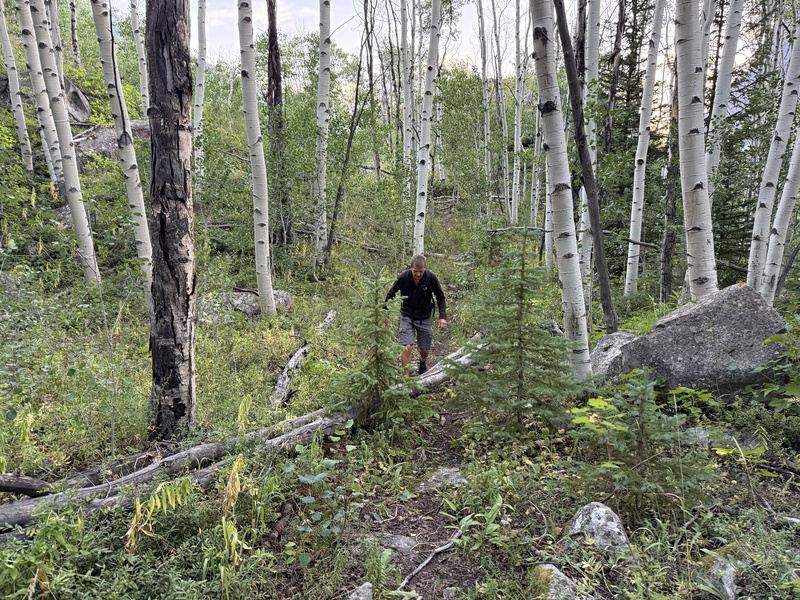
After the crossing we were able to find the use trail up into Bear Creek drainage on the right side of the creek and this was a great trail as Ben mentioned in his report and helps substantially with the approach limiting the bushwhacking. We did get pulled off at times by game trails but overall, it’s there and really helps to the waterfalls and above the waterfalls.
Heading up Bear CreekThe overall nice Bear Creek use trailShortly after crossing Snowmass creek
This brings me to the crux of the approach. Derek’s book mentions staying to the north or right side of the falls. Ben mentioned he thought left looked easier, but their beta was to go right over a slabby section with aspens. He talks about it being a pretty heinous bushwhack. I had wondered looking at photos if one could go left of the falls and sneak near the obvious strip of pine trees next to a cliff band and avoid some of the bush whacking. I figured if I was hunting or had zero beta, looking at it there is no way I would choose right over left, and Will was willing to try left. This ended up being a very good decision I believe. We crossed the creek well below the falls and before any willows started. We then side hilled above the willows on talus, there is a minor band of small pines to get through which was easy and this led to a talus/willow free slope. We took this up to the trees, next to the cliffs and climbed up to what looked to be an old mine shaft in the base of the cliffs. From here we could see there was a steep yet easy, bushwhack free option to get above the trees between the cliffs and the band of pines mostly on grass/talus. Once above the trees we cut right back towards the creek above the waterfall using again mostly grass requiring very minimal willow bashing and then angled through the forest to find the trail above the falls after crossing Bear Creek again. This was a very average bush whack, and in my opinion straight forward and seems much better than Ben’s report of the right side of the falls. Do what you want, but in my opinion, go LEFT at the falls! See below for photos.
Here is the photo of the falls, most beta says go right through the aspens and slabs but left seemed to have a relatively bushwhack free way. It ended up being relatively painlessHere is the same photo with a line drawn in of our rough route. The mine shaft can be seen in the large cliff walls on the left near the band of trees level with the waterfalls.The mine area that is a good landmark to get to on the bypass of the fallsWill coming up the slope tucked behind the band of trees and between the cliffs. The mine area is just below himWill coming down the willow and aspen free climb left of the falls on return showing the view up the waterfall bypassWill above the band of trees, mine shaft and waterfall cutting back to the forest with minimal bushwackCrossing back over Bear Creek above the waterfalls as we angled through the forest back to the use trail.
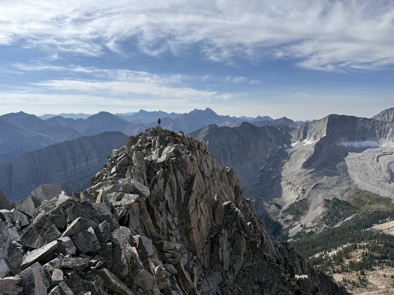
After we relocated the trail above the falls, we followed this up into the basin where the views of Snowmass grow substantially as you go. I was pleased to have reached Pierre Lakes Basin as I had always wanted to stand in this amazing place rather than just gaze down into it. After working up the valley mostly still following the use trail, we then turned right to start our ascent up 13,067. We ended up turning up a bit too early but contoured into the correct and obvious gully once you see it and then started the ascent. This is a grind, but overall, it was what we expected. As we neared the saddle we contoured left under some difficulties on an ascending traverse on broken class 3 to the false summit. The initial class 3 portion of the climb has a lot of loose rock but minimal exposure. Rock fall is the main danger here in my opinion. From the false summit, the class 3 traverse (dubbed apparently “the wings of God” traverse) to the main summit was as advertised. It is exposed at a few spots, but it is somehow solid. At one point there is a small knife edge and another where we squeezed between two vertical flakes of granite. Everything looks like it should fall off the ridge and it is not confidence inspiring with the exposure to both sides. Fortunately for us nothing moved as we delicately made our way to the true summit and back. We summited about 930AM. The paper in the register has a plastic like feel and unfortunately is crumbling. We were the first ones to sign in since Ben and Whiley did last fall making us the first to sign in this year. The views of the basin are amazing, and we could see our intended route up Clark.
Above the falls at a good camp site nearing the turn off for the climb up 13067Will with 13,067 ascent gully behind him. We started up 13,067 a bit early but contoured into the correct gullyWill on some of the initial ascending traverse to the false summit high up in the gullyWill on the third class higher on the peak nearing the false summitWill on the false summit of 13,067, with the "wings of God" traverse between him and meWill on the traverse portionWill signing in to a hard earned and rarely visited peak (we were the first this year)Summit shot with Capital and Clark behind. The south ridge route of Clark we took is pretty much the entire ridge coming left off the summit in this photoWill on the main summit while I took a photo back to him on the "wings of God" traverse. It's amazing it is solid and nothing moved. Test everything here
After some pictures, I knew the traverse up high to Clark was a no go so we headed back to the south facing gully and started the decent. I think Will and I both thought this was our least favorite part of the day. It’s not overly steep but lots of loose scree on some hard dirt and looser small talus that slides around some. It didn’t really seem dangerous but just tedious and we thought it was a bit tougher going down then up the southern gulley of 13,067. As soon as we got below substantial cliffs in the gully on descenders right, we climbed a small rib and started contouring towards Clark and the farthest east Pierre Lakes.
Will in the gully on decent, we did not descend the entire gully and started the traverse over to Clark and Pierre lakes higher on the slope to try to minimize the decent in the gully after the cliffs were bypassed
The talus of Pierre Lakes basin is large and also expansive, but we found it to be overall stable. There really is no talus basin like it that I can think of in Colorado and the lakes with the views of Capitol, Satan's traverse, and Snowmass are unmatched. From Pierre lakes 13,067 looks like an absolute monster and the ridge traverse from 13,067 to Clark looks absolutely daunting! I've not found any reports of it being completed and looking at it from below I'd be surprised if it has been done. The talus traverse in the basin was not fast going but we were soon between the two eastern most Pierre Lakes looking at the ~1,400 foot climb up the southern ridge of Clark. I had very little beta on this climb but knew the crux was lower in the climb. From the lakes we followed steep tiny strips of grass up to a bench above the lake and then started towards the south ridge and the 3rd class climb. It looks steep and loose when approaching. Fortunately, we found the ~200 foot class 3 climb to be very stable and soon we were on easier ground above the cliff band. I was anticipating this ridge to be loose and steep but we both found it to be a straightforward class 2 climb. The boulders and talus are large and engaging to scamper about and overall, the ridge was substantially more stable and enjoyable then we both anticipated. Care must be taken as I am sure you could encounter a larger moving rock but by in large the climb was stable and very enjoyable. We summited right at noon. This was Will’s second time up Clark as he had done it form Moon Lake the previous summer. Thanks again Will for joining me on a repeat for you! For what it’s worth, he thought the scrambling portions of the South ridge vs West ridge were comparable overall and if doing Clark alone Moon Lake would be the way to go.
The views from the summit are stupendous and we could see people on K2 and the knife edge. We checked out every bump on Clark’s summit for photos (13,067 looks so tiny from Clark) and contemplated descending to Moon Lake to make the trip a loop but ultimately felt it may be our only time in Pierre Lakes basin so eventually headed back down the south ridge to the 3rd class scramble and to the lakes where we had lunch.
Just above the farthest east Pierre Lake. We went around the left side of this lake then started up Clark to the initial bench with the small patch of snow then climbed the left/southern ridge of Clark.Will climbing above the lake using the little bit of grass Pierre lakes offered gaining the initial bench above the lake. 13,067 looks absolutely menacing from upper Pierre Lakes basinLooking up the class 3 scramble to start the ridge. It looked pretty intimidating but with some weaving and ledges could be kept class 3Will on the 3rd class portion of the climbMore of 3rd class ascent on ClarkNearing the top of the scrambling (this was taken on decent. It was steep 3rd class but overall, very stable and much less loose than we expected)2nd class ridge walk above the 3rd class initial scramble. Lots of large boulders but we found them engaging to scamper around and overall fairly stable. 13,067 to upper leftWill just above the initial difficulties of the south ridge of Clark with Pierre Lakes basin in all its talusy gloryLooking up the route above the 3rd class. Again, we were surprised how stable and less steep this ridge was. It steepened a bit up near the summit with larger boulders, but we found it fun and engagingnearing the summit looking down the ridgeNear where we crested the summit ridge. We could see people on Capitol and the knife edgeWe walked to both bumps on Clark's summit for better shots of Capitol and 13,067. Summit shot of Capitol with the Will E poseSummit shot with me and Will framing 13,067 well below us
From the lakes we started to notice what seemed to be search and rescue helicopter activity circling Snowmass area. The helicopter was active most of our hike out of the basin. I hope everything is ok with anyone that may have been involved in an incident.
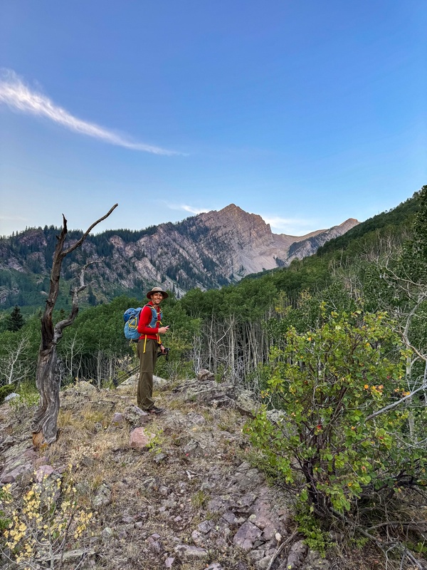
We saw from higher on the peaks we could get on grass for a good amount of the decent down to the lower basin and this worked out well. There was one very steep section in the trees that we feared may cliff out but ultimately it went to the valley floor where we found the use trail for the remaining decent. At the falls we retraced our steps around the water fall in the way we ascended and back to the trailhead to complete a fantastic day on 2 amazingly rewarding elk summits getting back to the trucks at 530PM.
Finally reaching some grass in pierre lakes basin ready for the walk out Bear Creek. 13,067 above Will still looking menacing
Total stats on the day from the winter parking were - 20.3 miles and 7K of gain in 12.5 total hours of time. These 2 peaks lived up to their reputation but if doing 13067, the southern route is the winner in my book but it sure still doesn’t come easy. I hope this info is helpful to some in the future.
My GPS Tracks on Google Maps (made from a .GPX file upload):
Nice climb and linking up two difficult peaks in one trip! This is a great report on two spectacular peaks not climbed much, especially 13067. I approached 13067 via Moon Lake, then took the loose gulley to the NE of Clark, descended into the Copper Creek 13067 basin, then hit the approach ramp to the false summit. There are definitely a few ways to get up there, but all of them off trail and remote.
Will - I can’t wait for our next outing already whenever that may be!
Luke- the moon lake approach looks difficult well done on that route! No matter how you slice it 13067 is a tricky little dude. Congrats on your recent bike tour of the 14ers, that’s really impressive!
Desertdog- I actually read your Clark conditions report a while back as part of realizing Clark was an option from this side. Nothing easy about this day and some may want to backpack to above the falls to help get it done. Doing it in one day is certainly ambitious and requires sublime weather forecast. I hope the easier bushwhack around the falls will help others
No joke about the talus. Last year I descended into it after Capitol/K2 all the way to Heckert Pass and I think I walked backwards because of how long it took in the endless sea of never ending rocks. I should have come out Bear Creek but I am stubborn. Felt like the last time I was out will Will when I had a genius idea for the Alto peaks. This means Will had climbed Clark twice now? Ask him if he's ready to do this in winter. I know a great route!
9patrickmurphy - glad it will be beta that hopefully helps! I’ve received so much info and help from this community on different peaks it makes me very happy if I can help someone else with some beta!
Blazintoes - Will has recounted a few of you guys adventures to me! He actually brought up Clark in winter to me on this very trip but said he wasn’t planning on it. Knowing Will I’d bet you could talk him into it though!
Caution: The information contained in this report may not be accurate and should not be the only resource used in preparation for your climb. Failure to have the necessary experience, physical conditioning, supplies or equipment can result in injury or death. 14ers.com and the author(s) of this report provide no warranties, either express or implied, that the information provided is accurate or reliable. By using the information provided, you agree to indemnify and hold harmless 14ers.com and the report author(s) with respect to any claims and demands against them, including any attorney fees and expenses. Please read the 14ers.com Safety and Disclaimer pages for more information.
Please respect private property: 14ers.com supports the rights of private landowners to determine how and by whom their land will be used. In Colorado, it is your responsibility to determine if land is private and to obtain the appropriate permission before entering the property.








 Download GPX file used in this map