Log In 
Report Type 
Mini
Peak(s)  Meeker Ridge  -  13,861 feet
Mt. Meeker  -  13,916 feet
"Southeast Longs" 14,067 ft
Longs Peak  -  14,259 feet
Pagoda Mountain  -  13,488 feet
Storm Peak  -  13,323 feet
Mt. Lady Washington  -  13,277 feet
Battle Mountain 12,043 ft
"Pine Ridge" 11,925 ft
Estes Cone 11,009
Date Posted  08/05/2025
Modified  08/06/2025
Date Climbed   08/04/2025
Author  Choss Plate
 Extreme Yoga: Tackling the Ten Tadasanas   

First off, I want to acknowledge jessesumrack's excellent report of this linkup. That, along with the other "slam" reports will be a better resource for detailed photos and descriptions. However, I didn't see a gpx of the whole route anywhere, so I figured I would use a "mini" to upload mine as well as add my own thoughts on the route.

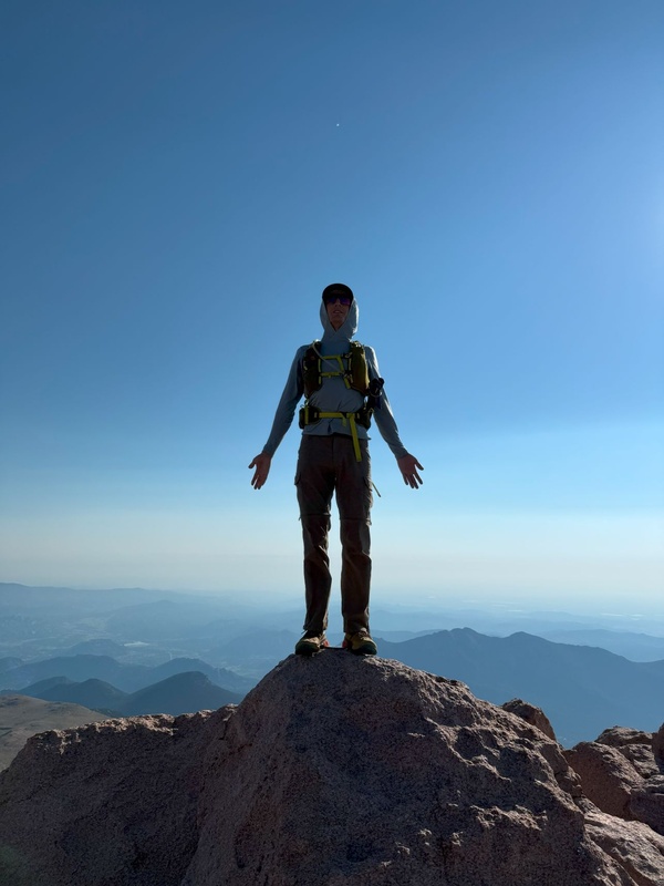
I too have had Nesotaieux's Ten Tadasanas on my radar since I first saw it in Roach's guidebook. It seemed to perfectly straddle the line between "that sounds ridiculous" and "probably doable". The opportunity to bag a yet unclaimed tricentennial and a 73-lister were icing on the cake. Also, I wanted to add my twist of actually DOING a tadasana on all 10 peaks. Now, the sum total of my training for this goal was to google "tadasana yoga pose" and try to mimic the first image results, so I don't think I'm winning any yogi awards, but I think I gave it a solid effort.
23178_03
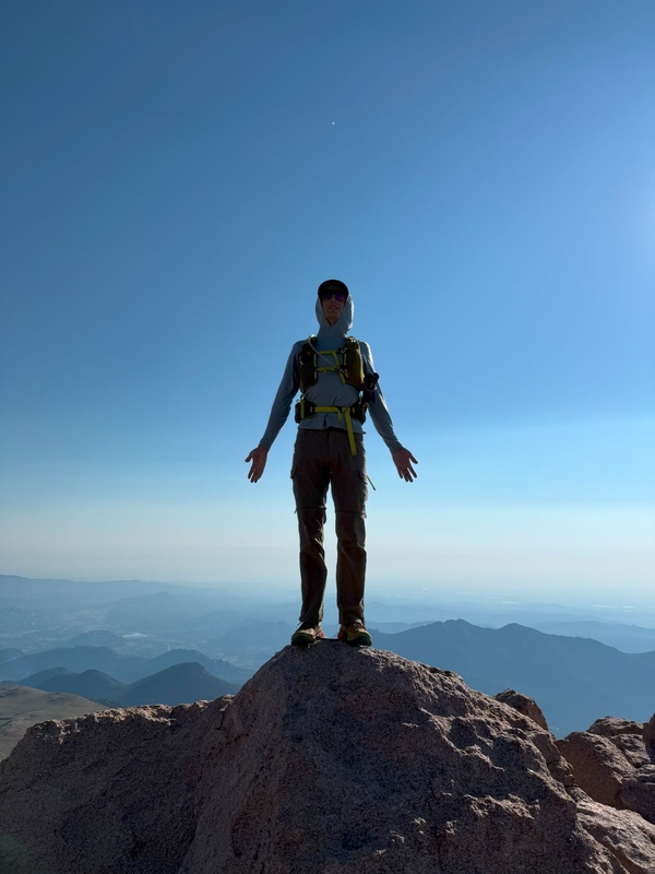
On Longs. My only pose caught by an actual human, not my phone on a timer and tripod


A condensed Timeline / Stream-of-thought:

  • I started just after 4:00 AM, with the goal of "headlamp off" at Chasm Lake and pretty much nailed it. Great start!
  • Iron Gates to Meeker Ridge is an awesome route up Meeker! Way better than when I trudged up the south slopes six years ago. That last time, I'd taken a few steps towards the east peak, but bailed quickly. This time, the ridge was cruiser and fun. What a difference those years of experience make!
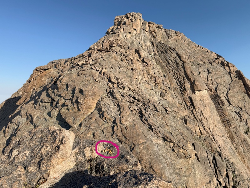
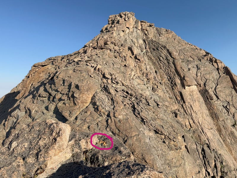
  • There's a rappel anchor at the top of Southeast Longs. I'm not sure if that's in the spirit of the challenge, and it's a long day to be hauling a rope, but I was thinking of those chains as I passed directly below them a little while later. Maybe bribe a friend to carry the rope?
  • This was my first time on Clark's Arrow and found it to be pretty straightforward. I was honestly expecting more cairns on such a well-traveled route, but I never felt lost. The hardest part was figuring out where to start. That may be easier when traversing the loft instead of downclimbing SE Longs. I didn't find the arrow, which was a bummer. Not so much for routefinding but more because I wanted to see the famous mark.
  • I probably should have previewed more beta for the traverse to Pagoda. I overshot on the narrows a little, but found a ledge system that let me do a descending backtrack to get back on route without much fuss. Then I cliffed out over the Keyboard of the Winds TWICE! Entirely because I was too stubborn to go as far left as required. Don't be dumb like me. Just follow the cairns to the correct downclimb, and it goes fine.
  • A funny story from Storm Peak: On my way up and on the summit, I heard some "booming" noises. Like maybe a far off shotgun blast or maybe rockfall? i was seriously considering asking a ranger what was up when I got down. Then, as I descended towards the campsite, I noticed the the privy doors would occasionally slam loudly, and now I'm like 90% sure, I was just hearing those slams with the weird acoustics from echoes off Lady Washington and all the other rock in the area.
  • While descending Lady Washington and noting the tundra walk to Battle Mountain, I was slightly concerned by the number of people on the trail. I really didn't want to explain to a "trail Karen" why I was deliberately leaving the trail despite all the signs specifically saying not to do that. Fortunately I crossed the trail during a perfect lull in the crowd and got away scot-free.
  • I was prepared for the bushwhack to Estes Cone to really suck, and don't get me wrong, it's not fun. But there's enough relatively open areas in the forest, and I prioritized linking those over a direct line towards the trail. There's some heinous spots of deadfall and underbrush in there, but if you don't mind a little wandering, you can probably find a way that doesn't require bashing through them.
  • I got back to the trailhead almost exactly at 3:00 PM, so just under 11 hours total. Pretty fast, I think, but there's crushers here I'm sure could do better. Guidebook says 17.8 mi and 8,720 ft, and my watch recorded 17.64 mi and 9,206 ft. Pretty close!


Now for the most important question: The dang pushups. The whole day, I was convinced I'd do all 100, even if I had to take my time and split them into sets. Unfortunately, I was forgetting the critical fact that I hadn't done a single pushup in at least a year. So, I started off ok for the first 20 or so, and then my arms just... gave up. After a few more declining sets, I squeaked to 51 and called it. If there was more than pride on the line, I'm sure I could have stuck around for another hour, chipping away at the 100, but I was ready to go home. So, just a warning if you're built like me (read: nothing but legs and some climbing muscles) and want to get this thing 100% clean, you may have to train a little, lol.

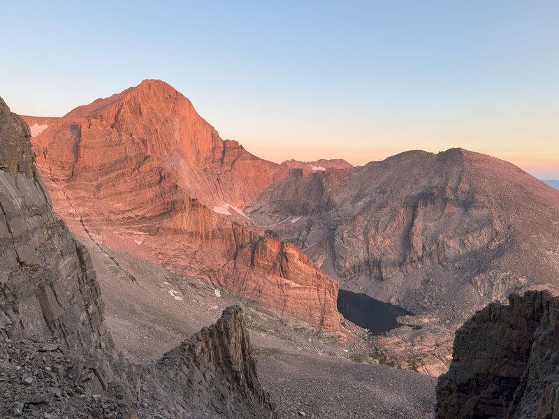
23178_04
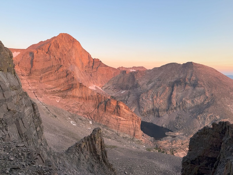
My favorite shot of the day. Iron Gates at the perfect time.
23178_06
Tempting anchor on Southeast Longs. I wonder how much time you could save if you rappel into The Notch.
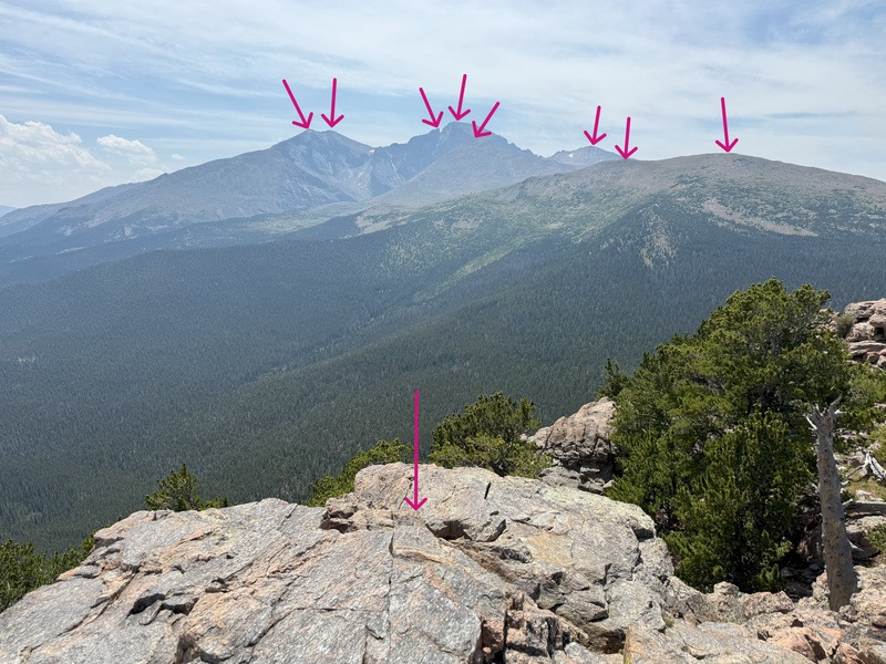
23178_08
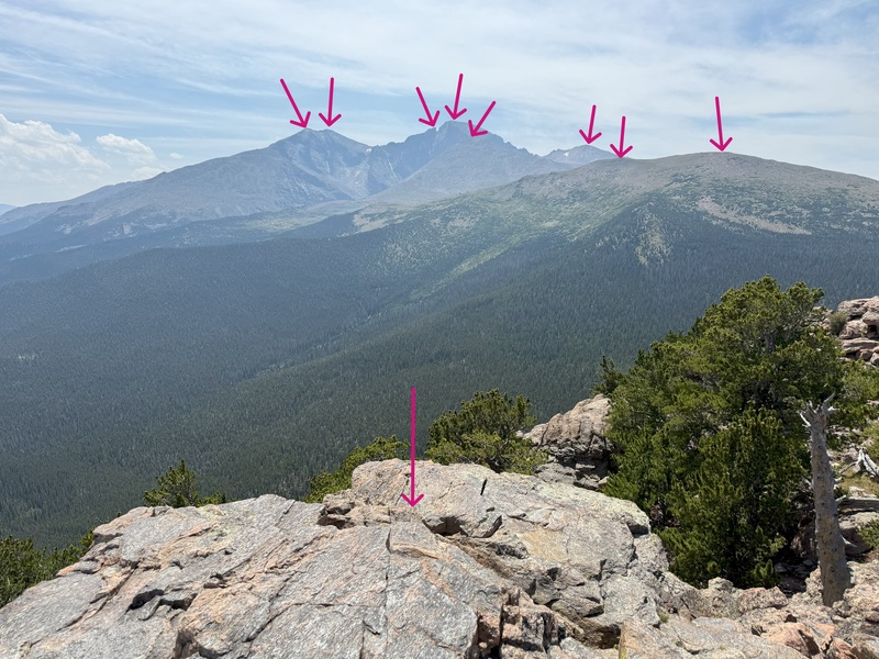
Estes Cone gives you a great opportunity to reflect on your day. 9 of 10 peaks are visible. Only Pagoda is hiding.

My GPS Tracks on Google Maps (made from a .GPX file upload):


Thumbnails for uploaded photos (click to open slideshow):
1 2 3 4


Comments or Questions
   Not registered?


Caution: The information contained in this report may not be accurate and should not be the only resource used in preparation for your climb. Failure to have the necessary experience, physical conditioning, supplies or equipment can result in injury or death. 14ers.com and the author(s) of this report provide no warranties, either express or implied, that the information provided is accurate or reliable. By using the information provided, you agree to indemnify and hold harmless 14ers.com and the report author(s) with respect to any claims and demands against them, including any attorney fees and expenses. Please read the 14ers.com Safety and Disclaimer pages for more information.

Please respect private property: 14ers.com supports the rights of private landowners to determine how and by whom their land will be used. In Colorado, it is your responsibility to determine if land is private and to obtain the appropriate permission before entering the property.