Download Agreement, Release, and Acknowledgement of Risk:
You (the person requesting this file download) fully understand mountain climbing ("Activity") involves risks and dangers of serious bodily injury, including permanent disability, paralysis, and death ("Risks") and you fully accept and assume all such risks and all responsibility for losses, costs, and damages you incur as a result of your participation in this Activity.
You acknowledge that information in the file you have chosen to download may not be accurate and may contain errors. You agree to assume all risks when using this information and agree to release and discharge 14ers.com, 14ers Inc. and the author(s) of such information (collectively, the "Released Parties").
You hereby discharge the Released Parties from all damages, actions, claims and liabilities of any nature, specifically including, but not limited to, damages, actions, claims and liabilities arising from or related to the negligence of the Released Parties. You further agree to indemnify, hold harmless and defend 14ers.com, 14ers Inc. and each of the other Released Parties from and against any loss, damage, liability and expense, including costs and attorney fees, incurred by 14ers.com, 14ers Inc. or any of the other Released Parties as a result of you using information provided on the 14ers.com or 14ers Inc. websites.
You have read this agreement, fully understand its terms and intend it to be a complete and unconditional release of all liability to the greatest extent allowed by law and agree that if any portion of this agreement is held to be invalid the balance, notwithstanding, shall continue in full force and effect.
By clicking "OK" you agree to these terms. If you DO NOT agree, click "Cancel"...
Pretty awesome peak! West Eolus has 299.475 feet of prominence and is only ~7.62 mm (a stack of 5 pennies) shy of being ranked. Boggy’s beta for this peak is spot on.
Some anchor notes for rappels as of 7/30/25: P1/R3 has a slung horn (new sling) and a slung choke stone P2/R2 has 3 bomber looking nuts and a new sling P3/R1 has a new sling around the boulder, a solid nut, and a solid pink tricam (always pink lol)
We used a single 70m rope and didn’t have any issues with it getting stuck. R2 to the top of P1 is almost exactly 35m. We were also able to pull the R2 rope from the top of P1 instead of around the corner. A set of double ropes should probably be pulled around the corner as Boggy instructs.
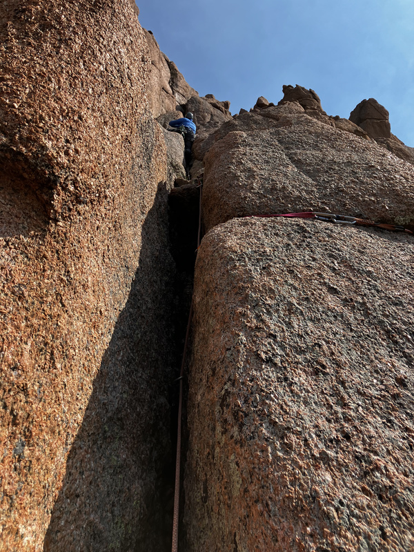
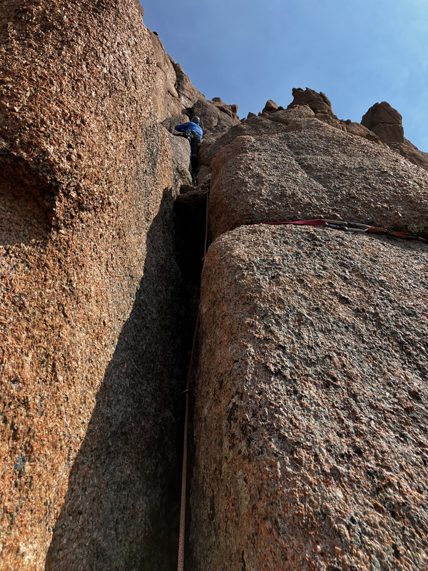
We found the crux off width to be pretty tricky! We don’t climb off width very often and only climb moderates. I initially couldn’t find a way up but my dad saved the day and somehow wriggled up. We didn’t have a #4 cam but it would’ve been nice as we wouldn’t have had to reach so far into the off width to place it. I ended up using a cam as an aid handhold.
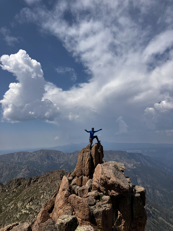
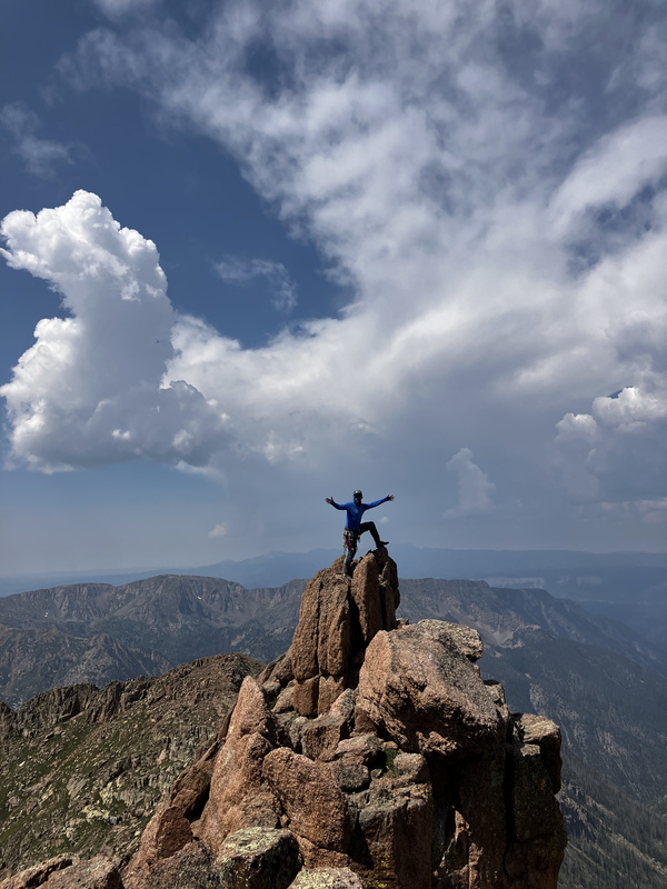
Not a lot of warm fuzzies on the summit block as it’s a crumbling piece of granite that would deposit you at the bottom of the cliff if it so desired. One could belay it if they really wanted to.
All three pitches generally protected really well and rockfall was manageable as all of the anchors/belays are offset left to right. The most dangerous parts were probably the summit block and the class 2+ ledge to access the climb.
Overall an excellent San Juan adventure!
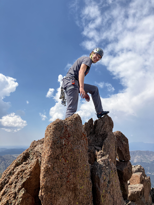
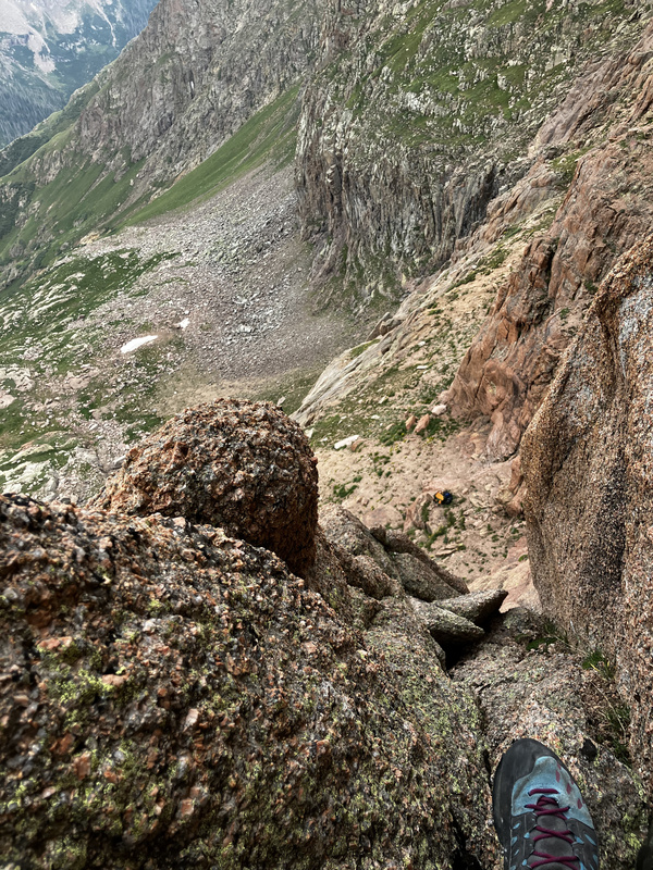
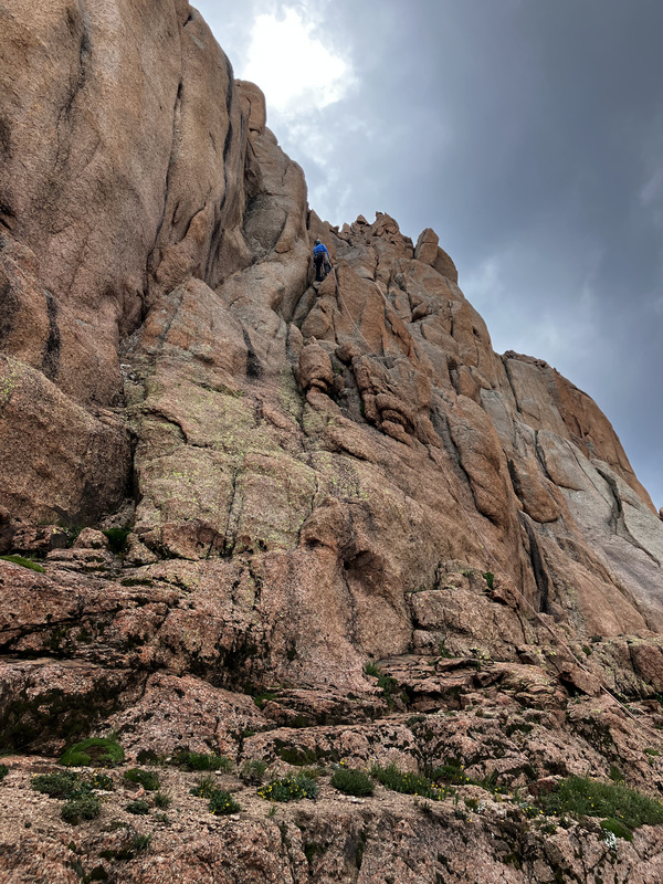
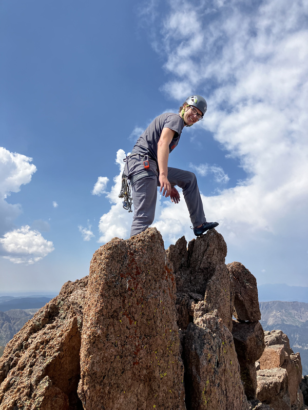
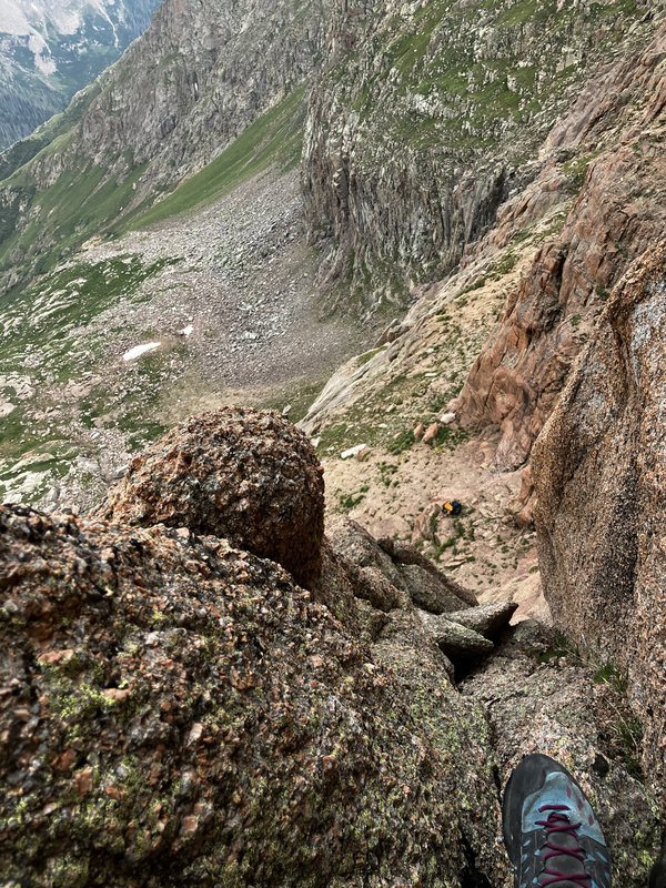
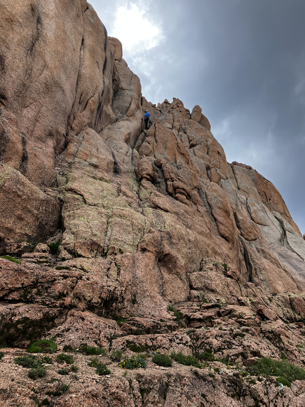
My dad above the crux off width. Notice the wacko cam I somehow placed to the right.Me on the summitMy dad on the summitLooking down P1My dad rappelling P1/R3
My GPS Tracks on Google Maps (made from a .GPX file upload):
A stack of 5 pennies really illustrates the margin here. Look at your foot on the actual summit. Did a LiDAR pass (I think there were 2) grace the few square inches of that point that are within 7.6 mm of the top? With horizontal accuracy of +/- 1 sq. meter (1,550 sq. inches), I submit it did not. lol
The odds are extremely in favor of ranking it. EDIT - I had AI calculate the probabilities (because ew) given the stated params and a very generous estimate of 16 sq. in for the base of the cone that is within 7.6 vert mm of the apex. Probability of a miss is 98.97% for a single pass and 97.95% over two passes.
Keep in mind the same error exists for the elevation of the exact low point of the saddle - if the LiDAR hit a meter further in either direction it would reduce prominence slightly as well!
The probability of LiDAR hitting the exact point in space for the summit or saddle of any peak is almost nil. But the probability of hitting a point within a given vertical distance of that exact point depends on the specific terrain for every summit/saddle.
For most LiDAR-ranked peaks, it's irrelevant. For West Eolus it's critical. Whereas the summit can be represented by a tiny cone with dimensions smaller than the numbers I gave above, the saddle with Eolus is relatively long, narrow, but not a knife edge. So the probability of a LiDAR hit very close to the saddle elevation is far greater than for the summit.
Things get interesting here because the LiDAR return could be lower or higher than the actual saddle. If higher, that increases the probability of being ranked, and if lower, decreases.
I'd guess for W Eolus specifically, the likelihood of sampling the summit by way less than 7.6 mm negates the error at the saddle (though it could add or subtract from prominence).
Certainly seems like the peak is ranked or will at least be debated over rank unless something changes the measurements. I am still very fascinated by how people have reported a class 4 route but can’t recall the details of the route. For you people that have been up it recently and looking around while up there do you think this is the easiest route or is there still a hidden stiff class 4 route in there? It’s just so weird people have reported doing it 4th class…
Corey
I agree, "West Eolus" should be ranked. The margin is so, so small that I think it should be promoted purely err on the side of caution. It's just too close, and there's too much room for error, to say with certainty whether it truly is or truly is not. Anyone saying "I want to climb all of X," where X is likely the ranked thirteeners, should climb it so there is zero question whether they did or did not climb them all. Hopefully further measurements make my opinion into fact.
Caution: The information contained in this report may not be accurate and should not be the only resource used in preparation for your climb. Failure to have the necessary experience, physical conditioning, supplies or equipment can result in injury or death. 14ers.com and the author(s) of this report provide no warranties, either express or implied, that the information provided is accurate or reliable. By using the information provided, you agree to indemnify and hold harmless 14ers.com and the report author(s) with respect to any claims and demands against them, including any attorney fees and expenses. Please read the 14ers.com Safety and Disclaimer pages for more information.
Please respect private property: 14ers.com supports the rights of private landowners to determine how and by whom their land will be used. In Colorado, it is your responsibility to determine if land is private and to obtain the appropriate permission before entering the property.




 Download GPX file used in this map