| Report Type | Full |
| Peak(s) |
McHenrys Peak - 13,330 feet Powell Peak - 13,195 feet Taylor Peak - 13,157 feet |
| Date Posted | 07/15/2025 |
| Date Climbed | 07/13/2025 |
| Author | Tunevins |
| Stoneman to Andrews Glacier - McHenrys, Powell, and Taylor |
|---|
|
I wanted to do this route because a buddy of mine was trying to talk me into doing the Glacier Gorge Traverse. The whole thing sounded miserable, but this section looked fun and manageable. I'd read about McHenry's and how it's supposedly the hardest non-technical summit in the park. I don't know about that, but it was a lot of scrambling, and a lot of fun. First off, I decided to do it clockwise because the scrambling looked very fun on the southern ridge/face of McHenry's. I wasn't sure how the knees would be feeling at the top, so I figured I'd just do the part that looked the most fun first and decide whether to continue at that point. This route would probably be faster going the other way, although downclimbing McHenry's and Stoneman would be much more strenuous than glissading down Andrew's Glacier. I started solo from the two-thirds-full Glacier Gorge parking lot at 4:10am. The headlamp brigade had begun, but I saw nobody on the fire trail. I made it to Black Lake in just under an hour and a half, just in time for a nice sunrise. 
Above Black Lake, the trail meandered south a bit and some point the trail split. I took the fainter one to the right, roughly westward. Past this it was a bit of a choose-your-own adventure up through the vegetation and to the bottom of the slabs below Stoneman. Because of the snow, it helped me to take a picture of the pass from below to reference on my way up. The snow may not have been completely avoidable, but I didn't use spikes. They could have been nice, but I felt lazy and didn't want to grab them out of my pack. 
At 7:10, about 3 hours after leaving the trailhead, I made it up to Stoneman Pass. The view is pretty incredible from up there, and to be honest, getting to this point was more difficult in terms of routefinding than the rest of the way up McHenry's. I could see the ridge being super windy, but it was very pleasant and calm this trip. 
Starting up McHenry's, I stayed on the face most of the way up. There are dozens of options to make it harder, but the C3 route is pretty obvious up the face. Stay close to the ridge, but don't bother climbing the tallest points unless you're looking for more of a challenge. At some point it becomes pretty clear that the easiest route cuts over to the left below a tall pillar of rock. It looked like there were a lot of C4 / low C5 options if you stay higher on the ridge, but I was alone and went for the more conservative route. 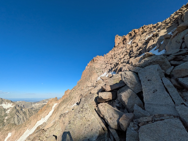
From below the pillar, there are many C3 options to the summit. Don't stress this decision too much. Just pick something that looks fun. 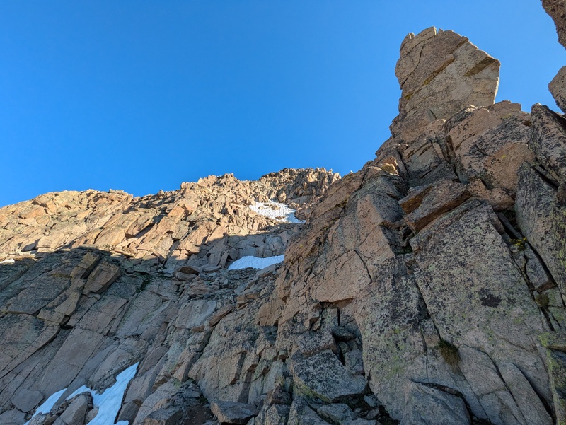
The rest of the climb up McHenry's is very enjoyable. Watch for loose rocks, of course. I did not see another soul until I got below the notch on my way to Powell. This one a very cool route, and I would love to come back with a friend and try some of the steeper sections of the ridge. 
From the summit of McHenry's you get one of the best views of the park. This almost makes up for the long slog you're about to endure. 
After summiting McHenry's, signing the register, and texting my emergency contact (there is service at the summit of both McHenry's and Powell, but not Taylor), I continued on to the north ridge towards Powell. Stay fairly high on the ridge, but keep your eyes peeled for a ledge that runs along the left side of it. This is the best way to enter the exit gully. Another thing to note is that there are three pretty distinct gullies that look like they go towards the notch. The second one is the one I used, but I have read at least one report from someone descending the third. The first one drops you much lower and is probably not advisable. From the top of the second gully, I saw some tat on a square block. After inspecting it and adding a quick link to the very fresh-looking webbing, I rappelled down to a grassy ledge. I used a 65m static line (Petzl Pur line) with a Grivel Scream, which is my favorite rap system if I am not planning on going up anything roped up. 
After the first rappel, I spent a while looking for another anchor, which did not exist. I ended up slinging a large block with some 7mm cord and a quick link. This could maybe use another cord or sling for redundancy. 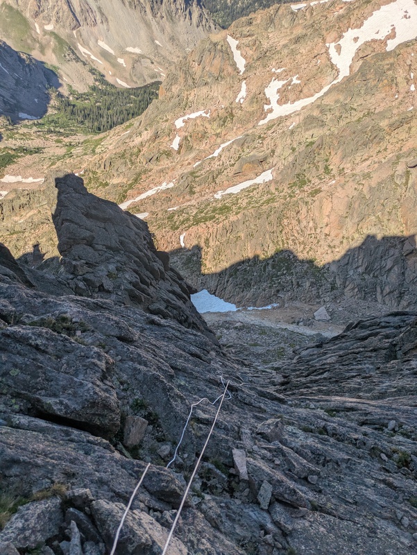
It took me a while to find something I wanted to build an anchor on for the second rappel. The anchor I set up could use a little reinforcement, but I think it is a decent spot. The following picture shows where I packed up the rope and started downclimbing. I think if you had a 70m rope, you could avoid the class 4 downclimbing entirely. It felt a little silly to have spent so much time setting up anchors and messing with a rope and then still having to downclimb a little bit, but the terrain was not too bad. I would say that having the ability to comfortably navigate class 4 terrain makes this route feel much less dangerous. There may have been somewhere to set up a third anchor, but I didn't really have the gear for another one and felt safe downclimbing the rest. 
After having done these rappels, I think it would be fairly easy to just climb up the other direction, but oh well. Once you're on the ground, you'll need to go down a bit through really loose stuff. I would really hate to climb up the gully on the lake Powell side. There is just so much loose rock ready to rip down the narrow gully. As you descend, there is a patch of pretty bare dirt that you can get to without too much hassle. From here it's C2+ terrain around the large rock spire and towards the gully up Powell. I read a report saying that you should not try to stay high from the notch, so that's why I went lower, but in hindsight, I am fairly certain that if you are a decent 4th class climber, staying a bit higher would not be that hard, and would save some nasty, loose vert. The higher route is where I saw the only other person on the entire route from Stoneman to Andrew's Glacier. He was headed the other way. 
Once you're around a big rock face, you should be able to see up the gully. It's the first major weakness you see going up towards the summit. There was still a decent bit of snow in the gully, but it was pretty avoidable if you pick a side up the rock. 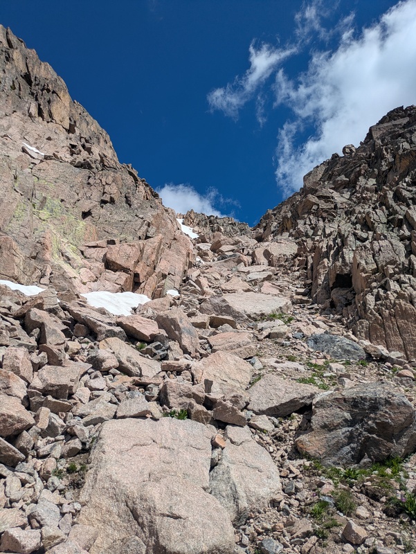
The snow ended fairly quickly, and it was smooth sailing through the mostly class 2 gully. There are probably a few mandatory class 3 moves, but most of it felt pretty easy. 
On the summit of Powell, you get more great views, including a good look at what you just came down. I saw a couple marmots on Powell that were perhaps a bit too friendly. From here you can see Talyor. It doesn't look that far, but don't worry, it will feel farther. 
Along the way to Taylor, you can peep through a few notches to get a nice look at the top of Taylor Glacier and the lakes below. 
I tried my best to keep a high contour along the ridge. Once you start climbing up Taylor, you will soon realize that it may have been worth skipping. After a false summit or two, you finally gain the summit. It's a good view, but man, the vert was getting old at this point. 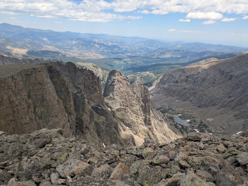
Okay so it's a pretty great view. Sharkstooth, the Petit Grepon, Sky pond, Powell... all of it was worth the hike, however much I complain. Once you reach the Taylor summit, you're done climbing! Congrats, now you get to abuse your knees for over 4,000 vertical feet. Next stop, Andrew's Glacier. 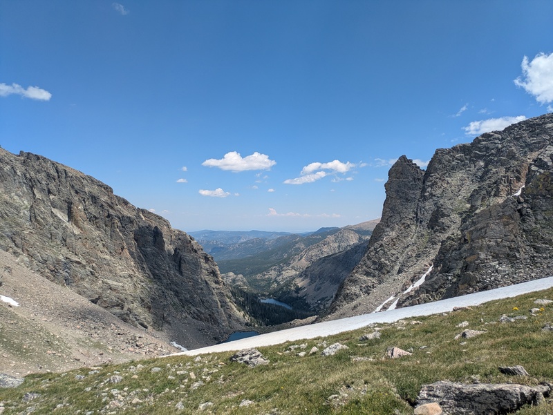
On the way down towards the glacier, I saw a couple bull elk. They were completely unbothered, but I made sure to keep a wide berth. 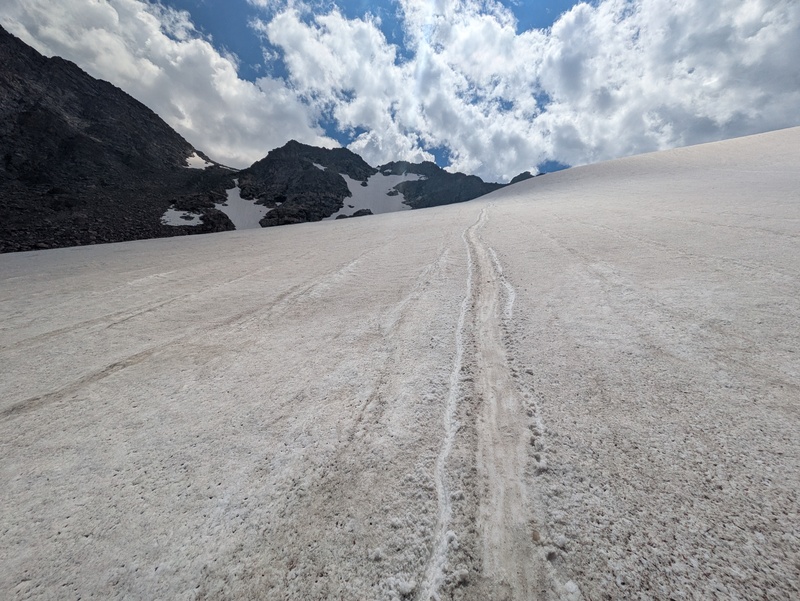
And there you have it! Once I was down to Andrew's Tarn, I dipped my feet and taped some blisters. Remember at this point there are still a few miles and a lot of descending to get back to the car. Overall, this was a nice lap with some incredible views. Either direction would have its own highlights and challenges, but if I did it again, I would go the other way and ditch the rope. Car-to-car in 11:50. My phone says 16.2 miles. Not sure on vert, but I'd guess around 6,700'. Could have cut out some time on the rappels. Thumbnails for uploaded photos (click to open slideshow): ")
")
")
")
")
")
")
")
")
")
")
")
")
")
")
")
")
")
|
| Comments or Questions | ||||||
|---|---|---|---|---|---|---|
|
Caution: The information contained in this report may not be accurate and should not be the only resource used in preparation for your climb. Failure to have the necessary experience, physical conditioning, supplies or equipment can result in injury or death. 14ers.com and the author(s) of this report provide no warranties, either express or implied, that the information provided is accurate or reliable. By using the information provided, you agree to indemnify and hold harmless 14ers.com and the report author(s) with respect to any claims and demands against them, including any attorney fees and expenses. Please read the 14ers.com Safety and Disclaimer pages for more information.
Please respect private property: 14ers.com supports the rights of private landowners to determine how and by whom their land will be used. In Colorado, it is your responsibility to determine if land is private and to obtain the appropriate permission before entering the property.