Download Agreement, Release, and Acknowledgement of Risk:
You (the person requesting this file download) fully understand mountain climbing ("Activity") involves risks and dangers of serious bodily injury, including permanent disability, paralysis, and death ("Risks") and you fully accept and assume all such risks and all responsibility for losses, costs, and damages you incur as a result of your participation in this Activity.
You acknowledge that information in the file you have chosen to download may not be accurate and may contain errors. You agree to assume all risks when using this information and agree to release and discharge 14ers.com, 14ers Inc. and the author(s) of such information (collectively, the "Released Parties").
You hereby discharge the Released Parties from all damages, actions, claims and liabilities of any nature, specifically including, but not limited to, damages, actions, claims and liabilities arising from or related to the negligence of the Released Parties. You further agree to indemnify, hold harmless and defend 14ers.com, 14ers Inc. and each of the other Released Parties from and against any loss, damage, liability and expense, including costs and attorney fees, incurred by 14ers.com, 14ers Inc. or any of the other Released Parties as a result of you using information provided on the 14ers.com or 14ers Inc. websites.
You have read this agreement, fully understand its terms and intend it to be a complete and unconditional release of all liability to the greatest extent allowed by law and agree that if any portion of this agreement is held to be invalid the balance, notwithstanding, shall continue in full force and effect.
By clicking "OK" you agree to these terms. If you DO NOT agree, click "Cancel"...
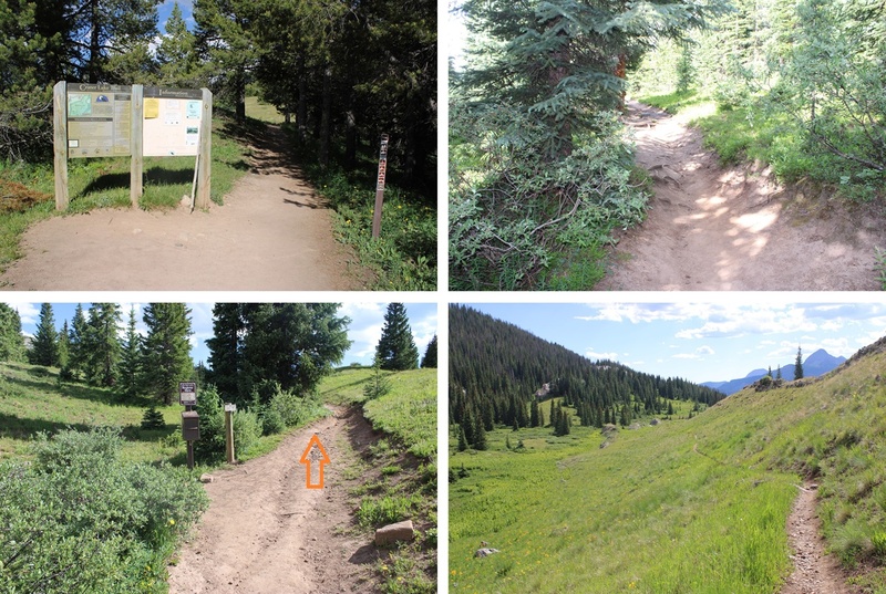
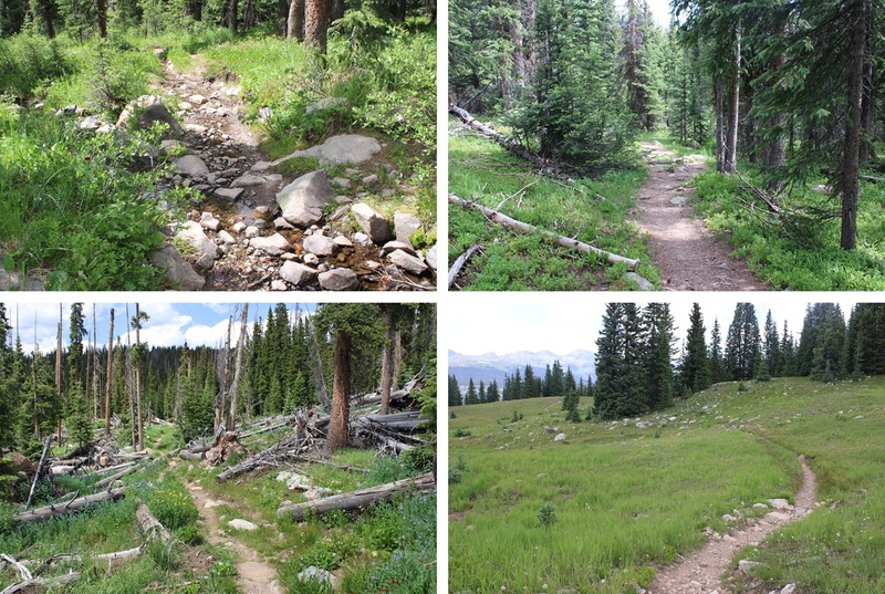
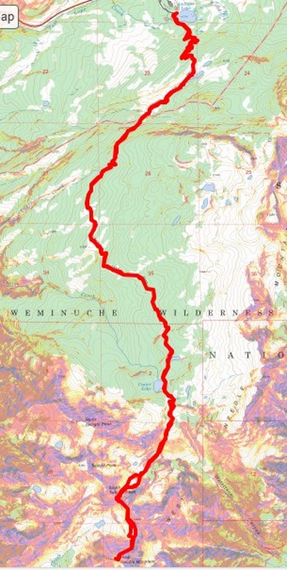
I started from the Andrews Lake trailhead at 6am. On a positive note, the bathrooms were clean this time! No toilet paper, but the seats were clean (always bring your own TP). The trail starts by skirting the south side of the lake.
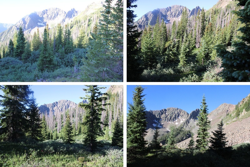
I then took Trail 623/Crater Lake Trail all the way to Crater Lake. This is an easy, class 1 trail that is easy to follow with no major junctions. I hiked the 5.5 miles to Crater Lake on this trail.
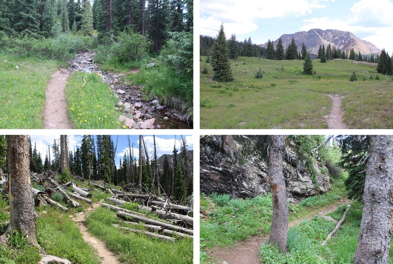
Once at Crater Lake there’s a side trail that goes off to the left. This trail stops at 11750’ at a small pond. I took the trail to the pond.
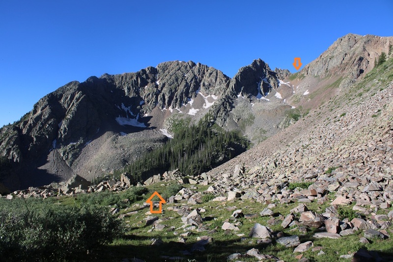
The trail stops at 11750’ and now it’s time to bushwhack. I lost 400’ of elevation as I headed southwest towards a gully I couldn’t yet see. Here’s an overview of where I was headed.
Aiming southwest I skirted the hillside until I came to the end of the trees.
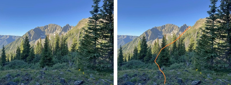
I now had a clear view of my path to the saddle between South Twilight Peak and PT 12932. I kept descending towards the creekbed and then ascended up 1260’ towards the saddle.
The route was obvious but not marked. I went to the left on the way up, to the right on the way down, and both were similar. The left side had larger boulders and the right side had more tundra, but both were essentially snow free and clear.
Here are some pictures of the route to the saddle
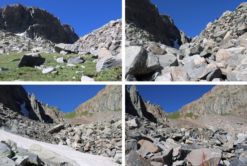
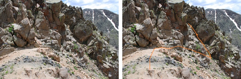
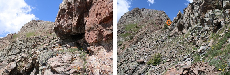
Now at the saddle I had to descend a bit to traverse towards West Needle Mountain. I descended about 25 feet to the south and found an access gully on the left that would get me around the rock outcroppings.
I ascended the class 2 gully
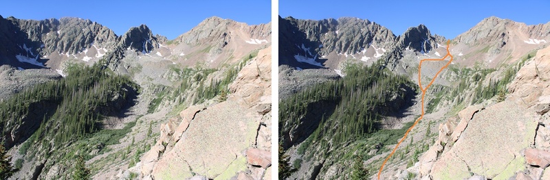
From the top of the gully I could see my intended route for West Needle Mountain. I would initially stay high, just under the rock outcroppings, then pick up a game trail for a while and follow it towards the base of the ridge in the distance, aiming towards just below the two large outcroppings and up a gully.
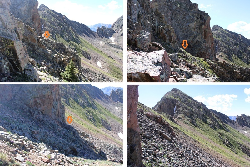
Here are some pictures of the route to the base of the gully I used.
From here it’s a great time to look at the route before you. This is choose your own adventure, and there seem to be a lot of different possibilities for gaining the ridge. All class 3. This is the route I chose, first going up the loose and rocky gully then straight up the class 3 face.
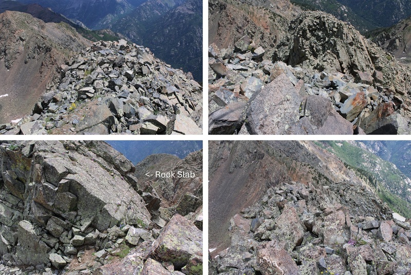
Once on the ridge it was still choose your own adventure. I stuck mainly to the ridge itself in class 3 terrain. There was one ‘sketchy’ move where I had to slide down a 10-15 foot boulder/rock slab and shimmy down. It wasn’t difficult, but there was exposure. The entire ridge for me was ‘figure it out as you go’. I just kept following it up, never cliffed out, and kept heading southwest.
Of course there was a false summit, but luckily the terrain got easier from there.
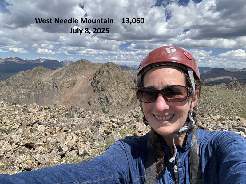
I summited West Needle Mountain at 11:40am
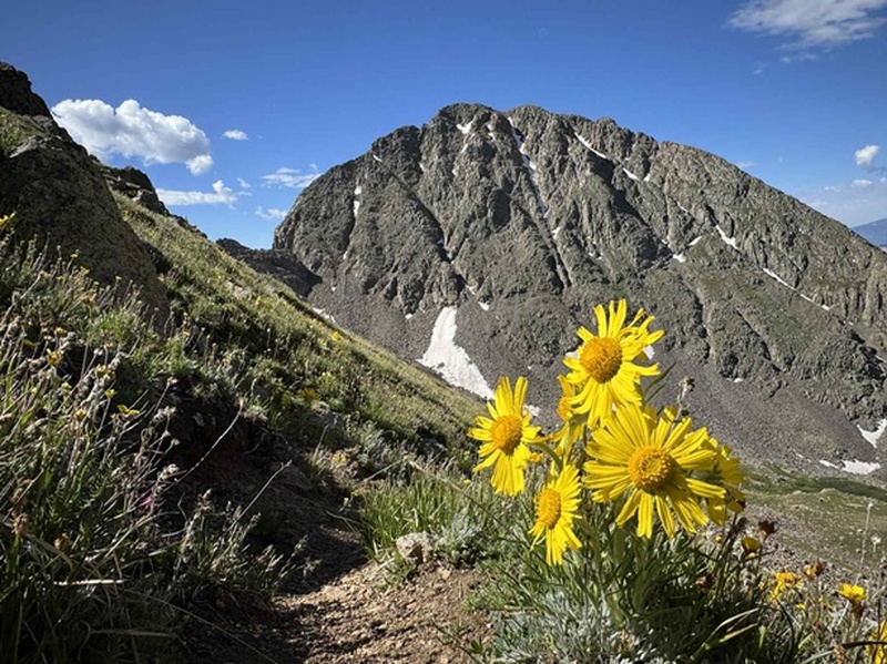
West Needle Mountain:
This was an out and back hike for me, so I turned around and headed towards the false summit
Then back down the ridge. Downclimbing seemed much easier than upclimbing on this route. The route was easier to ‘find’ on the way down.
And then back towards the gully. It’s easy to know when to start the descent towards the gully as the terrain gets noticeably easier and you have a line of sight as to where you need to descend.
From the base of the gully this is my route back up to the saddle. I’d be ascending about 250’ to get there.
Then it was back down the gully and up towards the saddle
From the saddle I could see my route back towards Crater Lake. I’d descend back down 1260’, then up 400’.
First to head back down the drainage
Then to head back up towards the pond at 11750’. To help me navigate I first aimed for this large boulder in the distance, then headed north through the trees.
Once at the pond at 11750’ I found the Crater Lake Trail and took it the 5.5 miles back to Andrews Lake.
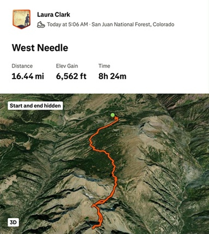
I made it back to my truck at 5:30pm, making this a 19.1 mile hike with 4853’ of elevation gain in 11 hours, 30 minutes. At least according to CalTopo. Strava gave me different numbers.
On to the next trailhead!
Thumbnails for uploaded photos (click to open slideshow):
I definitely think your stats were reading high. We did all the twilights and Snowdon + n2 and has 18.5 miles, and even we weren't sure if that was accurate.
The scramble up west was cool though. Felt kind of like Eolus to me
My stats always higher than others, but it's what CalTopo gives me, so I like to remain consistent and give numbers from CalTopo every time so people know what to expect. My stats from Strava are all over the board. I've found when I hike with other people of similar height (I'm short) we get similar stats, but when I hike with someone taller they have shorter distances. Not sure what's up?
Caution: The information contained in this report may not be accurate and should not be the only resource used in preparation for your climb. Failure to have the necessary experience, physical conditioning, supplies or equipment can result in injury or death. 14ers.com and the author(s) of this report provide no warranties, either express or implied, that the information provided is accurate or reliable. By using the information provided, you agree to indemnify and hold harmless 14ers.com and the report author(s) with respect to any claims and demands against them, including any attorney fees and expenses. Please read the 14ers.com Safety and Disclaimer pages for more information.
Please respect private property: 14ers.com supports the rights of private landowners to determine how and by whom their land will be used. In Colorado, it is your responsibility to determine if land is private and to obtain the appropriate permission before entering the property.


")
")
")
")
")
")
")
")
")
")
")
")
")
")
")
")
")
")
")
")
")
")
")
")
")
")
")
")
")
")
")
")
")
")
")
")
")
")
")
")
")


