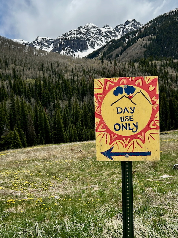
I had tried V3 one time before in late spring, only to find the Swamp Basin living up to its name - the Dead Marshes were enough to deter me from embarking. This year, I tried the peak from a small trail on the west side of the town of Ophir, marked by a friendly sign:
This trail leads to an old mining track that I think has long been closed to motor vehicles. It narrows to cross the stream and then expands back to to a road width, climbing fairly steeply for several hundred feet after the creek. After that part, I found myself in an easygoing valley; very little gain as I walked among willows and grasses. The road quickly faded to a small footpath. I kept my gaze down the valley and wasn't looking close at foot, and nearly walked into this prickly fellow:
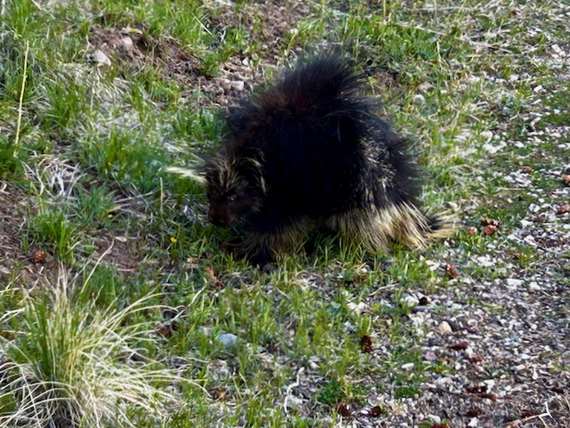
"Share the trail" ethos sprang readily to mind, as we turned our backs to another: the porcupine to the east and I to the west.
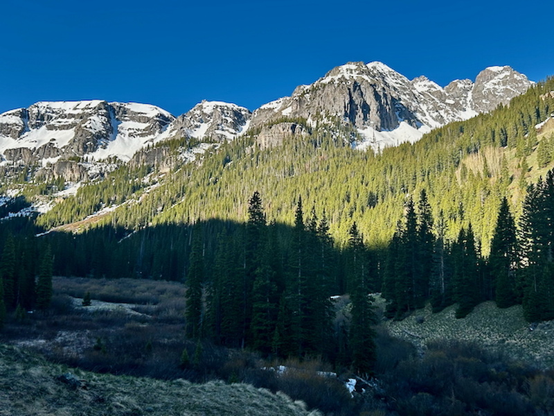
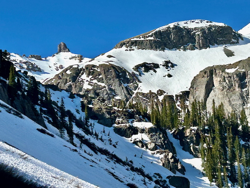
This narrow valley juts to the south, arcing slightly eastward on its way and provides great views along its western edge and also back to the ridge that hems in Ophir to the north.
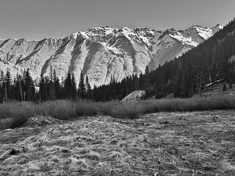
The way up the valley continued easily, despite the trail becoming fainter, and I kept looking for the right spot to leave it and head southeast to V3. This was a poor spring snow season, and despite my knowledge of that and thus planning to find this valley mostly dry, I still found it remarkable. Looking ahead, I saw a likely snow gully and also reasoned that, if it looked to be in poor shape, I could likely take the dry slopes this side of it.

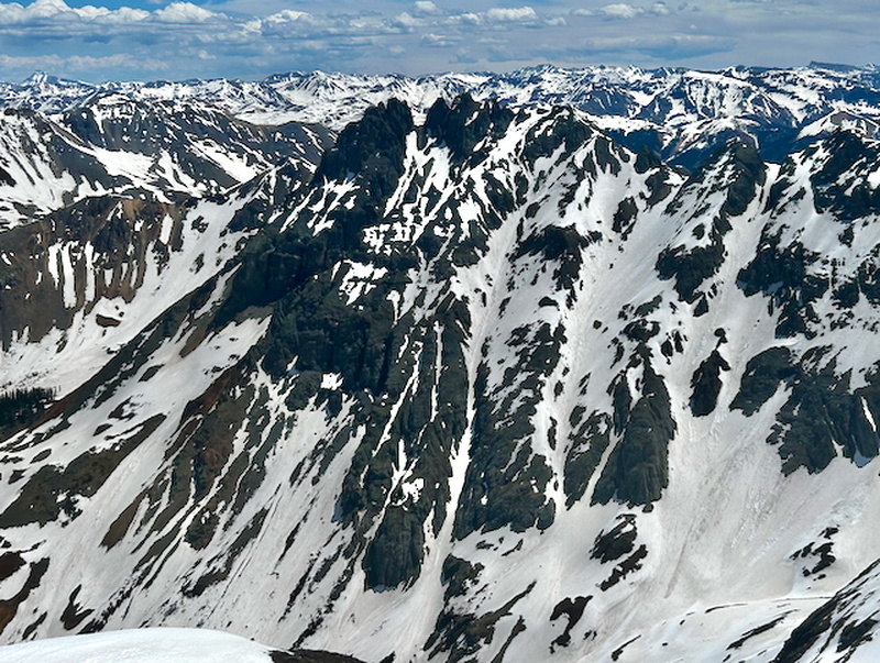
As I neared my ascent path, my eyes were drawn again to the valley's head, to the snow-mantled mountains that walled it in. The formation on the skyline instantly reminded me of Lizard Head and I studied my gps. It was the wrong direction for sure. I realized I was seeing the north face of Pilot Knob.
Enough sightseeing; it was time to gain some elevation. I had my axe but had brought micro spikes and not crampons. The snow in the gully was supportive and the angle so low that I just moved onward with my trekking poles, not bothering to unsling the axe.

Much farther up the gully, it steepened, and I found it dry on my right side as well as my left. The grassy slopes beckoned - fast progress, I thought - and I abandoned the snow.
This did go well for a few hundred feet, but it led to less pleasant terrain:
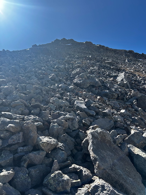
This talus was irritating, but mostly cantaloupe-sized and bigger, and not near as loose as it could've been. I made my way upward, slowly but steadily.
Now I found myself at what I styled the "summit plateau." It looked to me that the high point stood just out of sight on the far right, and I consulted my OnX app to make sure. It actually got a bit weird here, or maybe it was me: it seemed to show a much larger area (especially on the east/other side of the peak that was less steep than what I encountered). But I have enjoyed over a half century on this planet, so it's more likely the scale on the app and my unaided eyes not being able to determine the distance on a phone screen relative to the terrain underfoot and on sight. Regardless, this is what I saw ahead of me:
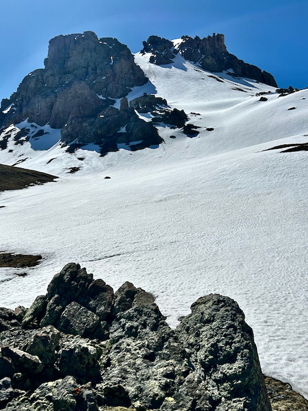
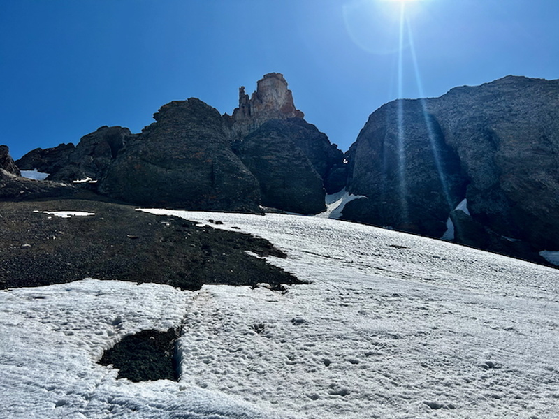
Originally, I considered which of the two couloirs to climb. As I got out the ax and put the spikes back on, I doubted if the spikes would be up to the task on either selection, rueing my decision to leave the crampons. Of the two options, the left one looked easier but then left to doubt the way around the buttress at the top, while the right option appeared harder but seemed to afford more certain progress to the summit.
And then I saw some old boot tracks, heading not toward either couloir, but southward, up the plateau, so to speak. I followed the tracks, judging them to be from perhaps the prior weekend or maybe two weeks old. They were shallow, and this area held plenty of exposure to wind.
I moved slowly here, as the slope was pretty steep and it was only my third trip above treeline this year. My steps took me due south, and I wondered perhaps the route of least resistance would have me contour all the way around to the southeast of the summit. When I neared that area, however, that quickly became out of the question, as the terrain southeast of the high point drops precipitously into a tiny valley between US Grant, V3 and V4.
This section of the upper mountain, its southwest aspect right at 13,000', provided some great views. Straight ahead to the right (south), the mighty Ulysses (S. Grant) reared his great head. (That's a funny phrase, I think.) In the far distance to the opposite direction, I espied the giants of Lake City, Wetterhorn and Uncompaghre, with Mt Emma and the infamous Santa Sophia ridge in the foreground.
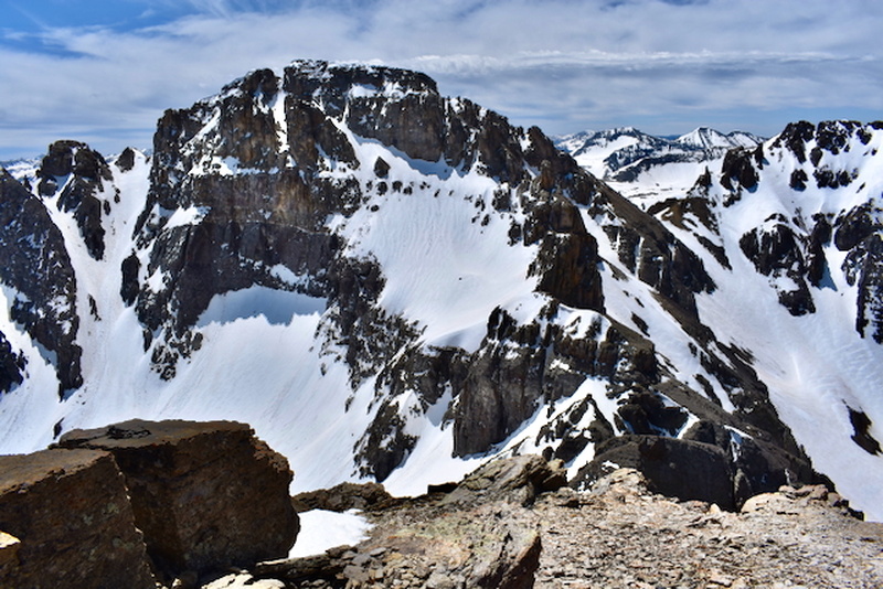
I looked around enough to decide the way upward from where I stood looked more appealing than any venture further right to wrap around the summit's south face and, accordingly, set forth straightaway. The summit massif presented an interesting ensemble, and I consulted my gps to confirm my suspicion that the prominent, lighter colored buttress was not the goal, but that the high point lay out of sight to the right of the narrow gully. So close! But from here, it would take me 40 minutes to stand atop the summit.
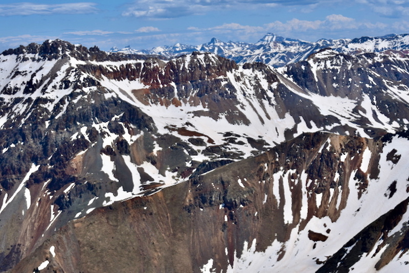
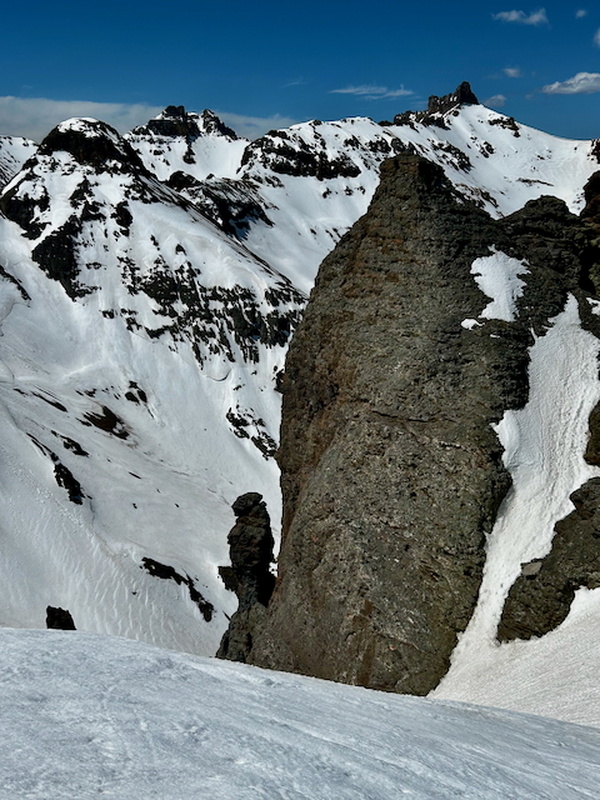
Allowing an extra moment to catch my breath before moving to this final section, I glanced behind me and appreciated the view of Pilot Knob at right, Golden Horn mostly blocking Vermillion back and left of center, with the breccia pinnacle I had circumvented a few minutes ago looming in the foreground.
The gully was short but steep, and icy in sections. Having the ax in those spots was crucial, as my spikes were simply not up to the task, so the shoulders took up the work that the legs had been doing on this short but steep climb.
On top, the snow was still several feet deep and I sunk up to my waist as I rounded the corner to my right, staying close to the rock for 20 feet or so before the snow abruptly disappeared and I walked another 20 feet to the small rocky summit, which was spacious enough to accommodate 6-8 people. From the summit, both US Grant and S Lookout tower. The sun at this point was positioned right over US Grant, but here is a view ENE to S Lookout.
I enjoyed the sunshine on the summit - and lunch - for a solid 25-30 minutes before heading back down. Exploring the terrain up top, I found a slightly different descent route to take advantage of the opportunity to glissade.

Aside from supranihilest's report, I had only heard the tales of the junkiness of V3. I have no doubt in full summer conditions that this peak is a tower of rubble, but with some snow cover, I found it to be a fun outing and an exhilarating foray into wilderness so close to the hamlet of Ophir. The round trip on this day was just shy of 8 miles, and it seemed to me to encapsulate a vast amount of space into such a small area, holding spectacular positions and views.
 I saw the sign!")
")
")
")
")
")
")
")
")
")
")
")
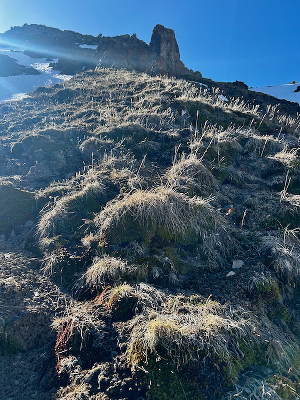
 Gazing ahead to the path upward")
 Looking back north")
 I yield!")
 Looking down the valley")


