Download Agreement, Release, and Acknowledgement of Risk:
You (the person requesting this file download) fully understand mountain climbing ("Activity") involves risks and dangers of serious bodily injury, including permanent disability, paralysis, and death ("Risks") and you fully accept and assume all such risks and all responsibility for losses, costs, and damages you incur as a result of your participation in this Activity.
You acknowledge that information in the file you have chosen to download may not be accurate and may contain errors. You agree to assume all risks when using this information and agree to release and discharge 14ers.com, 14ers Inc. and the author(s) of such information (collectively, the "Released Parties").
You hereby discharge the Released Parties from all damages, actions, claims and liabilities of any nature, specifically including, but not limited to, damages, actions, claims and liabilities arising from or related to the negligence of the Released Parties. You further agree to indemnify, hold harmless and defend 14ers.com, 14ers Inc. and each of the other Released Parties from and against any loss, damage, liability and expense, including costs and attorney fees, incurred by 14ers.com, 14ers Inc. or any of the other Released Parties as a result of you using information provided on the 14ers.com or 14ers Inc. websites.
You have read this agreement, fully understand its terms and intend it to be a complete and unconditional release of all liability to the greatest extent allowed by law and agree that if any portion of this agreement is held to be invalid the balance, notwithstanding, shall continue in full force and effect.
By clicking "OK" you agree to these terms. If you DO NOT agree, click "Cancel"...
With plans to climb RGP and return in a day, I had created a route with OnX that would take me along the Rio Grande Reservoir, up to Weminuche Pass, along the Rincon La Vaca trail, up a portion of Skyline trail to avoid very loose scree, and then up the mountain along the east ridge.. Estimated to be 22.5 miles and 4500' elevation gain.. I had climbed Snowmass in a day, in about 12:15 hours out-and-back, so I figured this would be a bit easier and a couple hours faster.
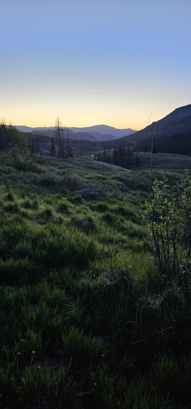
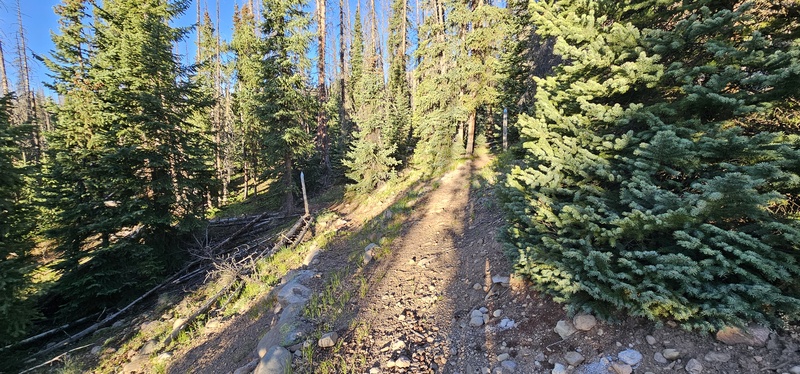
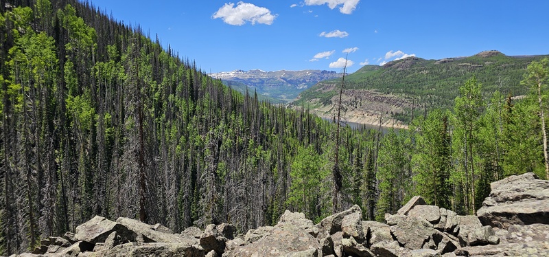
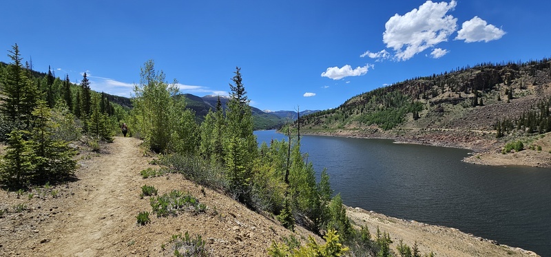
I started out from Thirty Mile CG campsite #24 around 4:20am on June 14, 2025; a crisp Saturday morning under nearly a full moon. Met the Thirty Mile/Weminuche Pass TH marker around 4:30am. From there the trail gains elevation as it nears the Rio Grande Dam, which is pretty well lit. The trail then rolls up and down as you hike single track alongside the Rio Grande Reservoir, which under full moon looks amazing. First light was starting to creep in and around 2.4 miles in, I found the bridge crossing; the bridge was in great shape and I could tell a lot of water was coming down. After the bridge, the trail gets a little rough as it steeply gains elevation.. There were a couple smaller, downed trees, yet nothing too hard to overcome. Once the trail began to level out, I was able to look back as sunrise was just beginning to make its way up and the scene was serene.
Looking NE at first light, near Weminuche Pass
Looking NE at first light, near Weminuche Pass
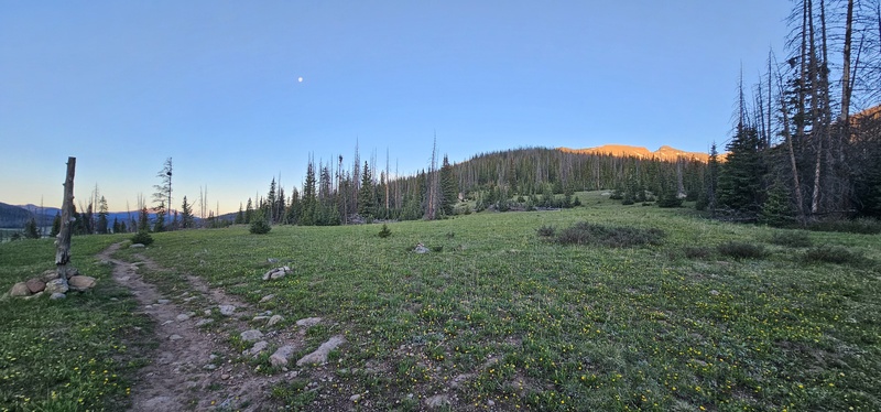
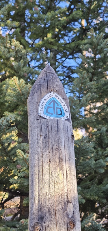
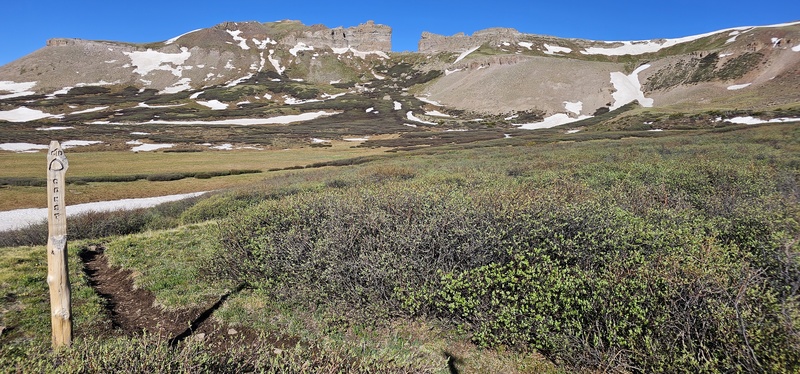
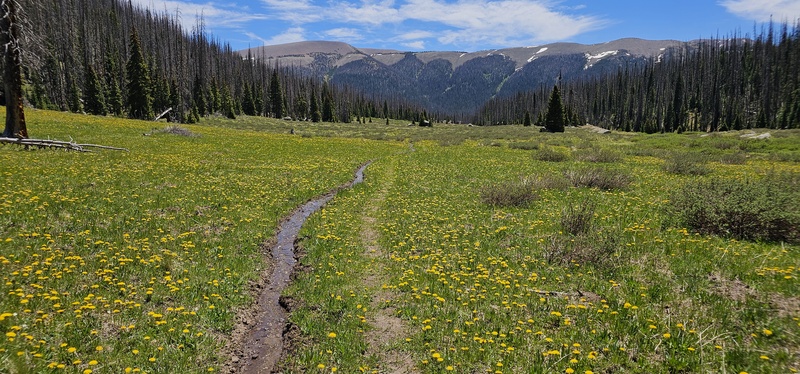
The trail became a lot nicer and was very runnable, with just a couple of easy creek crossings. Deer, Elk, and several species of birds were out in the cool morning air. There were a couple open meadows where it felt like I was at the top of Weminuche Pass, yet I wasn't officially there until I saw this pole. This should also have been where they Skyline/Opal Lake trail started, yet there was absolutely no obvious sign of that trail anywhere. However, given other RGP trip reports I read, I wasn't surprise and continued on with my plan to follow the Rincon La Vaca trail to the base of RGP.
The start of Skyline Trail?
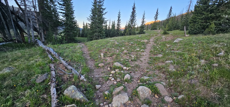
There were a couple forks on the trail, which I assumed went to campsites, yet with my GPS in hand, I stayed to the right and kept on truckin'.
Keep to the right, as the left goes down into the meadow
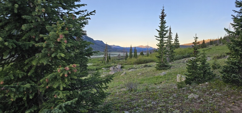
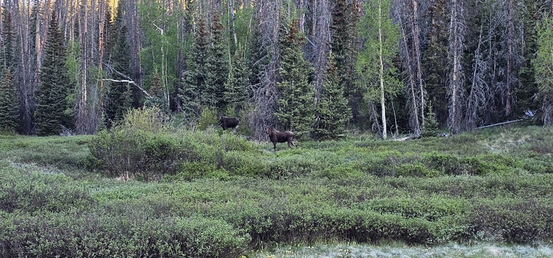
The meadow views along Weminuche Pass were fantastic and I even caught glimpse of three moose along the way.
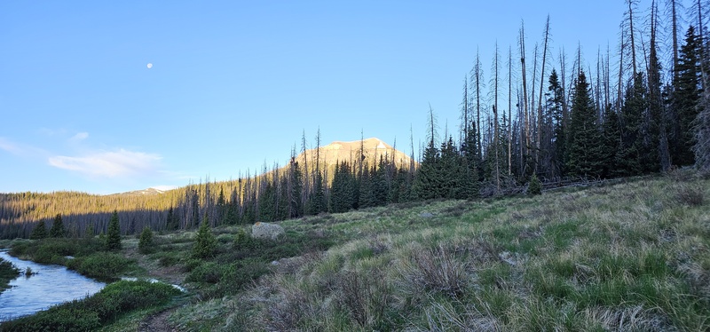
Looking south shortly after sunrise
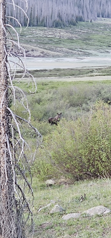
There are moose in the area
More moose in the area
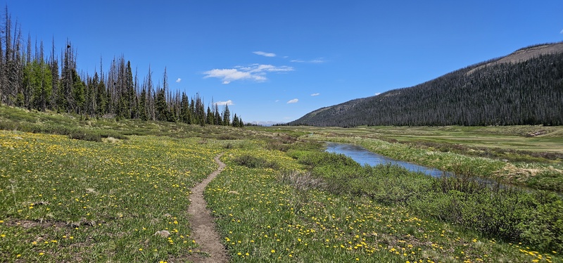
Eventually, you'll find yourself hiking along the Robert Lohr Ditch, a great source for water miles into the hike. However, this time of year, the ditch was overflowing in some parts, so there was a little bit of going off trail to avoid 6" deep water.
Rincon La Vaca trail will take you along the Robert Lohr ditch for a short while
Not RGP, yet still a big looking mountain to the south.
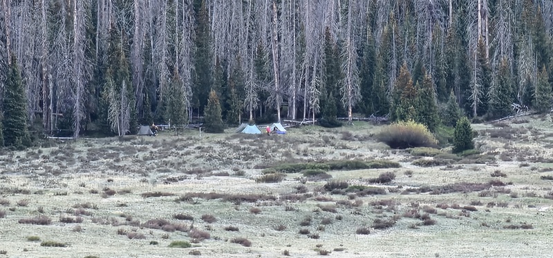
The only other two people I saw anywhere near the trail that morning were a couple of campers across the meadow, maybe making their way along the CDT. Otherwise, I had the whole trail to myself!
Two campers across the meadow - the only other people I saw
I eventually found Section 7 of the CDT about 6.5 miles in and, once again, stayed to the right.
Finally, the CDT! Stay to the right.
CDT sign
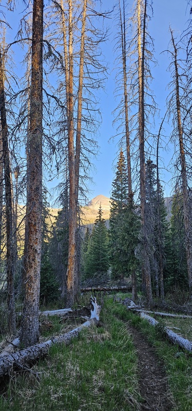
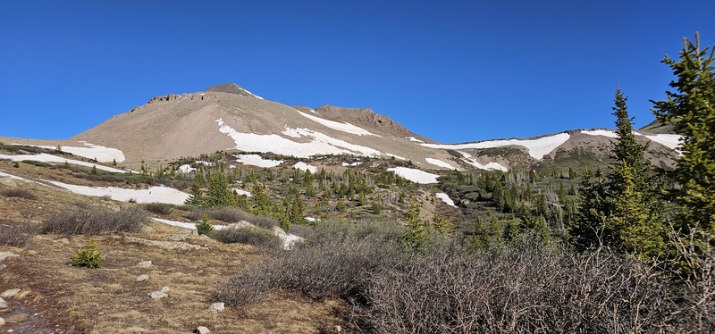
About another half-mile or so past the CDT fork, I caught my first glimpse of Rio Grande Pyramid (RGP).
First glimpse of RGP
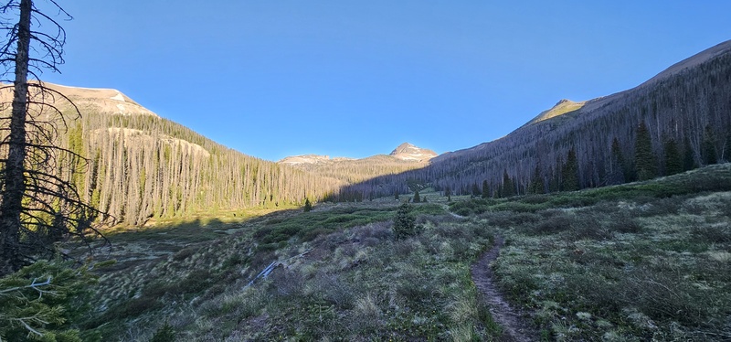
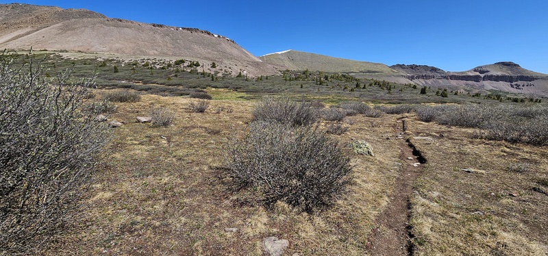
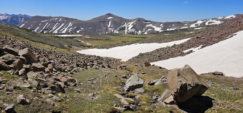
The trail was still very runnable as I encountered another wide open meadow section with a great view of RGP.
The last flat area for a while
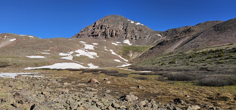
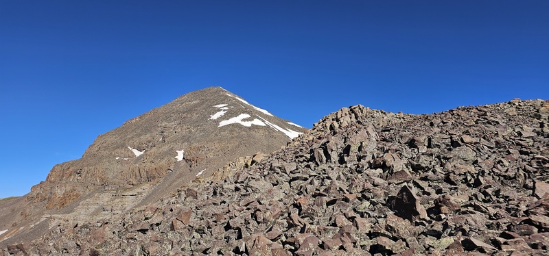
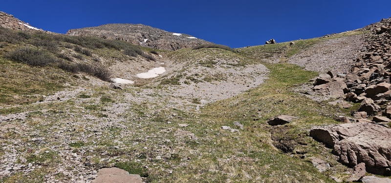
After that, the trail began to ascend more steeply with several switchbacks up to right about treeline; there were a couple very small snowfield crossings, though nothing serious. About 9 miles in, after the switchbacks, is where I got a good view of the base of RGP and the first ugly scree slope I wanted to avoid with the help of Skyline trail.
Looking up towards the ball-bearing scree section of RGP
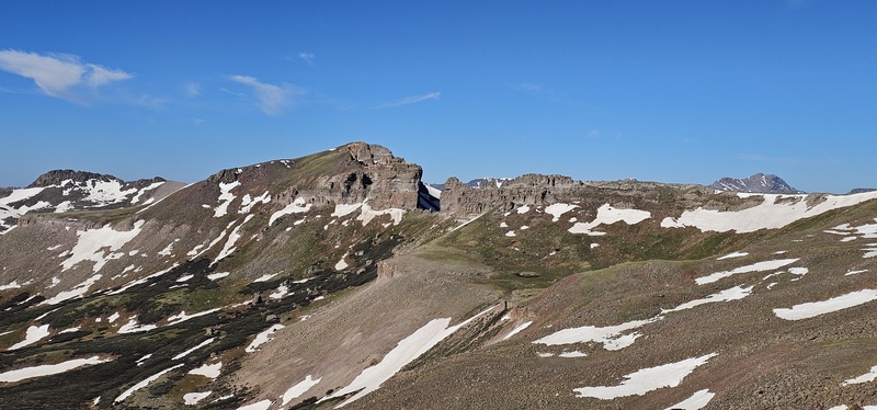
And as I neared where OnX said Skyline trail should fork back into Rincon La Vaca (RLV), I caught a great view of The Window.
Great view of The Window!
..I never did find Skyline trail; there simply was no sign of it anywhere.. again. However, continuing with my plan to get up to the east ridgeline, I plodded off trail towards the base of RGP.
This is where Skyline should've forked to the left..
Base of RGP; I followed the game trail up the scree to the right.. I would not recommend that for you. Head up the grass instead!
I used the rockfield for solid footing to avoid the marshes from the snowmelt. I then pushed my way through about 50 feet of chest-high willows, towards the first scree slope and a game trail traversing upward. Having read the other RGP trip reports, I knew what to expect here.. Ball-bearing scree.. And it was! For every two steps, it seemed that scree pulls you back at least one! Fortunately there was only a couple hundred feet or so of it to manage and then the smallest scree gave way to larger, soccerball sized scree.
On the lower ridge. The scree grows larger as you climb, yet it remains unstable.
I continued to follow the ridgeline as closely as I could toward the top of the mountain. The scree continued to grow in size, yet it seemed like every piece of it was unstable.. TEST EVERYTHING on this mountain before you commit! Test your handholds and your foot placements. I nearly had a couple small, table-sized boulders roll from under me and down on to me! The ridgeline was definitely Class 3 scrambling and scree-hopping all the way to the top!
Great views of the ridgeline
The views were so worth it though! I summited around 9:38am, just over 5 hours from starting out! (BTW, there's no organized windbreak at the top, just a pile of rocks!) The weather was perfect, in the low 50's up top with a cool breeze! And, after hanging out at the top for a few minutes to grab a quick meal and several videos/photos, I started on my way back down.
Looking back at The Window
Instead of sticking closely to the ridgeline, I came down a little more south of it, and then angled towards the grassy section near the base of RGP.. I figured it had to be easier to dealing with all of the scree - especially the smaller stuff! And, in fact, this is now the path I recommend you take to climb and descend RGP rather than pushing through the ball-bearing scree!
On my down, looking down the grassy section of RGP, towards Rincon La Vaca trail.
Looking back up the grassy section from the bottom.
On my way back to the trailhead, the warmth of the sun opened up hundreds of thousands of flowers I had not seen in the morning.. Old Man Of The Mountain's, Lilies, Forget-Me-Not's, and fields of Dandelions!
Full fields of dandelions!
More fields of dandelions!
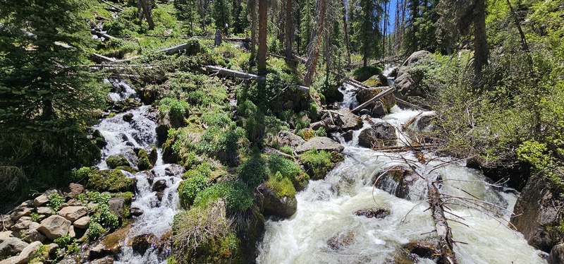
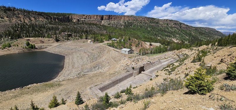
I could also see the water coming down at the bridge crossing much better, as well as different aspects of the RG Reservoir and Dam that I couldn't see before sunrise.
Double-falls at the bridge crossing
Looking toward the west end of the RG Reservoir
Rio Grande Dam
Looking up RG Reservoir
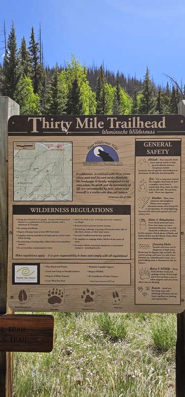
Thirty Mile TH info board
I estimate that I would've made it back to our campsite in about 10 hours total, out-and-back. Yet, I found my wife on trail along the way down and enjoyed the last few miles out at her pace. And, somehow, I ended up tracking 23.59 miles and 6060' of elevation gain! Still, it was a great run-&-hike with absolutely beautiful weather and trail conditions!
A view of Robert Lohr Ditch on the way back
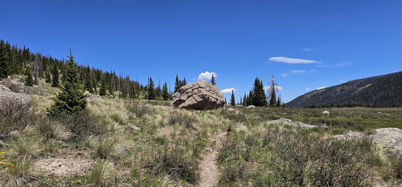
An intriguing boulder on the way back to Weminuche Pass
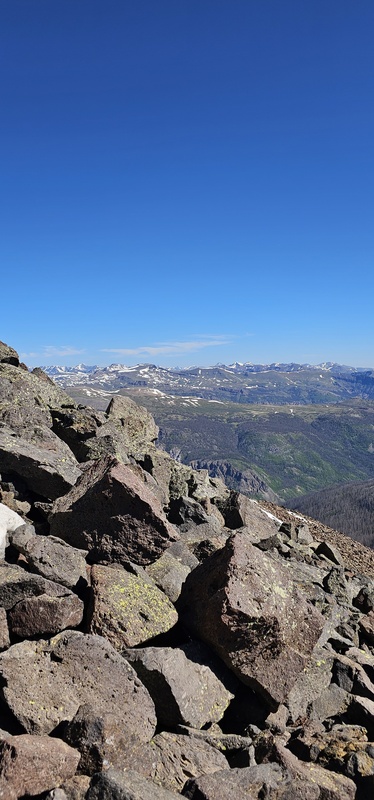
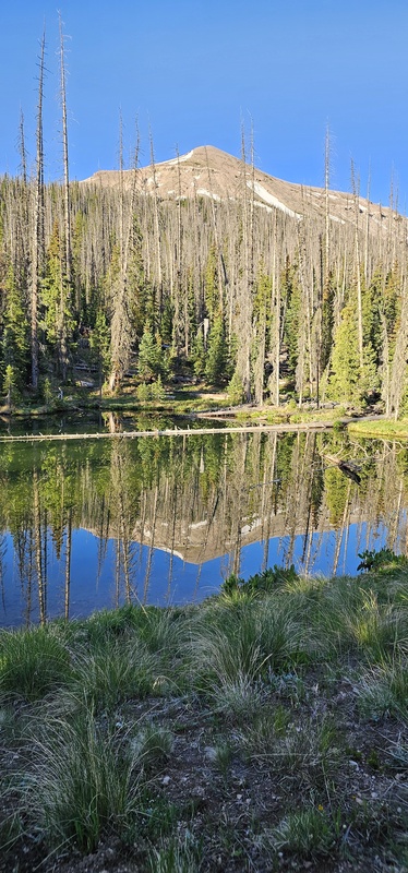
Small, completely still lake
My GPS Tracks on Google Maps (made from a .GPX file upload):
Years ago when I did RGP there was a pole at the top of Weminuche Pass that vaguely marked it and we were able to find it. It had a significant amount of deadfall even then. I'm not sure what condition it would be in at this point even if you could find it. I remember doing a lot of willow bashing as well once we got above treeline.
I did RGP via Skyline early last season without any insight into the route. What I learned is about ~6 miles in, you take a hard right after the final creek crossing. The first few hundred feet is not obvious but the trail will come into view as you head in the direction of RGP and through the trees. It was in great condition for Wemi standards, and the trail is faint in sections. Willows weren’t too bad either. It was runnable and quite enjoyable.
I did this route the same day as the author of this TR (great writing btw). We didn’t bump into each other because I started late, I was slow, and I took skyline up. The pole in pic three (with the cairns across the trail) indeed mark the start of skyline. I posted a fairly detailed conditions report with my findings.
With the right gpx file to navigate, the hardest trail finding on the skyline trail is the first 100ft after you leave the weminuche trail. Lots of blowdown in one section, sure, but not on the level of gore range or ruby lake approach to P&T. Having said that, the CDT miles are definitely the smoothest and the difference between 21 and 23 miles is negligible when you’re omitting 2 smooth miles in favor a rough and sometimes faint path.
Caution: The information contained in this report may not be accurate and should not be the only resource used in preparation for your climb. Failure to have the necessary experience, physical conditioning, supplies or equipment can result in injury or death. 14ers.com and the author(s) of this report provide no warranties, either express or implied, that the information provided is accurate or reliable. By using the information provided, you agree to indemnify and hold harmless 14ers.com and the report author(s) with respect to any claims and demands against them, including any attorney fees and expenses. Please read the 14ers.com Safety and Disclaimer pages for more information.
Please respect private property: 14ers.com supports the rights of private landowners to determine how and by whom their land will be used. In Colorado, it is your responsibility to determine if land is private and to obtain the appropriate permission before entering the property.


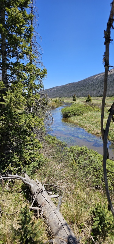
 Looking NE at first light, near Weminuche Pass")
 Looking NE at first light, near Weminuche Pass")
 The start of Skyline Trail?")
 Keep to the right, as the left goes down into the meadow")
 Looking south shortly after sunrise")
 There are moose in the area")
 Rincon La Vaca trail will take you along the Robert Lohr ditch for a short while")
 More moose in the area")
")
 Two campers across the meadow - the only other people I saw")
 Finally, the CDT! Stay to the right.")
 CDT sign")
 First glimpse of RGP")
 The last flat area for a while")
 Small, completely still lake")
 Looking up towards the ball-bearing scree section of RGP")
 Great view of The Window!")
")
 On the lower ridge. The scree grows larger as you climb, yet it remains unstable.")
 Looking back at The Window")
 Great views of the ridgeline")
 On my down, looking down the grassy section of RGP")
")
")
 Full fields of dandelions!")
 A view of Robert Lohr Ditch on the way back")
 More fields of dandelions!")
 An intriguing boulder on the way back to Weminuche Pass")
 Double-falls at the bridge crossing")
 Looking toward the west end of the RG Reservoir")
 Rio Grande Dam")
 Looking up RG Reservoir")
 Thirty Mile TH info board")